Items Similar to Antique Map of Italy and Corse in Ancient Times, 1848
Want more images or videos?
Request additional images or videos from the seller
1 of 5
Antique Map of Italy and Corse in Ancient Times, 1848
About the Item
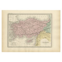
Antique map titled 'Italia Superior et Corsica'.
Old map of northern Italy and Corse originating from 'Orbis Terrarum Antiquus in usum Scholarum'. Artists and Engravers: Published by Justus Perthes, 1848.
Artist: Published by Justus Perthes, 1848.
Condition: Good, general age-related toning. Minor defects, please study image carefully.
Date: 1848
Overall size: 31.7 x 24.8 cm.
Image size: 23.6 x 17.5 cm.
We sell original antique maps to collectors, historians, educators and interior decorators all over the world. Our collection includes a wide range of authentic antique maps from the 16th to the 20th centuries. Buying and collecting antique maps is a tradition that goes back hundreds of years. Antique maps have proved a richly rewarding investment over the past decade, thanks to a growing appreciation of their unique historical appeal. Today the decorative qualities of antique maps are widely recognized by interior designers who appreciate their beauty and design flexibility. Depending on the individual map, presentation, and context, a rare or antique map can be modern, traditional, abstract, figurative, serious or whimsical. We offer a wide range of authentic antique maps for any budget.
- Dimensions:Height: 12.49 in (31.7 cm)Width: 9.77 in (24.8 cm)Depth: 0 in (0.01 mm)
- Materials and Techniques:
- Period:
- Date of Manufacture:1848
- Condition:
- Seller Location:Langweer, NL
- Reference Number:
About the Seller
5.0
Platinum Seller
These expertly vetted sellers are 1stDibs' most experienced sellers and are rated highest by our customers.
Established in 2009
1stDibs seller since 2017
1,916 sales on 1stDibs
Typical response time: <1 hour
- ShippingRetrieving quote...Ships From: Langweer, Netherlands
- Return PolicyA return for this item may be initiated within 14 days of delivery.
More From This SellerView All
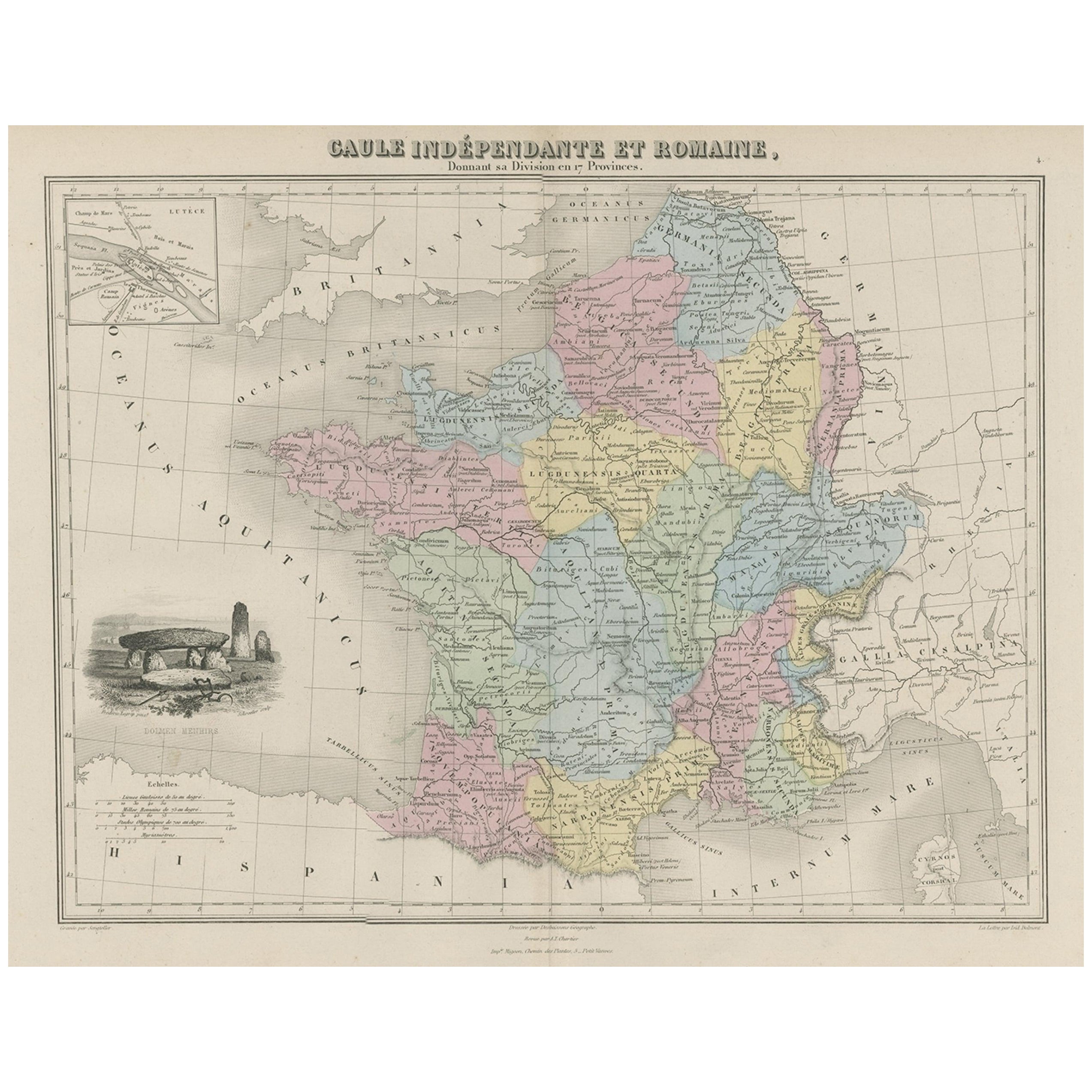
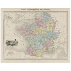
- Antique Map of France in Ancient Roman Times, 1880Located in Langweer, NLAntique map titled 'Gaule indépendante et Romaine'. Old map of Gaul or France in ancient Roman times. The map covers from the southern part of England (Britannia) to the north of S...Category
Antique 19th Century Maps
MaterialsPaper
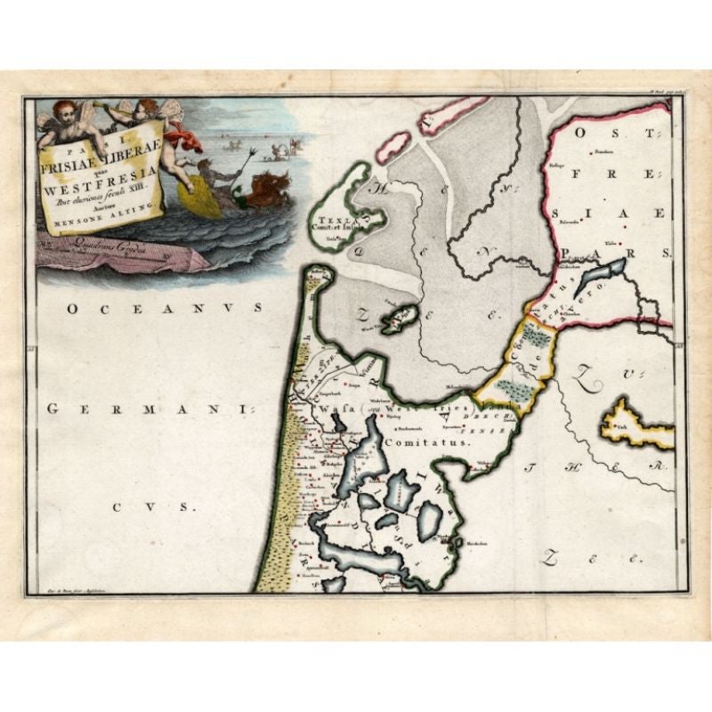
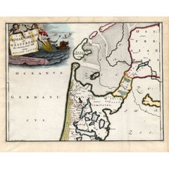
- Antique Map of Westfriesland in Ancient Times by Alting, 1697Located in Langweer, NLAntique map titled 'Frisiae Liberae quae Westfresia Post eluviones seculi XIII'. Map of Westfriesland in ancient times. This copper engraved map shows part of Holland as it was in an...Category
Antique 17th Century Maps
MaterialsPaper
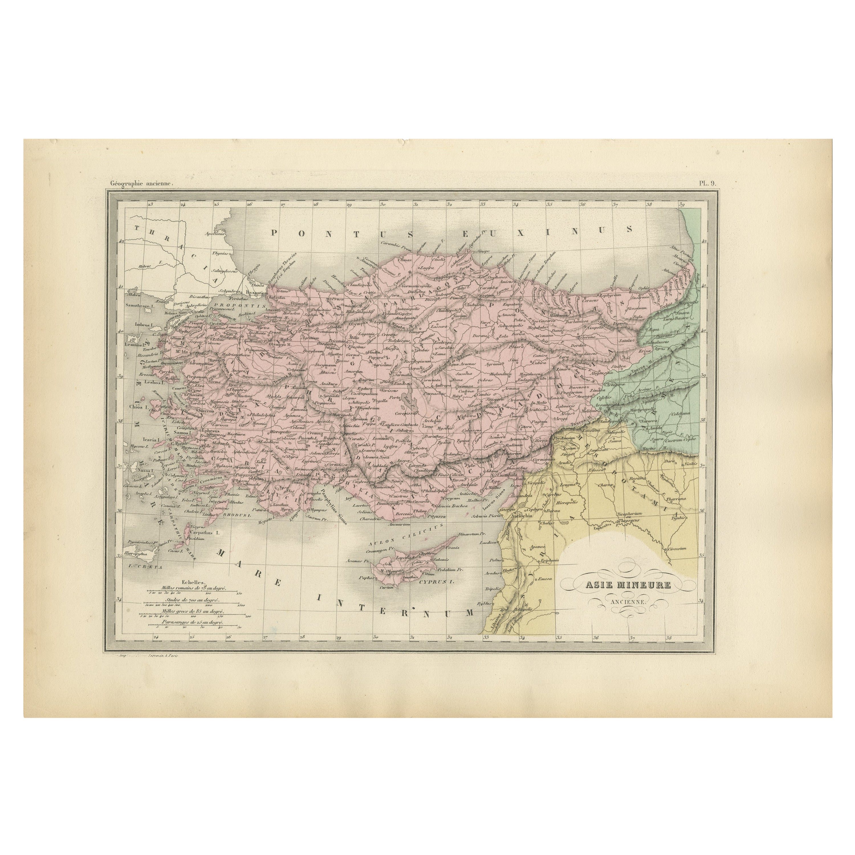
- Antique Map of Asia Minor Showing Turkey in Ancient Times, 1880Located in Langweer, NLMap Pl. 9: 'Asie Mineure.' This map shows Asia Minor / Turkey in ancient times. This original antique map originates from 'Atlas de la Geographie Universelle ou Description de toutes...Category
Antique 19th Century Maps
MaterialsPaper
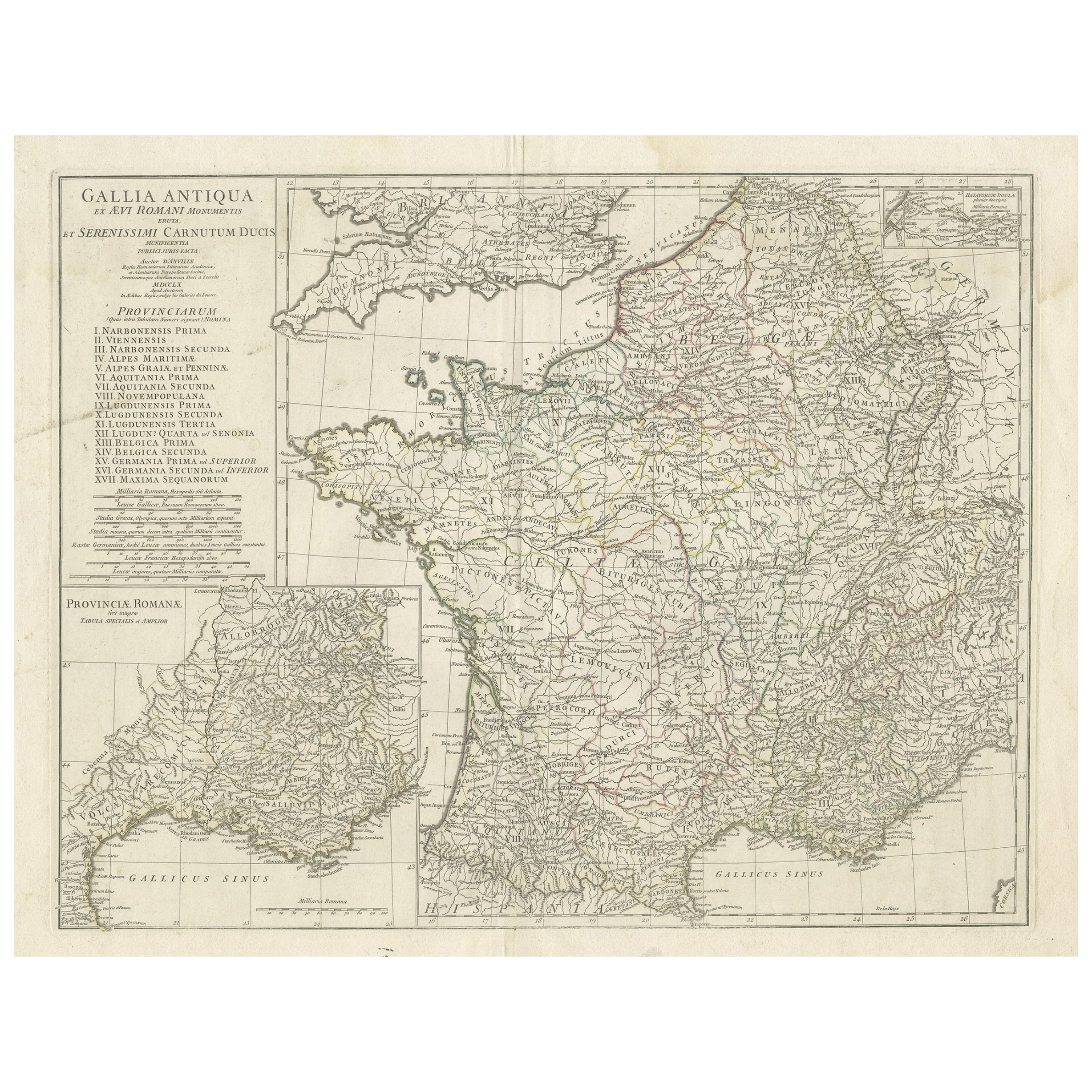
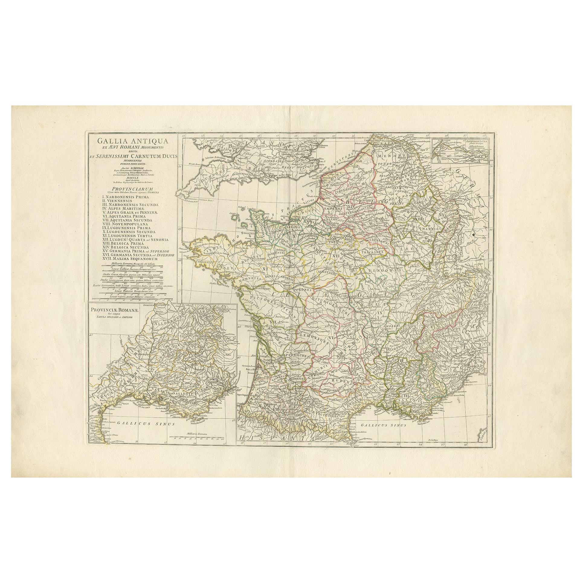
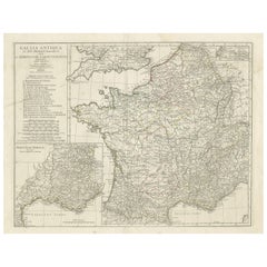
- Large Antique Map of Gaul, or France in Ancient Roman TimesLocated in Langweer, NLOriginal antique map titled 'Gallia Antiqua ex Aevi Romani Monumentis (..)'. Large map of Gaul, or France in ancient Roman times, showing Roman provinces. Inset bottom left a detaile...Category
Antique Mid-18th Century Maps
MaterialsPaper
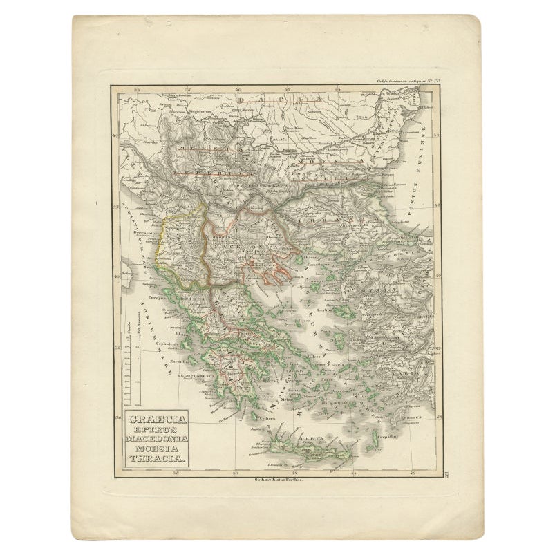
- Antique Map of Greece and Macedonia, 1848Located in Langweer, NLAntique map titled 'Graecia Epirus Macedonia Moesia Thracia'. Old map of Greece originating from 'Orbis Terrarum Antiquus in usum Scholarum'. Artists and Engravers: Published by Just...Category
Antique 19th Century Maps
MaterialsPaper
- Antique Map of France in Ancient Roman Times by d'Anville 'c.1795'Located in Langweer, NLAntique map titled 'Gallia Antiqua ex Aevi Romani Monumentis (..)'. Original, large, map of France in ancient Roman times. Bottom left, a large inset shows Gallia's southern most Rom...Category
Antique Late 18th Century Maps
MaterialsPaper


You May Also Like
- Beautiful Colour French Antique 1856 Hand Watercolour Map of Dept Des La CorseLocated in GBWe are delighted to offer for sale this stunning 1856 hand watercolour map of the Austrian Alps titled Dept Des La Course taken from the Atlas National ...Category
Antique 1850s French Early Victorian Maps
MaterialsPaper
- Original Antique Map of Ancient Greece, Phocis, Gulf of Corinth, 1787Located in St Annes, LancashireGreat map of Ancient Greece. Showing the region of Phocis, including the Gulf of Corinth Drawn by J.D. Barbie Du Bocage Copper plate engraving by P.F Tardieu Original hand c...Category
Antique 1780s French Other Maps
MaterialsPaper
- Original Antique Map of Italy. C.1780Located in St Annes, LancashireGreat map of Italy Copper-plate engraving Published C.1780 Unframed.Category
Antique Early 1800s English Georgian Maps
MaterialsPaper

- Original Antique Map of Italy. Arrowsmith. 1820Located in St Annes, LancashireGreat map of Italy Drawn under the direction of Arrowsmith Copper-plate engraving Published by Longman, Hurst, Rees, Orme and Brown, 1820 Unframed.Category
Antique 1820s English Maps
MaterialsPaper
- Antique Map of Italy by Andriveau-Goujon, 1843By Andriveau-GoujonLocated in New York, NYAntique Map of Italy by Andriveau-Goujon, 1843. Map of Italy in two parts by Andriveau-Goujon for the Library of Prince Carini at Palazzo Carini i...Category
Antique 1840s French Maps
MaterialsLinen, Paper
- 1854 Map of Massachusetts, Connecticut and Rhode Island, Antique Wall MapLocated in Colorado Springs, COThis striking wall map was published in 1854 by Ensign, Bridgman & Fanning and has both full original hand-coloring and original hardware. This impression is both informative and highly decorative. The states are divided into counties, outlined in red, green, and black, and subdivided into towns. Roads, canals, and railroad lines are prominently depicted, although they are not all labeled. The mapmakers also marked lighthouses, banks, churches, and prominent buildings, with a key at right. The map is an informative and comprehensive overview of the infrastructural development of New England prior to the Civil War. Physical geographies depicted include elevation, conveyed with hachure marks, rivers and lakes. The impression features an inset map of Boston...Category
Antique 19th Century American Maps
MaterialsPaper


Recently Viewed
View AllMore Ways To Browse
Antique Italian Map
Antique Italy Map
Italy Antique Map
Italy Map Antique
Antique Maps Italy
Antique Map Italy
Antique Italian Maps
Antique Italy Maps
Antique Map Of Italy
Map Of Italy Antique
Antique Maps Of Italy
Orbis Map
Antique Italia
Ancient World Map
Antique Map Of Northern Italy
Corse Antique
Antique Maps Of United States
Antique Collectible Bears