Items Similar to Antique Map of Westfriesland in Ancient Times by Alting, 1697
Want more images or videos?
Request additional images or videos from the seller
1 of 6
Antique Map of Westfriesland in Ancient Times by Alting, 1697
About the Item
Antique map titled 'Frisiae Liberae quae Westfresia Post eluviones seculi XIII'. Map of Westfriesland in ancient times. This copper engraved map shows part of Holland as it was in ancient times. It focuses on the region of West-Friesland with part of the enclosed Zuyder Zee and the marshy Heyden Zee. The title cartouche features Neptune riding his chariot pulled by aquatic horses, mermaids, mermen and putti.
From 'Descriptio, secundum antiquos, agri Batavi et Frisii', published in Amsterdam by H. Wetstein in 1697-1701. This was the first historic description of the Netherlands.
Artists and Engravers: Menso Alting (1637-1713), Dutch cartographer and mayor of Groningen.
Condition: Good, general age related toning; some light staining from handling. Original folds. Remains of tape from framing on verso. Please study image carefully.
Date: 1697
Overall size: 46 x 38 cm.
Image size: 42 x 32 cm.
We sell original antique maps to collectors, historians, educators and interior decorators all over the world. Our collection includes a wide range of authentic antique maps from the 16th to the 20th centuries. Buying and collecting antique maps is a tradition that goes back hundreds of years. Antique maps have proved a richly rewarding investment over the past decade, thanks to a growing appreciation of their unique historical appeal. Today the decorative qualities of antique maps are widely recognized by interior designers who appreciate their beauty and design flexibility. Depending on the individual map, presentation, and context, a rare or antique map can be modern, traditional, abstract, figurative, serious or whimsical. We offer a wide range of authentic antique maps for any budget.
- Dimensions:Height: 14.97 in (38 cm)Width: 18.12 in (46 cm)Depth: 0 in (0.01 mm)
- Materials and Techniques:
- Period:
- Date of Manufacture:1697
- Condition:Condition: Good, general age related toning; some light staining from handling. Original folds. Remains of tape from framing on verso. Please study image carefully.
- Seller Location:Langweer, NL
- Reference Number:
About the Seller
5.0
Platinum Seller
These expertly vetted sellers are 1stDibs' most experienced sellers and are rated highest by our customers.
Established in 2009
1stDibs seller since 2017
1,916 sales on 1stDibs
Typical response time: <1 hour
- ShippingRetrieving quote...Ships From: Langweer, Netherlands
- Return PolicyA return for this item may be initiated within 14 days of delivery.
More From This SellerView All
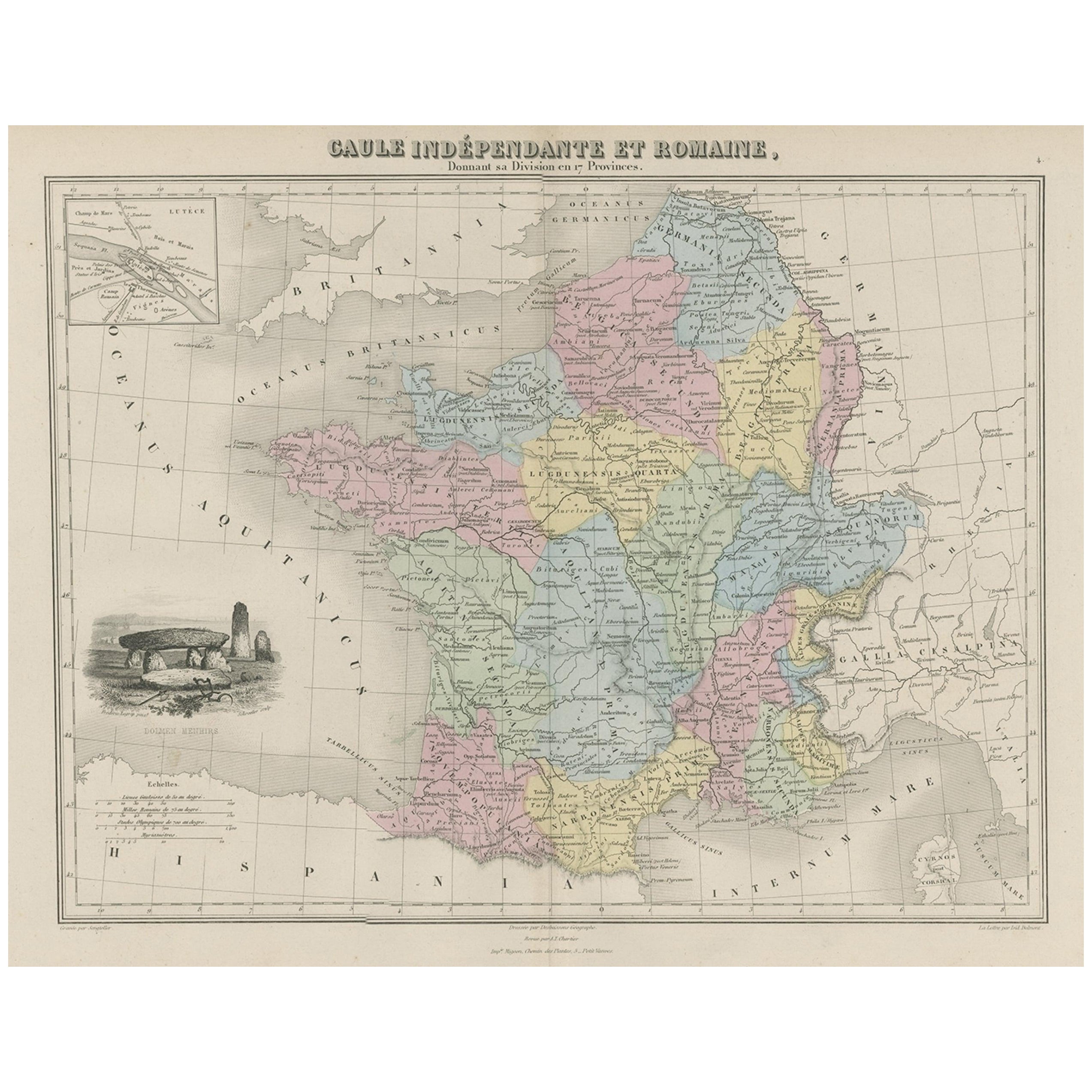
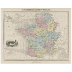
- Antique Map of France in Ancient Roman Times, 1880Located in Langweer, NLAntique map titled 'Gaule indépendante et Romaine'. Old map of Gaul or France in ancient Roman times. The map covers from the southern part of England (Britannia) to the north of S...Category
Antique 19th Century Maps
MaterialsPaper
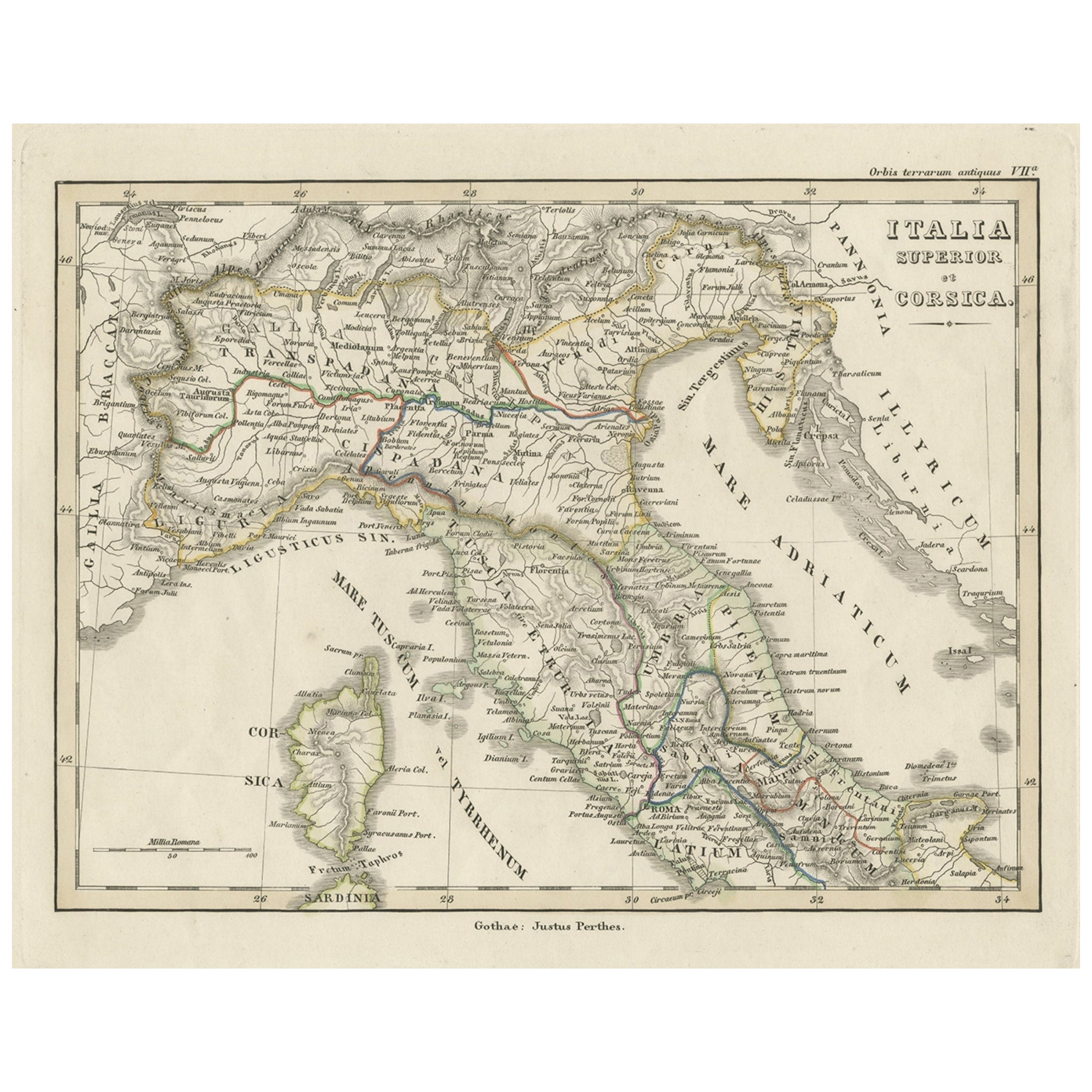
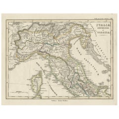
- Antique Map of Italy and Corse in Ancient Times, 1848Located in Langweer, NLAntique map titled 'Italia Superior et Corsica'. Old map of northern Italy and Corse originating from 'Orbis Terrarum Antiquus in usum Scholarum'. Artists and Engravers: Publishe...Category
Antique 19th Century Maps
MaterialsPaper
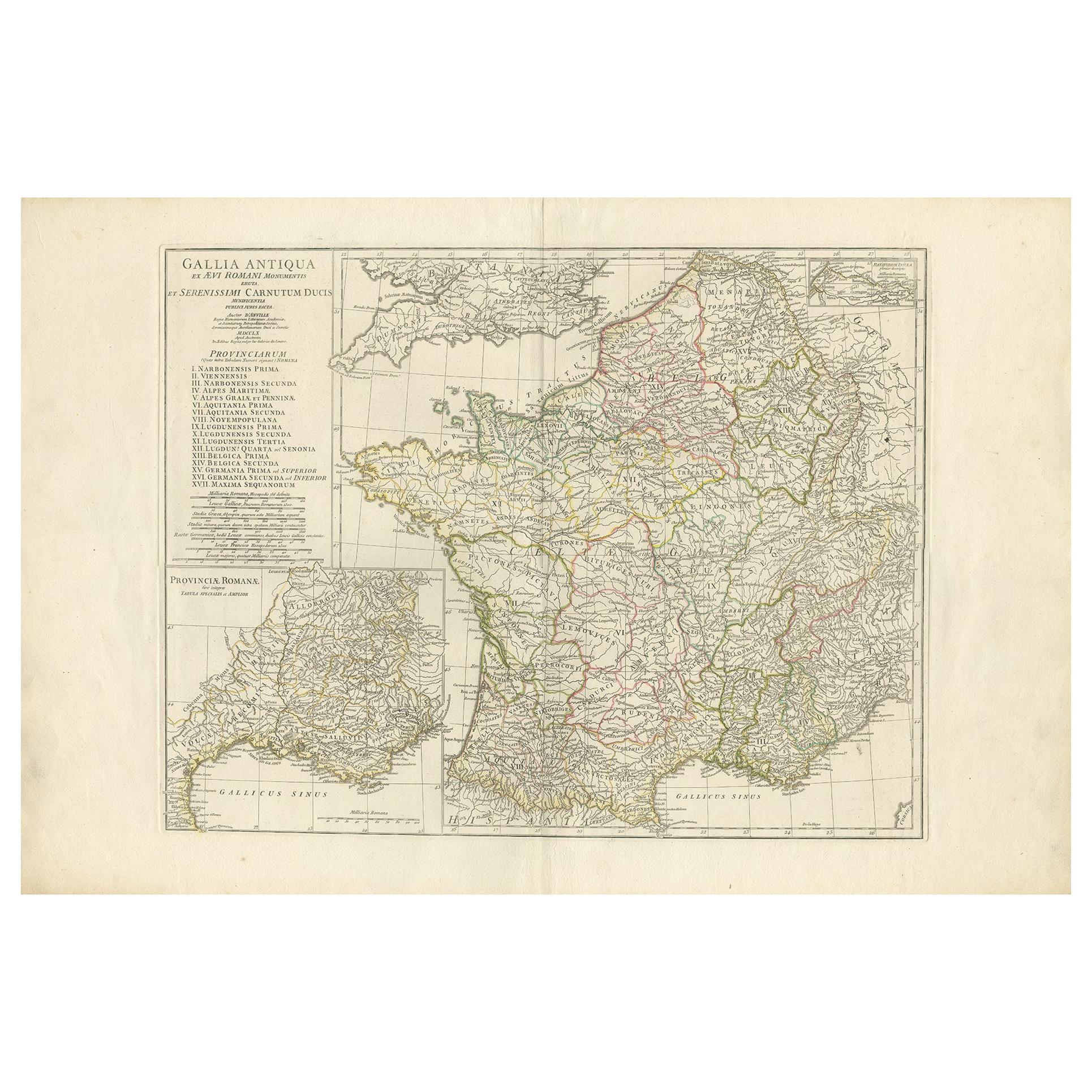
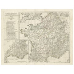
- Antique Map of France in Ancient Roman Times by d'Anville 'c.1795'Located in Langweer, NLAntique map titled 'Gallia Antiqua ex Aevi Romani Monumentis (..)'. Original, large, map of France in ancient Roman times. Bottom left, a large inset shows Gallia's southern most Rom...Category
Antique Late 18th Century Maps
MaterialsPaper
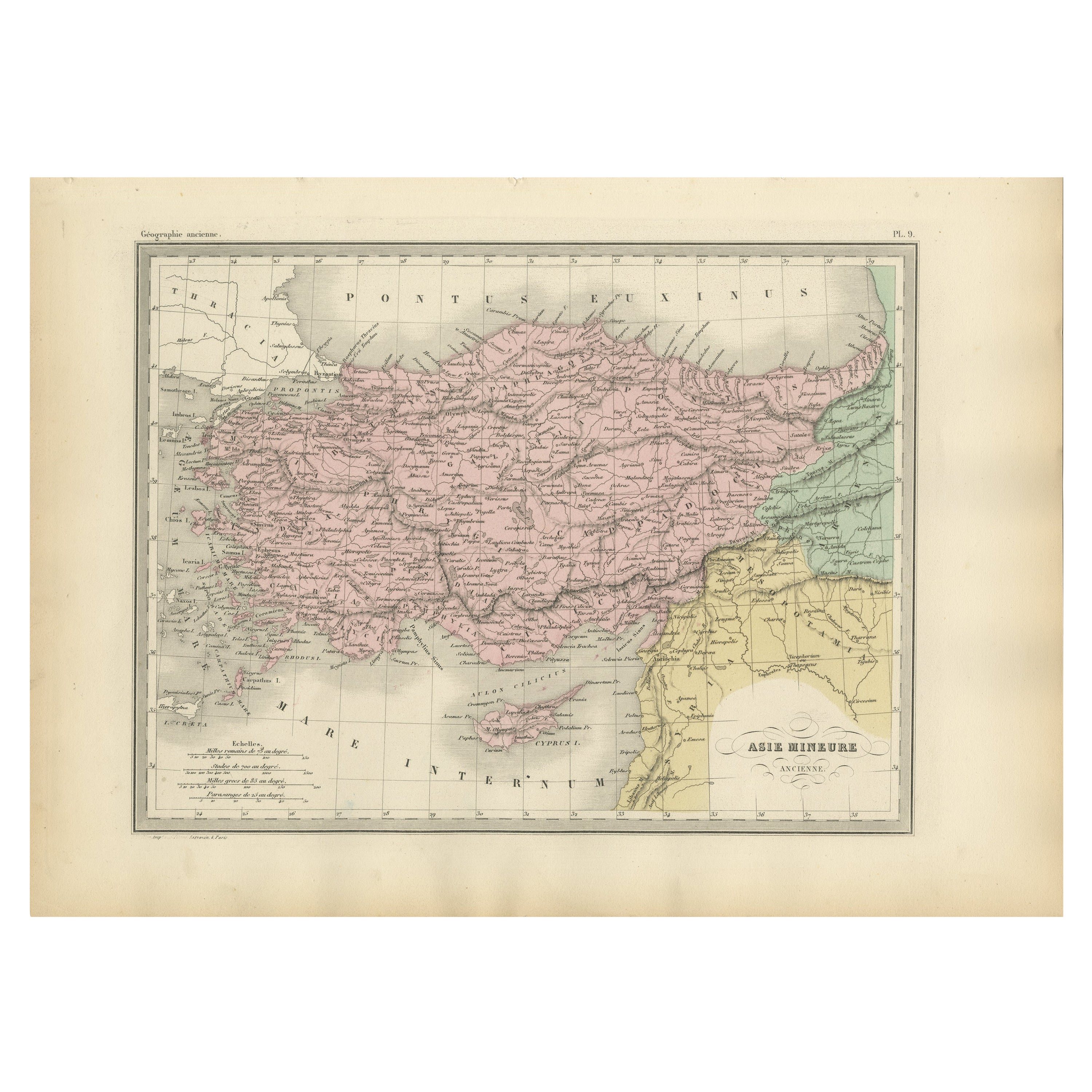
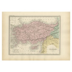
- Antique Map of Asia Minor Showing Turkey in Ancient Times, 1880Located in Langweer, NLMap Pl. 9: 'Asie Mineure.' This map shows Asia Minor / Turkey in ancient times. This original antique map originates from 'Atlas de la Geographie Universelle ou Description de toutes...Category
Antique 19th Century Maps
MaterialsPaper
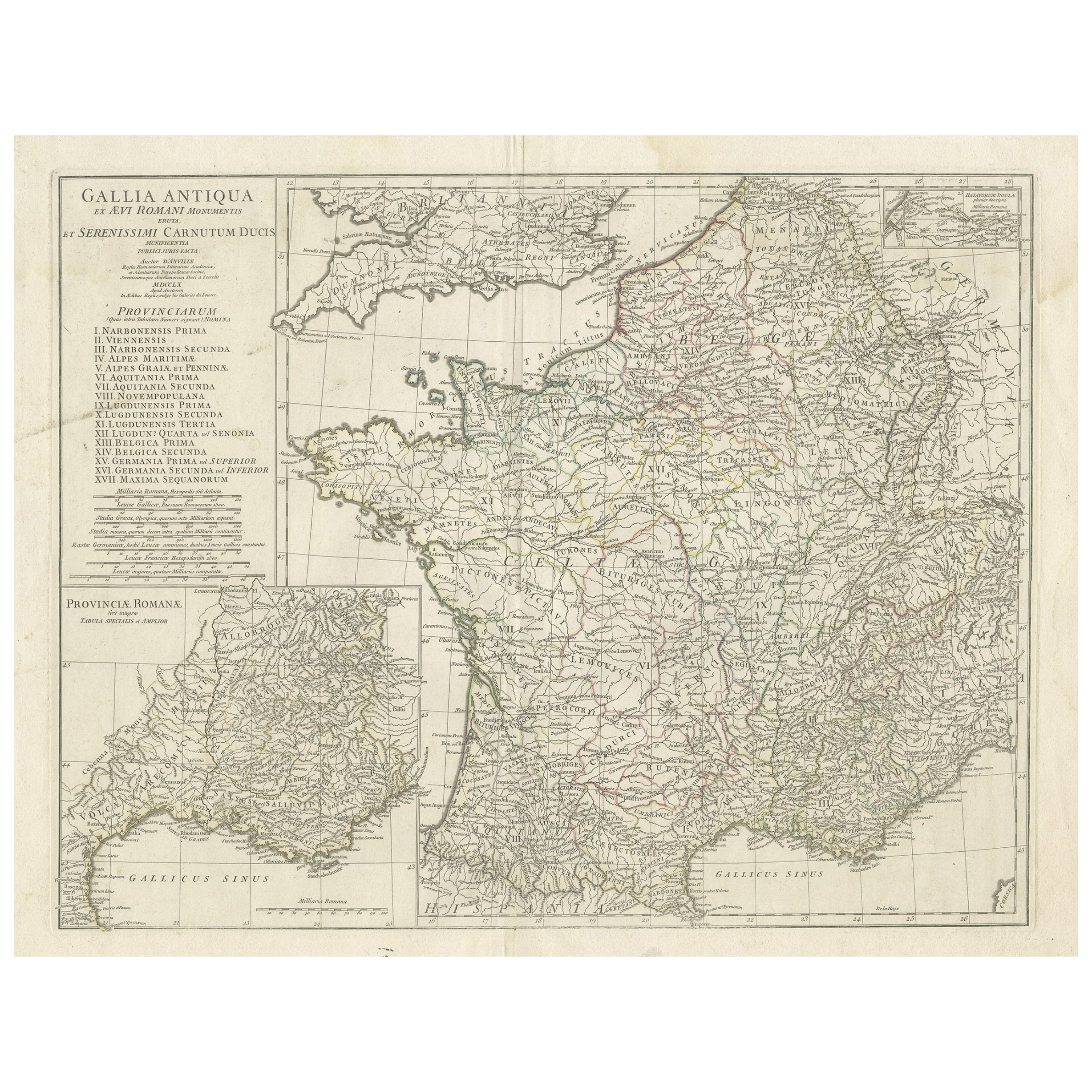
- Large Antique Map of Gaul, or France in Ancient Roman TimesLocated in Langweer, NLOriginal antique map titled 'Gallia Antiqua ex Aevi Romani Monumentis (..)'. Large map of Gaul, or France in ancient Roman times, showing Roman provinces. Inset bottom left a detaile...Category
Antique Mid-18th Century Maps
MaterialsPaper
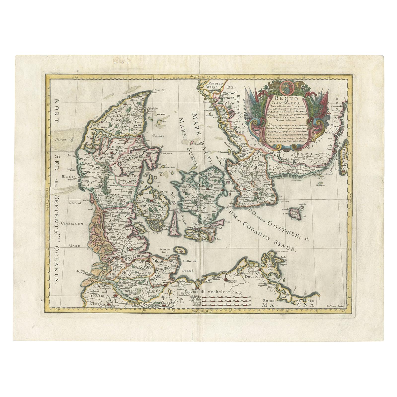
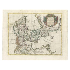
- Antique Map of Denmark by De Rossi (1697)Located in Langweer, NLAntique map of Denmark titled 'Regno di Danimarca'. Old map of Denmark showing Jutland, Funen, Zealand, Lolland-Falster, Bornholm, etc. This map was engraved by S. Roges and publishe...Category
Antique Late 17th Century Maps
MaterialsPaper

You May Also Like
- Original Antique Map of Ancient Greece, Achaia, Corinth, 1786Located in St Annes, LancashireGreat map of Ancient Greece. Showing the region of Thessaly, including Mount Olympus Drawn by J.D. Barbie Du Bocage Copper plate engraving by P.F Tardieu Original hand color...Category
Antique 1780s French Other Maps
MaterialsPaper
- Original Antique Map of Ancient Greece- Boeotia, Thebes, 1787Located in St Annes, LancashireGreat map of Ancient Greece. Showing the region of Boeotia, including Thebes Drawn by J.D. Barbie Du Bocage Copper plate engraving by P.F T...Category
Antique 1780s French Other Maps
MaterialsPaper
- Original Antique Map of Ancient Greece, Phocis, Gulf of Corinth, 1787Located in St Annes, LancashireGreat map of Ancient Greece. Showing the region of Phocis, including the Gulf of Corinth Drawn by J.D. Barbie Du Bocage Copper plate engraving by P.F Tardieu Original hand c...Category
Antique 1780s French Other Maps
MaterialsPaper
- 1907 Map of Colorado, Antique Topographical Map, by Louis NellLocated in Colorado Springs, COThis highly detailed pocket map is a topographical map of the state of Colorado by Louis Nell from 1907. The map "has been complied from all availabl...Category
Antique Early 1900s American Maps
MaterialsPaper
- 1861 Topographical Map of the District of Columbia, by Boschke, Antique MapLocated in Colorado Springs, COPresented is an original map of Albert Boschke's extremely sought-after "Topographical Map of the District of Columbia Surveyed in the Years 1856 ...Category
Antique 1860s American Historical Memorabilia
MaterialsPaper
- Antique Map of Italy by Andriveau-Goujon, 1843By Andriveau-GoujonLocated in New York, NYAntique Map of Italy by Andriveau-Goujon, 1843. Map of Italy in two parts by Andriveau-Goujon for the Library of Prince Carini at Palazzo Carini i...Category
Antique 1840s French Maps
MaterialsLinen, Paper


Recently Viewed
View AllMore Ways To Browse
Antique Map Argentina
Antique Map Of Argentina
John Acton
William Acton
Antique Map Norfolk
Antique Map Of Colombia
Antique Maps Hampshire
Antique Maps Norfolk
Colombia Map Antique
Durham Antique Map
Mozambique Antique Map
Nottinghamshire Antique Map
Patagonia Map
Antique Furniture Queensland
Gabon Antique Map
Minnesota Map
Moravia Map
Alabama Map