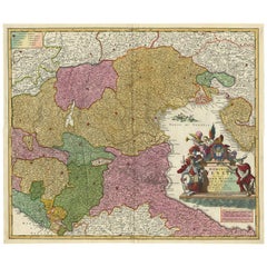
Antique Map Of Northern Italy
2
to
21
56
10
50
22
17
15
10
7
6
6
5
5
5
3
3
3
3
3
3
2
2
1
1
1
1
1
1
1
3
2
2
2
1
Sort By
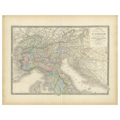
Antique Map of Northern Italy by Levasseur, 1875
Located in Langweer, NL
Antique map titled 'Carte l'Italie (..)'. Large map of Northern Italy. This map originates from
Category
Late 19th Century Antique Map Of Northern Italy
Materials
Paper
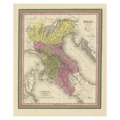
Old Antique Colourful Decorative Map of Northern Italy, 1846
Located in Langweer, NL
Description: Antique map titled 'Italy North Part'.
Old map of Northern Italy. This map
Category
1840s Antique Map Of Northern Italy
Materials
Paper
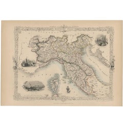
Antique Map of Northern Italy by J. Tallis, circa 1851
Located in Langweer, NL
A highly decorative mid-19th century map of Northern Italy which was drawn and engraved by John
Category
Mid-19th Century Antique Map Of Northern Italy
Materials
Paper
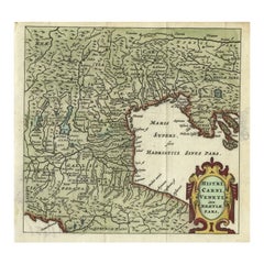
Antique Map of Northern Italy by Cluver, 1685
Located in Langweer, NL
Antique map titled 'Histri, Carni, Veneti item Rhaetiae Pars.' Charming miniature map of northern
Category
17th Century Antique Map Of Northern Italy
Materials
Paper
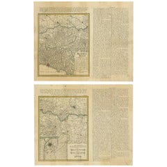
Set of Two Antique Maps of Northern Italy by Homann Heirs, 1754
Located in Langweer, NL
Set of two maps of northern Italy showing the position of troups during the war in April and March
Category
Mid-18th Century Antique Map Of Northern Italy
Materials
Paper
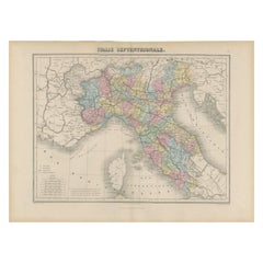
Antique Map of Northern Italy by Migeon, 1880
Located in Langweer, NL
Antique map titled 'Italie Septentrionale'. Old map of the northern part of Italy. This map
Category
19th Century Antique Map Of Northern Italy
Materials
Paper
Antique Map of Northern Italy by Homann Heirs, c.1730
Located in Langweer, NL
map of northern Italy by J. B. Homann. This map shows Venice and its adjacent states Parma, Modena
Category
18th Century Antique Map Of Northern Italy
Materials
Paper
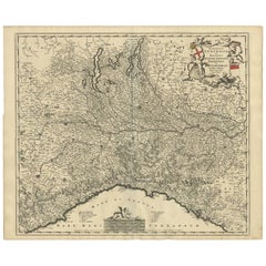
Antique Map of Northern Italy by F. de Wit, 1690
Located in Langweer, NL
A very decorative map centered on Genua, and including the towns of Milan, Torino, Parma, Cremona
Category
Late 17th Century Antique Map Of Northern Italy
Materials
Paper
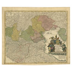
Stunning Antique Map of Northern Italy by J.B. Homann, circa 1745
By Johann Baptist Homann
Located in Langweer, NL
This beautiful hand-colored map covers from Bergamo east as far as Albona (Labin) and from Vipiteno
Category
Mid-18th Century Antique Map Of Northern Italy
Materials
Paper
Antique Map of Italy and Corse in Ancient Times, 1848
Located in Langweer, NL
Antique map titled 'Italia Superior et Corsica'.
Old map of northern Italy and Corse
Category
19th Century Antique Map Of Northern Italy
Materials
Paper
Antique Map Covering Northern Italy, Austria, Slovenia & Croatia, ca.1690
Located in Langweer, NL
covering the region of northern Italy, Austria, Slovenia and Croatia. The course of the Danube is
Category
1690s Antique Map Of Northern Italy
Materials
Paper
H 21.07 in W 25.2 in D 0 in
Finely Detailed Map Covering Northern Italy, Austria, Slovenia & Croatia, c.1690
Located in Langweer, NL
detailed map covering the region of northern Italy, Austria, Slovenia and Croatia. The course of the Danube
Category
1690s Antique Map Of Northern Italy
Materials
Paper
H 20.63 in W 23.31 in D 0 in
Antique Map of Northern England and Wales by Zatta, 1784
Located in Langweer, NL
map of the northern part of England and Wales, with title cartouche. Shows political and
Category
18th Century Antique Map Of Northern Italy
Materials
Paper
Antique Map of the Northern Coast of Africa and Southern Europe, circa 1745
By Covens & Mortier
Located in Langweer, NL
-colored map of the northern coast of Africa, Spain, Italy and the Mediterranean with the islands of
Category
Mid-18th Century Antique Map Of Northern Italy
Materials
Paper
H 21.07 in W 25.4 in D 0.02 in
Antique Map of Northern Africa "Barbary Coast" by R. Bonne, circa 1780
Located in Langweer, NL
adjacent Spain, Italy and Greece. This map was made in response to European interest in the region due to
Category
Late 18th Century Antique Map Of Northern Italy
Materials
Paper
H 10.24 in W 15.08 in D 0.02 in
Northern Italy: A 16th Century Hand-colored Map by Abraham Ortelius
By Abraham Ortelius
Located in Alamo, CA
This is a framed 16th century hand-colored copperplate map of northern Italy entitled "Veronae
Category
16th Century Old Masters Antique Map Of Northern Italy
Materials
Engraving
H 21.5 in W 28 in D 0.75 in
Antique Map of Europe Stretching from Northern Africa to the Baltic Sea, 1719
Located in Langweer, NL
conquestes'. Original antique map of Europe stretching from northern Africa to the Baltic Sea. It shows the
Category
18th Century Antique Map Of Northern Italy
Materials
Paper
H 17.52 in W 20.28 in D 0 in
Antique Map of Southern Italy by J. Tallis, circa 1851
Located in Langweer, NL
world atlas. The Northern Italy map was typical of the many fine ones that appeared in this work with
Category
Mid-19th Century Antique Map Of Northern Italy
Materials
Paper
Antique Map of Italy, North Part, by W. G. Blackie, 1859
Located in Langweer, NL
renowned cartographic works, this map offers a detailed and comprehensive view of Northern Italy
Category
Mid-19th Century Antique Map Of Northern Italy
Materials
Paper
Large Italian Map of Islands of Oceania, incl Papua, Timor, Banda, Ceram, 1855
Located in Langweer, NL
missions in northern Borneo. Born in Cadiz to an Italian father and Spanish mother, Carlos went to sea at
Category
1850s Antique Map Of Northern Italy
Materials
Paper
H 29.14 in W 21.26 in D 0 in
Antique Map of Italy, Showing Corsica, Sardinia, Croatia, Malta and More, C.1740
Located in Langweer, NL
.'
Attractive detailed map showing Italy as well as Corsica, Sardinia, Minorca, Croatia, Albania, Dalmatia, a
Category
18th Century Antique Map Of Northern Italy
Materials
Paper
H 21.78 in W 17.13 in D 0 in
The Kingdom of Naples and Southern Italy: A Hand-Colored 18th Century Homann Map
By Johann Baptist Homann
Located in Alamo, CA
hand colored map of southern Italy and the ancient Kingdom of Naples created by Johann Baptist Homann
Category
Early 18th Century German Antique Map Of Northern Italy
Materials
Paper
H 20 in W 23.88 in D 0.07 in
Original Antique Sea Chart of the Northern Part of Hispaniola, Western Cuba
Located in Langweer, NL
northern part of Hispaniola, western Cuba. The map includes the Turks & Caicos Islands and southern part of
Category
Late 17th Century Antique Map Of Northern Italy
Materials
Paper
H 21.26 in W 24.02 in D 0.02 in
17th Century Nicolas Visscher Map of Southeastern Europe
Located in Hamilton, Ontario
Northern Italy (showing the cities Bologna, Padua, and Venice), Bohemia, Austria (showing Vienna), Hungary
Category
17th Century Dutch Antique Map Of Northern Italy
Materials
Paper
Antique Map of the East Indies by Rossi, 1683
Located in Langweer, NL
nuova scoperta e l'Isole de Ladri ne Mare del Zud (..)'. Decorative map of Southeast Asia, northern
Category
17th Century Antique Map Of Northern Italy
Materials
Paper
Rare and Interesting Small Antique Woodcut Map of the Mediterranean
Located in Langweer, NL
Paul. It shows the Mediterranean with Greece, Asia Minor (Turkey), Northern Africa, Southern Italy and
Category
16th Century Antique Map Of Northern Italy
Materials
Paper
Mediterranean Tapestry: A 19th Century Map of the Mediterranean Shores, 1882
Located in Langweer, NL
Europe down to the northern coastlines of Africa.
The map is a vivid document of the time, with each
Category
1880s Antique Map Of Northern Italy
Materials
Paper
H 11.03 in W 14.97 in D 0 in
Original Antique Map of Brasil, Published in the 16th Century, 1561
Located in Langweer, NL
note in Italian in the centre of the map states that ‘The Indians native to these countries eat human
Category
1660s Antique Map Of Northern Italy
Materials
Paper
No Reserve
H 8.67 in W 11.82 in D 0 in
Original Old Composite of Several Maps of the Ancient World on One Sheet, 1880
Located in Langweer, NL
This original antique map is from Karl Spruner von Merz's "Atlas Antiquus", later edited by
Category
1880s Antique Map Of Northern Italy
Materials
Paper
Free Shipping
H 15.56 in W 18.51 in D 0 in
Rare 16th Century Original Handcolored Miniature Map of China, Published in 1593
Located in Langweer, NL
.
Very interesting and decorative miniature map of China.
Italian text with 'India' in title on the
Category
16th Century Antique Map Of Northern Italy
Materials
Paper
H 4.53 in W 6.3 in D 0 in
Antique Map of Germany During the Mid-18th Century, Published in 1747
Located in Langweer, NL
, Denmark and parts of Eastern Europe. Parts of northern Italy, Poland and Hungary are also included
Category
18th Century Antique Map Of Northern Italy
Materials
Paper
Antique Map of the Danube River and Surroundings by Homann Heirs, c.1730
By Homann Heirs
Located in Langweer, NL
magna parte Italiae exhibentur a Ioh. Bapt. Homanno S.C. M. Geographo Norimbergae.' Map of the northern
Category
18th Century Antique Map Of Northern Italy
Materials
Paper
H 21.15 in W 25.01 in D 0 in
Four 18th Century Engraved and Hand-Colored Maps by Weigel
By Christoph Weigel
Located in Copenhagen, K
Small collection of four engraved maps of Italy, Balkan and of Central Asia.
Two are of Italy
Category
18th Century German Antique Map Of Northern Italy
Materials
Paper
Map of Canonor - Etching by G. Braun/F. Hogenberg - 1575
Located in Roma, IT
his Latin name Rantzovius, who provided maps of Northern Europe, specially of Danish cities. The
Category
16th Century Modern Antique Map Of Northern Italy
Materials
Etching
H 5.52 in W 6.3 in D 0.04 in
Map of San Georgi - Etching by G. Braun/F. Hogenberg - 1575
Located in Roma, IT
), beter known under his Latin name Rantzovius, who provided maps of Northern Europe, specially of Danish
Category
16th Century Modern Antique Map Of Northern Italy
Materials
Etching
H 5.52 in W 6.3 in D 0.04 in
[Civitates Orbis Terrarum]Map of Cefal - Etching by G. Braun/F. Hogenberg - 1575
Located in Roma, IT
his Latin name Rantzovius, who provided maps of Northern Europe, specially of Danish cities. The
Category
16th Century Contemporary Antique Map Of Northern Italy
Materials
Etching
Giant Egg of the Extinct 'Elephant Bird'
Located in London, GB
a raffia palm. In the fifteenth century, Italian cartographer Fra Mauro mentioned the roc on his map
Category
15th Century and Earlier Malagasy Antique Map Of Northern Italy
Materials
Eggshell
Last Days of Napoleon in St-Helena
Located in Paris, FR
: Swiss sculptor, active mainly in northern Italy. He was born in the village of Ligornetto in Ticino
Category
1860s Realist Antique Map Of Northern Italy
Materials
Bronze
Antique rare amusing Russian silver model of a bear, St Petersburg, circa 1890
Located in Tel Aviv - Jaffa, IL
many treasures admired by visitors on the Northern Grand Tour, which Included Russia. So shops and
Category
1890s Russian Antique Map Of Northern Italy
Materials
Onyx, Silver
A truly delightful miniature terrestrial pocket globe
By Nathaniel Mills
Located in ZWIJNDRECHT, NL
). There is some slight loss to a portion of North America, and there is a crack to the northern portion of
Category
Mid-18th Century British Dutch Colonial Antique Map Of Northern Italy
Materials
Other
Portrait Painting Oil on Canvas by Joseph Badger
Located in Rome, IT
portrait tradition to the northern colonies. He established a studio in Boston on Queen Street (now Court
Category
18th Century Academic Antique Map Of Northern Italy
Materials
Oil
A beautiful Celestial Table Globe produced by Gerard & Leonard Valk
By Gerard and Leonard Valk
Located in ZWIJNDRECHT, NL
Gerard began his publishing firm producing maps and atlases in co-operation with Petrus Schenk about 1680
Category
Early 18th Century Dutch Dutch Colonial Antique Map Of Northern Italy
Materials
Other
Portrait Painting Oil on Canvas by Joseph Badger
Located in Rome, IT
portrait tradition to the northern colonies. He established a studio in Boston on Queen Street (now Court
Category
18th Century Academic Antique Map Of Northern Italy
Materials
Oil
Ptolemaic map of Balkan coast extending north by Mercator - Engraving - 17th c.
By Gerard Mercator
Located in Zeeland, Noord-Brabant
, Dalmatia, cum Italiae parte. (…).' - A beautiful Ptolemaic map of the Balkan coast and northern Italy along
Category
1690s Old Masters Antique Map Of Northern Italy
Materials
Engraving
1680 Athanasius Kircher Map "Territorii Tiburtini Veteris Et Novi Descriptio"
By Athanasius Kircher
Located in Drottningholm, SE
map of the northern parts of Italy, made by Athanasius Kircher in the late 17th century.
This map is
Category
1680s Dutch Antique Map Of Northern Italy
H 40 in W 49 in D 1.5 in
Sunset with Figure Walking into Village with Stream in the foreground
By In the style of George Inness
Located in Graton, CA
a map engraver. Impatient with supervision, he started to paint alone and exhibited with the
Category
Late 19th Century Tonalist Antique Map Of Northern Italy
Materials
Oil
Duchy of Milan
By Abraham Ortelius
Located in Houston, TX
Milan). From Theatrum Orbis Terrarum, Antwerp, 1603.
The Duchy of Milan was a state in northern Italy
Category
Early 1600s Dutch Antique Map Of Northern Italy
De oude Wereldt tot beter verstandt der oude geschiedenissen.
By Jacob Keyser
Located in Zeeland, Noord-Brabant
East. Two inset maps show Peloponnese and Northern Italy.
Algemene kerkelyke en werldlyke
Category
Early 18th Century Antique Map Of Northern Italy
Materials
Engraving, Etching
H 15.24 in W 28.59 in
'Vestigii del Theatro che fu edificato da Augusto […].
By Aegidius Sadeler
Located in Zeeland, Noord-Brabant
-1629) was a Flemish engraver from a large family of engravers. He worked in Prague and Italy. He was a
Category
Early 1600s Antique Map Of Northern Italy
Materials
Engraving
Vestigii del Monumento over mole d'Adriano […].
By Aegidius Sadeler
Located in Zeeland, Noord-Brabant
engravers. He worked in Prague and Italy. He was a pupil of Hans Sadeler and a brother of Hans and Raphael
Category
Early 1600s Antique Map Of Northern Italy
Materials
Engraving
Dedication page.
By Aegidius Sadeler II
Located in Zeeland, Noord-Brabant
large family of engravers. He worked in Prague and Italy. He was a pupil of Hans Sadeler and a brother
Category
Early 1600s Antique Map Of Northern Italy
Materials
Engraving
Antique Map of India, One of the Earliest Modern Maps of the Region, c.1574
Located in Langweer, NL
Antique map India titled 'Calecut Nuova Tavola'. Second edition of Ruscelli's modern map of India
Category
16th Century Antique Map Of Northern Italy
Materials
Paper
H 11.82 in W 8.67 in D 0 in
Very Old Engraving of Casablanca (Anfa), Azemmour (Azamor) and Diu, 1574
Located in Langweer, NL
officially incorporated into the empire by Caligula. Following the Vandal conquest of northern Africa in the
Category
16th Century Antique Map Of Northern Italy
Materials
Paper
Map of Grodna - From "Civitates Orbium Terrarum" by F. Hogenberg - 1575
By Franz Hogenberg
Located in Roma, IT
), beter known under his Latin name Rantzovius, who provided maps of Northern Europe, specially of Danish
Category
16th Century Antique Map Of Northern Italy
Materials
Etching, Aquatint
H 11.82 in W 18.9 in D 0.04 in
"Twilight In Venice"
By George Inness
Located in Lambertville, NJ
worked for a map engraver. Impatient with supervision, he started to paint alone and exhibited with the
Category
19th Century Impressionist Antique Map Of Northern Italy
Materials
Canvas, Oil
Vintage Map of Northern Italy, 1830
Located in Houston, TX
Charming antique french engraved map of northern Italy, 1830. Shows rivers, mountains, states and
Category
19th Century Other Art Style Antique Map Of Northern Italy
Materials
Ink, Paper, Watercolor
Antique Map of Northern Italy and Livorno by E. Bowen, 1747
Located in Langweer, NL
Decorative engraved map of North Italy by Bowen from 'A Complete System of Geography'. Showing the
Category
Mid-18th Century Antique Map Of Northern Italy
Materials
Paper
Antique Map of Piemonte, Torino and Savoye Italy by Sanson, circa 1660
Located in Langweer, NL
northern Italy (Piemonte and Torino) and Savoye, reaching across the Alps to Lake Geneva. Large figurative
Category
Mid-17th Century Antique Map Of Northern Italy
Materials
Paper
H 24.89 in W 20.79 in D 0.02 in
Antique Map of Northern Africa by Ortelius 'circa 1590'
Located in Langweer, NL
Edition, 'circa 1590'.
Double-page engraved map of northern Africa and western Mediterranean Sea. 18 1
Category
16th Century Antique Map Of Northern Italy
Materials
Paper
Hand-Colored 18th Century Printing of Jacopo De Barbari's Map of Venice
Located in Hudson, NY
century version newly framed with exposed margins showing the papers edge and plate marks. This map
Category
Late 18th Century Italian Renaissance Antique Map Of Northern Italy
H 23.75 in W 43 in D 0.75 in
- 1
Get Updated with New Arrivals
Save "Antique Map Of Northern Italy", and we’ll notify you when there are new listings in this category.
Antique Map Of Northern Italy For Sale on 1stDibs
Find many varieties of an authentic antique map of northern italy available at 1stDibs. Frequently made of paper, every antique map of northern italy was constructed with great care. Your living room may not be complete without an antique map of northern italy — find older editions for sale from the 18th Century and newer versions made as recently as the 19th Century. Covens & Mortier, Homann Heirs and Johann Baptist Homann each produced at least one beautiful antique map of northern italy that is worth considering.
How Much is a Antique Map Of Northern Italy?
An antique map of northern italy can differ in price owing to various characteristics — the average selling price 1stDibs is $744, while the lowest priced sells for $115 and the highest can go for as much as $2,115.
More Ways To Browse
Jan Luyken
Antique Ornamental Map
Tunisia Antique Map
Albania Map
Ottoman Shield
Ruscelli Map
Montenegro Antique Map
Map Of Majorca
Antique Map Tuscany
Mappemonde Antique
J And C Bavaria
X Line Nuova
Colosseum Mirror
Orange Depression Glass Bowl
Vintage African Wood Carved Floor Sculpture
Johann Baptist Homann On Sale
Covens & Mortier On Sale
Bolivia Antique Map
