Items Similar to A beautiful Celestial Table Globe produced by Gerard & Leonard Valk

Video Loading
Want more images or videos?
Request additional images or videos from the seller
1 of 20
A beautiful Celestial Table Globe produced by Gerard & Leonard Valk
About the Item
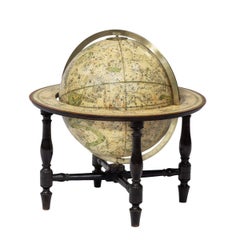
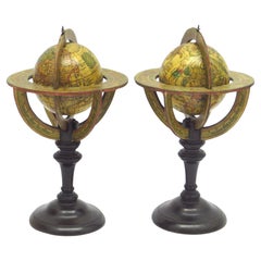
A magnificent and very rare early 18th century celestial table globe produced by Gerard and Leonard Valk. Established at the end of the previous century by Gerard Valk, and assisted by his son Leonard, the firm became the only publisher of globes in the Netherlands in the 18th century. In Amsterdam Gerard began his publishing firm producing maps and atlases in co-operation with Petrus Schenk about 1680. It was about 30 years later that he began to publish globes with his son. After the death of Leonard, the firm continued under the stewardship of his widow, Maria Schenk, and towards the end of the 18th century the globe factory came in to the possession of Cornelis Covens.
A handsome and impressive 46cm Dutch celestial table globe. Made up of a set of beautiful original hand coloured, copper engraved gores. With a (wooden) horizon ring (a circular band of printed paper laminated to wood or metal, wrapping around the equatorial area of a globe, and generally containing calendar or zodiacal information.);
A highly unusual two pointer brass hour ring (a small, thin metal circle on the top of a globe, divided into 24 segments and imprinted or engraved with the hours of the day and night. By turning it, one can calculate the time difference between various locations on the globe); a graduated brass meridian ring (a semi-circular band, usually metal, arcing around the globe and passing over, or attached to, the poles. A semi-circular meridian is called a half meridian; a complete circle, a full meridian).
With four fluted table legs complete with circular, turned ebony feet; resting on sturdy cross-stretchers; an ebony central stand; a base consisting of beautiful circular rings of segmented (wood), inset with alternate concentric circles of an ornate and pleasing floral design. Height 28 in. / 71cm.
Legends:
Title, in a simple oval cartouche, printed on a separate piece of paper and pasted below Cetus.
URANOGRAPHIA / SYDERUM ET STELLARUM / in Singulis Syderibus conspicuarum / exhibens Delineationem accuratissimam, / qua / ex Observationibus Astronomi plane Singularis / IOHANIS HEVELII / usque ad finem anni MDCC emendata est. / Nova praeterea methodo additus est / ex mente LOTHARII ZUMBACH M.D. et Mathem. Claris. / HORIZON ad MERIDIANUM AMSTELAEDAMENSEM / accurate per annes plures quam ducentos Lunae Syzygias indicans, / praeter annes commune et bissextiles; / Opera et Studio / GERHARDI et LEONHARDI VALK / Amstelaedamensium 1715. / cum Privilegio.
Uranographia, showing a most accurate depiction of the constellations and of the conspicious stars in the individual constellations, which is adapted from the observations of the matchless astronomer Johannes Hevelius for the end of the year 1700. Moreover, by a new method invented by Lotharius Zumbach, Doctor of Medicine and a famous mathmatician, the horizon at the meridian of Amsterdam is added, showing accurately for more than 200 years the syzygies of the moon, as well as the common years and the bissextiles. By the labour and enthusiasm of gerard and Leonard Valk from Amsterdam, 1715. With privilege.
Dedication:
A leaf encircled cartouche (between Hydra and Argo.)
VIRO / AMPLISSIMA DIGNITATE / ac / MERITORUM SPLENDORE / CONSPICUO / IOHANNI TRIP, J.U.D. / Reipublicae Amstelaedamensis / CONSULI GRAVISSIMO, / Societatis Indiae Orientalis / MODERATORI INTEGERRIMO, / Toparchae in berkenrode / IUSTISSIMO, / &c. / URANOGRAPHIAM / hic ea, qua par est, / reverentia / D.D.D. / GERHARDUS et LEONHARDUS / VALK.
To Johannes Trip, J.U.D., a man noteworthy for is most splendid deserts and for the brilliance of his virtues, the most eminent consul of the State of Amsterdam, the incorruptable director of the East India Company, most upright Lord of Berkenrode, etc., the Uranographia is given and dedicated with equal reverence, by Gerhard and Leonard Valk.
Cartography:
Complete with the Equator, the tropics, the polar circles, a half equinoctal colure, a half circle of declination through 30 degrees. Ecliptic, circles and parallels of latitude every 5 degrees. The equator and ecliptic are graduated. The stars / constellations are represented as their figures, and their names are displayed in Latin. There is a legend that is crowned by the sun.
There is an attractive “Sextans Uraniae” situated just below “Leo.”
What is a Celestial Globe?
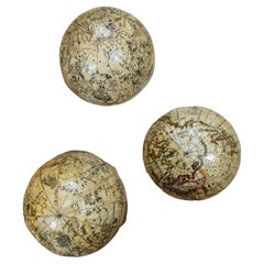
A celestial globe (star globe) is a globe of the stars and constellation. They are mapped onto a sphere to show how they appear in the night sky from the earth, as if the earth were in the centre of the sphere. Given this point of view, the constellation figures are rendered differently from those on a star map -- they are usually reversed and drawn as if we were viewing them from the back, from some imaginary point in the cosmos beyond the earth and stars.
Condition.
This globe is in fine condition, with no facsimile work done. The globe has been cleaned and revarnished, and the gold embossing has been supplemented in certain places. The colouring is fine and original, as has a lovely looking ‘aged patina’. The celestial figures are finely engraved and rendered in truly glorious and eye-catching detail, including a lot of gold embossing to the stars, the constellations, and to the decorative sextant.
The Celestial Heavens. (What does the globe display.)
Constellation names that come from Greek mythology, including the names of the zodiac constellations, are the ones that are best known. These constellations were first catalogued by the Greek astronomer Claudius Ptolemy in the 2nd century CE. Ptolemy did not name these constellations, but simply documented them in his Almagest. The constellations were well known to observers long before his time.
These include:
Orion (the Hunter)
Andromeda (the Chained Maiden)
Cassiopeia (the Queen)
Perseus
Hercules
Ursa Major (the Great Bear)
Ursa Minor (the Small Bear)
Canis Major (the Greater Dog)
Canis Minor (the Smaller Dog)
Auriga (the Charioteer)
Draco (the Dragon)
Cygnus (the Swan)
Leo (the Lion)
Aquarius (the Water Bearer)
Names associated with figures from mythology were given to a number of prominent constellations. These include most of the members of the Perseus family (Perseus, Andromeda, Cassiopeia, Cetus, Cepheus, Pegasus, and Auriga), Hercules family (Hercules, Sagitta, Aquila, Lyra, Cygnus, Hydra, Crater, Corvus, Ophiuchus, Serpens, Centaurus, Lupus, Corona Australis, and Ara), Orion family (Orion, Canis Major, Canis Minor, Lepus, Monoceros), Zodiac family (Aries, Taurus, Gemini, Cancer, Leo, Virgo, Libra, Scorpius, Sagittarius, Capricornus, Aquarius, Pisces), and Ursa Major family (Ursa Major, Ursa Minor, Draco, Canes Venatici, Boötes, and Corona Borealis).
Most of the modern constellations that were not catalogued by Ptolemy were created between the 16th and 19th centuries. Many of them were unknown to the Greeks because they lie in the far southern sky and are invisible from mid-northern latitudes.
Twelve constellations were created by Dutch explorers who sailed to Indonesia in 1595. They were named after the animals the explorers encountered on their journeys. These constellations were first depicted on a celestial globe designed by the Dutch-Flemish astronomer Petrus Plancius in 1597/1598.
They include:
Apus (the Bird of Paradise)
Chamaeleon
Dorado (the Dolphinfish or Swordfish)
Grus (the Crane)
Tucana (the Toucan)
Volans (the Flying Fish)
Musca (the Fly)
The Polish astronomer Johannes Hevelius added 10 new constellations in the 17th century. Seven of these are still in use:
Canes Venatici (the Hunting Dogs)
Lacerta (the Lizard)
Leo Minor (the Smaller Lion)
Lynx
Scutum (the Shield)
Sextans (the Sextant)
Vulpecula (the Little Fox)
Conclusion:
A unique opportunity to acquire an exceptional celestial globe from one of the major world globe publishers. The Dutch have never been surpassed in their lavish designs and their eye for detail in globe making. Gerard and Leonard Valk continued on this wonderful tradition of the Dutch ‘golden age’ of wonder, (approximately from the 1590s until the 1670s) from famous 17th century predecessors like Blaeu, Van Langren, Hondius and Van Keulen.
This magnificent globe would be a most handsome addition to any institution, museum or household it entered. Globes of this age and magnificence are always sought after by collectors and institutions alike, as they have the combined appeal of value and undoubted aesthetics.
This terrific celestial globe is a gorgeous and superb testament to the globe maker’s art and technical skill from over three hundred years ago.
Know examples around the World:
BELGIUM 1
CZECH 1
FRANCE 1
ITALY 1
NETHERLANDS 2
POLAND 2
SWEDEN 2
GERMANY 6
Provenance: from a private collector, The Netherlands.
- Creator:Gerard and Leonard Valk (Designer)
- Dimensions:Height: 28 in (71.12 cm)Diameter: 18 in (45.72 cm)
- Style:Dutch Colonial (Of the Period)
- Materials and Techniques:
- Place of Origin:
- Period:
- Date of Manufacture:1715
- Condition:Replacements made: Cleaned and revarnished, the gold raising has been supplemented in certain places.
- Seller Location:ZWIJNDRECHT, NL
- Reference Number:1stDibs: LU9419237343972
About the Seller
New to 1stDibs
Joined in the past six months.
No Reviews Yet
Vetted Seller
These experienced sellers undergo a comprehensive evaluation by our team of in-house experts.
1stDibs seller since 2023
- ShippingRetrieving quote...Ships From: ZWIJNDRECHT, Netherlands
- Return PolicyA return for this item may be initiated within 14 days of delivery.
More From This SellerView All
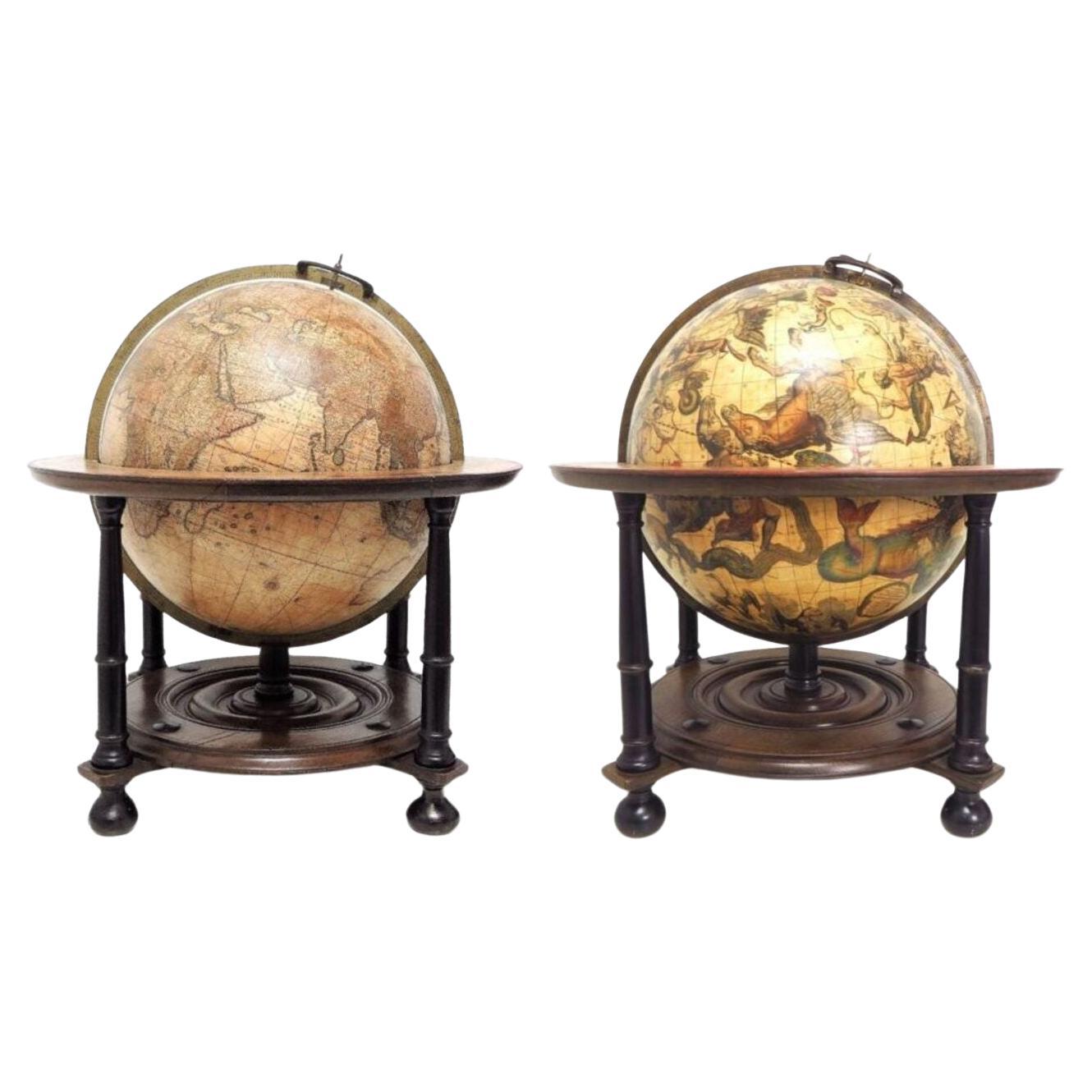
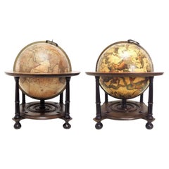
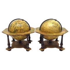
- A pair of extremely rare Valk table globesBy Gerard and Leonard ValkLocated in ZWIJNDRECHT, NLTitle on the globes: VALK, Gerard and Leonard. [Terrestrial globe:] Cosmotheore, caelesti nostro globo, par, et plane novus, hic terrestris ut existeret, certo scias, errore veterum ...Category
Antique 18th Century Dutch Dutch Colonial Globes
MaterialsOther
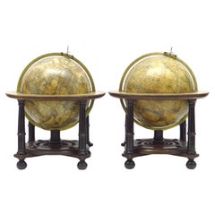
- An exceptional pair of BLAEU table globesBy Willem BlaeuLocated in ZWIJNDRECHT, NLA very rare set of globes, 9 inch / 23cm, with an overall height of 38 cm, Amsterdam, dated 1602, but published after 1621. In their original stands with circular wooden horizon rings, covered with printed paper, supported by four legs and brass meridian rings supported by a single column. The terrestrial and celestial globe are made up of a set of 12 engraved gores, heightened in gold and Arctic ice caps, printed on paper and mounted on a plaster sphere of papier maché. Each sphere is mounted in a graduated brass meridian ring with the production number stamped at the back of the ring. Both globes are mounted on four-legged ebonized oak Dutch stands, which support the horizon ring. The legs are connected by two crossbeams which support a circular base plate with central support for the meridian ring. The horizon rings are covered with printed paper. With usual defects: paper equinoctial tables present gaps that are filled and restored; small splits along gores; several partially deleted entries; on the globe, the date 1602 and the text of the cartouche in America, are illegible ; small scattered spots but in general in good condition for such an early globe pair of which presently only 19 pair are recorded. These 9-inch globes are among the rarest since very few copies of them are known to exist, in comparison with the smaller or larger globes of Blaeu (4, 6, 13.5, and 26 inches). Blaeu's terrestrial globes were highly valued and were much in demand, because of the care with which they had been prepared, because of the efforts to give the latest information on discoveries, and because of the loxodromic lines that made them of special value to navigators. His celestial globes were appreciated for the fact that he had been the pupil of Tycho Brahe, who was himself known to be the greatest astronomer of his time. Willem Janszoon Blaeu (1571–1638), originally trained in astronomy, he quickly became a leading maker of maps, atlases and instruments. Blaeu’s globes were luxury items for wealthy and intellectual merchants and nobility who benefited from Blaeu’s access through the Dutch East India Company to the latest navigational discoveries and geographical information. Willem Jansz Blaeu collected information that Dutch mariners gathered from around world and brought back to Amsterdam. Crews were instructed to record information about the lands they visited and the skies they saw. Blaeu incorporated these observations in maps and globes. Through his web of contacts and thanks to assiduous research, he was also able to obtain the most recent information about the latest discoveries in the western hemisphere and the South Pacific, where Dutch explorers were particularly active at the time. Since the globe was published after 1618, Blaeu was able to include the discoveries made by Henry Hudson in his attempt to find a passage to the East Indies. He also included recent Pacific discoveries of the celebrated voyages of Willem Cornelis Schouten and Jacob Le Maire, who both traversed the South Pacific and the Atlantic. The findings of Schouten and Le Maire in the Tierra del Fuego region are also incorporated. The Strait of Le Maire is drawn and the hypothetical southern continent is labelled “Terra Australis Incognita Magalanica”. Olivier van Noort’s track is drawn and labelled. His route is indicated with a broken line and the words: “Navigationis Olivierij ductus” (several times). There are various decorative features, such as animals on the different continents, many ships on the high seas and allegorical and mythical figures around the cartouches. The nine-inch globe is not just a smaller version of the one published in 1599. Drawings of animals and people do often correspond to those on the earlier globe, but Blaeu made several significant changes. - The west coast of North America is drawn differently and the river system of Brazil is altered. - The hypothetical southern continent is labelled: Terra Australis Incognita Magallanica. - There are nine ocean names in handsome curling letters: Mare Congelatum, Mare Atlanticum, Oceanus Aethiopicus, Mare Arabicum et Indicum, Mare di India, Oceanus Chinensis, Mar del Zur, Mare Pacificum, Mar del Nort. - Willem Blaeu...Category
Antique 17th Century European Dutch Colonial Globes
MaterialsOther
- Fine double pocket globeBy Carl BauerLocated in ZWIJNDRECHT, NLPublisher: Carl Bauer (Germany, 1780-1857) Place / Date: Nürnberg, ca. 1840 Size: Diameter Globes 6,5 cm. Terrestrial and celestial "Mother and Child" or double globe; the ...Category
Antique 1840s German Dutch Colonial Globes
MaterialsWood, Paper
- An extremely rare pair of miniature globes by Johann Baptist HomannBy Johann Baptist HomannLocated in ZWIJNDRECHT, NLJ.H. Homann (Germany, 1664-1724) Nürnberg, after 1715 Globus Terrestris [and] Globus Celestis. juxtu observationes Parisienses Regia Academia Scientiarum constructus [and] juxtu observationes Parisienses Regia Academia Scientiarum constructus. Nuremberg, [after 1715]. Original stands by Homann Heirs, [after 1730]. An extremely rare pair of terrestrial and celestial globes, each with 12 hand-coloured engraved paper gores, over a papier mâché and plaster sphere, each globe with papier mâché meridian ring, mounted on horizon rings with a handwritten number VIII and III on each globe. The horizon rings supported by four quadrants with text "Zu finden in Nürnberg / wohnhaft unter der Vesten / bey denen Homaenischen Erben/ dem Prediger Klöster gegenüber", both globes on a turned single wooden black stand. Diameter 64 mm (2.5 inches), height 185 mm. RARE. Johann Baptist Homann (1664–1724), a German geographer and cartographer. He founded a publishing business in Nürnberg in 1702, and published his first atlas in 1707, becoming a member of the Academy of Sciences in Berlin in the same year. Homann was appointed Imperial Geographer to Charles VI in 1715 and became the most important map...Category
Antique 1710s German Dutch Colonial Globes
MaterialsOther
- A truly delightful miniature terrestrial pocket globeBy Nathaniel MillsLocated in ZWIJNDRECHT, NLA truly delightful miniature terrestrial pocket globe in a celestial case, 3 inches / 6.8 cm. The globe consists of 12 wonderful varnished, engraved hand-coloured gores that stretch from pole to pole. In the original case of black fish-skin with a brass hinge and two brass hook-and-eyelet closures, case with a unique silver plaque which reads: "B. Bellchamber S. King - Gul's Fox Summum Geographicum Praemium Pares Meruere". * [This very roughly translates to:] "B. Bellchamber S. King - Gul's Fox Earns Top Geographical Peers Award". *Is it too much to suppose and speculate that this wonderful silver plaque attached to the outer case is in recognition of a [geographic?] scholastic achievement? The prize awarded to the lucky recipients (B. Bellchamber & S. King?) is this globe? This terrestrial globe has two repairs; to the area concerning the British Isles, and also to parts of Europe and Scandinavia (with some loss). There is some slight loss to a portion of North America, and there is a crack to the northern portion of South America. It is partly worn in other places and has some slight spotting. It is lacking the axis metal pin, and the two holes that normally allow for this pin have been closed. The case is split and segmented, partly rubbed and worn with cracks, (as is usual.) The case will close. There is some minor chipping and cracking to the outer rim of the inside of the case. About Pocket Globes. It is generally thought that Joseph Moxon brought pocket globes to England in the late seventeenth century. These globes usually consist of a terrestrial sphere of about 7.5 cm in diameter that fits into an outer case (usually made of fish-skin). The interior of this case often bears bright, colourful celestial cartography, so you effectively have the celestial heavens surrounding the terrestrial earth. Pocket globes, although highly desirable, are for all intents and purposes somewhat impractical, as their size makes accurate calculations impossible. Few, if any, pocket globes came with accompanying booklets, so it is hard for anyone to know who used them and for what purposes. Pocket globes could simply have served purely as status symbols for wealthy gentlemen, who had an interest in geography or astronomy. The fields of geography and the sciences were quickly advancing during this period. Alternatively, pocket globes could be seen as a tool used in children’s education, especially when you think that they are construction from cheap materials such as papier-mâché. Points of Interest. This particular globe shows California as a peninsula, whereas previously it had been depicted as an island – a misconception dating back to the sixteenth century; it has the northwest coast of America simply as "unknown parts."; - due to a profound lack of knowledge of the region; the track of Admiral George Anson’s circumnavigation of the world (1740-44) is drawn – Anson led a squadron of eight ships on a mission to disrupt or capture the Pacific Ocean possessions of the Spanish Empire, for emphases, the trade winds are indicated by red arrows. There are three large lakes engraved in Africa that may longer exist. The Celestial Gores. The celestial gores, housed within the case, are fun and eye-catching both in their display and in their content. Constellations and both hemispheres and are represented. Gemini, Cancer, Virgo, Orion, Andromeda, Taurus, Leo, Ursa Major etc in the north, and Scorpio, Libra, Canis Major etc in the south. A celestial globe is a mapping of the stars, and has been used since classical times. Celestial globes were first used by Greek astronomers, and later by the Islamic world, where the earliest known globes date from the eleventh century. The stars were thought to sit on the surface of a giant sphere around the earth, and the constant movement of the stars each night and throughout the year appeared to be caused by this giant sphere slowly turning overhead. In line with its counterpart, the terrestrial globe, celestial globes are mapped by a north and a south pole, an equator, and lines of latitude and longitude. The Terrestrial Globe. The North Pole encompasses the Arctic Circle, Baffin Bay (Canada), Iceland, Greenland, northern Siberia and Nuova Zembla. Europe shows the Dominion of Muscovy (a principality of the late Middle Ages centered on Moscow), Turkey, the British Isles, Italy etc. Africa highlights the Barbary coast, Biledulgerid (a former country in North Africa), the Zaara Desart (Sahara Desert), Negroland (an archaic term in European mapping referring to large portions of West Africa), Guinea, Ethiopia, Congo, the islands of the Azores and the Canaries. Australia (New Holland) shows the outdated cartography of an incomplete coastline; The West Australian and Northern Territory coastlines are in full, however, there is no connected mainland coastline from South Australia up to Northern Queensland. Papua New Guinea is still thought to be a part of the Australian mainland. A portion of Tasmania’s coastline is engraved. The only places/regions mentioned are: Dimens Land and Carpentaria in the north; Lewins, St. Francis, Mary’s Island, South Cape, and Dimens Land in the south. Interestingly, a place named Hartog’s Island is mentioned off the West Australian coast. This island has a unique place within Australia’s history as it is the first recorded European landing on Australian soil in 1616 by the island’s namesake, Dutch captain Dirk Hartog...Category
Antique Mid-18th Century British Dutch Colonial Globes
MaterialsOther
- A decorative pair of rare table globes in a fine condition.By Johann Gabriel DoppelmayrLocated in ZWIJNDRECHT, NLThese pair of globes, dated 1730, are original and in fine condition. Title: Globus terrestris novus Loca Terrae insigniora sec. praestant Astron. et Geogr. observationes sistens op...Category
Antique Early 18th Century German Baroque Globes
MaterialsOther

You May Also Like
- Celestial Table Globe by Harris and SonLocated in Lymington, HampshireA 12 inch celestial table globe by Harris and Son, the horizon ring, with the original papers, set on four turned mahogany legs, the label statin...Category
Antique 1810s English Globes
MaterialsMahogany
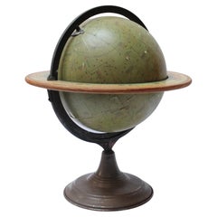
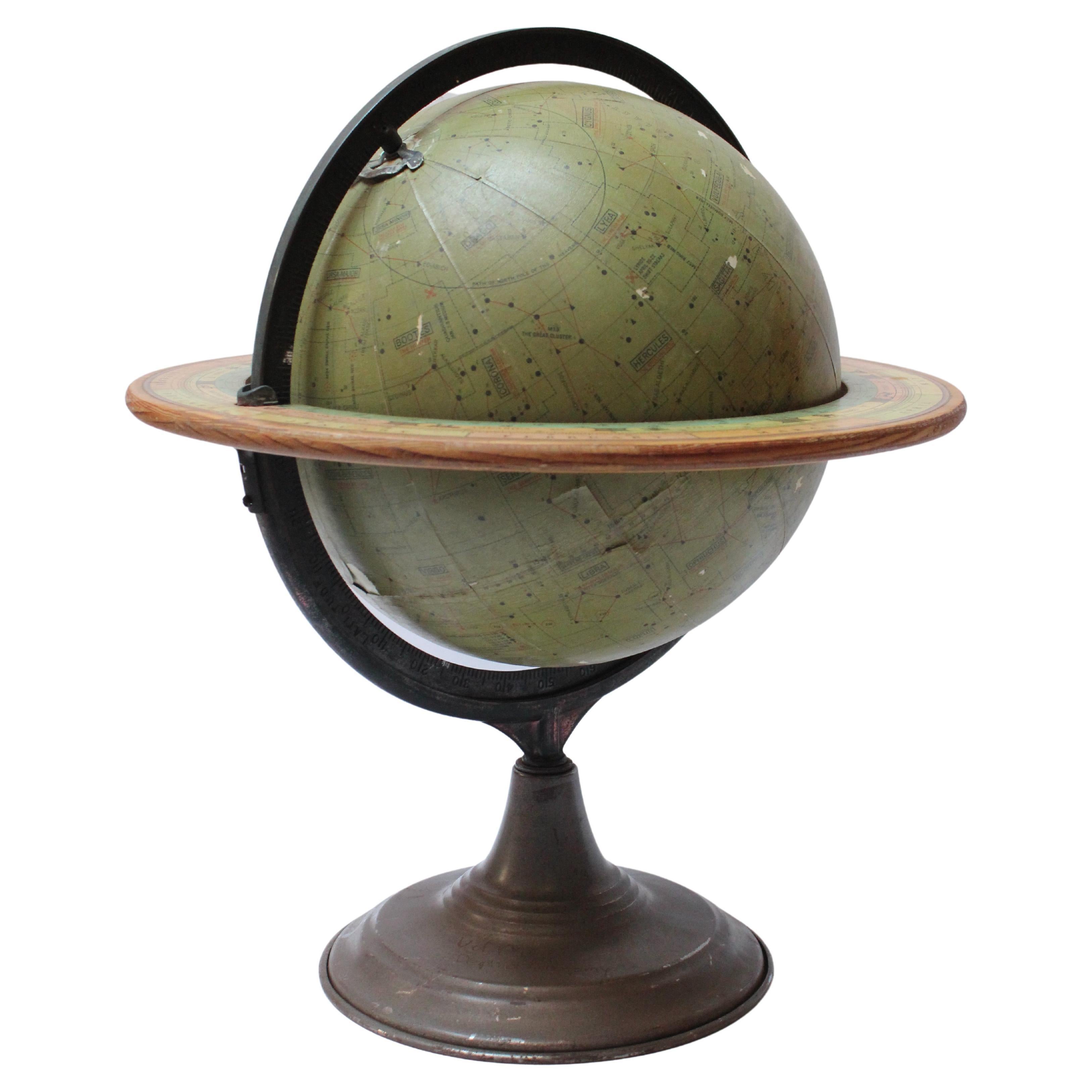
- Vintage Dennoyer-Geppert Celestial GlobeLocated in Brooklyn, NYDennoyer-Geppert Celestial Globe designed by Commander Stubbs RNR (Royal Navy) for classroom astronomy demonstration purposes (ca. 1930, Chicago, IL.). Composed of paper gores in olive green over a hollow metal core, featuring an adjustable cast-metal meridian with bronze finish and a wood horizon...Category
Vintage 1930s American Art Deco Globes
MaterialsMetal
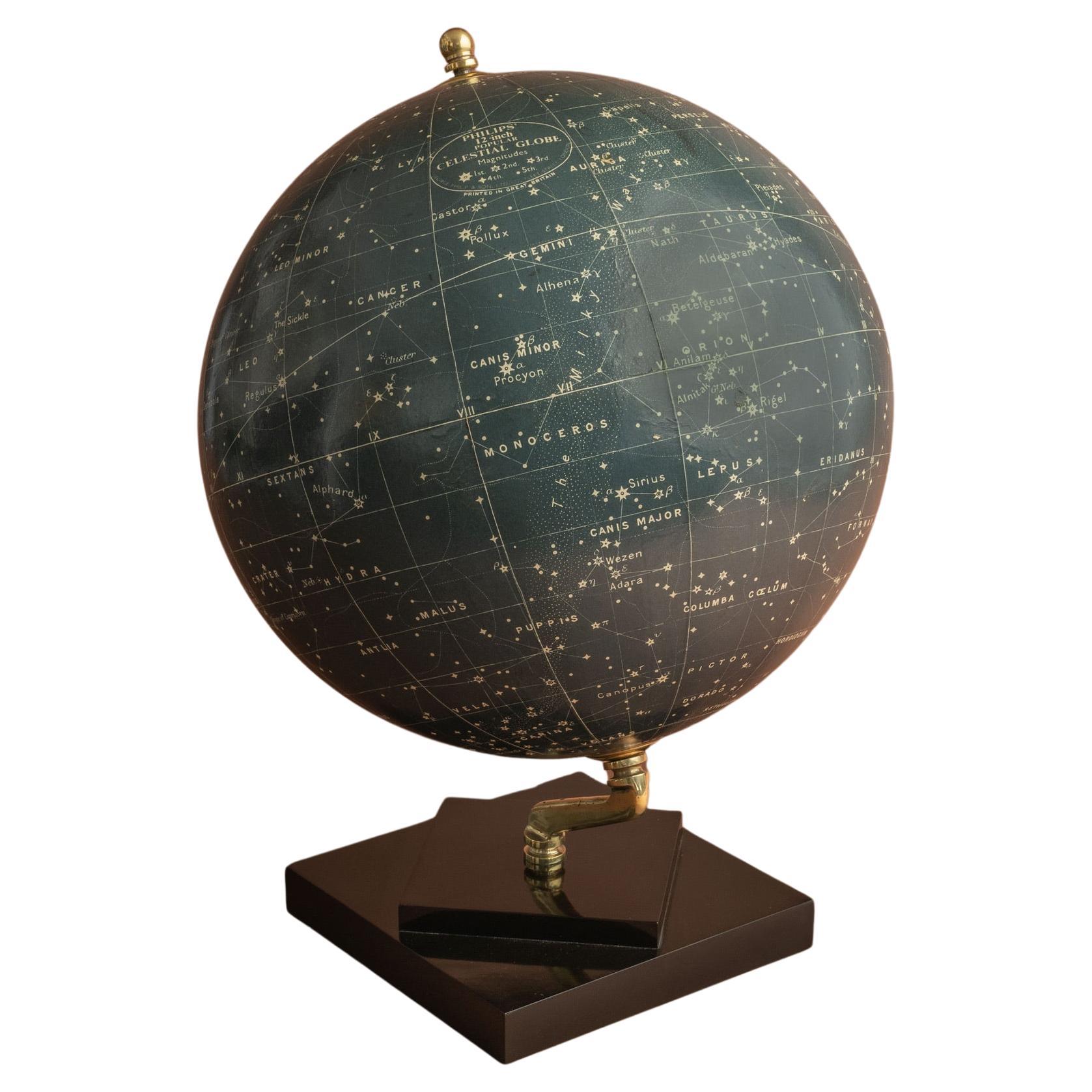
- Philips' Celestial Globe, circa 1935By George Philip & SonLocated in London, GBA stylish celestial globe on a brass inclined plain mount attached to original square bakelite base and secured at the top by a brass acorn finial. By George Philip and Son; circa 1935...Category
Vintage 1930s British Globes
MaterialsBrass
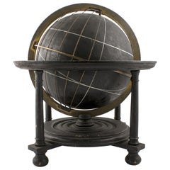
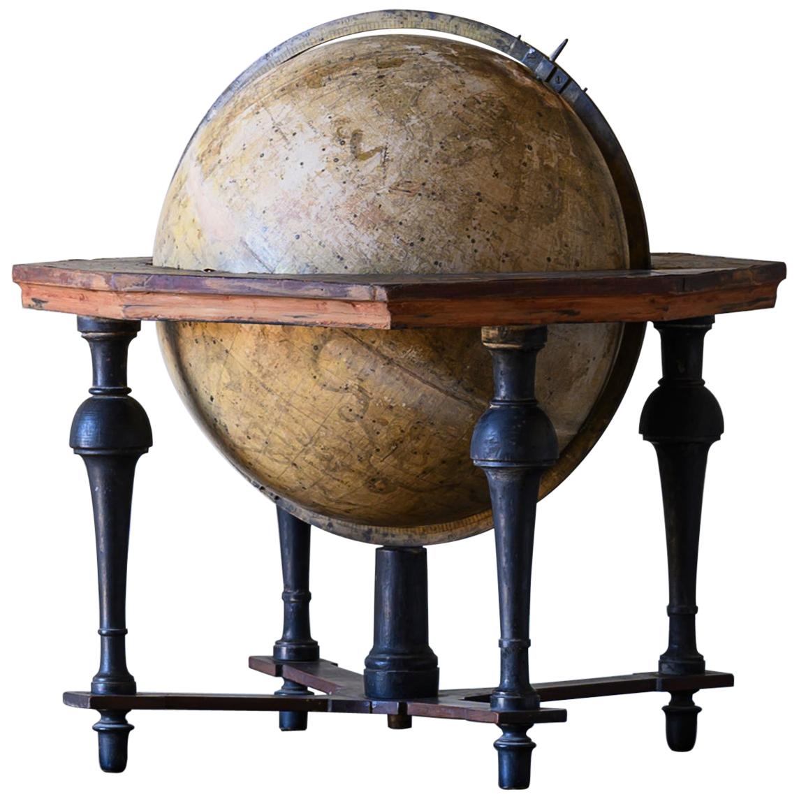
- 18th Century Celestial GlobeLocated in Mjöhult, SERare 18th century celestial globe (Globus Coelestis) on a stand in mahogany and blackened wood by Anders Akerman, 1759. In 1758, the "Cosmographic Society" was formed in Uppsala, ...Category
Antique Mid-18th Century Swedish Rococo Globes
MaterialsBrass
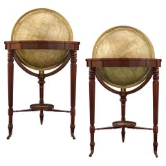
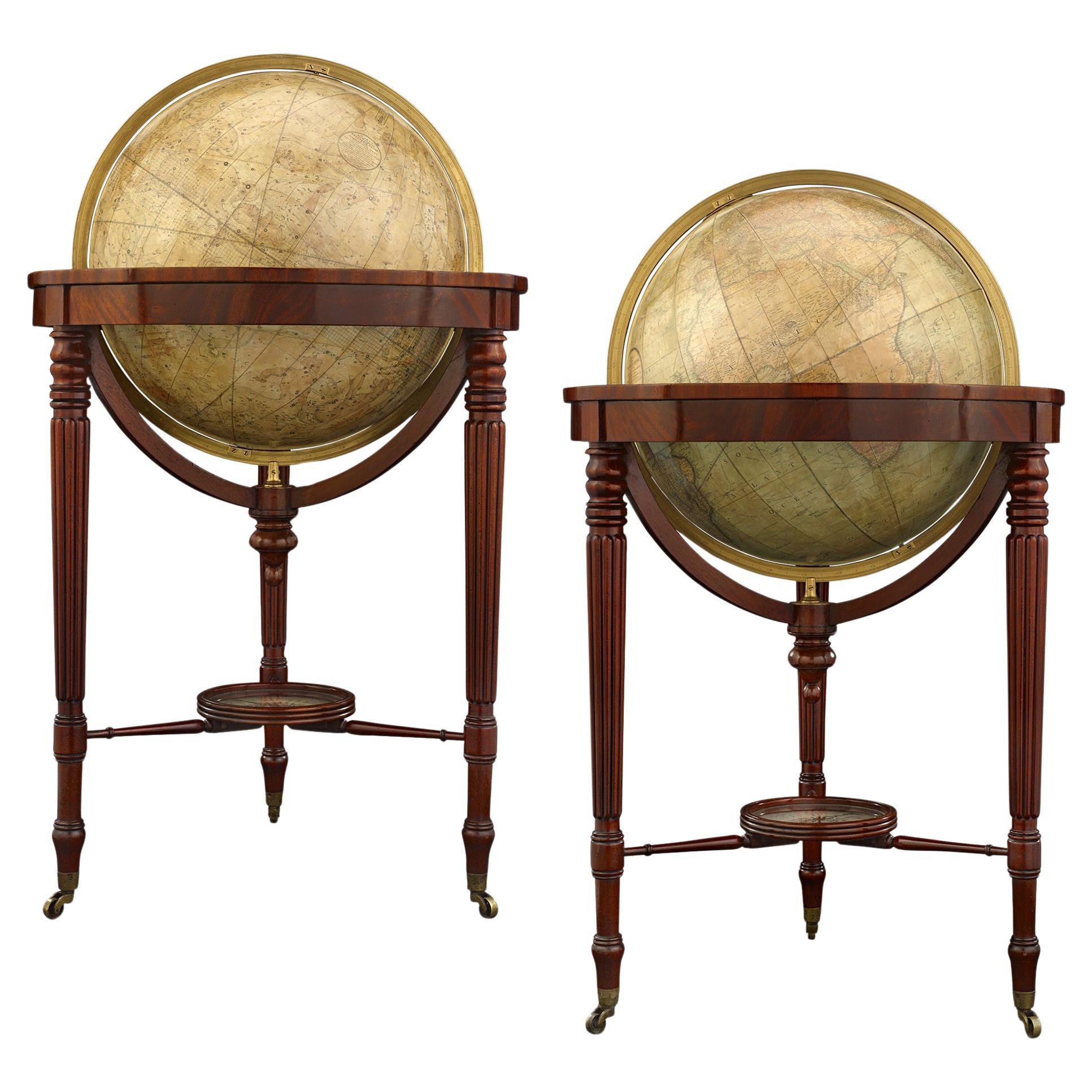
- William IV Terrestrial And Celestial Floor Globes By J. W. CaryBy John & William CaryLocated in New Orleans, LAThis stately pair of William IV Terrestrial and Celestial Globes was crafted by the esteemed mapmaking firm J. & W. Cary, exuding the essence of late Regency-era elegance. Beyond the...Category
Antique 19th Century English Regency Globes
MaterialsMahogany
- Celestial Globe, Sweden, Early 19th CenturyLocated in Kastrup, DKBlack wooden celestial globe in original condition. Blackened wood, horizon circle and brass rings with longitude measurements. Mounted on wooden stand with turned legs and bun fee...Category
Antique Early 19th Century Globes
MaterialsWood