Items Similar to Original Old Composite of Several Maps of the Ancient World on One Sheet, 1880

Want more images or videos?
Request additional images or videos from the seller
1 of 9
Original Old Composite of Several Maps of the Ancient World on One Sheet, 1880
About the Item
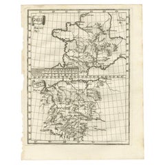
This original antique map is from Karl Spruner von Merz's "Atlas Antiquus", later edited by Theodorus Menke. The map is a detailed depiction of the ancient world. The atlas it comes from is known for its scholarly accuracy and was widely used for educational purposes in the 19th century.
This particular map likely represents multiple historical periods, given Spruner's comprehensive approach to cartography. The map is a colored lithograph with hand-colored borders, a common practice of the time to distinguish different regions or nations. It’s composed of several smaller maps and charts, each focusing on different regions or aspects of the ancient world. The main map seems to depict the classical lands of Europe, North Africa, and parts of Asia, reflecting the Roman Empire at its extent.
The map includes various Latin inscriptions, indicating regions, cities, and important geographical features such as rivers, mountains, and seas. It also contains tables and notes that would provide context and additional information to the viewer, likely historical data relevant to the periods and places shown.
Given the indicated publication year of 1880, this map was one of the later editions of Spruner’s atlas, at a time when such detailed historical atlases were particularly valuable to academics and educators. The combination of Spruner's detailed cartographic work and Menke's editing would have made this a significant educational resource for understanding historical geography.
This map, with its intricate detail and historical value, is not only a tool for learning but also a work of art, reflecting the high standards of craftsmanship and academic rigor of the period.
To observe the map in more detail and in various sections, read here:
1. **Top Left Corner**: A smaller inset map that appears to be a wind rose or a classical depiction of the known world, possibly showing the classical elements or winds with Greek or Latin inscriptions.
2. **Main Central Map**: This is the largest section and seems to show the ancient world, with parts of Europe, Northern Africa, and Asia. The territories are marked with different colors, possibly representing the boundaries of various empires or states.
3. **Bottom Left Corner**: Here, there are three inset maps. The topmost one appears to show the Arabian Peninsula; the middle one could be depicting the Nile delta and surrounding regions of Egypt; and the bottom one might be focusing on the island of Sicily with its Greek colonies.
4. **Bottom Center**: This section seems to be another detailed map, potentially zooming in on the Mediterranean region, featuring parts of Southern Europe, Northern Africa, and the Near East. The detail here suggests important cities, trade routes, or other significant historical features.
5. **Bottom Right Corner**: Similar to the bottom left, there are three inset maps. They likely depict specific regions of historical interest, possibly including the Italian peninsula and other culturally significant localities of the ancient world.
6. **Borders and Tables**: Surrounding the maps are various tables and notes. These could contain important contextual information such as the names of regions, historical notes, distances, or a legend explaining the symbols and colors used on the map.
7. **Overall Style and Detail**: The map is intricately detailed, with various lines denoting borders, possibly trade routes, and other geographical features like mountains and rivers. The use of color is strategic, demarcating different regions for easy visual distinction.
The map is a rich historical document, offering a window into how 19th-century scholars viewed and interpreted the ancient world. It's a blend of geography and history, serving as an educational tool for understanding the vastness and complexity of ancient civilizations.
- Dimensions:Height: 15.56 in (39.5 cm)Width: 18.51 in (47 cm)Depth: 0 in (0.02 mm)
- Materials and Techniques:
- Period:
- Date of Manufacture:1880
- Condition:Good, given age. General age-related toning, especially around the edges and fold line. Vertical folding line as issued. Please study scan carefully.
- Seller Location:Langweer, NL
- Reference Number:
About the Seller
5.0
Platinum Seller
These expertly vetted sellers are 1stDibs' most experienced sellers and are rated highest by our customers.
Established in 2009
1stDibs seller since 2017
1,916 sales on 1stDibs
Typical response time: <1 hour
- ShippingRetrieving quote...Ships From: Langweer, Netherlands
- Return PolicyA return for this item may be initiated within 14 days of delivery.
More From This SellerView All
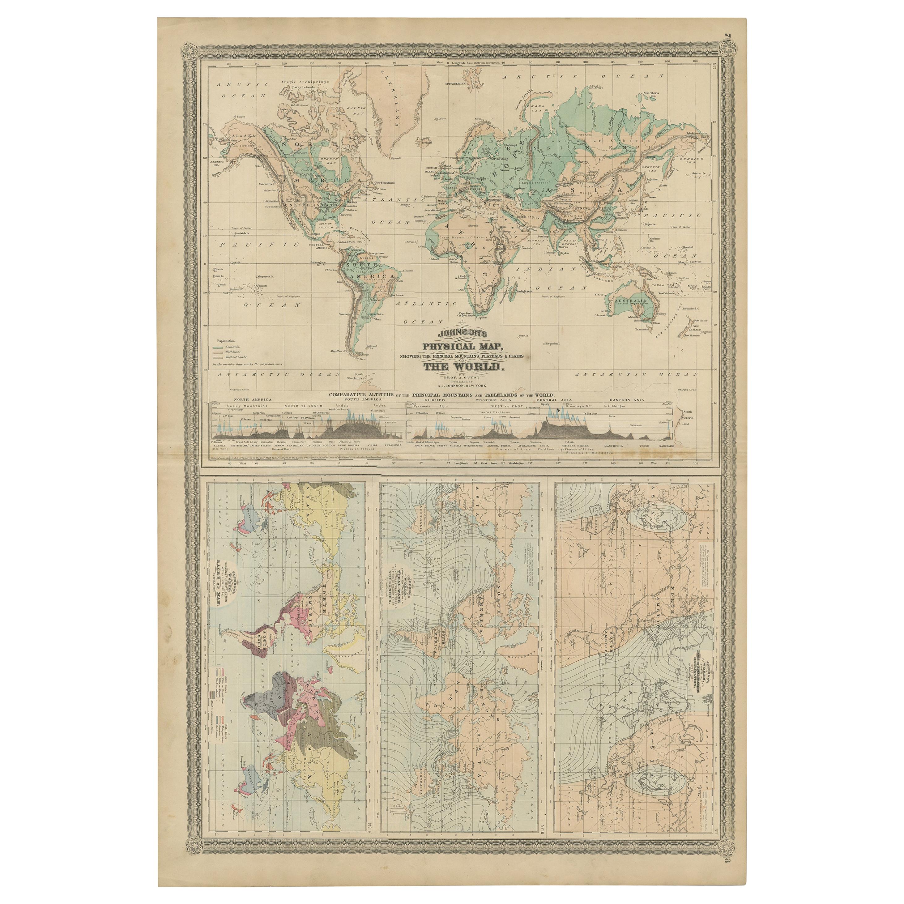
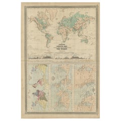
- Four Physical Maps of the World on One Sheet , 1872Located in Langweer, NLFour physical maps of the world on one sheet. The upper map shows lowlands, highlands and highest lands. The other maps show world's races, ocean current and volcanoes, and magnetic ...Category
Antique Late 19th Century Maps
MaterialsPaper
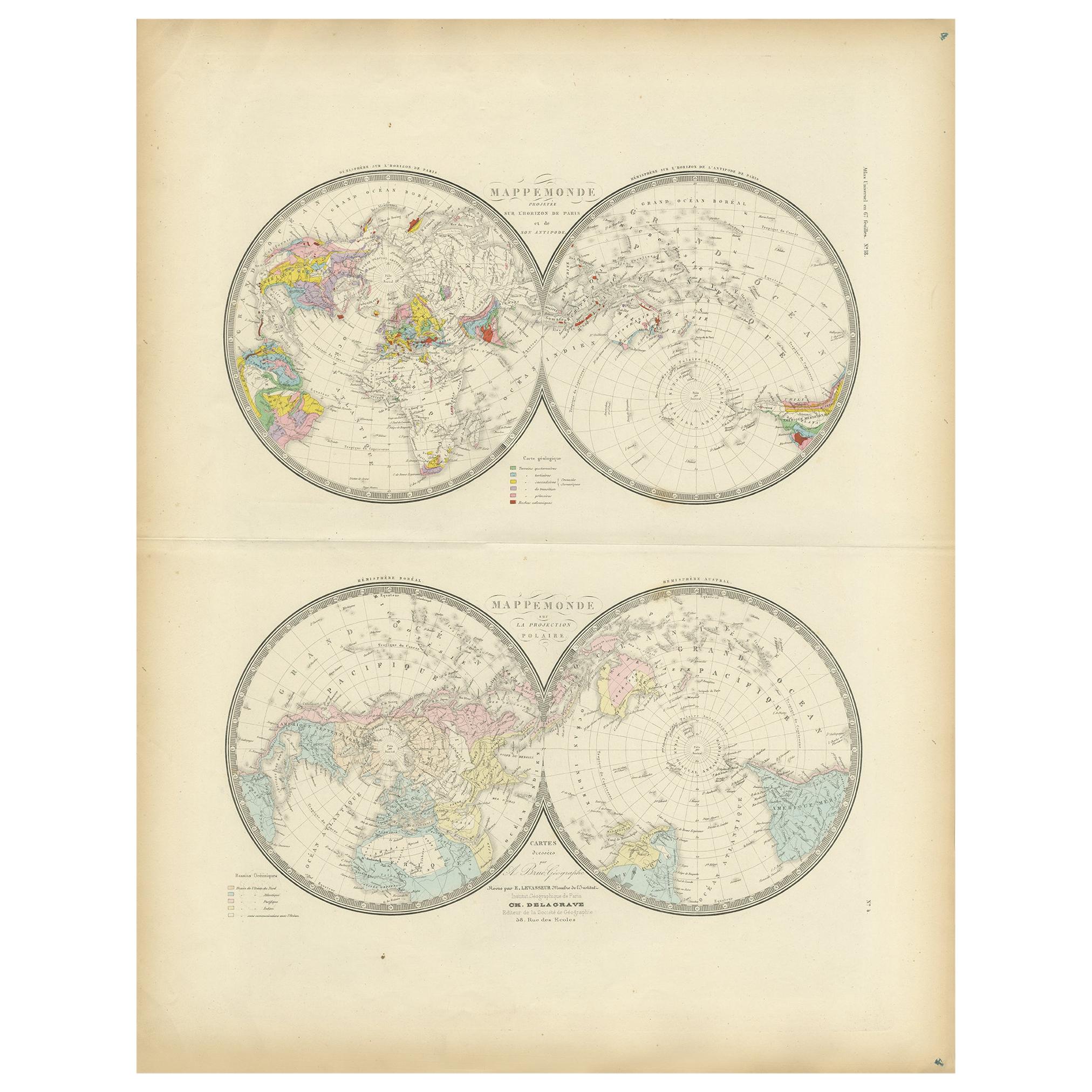
- Antique Hemisphere Map of the World 'Two on One Sheet' by Levasseur, '1875'Located in Langweer, NLAntique map titled 'Mappemonde projetée sur l'Horizon de Paris et de son Antipode - Mappemonde sur la projection polaire'. Large map with two hemisphere world maps...Category
Antique Late 19th Century Maps
MaterialsPaper
- Antique Map of the World in two sheets, 1852Located in Langweer, NLAntique map titled 'The World on Mercator's Projection'. Two individual sheets of the world. This map originates from 'Lowry's table Atlas constructed and engraved from the most rece...Category
Antique Mid-19th Century Maps
MaterialsPaper
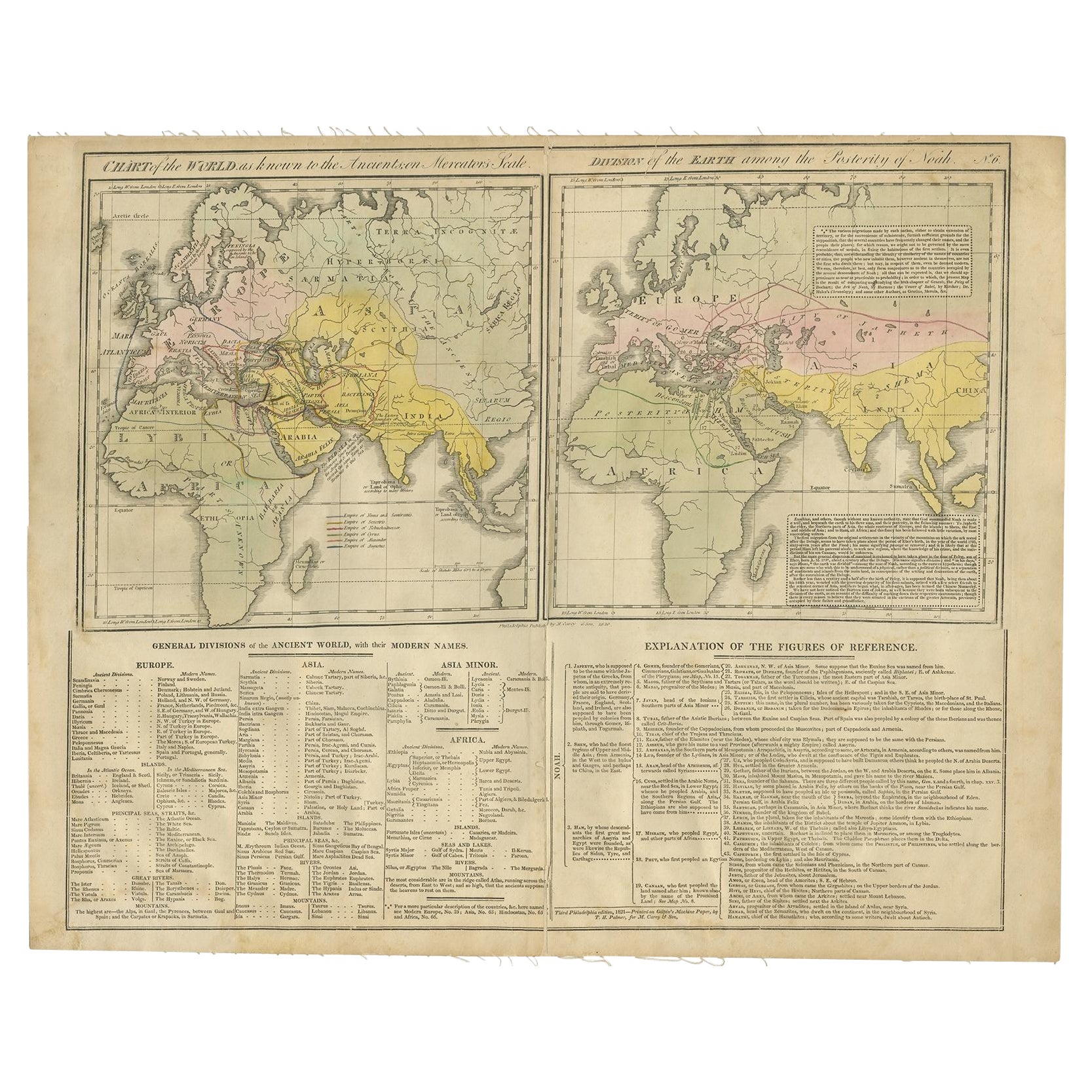
- Maps of the Ancient World and the Posterity of Noah, 1820Located in Langweer, NLTwo maps on one sheet. Hhand colored engraved lithograph, depicting the world as known to the Ancients on Mercator's projection and the Posterity of Noah. The first showns the Empire...Category
Antique 19th Century Prints
MaterialsPaper
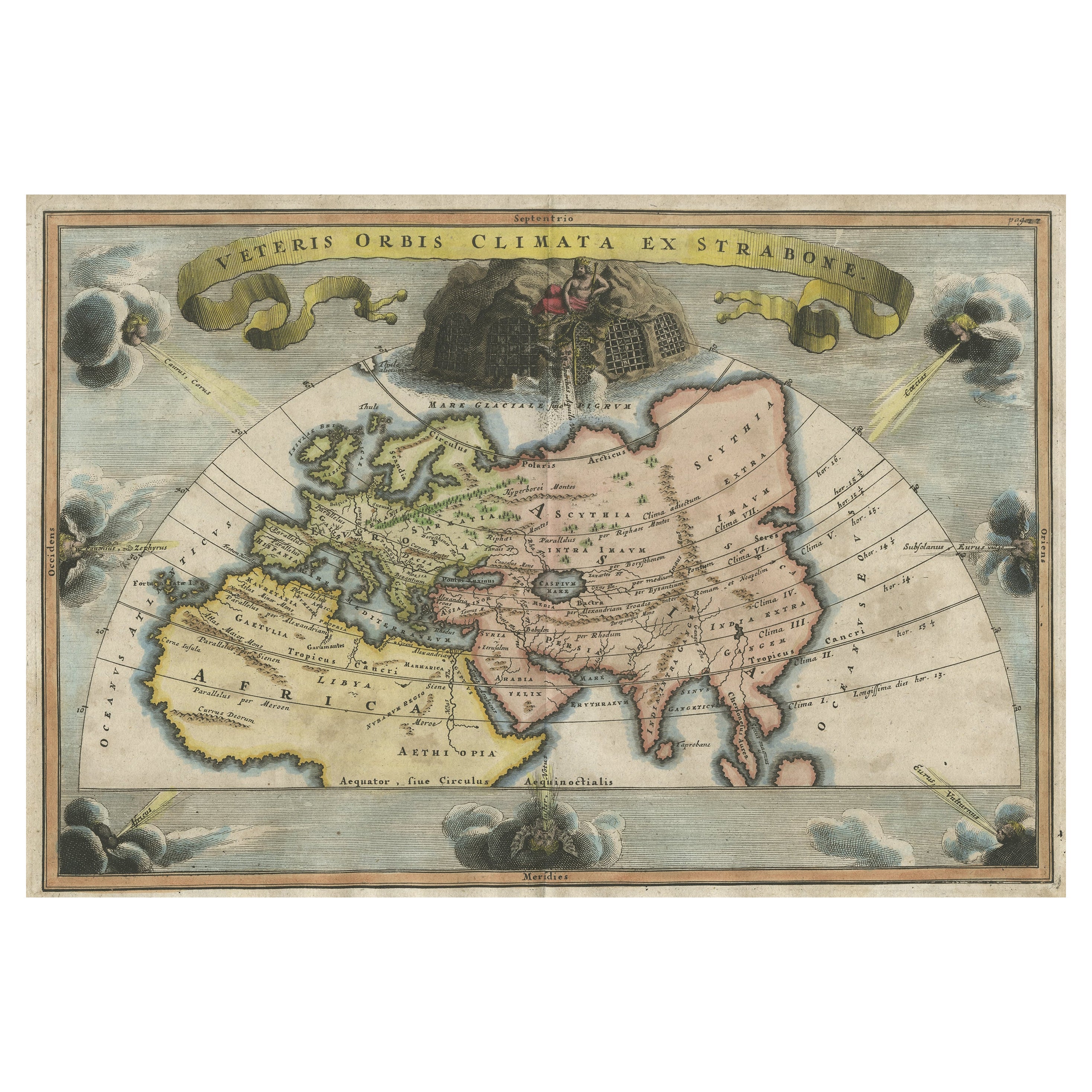
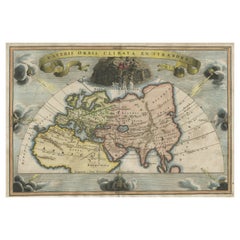
- Decorative Ancient World Map with Large Parts of the World Still Unknown, c 1731Located in Langweer, NLInteresting ancient map of the world, based upon Strabo. The Southern tip of Africa is undiscovered. No sign of Japan, the Korean Peninsula or Australia and Oceana. Excellent NE Pass...Category
Antique 1730s Maps
MaterialsPaper
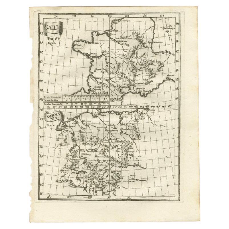
- Antique Map of Gallia and Germania on one Sheet, c.1703Located in Langweer, NLAntique map depicting France (Gallia) and Germany (Germania). Printed for Scherer's 'Atlas Novus' (1702-1710). Artists and Engravers: Heinrich Scherer (1628-1704) was a Professor...Category
Antique 18th Century Maps
MaterialsPaper


You May Also Like
- Large Original Vintage Map of The World, circa 1920Located in St Annes, LancashireGreat map of The World Original color. Good condition / minor foxing Published by Alexander Gross Unframed.Category
Vintage 1920s English Maps
MaterialsPaper
- Large Original Antique Map of The World, Fullarton, C.1870Located in St Annes, LancashireGreat map of the World. Showing both hemispheres From the celebrated Royal Illustrated Atlas Lithograph. Original color. Published by Fullarton, Edinburgh, C.1870 Unframed. Rep...Category
Antique 1870s Scottish Maps
MaterialsPaper
- 1847 “World at One View” Antique Hand-Colored Wall Map of the WorldLocated in Colorado Springs, COThis is a highly desirable hanging wall map of the "World at One View", published in 1847 by Ensign and Thayer, New York. This pictorial map was printed as a broadside and features...Category
Antique 19th Century American Maps
MaterialsPaper
- Colored wall map of the WORLDBy ChambonLocated in ZWIJNDRECHT, NL“Mappe Monde, contenant les Parties Connues du Globe Terrestre” CHAMBON, Gobert-Denis (France, 17.. - 1781) Paris, Longchamps et Janvier, 1754 Size H. 115 x W. 145 cm. Gobert-Denis Chambon made copper engraving after the work of Guillaume De L’Isle, published in 1754 by Jean Janvier and S.G. Longschamps. A huge wall map of the world in two hemispheres printed on two sheets, depicting the Eastern and Western hemispheres supported by two male figures, decorated at the bottom right and left with two celestial hemispheres (boreal and southern) and at the bottom in the middle with an armillary sphere, in addition. This map is most notable for its depiction of the Sea of Japan labeled "Mer de Corée" and of "Mer de L'Ouest" or Sea of the West - a great sea, easily the size of the Mediterranean, to flow from the then-known Strait of Juan de Fuca...Category
Antique Mid-18th Century French French Provincial Maps
MaterialsWood, Paper

- Map, Exploring The WorldLocated in New York City, NY300 stunning maps from all periods and from all around the world, exploring and revealing what maps tell us about history and ourselves. Selected by an international panel of cartographers, academics, map dealers and collectors, the maps represent over 5,000 years of cartographic innovation drawing on a range of cultures and traditions. Comprehensive in scope, this book features all types of map from navigation and surveys to astronomical maps, satellite and digital maps, as well as works of art inspired by cartography. Unique curated sequence presents maps in thought-provoking juxtapositions for lively, stimulating reading. Features some of the most influential mapmakers and institutions in history, including Gerardus Mercator, Abraham Ortelius, Phyllis Pearson, Heinrich Berann...Category
21st Century and Contemporary Hong Kong Books
MaterialsPaper
- Original Antique Map of The World by Thomas Clerk, 1817Located in St Annes, LancashireGreat map of The Eastern and Western Hemispheres On 2 sheets Copper-plate engraving Drawn and engraved by Thomas Clerk, Edinburgh. Published by Mackenzie And Dent, 1817 ...Category
Antique 1810s English Maps
MaterialsPaper


