Items Similar to Antique Map of Northern England and Wales by Zatta, 1784


Want more images or videos?
Request additional images or videos from the seller
1 of 5
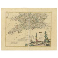
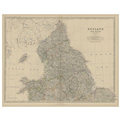
Antique Map of Northern England and Wales by Zatta, 1784
About the Item
Antique map titled 'Parte Settentrionale dell' Inghilterra e del Principato di Galles'. Engraved map of the northern part of England and Wales, with title cartouche. Shows political and administrative divisions, towns, villages, forests, mountains and rivers. This print originates from 'Atlante Novissimo, illustrato ed accresciuto sulle osservazioni, e scoperte fatte dai piu' celebri e piu' recenti geografi' by A. Zatta. Artists and Engravers: Antonio Zatta (active 1757-1797) was the most prominent Italian map publisher of the late 18th and early 19th century. His firm, based in Venice, produced maps that mark an important transition from 18th to 19th century cartographic styles.
Artist: Antonio Zatta (active 1757-1797) was the most prominent Italian map publisher of the late 18th and early 19th century. His firm, based in Venice, produced maps that mark an important transition from 18th to 19th century cartographic styles.
Condition: Good, age-related toning. Some wear and soiling. Blank verso, please study image carefully.
Date: 1784
Overall size: 48.5 x 38 cm.
Image size: 0.001 x 40.5 x 31 cm.
Antique prints have long been appreciated for both their aesthetic and investment value. They were the product of engraved, etched or lithographed plates. These plates were handmade out of wood or metal, which required an incredible level of skill, patience and craftsmanship. Whether you have a house with Victorian furniture or more contemporary decor an old engraving can enhance your living space. We offer a wide range of authentic antique prints for any budget.
- Dimensions:Height: 14.97 in (38 cm)Width: 19.1 in (48.5 cm)Depth: 0 in (0.01 mm)
- Materials and Techniques:
- Period:
- Date of Manufacture:1784
- Condition:
- Seller Location:Langweer, NL
- Reference Number:
About the Seller
5.0
Platinum Seller
These expertly vetted sellers are 1stDibs' most experienced sellers and are rated highest by our customers.
Established in 2009
1stDibs seller since 2017
1,947 sales on 1stDibs
Typical response time: <1 hour
- ShippingRetrieving quote...Ships From: Langweer, Netherlands
- Return PolicyA return for this item may be initiated within 14 days of delivery.
More From This SellerView All
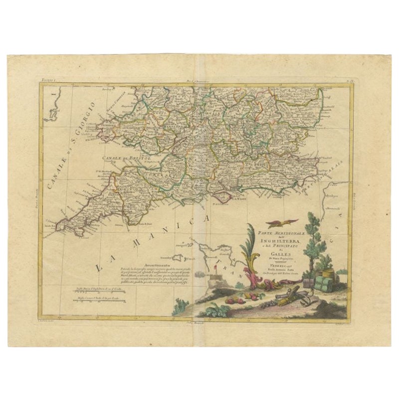
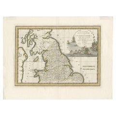
- Antique Map of Southern England and Wales by Zatta, 1784Located in Langweer, NL"Antique map titled 'Parte Meridionale dell' Inghilterra e del Pricipato di Galles'. Engraved map of the southern part of England and Wales, with title cartouche. Shows political and...Category
Antique 18th Century Maps
MaterialsPaper
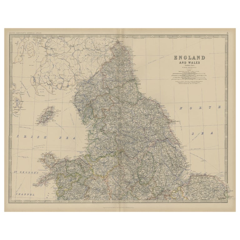
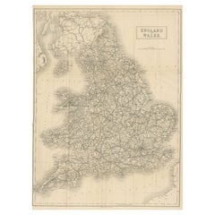
- Antique Map of, Northern England and Wales by Johnston, 1882Located in Langweer, NLAntique map titled 'England and Wales'. Old map of England and Wales. This map originates from 'The Royal Atlas of Modern Geography, Exhibiting, in a Series of Entirely Original an...Category
Antique 19th Century Maps
MaterialsPaper
- Antique Map of Northern England and Wales by Cassini, 'circa 1795'By Giovanni Maria CassiniLocated in Langweer, NLAntique map titled 'La Parte Settentrionale dell' Inghilterra e del Principato di Galles'. Engraved map of Northern England and Wales. Shows Northum...Category
Antique Late 18th Century Maps
MaterialsPaper
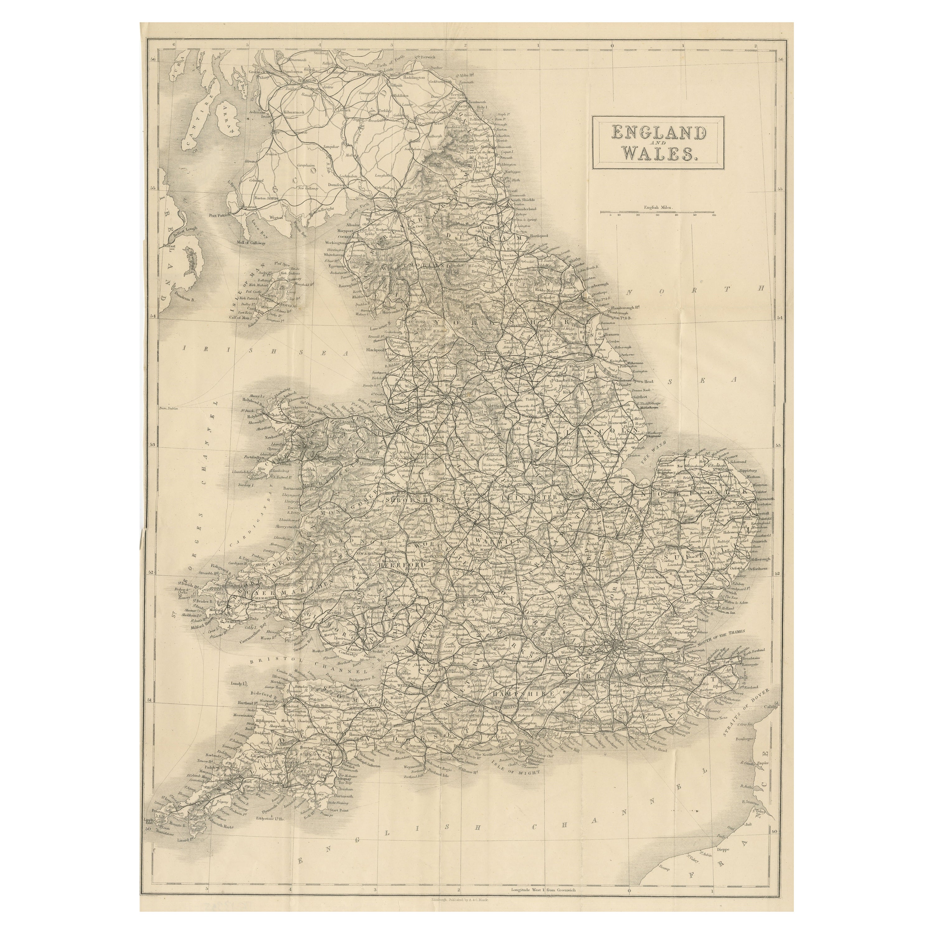
- Antique Folding Map of England and WalesLocated in Langweer, NLAntique map titled 'England and Wales'. Original folding map of England and Wales. Publishes by A. & C. Black, circa 1890.Category
Antique Late 19th Century Maps
MaterialsPaper
- Large Antique Map of England and WalesLocated in Langweer, NLAntique map titled 'An Accurate Map of England and Wales'. Original old map of England and Wales. Engraved by John Cary. Originates from 'New British Atlas' by John Stockdale, publis...Category
Antique Early 19th Century Maps
MaterialsPaper
- Miniature Antique Map of England and WalesLocated in Langweer, NLMiniature map titled 'England & Wales'. Original antique map of England & Wales. This map originates from 'Darton's New Miniature Atlas' publis...Category
Antique Early 19th Century Maps
MaterialsPaper


You May Also Like
- Old Horizontal Map of EnglandBy TassoLocated in Alessandria, PiemonteST/520 - Old rare Italian map of England, dated 1826-1827 - by Girolamo Tasso, editor in Venise, for the atlas of M.r Le-Sage.Category
Antique Early 19th Century Italian Other Prints
MaterialsPaper
- Map North Wales Robert Marsden AngleseyLocated in BUNGAY, SUFFOLKMap of North Wales by Robert Marsden Including Anglesey Charming topography and detail and colouring just purchased more information to follow.Category
Antique 18th Century English Georgian Maps
MaterialsPaper
- Large Scale Antique Scroll Map of Lincolnshire, England, Dated 1778Located in St Annes, LancashireWonderful scroll map of Lincolnshire By Captain Armstrong, 1778 Copper plate engraving on paper laid on canvas Original ebonized wood frame with lo...Category
Antique 1770s English Georgian Maps
MaterialsWood, Paper
- Large Original Antique Folding Map of Manchester, England, Dated 1793Located in St Annes, LancashireSuperb map of Manchester and Salford Folding map. Printed on paper laid on to the original canvas Unframed. Published by C. Laurent, 1793. ...Category
Antique 1790s English Georgian Maps
MaterialsCanvas, Paper
- Lunardi - Account of the First Aerial Voyage in England - 1784 - First EditionLocated in Hillsborough, NJAUTHOR: LUNARDI, Vincent. TITLE: An Account Of The First Aerial Voyage In England, In A Series Of Letters To His Guardian, Chevalier Gherardo Compagni, Written under the impressi...Category
Antique 1780s British Books
MaterialsPaper
- 17th Century Hand-Colored Map of Southeastern England by Mercator and HondiusBy Gerard MercatorLocated in Alamo, CAA 17th century copperplate hand-colored map entitled "The Sixt Table of England" by Gerard Mercator and Jodocus Hondius, published in Amsterdam in 1635 in 'Cosmographicall Descriptio...Category
Antique Mid-17th Century Dutch Maps
MaterialsPaper


Recently Viewed
View AllMore Ways To Browse
Antique Decor And More
Antique Cartography
1784 Furniture
Piu Piu
Antique Style Map
Pius X
Maps Wales
Map Of Wales
Political Map
Antique Print Venice
Antique Maps Wales
Antique Map Wales
Antique Map Of Wales
Antique Maps Of Wales
Antique Map Of Northern Italy
Antique Maps Venice
Antique Venice Map
Antique Map Venice