Maps Wales
11
to
27
164
83
84
84
63
53
45
41
31
27
19
18
17
17
16
16
10
9
8
8
6
6
6
5
5
4
4
4
4
4
3
2
2
2
2
2
2
2
1
1
1
1
1
1
1
1
1
1
1
1
20
19
3
2
2
Sort By
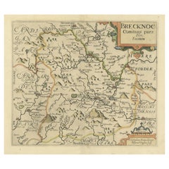
Original Antique Map of Brecknockshire, Wales
Located in Langweer, NL
Antique map titled 'Brecknoc comitaus pars olim silurum'. Original old map of Brecknockshire, Wales
Category
Antique Mid-17th Century Maps
Materials
Paper
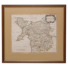
Map North Wales Robert Marsden Anglesey
Located in BUNGAY, SUFFOLK
Map of North Wales by Robert Marsden
Including Anglesey
Charming topography and detail and
Category
Antique 18th Century English Georgian Maps
Materials
Paper
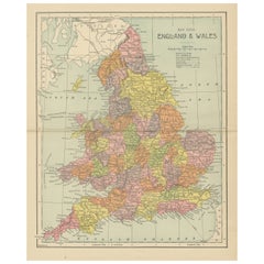
Lithographed Antique Map of England and Wales
Located in Langweer, NL
Original antique map titled 'Map XXIII England & Wales'. Lithographed map of England and Wales
Category
Antique Late 19th Century Maps
Materials
Paper
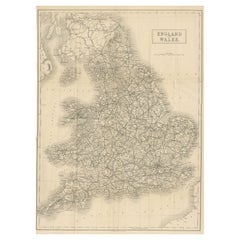
Antique Folding Map of England and Wales
Located in Langweer, NL
Antique map titled 'England and Wales'. Original folding map of England and Wales. Publishes by A
Category
Antique Late 19th Century Maps
Materials
Paper
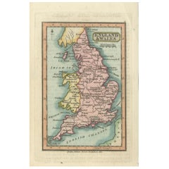
Miniature Antique Map of England and Wales
Located in Langweer, NL
Miniature map titled 'England & Wales'. Original antique map of England & Wales. This map
Category
Antique Early 19th Century Maps
Materials
Paper
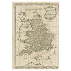
Original Antique Map of England and Wales
Located in Langweer, NL
Antique map titled 'A New and Correct Map of England and Wales from the Latest and Best
Category
Antique Late 18th Century Maps
Materials
Paper
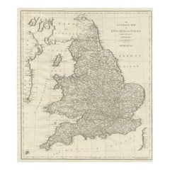
Large Antique Map of England and Wales
Located in Langweer, NL
Antique map titled 'An Accurate Map of England and Wales'. Original old map of England and Wales
Category
Antique Early 19th Century Maps
Materials
Paper
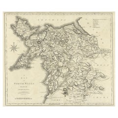
Large Antique County Map of North Wales, England
Located in Langweer, NL
Antique map titled 'A Map of North Wales from the best Authorities'. Original old county map of
Category
Antique Early 19th Century Maps
Materials
Paper
Large Antique County Map of South Wales, England
Located in Langweer, NL
Antique map titled 'A Map of South Wales from the best Authorities'. Original old county map of
Category
Antique Early 19th Century Maps
Materials
Paper
Antique Map of England & Wales by Wyld '1845'
Located in Langweer, NL
Antique map titled 'England & Wales'. Original antique map of England & Wales. This map originates
Category
Antique Mid-19th Century Maps
Materials
Paper
Miniature Antique Map of Glamorganshire, Wales, c.1646
Located in Langweer, NL
Antique map titled 'Glamorganshire'. Miniature map of Glamorganshire, Wales. Later, this map was
Category
Antique 17th Century Maps
Materials
Paper
Miniature Map of England and Wales with Hand Coloring
Located in Langweer, NL
Antique map titled 'England and Wales'. An attractive miniature map of England and Wales enhanced
Category
Antique Late 18th Century Maps
Materials
Paper
Colorful Detailed Antique Map of England and Wales, 1882
Located in Langweer, NL
Explore the Historic Splendor of 'England and Wales' with this Antique Map! Part of a distinguished
Category
Antique 1880s Maps
Materials
Paper
Antique Map of England and Wales with Roman Numerals
Located in Langweer, NL
Untitled original antique map of England and Wales. Drawn & Engraved for Cobbetts 'Geographical
Category
Antique Mid-19th Century Maps
Materials
Paper
Antique Map of New South Wales by Johnston, '1909'
Located in Langweer, NL
Antique map titled 'South Australia, New South Wales, Victoria and Queensland'. Original antique
Category
Early 20th Century Maps
Materials
Paper
Antique Map of England and Wales by Johnson '1872'
Located in Langweer, NL
Antique map titled 'Johnson's England and Wales'. Original map of England and Wales. This map
Category
Antique Late 19th Century Maps
Materials
Paper
Antique Map of New South Wales by Lowry, '1852'
Located in Langweer, NL
Antique map titled 'New South Wales north'. Original map of New South Wales, Australia. This map
Category
Antique Mid-19th Century Maps
Materials
Paper
Antique Map of New South Wales by Lowry, 1852
Located in Langweer, NL
Antique map titled 'New South Wales and part of Victoria'. Two individual sheets of New South Wales
Category
Antique Mid-19th Century Maps
Materials
Paper
Original Antique Map of England, Ireland, Scotland and Wales
Located in Langweer, NL
Antique map titled 'Les Isles Britanniques, ou sont les Royaumes d Angleterre (..)'. Detailed map
Category
Antique Early 18th Century Maps
Materials
Paper
Antique Map of England and Wales by Johnston, 1882
Located in Langweer, NL
Antique map titled 'England and Wales'. Old map of England and Wales, with an inset map of Scilly
Category
Antique 19th Century Maps
Materials
Paper
Original Antique Map of England and Wales, with Decorative Cartouche
Located in Langweer, NL
Antique map titled 'England and Wales from the best Authorities'. Original antique map of England
Category
Antique Late 18th Century Maps
Materials
Paper
Original Antique Map of England and Wales with Large Cartouche
Located in Langweer, NL
of England and Wales by J.B. Nolin after Coronelli. With decorative cartouche, table and inset map of
Category
Antique Late 17th Century Maps
Materials
Paper
Antique Map of New South Wales 'Australia' by Wyld '1845'
Located in Langweer, NL
Antique map titled 'British Settlements in New South Wales'. Original antique map of New South
Category
Antique Mid-19th Century Maps
Materials
Paper
Original Antique Poly-Olbion Map of Denbighshire and Flintshire, Wales
Located in Langweer, NL
Rare and original antique map of Denbighshire and Flintshire, Wales. From the 'Poly-Olbion,' an
Category
Antique Mid-17th Century Maps
Materials
Paper
H 10.36 in W 13.51 in D 0.02 in
Antique Map of New South Wales by Tallis, circa 1851
Located in Langweer, NL
Antique map titled 'New South Wales'. Decorative and detailed map of New South Wales which was
Category
Antique Mid-19th Century Maps
Materials
Paper
Antique Map of, Northern England and Wales by Johnston, 1882
Located in Langweer, NL
Antique map titled 'England and Wales'.
Old map of England and Wales. This map originates from
Category
Antique 19th Century Maps
Materials
Paper
Antique Map of Flintshire in Wales, United Kingdom, c.1850
Located in Langweer, NL
Antique map titled 'Flintshire'. Antique map of Flintshire with a inlay plan of Flintshire town
Category
Antique 19th Century Maps
Materials
Paper
Antique Map of Northern England and Wales by Zatta, 1784
Located in Langweer, NL
map of the northern part of England and Wales, with title cartouche. Shows political and
Category
Antique 18th Century Maps
Materials
Paper
Antique Map of New South Wales with Inset Maps of Australia and Swan River, 1854
Located in Langweer, NL
Antique map titled 'Colony of New South Wales'. Map of New South Wales with inset maps of Australia
Category
Antique 19th Century Maps
Materials
Paper
H 18.31 in W 14.57 in D 0 in
Antique Map of Southern England and Wales by Zatta, 1784
Located in Langweer, NL
"Antique map titled 'Parte Meridionale dell' Inghilterra e del Pricipato di Galles'. Engraved map
Category
Antique 18th Century Maps
Materials
Paper
Antique Map of England and Wales with Decorative Vignettes, 1851
Located in Langweer, NL
Antique map titled ‘England and Wales’. Includes decorative vignettes titled The grand stand on the
Category
Antique 19th Century Maps
Materials
Paper
Antique Map of New South Wales in Australia, ca. 1850
Located in Langweer, NL
Antique map of Victoria, or Port Phillip (12.7 x 10.0") in Australia. Superb map of Victoria
Category
Antique Mid-19th Century European Maps
Materials
Paper
Large Antique Map England and Wales, with Part of the Coastlines
Located in Langweer, NL
Antique map titled 'A Map of England and Wales (..)'. Large antique map of England and Wales, with
Category
Antique Late 18th Century Maps
Materials
Paper
Antique Map of England and Wales, with References to the Counties
Located in Langweer, NL
Antique map titled 'England and Wales'. Original antique map of England and Wales, with references
Category
Antique Early 19th Century Maps
Materials
Paper
Antique Map of England and Wales, Also Showing the English Channel
Located in Langweer, NL
Antique map titled 'England and Wales'. Original antique map of England and Wales. Drawn and
Category
Antique Mid-19th Century Maps
Materials
Paper
Colorful Detailed Antique Map of England and Wales (South Part), 1882
Located in Langweer, NL
Embark on a Journey Through the Southern Part of 'England and Wales' with this Exquisite Antique
Category
Antique 1880s Maps
Materials
Paper
Detailed Antique Map of Britain, Wales and the Coast of Ireland
Located in Langweer, NL
Antique map titled 'Carta d'Inghilterra e del Principato di Galles'. Detailed map of Britain, Wales
Category
Antique Mid-19th Century Maps
Materials
Paper
1859 Vintage Maps of England and Wales: Blackie's Imperial Geographic Detail
Located in Langweer, NL
The "Antique Map of England & Wales" from 'The Imperial Atlas of Modern Geography', published by W
Category
Antique Mid-19th Century Maps
Materials
Paper
H 14.57 in W 21.26 in D 0.02 in
Antique Detailed Map of New South Wales, Queensland & Victoria, Australia, 1865
Located in Langweer, NL
Antique map Australia titled 'South Australia, New South Wales, Victoria & Queensland'. Old map
Category
Antique 19th Century Maps
Materials
Paper
H 24.41 in W 19.49 in D 0 in
Large Original Vintage Map of New South Wales, Australia, circa 1920
Located in St Annes, Lancashire
Great map of New South Wales
Original color.
Good condition
Published by Alexander Gross
Category
Vintage 1920s English Edwardian Maps
Materials
Paper
No Reserve
H 25 in W 19.5 in D 0.07 in
Antique Map of England and Wales by A.K. Johnston, 1865
Located in Langweer, NL
Antique map titled 'England and Wales (Southern Sheet)'. With an inset map of the Scilly Islands
Category
Antique Mid-19th Century Maps
Materials
Paper
Antique Map of Northern England and Wales by Cassini, 'circa 1795'
By Giovanni Maria Cassini
Located in Langweer, NL
'.
Engraved map of Northern England and Wales. Shows Northumberland, Westmoreland, Cumberland, Durham
Category
Antique Late 18th Century Maps
Materials
Paper
No Reserve
H 17.92 in W 23.63 in D 0.02 in
Colourful Antique Map of England and Wales Divided in Counties, 1854
Located in Langweer, NL
Antique map titled 'A Map Shewing the Places in England & Wales Sending Members to Parliament with
Category
Antique 19th Century Maps
Materials
Paper
Antique Map of England and Wales, Also Including the Isle of Man
Located in Langweer, NL
Antique map titled 'England'. Original antique map of England and Wales from Northumberland to
Category
Antique Mid-19th Century Maps
Materials
Paper
Original Antique Map of England and Wales from the 1909 Royal Atlas
Located in Langweer, NL
The antique map titled 'England and Wales' is a historical cartographic representation of these two
Category
Early 20th Century Maps
Materials
Paper
No Reserve
H 19.49 in W 24.41 in D 0.02 in
Small Antique Map of England, Wales, Scotland and Ireland with Original Coloring
Located in Langweer, NL
Antique map titled 'Les Royaumes d'Angleterre d'Escosse et d'Irlande (..)'. A lovely, small map of
Category
Antique Early 18th Century Maps
Materials
Paper
H 7.76 in W 10.04 in D 0.02 in
Antique Map of England and Wales 'North' by A.K. Johnston, 1865
Located in Langweer, NL
Antique map titled 'England and Wales (Northern Sheet)'. This map originates from the ‘Royal Atlas
Category
Antique Mid-19th Century Maps
Materials
Paper
Two Sheet Map of the Principality of Wales Divided into Counties, 1804
Located in Langweer, NL
A well engraved and detailed large-scale map of Wales, printed on two sheets .
The map is
Category
Antique Early 1800s Maps
Materials
Paper
H 21.26 in W 25.2 in D 0.02 in
Antique Map of England and Wales Depicting the Period of the Saxon Heptarchy
Located in Langweer, NL
Compleat Chorography of England and Wales in 50 Maps'. Circa 1766-77.
Category
Antique Late 18th Century Maps
Materials
Paper
H 10.28 in W 8.39 in D 0.02 in
Antique Map of New South Wales and Victoria by W. G. Blackie, 1859
Located in Langweer, NL
Antique map titled 'New South Wales and Victoria'. Original antique map of New South Wales and
Category
Antique Mid-19th Century Maps
Materials
Paper
Small Antique Map of England and Wales as It Was During the Heptarchy
Located in Langweer, NL
Antique map titled 'La Britannique dans sa Heptarchie Anglois Saxonique'. This little map shows
Category
Antique Mid-18th Century Maps
Materials
Paper
Antique Map of New South Wales with an Inset of Sydney, Australia, 1833
Located in Langweer, NL
Antique map of Australia titled 'New South Wales'. Old map of New South Wales, Australia. With an
Category
Antique 19th Century Maps
Materials
Paper
Antique Map of South Australia, Victoria, Queensland and New South Wales, c.1860
Located in Langweer, NL
Antique map Australia titled 'South Australia, New South Wales, Victoria & Queensland'. Old map
Category
Antique 19th Century Maps
Materials
Paper
H 18.71 in W 14.57 in D 0 in
Antique Map of Endeavour River and Botany Bay, New South Wales, Australia, 1803
Located in Langweer, NL
Antique map Australia titled 'Mond van de Endeavour Rivier in Nieuw Zuid Wales' and 'Botanie Baai
Category
Antique 19th Century Maps
Materials
Paper
H 9.65 in W 19.49 in D 0 in
Saxtons Map of Oxtons, Bucks, Berk
Located in Alton, GB
Wales, this map depicts the southeastern English counties.
Category
Antique 16th Century British Maps
Materials
Paper
Old Map of Southern Australia, with an Inset Map of Cape York Peninsula, 1882
Located in Langweer, NL
Antique map titled 'South Australia, New South Wales, Victoria & Queensland'.
Old map of
Category
Antique 1880s Maps
Materials
Paper
H 24.22 in W 19.53 in D 0 in
Antique Map of Buckinghamshire in England, 1743
Located in Langweer, NL
Antique map titled 'Buckingham both shyre and shire towne describ'. Map of Buckinghamshire, England
Category
Antique 18th Century Maps
Materials
Paper
Map Southern Scotland Thomas Conder Alex Hogg 1795
Located in BUNGAY, SUFFOLK
A new map of the southern part of Scotland containing the counties of Stirling, Lanerk, Renfrew
Category
Antique 18th Century English Georgian Maps
Materials
Paper
Antique Map of South Australia by Johnston, 1882
By Thomas Kitchin
Located in Langweer, NL
Antique map titled 'South Australia, New South Wales, Victoria & Queensland'. Old map of Southern
Category
Antique 19th Century Maps
Materials
Paper
Map of the British Isles with Historical Kings, 1719
Located in Langweer, NL
This antique map, titled "Les Royaumes d'Angleterre d'Escosse et d'Irlande," offers a detailed view
Category
Antique Early 18th Century Maps
Materials
Paper
- 1
Get Updated with New Arrivals
Save "Maps Wales", and we’ll notify you when there are new listings in this category.
Maps Wales For Sale on 1stDibs
Find a variety of maps Wales available on 1stDibs. Frequently made of paper, fabric and silk, all maps Wales available were constructed with great care. Maps Wales have been produced for many years, with earlier versions available from the 18th Century and newer variations made as recently as the 20th Century. There are many kinds of maps Wales to choose from, but at 1stDibs, Georgian and Victorian maps Wales are of considerable interest. Geographia, Ltd., Giovanni Maria Cassini and Homann Heirs each produced beautiful maps Wales that are worth considering.
How Much are Maps Wales?
Maps Wales can differ in price owing to various characteristics — the average selling price at 1stDibs is $264, while the lowest priced sells for $40 and the highest can go for as much as $4,850.
More Ways To Browse
Custom Engraved Rolex
Leather Rolex Air King
Duke Of Norfolk
St Esprit
North Sea Chart
Antique Barnsley
Antique St Albans
Astronomy Chart
Indian Ocean Antique Map
Bay Of Bengal
Rolex Air King Second Hand
David Roberts Ra
Antique Outpost
Maps South East Asia
Bay Bengal
Dial M For Modern
Vintage Sterling Charm Bracelet
Vintage Sterling Silver Bracelet Charms
