Items Similar to Antique Map of Buckinghamshire in England, 1743


Want more images or videos?
Request additional images or videos from the seller
1 of 5
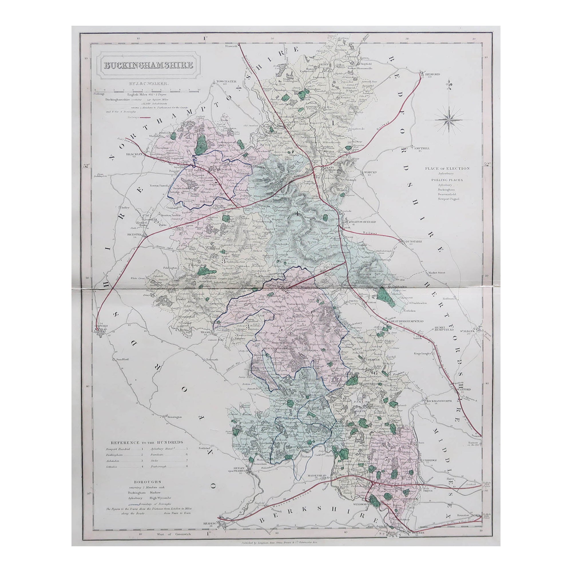
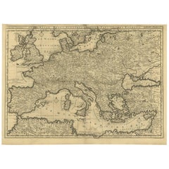
Antique Map of Buckinghamshire in England, 1743
About the Item
Antique map titled 'Buckingham both shyre and shire towne describ'. Map of Buckinghamshire, England. With town plans of Buckingham and Redding. This map originates from Overton's atlas 'England Fully Described in a Compleat Sett of Mapps of ye County's of England & Wales'.
Artists and Engravers: John Overton (1640-1713) and his son, Henry, produced a number of atlases and maps from 1665 to c.1755. They never possessed a complete set of county map plates and made up their atlases in the early Dutch tradition by using the prints of other publishers, notably the maps of Blaeu and Jansson. Only when these were not available did they arrange for a plate of their own to be produced.
We sell original antique maps to collectors, historians, educators and interior decorators all over the world. Our collection includes a wide range of authentic antique maps from the 16th to the 20th centuries. Buying and collecting antique maps is a tradition that goes back hundreds of years. Antique maps have proved a richly rewarding investment over the past decade, thanks to a growing appreciation of their unique historical appeal. Today the decorative qualities of antique maps are widely recognized by interior designers who appreciate their beauty and design flexibility. Depending on the individual map, presentation, and context, a rare or antique map can be modern, traditional, abstract, figurative, serious or whimsical. We offer a wide range of authentic antique maps for any budget.
- Dimensions:Height: 15.75 in (40 cm)Width: 20.48 in (52 cm)Depth: 0 in (0.01 mm)
- Materials and Techniques:
- Period:
- Date of Manufacture:1743
- Condition:Additions or alterations made to the original: new Japanese paper backing. Condition: Fair, bleached and new Japanese paper backing. Blank verso, please study image carefully.
- Seller Location:Langweer, NL
- Reference Number:Seller: BG-12705-71stDibs: LU3054326085092
About the Seller
5.0
Platinum Seller
These expertly vetted sellers are 1stDibs' most experienced sellers and are rated highest by our customers.
Established in 2009
1stDibs seller since 2017
1,928 sales on 1stDibs
Typical response time: <1 hour
- ShippingRetrieving quote...Ships From: Langweer, Netherlands
- Return PolicyA return for this item may be initiated within 14 days of delivery.
Auctions on 1stDibs
Our timed auctions are an opportunity to bid on extraordinary design. We do not charge a Buyer's Premium and shipping is facilitated by 1stDibs and/or the seller. Plus, all auction purchases are covered by our comprehensive Buyer Protection. Learn More
More From This SellerView All
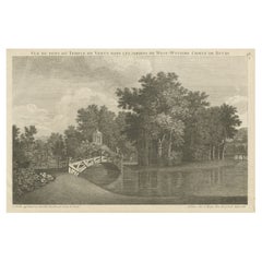
- Antique Print of West Wycombe Park in Buckinghamshire, England, c.1785Located in Langweer, NLAntique print titled 'Vue du Pont, du Temple de Venus dans les Jardins de West-Wycomb (..)'. Copper engraving of West Wycombe park, showing the bridge and temple. West Wycombe Park is a country house built between 1740 and 1800 near the village of West Wycombe in Buckinghamshire, England. It was conceived as a pleasure palace for the 18th-century libertine and dilettante Sir Francis Dashwood, 2nd Baronet. The house is a long rectangle with four façades that are columned and pedimented, three theatrically so. The house encapsulates the entire progression of British 18th-century architecture from early idiosyncratic Palladian to the Neoclassical, although anomalies in its design make it architecturally unique...Category
Antique 18th Century Prints
MaterialsPaper
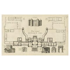
- Antique Print of the Stowe House in Stowe, Buckinghamshire, England, c.1785Located in Langweer, NLAntique print titled 'Plan actuel du Chateau de Stowe'. Copper engraving showing a plan and elements of the Stowe House. Stowe House is a grade I l...Category
Antique 18th Century Prints
MaterialsPaper
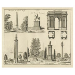
- Antique Print of Elements of Stowe Park, Stowe, Buckinghamshire, England, c.1785Located in Langweer, NLAntique print titled 'Stowe - L'Arc Corinthien - Obelisque du Général Wolfe (..)'. Copper engraving showing several elements of Stowe Park, Buckingha...Category
Antique 18th Century Prints
MaterialsPaper
- Antique Bible World Map by R. & J. Wetstein, 1743Located in Langweer, NLAntique world map titled 'De Werelt Caart'. A scarce and richly detailed double hemisphere world map that was probably based on an earlier work by Cornelis Dankerts. This map has t...Category
Antique Mid-18th Century Maps
MaterialsPaper

- Antique Bible Map of the Middle East by A. Schut, 1743Located in Langweer, NLAntique map titled 'De Gelegentheyt van 't Paradys en 't Landt Canaan'. Dutch Bible map covering the region between the Mediterranean and the Persian Gulf, ...Category
Antique Mid-18th Century Maps
MaterialsPaper
- Rare Antique Bible Map of Southern Europe by A. Schut, 1743Located in Langweer, NLAntique map of the Mediterranean and a large part of Europe, illustrating the voyage of St. Paul to Rome. This map originates from ‘Biblia Sacra, dat is, de H. Schriftuer van het Oud...Category
Antique Mid-18th Century Maps
MaterialsPaper

You May Also Like
- Old Horizontal Map of EnglandBy TassoLocated in Alessandria, PiemonteST/520 - Old rare Italian map of England, dated 1826-1827 - by Girolamo Tasso, editor in Venise, for the atlas of M.r Le-Sage.Category
Antique Early 19th Century Italian Other Prints
MaterialsPaper
- Antique Map of Principality of MonacoBy Antonio Vallardi EditoreLocated in Alessandria, PiemonteST/619 - "Old Geographical Atlas of Italy - Topographic map of ex-Principality of Monaco" - ediz Vallardi - Milano - A somewhat special edition ---Category
Antique Late 19th Century Italian Other Prints
MaterialsPaper
- Hampshire County, Britain/England: A Map from Camden's" Britannia" in 1607By John NordenLocated in Alamo, CAAn early hand-colored map of Britain's Hampshire county, published in the 1607 edition of William Camden's great historical description of the British Isles, "Britannia". This map was drawn by cartographer John Norden (c. 1547-1625) and engraved by William Hole (active 1607-1624) and William Kip...Category
Antique Early 17th Century English Maps
MaterialsPaper
- England, Scotland & Ireland: A Hand Colored Map of Great Britain by TirionBy Isaak TirionLocated in Alamo, CAThis is a hand-colored double page copperplate map of Great Britain entitled "Nieuwe Kaart van de Eilanden van Groot Brittannien Behelzende de Kon...Category
Antique Mid-18th Century Dutch Maps
MaterialsPaper
- Large Antique 1859 Map of North AmericaLocated in Sag Harbor, NYThis Map was made by Augustus Mitchell in 1859 It is in amazing condition for being 163 years old. This price is for the rolled up easy to ship version of this piece. I will be Frami...Category
Antique Mid-19th Century American Maps
MaterialsCanvas, Paper

- Antique Map of Italy by Andriveau-Goujon, 1843By Andriveau-GoujonLocated in New York, NYAntique Map of Italy by Andriveau-Goujon, 1843. Map of Italy in two parts by Andriveau-Goujon for the Library of Prince Carini at Palazzo Carini i...Category
Antique 1840s French Maps
MaterialsLinen, Paper


Recently Viewed
View AllMore Ways To Browse
New England Antiques
New England Made Furniture
New England Early Furniture
New England Used Office Furniture
New England Collection
Antique Furniture From New England
18th Century New England
New World Map
New World Maps
England 16th
16th Century England
Early 18th Century New England
Town Plan
Antique Fairs England
Antique World Map Print
Japan Antiques Collectables
Antique Map England
Antique Maps England