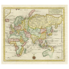
New World Map
16
to
106
1,100
766
1,044
586
451
272
256
222
110
103
98
92
87
62
53
50
48
43
38
30
29
26
25
23
22
22
20
18
17
14
13
12
12
11
10
8
7
7
6
5
5
4
4
4
4
4
4
3
2
2
2
2
2
2
2
1
1
1
1
1
1
54
42
42
39
34
Sort By
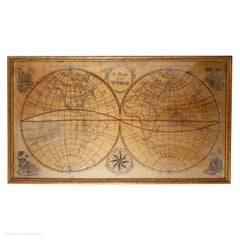
Map Silk Embroidered Western Eastern Hemisphere New Old World Asia America Afri
Located in BUNGAY, SUFFOLK
A rare, late-18th century, silk, embroidered, double hemisphere, world map, blackwork, sampler
Category
Antique 18th Century British Georgian Maps
Materials
Silk
H 0.4 in W 0.4 in D 0.4 in
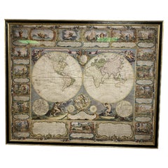
Colored wall map of the WORLD
By Chambon
Located in ZWIJNDRECHT, NL
huge wall map of the world in two hemispheres printed on two sheets, depicting the Eastern and Western
Category
Antique Mid-18th Century French French Provincial Maps
Materials
Wood, Paper
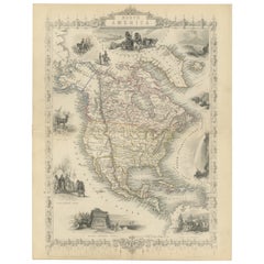
Victorian Visions of the New World: A Detailed Tallis Map of North America, 1851
Located in Langweer, NL
The map presented here is an intricate example from the series of maps produced by John Tallis
Category
Antique 1850s Maps
Materials
Paper
H 14.26 in W 10.71 in D 0 in
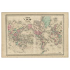
Antique Map of the World by Johnson, '1872'
Located in Langweer, NL
Antique map titled 'Johnson's World. Original world map. This map originates from 'Johnson's New
Category
Antique Late 19th Century Maps
Materials
Paper
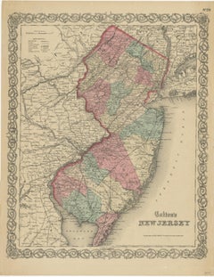
Antique Map of New Jersey
Located in Langweer, NL
Antique map titled 'Colton's New Jersey'. This rare hand colored map of New Jersey is a copper
Category
Antique Mid-19th Century Maps
Materials
Paper
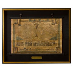
1847 “World at One View” Antique Hand-Colored Wall Map of the World
Located in Colorado Springs, CO
This is a highly desirable hanging wall map of the "World at One View", published in 1847 by Ensign
Category
Antique 19th Century American Maps
Materials
Paper
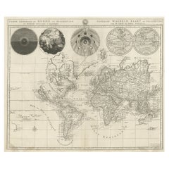
Antique Detailed World Map Drawn on Mercator's Projection, 1700
Located in Langweer, NL
Antique world map titled 'Carte generale du monde, ou description du monde terrestre & Aquatique
Category
Antique 17th Century Maps
Materials
Paper
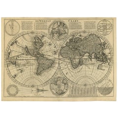
Antique Bible World Map by R. & J. Wetstein, 1743
Located in Langweer, NL
Antique world map titled 'De Werelt Caart'.
A scarce and richly detailed double hemisphere world
Category
Antique Mid-18th Century Maps
Materials
Paper
Antique Map of the Eastern Part of the World
Located in Langweer, NL
Antique map titled 'Nieuwe Kaart van het Oostelykste Deel der Weereld, diendende tot aanwyzing van
Category
Antique Mid-18th Century Maps
Materials
Paper
Antique Map of New Ireland, 1774
Located in Langweer, NL
Antique print titled 'Neu Irrland (..)'. Antique map of New Ireland with 7 coastal profiles, Papua
Category
Antique 18th Century Maps
Materials
Paper
Antique Map of New Zealand, 1895
Located in Langweer, NL
Antique map titled 'Neu-Seeland.' Map of New Zealand. With inset maps of the large cities. This
Category
Antique 19th Century Maps
Materials
Paper
Antique Map of the World in Hemispheres by Johnson, '1872'
Located in Langweer, NL
Antique map titled 'Johnson's Globular World. Original world map depicting the Eastern Hemisphere
Category
Antique Late 19th Century Maps
Materials
Paper
Four Physical Maps of the World on One Sheet , 1872
Located in Langweer, NL
map originates from 'Johnson's New Illustrated Family Atlas of the World' by A.J. Johnson. Published
Category
Antique Late 19th Century Maps
Materials
Paper
Antique Map of the World on Mercator Projection by Anson, 1749
Located in Langweer, NL
'. Original antique map of the world on Mercator's Projection from a Dutch edition of Anson's voyages. The map
Category
Antique 18th Century Maps
Materials
Paper
1864 Johnson's Map of the World on Mercator's Projection, Ric.B009
Located in Norton, MA
An 1864 Johnson's map of
the World on Mercator's Projection
Ric.b009
About this Item
Category
Antique 19th Century Dutch Maps
Materials
Paper
Antique Map of New York by Johnson '1872'
Located in Langweer, NL
Island. This map originates from 'Johnson's New Illustrated Family Atlas of the World' by A.J. Johnson
Category
Antique Late 19th Century Maps
Materials
Paper
Very Attractive Antique Map of the World as Planisphere, Shows Cook's Voyages
Located in Langweer, NL
Antique map titled 'Chart of the World, according to Mercators Projection'. This world map shows
Category
Antique Late 18th Century Maps
Materials
Paper
No Reserve
H 16.15 in W 20.08 in D 0.02 in
Antique Map of New Zealand and Tasmania, 1904
Located in Langweer, NL
This large antique map is taken from; 'Andrees Allgemeiner Handatlas in 126 Haupt-Und 139
Category
20th Century Maps
Materials
Paper
Gorgeous Antique World Map by the Dutch Mapmaker Visscher, published circa 1679
Located in Langweer, NL
example of Nicholas Visscher's World map, which appeared in his Atlas Minor after 1679.
The map is
Category
Antique Late 17th Century Maps
Materials
Paper
Free Shipping
H 20.79 in W 25.2 in D 0.02 in
Antique Map of the World in Hemispheres by Keizer & de Lat, 1788
Located in Langweer, NL
double hemisphere world map on polar projections. In North America, there is a large Island of California
Category
Antique Late 18th Century Maps
Materials
Paper
Antique Map of the Eastern Part of the World by Tirion, 1755
By Isaak Tirion
Located in Langweer, NL
Antique map titled 'Nieuwe Kaart van het Oostelykste Deel der Weereld, dienende tot Aanwyzing van
Category
Antique Mid-18th Century Dutch Maps
Materials
Paper
Free Shipping
H 15.56 in W 15.56 in D 0.02 in
Antique Map of Australia and New Zealand, c.1860
Located in Langweer, NL
Antique map titled 'Australia and New Zealand'. Unusual edition of this map of Australia and New
Category
Antique 19th Century Maps
Materials
Paper
Antique Map of the World Showing the Distribution of Plants and Minerals, 1872
Located in Langweer, NL
Antique map titled 'Johnson's World showing the distribution of the Characteristic Forest Trees
Category
Antique Late 19th Century Maps
Materials
Paper
H 13.39 in W 16.93 in D 0.02 in
German Antique Map of Australia and New Zealand, 1857
Located in Langweer, NL
interior decorators all over the world. Our collection includes a wide range of authentic antique maps from
Category
Antique 19th Century Maps
Materials
Paper
Antique Map of the World with Polar Projections by Keizer & de Lat, 1788
Located in Langweer, NL
Antique map titled 'Schuine Ronde Aard-Klooten (..)'. Interesting double hemisphere world map with
Category
Antique Late 18th Century Maps
Materials
Paper
H 8.08 in W 11.03 in D 0.02 in
Antique Map of the World in 12 Globe Gores by Scherer, 'circa 1702'
Located in Langweer, NL
Superinducendus'. Beautiful example of Scherer's map of the World, configured in 12 globe gores. California is
Category
Antique Early 18th Century Maps
Materials
Paper
Antique Map of New Zealand by A & C. Black, 1870
Located in Langweer, NL
, New Zealand and Tasmania. This map originates from ‘Black's General Atlas of The World’. Published by
Category
Antique Late 19th Century Maps
Materials
Paper
1865 "Johnson's California, Utah, Nevada, Colorado, New Mexico, Arizona" Map
Located in Colorado Springs, CO
, New Mexico, and Arizona” map. First published in 1864, this map was issued as pages 66 and 67 in the
Category
Antique Mid-19th Century Maps
Materials
Paper
H 22.5 in W 30.5 in D 0.75 in
Antique Map of Pennsylvania and New Jersey by Johnson, 1872
Located in Langweer, NL
New Jersey. This map originates from 'Johnson's New Illustrated Family Atlas of the World' by A.J
Category
Antique Late 19th Century Maps
Materials
Paper
Antique Map of New South Wales 'Australia' by Wyld '1845'
Located in Langweer, NL
Antique map titled 'British Settlements in New South Wales'. Original antique map of New South
Category
Antique Mid-19th Century Maps
Materials
Paper
Antique Map of New Zealand by Scottish Geographer Johnston, 1882
Located in Langweer, NL
Antique map titled 'New Zealand'.
Old map of New Zealand. This map originates from 'The Royal
Category
Antique 19th Century Maps
Materials
Paper
Antique Map of New South Wales in Australia, ca. 1850
Located in Langweer, NL
Antique map of Victoria, or Port Phillip (12.7 x 10.0") in Australia. Superb map of Victoria
Category
Antique Mid-19th Century European Maps
Materials
Paper
Antique Map of the Coast of New Ireland, Earlier Part of German New Guinea, 1833
Located in Langweer, NL
. New Ireland, also New Mecklenburg, is the Northeastern Province of Papua New Guinea. Map no. 26 from
Category
Antique 19th Century Maps
Materials
Paper
H 18.86 in W 25.44 in D 0 in
Antique Map of New Jersey, Delaware and Maryland by Johnson, 1872
Located in Langweer, NL
Antique map titled 'Johnson's New Jersey (..). Two maps on one sheet showing New Jersey, Delaware
Category
Antique Late 19th Century Maps
Materials
Paper
Antique Map of California, Utah, Nevada, Colorado, New Mexico & Arizona '1872'
Located in Langweer, NL
, New Mexico and Arizona. This map originates from 'Johnson's New Illustrated Family Atlas of the World
Category
Antique Late 19th Century Maps
Materials
Paper
H 18.12 in W 26.38 in D 0.02 in
Antique Detailed Map of New South Wales, Queensland & Victoria, Australia, 1865
Located in Langweer, NL
Antique map Australia titled 'South Australia, New South Wales, Victoria & Queensland'. Old map
Category
Antique 19th Century Maps
Materials
Paper
H 24.41 in W 19.49 in D 0 in
Pictorial Vintage Map of New York City Showing Numerous Landmarks, 1939
Located in Langweer, NL
This pictorial souvenir map focuses on New York City and the site of the 1939 World's Fair. It was
Category
Vintage 1930s Maps
Materials
Paper
Antique Map of New Brunswick, Nova Scotia and Surroundings by Johnson, 1872
Located in Langweer, NL
Antique map titled 'Johnson's Quebec, of the dominion of Canada (..)'. Original map of New
Category
Antique Late 19th Century Maps
Materials
Paper
H 18.12 in W 26.58 in D 0.02 in
Antique Map of South Australia, Victoria, Queensland and New South Wales, c.1860
Located in Langweer, NL
Antique map Australia titled 'South Australia, New South Wales, Victoria & Queensland'. Old map
Category
Antique 19th Century Maps
Materials
Paper
H 18.71 in W 14.57 in D 0 in
Map of Australia, New Zealand, Part of China, Japan and Southeast Asia, 1857
Located in Langweer, NL
German Antique map titled 'Australien'. Map of Australia, New Zealand, part of China, Japan and
Category
Antique 19th Century Maps
Materials
Paper
No Reserve
H 23.23 in W 27.96 in D 0 in
Antique Map of Endeavour River and Botany Bay, New South Wales, Australia, 1803
Located in Langweer, NL
in Nieuw Zuid Wales'. Antique map of the Endeavour river and a map of Botany Bay, New South Wales
Category
Antique 19th Century Maps
Materials
Paper
H 9.65 in W 19.49 in D 0 in
Antique Map of Venezuela, New Granada, Ecuador and Peru by a & C. Black, 1870
Located in Langweer, NL
Venezuela, New Granada, Ecuador and Peru & c. This map originates from ‘Black's General Atlas of The World
Category
Antique Late 19th Century Maps
Materials
Paper
H 17.52 in W 13 in D 0.02 in
Detailed Map of New Zealand Showing the Route of Capt. Cook's First Voyage, 1803
Located in Langweer, NL
Antique map New Zealand titled 'De Rivier de Theems en Mercurius Baai in Nieuw Zeeland'. Detailed
Category
Antique 19th Century Maps
Materials
Paper
H 13.78 in W 20.48 in D 0 in
Antique Map of Mar del Sur, Chile, Peru, New Guinea and Tierra del Fuego, 1621
Located in Langweer, NL
Uncommon and rare map of Mar del Sur and the coast of Peru. With inset maps of part of New Guinea
Category
Antique 17th Century Maps
Materials
Paper
H 17.33 in W 6.7 in D 0 in
Colourful Old Map of the Austrian Empire, with an Inset Map of Vienna, 1846
Located in Langweer, NL
Vienna. This map originates from 'A New Universal Atlas Containing Maps of the various Empires, Kingdoms
Category
Antique 1840s Maps
Materials
Paper
H 13.78 in W 17.13 in D 0 in
Old Map of Southern Australia, with an Inset Map of Cape York Peninsula, 1882
Located in Langweer, NL
Antique map titled 'South Australia, New South Wales, Victoria & Queensland'.
Old map of
Category
Antique 1880s Maps
Materials
Paper
H 24.22 in W 19.53 in D 0 in
Decorative Antique Map of Germany, 1846
Located in Langweer, NL
Antique map titled 'Germany'. Old map of Germany.
This map originates from 'A New Universal
Category
Antique 1840s Maps
Materials
Paper
Colourful Antique Map of Switzerland, 1846
Located in Langweer, NL
Antique map titled 'Switzerland'. Old map of Switzerland.
This map originates from 'A New
Category
Antique 1840s Maps
Materials
Paper
Antique Map of Ontario with an Inset Map of the Niagara River by Johnson, 1872
Located in Langweer, NL
, Canada, with an inset map of the Niagara River and vicinity. This map originates from 'Johnson's New
Category
Antique Late 19th Century Maps
Materials
Paper
No Reserve
H 18.12 in W 26.58 in D 0.02 in
A Decorative Detailed Map of the Crimea, with an Inset Map of Sebastopol, c 1851
Located in Langweer, NL
from 1849 to 1853, was the last decorative world atlas. 'The Crimea' map was typical of the many fine
Category
Antique 1850s Maps
Materials
Paper
H 10.83 in W 14.18 in D 0 in
Old Map of Spain and Portugal, with an Inset Map of the Region of Madrid, 1846
Located in Langweer, NL
inset map of the region of Madrid. This map originates from 'A New Universal Atlas Containing Maps of
Category
Antique 1840s Maps
Materials
Paper
H 13.78 in W 17.13 in D 0 in
Antique Map of Indiana by Johnson, 1872
Located in Langweer, NL
'Johnson's New Illustrated Family Atlas of the World' by A.J. Johnson. Published, 1872.
Category
Antique Late 19th Century Maps
Materials
Paper
Antique Map of Illinois by Johnson, 1872
Located in Langweer, NL
'Johnson's New Illustrated Family Atlas of the World' by A.J. Johnson. Published, 1872.
Category
Antique Late 19th Century Maps
Materials
Paper
Antique Map of Europe by Johnson, '1872'
Located in Langweer, NL
New Illustrated Family Atlas of the World' by A.J. Johnson. Published 1872.
Category
Antique Late 19th Century Maps
Materials
Paper
Antique Map of Asia by Johnson, 1872
Located in Langweer, NL
Antique map titled 'Johnson's Asia'. Original map of Asia. This map originates from 'Johnson's New
Category
Antique Late 19th Century Maps
Materials
Paper
Antique Map of Asia by Guthrie, 1787
Located in Langweer, NL
Antique map titled 'Asia from the best Authorities'. Old map of the Asian continent. This map
Category
Antique 18th Century Maps
Materials
Paper
Original Decorative Antique Map of Prussia, 1628
Located in Langweer, NL
cartographer from the County of Flanders. He is most renowned for creating the 1569 world map based on a new
Category
Antique 1620s Maps
Materials
Paper
Antique Map of Old European Russia, 1846
Located in Langweer, NL
Antique map titled 'Russia in Europe'. Old map of European Russia. This map originates from 'A New
Category
Antique 19th Century Maps
Materials
Paper
1851 Map of "Independent Tartary", Ric. R018
Located in Norton, MA
. (London & New York) between 1838 and 1851. After 1850-51, their maps were published by the London Printing
Category
Antique 19th Century Unknown Maps
Materials
Paper
Antique Map of Asia by Larousse, 1897
Located in Langweer, NL
maps to collectors, historians, educators and interior decorators all over the world. Our collection
Category
Antique 19th Century Maps
Materials
Paper
- 1
- ...
Get Updated with New Arrivals
Save "New World Map", and we’ll notify you when there are new listings in this category.
New World Map For Sale on 1stDibs
Find the exact new world map you’re shopping for in the variety available on 1stDibs. In our selection of items, you can find contemporary examples as well as an abstract version. Finding the perfect new world map may mean sifting through those created during different time periods — you can find an early version that dates to the 18th Century and a newer variation that were made as recently as the 21st Century. When looking for the right new world map for your space, you can search on 1stDibs by color — popular works were created in bold and neutral palettes with elements of gray, brown, beige and blue. There have been many interesting new world map examples over the years, but those made by (after) Henri Matisse, Henri Matisse, Heny Steinberg, Bradford J. Salamon and William Gropper are often thought to be among the most thought-provoking. Artworks like these of any era or style can make for thoughtful decor in any space, but a selection from our variety of those made in paint, fabric and canvas can add an especially memorable touch.
How Much is a New World Map?
A new world map can differ in price owing to various characteristics — the average selling price for items in our inventory is $1,875, while the lowest priced sells for $30 and the highest can go for as much as $1,150,000.
More Ways To Browse
Johannes Janssonius On Sale
Map Of Quebec
Pieter Claesz
Antique Map Nova Scotia
Arizona Map
Philippines Paper Notes
William Acton
Antique Maps Norfolk
Map Oxford England
Albania Antique Map
Irish Settle
Antique Map Norfolk
Antique Map Of Argentina
Antique Map Argentina
Map Of Arizona
Irish Canterbury
Caucasus Map
Irish Canterbury Furniture
