Map Oxford England

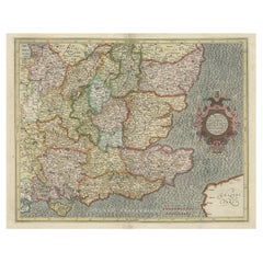
Original Old Map of South East England Incl London, Oxford, Cambridge, Etc, 1633
Located in Langweer, NL
'. Old map of south east England. Includes London, Salisbury, Oxford, Cambridge, Leicester and Norwich
Category

Antique 1630s Maps

Materials

Paper

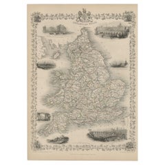
Antique Map of England and Wales with Decorative Vignettes, 1851
Located in Langweer, NL
Antique map titled ‘England and Wales’. Includes decorative vignettes titled The grand stand on the
Category

Antique 19th Century Maps

Materials

Paper

17th Century Hand-Colored Map of Southeastern England by Mercator and Hondius
By Gerard Mercator
Located in Alamo, CA
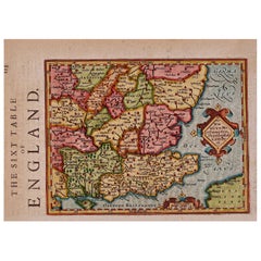
A 17th century copperplate hand-colored map entitled "The Sixt Table of England" by Gerard Mercator
Category

Antique Mid-17th Century Dutch Maps

Materials

Paper

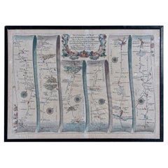
Map Road Strip Britannia Sheet 2 John Ogilby London Aberistwith Islip Bramyard
By John Ogilby
Located in BUNGAY, SUFFOLK
of England and Wales. Strip map Islip to Bramyard, on a scale of approximately one inch to the mile
Category

Antique 17th Century English Baroque Maps

Materials

Paper

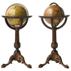
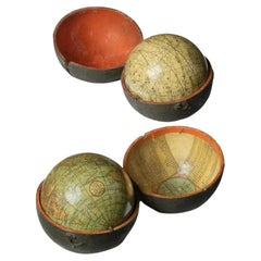
Pair of Miniature Globes Lane’s on Tripod Bases, London post 1833, ante 1858
By Lane's
Located in Milano, IT
-1851, London 1995, s. v.; E. Dekker, Globes at Greenwich, Oxford 1999, pp. 128-129, 393-394.
Category

Antique 1840s English Early Victorian Maps

Materials

Paper, Wood

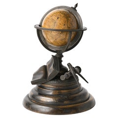
Miniature Terrestrial Globe Newton & Son London, Post 1833, Ante 1858
By Newton and Son
Located in Milano, IT
at Greenwich, Oxford 1999, pp. 422-428, cfr. mostly il n. GLB0015).   
Category

Antique 1840s English Early Victorian Maps

Materials

Bronze

Rare Engraving of Dutch and Danish Forts on the West African Gold Coast, 1744
Located in Langweer, NL
Amsterdam, 1653; d London, 1722). Dutch draughtsman, engraver and dealer, active in England. He was a pupil
Category

Antique 1740s Maps

Materials

Paper

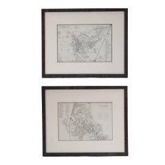
Mid 19th Century Pair of Framed English Maps of Oxford and Cambridge
Located in Los Angeles, CA
Pair of maps of Oxford and Cambridge in custom black wood frames. With beautiful hand-drawn
Category

Antique 19th Century English Victorian Prints

Materials

Paper, Wood

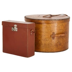
Vintage English luggage Maps & Guide case and Hat box
Located in London, GB
Vintage English luggage maps & guide case and hat box English, 20th Century Round case: height
Category

20th Century English Modern Trunks and Luggage

Materials

Leather

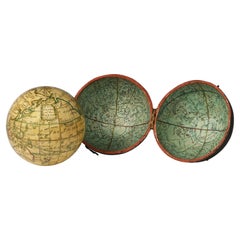
Pair of George III 3 inch pocket globes by J & W Cary, one dated 1791
Located in Lymington, Hampshire
engraved map of the ‘world as known in CÆSAR’s Time agreeable to D’Anville’ and ‘A Table of Latitudes
Category

Antique 1790s English Globes

Materials

Shagreen

The Holy Bible, Containing the Old and New Testaments, 1887
Located in Colorado Springs, CO
, in Oxford, England, for the British and Foreign Bible Society. The British and Foreign Bible Society
Category

Antique 1880s English Late Victorian Books

Materials

Leather, Paper

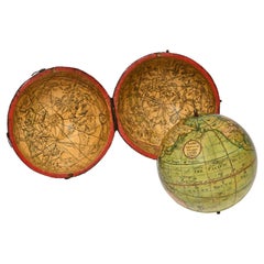
Pocket Globe, Nicholas Lane, London, post 1779
By Nicholas Lane
Located in Milano, IT
Wall of China is also depicted on the map. Some of the routes of the voyages of Anson and Cook are
Category

Antique 1780s English Other Models and Miniatures

Materials

Leather, Wood, Paper

TOLKIEN. The Hobbit. 1937 - 1st ED 2nd IMPRESSION - THE FIRST WITH COLOR PLATES!
Located in Hillsborough, NJ
and endpapers, original cloth covers and spine bound in rear, original front and rear map pastedowns
Category

Vintage 1930s British Books

Materials

Leather

TOLKIEN, J. R. R. - The Hobbit - 1937 - FIRST EDITION - FIRST PRINTING !
Located in Hillsborough, NJ
tinted green, bound in the publisher's original stamped green cloth, map pastedowns and endpapers
Category

Vintage 1930s British Books

Materials

Fabric

Rare Antique Engraving of Life Near The Sestro River, Liberia in Africa, 1744
Located in Langweer, NL
Description: Antique print, titled: 'A map of Sestro River (…).' - This plate shows Fish, birds
Category

Antique 1740s Prints

Materials

Paper

Antique Print with Various Creatures from A Travel Account, 1744
Located in Langweer, NL
creatures (parakeet, sea cow, monkeys), a small map of Papo’s Bay at Tary (Cayenne?), birds eating fish at
Category

Antique 1740s Prints

Materials

Paper

8 Volumes. Jean Froissart, Froissart's Chronicles.
Located in New York, NY
England inlaid on front boards, top edges gilt, deckle edges, limited & numbered 1/350 copies printed at
Category

Early 20th Century English Books

Materials

Leather

People Also Browsed

Two Charming Dutch Rural Ladder Back Oak Rush Seat Armchairs 1920's
Located in Boven Leeuwen, NL
These charming oak ladder back chairs featuring wicker seats make an excellent choice for enhancing the ambiance of any living space. Combining style, comfort, and durability, they a...
Category

Vintage 1920s Dutch Country Lounge Chairs

Materials

Rush, Oak

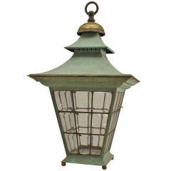
English Georgian Patinated Copper Outdoor Lantern
Located in New York, NY
English Georgian-style square copper green patinated hanging lantern with leaded glass side panels. (19/20th Century).  
Category

Antique 19th Century English Georgian Lanterns

Materials

Copper, Lead, Tôle

‘Gloria Victis’, A Patinated Bronze Figural Group by Mercié, Cast by Barbedienne
By Ferdinand Barbedienne
Located in Brighton, West Sussex
A Patinated Bronze Figural Group of ‘Gloria Victis’ (‘Glory to the Vanquished’), Cast by Ferdinand Barbedienne from the Model by Marius-Jean-Antonin Mercié (French, 1845-1916). ‘Gl...
Category

Antique 19th Century French Figurative Sculptures

Materials

Bronze

An equestrian bronze of the Duke of Wellington by Edward Baily, 1844
Located in Lymington, Hampshire
This bronze statuette shows Arthur Wellesley, Duke of Wellington riding his warhorse Copenhagen. He is dressed in civilian clothes with the reins in one hand and his top hat in the ...
Category

Antique 1840s English Figurative Sculptures

Materials

Bronze

George III Serpentine Inlaid Writing Dressing Table
By Pierre Langlois
Located in Lymington, GB
A George III period sabicu and goncalo alves serpentine writing / dressing table. In the manner of master cabinet-maker Pierre Langlois, circa 1770. Great color, condition and surfac...
Category

Antique 1770s English Tables

Materials

Wood

17th Century Hand-Colored Map of West Africa by Mercator/Hondius
Located in Alamo, CA
A 17th century hand-colored map entitled "Guineae Nova Descriptio" by Gerard Mercator and Jodocus Hondius, published in their 'Atlas Minor' in Amsterdam in 1635. It is focused on the...
Category

Antique Mid-17th Century Dutch Maps

Materials

Paper

Yellow Shanks Snipe (South Carolina) /// Bird Ornithology John James Audubon
By John James Audubon
Located in Saint Augustine, FL
Artist: John James Audubon (American, 1785-1851) Title: "Yellow Shanks Snipe (South Carolina)" (Plate 344, No. 69) Portfolio: The Birds of America, First Royal Octavo Edition Year: 1...
Category

1840s Victorian Animal Prints

Materials

Lithograph, Watercolor

Early 19th Century Gainsford & Co Country English Faux Painted Linen Press
By Gainsford and Co.
Located in Forney, TX
A most impressive large scale refined English country house faux painted pine satin birch linen press armoire (or housekeeper’s cupboard) by Gainsford & Company, London, England. H...
Category

Antique Early 19th Century English Georgian Linen Presses

Materials

Pine

Antique Map of the Islands of the Atlantic by J. Tallis
Located in Langweer, NL
A highly decorative and detailed mid-19th century map of the Islands of the Atlantic -- including the Azores, Madeira, Bermuda, the Canary Islands and the Cape Verde Islands -- which...
Category

Antique Mid-19th Century Maps

Materials

Paper

Dutch Art Deco Marbled Pink Glass Pendant Chandelier, c. 1930's
Located in Norwalk, CT
Step into an era where elegance was etched into every detail with this stunning Dutch Art Deco Marbled Pink Glass Pendant Chandelier. Dating back to the 1930s, this masterpiece harks...
Category

Early 20th Century Art Deco Chandeliers and Pendants

Materials

Metal

An Impressive Fusee Dial Clock By Shore, London
Located in Amersham, GB
An impressive fusee timepiece by J.Shore. The high quality eight day four columnar pillar single chain fusee movement and thick brass plates is in excellent condition. Housed in a ca...
Category

Antique 1830s English Regency Wall Clocks

Materials

Brass, Steel

Mercator's Ptolemaic Map of the Holy Land, Cyprus and Syria, circa 1580
Located in Langweer, NL
Antique map titled 'Asiae IIII Tab'. Beautiful map of Mercator's Ptolemaic map of the Holy Land, Cyprus, Syria, etc. Originates from Mercator's 'Geographia'. Gerard Mercator (1512 ...
Category

Antique 16th Century Maps

Materials

Paper

Delft Blue and White "St Domingo" Tobacco Jar
Located in Houston, TX
Delft blue and white "St Domingo" tobacco jar with lid, Netherlands, circa 1790-1809. Decorated with floral medallion. Inscribed with "St Domingo," a popular tobacco variety cultivat...
Category

Antique Early 19th Century Dutch Rococo Jars

Materials

Delft, Faience

Antique Dutch Porcelain Lamp
Located in New York, NY
A circa 1920s Dutch porcelain floral lamp. Measurements: Height of body: 17.5" Diameter: 10.5"
Category

Vintage 1920s Dutch Table Lamps

Materials

Porcelain

Antique Dutch Porcelain Lamp
H 17.5 in Dm 10.5 in
Gold Rush Era Masterpiece: The Tallis & Rapkin Rare Map of Pre-Queensland, 1851
Located in Langweer, NL
The image is an original historical map of Australia from the year 1851, created by John Rapkin with illustrations by J. Marchant and engravings by J. B. Allen. The map was published...
Category

Antique 1850s Maps

Materials

Paper

Antique Map of Asia Minor by J. Tallis, circa 1851
Located in Langweer, NL
A highly decorative mid-19th century map of 'Asia Minor' (modern day Turkey) which was drawn and engraved by J. Rapkin and published in John Tallis's Illustrated Atlas (London & New ...
Category

Antique Mid-19th Century Maps

Materials

Paper

Recent Sales

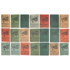
Pattisons' Cycling Maps
Located in Oxfordshire, GB
maps were originally produced for Pattisons', 15 of England and Wales and 8 of Scotland. The cloth
Category

Antique Early 1900s British Maps

Pattisons' Cycling Maps
H 3.55 in W 2.37 in D 0.04 in
English Pocket Globe by Lane, London, between 1817 and 1833
By Lane's
Located in Milano, IT
Dekker (E., Dekker, Globes at Greenwich, Oxford 1999, pp. 128-129). Around 1757 James Ferguson began to
Category

Antique 1820s English George IV Maps

Materials

Shagreen, Paper

Antique Library Table, English, William IV, Mahogany, Cartographers, circa 1835
Located in Hele, Devon, GB
tones to the select mahogany Grain interest and a desirable aged patina Oxford green, Morocco
Category

Antique 19th Century English William IV Conference Tables

Materials

Mahogany

The American Commonwealth by James Bryce, Three Volume Set, 1888
Located in Colorado Springs, CO
regius professor of civil law at Oxford while he wrote The American Commonwealth. The three volume set
Category

Antique 1880s English Books

Materials

Leather, Paper

J. R. R. Tolkien, The Hobbit, First Edition Second Impression, 1937
Located in Hillsborough, NJ
endpapers, original cloth covers and spine bound in rear, original front map pastedown and endpaper bound in
Category

Vintage 1930s British Books

Materials

Leather

Old Print of the Sestro River in Liberia Showing People and Animals, 1744
By Johannes Kip
Located in Langweer, NL
Antique print, titled: 'A map of Sestro River (…).' - This plate shows Fish, birds, animals and
Category

Antique 18th Century Prints

Materials

Paper

Europe in the 16th Century 1494-1598 by A.H. Johnson, M.A.
Located in valatie, NY
. Johnson, M.A., historical lecturer to Merton, Trinity and University Colleges, Oxford. Chapters include
Category

Early 20th Century English Books

Materials

Leather, Paper

Seven Pillars of Wisdom, A Triumph by T. E. Lawrence, First Trade Edition, 1935
Located in Colorado Springs, CO
maps. It is presented beautifully rebound in full brown leather boards, embossed with silver and black
Category

Vintage 1930s English Books

Materials

Leather, Paper

Get Updated with New Arrivals
Save "Map Oxford England", and we’ll notify you when there are new listings in this category.

Map Oxford England For Sale on 1stDibs

Find many varieties of an authentic map oxford England available at 1stDibs. Each map oxford England for sale was constructed with extraordinary care, often using paper, wood and animal skin. Whether you’re looking for an older or newer map oxford England, there are earlier versions available from the 18th Century and newer variations made as recently as the 20th Century. A map oxford England, designed in the Victorian style, is generally a popular piece of furniture. A well-made map oxford England has long been a part of the offerings for many furniture designers and manufacturers, but those produced by Gerard Mercator, Lane's and Newton and Son are consistently popular.

How Much is a Map Oxford England?

The average selling price for a map oxford England at 1stDibs is $1,244, while they’re typically $238 on the low end and $12,500 for the highest priced.

Read More

Pamela Shamshiri Shares the Secrets behind Her First-Ever Book and Its Effortlessly Cool Interiors

The sought-after designer worked with the team at Hoffman Creative to produce a monograph that beautifully showcases some of Studio Shamshiri's most inspiring projects.

Moroccan Artworks and Objects Take Center Stage in an Extraordinary Villa in Tangier

Italian writer and collector Umberto Pasti opens the doors to his remarkable cave of wonders in North Africa.

Montecito Has Drawn Royalty and Celebrities, and These Homes Are Proof of Its Allure

Hollywood A-listers, ex-pat aristocrats and art collectors and style setters of all stripes appreciate the allure of the coastal California hamlet — much on our minds after recent winter floods.

Whaam! Blam! Pow! — a New Book on Pop Art Packs a Punch

Publishing house Assouline and writer Julie Belcove have teamed up to trace the history of the genre, from Roy Lichtenstein, Andy Warhol and Yayoi Kusama to Mickalene Thomas and Jeff Koons.

The Sparkling Legacy of Tiffany & Co. Explained, One Jewel at a Time

A gorgeous new book celebrates — and memorializes — the iconic jeweler’s rich heritage.

What Makes a Gem-Encrusted Chess Set Worth $4 Million?

The world’s most opulent chess set, weighing in at 513 carats, is literally fit for a king and queen.

Tauba Auerbach’s Geometric Pop-Up Book Is Mighty Rare, Thanks to a Hurricane

This sculptural art book has an epic backstory of its own.

Step inside the Storied Mansions of Palm Beach’s Most Effervescent Architect

From Spanish-style courtyards to fanciful fountains, these acclaimed structures abound in surprising and elegant details.