Items Similar to Mercator's Ptolemaic Map of the Holy Land, Cyprus and Syria, circa 1580
Want more images or videos?
Request additional images or videos from the seller
1 of 6
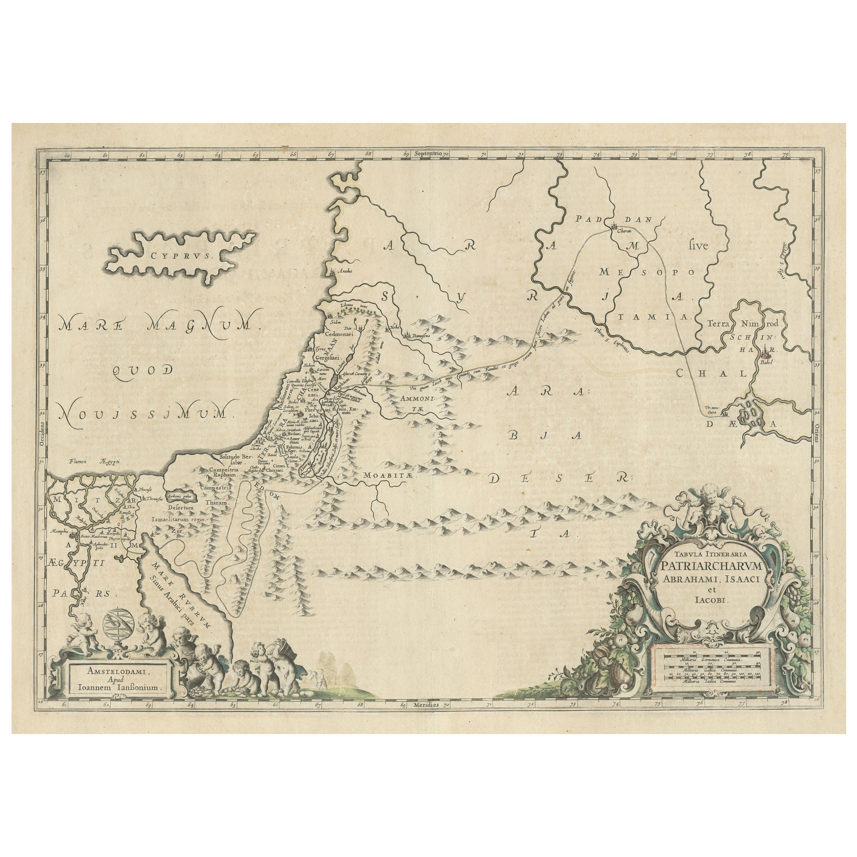
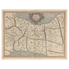
Mercator's Ptolemaic Map of the Holy Land, Cyprus and Syria, circa 1580
About the Item
Antique map titled 'Asiae IIII Tab'. Beautiful map of Mercator's Ptolemaic map of the Holy Land, Cyprus, Syria, etc. Originates from Mercator's 'Geographia'.
Gerard Mercator (1512 - 1594) originally a student of philosophy was one of the most renowned cosmographers and geographers of the 16th century, as well as an accomplished scientific instrument maker. He is most famous for introducing Mercators Projection, a system which allowed navigators to plot the same constant compass bearing on a flat map.
- Dimensions:Height: 15.63 in (39.7 cm)Width: 19.77 in (50.2 cm)Depth: 0.02 in (0.5 mm)
- Materials and Techniques:
- Period:
- Date of Manufacture:c.1580
- Condition:General age-related toning. Original folding line. Shows a few tiny defects, also affecting image. Latin text on verso. Please study image carefully.
- Seller Location:Langweer, NL
- Reference Number:Seller: BG-135101stDibs: LU3054335446612
About the Seller
5.0
Platinum Seller
These expertly vetted sellers are 1stDibs' most experienced sellers and are rated highest by our customers.
Established in 2009
1stDibs seller since 2017
1,919 sales on 1stDibs
Typical response time: <1 hour
- ShippingRetrieving quote...Ships From: Langweer, Netherlands
- Return PolicyA return for this item may be initiated within 14 days of delivery.
Auctions on 1stDibs
Our timed auctions are an opportunity to bid on extraordinary design. We do not charge a Buyer's Premium and shipping is facilitated by 1stDibs and/or the seller. Plus, all auction purchases are covered by our comprehensive Buyer Protection. Learn More
More From This SellerView All
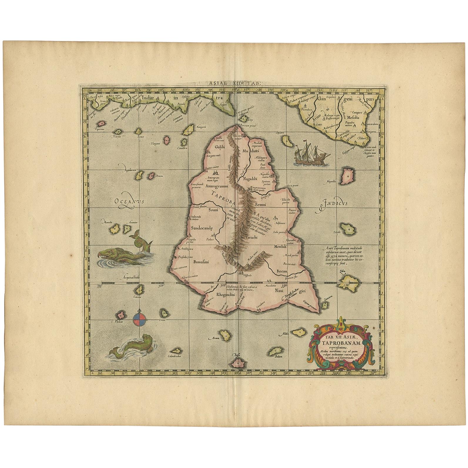
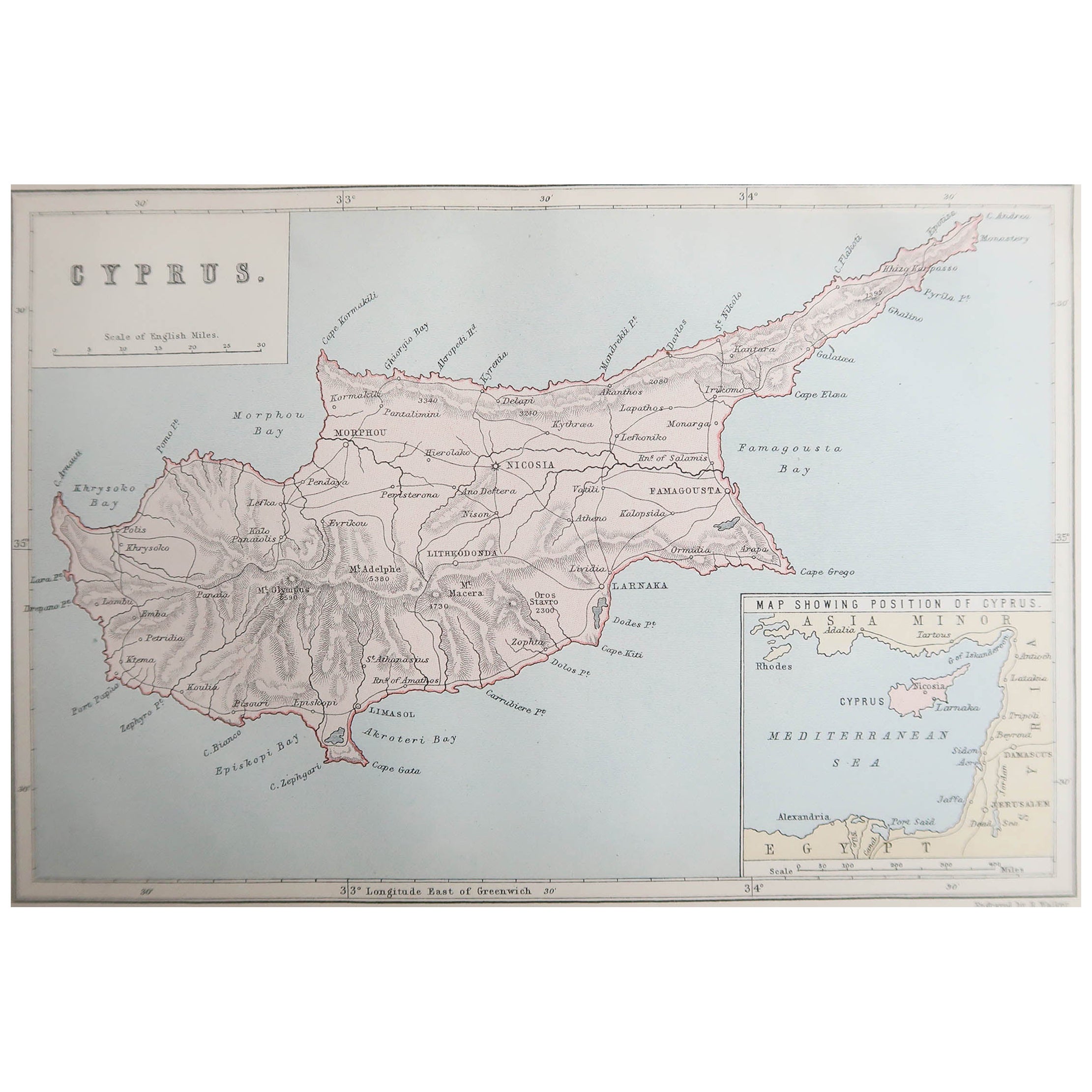
- Mercator's Ptolemaic map of Taprobana, (Ceylon) Sri LankaLocated in Langweer, NLAntique map titled 'Asiae XII Tab'. Mercator's Ptolemaic map of Taprobana. The map shows Ptolemy's erroneous location of the island of Sri Lanka near the equator, with a bit of India...Category
Antique 16th Century Maps
MaterialsPaper
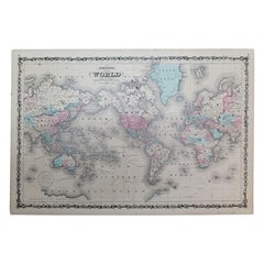
- Antique Map of the World on Mercator's Projection, 1788Located in Langweer, NLAntique map titled 'Kaart van de Geheele Wereld (..)'. Uncommon small world map on Mercator's projection. Nice detail of the islands throughout the wor...Category
Antique Late 18th Century Maps
MaterialsPaper
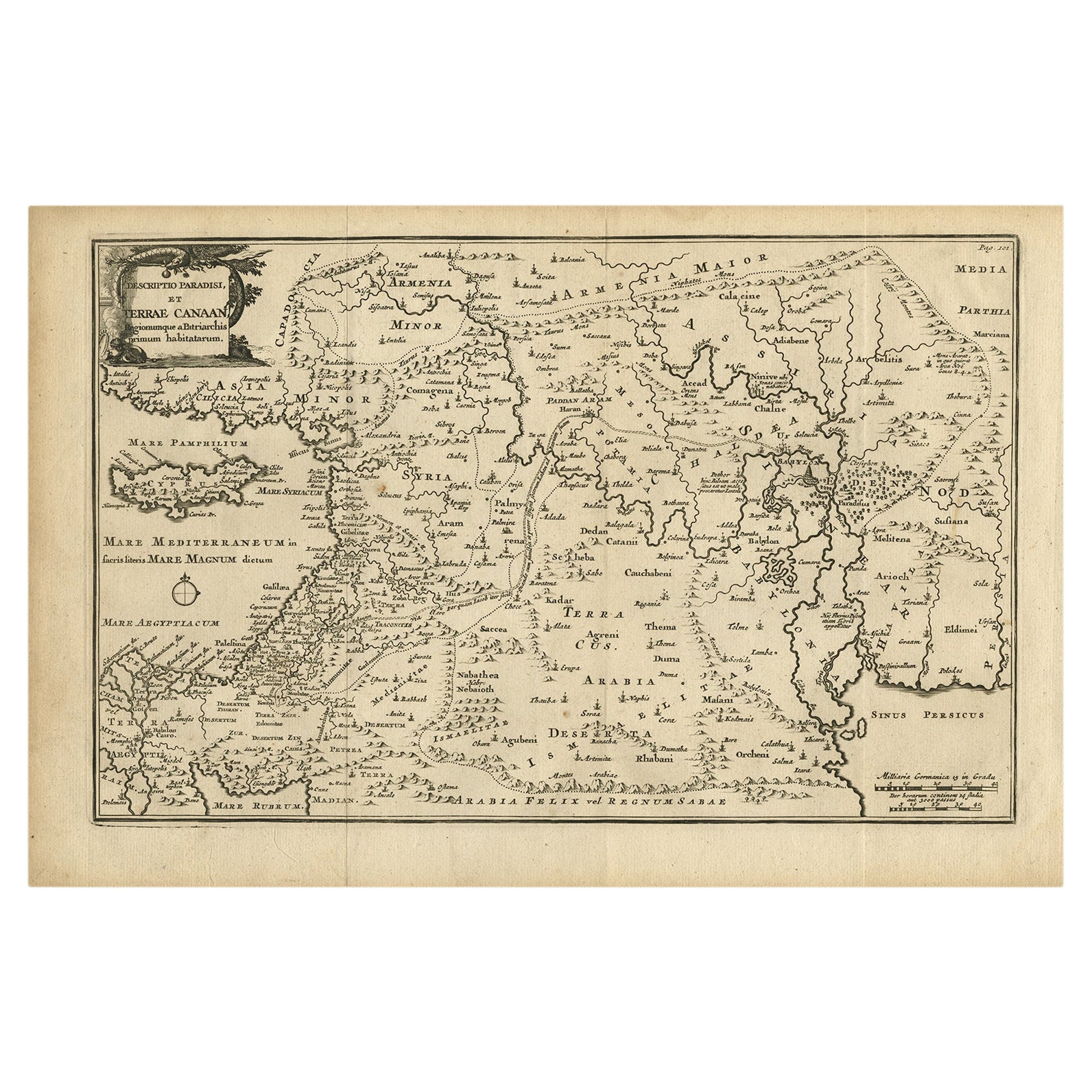
- Antique Map of the Holy Land, c.1710Located in Langweer, NLAntique map titled 'Totius Terrae Sanctae Delineatio'. Map of the Holy Land extending to Egypt and showing the route of the Children of Israel in their e...Category
Antique 18th Century Maps
MaterialsPaper
- Antique Map of the Holy Land, c.1717Located in Langweer, NLAntique map Israel titled 'Tabula Geographica Terrae Sanctae'. Rare edition made after a map of the Holy Land by J. Bonfrerius. The map is oriented ...Category
Antique 18th Century Maps
MaterialsPaper
- Antique Detailed World Map Drawn on Mercator's Projection, 1700Located in Langweer, NLAntique world map titled 'Carte generale du monde, ou description du monde terrestre & Aquatique - Generale Waereld kaart, of beschryving van de land en water waereld'. This is Pierr...Category
Antique 17th Century Maps
MaterialsPaper
- Exploring Ancient Persia: Ptolemaic Map of Iran and Iraq by Ptolemy and MercatorLocated in Langweer, NLClaudius Ptolemy was a mathematician, astronomer and geographer who worked in Alexandria, then a part of the Roman Empire, in the 2nd century AD. One of the most learned and influent...Category
Antique 1610s Maps
MaterialsPaper


You May Also Like
- 1864 Johnson's Map of the World on Mercator's Projection, Ric.B009Located in Norton, MAAn 1864 Johnson's map of the World on Mercator's Projection Ric.b009 About this Item "This antique map came from Johnson's New Illustrated (Steel Plate) Family Atlas, publ...Category
Antique 19th Century Dutch Maps
MaterialsPaper
- The Holy Land at the Time of Jesus: A 17th Century Dutch Map by VisscherBy Nicolaes Visscher IILocated in Alamo, CAThis detailed Dutch map entitled "Het Beloofe de Landt Canaan door wandelt van onsen Salichmaecker Iesu Christo, nessens syne Apostelen" by Nicolaes Visscher was published in Amsterd...Category
Antique Mid-17th Century Dutch Maps
MaterialsPaper
- Flowers from The Holy Land souvenir bookLocated in East Geelong, VICContained within the olive wood covers of this Flowers from The Holy Land souvenir book are 11 thick cardboard pages, 10 of which have pressed flowers arranged on them. The flowers a...Category
Antique 1890s Israeli Books
MaterialsPaper
- Map of the Holy Land "Carte de la Syrie et de l'Egypte" by Pierre M. LapieBy Pierre M. LapieLocated in Alamo, CAAn early 19th century map of ancient Syria and Egypt entitled "Carte de la Syrie et de l'Egypte anciennes/dressée par M. Lapie, Colonel d'Etat Major, et...Category
Antique Early 19th Century French Maps
MaterialsPaper
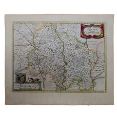
- 1625 Mercator Map of the Provenience of Quercy, "Quercy Cadvrcivm Ric.0013Located in Norton, MA1625 Mercator map of the provenience of Quercy, entitled "Quercy Cadvrcivm," Ric.0013 " Authentic" - Map of the provenience of Quercy Cadvrcivm D...Category
Antique 17th Century French Maps
MaterialsPaper
- Map Holy Promise Land Canaan Richard Palmer Richard Blome 1687 Joseph MoxonLocated in BUNGAY, SUFFOLKCanaan comonly called the Holy Land or the Land of Promise, being the Possesion of the Israelites & travelled through by Our Lord & Saviour Iesus Christ and his Apostles. Engraven by Richard Palmer for Richard Blome. 1687 Blome, Richard, 1641-1705. London. 283 x 452 mm. Copperplate. Probably from an English Bible...Category
Antique 17th Century British Baroque Maps
MaterialsPaper


Recently Viewed
View AllMore Ways To Browse
Bolivian Antique
St Thomas Cross
Map Of Liverpool
Georgetown Antique
Map Of Gulf Of Mexico
Authentic Pirate
Historic Map Virginia
Map Of Indonesia
United States Antique Map
Antique Map Coats Of Arms
Antique Book Map France
Old Maps England
Map Sumatra
Scotland Coat Of Arms
Malaysia Antique
Map Of Siam
Antique Map Of Sri Lanka
Globes Antique Terrestre