Antique Book Map France
1
to
14
215
14
94
87
83
62
48
26
18
13
12
12
10
7
7
6
5
5
4
4
4
3
3
3
3
2
2
1
1
1
1
1
1
1
42
42
21
3
2
Sort By
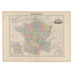
Antique Political Map of France, 1880
By J. Migeon
Located in Langweer, NL
Antique map titled 'France Féodale'. Old map of France with a decorative vignette of Castle de
Category
Antique 19th Century Maps
Materials
Paper
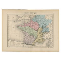
Antique Map of France by Migeon, 1880
Located in Langweer, NL
Antique map titled 'France Physique'. Old map of France. This map originates from 'Géographie
Category
Antique 19th Century Maps
Materials
Paper
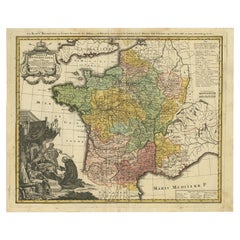
Antique Map of France by Homann, 1738
Located in Langweer, NL
. S. Benedict (..)'. Beautiful antique map of France with the provinces of the Order of Saint Benedict
Category
Antique 18th Century Maps
Materials
Paper
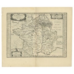
Antique Map of France by Janssonius, c.1650
Located in Langweer, NL
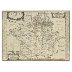
Antique map titled 'Gallia Vetus'. Beautiful map of France based on Caesar's De Bello Gallico. In
Category
Antique 17th Century Maps
Materials
Paper
Antique Map of France by Janssonius, c.1650
Located in Langweer, NL
Antique map titled 'Gallia Vetus'. Beautiful map of France based on Caesar's De Bello Gallico. In
Category
Antique 17th Century Maps
Materials
Paper
Antique Map of France in Ancient Roman Times, 1880
Located in Langweer, NL
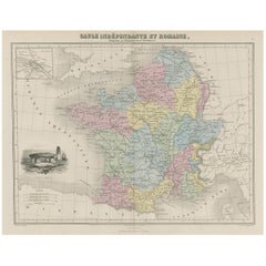
Antique map titled 'Gaule indépendante et Romaine'.
Old map of Gaul or France in ancient Roman
Category
Antique 19th Century Maps
Materials
Paper
Decorative Antique Map of the Berry Region, France, 1657
Located in Langweer, NL
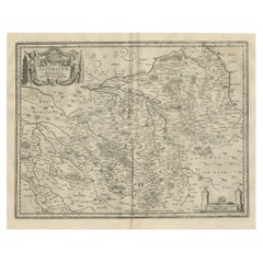
Antique map of France titled 'Bituricum Ducatus - Duche de Berri'.
Decorative map of the Berry
Category
Antique 1650s Maps
Materials
Paper
Antique Map of the Departments of France by Migeon, 1880
By J. Migeon
Located in Langweer, NL
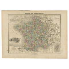
Antique map titled 'France par Départements'. Old map of France with a decorative vignette of
Category
Antique 19th Century Maps
Materials
Paper
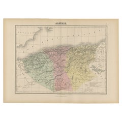
Antique Map of Algeria, 1880
Located in Langweer, NL
Antique map titled 'Algérie. Old map of Algeria. This map originates from 'Géographie Universelle
Category
Antique 19th Century Maps
Materials
Paper
Antique Map of Asia, 1846
Located in Langweer, NL
Antique map titled 'Asie'. Original antique map of Asia. Source unknown, to be determined
Category
Antique 19th Century Maps
Materials
Paper
Decorative Antique Map of the Quercy Region in France, 1657
Located in Langweer, NL
Antique map of France titled 'Quercy olim Cadurcium'.
Decorative map of the Quercy region
Category
Antique 1650s Maps
Materials
Paper
Antique Map of Greece from an Old French School Atlas, 1880
Located in Langweer, NL
Antique map titled 'Grèce Moderne '. Old map of Greece and surroundings. This map originates from
Category
Antique 19th Century Maps
Materials
Paper
Antique Map of the Region of Touraine, France by Janssonius, 1657
By Johannes Janssonius
Located in Langweer, NL
Antique map of France titled 'Touraine - Turonensis Ducatus'. Decorative map of the Touraine region
Category
Antique 17th Century Maps
Materials
Paper
Detailed Original Antique Map of the Picardy Region of France, 1657
Located in Langweer, NL
Antique map of France titled 'Picardia vera et inferior'.
Detailed map of the Picardy region of
Category
Antique 1650s Maps
Materials
Paper
Antique Map of France with Beautiful Title Cartouche and Border, c.1740
Located in Langweer, NL
Antique map titled 'La France suivant les nouvelles Observations de Messrs de l'Academie Royale des
Category
Antique 18th Century Maps
Materials
Paper
Antique Map of the Region of 'Île de France' by Janssonius, 1657
By Johannes Janssonius
Located in Langweer, NL
Antique map of France titled 'Ager Parisiensis vulgo l'Isle de France'. Old map of Paris and
Category
Antique 17th Century Maps
Materials
Paper
Original Antique Map of the Southern Coast of France by Janssonius, 1657
By Johannes Janssonius
Located in Langweer, NL
Antique map of France titled 'Comté et Gouvernement de Provence'. Decorative map of the southern
Category
Antique 17th Century Maps
Materials
Paper
H 19.69 in W 23.63 in D 0 in
Antique Map of the Region of Sarlat in France by Janssonius, 1657
By Johannes Janssonius
Located in Langweer, NL
Antique map of France titled 'Le Diocese de Sarlat dioccesis Sarlatensis'. Decorative map of the
Category
Antique 17th Century Maps
Materials
Paper
Antique Map of the Region of Touraine in France by Janssonius, 1657
By Johannes Janssonius
Located in Langweer, NL
Antique map titled 'Touraine - Turonensis Ducatus'.
Decorative map of the Touraine region. This
Category
Antique 17th Century Maps
Materials
Paper
Antique Map of Cayenne and Cassepouri, French Guinea, South America, c.1730
Located in Langweer, NL
Antique map titled 'A Map of the Island Cayenne (..)’. A set of interesting copper engravings of
Category
Antique 18th Century Maps
Materials
Paper
H 16.54 in W 13.59 in D 0 in
Antique Map of Guadelupe in the Caribbean, 1759
By Jacques-Nicolas Bellin
Located in Langweer, NL
Antique map titled 'Carte De L'Isle De La Guadeloupe'. Detailed map of Guadalupe, Mari-Galante and
Category
Antique Mid-18th Century French Maps
Materials
Paper
Striking Antique Map of Cayenne in French Guyana, South America, ca.1760
Located in Langweer, NL
Description: Antique map titled 'Land-kaart van het Eiland en de Volkplanting van Cayenne aan de
Category
Antique 1760s Maps
Materials
Paper
Antique Map of the Europe Continent, 1880
Located in Langweer, NL
Antique map titled 'Europe'. Old map of the European continent. This map originates from
Category
Antique 19th Century Maps
Materials
Paper
Antique Map of Normandy by Janssonius, 1657
Located in Langweer, NL
Antique map of France titled 'Normandia Ducatus'. Decorative map of the Normandy region, including
Category
Antique 17th Century Maps
Materials
Paper
Antique Map of the Vermandois Region 'Picardy' in France by Janssonius, C.1640
Located in Langweer, NL
Antique map titled 'Vermandois'. Old map of the Vermandois region, France. Vermandois was a French
Category
Antique 17th Century Maps
Materials
Paper
H 14.77 in W 19.69 in D 0 in
Antique Map of the Region of Beauce in France by Janssonius, c.1650
Located in Langweer, NL
Antique map of France titled 'La Beauce'. Decorative map of the region of Beauce, a natural region
Category
Antique 17th Century Maps
Materials
Paper
Antique Map of the Region of Vermandois and Cappelle, France by Janssonius, 1657
By Johannes Janssonius
Located in Langweer, NL
Antique map of France titled 'Descriptio Veromanduorum - Gouvernement de la Cappelle'. Two detailed
Category
Antique 17th Century Maps
Materials
Paper
H 19.69 in W 23.63 in D 0 in
Antique Map of the French Province Maine, Showing Le Mans, Alencon Etc., Ca1640
Located in Langweer, NL
Antique map titled 'Le Maine'.
Old map of the province of Maine, France. It shows the cities of
Category
Antique 1640s Maps
Materials
Paper
H 19.49 in W 23.04 in D 0 in
Old Handcolored Antique Map of Pays De Caux in Normandy, France, ca.1640
Located in Langweer, NL
Antique map titled 'Le Pais de Caux'.
Old map of Pays de Caux, France. Pays de Caux is an area
Category
Antique 1640s Maps
Materials
Paper
H 19.49 in W 23.04 in D 0 in
Antique Map of the Kingdom of Prussia, 1880
Located in Langweer, NL
Antique map titled 'Prusse'. Old map of the Kingdom of Prussia, with a decorative vignette of the
Category
Antique 19th Century Maps
Materials
Paper
Antique Map of Northern Italy by Migeon, 1880
Located in Langweer, NL
Antique map titled 'Italie Septentrionale'. Old map of the northern part of Italy. This map
Category
Antique 19th Century Maps
Materials
Paper
Antique Map of Southern Italy by Migeon, 1880
Located in Langweer, NL
"Antique map titled 'Italie Méridionale'. Old map of southern Italy including Sicily/Sicilia. This
Category
Antique 19th Century Maps
Materials
Paper
Antique Map of the Rethelois or Rethel Region in France by Janssonius, ca.1650
By Johannes Janssonius
Located in Langweer, NL
Antique map of France titled 'Dioecese de Rheims et le Païs de Rethel'.
Detailed map, centered
Category
Antique 17th Century Maps
Materials
Paper
H 19.69 in W 22.64 in D 0 in
Very Old Original Antique Map of The City of Douai in France, ca.1575
Located in Langweer, NL
Antique Map of Douai (France) titled 'Duacum, Catuacorum Urbs, tam situ, quam incolis, et
Category
Antique 16th Century Maps
Materials
Paper
Antique Map of Northern Asia by Mallet, 1719
Located in Langweer, NL
Antique map titled 'Das Mitternächtige Theil des Alten Asien'. This sheet of five miniature maps
Category
Antique 18th Century Maps
Materials
Paper
Antique Map of the Netherlands and Belgium, circa 1880
Located in Langweer, NL
Antique map titled 'Hollande et Belgique'. Old map of the Netherlands and Belgium. With decorative
Category
Antique 19th Century Maps
Materials
Paper
Antique Map of the Region of Sedan and Doncheri in France by Janssonius, c.1650
By Johannes Janssonius
Located in Langweer, NL
Antique map of France titled 'La Souveraineté de Sedan et de Raucourt, et la prevosté de Doncheri
Category
Antique 17th Century Maps
Materials
Paper
H 19.69 in W 23.23 in D 0 in
Antique Map of the German Empire by Migeon, 1880
Located in Langweer, NL
Antique map titled 'Empire d'Allemagne'. Old map of Germany. With decorative vignette of Mainz
Category
Antique 19th Century Maps
Materials
Paper
Antique Map of Spain and Portugal by Migeon, 1880
Located in Langweer, NL
Antique map titled 'Espagne et Portugal'. Old map of Spain and Portugal with a decorative vignette
Category
Antique 19th Century Maps
Materials
Paper
Antique Map of the Maine Region by Janssonius, 1657
By Johannes Janssonius
Located in Langweer, NL
Antique map of France titled 'Diocese du Mans vulgo le Mains'. Decorative map of the region of
Category
Antique 17th Century Maps
Materials
Paper
Antique Map of Russia in Europe by Migeon, 1880
Located in Langweer, NL
Antique map titled 'Russie d'Europe'. Old map of Russia in Europe. This map originates from
Category
Antique 19th Century Maps
Materials
Paper
Antique Map of the Austrian Empire by Migeon, 1880
Located in Langweer, NL
Antique map titled 'Empire d'Autriche'. Old map of the Austrian Empire. With decorative vignette
Category
Antique 19th Century Maps
Materials
Paper
Antique Map of Sweden and Norway by Migeon, 1880
Located in Langweer, NL
Antique map titled 'Suède et Norvége'. Old map of Sweden and Norway. With decorative vignette of
Category
Antique 19th Century Maps
Materials
Paper
Antique Map of Russia and Siberia by Migeon, 1880
Located in Langweer, NL
Antique map titled 'Sibérie ou Russie d'Asie'. Migeon's map covers the Russian empire in Asia from
Category
Antique 19th Century Maps
Materials
Paper
Antique World Map before the Voyages of Christopher Columbus, 1880
Located in Langweer, NL
Antique world map titled 'Monde Connu des Anciens'. Antique map of the World and continents before
Category
Antique 19th Century Maps
Materials
Paper
Antique Map of Manchuria and the Northeast Portion of Tartary
Located in Langweer, NL
Antique map titled 'Carte de la Tartarie Orientale (..)'. Detailed map of Manchuria and the
Category
Antique Mid-18th Century Maps
Materials
Paper
Antique Map of the Region of Nivernais by Janssonius, 1657
By Johannes Janssonius
Located in Langweer, NL
Antique map of France titled 'Carte du Païs et Duché de Nivernois'. Decorative map of the Nivernais
Category
Antique 17th Century Maps
Materials
Paper
Antique Map of the Region of Rethel by Janssonius, 1657
By Johannes Janssonius
Located in Langweer, NL
Antique map of France titled 'Carte du Pais de Retelois'. Detailed map of the region of Rethel in
Category
Antique 17th Century Maps
Materials
Paper
Antique Map of the Region of Dauphiné by Janssonius, 1657
Located in Langweer, NL
Antique map of France titled 'Nova et Accurata descriptio Delphinatus vulgo Dauphiné'. Decorative
Category
Antique 17th Century Maps
Materials
Paper
Antique Map of the Region of Guyenne by Janssonius, 1657
By Johannes Janssonius
Located in Langweer, NL
Antique map of France titled 'Description du Guienne'. Decorative map of Guyenne region. Guyenne or
Category
Antique 17th Century Maps
Materials
Paper
Antique Map of the Region of Périgord by Janssonius, 1657
By Johannes Janssonius
Located in Langweer, NL
Antique map of France titled 'Le Comte de Perigort'. Decorative map of the Périgord region
Category
Antique 17th Century Maps
Materials
Paper
Antique Map of the Region of Lyon by Janssonius, 1657
By Johannes Janssonius
Located in Langweer, NL
Antique map of France titled 'La Principaute de Dombes'. Detailed map of the area above Lyon. This
Category
Antique 17th Century Maps
Materials
Paper
Antique Map of the Region of Beauvais by Janssonius, 1657
Located in Langweer, NL
Antique map of France titled 'Beauvaisis Comitatus Belovacium'. Detailed map of the region centered
Category
Antique 17th Century Maps
Materials
Paper
Antique Map of the Region of Bresse by Janssonius, 1657
Located in Langweer, NL
Antique map of France titled 'Bressia vulgo Bresse'. Decorative map of Bresse, including Lyon
Category
Antique 17th Century Maps
Materials
Paper
Antique Map of the Region of Brie by Janssonius, 1657
Located in Langweer, NL
Antique map of France titled 'Le Pais de Brie'. Old map of the Brie Region, to the east of Paris
Category
Antique 17th Century Maps
Materials
Paper
Antique Map of the Region of Bourbon by Janssonius, 1657
Located in Langweer, NL
Antique map of France titled 'Borbonium Ducatus - Bourbonnois'. Decorative map of the Bourbon
Category
Antique 17th Century Maps
Materials
Paper
Antique Map of the Region of Saintonge by Janssonius, 1657
By Johannes Janssonius
Located in Langweer, NL
Antique map of France titled 'La Saintonge vers le Septentrion avecq le Pays d'Aulnis'. Decorative
Category
Antique 17th Century Maps
Materials
Paper
Antique Map of the Coast of Artois by Janssonius, 1657
By Johannes Janssonius
Located in Langweer, NL
Antique map of France titled 'Descriptio Boloniae, Pontieu'. Detailed map of the coast of Artois
Category
Antique 17th Century Maps
Materials
Paper
Original Antique Map Covering the Russian Empire in Asia, 1880
Located in Langweer, NL
Antique map titled 'Sibérie ou Russie d'Asie'.
Migeon's map covers the Russian empire in Asia
Category
Antique 1880s Maps
Materials
Paper
Antique Map of Eastern Siberia Extending to Kamtchatka, Russia, 1764
By Jacques-Nicolas Bellin
Located in Langweer, NL
Antique map titled 'Suite De La Carte De La Siberie Et le Pays de Kamtchatka'. Detailed map the
Category
Antique 18th Century Maps
Materials
Paper
- 1
Get Updated with New Arrivals
Save "Antique Book Map France", and we’ll notify you when there are new listings in this category.
More Ways To Browse
Custom Engraved Rolex
Extreme Rolex
Rolex Air King Tiffany
Rolex Rear
Rolex 99 Air King
Rolex Air King 99
Rolex Royal Air King
Rolex Sea King
Rolex Air King Ii
Map Zanzibar
Buy Rolex Air King
Rolex Things
Change Time On Rolex
Changing Time On A Rolex
No Time To Die Rolex
Map Of Barbados
Identify Rolex
Rolex Identifier
