Items Similar to Detailed Original Antique Map of the Picardy Region of France, 1657


Want more images or videos?
Request additional images or videos from the seller
1 of 5
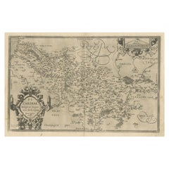
Detailed Original Antique Map of the Picardy Region of France, 1657
About the Item
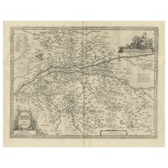
Antique map of France titled 'Picardia vera et inferior'.
Detailed map of the Picardy region of France. This map originates from 'Atlas Novus, Sive Theatrum Orbis Orbis Terrarum: In quo Galliae, Helvetiae (..)' by J. Janssonius (1656-1657).
Artists and engravers: Johannes Janssonius also known as Jan Jansson (1588-1664) was born in Arnhem, Netherlands. His father was a bookseller and publisher (Jan Janszoon the Elder). When he married the daughter of the cartographer Jodocus Hondius he also set up a business as book publisher in Amsterdam. His first map was published in 1616. Around 15 years later he set up a partnership with his brother in law Hondius add issued further editions of the Mercator/Hondius atlas. After his death his heirs still have published several maps. Many of his plates have been acquired by Pieter Schenk and Gerard Valk.
- Dimensions:Height: 19.69 in (50 cm)Width: 23.43 in (59.5 cm)Depth: 0 in (0.02 mm)
- Materials and Techniques:
- Period:1650-1659
- Date of Manufacture:1657
- Condition:Wear consistent with age and use. Condition: Good, general age-related toning. Original, contemporary hand coloring. Latin text on verso. Please study image carefully.
- Seller Location:Langweer, NL
- Reference Number:
About the Seller
5.0
Platinum Seller
These expertly vetted sellers are 1stDibs' most experienced sellers and are rated highest by our customers.
Established in 2009
1stDibs seller since 2017
1,919 sales on 1stDibs
Typical response time: <1 hour
- ShippingRetrieving quote...Ships From: Langweer, Netherlands
- Return PolicyA return for this item may be initiated within 14 days of delivery.
More From This SellerView All
- Antique Map of the Region of Picardy by Janssonius, 1657By Johannes JanssoniusLocated in Langweer, NLAntique map of France titled 'Picardia vera et inferior'. Detailed map of the Picardy region of France. This map originates from 'Atlas Novus, Sive Theatrum Orbis Orbis Terrarum: In ...Category
Antique Mid-17th Century Maps
MaterialsPaper
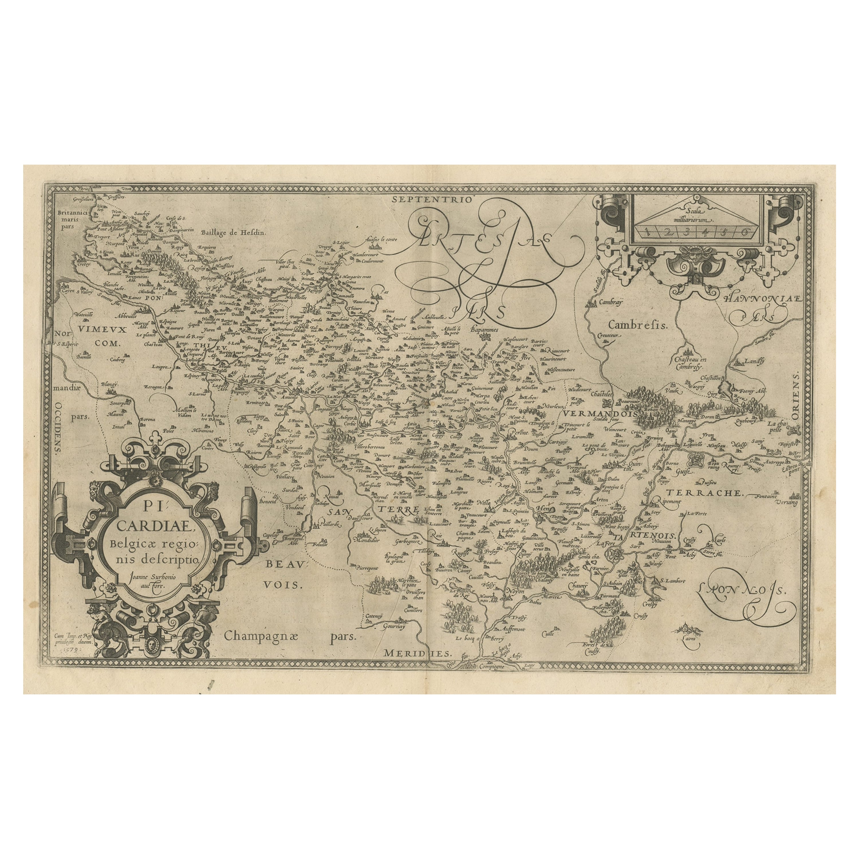
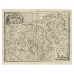
- Original Antique Map of the Region of Picardy, France, ca.1602Located in Langweer, NLAntique map titled 'Picardiae Belgicae regionis descriptio'. Original antique map of the region of Picardy, France. Superb example of the decorative style of Ortelius and filled ...Category
Antique Early 1600s Maps
MaterialsPaper
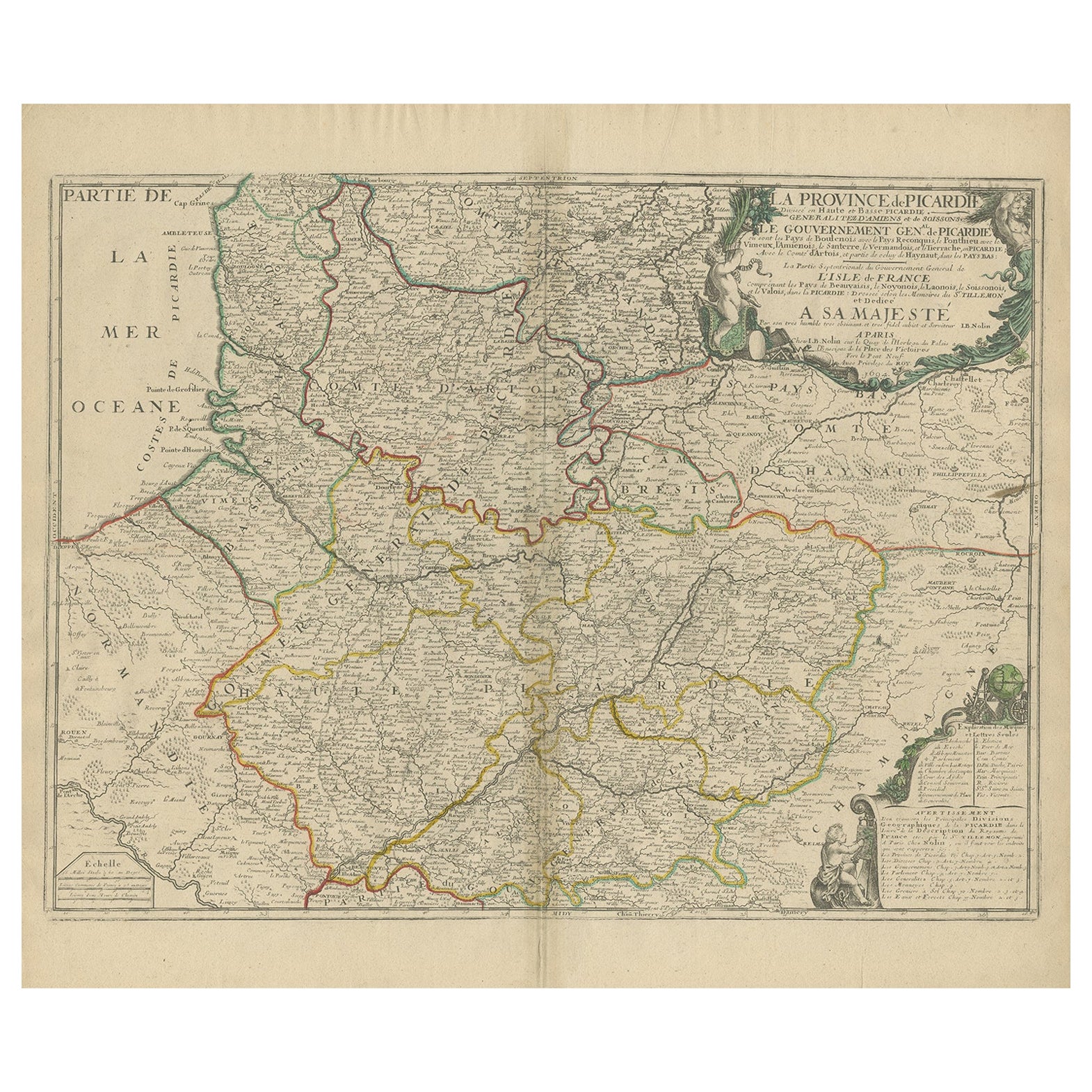
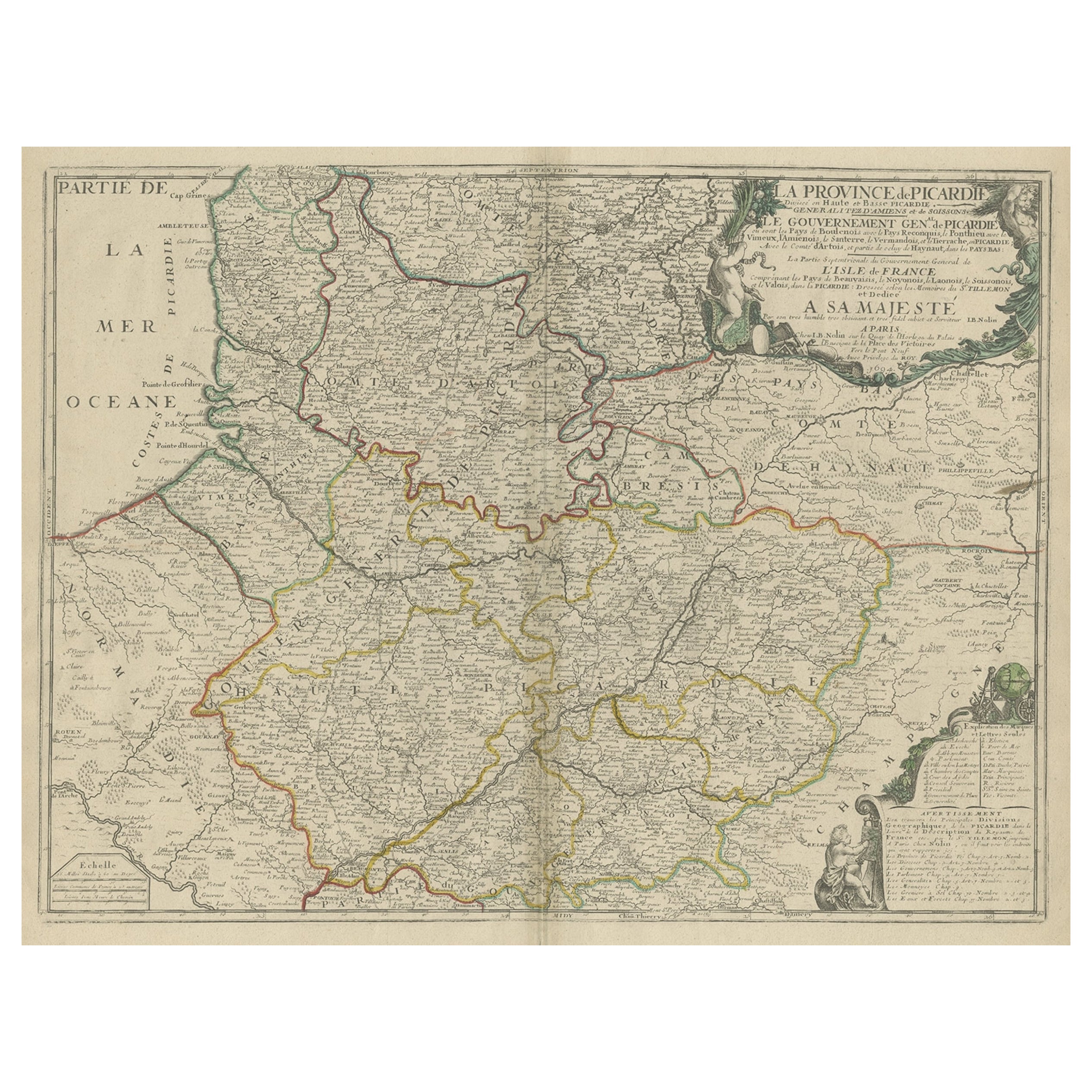
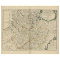
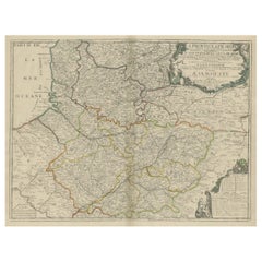
- Original Antique Map of the Picardy Region in Northern France, 1694Located in Langweer, NLAntique map titled 'La Province de Picardie (..)'. Large map of the Picardy region of France. Shows the cities of Beaumont, Mondidier, Lille and others. Artists and Engravers: Je...Category
Antique 17th Century Maps
MaterialsPaper
- Large Antique Map of the Picardy Region of France, 1694Located in Langweer, NLAntique map titled 'La Province de Picardie (..)'. Large map of the Picardy region of France. Shows the cities of Beaumont, Mondidier, Lille and others. Artists and Engravers...Category
Antique 1690s Maps
MaterialsPaper
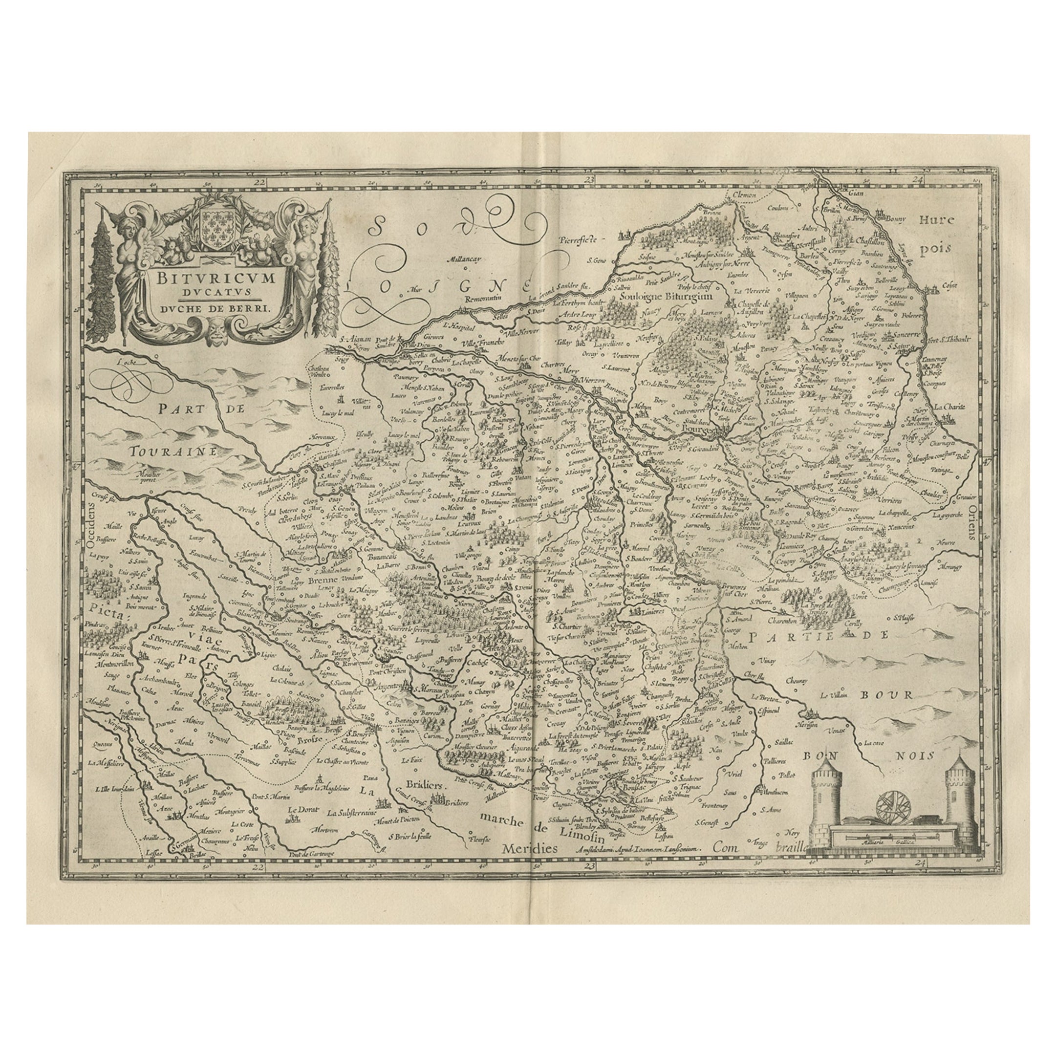
- Decorative Antique Map of the Berry Region, France, 1657Located in Langweer, NLAntique map of France titled 'Bituricum Ducatus - Duche de Berri'. Decorative map of the Berry region, France. Berry is a region located in the center of France. It was a provinc...Category
Antique 1650s Maps
MaterialsPaper
- Antique Map of the Region of Touraine, France by Janssonius, 1657By Johannes JanssoniusLocated in Langweer, NLAntique map of France titled 'Touraine - Turonensis Ducatus'. Decorative map of the Touraine region. This map originates from 'Atlas Novus, Sive Theatrum Orbis Orbis Terrarum: In quo...Category
Antique 17th Century Maps
MaterialsPaper

You May Also Like
- The Normandy Region of France: A 17th C. Hand-colored Map by Sanson and JaillotBy Nicolas SansonLocated in Alamo, CAThis large hand-colored map entitled "Le Duché et Gouvernement de Normandie divisée en Haute et Basse Normandie en divers Pays; et par evêchez, avec le Gouvernement General du Havre ...Category
Antique 1690s French Maps
MaterialsPaper
- Original Antique Map of Italy. C.1780Located in St Annes, LancashireGreat map of Italy Copper-plate engraving Published C.1780 Unframed.Category
Antique Early 1800s English Georgian Maps
MaterialsPaper

- Original Antique Map of Asia. C.1780Located in St Annes, LancashireGreat map of Asia Copper-plate engraving Published C.1780 Two small worm holes to right side of map Unframed.Category
Antique Early 1800s English Georgian Maps
MaterialsPaper

- Original Antique Map of India. C.1780Located in St Annes, LancashireGreat map of India Copper-plate engraving Published C.1780 Three small worm holes to right side of map and one bottom left corner Unframed.Category
Antique Early 1800s English Georgian Maps
MaterialsPaper

- Original Antique Map of The World by Thomas Clerk, 1817Located in St Annes, LancashireGreat map of The Eastern and Western Hemispheres On 2 sheets Copper-plate engraving Drawn and engraved by Thomas Clerk, Edinburgh. Published by Mackenzie And Dent, 1817 ...Category
Antique 1810s English Maps
MaterialsPaper
- Original Antique Map of Canada, Arrowsmith, 1820Located in St Annes, LancashireGreat map of Canada. Drawn under the direction of Arrowsmith. Copper-plate engraving. Published by Longman, Hurst, Rees, Orme and Brown, 1820 ...Category
Antique 1820s English Maps
MaterialsPaper


