Items Similar to Original Antique Map of the Region of Picardy, France, ca.1602


Want more images or videos?
Request additional images or videos from the seller
1 of 5
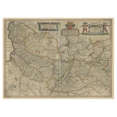
Original Antique Map of the Region of Picardy, France, ca.1602
About the Item
Antique map titled 'Picardiae Belgicae regionis descriptio'.
Original antique map of the region of Picardy, France. Superb example of the decorative style of Ortelius and filled with detail of the countryside along the Somme River. Includes Abbeville, Amiens, Saint Quentin and La Fere. Two large and elaborate strapwork cartouches. Based on a map by Jean Surhon. This map originates from a Spanish edition of 'Theatrum Orbis Terrarum' by A. Ortelius, published circa 1602.
Artists and Engravers: Abraham Ortelius (1527 -1598) was a Flemish cartographer, cosmographer, geographer and publisher and a contemporary of Gerard Mercator, with whom he travelled through Italy and France. Although it is Mercator who first used the word "Atlas" as a name for a collection of maps, it is Ortelius who is remembered as the creator of the first modern atlas. 'Theatrum Orbis Terrarum' was the first systematically collated set of maps by different map makers in a uniform format. Three Latin editions as well as a Dutch, French and German edition of 'Theatrum Orbis Terrarum' were published by 1572 and a further 25 editions printed before Ortelius' death in 1598. Several more were subsequently printed until around 1612. Ortelius is said to have been the first person to pose the question of the continents once being a single land mass before separating into their current positions.
- Dimensions:Height: 17.13 in (43.5 cm)Width: 22.84 in (58 cm)Depth: 0 in (0.02 mm)
- Materials and Techniques:
- Period:1600-1609
- Date of Manufacture:circa 1602
- Condition:Wear consistent with age and use. Condition: Fair/good, general age-related toning. Original folding line. Shows some wear and staining, mainly in margins. The image largely intact and therefor perfect for framing. Spanish text on verso, please study image carefully.
- Seller Location:Langweer, NL
- Reference Number:
About the Seller
5.0
Platinum Seller
These expertly vetted sellers are 1stDibs' most experienced sellers and are rated highest by our customers.
Established in 2009
1stDibs seller since 2017
1,916 sales on 1stDibs
Typical response time: <1 hour
- ShippingRetrieving quote...Ships From: Langweer, Netherlands
- Return PolicyA return for this item may be initiated within 14 days of delivery.
More From This SellerView All
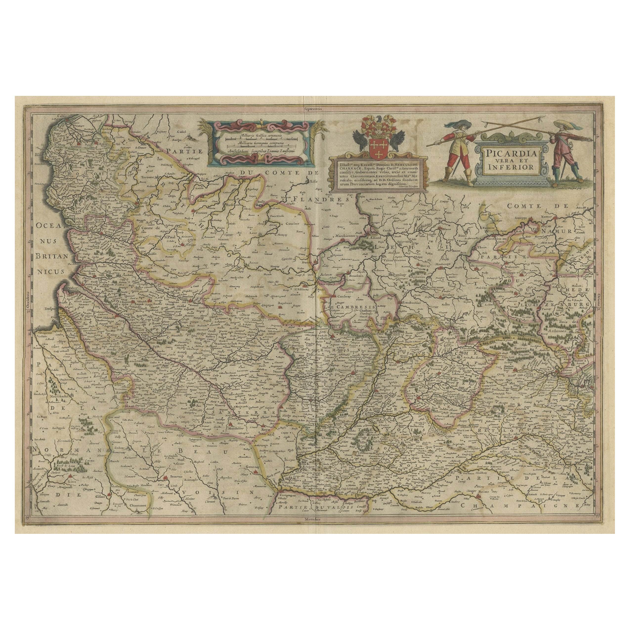
- Detailed Original Antique Map of the Picardy Region of France, 1657Located in Langweer, NLAntique map of France titled 'Picardia vera et inferior'. Detailed map of the Picardy region of France. This map originates from 'Atlas Novus, Sive Theatrum Orbis Orbis Terrarum:...Category
Antique 1650s Maps
MaterialsPaper
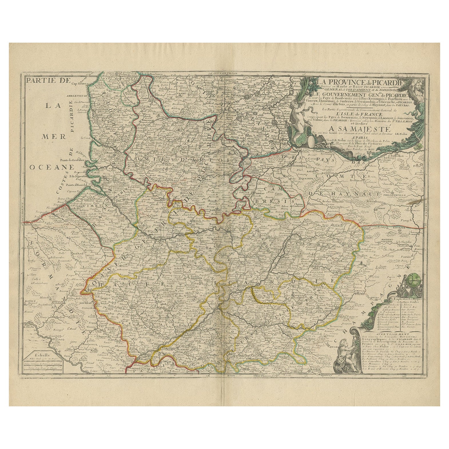
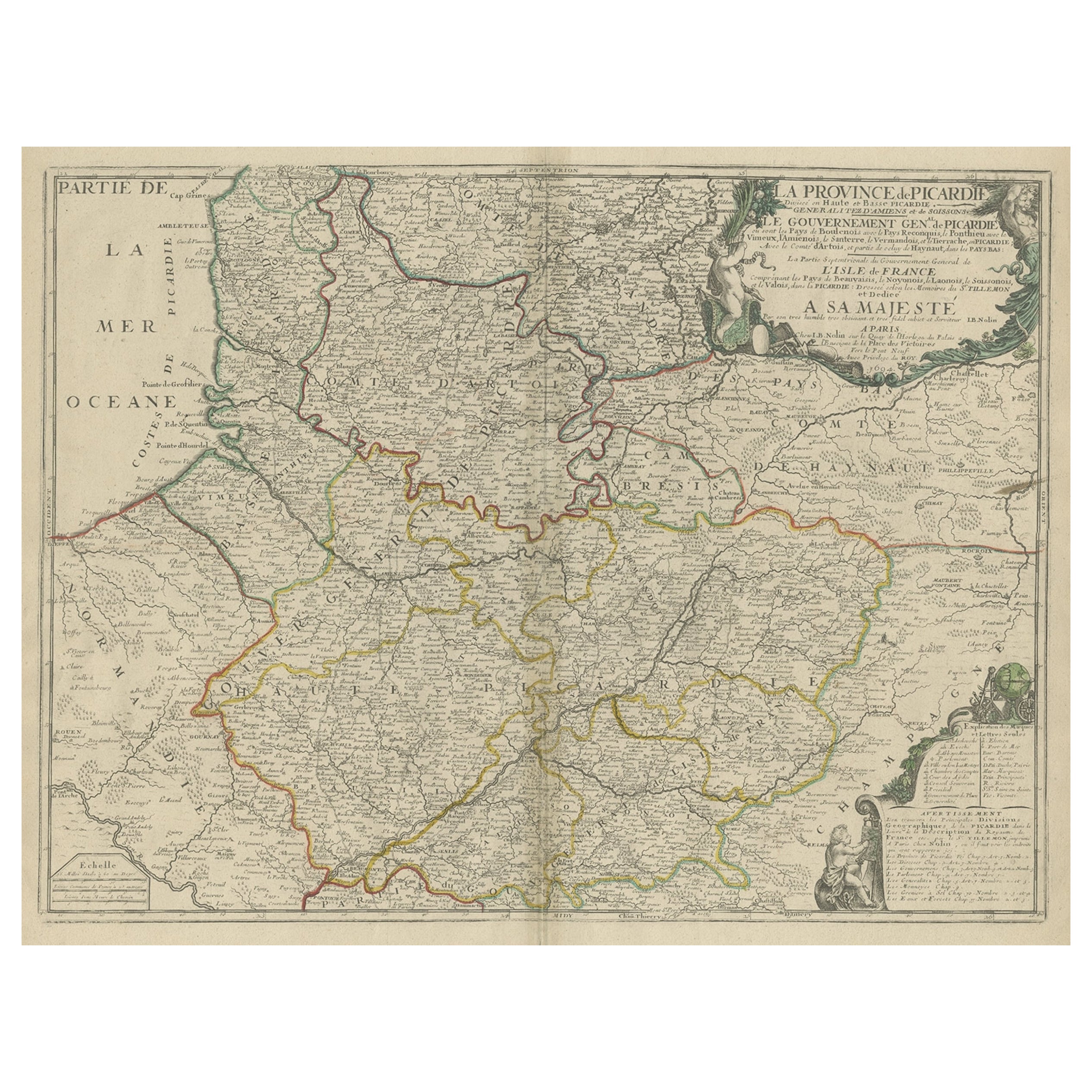
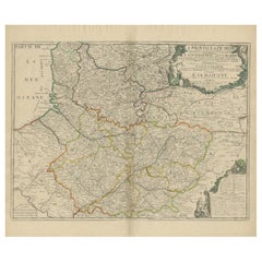
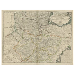
- Original Antique Map of the Picardy Region in Northern France, 1694Located in Langweer, NLAntique map titled 'La Province de Picardie (..)'. Large map of the Picardy region of France. Shows the cities of Beaumont, Mondidier, Lille and others. Artists and Engravers: Je...Category
Antique 17th Century Maps
MaterialsPaper
- Large Antique Map of the Picardy Region of France, 1694Located in Langweer, NLAntique map titled 'La Province de Picardie (..)'. Large map of the Picardy region of France. Shows the cities of Beaumont, Mondidier, Lille and others. Artists and Engravers...Category
Antique 1690s Maps
MaterialsPaper
- Antique Map of the Region of Picardy by Janssonius, 1657By Johannes JanssoniusLocated in Langweer, NLAntique map of France titled 'Picardia vera et inferior'. Detailed map of the Picardy region of France. This map originates from 'Atlas Novus, Sive Theatrum Orbis Orbis Terrarum: In ...Category
Antique Mid-17th Century Maps
MaterialsPaper
- Antique Map of the Picardy Region of France by Ortelius, 'circa 1590'Located in Langweer, NLAntique map titled 'Picardiae Belgicae regionis descriptio'. Original antique map of the Picardy region, France. Published by A. Ortelius, circa 1590.Category
Antique 16th Century Maps
MaterialsPaper
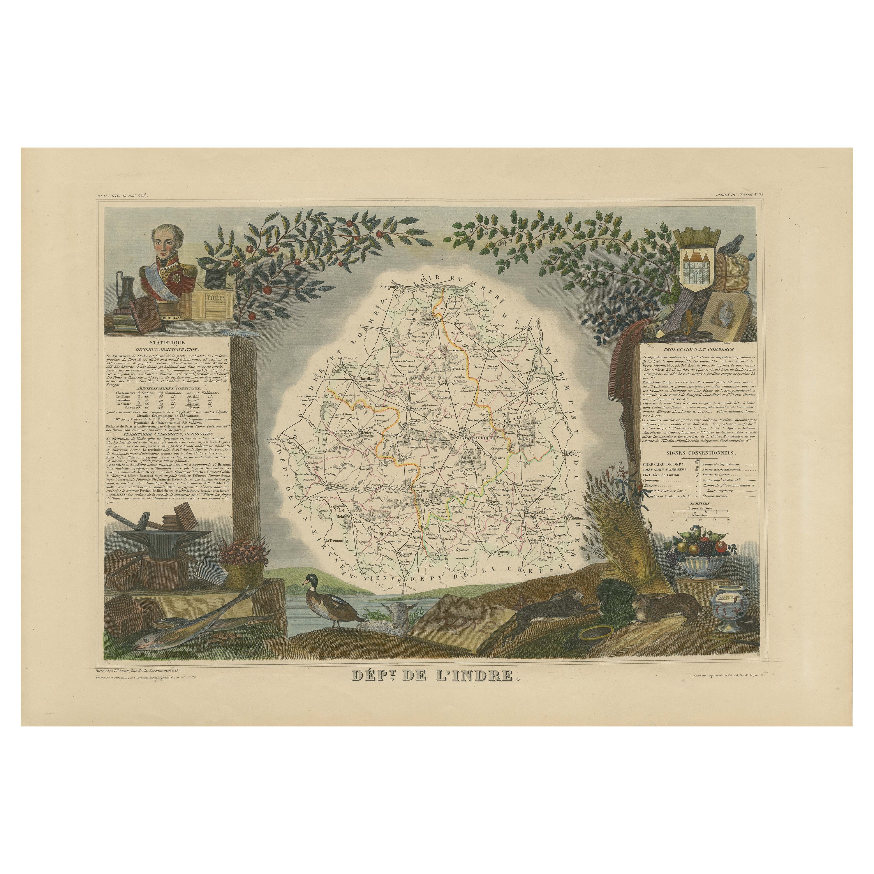
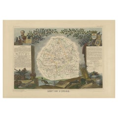
- Antique Map of the Indre Region in France, ca. 1852Located in Langweer, NLAntique map titled 'Dépt. de l'Indre'. Map of the French department of Indre, France. Part of the Loire Valley wine region, this area is known for its production of Chinon wines, typically red, and production of Pouligny-Saint-Pierre, goats'-milk cheese. It is also the birthplace of the great philosopher Rene Descartes...Category
Antique Mid-19th Century Maps
MaterialsPaper


You May Also Like
- Original Antique Map of France, Arrowsmith, 1820Located in St Annes, LancashireGreat map of France Drawn under the direction of Arrowsmith. Copper-plate engraving. Published by Longman, Hurst, Rees, Orme and Brown, 1820 Unframed.Category
Antique 1820s English Maps
MaterialsPaper
- The Normandy Region of France: A 17th C. Hand-colored Map by Sanson and JaillotBy Nicolas SansonLocated in Alamo, CAThis large hand-colored map entitled "Le Duché et Gouvernement de Normandie divisée en Haute et Basse Normandie en divers Pays; et par evêchez, avec le Gouvernement General du Havre ...Category
Antique 1690s French Maps
MaterialsPaper
- Original Antique Map of Italy. C.1780Located in St Annes, LancashireGreat map of Italy Copper-plate engraving Published C.1780 Unframed.Category
Antique Early 1800s English Georgian Maps
MaterialsPaper

- Original Antique Map of Asia. C.1780Located in St Annes, LancashireGreat map of Asia Copper-plate engraving Published C.1780 Two small worm holes to right side of map Unframed.Category
Antique Early 1800s English Georgian Maps
MaterialsPaper

- Original Antique Map of India. C.1780Located in St Annes, LancashireGreat map of India Copper-plate engraving Published C.1780 Three small worm holes to right side of map and one bottom left corner Unframed.Category
Antique Early 1800s English Georgian Maps
MaterialsPaper

- Original Antique Map of The World by Thomas Clerk, 1817Located in St Annes, LancashireGreat map of The Eastern and Western Hemispheres On 2 sheets Copper-plate engraving Drawn and engraved by Thomas Clerk, Edinburgh. Published by Mackenzie And Dent, 1817 ...Category
Antique 1810s English Maps
MaterialsPaper


Recently Viewed
View AllMore Ways To Browse
Spanish French Antiques
Large Antique Prints Set
Uniform Antique
Orbis Map
Antique Style Map
Spain Antique Map
Antique Map Spain
Antique Maps Spain
Antique Spain Map
Antique Maps Of Spain
Antique Map Of Spain
Mercator Map
Mercator Antique
Antique Map Set
Set Of Antique Maps
Antique Style Atlas
Map Print Set
Large Map Of Italy