Antique Style Atlas
11
to
28
194
80
171
95
76
40
32
30
30
26
20
14
10
10
8
8
7
5
5
5
4
4
4
4
4
4
3
3
3
3
2
2
2
2
2
1
1
1
1
1
1
57
6
3
3
3
Sort By
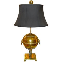
Atlas Globe Samovar Table Lamp
Located in Hanover, MA
style with delicately cast figure of Atlas holding the globe. Supported on square solid brass platform
Category
19th Century English Empire Revival Antique Style Atlas
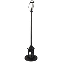
Arts & Crafts Muscular Males Bronze Floor Lamp w. 3 Atlas Style Pose Sculptures
Located in Lisse, NL
Beautiful and rare Art Deco / Jugendstil floor lamp with cast bronze atlas style pose Male
Category
Early 20th Century European Arts and Crafts Antique Style Atlas
Materials
Bronze
Free Shipping
H 54 in Dm 14.5 in
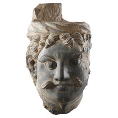
A Finely Carved Gandhara Head of ‘Atlas’
Located in London, GB
A Finely Carved Gandhara Head of ‘Atlas’
Grey schist
India
3rd - 4th Centuries AD
SIZE: 19cm high
Category
15th Century and Earlier Indian Antique Style Atlas
Materials
Schist
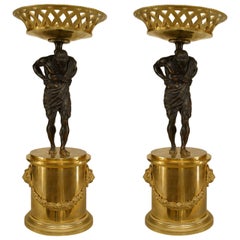
Pair of French Neoclassic Bronze Atlas Centerpieces
Located in New York, NY
Pair of French Neo-classic style (mid 19th Cent) bronze tazzas/centerpieces with an Atlas figure
Category
Mid-19th Century French Neoclassical Antique Style Atlas
Materials
Bronze
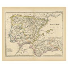
Ancient Iberia: Hispania Map from Spruner-Menke Atlas Antiquus, 1880
Located in Langweer, NL
original antique map from the "Spruner-Menke Atlas Antiquus," a 19th-century historical atlas. The maker of
Category
1880s Antique Style Atlas
Materials
Paper
No Reserve
H 15.56 in W 18.51 in D 0 in
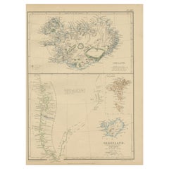
1859 Antique Arctic Vista: Greenland, Iceland and Faroe Islands, Blackie's Atlas
Located in Langweer, NL
from 'The Imperial Atlas of Modern Geography', published by W. G. Blackie in 1859. This map provides a
Category
Mid-19th Century Antique Style Atlas
Materials
Paper
H 14.57 in W 10.63 in D 0.02 in
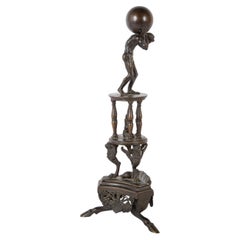
19th Century Italian Grand Tour Bronze of Atlas On A Stand With Turtle
Located in Stamford, CT
Italian Grand Tour bronze in the Renaissance style of Atlas on an elaborate tripod base ending in
Category
Late 19th Century Italian Grand Tour Antique Style Atlas
Materials
Bronze
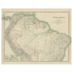
Exploring South America's North: Antique Map from the Royal Atlas of 1909
Located in Langweer, NL
Isles and Lima Callao. It is sourced from the 'Royal Atlas of Modern Geography,' which was published by
Category
Early 20th Century Antique Style Atlas
Materials
Paper
H 19.49 in W 24.41 in D 0.02 in
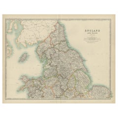
Original Antique Map of England and Wales from the 1909 Royal Atlas
Located in Langweer, NL
nations. This original antique map of England and Wales is sourced from the 'Royal Atlas of Modern
Category
Early 20th Century Antique Style Atlas
Materials
Paper
No Reserve
H 19.49 in W 24.41 in D 0.02 in
Original Air France Poster, North Africa by plane, Morocco Atlas, Koutoubia 1934
Located in SAINT-OUEN-SUR-SEINE, FR
is located 200 meters from Jemaa el-Fna Square, stands out in front of the peaks of the Atlas
Category
Early 20th Century French Art Deco Antique Style Atlas
Materials
Paper
Free Shipping
H 19.49 in W 12.09 in D 0.4 in
1859 Denmark and Schleswig-Holstein Map: A Historical View from Blackie's Atlas
Located in Langweer, NL
The "Antique Map of Denmark with Schleswig & Holstein" from 'The Imperial Atlas of Modern Geography
Category
Mid-19th Century Antique Style Atlas
Materials
Paper
H 14.57 in W 10.63 in D 0.02 in
1859 Detailed Map of North West Germany with Bavaria Inset - Blackie's Atlas
Located in Langweer, NL
'The Imperial Atlas of Modern Geography', published in 1859 by W. G. Blackie. This original antique map
Category
Mid-19th Century Antique Style Atlas
Materials
Paper
H 21.26 in W 14.57 in D 0.02 in
Original 1859 Map of Asia from W.G. Blackie's Imperial Atlas of Modern Geography
Located in Langweer, NL
Atlas of Modern Geography’. Published by W. G. Blackie, 1859.
The "Classic Cartographic Masterpiece
Category
Mid-19th Century Antique Style Atlas
Materials
Paper
H 14.57 in W 21.26 in D 0.02 in
French Empire Style Porcelain Cartographic Cabinet Plate
Located in Fort Lauderdale, FL
A beautiful French Empire style porcelain cartographic cabinet plate made circa 1825 featuring a
Category
Early 19th Century French Empire Antique Style Atlas
Materials
Porcelain
Antique Map of China and Japan, with Frame Style Border
Located in Langweer, NL
originates from Maison Basset's 1852 edition of 'Atlas Illustre Destine a l'enseignement de la Geographie
Category
Mid-19th Century Antique Style Atlas
Materials
Paper
Antique Map of Russia in Europe, with Frame Style Border
Located in Langweer, NL
Maison Basset's 1852 edition of 'Atlas Illustre Destine a l'enseignement de la Geographie elementaire'.
Category
Mid-19th Century Antique Style Atlas
Materials
Paper
Antique Map of Spain and Portugal, with Frame Style Border
Located in Langweer, NL
, Majorca, and Minorca. This map originates from Maison Basset's 1852 edition of 'Atlas Illustre Destine a
Category
Mid-19th Century Antique Style Atlas
Materials
Paper
Antique Map of Turkey in Asia, with Frame Style Border
Located in Langweer, NL
, including Cyprus. This map originates from Maison Basset's 1852 edition of 'Atlas Illustre Destine a
Category
Mid-19th Century Antique Style Atlas
Materials
Paper
Antique Tapestry in the Style of van Orley Depicting Hercules
By Bernard Van Orley
Located in London, GB
Antique tapestry in the style of van Orley depicting Hercules
Continental, 19th century
Height
Category
19th Century European Renaissance Antique Style Atlas
Materials
Wool
Antique Map of Greece and Its Colonies, with Frame Style Border
Located in Langweer, NL
. This map originates from Maison Basset's 1852 edition of 'Atlas Illustre Destine a l'enseignement de la
Category
Mid-19th Century Antique Style Atlas
Materials
Paper
Antique Map of Russia in Asia and Siberia, with Frame Style Border
Located in Langweer, NL
map originates from Maison Basset's 1852 edition of 'Atlas Illustre Destine a l'enseignement de la
Category
Mid-19th Century Antique Style Atlas
Materials
Paper
A Louis XIV Style Bureau Plat By Cueunières, Paris, After the Model by Cressent
By L. Cueunieres Ebeniste.
Located in Brighton, West Sussex
A Louis XIV Style Gilt-Bronze Mounted Mahogany Bureau Plat, By Cueunières, Paris. After the Model
Category
19th Century French Louis XIV Antique Style Atlas
Materials
Ormolu
H 31.89 in W 73.04 in D 37.01 in
A Group of Four 18th Century Engravings from Captain Cook's 3rd Voyage Journal
By John Webber
Located in Alamo, CA
A grouping of four framed engravings from the atlas of the official British Admirality sanctioned
Category
1780s Other Art Style Antique Style Atlas
Materials
Engraving
H 20.75 in W 26.75 in D 0.88 in
Map of the County of Buckingham From an Actual Survey
Located in Paonia, CO
Atlas of The Counties of England from an Actual Survey. This Atlas was finely drafted and engraved and
Category
19th Century Other Art Style Antique Style Atlas
Materials
Engraving
England Map of the County of Southampton from an Actual Survey
Located in Paonia, CO
Atlas of The Counties of England from an Actual Survey. This Atlas was finely drafted and engraved and
Category
19th Century Other Art Style Antique Style Atlas
Materials
Engraving
'Map of Milwaukee' color lithograph published by George F. Cram of Chicago
Located in Milwaukee, WI
nephew, which sold maps and atlases, was named Blanchard & Cram. However, in 1869, Cram took full control
Category
1890s Other Art Style Antique Style Atlas
Materials
Lithograph
Planiglobii Terrestris Mappa Universalis / Mappe Monde
By Homann Heirs
Located in New York, NY
. He published his first atlas, "Atlas Novus" in 1707, and in recognition of this achievement, he was
Category
18th Century Other Art Style Antique Style Atlas
Materials
Engraving
H 20.13 in W 23.88 in D 0.94 in
Map of Tabula Geographica Territorium Civitatis Svevo=Hallensis by Homann 1762
By Homann Heirs
Located in Paonia, CO
in Berlin. In 1716 he published Grosser Atlas die ganze Welt ( Grand Atlas of all the World) which
Category
1760s Other Art Style Antique Style Atlas
Materials
Engraving
Indiarum Occidentalium Tractus Littorales cum Insulis Caribicis / Pascaert van W
By Louis Renard
Located in New York, NY
. Renard acquired the plate, made some updates and then issued it in “Atlas de la Navigation, et du
Category
18th Century Other Art Style Antique Style Atlas
Materials
Engraving
England and the British Isles: A Large 17th Century Hand-colored Map by de Wit
By Frederick de Wit
Located in Alamo, CA
spots and some discoloration related to color transfer occurring over its centuries within an atlas
Category
Late 17th Century Other Art Style Antique Style Atlas
Materials
Engraving
Spain and Portugal: A Hand-colored 17th/18th Century Map by Visscher
By Nicolaus Visscher
Located in Alamo, CA
and also atlases made up to their customers’ specifications. They are commonly regarded as second only
Category
Late 17th Century Other Art Style Antique Style Atlas
Materials
Engraving
H 26.5 in W 30 in D 0.25 in
Southern Holland: An Original 17th C. Hand-colored Visscher Map "Hollandiae"
By Nicolaus Visscher
Located in Alamo, CA
, producing individual maps and also atlases made up to their customers’ specifications. They are commonly
Category
Late 17th Century Other Art Style Antique Style Atlas
Materials
Engraving
H 26.63 in W 30.13 in D 0.88 in
Nouvelle Mappe Monde, dediee au progres de nos connoissances.
Located in New York, NY
re-issued Santini's "Atlas Univ." in 1784. "Nouvelle Mappe Monde" is a copper plate engraving
Category
18th Century Other Art Style Antique Style Atlas
Materials
Watercolor, Engraving
H 20.75 in W 28.25 in D 0.94 in
AYX Map of Aix en Provence, France by J. Blaeu 17th c.
By Joan (Johannes) Blaeu
Located in Paonia, CO
in the years 1704/05 in an atlas comprising four volumes.
Category
Late 17th Century Other Art Style Antique Style Atlas
Materials
Engraving
Belgium and the Netherlands: A Hand-colored 17th Century Map by Visscher
By Nicolaus Visscher
Located in Alamo, CA
individual maps and also atlases made up to their customers’ specifications. They are commonly regarded as
Category
Late 17th Century Other Art Style Antique Style Atlas
Materials
Engraving
H 26.63 in W 30 in D 0.75 in
Ancient Cartography of Britannia and Hibernia, Published in 1880
Located in Langweer, NL
produced for a historical atlas, to illustrate the geographical understanding of the British Isles in
Category
1880s Antique Style Atlas
Materials
Paper
Free Shipping
H 18.51 in W 15.56 in D 0 in
Old Map of The Mughal Empire and the Indian Peninsula South of the Ganges, 1787
Located in Langweer, NL
Bonne was known for his precise and detailed cartography which represented a shift in the style of map
Category
1780s Antique Style Atlas
Materials
Paper
Free Shipping
H 16.62 in W 11.42 in D 0 in
Roman Frontiers Engraved: Germania, Raetia, and Noricum, Published in 1880
Located in Langweer, NL
of a historical atlas designed for educational purposes, offering a detailed view of the region
Category
1880s Antique Style Atlas
Materials
Paper
No Reserve
H 15.56 in W 18.51 in D 0 in
Antique Decorative Coloured Map Egypt, Nubia, Abyssinia and more, 1882
Located in Langweer, NL
from the Blackie & Son atlas published in 1882 are interesting for several reasons:
1. **Historical
Category
1880s Antique Style Atlas
Materials
Paper
Free Shipping
H 14.97 in W 22.45 in D 0 in
Antique Decorative Coloured Map of North America, 1882
Located in Langweer, NL
, or provinces.
2. **Cartographic Style**: As with the other maps from the Blackie & Son Atlas, this
Category
1880s Antique Style Atlas
Materials
Paper
Hand Colored Antique Map of the Department of Ardèche, France
By Victor Levasseur
Located in Langweer, NL
and trade richness of the land.
This map originates from 'Atlas National de la France Illustree
Category
Mid-19th Century Antique Style Atlas
Materials
Paper
Old Map of the French Department of Ardèche, France
By Victor Levasseur
Located in Langweer, NL
and trade richness of the land.
This map originates from 'Atlas National de la France Illustree
Category
Mid-19th Century Antique Style Atlas
Materials
Paper
Hand Colored Antique Map of the Department of Oise, France
By Victor Levasseur
Located in Langweer, NL
left and right sides of the map.
This map originates from 'Atlas National de la France Illustree
Category
Mid-19th Century Antique Style Atlas
Materials
Paper
Hand Colored Antique Map of the Department of L'aisne, France
By Victor Levasseur
Located in Langweer, NL
side of the map.
This map originates from 'Atlas National de la France Illustree' published by V
Category
Mid-19th Century Antique Style Atlas
Materials
Paper
Hand Colored Antique Map of the Department of Basses-Alpes, France
By Victor Levasseur
Located in Langweer, NL
left and right sides of the map.
This map originates from 'Atlas National de la France Illustree
Category
Mid-19th Century Antique Style Atlas
Materials
Paper
Hand Colored Antique Map of the Department of Doubs, France
By Victor Levasseur
Located in Langweer, NL
sides of the map.
This map originates from 'Atlas National de la France Illustree' published by V
Category
Mid-19th Century Antique Style Atlas
Materials
Paper
Old Map of the French department of l'Aisne, France
By Victor Levasseur
Located in Langweer, NL
side of the map.
This map originates from 'Atlas National de la France Illustree' published by V
Category
Mid-19th Century Antique Style Atlas
Materials
Paper
Hand Colored Antique Map of the department of Ardennes, France
By Victor Levasseur
Located in Langweer, NL
'Atlas National de la France Illustree' published by V. Levasseur, circa 1852.
Victor Levasseur (1800
Category
Mid-19th Century Antique Style Atlas
Materials
Paper
Old Map of the French Department of Eure-et-loir, France
By Victor Levasseur
Located in Langweer, NL
originates from 'Atlas National de la France Illustree' published by V. Levasseur, circa 1852.
Victor
Category
Mid-19th Century Antique Style Atlas
Materials
Paper
Hand Colored Antique Map of the Department of Eure-et-loir, France
By Victor Levasseur
Located in Langweer, NL
originates from 'Atlas National de la France Illustree' published by V. Levasseur, circa 1852.
Victor
Category
Mid-19th Century Antique Style Atlas
Materials
Paper
Hand Colored Antique Map of the department of Drôme, France
By Victor Levasseur
Located in Langweer, NL
map originates from 'Atlas National de la France Illustree' published by V. Levasseur, circa 1852
Category
Mid-19th Century Antique Style Atlas
Materials
Paper
Hand Colored Antique Map of the department of Loir-et-Cher, France
By Victor Levasseur
Located in Langweer, NL
sides of the map.
This map originates from 'Atlas National de la France Illustree' published by V
Category
Mid-19th Century Antique Style Atlas
Materials
Paper
Hand Colored Antique Map of the Department of Calais, France
By Victor Levasseur
Located in Langweer, NL
the left and right sides of the map.
This map originates from 'Atlas National de la France
Category
Mid-19th Century Antique Style Atlas
Materials
Paper
Hand Colored Antique Map of the Department of Creuse, France
By Victor Levasseur
Located in Langweer, NL
both the left and right sides of the map.
This map originates from 'Atlas National de la France
Category
Mid-19th Century Antique Style Atlas
Materials
Paper
Hand Colored Antique Map of the Department of Ariège, France
By Victor Levasseur
Located in Langweer, NL
depicted on both the left and right sides of the map.
This map originates from 'Atlas National de la
Category
Mid-19th Century Antique Style Atlas
Materials
Paper
Hand Colored Antique Map of the Department of Correze, France
By Victor Levasseur
Located in Langweer, NL
sides of the map.
This map originates from 'Atlas National de la France Illustree' published by V
Category
Mid-19th Century Antique Style Atlas
Materials
Paper
Hand Colored Antique Map of the Department of Cher, France
By Victor Levasseur
Located in Langweer, NL
map.
This map originates from 'Atlas National de la France Illustree' published by V. Levasseur
Category
Mid-19th Century Antique Style Atlas
Materials
Paper
Old Map of the French Department of Cantal, France
By Victor Levasseur
Located in Langweer, NL
sides of the map.
This map originates from 'Atlas National de la France Illustree' published by V
Category
Mid-19th Century Antique Style Atlas
Materials
Paper
Hand Colored Antique Map of the Department of Marne, France
By Victor Levasseur
Located in Langweer, NL
sides of the map.
This map originates from 'Atlas National de la France Illustree' published by V
Category
Mid-19th Century Antique Style Atlas
Materials
Paper
Hand Colored Antique Map of the department of Cantal, France
By Victor Levasseur
Located in Langweer, NL
sides of the map.
This map originates from 'Atlas National de la France Illustree' published by V
Category
Mid-19th Century Antique Style Atlas
Materials
Paper
- 1
Get Updated with New Arrivals
Save "Antique Style Atlas", and we’ll notify you when there are new listings in this category.
Antique Style Atlas For Sale on 1stDibs
Choose from an assortment of styles, material and more with respect to the antique style atlas you’re looking for at 1stDibs. Each antique style atlas for sale was constructed with extraordinary care, often using paper, metal and wood. Whether you’re looking for an older or newer antique style atlas, there are earlier versions available from the 18th Century and newer variations made as recently as the 20th Century. Each antique style atlas bearing Baroque, Art Deco or Victorian hallmarks is very popular. Victor Levasseur, George F. Cram and Horace Woodward & Co. Ltd. each produced at least one beautiful antique style atlas that is worth considering.
How Much is a Antique Style Atlas?
An antique style atlas can differ in price owing to various characteristics — the average selling price 1stDibs is $975, while the lowest priced sells for $175 and the highest can go for as much as $930,843.
Questions About Antique Style Atlas
- Is antique furniture in style?1 Answer1stDibs ExpertApril 22, 2024Yes, antique furniture is in style. Many people appreciate the beauty and handcrafted character of antique furniture and love the idea of owning pieces with a rich history. Remember that style preferences are nothing if not fluid, meaning what's in one year may not be the next. So, in choosing the furniture you're planning to live with, you should pay less attention to interior design fads than to what speaks to you. That way, you can select pieces that will add long-term character to your home. On 1stDibs, find a large collection of antique furniture.
More Ways To Browse
Meindert Hobbema
Drawing Of Sheep And Dog
Map 1700s
Valentino Vintage Shoes
Antique Map Singapore
Map Southampton
Alter Crucifix
Antique Map Of Yorkshire
Victorian Piano Bench
Gibbons Chair
Vintage Porcelain Shoes
Monks Settle
Antique Map Yorkshire
Antique Maps Yorkshire
Cheese Wheel
Bermuda Map
Rene Descartes
Taiwan Map
