Items Similar to Old Map of The Mughal Empire and the Indian Peninsula South of the Ganges, 1787
Want more images or videos?
Request additional images or videos from the seller
1 of 9
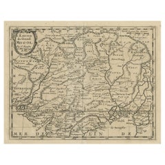
Old Map of The Mughal Empire and the Indian Peninsula South of the Ganges, 1787
About the Item
This is a historical map titled "L'Empire Du Mogol, Et La Presqu Isle De L'Inde En Deca Du Gange."
An original authentic map, created by Rigobert Bonne (1727-1794), an influential French cartographer, depicts the region of the Mughal Empire in India along with the Indian subcontinent south of the Ganges (Ganga) river, including Sri Lanka and the Maldives, with detailed topographical information.
Rigobert Bonne was known for his precise and detailed cartography which represented a shift in the style of map-making from the highly decorative to the more functional and informational. This transition was indicative of the Enlightenment's values, which emphasized utility over ornamentation.
Bonne's maps are recognized for their detail and the shift away from the ornamental style of the seventeenth century and the early to mid-eighteenth century. His simpler, more focused aesthetic was part of a broader trend towards more scientific and pragmatic approaches to cartography during that period.
The map itself would have been used for navigation and may have been included in Bonne's "Atlas Supplement" or other works such as the "Atlas Encyclopedique" (1788) which he collaborated on with Nicholas Desmarest, and later in the "Atlas de Toutes Les Parties Connues du Globe Terrestre" (1780) for the Abbe Raynal.
This map is not only a valuable piece of historical cartographic art but also serves as a document showing the geographical understanding of the Indian subcontinent during the late eighteenth century.
- Dimensions:Height: 16.62 in (42.2 cm)Width: 11.42 in (29 cm)Depth: 0 in (0.02 mm)
- Materials and Techniques:Paper,Engraved
- Period:1780-1789
- Date of Manufacture:1787
- Condition:Good. The sheet overall a little browned with some offset. General age-related toning and/or occasional minor defects from handling. Please study scan carefully. Middle fold as issued. Study the scans carefully.`.
- Seller Location:Langweer, NL
- Reference Number:
About the Seller
5.0
Platinum Seller
These expertly vetted sellers are 1stDibs' most experienced sellers and are rated highest by our customers.
Established in 2009
1stDibs seller since 2017
1,919 sales on 1stDibs
Typical response time: <1 hour
- ShippingRetrieving quote...Ships From: Langweer, Netherlands
- Return PolicyA return for this item may be initiated within 14 days of delivery.
More From This SellerView All
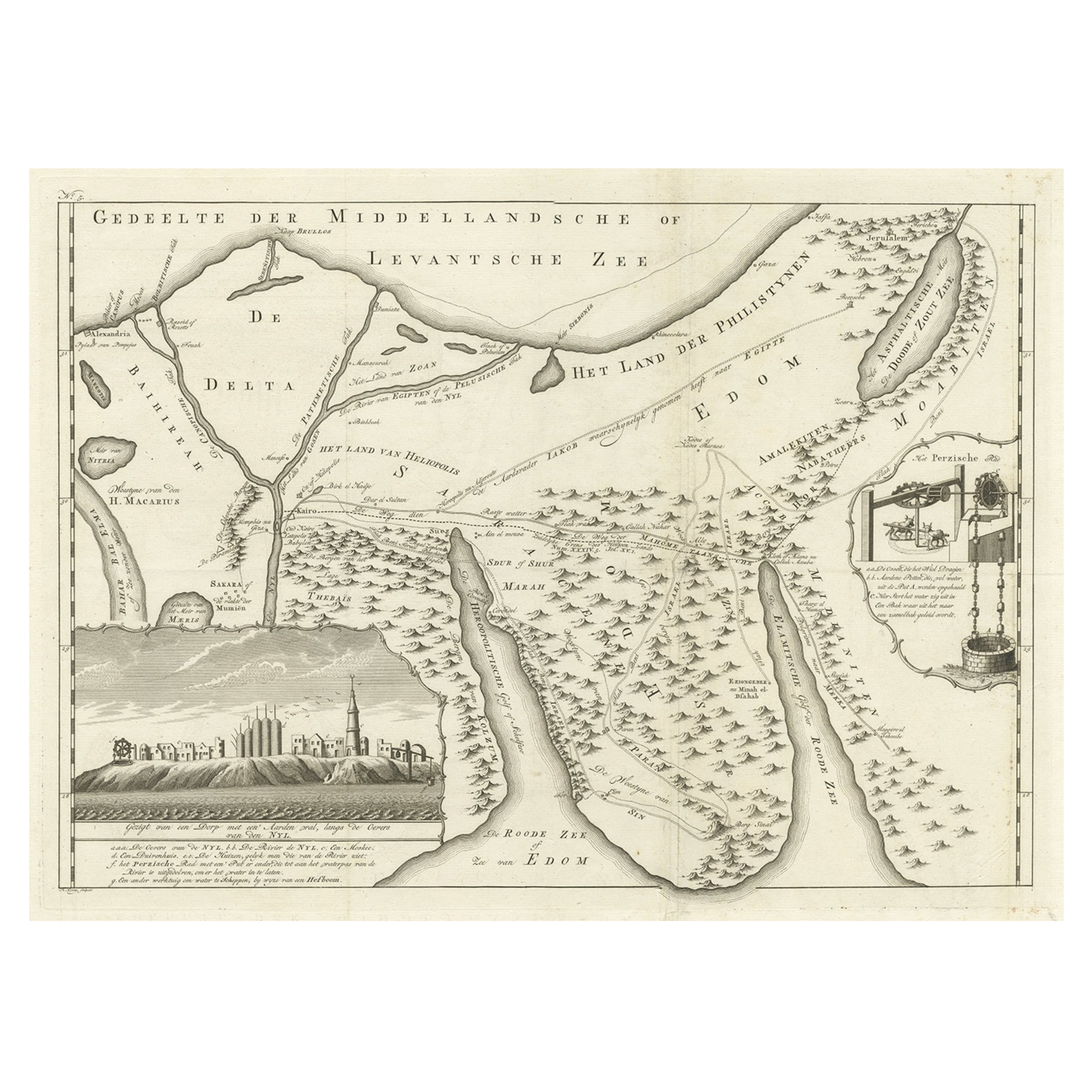
- Old Map of the Sinai Peninsula Showing the Mediterranean and the Red Sea, 1773Located in Langweer, NLAntique map of the Sinai Peninsula showing the Mediterranean Sea to the north and the Red Sea to the south. The map is decorated with images of a Persian wheel and a view of a vi...Category
Antique 1770s Maps
MaterialsPaper
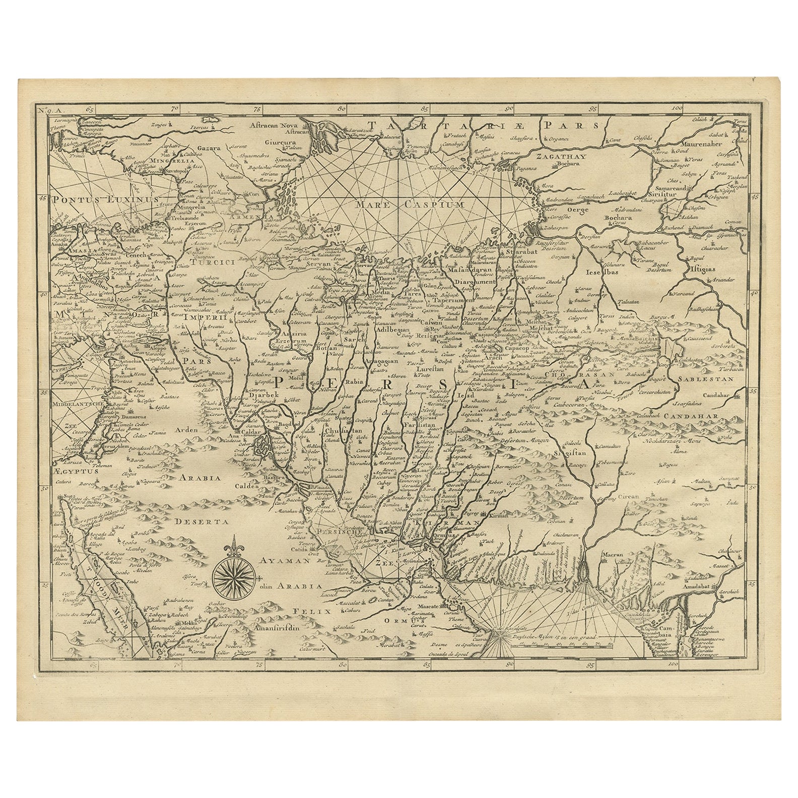
- Old Map of Persia, incl the Caspian Sea and Part of the Arabian Peninsula, 1726Located in Langweer, NLAntique map of Persia. It covers from the Gulf of Suez eastward to Ahmedabad (Amadabad) in modern day western India. This map, centered on Persia, includes the Caspian Sea and part of the Arabian...Category
Antique 1720s Maps
MaterialsPaper
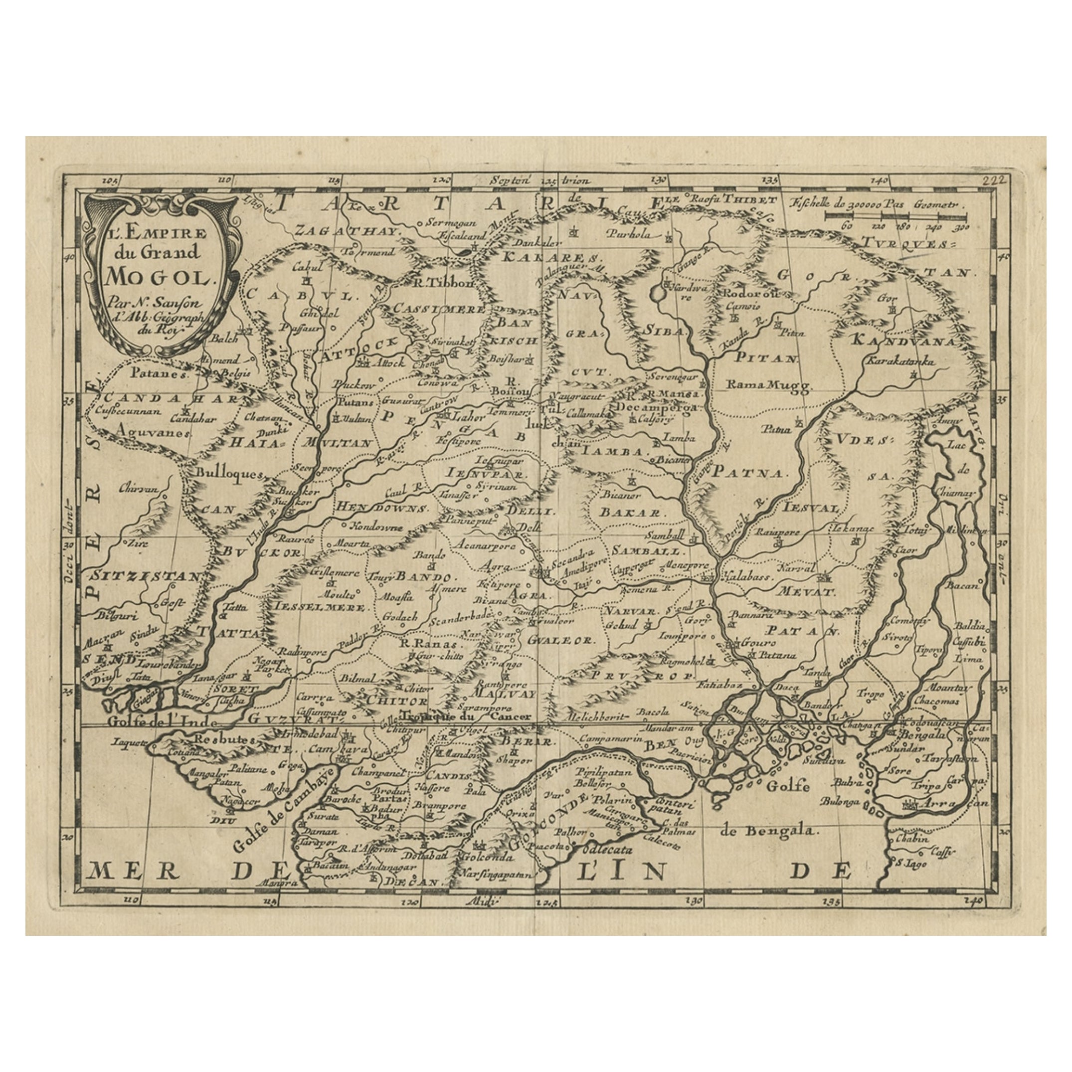
- Old Map of the Mughal Empire, Persia in the West to Lake Chimay etc., ca.1685Located in Langweer, NLAntique map titled 'L'Empire du Grand Mogol'. Old map of India and Central Asia. The map extends from Persia in the West to Lake Chimay and the Bay of Bengal...Category
Antique 1680s Maps
MaterialsPaper
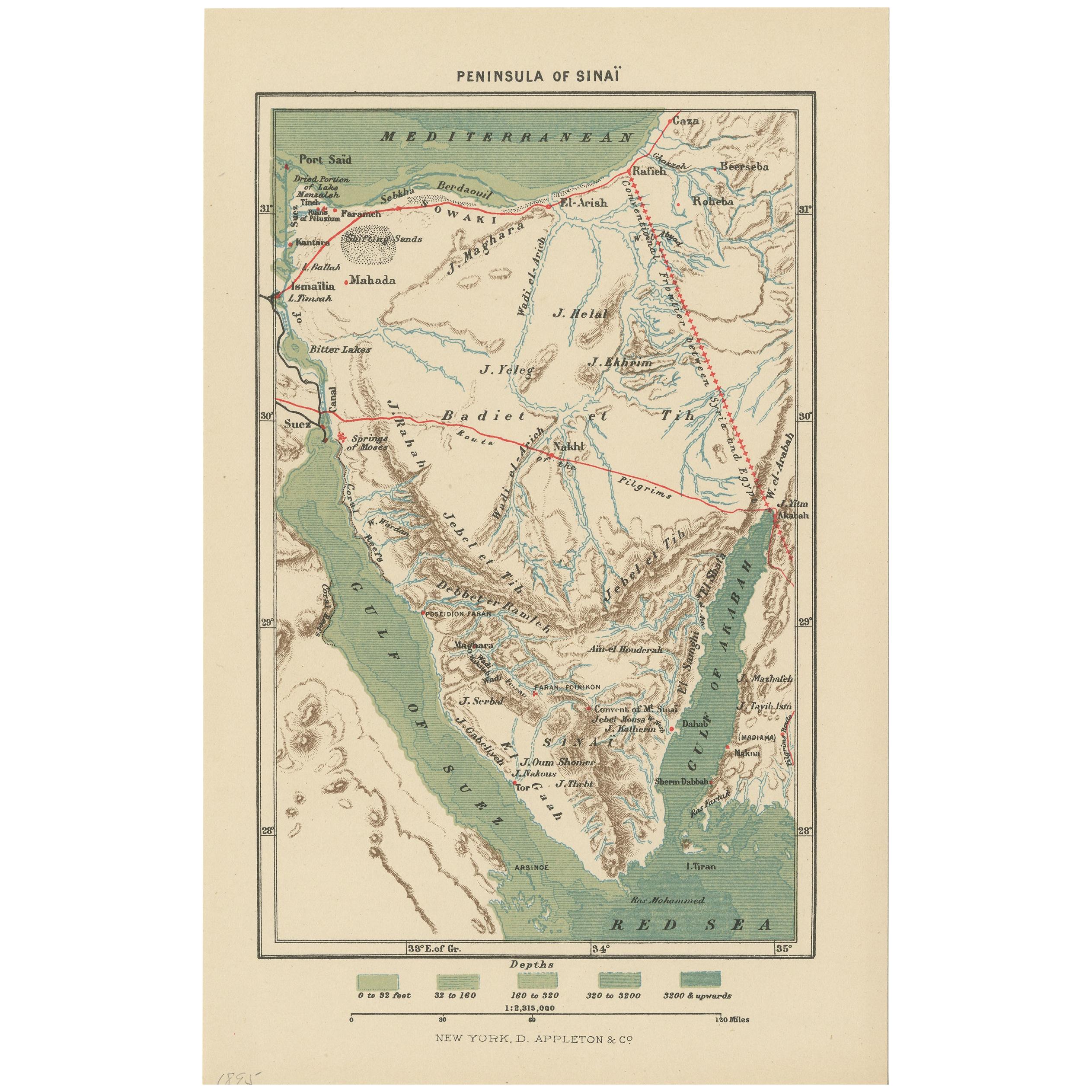
- Antique Map of the Sinai Peninsula, '1895'Located in Langweer, NLAntique map titled 'Peninsula of Sinaï'. Lithographed map of the Sinai Peninsula, a peninsula in Egypt, and the only part of the country located in Asia. It is situated between the M...Category
Antique Late 19th Century Maps
MaterialsPaper
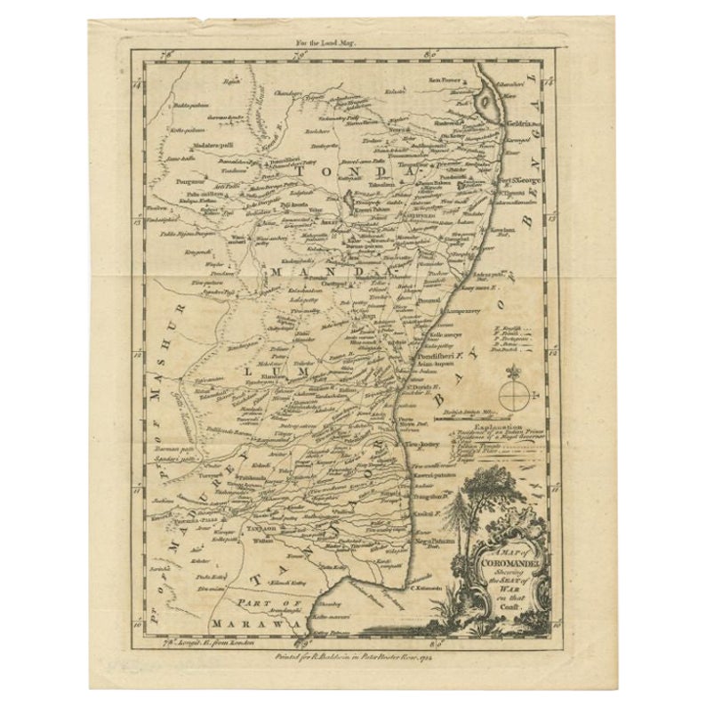
- Antique Map of the Coromandel Peninsula, 1754Located in Langweer, NLAntique map titled 'A map of Coromandel shewing the Seat of War on that coast'. Rare map of Coromandel printed for the London Magazine. Artists and Engravers: This map is not attr...Category
Antique 18th Century Maps
MaterialsPaper
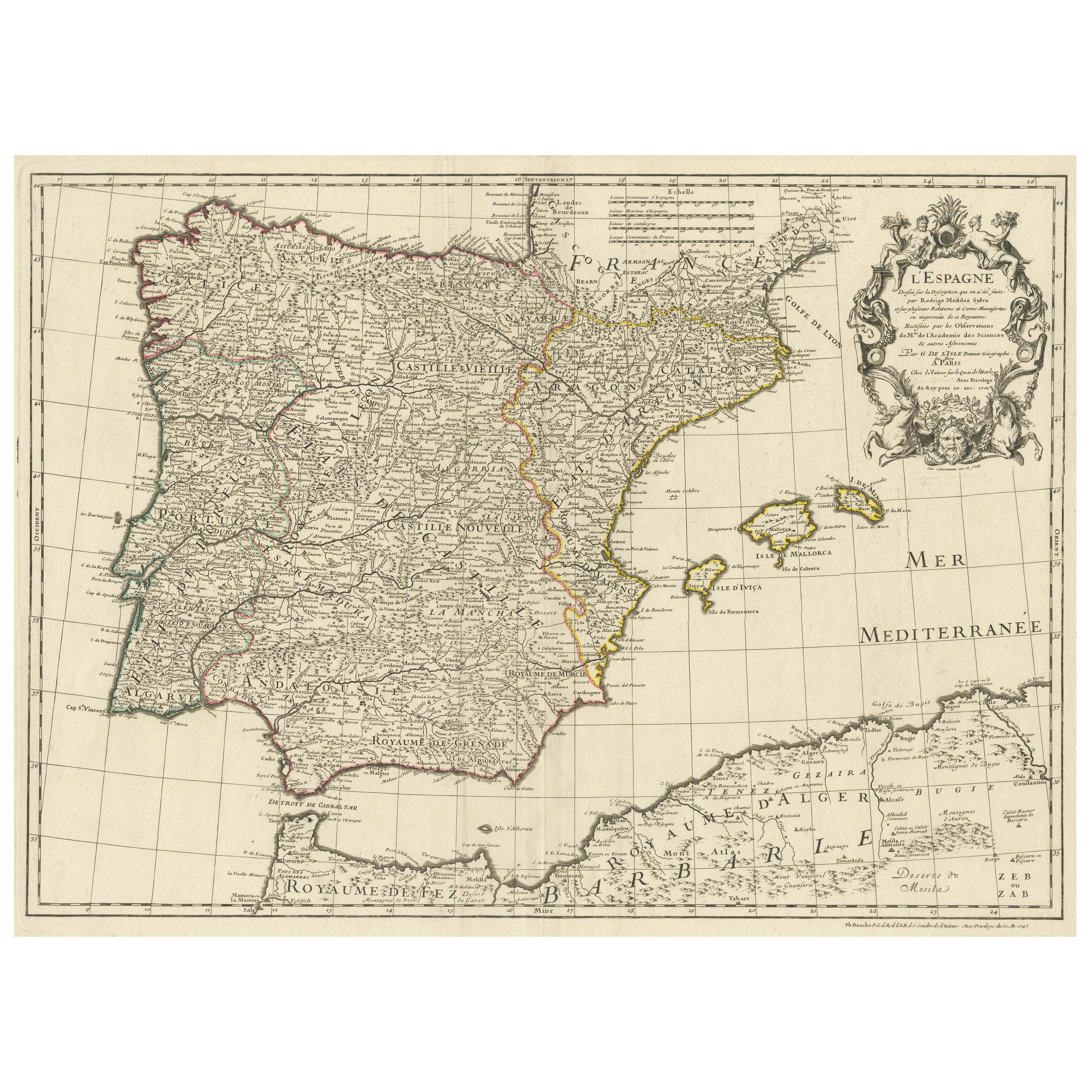
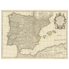
- Large Decorative Map of the Iberian PeninsulaLocated in Langweer, NLAntique map titled 'L'Espagne (..)'. Large map of the Iberian Peninsula, including the Balearic Islands and part of the north coast of Africa. The map is based on the cartography of ...Category
Antique Mid-18th Century Maps
MaterialsPaper


You May Also Like
- Original Antique Map of Ancient Greece- Boeotia, Thebes, 1787Located in St Annes, LancashireGreat map of Ancient Greece. Showing the region of Boeotia, including Thebes Drawn by J.D. Barbie Du Bocage Copper plate engraving by P.F T...Category
Antique 1780s French Other Maps
MaterialsPaper
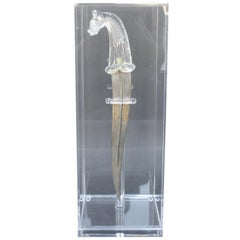
- Mughal, Style Indian DaggerLocated in Los Angeles, CAMughal - style Indian dagger. Made with rock crystal and inlaid gold. United Kingdom, late 19th century.Category
Antique Late 19th Century Indian Other Arms, Armor and Weapons
MaterialsRock Crystal, Metal
- Original Antique Map of Ancient Greece, Phocis, Gulf of Corinth, 1787Located in St Annes, LancashireGreat map of Ancient Greece. Showing the region of Phocis, including the Gulf of Corinth Drawn by J.D. Barbie Du Bocage Copper plate engraving by P.F Tardieu Original hand c...Category
Antique 1780s French Other Maps
MaterialsPaper
- Large Original Vintage Map of The South Pacific, circa 1920Located in St Annes, LancashireGreat map of The South Pacific Original color. Good condition / repairs to minor edge tears on top edge Published by Alexander Gross Unf...Category
Vintage 1920s English Edwardian Maps
MaterialsPaper
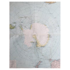
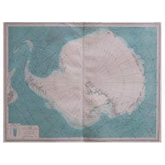
- Large Original Vintage Map of The South Pole, circa 1920Located in St Annes, LancashireGreat map of The South Pole Original color. Published by Alexander Gross Unframed. Repairs to minor edge tearsCategory
Vintage 1920s English Maps
MaterialsPaper
- Large Original Vintage Map of the South Pole, circa 1920Located in St Annes, LancashireGreat map of the South pole. Unframed. Original color. By John Bartholomew and Co. Edinburgh Geographical Institute. Published, circa 1920.Category
Vintage 1920s British Maps
MaterialsPaper