Items Similar to Large Decorative Map of the Iberian Peninsula

Want more images or videos?
Request additional images or videos from the seller
1 of 6
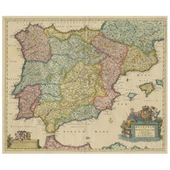
Large Decorative Map of the Iberian Peninsula
About the Item
Antique map titled 'L'Espagne (..)'. Large map of the Iberian Peninsula, including the Balearic Islands and part of the north coast of Africa. The map is based on the cartography of Rodrigo Mendez Sylva. The sheet is filled with detail and decorated with a beautiful title cartouche featuring Zephyrus, the Greek god of the west wind and Chloris, the goddess of spring and flowers. Originally published by Guillaume de l'Isle 1701, updated and republished by Philippe Buache in 1745 (signed lower right).
- Dimensions:Height: 19.61 in (49.8 cm)Width: 26.3 in (66.8 cm)Depth: 0.02 in (0.5 mm)
- Materials and Techniques:
- Period:
- Date of Manufacture:1745
- Condition:General age-related toning. Original folding line. Minor wear and soiling. Blank verso. Please study image carefully.
- Seller Location:Langweer, NL
- Reference Number:
About the Seller
5.0
Platinum Seller
These expertly vetted sellers are 1stDibs' most experienced sellers and are rated highest by our customers.
Established in 2009
1stDibs seller since 2017
1,922 sales on 1stDibs
Typical response time: <1 hour
- ShippingRetrieving quote...Ships From: Langweer, Netherlands
- Return PolicyA return for this item may be initiated within 14 days of delivery.
More From This SellerView All
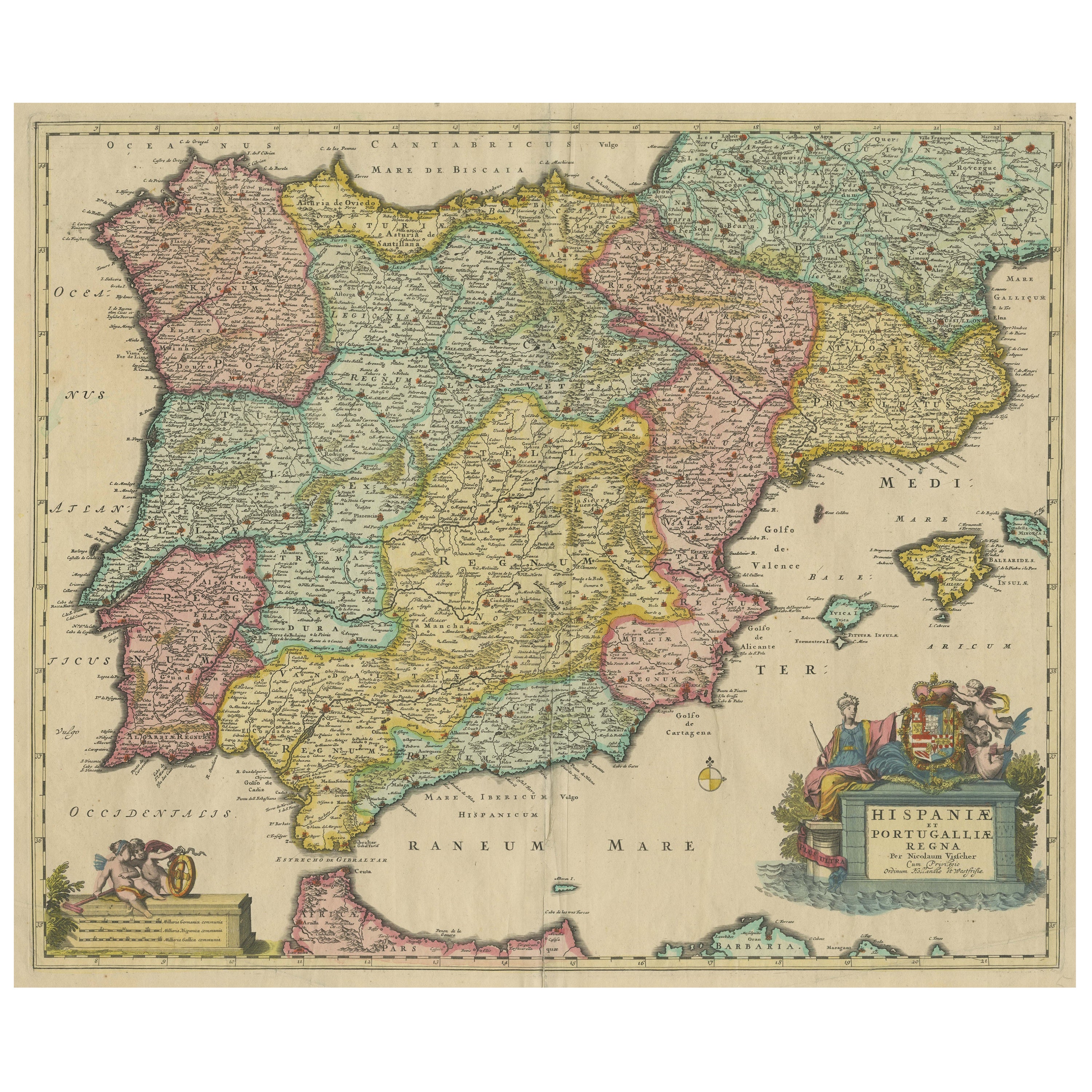
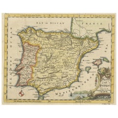
- Antique Map of the Iberian Peninsula with two decorative CartouchesLocated in Langweer, NLAntique map titled 'Hispaniae et Portugalliae Regna'. Original old map of the Iberian peninsula showing Spain, Portugal and the Balearic Islands. Two beautiful cartouches with severa...Category
Antique Late 17th Century Maps
MaterialsPaper
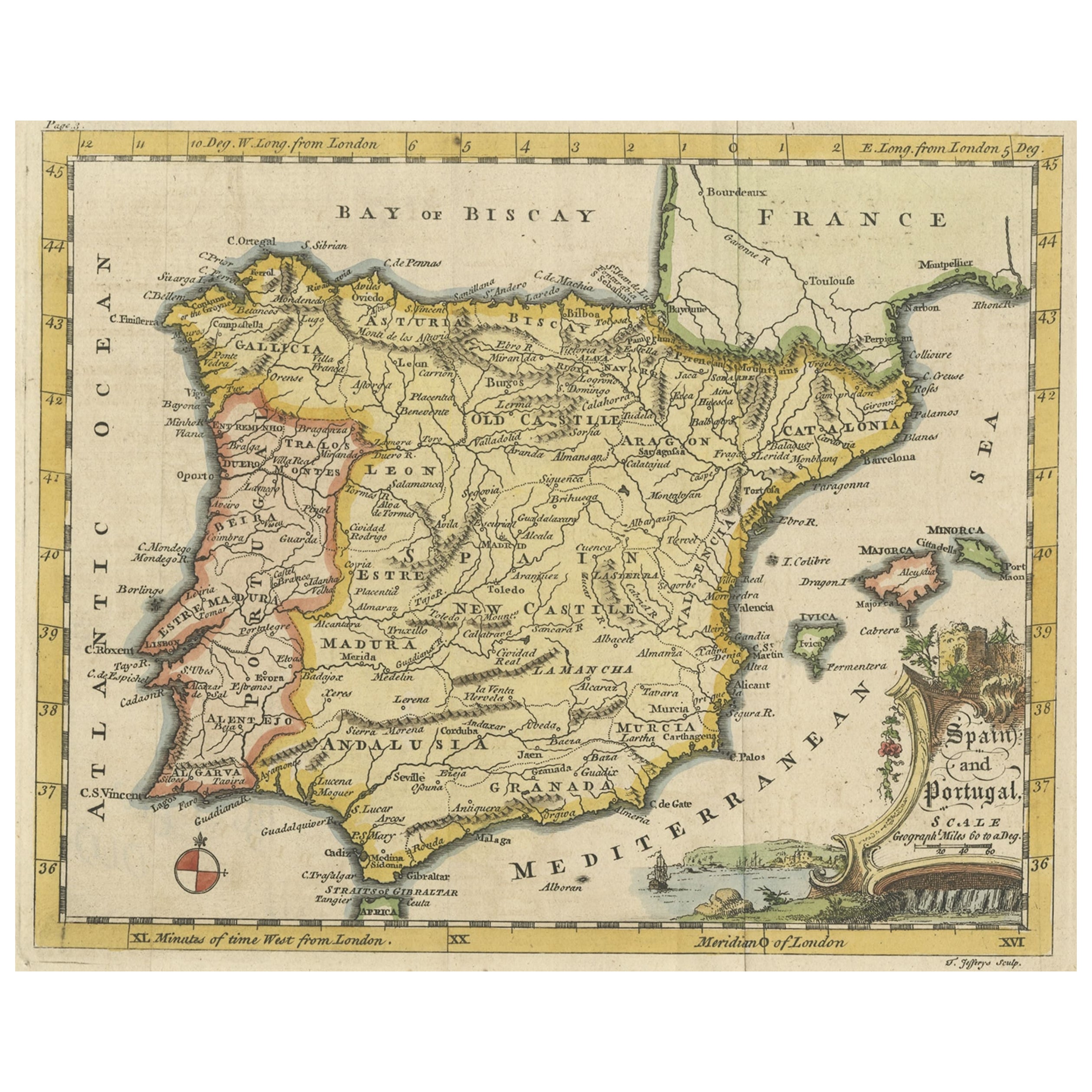
- Antique Map of Spain & Portugal 'Iberian Peninsula', Decorative Cartouche, c1755Located in Langweer, NLAntique map titled 'Spain and Portugal'. Small, detailed antique map of Spain and Portugal (Iberian Peninsula). Decorative title cartouche. Artists and Engravers: Thomas Jeff...Category
Antique 1750s Maps
MaterialsPaper
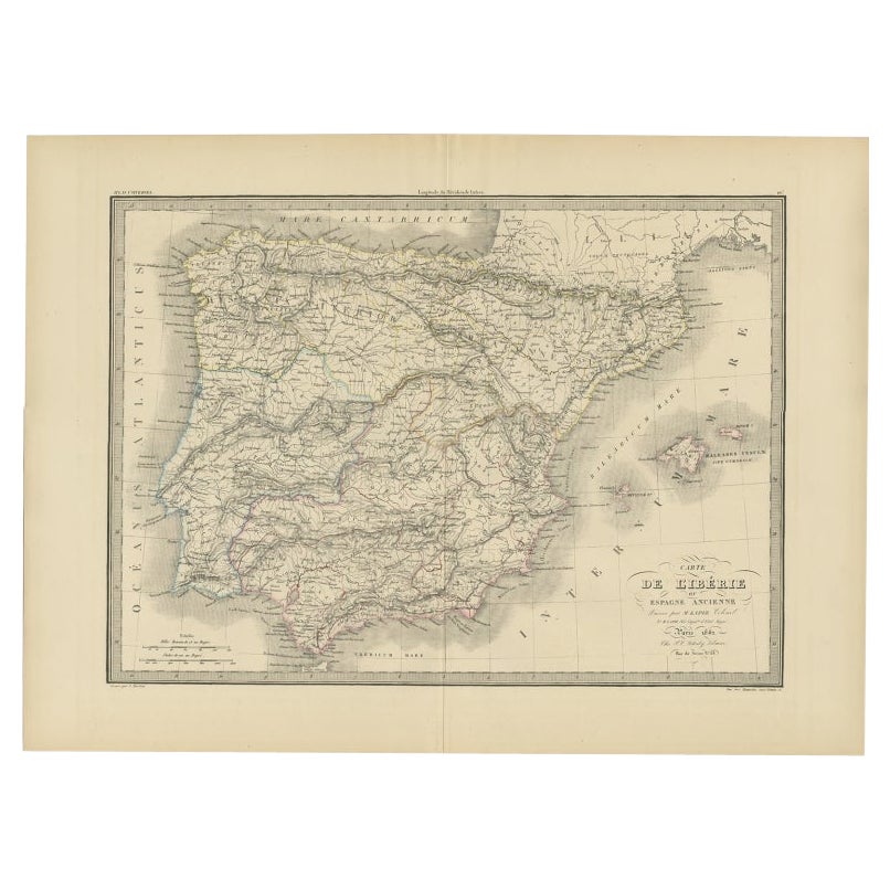
- Antique Map of Iberia or the Iberian Peninsula with Portugal and Spain, 1842Located in Langweer, NLAntique map titled 'Carte de l'Ibérie ou Espagne Ancienne'. Map of Iberia, or the Iberian Peninsula. This map originates from 'Atlas universel de géographie ancienne et moderne (..)'...Category
Antique 19th Century Maps
MaterialsPaper
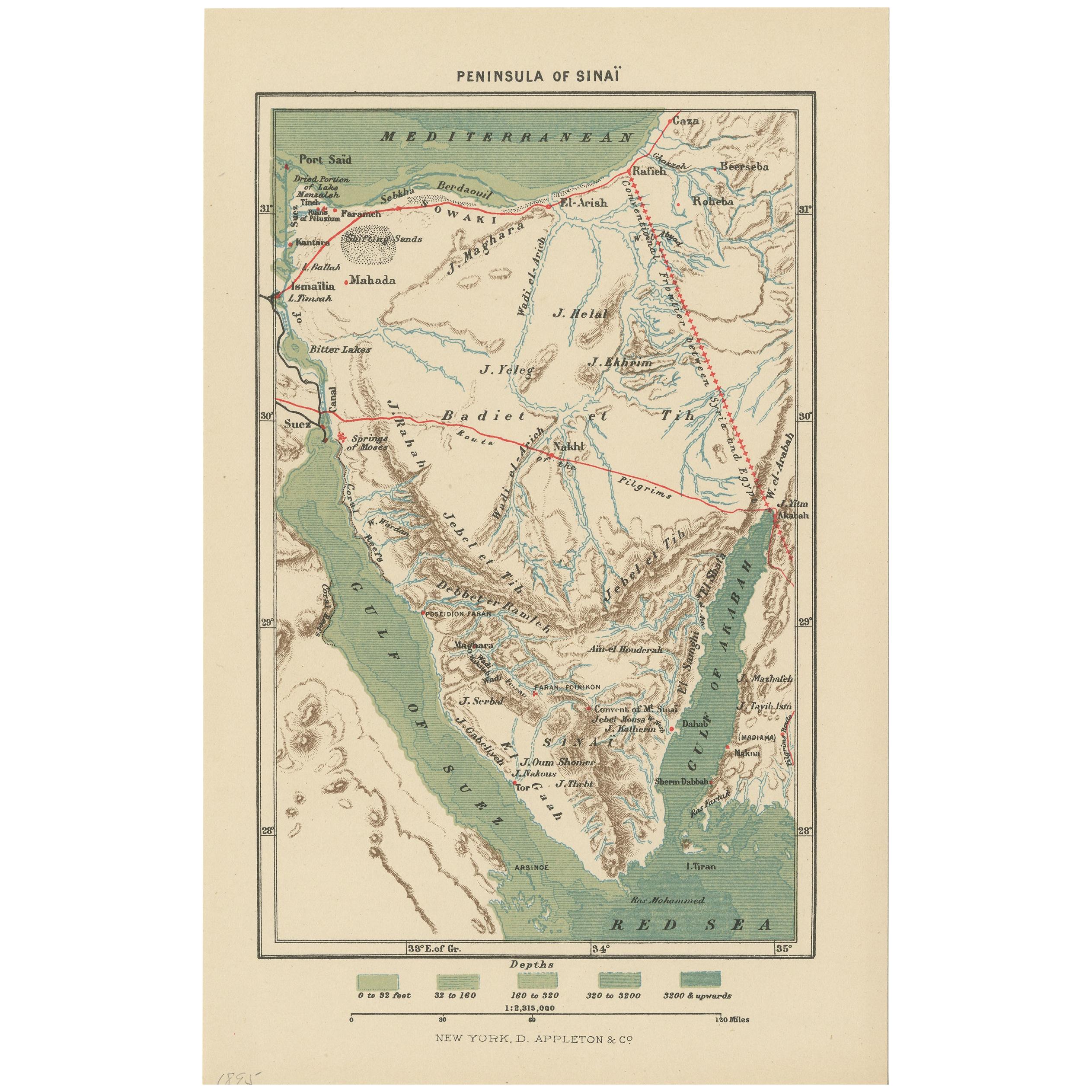
- Antique Map of the Sinai Peninsula, '1895'Located in Langweer, NLAntique map titled 'Peninsula of Sinaï'. Lithographed map of the Sinai Peninsula, a peninsula in Egypt, and the only part of the country located in Asia. It is situated between the M...Category
Antique Late 19th Century Maps
MaterialsPaper
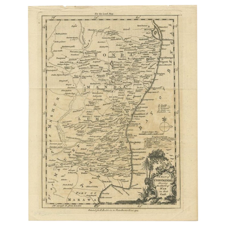
- Antique Map of the Coromandel Peninsula, 1754Located in Langweer, NLAntique map titled 'A map of Coromandel shewing the Seat of War on that coast'. Rare map of Coromandel printed for the London Magazine. Artists and Engravers: This map is not attr...Category
Antique 18th Century Maps
MaterialsPaper
- Antique Map of the Arabian Peninsula by Bonne 'c.1780'Located in Langweer, NLAntique map titled 'Carte de l'Arabie, du Golfe Persique, et de la Mer Rouge (..)'. Original antique map of the Arabian Peninsula, including the horn...Category
Antique Late 18th Century Maps
MaterialsPaper


You May Also Like
- Large Framed Map of the MediterraneanLocated in New York, NYLarge map/chart chart of The Mediterranean and the Grecian Archipelago showing Italy, Sardinia, Corsica, part of France, etc. in a black frame.Category
20th Century French Mid-Century Modern Maps
- Large Original Vintage Map of The World, circa 1920Located in St Annes, LancashireGreat map of The World Original color. Good condition / minor foxing Published by Alexander Gross Unframed.Category
Vintage 1920s English Maps
MaterialsPaper
- Large Original Antique Map of The World, Fullarton, C.1870Located in St Annes, LancashireGreat map of the World. Showing both hemispheres From the celebrated Royal Illustrated Atlas Lithograph. Original color. Published by Fullarton, Edinburgh, C.1870 Unframed. Rep...Category
Antique 1870s Scottish Maps
MaterialsPaper
- Original Antique Decorative Map of Japan, Fullarton, C.1870Located in St Annes, LancashireGreat map of Japan Wonderful figural border From the celebrated Royal Illustrated Atlas Lithograph. Original color. Published by Fullarton, Edinburgh, C.1870 Unframed...Category
Antique 1870s Scottish Maps
MaterialsPaper
- Large Original Antique Map of the United States of America. 1891By Rand McNally & Co.Located in St Annes, LancashireFabulous map of The United States Original color By Rand, McNally & Co. Dated 1891 Unframed Free shipping.Category
Antique 1890s American Maps
MaterialsPaper
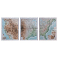
- Large Vintage Maps of the United States, in 3 Sections, 1920Located in St Annes, LancashireGreat maps of the USA in 3 sections Unframed Original color By John Bartholomew and Co. Edinburgh Geographical Institute Published, circa 1920 The measurements given is for just...Category
Vintage 1920s British Maps
MaterialsPaper


Recently Viewed
View AllMore Ways To Browse
Antique Map Of Sri Lanka
Globes Antique Terrestre
Antique Map New Orleans
Antique Maps Of New Orleans
Antique Maps Yorkshire
Shetland Map
Antique Map Iceland
Antique Map Of Iceland
Iraq Map
Taiwan Antique Map
Antique Illinois Map
Cuban Map
Map Of Cuba
Vietnam Map
Kansas Map
Map Of Puerto Rico
Nova Scotia Map
Bahamas Map