Map Of Puerto Rico
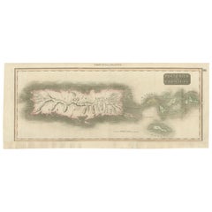
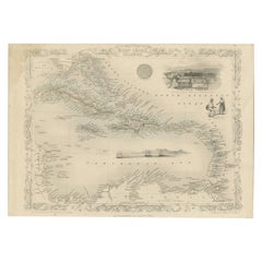
1817 Map of Puerto Rico and the Virgin Islands with Original Hand Coloring
Located in Langweer, NL
The title provided for this map is "Porto Rico and Virgin Isles," and it is an antique map from an
Category
Antique Early 19th Century Maps
Materials
Paper
Free Shipping
H 25.99 in W 11.03 in D 0 in
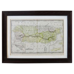
Puerto Rico 1910 Original Antique Map Of The Island In A Period Wood Frame
Located in Miami, FL
An antique framed map of Puerto Rico.
Very nice antique map of Puerto Rico printed in a folio of
Category
Antique Early 1900s Puerto Rican American Classical Prints
Materials
Glass, Wood, Paper
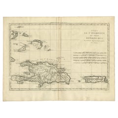
Detailed Antique Map of Santa Domingo, Puerto Rico, Eastern Bahamas, ca. 1780
Located in Langweer, NL
Description: Antique map titled 'L'Isle De St. Domingue, et celle De Porto-Rico.'
Detailed map
Category
Antique 1780s Maps
Materials
Paper
H 11.42 in W 15.12 in D 0 in
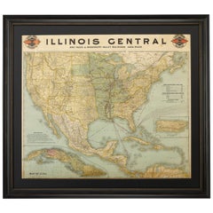
1899 Poole Brothers Antique Railroad Map of the Illinois Central Railroad
Located in Colorado Springs, CO
inset map of Puerto Rico is included along the right border. An “Explanatory” text block is at left
Category
Antique 1890s American Maps
Materials
Paper
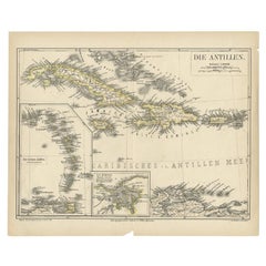
Antique Map of the Antilles by Meyer, 1878
Located in Langweer, NL
Antique map titled 'Die Antillen'. Old map of the Antilles, it shows Jamaica, Puerto Rico, the
Category
Antique 19th Century Maps
Materials
Paper
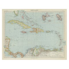
Vintage Map of the Greater Antilles and Lesser Antilles
Located in Langweer, NL
, Hispaniola (subdivided into the nations of the Dominican Republic and Haiti), Jamaica, and Puerto Rico. Also
Category
20th Century Maps
Materials
Paper
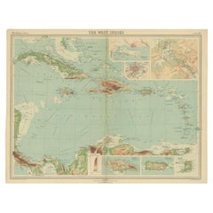
Antique Map of the West Indies in Full Color, 1922
Located in Langweer, NL
, Trinidad, Puerto Rico and Jamaica. Plate 96 from 'The Times Atlas'. Maps from the Edinburgh Geographical
Category
20th Century Maps
Materials
Paper
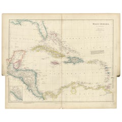
Original Antique Map of the West Indies by J. Arrowsmith, 1842
Located in Langweer, NL
Republic (eastern portion), is to the east of Cuba.
5. Jamaica is located south of Cuba.
6. Puerto Rico is
Category
Antique Early 19th Century Maps
Materials
Paper
No Reserve
H 20.87 in W 27.17 in D 0 in
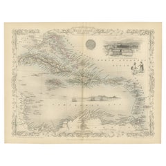
Engraving by Tallis and Rapkin of Map of the West Indies in The Caribbean, 1851
Located in Langweer, NL
Cuba, Santo Domingo (Hispaniola / Hayti), Puerto Rico (Porto Rico), the Virgin Islands, Guadeloupe
Category
Antique Mid-19th Century Maps
Materials
Paper
H 10.44 in W 14.57 in D 0 in
St. Christophe 'St. Kitts' Island: An 18th Century Hand-colored Map by Bellin
By Jacques-Nicolas Bellin
Located in Alamo, CA
. It lies east of Puerto Rico, while Nevis is located to the south-east and the Dutch island of St
Category
Antique Mid-18th Century French Maps
Materials
Paper
H 10 in W 14.25 in D 0.07 in
Ornate Cartography of Colonial Grandeur: The West India Islands around 1851
Located in Langweer, NL
, Hispaniola (containing Haiti and the Dominican Republic), Puerto Rico, and various smaller islands of the
Category
Antique 1850s Maps
Materials
Paper
No Reserve
H 10.71 in W 14.26 in D 0 in
S.Juan de Puerto Rico - Etching by Johannes Janssonius - 1650s
By Johannes Janssonius
Located in Roma, IT
S.Juan de Puerto Rico is an ancient map realized in 1650 by Johannes Janssonius (1588-1664).
Good
Category
1650s Modern Figurative Prints
Materials
Etching
H 18.71 in W 23.23 in D 0.04 in
"The Story Map Of The West Indies" 1936
Located in Bristol, CT
are also chronicled, such as Ponce de Leon's first settlement on Puerto Rico and the naval battle of
Category
1930s More Prints
Materials
Paper
St. Christophe (St. Kitts): Bellin 18th Century Hand Colored Map
Located in Alamo, CA
. It lies east of Puerto Rico, while Nevis is located to the south-east and the Dutch island of St
Category
1740s Other Art Style Landscape Prints
Materials
Engraving
People Also Browsed
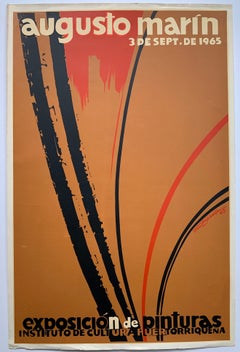
Augusto Marin exhibition poster (Puerto Rican artist)
By Rafael Tufino
Located in Wilton Manors, FL
Beautiful exhibition poster by Puerto rican artist, Rafael Tufino (1922-2008). Augusto Marin, Exposicion de Pinturas, 1965. Screen print on paper, 20 x 30 inches. Wear and creasing a...
Category
Mid-20th Century Abstract Expressionist Abstract Prints
Materials
Screen
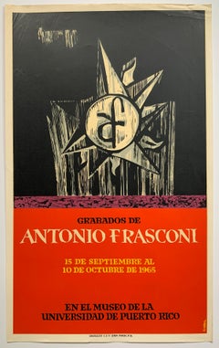
Antonio Frasconi mid-century exhibition poster (Puerto Rican artist)
By Lorenzo Homar
Located in Wilton Manors, FL
Rare exhibition poster by Puerto Rican artist, Lorenzo Homar (1913-2004). Grabados de Antonio Frasconi, 1965. Screen print poster on paper. Minor wear and creasing as depicted in det...
Category
Mid-20th Century Abstract Abstract Prints
Materials
Screen
Puerto Rico Institute of Culture poster (Puerto Rican artist)
By Lorenzo Homar
Located in Wilton Manors, FL
Rare promotional poster by Puerto Rican artist, Lorenzo Homar (1913-2004). Instituto de Cultura Puertorriquena San Juan, 1966. Sheet measures 18 x 24 inches. Screen print poster on ...
Category
Mid-20th Century Realist Abstract Prints
Materials
Screen
Novena Theater Festival mid-century exhibition poster (Puerto Rican artist)
By Lorenzo Homar
Located in Wilton Manors, FL
Rare exhibition poster by Puerto Rican artist, Lorenzo Homar (1913-2004). Noveno Festival de Theatro Puertorriqueno, 1966. Screen print poster on paper. Wear and creasing as depicted...
Category
Mid-20th Century Abstract Abstract Prints
Materials
Screen
Ruins of Central City, Vintage 1935 Framed Colorado Modernist Landscape
By Vance Kirkland
Located in Denver, CO
Vintage lithograph titled "Ruins of Central City 31/70" is a modernist landscape with decaying buildings and mountains by Vance Hall Kirkland, from 1935. Presented in a custom black ...
Category
1930s American Modern Landscape Prints
Materials
Paper, Lithograph
H 25.75 in W 29.5 in D 0.5 in
San Miguel, St. Michael, School of Cusco, Peru, Framed early 1900's
Located in Houston, TX
This is painting is from the School of Cusco depicting St. Michael the Archangel defeating the devil in battle. It is oil on canvas and is in very good condition. No crackling on th...
Category
Early 20th Century Folk Art Portrait Paintings
Materials
Canvas, Oil
Exhibition Poster Andy Warhol, Ladies and Gentlemen
By Andy Warhol
Located in Pasadena, CA
Ladies and Gentlemen Exhibition Poster (Portrait of Wilhelmina Ross) (1989)
Andy Warhol Vintage 1989 Pop Art Lithograph Print Framed Paris Exhibition Poster " Ladies and Gentlemen ( ...
Category
Late 20th Century Pop Art Portrait Prints
Materials
Lithograph, Offset, Screen
"Boy on Carousel" large oil painting
By Helen Rayburn Caswell
Located in San Francisco, CA
This artwork "Boy on Carousel" c.1970 is an oil painting on canvas by noted California artist, Helen Rayburn Caswell, 1923-2018. It is signed at the right bottom corner by the artist...
Category
Late 20th Century American Impressionist Figurative Paintings
Materials
Oil
Eduardo Vera Cortes poster Antonio Maldonado exhibition (Puerto Rican artist)
Located in Wilton Manors, FL
Rare exhibition poster by Puerto Rican artist Carlos Osario. Una Gota de Sangre, 1963. Screen print on paper, 17.5 x 25 inches. Some wear and creasing in margins as depicted in deta...
Category
Mid-20th Century Abstract Abstract Prints
Materials
Screen
Large Johnny Friedlaender Poster Print No Text
By Johnny Friedlaender
Located in Surfside, FL
Johnny Friedlaender (26 December 1912 – 18 June 1992) was a leading 20th-century artist, whose works have been exhibited in Germany, France, Netherlands, Italy, Japan and the United ...
Category
Mid-20th Century Modern Abstract Prints
Materials
Offset, Screen
1847 Antique Map of Mexico, Texas and California by Samuel Augustus Mitchell
By Samuel Augustus Mitchell 1
Located in Colorado Springs, CO
Presented is the second edition of Samuel Augustus Mitchell's Map of Mexico, Including Yucatan & Upper California, an important map showing the progress of the Mexican-American War. ...
Category
Antique 1840s American Maps
Materials
Paper
H 32 in W 23.63 in D 0.5 in
70s Original cuban poster for the day of solidarity with Puerto Rico - OSPAAAL
Located in PARIS, FR
Despite its geographic isolation, the island of Cuba has produced more graphic material in support of oppressed peoples around the world than any other nation.
This poster supports P...
Category
1970s Prints and Multiples
Materials
Lithograph, Paper
Charlotte Shore Daughter of 1st Lord Teignmouth. Portrait in India 1792 to 1795.
By Arthur William Devis
Located in Sutton Poyntz, Dorset
Arthur William Devis.
English ( b.1762 - d.1822 ).
Portrait of Charlotte Shore, Daughter of the 1st Lord Teignmouth 1790 - 1864.
Oil on Canvas.
Oval Image size 26.2 inches x 20.5 in...
Category
Early 19th Century Romantic Portrait Paintings
Materials
Canvas, Oil
Puerto Rican mid-century exhibition poster San Juan
Located in Wilton Manors, FL
Esposicion de Retratos, Instututo de Cultura Puertorriquena San Juan, 1965. Screen Print on paper measiures 20 x 30 inches. Wear and creasing as depicted in detail photos.
Beautifu...
Category
Mid-20th Century Abstract Abstract Prints
Materials
Screen
1859 "Map of the United States of America..." by J. H. Colton
By J.H. Colton
Located in Colorado Springs, CO
Presented is an 1859 “Map of the United States of America, the British Provinces, Mexico, the West Indies and Central America with Part of New Granada and Venezuela” by John Hutchins...
Category
Antique 1850s American Maps
Materials
Paper
Portrait Of The Steam/Sail Ship The Prins Frederik Hendrik.
Located in Jacksonville, FL
Provenance: Reference:
Antonio Jacobsen - The Checklist: Paintings and Sketches by Antonio N.G. Jacobsen (1850-1921) by Harold S. Sniffen (N.Y. and Newport News, Va.: The Mariners' M...
Category
19th Century Landscape Paintings
Materials
Canvas, Oil
Recent Sales
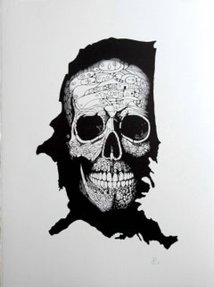
"Skull On The Map" - skull pen drawing on paper
By Pablo Caviedes
Located in Brooklyn, NY
; Washington, D.C.; Oakland, California; and Ponce, Puerto Rico. After moving to Manhattan in 2001, he’s been
Category
21st Century and Contemporary Contemporary Figurative Drawings and Water...
Materials
Cardboard, Archival Paper, Pen
Sea chart of Santa Domingo and its surroundings - Engraving - 18th century
Located in Zeeland, Noord-Brabant
eastern ends of Cuba and Jamaica, and the western end of Puerto Rico. Printed stipple rhumb lines are
Category
1750s Old Masters More Prints
Materials
Engraving
"Skull 4" - skull pen drawing on paper
By Pablo Caviedes
Located in Brooklyn, NY
; Washington, D.C.; Oakland, California; and Ponce, Puerto Rico. After moving to Manhattan in 2001, he’s been
Category
21st Century and Contemporary Contemporary Figurative Drawings and Water...
Materials
Cardboard, Archival Paper, Pen
"Skull 3" - skull pen drawing on paper
By Pablo Caviedes
Located in Brooklyn, NY
; Washington, D.C.; Oakland, California; and Ponce, Puerto Rico. After moving to Manhattan in 2001, he’s been
Category
21st Century and Contemporary Contemporary Figurative Drawings and Water...
Materials
Cardboard, Archival Paper, Pen
"Eve" - Skull drawing, pen on paper, framed
By Pablo Caviedes
Located in Brooklyn, NY
; Washington, D.C.; Oakland, California; and Ponce, Puerto Rico. After moving to Manhattan in 2001, he’s been
Category
21st Century and Contemporary Contemporary Figurative Drawings and Water...
Materials
Cardboard, Archival Paper, Pen
"Adam" - skull pen drawing
By Pablo Caviedes
Located in Brooklyn, NY
; Washington, D.C.; Oakland, California; and Ponce, Puerto Rico. After moving to Manhattan in 2001, he’s been
Category
21st Century and Contemporary Contemporary Figurative Drawings and Water...
Materials
Cardboard, Archival Paper, Pen
Bellin 18th Century Hand Colored Map of St. Christophe (St. Kitts)
By Jacques-Nicolas Bellin
Located in Alamo, CA
arc of the Windward Islands, in the Lesser Antilles. It lies east of Puerto Rico, while Nevis is
Category
Antique Mid-18th Century French Maps
Materials
Paper
Antique Map of the West India Islands and Central America by Johnston '1909'
Located in Langweer, NL
Antique map titled 'West India Islands and Central America'. Depicting Venezuela, Caribbean, Puerto
Category
Early 20th Century Maps
Materials
Paper
H 19.49 in W 24.41 in D 0.02 in
Gulf of Mexico, Florida, C. America, Cuba: 18th C. Hand-colored Map by Bellin
By Jacques-Nicolas Bellin
Located in Alamo, CA
of Venezuela, and the islands of the Caribbean and West Indies. Cuba, Puerto Rico, Haiti, The
Category
1750s Landscape Prints
Materials
Engraving
Early Map of Puerto Rico Printed in Venice by G. F. Camocio in 1571
Located in Langweer, NL
Porcacchi's map of the Island of Puerto Rico. One of the earliest obtainable maps of the Island and one of the
Category
Antique 16th Century Maps
Materials
Paper
Free Shipping
H 4.34 in W 5.91 in D 0.01 in
Antique Map of Cuba, Haïti, Jamaica, Puerto Rico and St Margareta, Havanna, 1630
Located in Langweer, NL
Title: "Cuba Insula" - "Hispaniola Insula".
2 old colors copper engraved maps of Cuba and Haïti
Category
Antique 1630s Maps
Materials
Paper
H 18.51 in W 22.45 in D 0 in
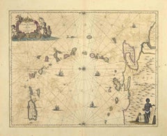
Antique Map of the Caribbean Islands by J. Jansson, circa 1650
By J. Jansson
Located in Langweer, NL
Beautiful hand-colored antique map which includes all the islands between Puerto Rico and Trinidad
Category
Antique Mid-17th Century Maps
Antique Map of the West India Islands and Central America by A.K. Johnston
Located in Langweer, NL
Antique map titled 'West India Islands and Central America'. Depicting Venezuela, Caribbean, Puerto
Category
Antique Mid-19th Century Maps
H 19.1 in W 24.41 in D 0.02 in
Gulf of Mexico, Florida, C. America, Cuba, etc.: 18th C. Hand-colored Bellin Map
By Jacques-Nicolas Bellin
Located in Alamo, CA
of Venezuela, and the islands of the Caribbean and West Indies. Cuba, Puerto Rico, Haiti, The
Category
Antique Mid-18th Century French Maps
Materials
Paper
H 12.63 in W 18 in D 0.13 in
Bellin 18th Century Hand Colored Map of St. Christophe (St. Kitts)
Located in Alamo, CA
arc of the Windward Islands, in the Lesser Antilles. It lies east of Puerto Rico, while Nevis is
Category
Late 18th Century Other Art Style Landscape Prints
Materials
Engraving
H 13.13 in W 17 in D 0.75 in
Original Vintage Poster West Indies Pan American Airways Educational Travel Map
Located in London, GB
, Dominican Republic Cuidad Trujillo, Puerto Rico San Juan, Virgin Islands, Leeward Islands, Windward Islands
Category
Vintage 1950s American Posters
Materials
Paper
H 20.87 in W 25.99 in D 0.04 in
Original Vintage Poster West Indies Pan American Airways Educational Travel Map
Located in London, GB
, Dominican Republic Cuidad Trujillo, Puerto Rico San Juan, Virgin Islands, Leeward Islands, Windward Islands
Category
1950s More Prints
Materials
Paper
J.H. Colton & Co. Hand Colored Engraved Map of Cuba, Jamaica, & Puerto Rico
By J.H. Colton
Located in Atlanta, GA
19th century circa 1850s hand colored engraved map of Cuba, Jamaica, and Puerto Rico, Published by
Category
Antique 19th Century American Maps
Materials
Paper
H 14 in W 16.75 in L 14 in
Map of Neuve Castille
By Alain Manesson Mallet
Located in New York, NY
Published in 1685 this hand-colored map was created by Alain Manesson Mallet. Also shows Puerto
Category
18th Century and Earlier Realist More Prints
Materials
Engraving
Port Et Ville De Porto-Rico Dan's D'Isle de ce nom
Located in New York, NY
Beautiful hand colored map of the the Harbor of San Juan in Puerto Rico, depicting soundings
Category
1760s Realist More Prints
Materials
Engraving
Get Updated with New Arrivals
Save "Map Of Puerto Rico", and we’ll notify you when there are new listings in this category.
Map Of Puerto Rico For Sale on 1stDibs
At 1stDibs, there are many versions of the ideal map of puerto rico for your home. A map of puerto rico — often made from paper — can elevate any home. There are many kinds of the map of puerto rico you’re looking for, from those produced as long ago as the 18th Century to those made as recently as the 20th Century. Many designers have produced at least one well-made map of puerto rico over the years, but those crafted by Jacques-Nicolas Bellin are often thought to be among the most beautiful.
How Much is a Map Of Puerto Rico?
Prices for a map of puerto rico can differ depending upon size, time period and other attributes — at 1stDibs, they begin at $92 and can go as high as $9,800, while the average can fetch as much as $681.
More Ways To Browse
Mexico Old Map
Poole England
San Francisco Yacht
Antique Map Caribbean
Antique Maps Caribbean
Caribbean Map Antique
Caribbean Antique Maps
Antique Caribbean Maps
Antique Caribbean Map
Map Of Eastern Europe
Antique Maps Of The Caribbean
18th C German Hand Colored Engravings
Antique Map Of Caribbean
Antique Map Of The Caribbean
Hernandez La
Dior Jamaica
Antique Marine Compass
Antique Marine Compasses
