Antique Caribbean Maps

6
to
22
72
26
61
44
37
22
13
13
12
11
10
9
8
5
3
3
3
3
2
1
1
1
1
1
1
1
1
1
1
1
1
8
6
2
1
1
Sort By
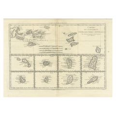
18th Century Antique Map of the Virgin Islands and Caribbean Inset Maps
Located in Langweer, NL
Antilles," featuring inset maps of various islands in the Caribbean, is from the "Atlas Encyclopedique" by
Category

Late 18th Century Antique Caribbean Maps

Materials

Paper

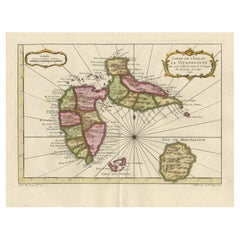
Antique Map of Guadelupe in the Caribbean, 1759
By Jacques-Nicolas Bellin
Located in Langweer, NL
Antique map titled 'Carte De L'Isle De La Guadeloupe'. Detailed map of Guadalupe, Mari-Galante and
Category

Mid-18th Century French Antique Caribbean Maps

Materials

Paper

Antique Map of Guadelupe in the Caribbean, 1759
Free Shipping
H 10.63 in W 13.59 in D 0.02 in
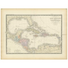
Antique Map of the Antilles in the Caribbean, '1875'
Located in Langweer, NL
Antique map titled 'Carte des Iles Antilles'. Large map of the Antilles. This map originates from
Category

Late 19th Century Antique Caribbean Maps

Materials

Paper

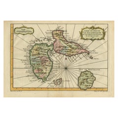
Antique Map of Guadeloupe, Island in the Caribbean, c.1757
Located in Langweer, NL
Antique map titled 'Carte de L'Isle de la Guadeloupe'. A very decorative map of Guadeloupe in the
Category

18th Century Antique Caribbean Maps

Materials

Paper

Detailed Antique Map of the Windward Islands in the Caribbean
By Covens & Mortier
Located in Langweer, NL
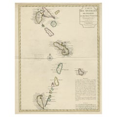
Antique map titled 'Carte des Antilles Francoises et des Isles Voisines'. Original antique map of
Category

Early 18th Century Antique Caribbean Maps

Materials

Paper

Antique Map the Windward or South Caribbean Islands and Guiana, 1859
Located in Langweer, NL
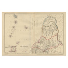
Antique map titled 'The Windward or South Caribbean Islands'. Original antique map of South
Category

Mid-19th Century Antique Caribbean Maps

Materials

Paper

Antique Map of the Caribbean Island of St Kitts, ca.1750
Located in Langweer, NL
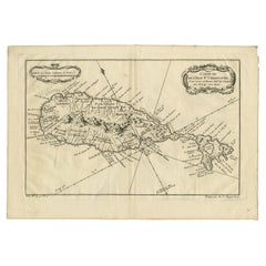
Description: Antique map titled 'Carte de l'Isle St. Christophe pour Servir a l'Histoire Genle. des
Category

1750s Antique Caribbean Maps

Materials

Paper

Authentic Antique Map of the Caribbean, Gulf Coast and Central America, 1787
Located in Langweer, NL
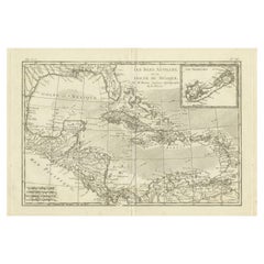
Antique map titled 'Les Isles Antilles et le Golfe du Méxique'. Original old map of the Caribbean
Category

Late 18th Century Antique Caribbean Maps

Materials

Paper

Martinique Island in the Caribbean by Bellin Original Original Antique Map, 1780
Located in Langweer, NL
This mid-18th century map, "Carte de l'Isle de la Martinique pour servir a l'historie generale des
Category

Late 18th Century Antique Caribbean Maps

Materials

Paper

Old 18th Century Composite Map of Key Caribbean Islands with Descriptive Texts
Located in Langweer, NL
. Bermudes sonst Sommers genannt'. Beautiful map of the British possessions in the Caribbean. Shows the
Category

1740s Antique Caribbean Maps

Materials

Paper

Antique Map of the Dutch Antilles 'Caribbean' by R. Bonne, circa 1780
Located in Langweer, NL
Antilles (Caribbean). Published by R. Bonne, circa 1780. The antique map titled 'Kaart van de Antilles' is
Category

Late 18th Century Antique Caribbean Maps

Materials

Paper

Antique Map with Hand Coloring of the United States and the Caribbean
Located in Langweer, NL
the United States of America showing the Caribbean. With an inset map of the surrounding area of
Category

Late 19th Century Antique Caribbean Maps

Materials

Paper

Antique Map of the United States of America, also showing the Caribbean
Located in Langweer, NL
the United States of America showing the Caribbean. With an inset map of the surrounding area of
Category

Mid-19th Century Antique Caribbean Maps

Materials

Paper

Original Antique Map of the Virgin Islands with Insets of Caribbean Isles, 1787
Located in Langweer, NL
Antique map titled 'Supplément pour les Isles Antilles (..)'. Original old map of the Virgin
Category

Late 18th Century Antique Caribbean Maps

Materials

Paper

Engraving of a Map of Florida, the Gulf Coast, Caribbean & Central America, 1728
Located in Langweer, NL
This exceptional antique map, titled "Nouvelle Carte Marine de Toute les Cotes de l´Amerique" and
Category

Mid-18th Century European Antique Caribbean Maps

Materials

Paper

Early 19th Century Hand Colored Map of the United States and Caribbean Islands
Located in Hamilton, Ontario
Hand coloured early 19th century map by Giraldon of France titled "Etats Unis et Grandes Antilles
Category

Early 19th Century French Antique Caribbean Maps

Materials

Paper

Engraving by Tallis and Rapkin of Map of the West Indies in The Caribbean, 1851
Located in Langweer, NL
Caribbean region during the mid-19th century. **Title:** Map of the West Indies **Cartographer/Engraver
Category

Mid-19th Century Antique Caribbean Maps

Materials

Paper

Old Map of the island of Saint Christopher or St. Kitts in the Caribbean, c.1765
Located in Langweer, NL
Antique map titled 'Carte de l'Isle de Saint-Christophe'. A detailed map of the island of Saint
Category

18th Century Antique Caribbean Maps

Materials

Paper

L'isle De La Martinique Caribbean Copper Engraving Original Handcoloring, 1704
Located in Langweer, NL
The original hand-colored map titled "Isle de la Martinique," published in 1704 and part of De
Category

Late 19th Century Antique Caribbean Maps

Materials

Paper

Original Engraving of the West Indies, Gulf of Mexico, Antilles, Caribbean, 1780
Located in Langweer, NL
during the late 18th century. **Title:** Map of the West Indies, Gulf of Mexico, Antilles, and Caribbean
Category

Late 18th Century Antique Caribbean Maps

Materials

Paper

Barados and St Christopher or St Kitts and Nevis Islands in the Caribbean, 1748
Located in Langweer, NL
historical context of these Caribbean territories during the colonial period. The map's delineation of
Category

Mid-18th Century Antique Caribbean Maps

Materials

Paper

Antique Map of the United States with inset map of the region of Mexico City
Located in Langweer, NL
the United States of America showing the Caribbean. With an inset map of the surrounding area of
Category

Mid-19th Century Antique Caribbean Maps

Materials

Paper

Original Steel Engraved Map of French Colonies in America, 1854
Located in Langweer, NL
Antique map titled 'Colonies Francaises (en Amerique)'. Detailed map bordered by vignettes showing
Category

Mid-19th Century Antique Caribbean Maps

Materials

Paper

Original Steel Engraved Map of French Colonies in America, 1854
Free Shipping
H 13.12 in W 18.71 in D 0.02 in
Copper Engraved Grenada Map by John Thompson Published in 1810
Located in Langweer, NL
John Thomson's original antique map of Grenada, dating back to 1810 and hailing from Edinburgh
Category

Early 19th Century Antique Caribbean Maps

Materials

Paper

Original Antique Map of the West Indies by J. Arrowsmith, 1842
Located in Langweer, NL
depiction of the Caribbean islands, this map is a testament to the skill and craftsmanship of 19th-century
Category

Early 19th Century Antique Caribbean Maps

Materials

Paper

Antique Map of the French Colony Guadeloupe by V. Levasseur, 1854
By Victor Levasseur
Located in Langweer, NL
the Caribbean Sea, with decorative frame containing views of the island. This map originates from
Category

Mid-19th Century Antique Caribbean Maps

Materials

Paper

Interesting Map of the Atlantic Showing Nelson's and Trade Routes, 1817
By John Thomson
Located in Langweer, NL
Antique map titled 'Chart of the North Atlantic Ocean with Tracks of the Shipping to West Indies
Category

19th Century Antique Caribbean Maps

Materials

Paper

Large Antique Map of Guadeloupe and Antigua with Adjacent Isles, 19th Century
Located in Langweer, NL
Title: "Antique Map of Guadeloupe and Antigua with Adjacent Isles, 19th Century" Source: New
Category

Early 19th Century Antique Caribbean Maps

Materials

Paper

An Ornate and Historical Tallis Map of Jamaica with Decorative Vignettes, 1851
Located in Langweer, NL
Caribbean, was a British colony at the time this map was produced. It is known for its rich history
Category

1850s Antique Caribbean Maps

Materials

Paper

1899 Poole Brothers Antique Railroad Map of the Illinois Central Railroad
Located in Colorado Springs, CO
This is an 1899 railroad map of the Illinois Central and Yazoo and Mississippi Valley Railroads
Category

1890s American Antique Caribbean Maps

Materials

Paper

Rare Handcolored Map of Isle de Juan Fernandes 'Robinson Crusoe Island', Chili
Located in Langweer, NL
Antique map titled 'Die Insel Iuan Fernandes in der Sudsee (..)'. This map depicts Robinson Crusoe
Category

Mid-18th Century Antique Caribbean Maps

Materials

Paper

Original Antique Map of the Island of Dominica in the West Indies, 1794
Located in Langweer, NL
narratives and socio-economic dynamics of the Caribbean region. Remarkably, the very year following the map
Category

1790s Antique Caribbean Maps

Materials

Paper

Antique Map of Cuba, Haiti and Porto Rico by W. G. Blackie, 1859
Located in Langweer, NL
Antique map titled 'The Leeward or North Caribbean Islands'. Original antique map of Cuba, Haiti
Category

Mid-19th Century Antique Caribbean Maps

Materials

Paper

1859 "Map of the United States of America..." by J. H. Colton
By J.H. Colton
Located in Colorado Springs, CO
across the Caribbean and South America. A large inset map on the lower left shows the Atlantic Ocean and
Category

1850s American Antique Caribbean Maps

Materials

Paper

Authentique Map by Pilon of The French Colonies in The West Indies, 1876
Located in Langweer, NL
The 1876 map titled "Carte des Colonies Françaises aux Antilles" represents a significant
Category

Late 19th Century Antique Caribbean Maps

Materials

Paper

Map of Guatemala or the Former United Provinces of Central America, 1845
Located in Langweer, NL
The image is an antique map titled "Guatemala or United States of Central America," which is drawn
Category

Mid-19th Century Antique Caribbean Maps

Materials

Paper

1817 Map of Puerto Rico and the Virgin Islands with Original Hand Coloring
Located in Langweer, NL
The title provided for this map is "Porto Rico and Virgin Isles," and it is an antique map from an
Category

Early 19th Century Antique Caribbean Maps

Materials

Paper

Original Engraved Map of Saint Lucia in the West Indies by Bellin, 1758
Located in Langweer, NL
Hydrographer and engineer of the French Navy, is a remarkable antique map showcasing the intricate details of
Category

1750s Antique Caribbean Maps

Materials

Paper

St. Christophe 'St. Kitts' Island: An 18th Century Hand-colored Map by Bellin
By Jacques-Nicolas Bellin
Located in Alamo, CA
Jacques Bellin's copper-plate map of the Caribbean island of Saint Kitts entitled "Carte De De
Category

Mid-18th Century French Antique Caribbean Maps

Materials

Paper

Antique Map of North America with Vignette of the Statue of Liberty, New York
Located in Langweer, NL
Antique map titled 'Amérique du Nord'. Original antique map of North America. Meticulous
Category

Late 19th Century Antique Caribbean Maps

Materials

Paper

Original Old Map of St Kitts, Antigua, Bermuda, Barbados, and Jamaica, ca.1745
Located in Langweer, NL
. Bermudes sonst Sommers genannt'. Beautiful map of the British possessions in the Caribbean. Shows the
Category

1740s Antique Caribbean Maps

Materials

Paper

Early Map of Puerto Rico Printed in Venice by G. F. Camocio in 1571
Located in Langweer, NL
Porcacchi's map of the Island of Puerto Rico. One of the earliest obtainable maps of the Island and one of the
Category

16th Century Antique Caribbean Maps

Materials

Paper

Antique Map of Guadeloupe with Les Saintes, Grand Bourg and La Désirade, c.1780
Located in Langweer, NL
Antique map titled 'Les Isles de la Guadeloupe (..).' Map of the Caribbean Island of Guadeloupe
Category

18th Century Antique Caribbean Maps

Materials

Paper

Antique Map of the Gulf of Mexico and all the islands of the West Indies
Located in Langweer, NL
islands in the Caribbean. This map originates from La Harpe's 'Histoire Generale des Voyages'. Engraved by
Category

Early 19th Century Antique Caribbean Maps

Materials

Paper

Engraved Map by Bellin of Saint Lucia or Sainte Lucie in the West Indies, 1764
Located in Langweer, NL
Hydrographer and engineer of the French Navy, is a remarkable antique map showcasing the intricate details of
Category

Late 19th Century Antique Caribbean Maps

Materials

Paper

Ornate Cartography of Colonial Grandeur: The West India Islands around 1851
Located in Langweer, NL
details typical of John Tallis maps: 1. The first image shows the northern part of the Caribbean
Category

1850s Antique Caribbean Maps

Materials

Paper

Sea Chart of Central America and the Northwest Coast of South America, ca.1745
Located in Langweer, NL
Antique map titled 'Novae Hispaniae, Chili, Peruviae et Guatamala Littorae.' Sea chart of
Category

1740s Antique Caribbean Maps

Materials

Paper

Engraving of Allegorical Celebrations of the British Victories in America, 1880
Located in Langweer, NL
the northeastern Coast of America and the Caribbean), gesturing at North America, watched by George
Category

1880s Antique Caribbean Maps

Materials

Paper

St. Christophe (St. Kitts): Bellin 18th Century Hand Colored Map
Located in Alamo, CA
Jacques Bellin's copper-plate map of the Caribbean island of Saint Kitts entitled "Carte De De
Category

1740s Other Art Style Antique Caribbean Maps

Materials

Engraving

Seminal guide to the East and West Indies, with 42 coloured maps and plates
By Jan Huygen van Linschoten
Located in ZWIJNDRECHT, NL
Seminal guide to the East and West Indies, with 42 double-page and folding plates, including 6 maps
Category

Early 17th Century Dutch Dutch Colonial Antique Caribbean Maps

Materials

Paper

Original Imray & Son Chart of North Atlantic, 1876
Located in Norwell, MA
Nautical chart of the North Atlantic showing the Eastern United States coast, Caribbean Islands
Category

1870s Antique Caribbean Maps

Materials

Paper

Indiarum Occidentalium Tractus Littorales cum Insulis Caribicis / Pascaert van W
By Louis Renard
Located in New York, NY
This early 18th-century engraved map was published by Louis Renard in Amsterdam. The image size is
Category

18th Century Other Art Style Antique Caribbean Maps

Materials

Engraving

A truly delightful miniature terrestrial pocket globe
By Nathaniel Mills
Located in ZWIJNDRECHT, NL
turning overhead. In line with its counterpart, the terrestrial globe, celestial globes are mapped by a
Category

Mid-18th Century British Dutch Colonial Antique Caribbean Maps

Materials

Other

1719 Chatelain Map of Mexico, Southeast North America and the Caribbean
By Henri-Abraham Chatelain
Located in New York, NY
Original first edition 1719 engraved map, full title in French "Carte contenant royaume mexique et
Category

1710s Realist Antique Caribbean Maps

Materials

Engraving

Cochin Rex elephante vextus [...].
By Jan Huygen van Linschoten
Located in Zeeland, Noord-Brabant
the New World, and island to island in the East Indies. The third book covers Florida, the Caribbean
Category

1630s Antique Caribbean Maps

Materials

Engraving

Virginis Lusitane in India […].
By Jan Huygen van Linschoten
Located in Zeeland, Noord-Brabant
island to island in the East Indies. The third book covers Florida, the Caribbean, and Brazil
Category

1630s Antique Caribbean Maps

Materials

Engraving

Indorum casae, villae, et vici circa Goam [...].
By Jan Huygen van Linschoten
Located in Zeeland, Noord-Brabant
Florida, the Caribbean, and Brazil (Description de l'Amerique ...). The work was first published in Dutch
Category

1630s Antique Caribbean Maps

Materials

Engraving

Naves celoces seu biremes […].
By Jan Huygen van Linschoten
Located in Zeeland, Noord-Brabant
book covers Florida, the Caribbean, and Brazil (Description de l'Amerique ...). The work was first
Category

1630s Antique Caribbean Maps

Materials

Engraving

Left: Naute Arabes [...] - Arabischer scheepluyden [...].
By Jan Huygen van Linschoten
Located in Zeeland, Noord-Brabant
island to island in the East Indies. The third book covers Florida, the Caribbean, and Brazil
Category

1630s Antique Caribbean Maps

Materials

Engraving

Horrendae Idolorum effigies [...].
By Jan Huygen van Linschoten
Located in Zeeland, Noord-Brabant
the New World, and island to island in the East Indies. The third book covers Florida, the Caribbean
Category

1630s Antique Caribbean Maps

Materials

Engraving

  • 1
Get Updated with New Arrivals
Save "Antique Caribbean Maps", and we’ll notify you when there are new listings in this category.

Antique Caribbean Maps For Sale on 1stDibs

At 1stDibs, there are several options of antique caribbean maps available for sale. The range of distinct antique caribbean maps — often made from paper, fruitwood and hardwood — can elevate any home. Antique caribbean maps have been made for many years, and versions that date back to the 18th Century alongside those produced as recently as the 19th Century. Antique caribbean maps are generally popular furniture pieces, but Folk Art and Regency styles are often sought at 1stDibs. J. Jansson and Nicolas Joannes Piscator each produced beautiful antique caribbean maps that are worth considering.

How Much are Antique Caribbean Maps?

Prices for antique caribbean maps can differ depending upon size, time period and other attributes — at 1stDibs, antique caribbean maps begin at $67 and can go as high as $12,508, while the average can fetch as much as $920.

Read More

Pamela Shamshiri Shares the Secrets behind Her First-Ever Book and Its Effortlessly Cool Interiors

The sought-after designer worked with the team at Hoffman Creative to produce a monograph that beautifully showcases some of Studio Shamshiri's most inspiring projects.

Moroccan Artworks and Objects Take Center Stage in an Extraordinary Villa in Tangier

Italian writer and collector Umberto Pasti opens the doors to his remarkable cave of wonders in North Africa.

Montecito Has Drawn Royalty and Celebrities, and These Homes Are Proof of Its Allure

Hollywood A-listers, ex-pat aristocrats and art collectors and style setters of all stripes appreciate the allure of the coastal California hamlet — much on our minds after recent winter floods.

Whaam! Blam! Pow! — a New Book on Pop Art Packs a Punch

Publishing house Assouline and writer Julie Belcove have teamed up to trace the history of the genre, from Roy Lichtenstein, Andy Warhol and Yayoi Kusama to Mickalene Thomas and Jeff Koons.

The Sparkling Legacy of Tiffany & Co. Explained, One Jewel at a Time

A gorgeous new book celebrates — and memorializes — the iconic jeweler’s rich heritage.

What Makes a Gem-Encrusted Chess Set Worth $4 Million?

The world’s most opulent chess set, weighing in at 513 carats, is literally fit for a king and queen.

Tauba Auerbach’s Geometric Pop-Up Book Is Mighty Rare, Thanks to a Hurricane

This sculptural art book has an epic backstory of its own.

Step inside the Storied Mansions of Palm Beach’s Most Effervescent Architect

From Spanish-style courtyards to fanciful fountains, these acclaimed structures abound in surprising and elegant details.