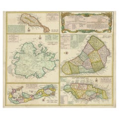
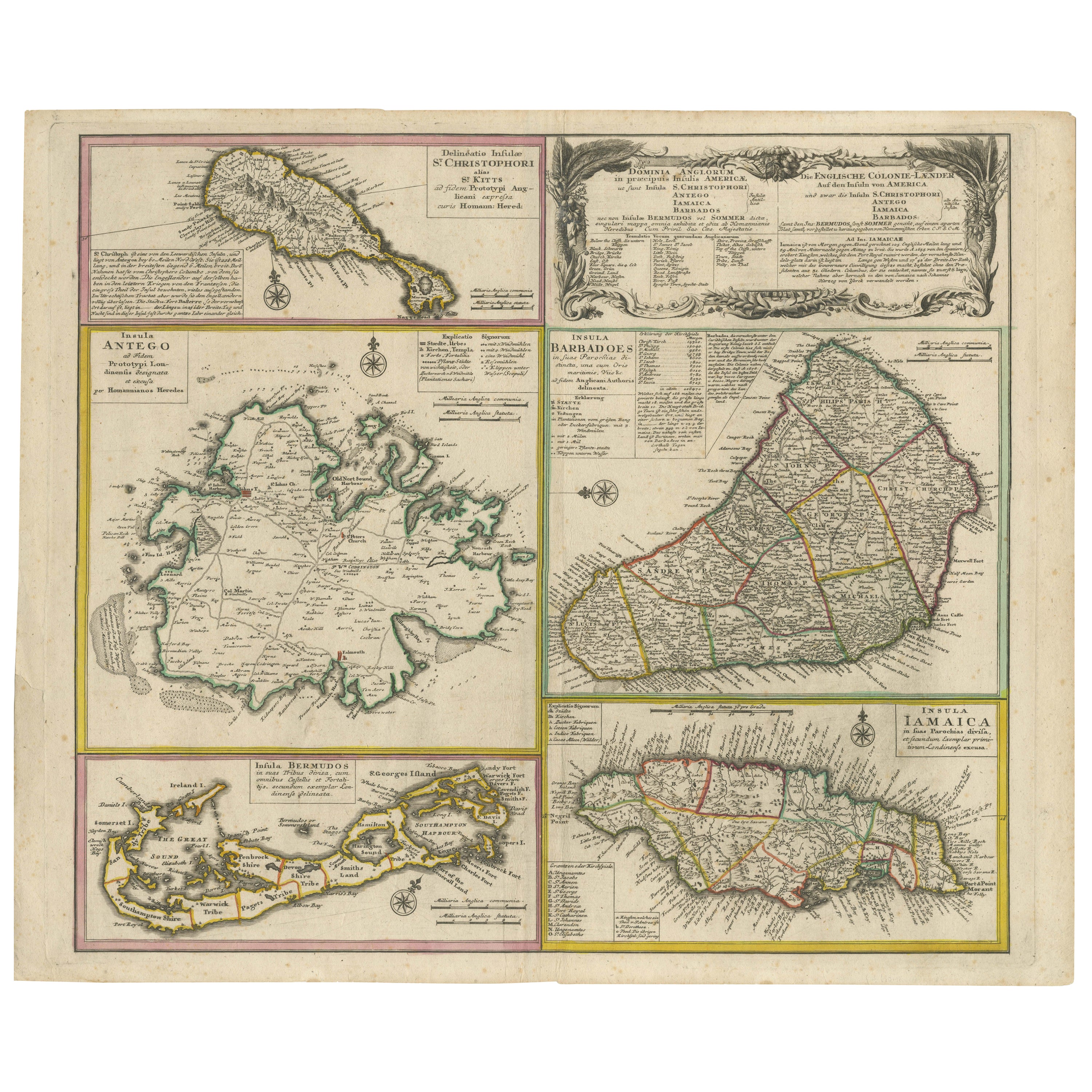
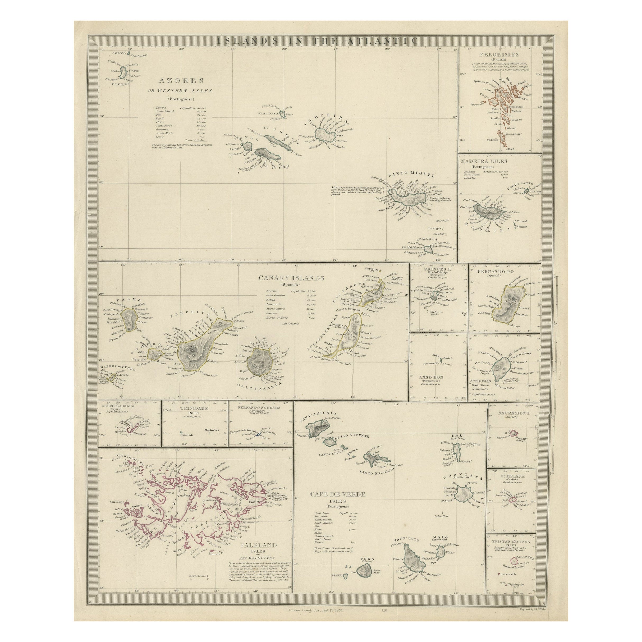
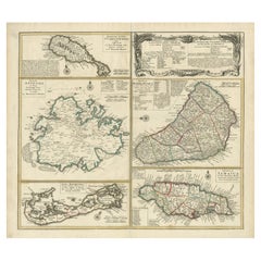
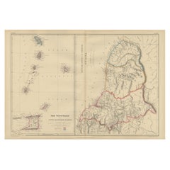
Stunning Map of Caribbean Islands, Incl Jamaica, Bermuda, Barbados and St. Kitts
View Similar Items

Want more images or videos?
Request additional images or videos from the seller
1 of 6
Stunning Map of Caribbean Islands, Incl Jamaica, Bermuda, Barbados and St. Kitts
About the Item
- Creator:Homann Heirs (Artist)
- Dimensions:Height: 19.89 in (50.5 cm)Width: 23.23 in (59 cm)Depth: 0.02 in (0.5 mm)
- Materials and Techniques:
- Period:
- Date of Manufacture:circa 1740
- Condition:Wear consistent with age and use. General age-related toning, minor wear. Original folding line, blank verso. Please study images carefully.
- Seller Location:Langweer, NL
- Reference Number:Seller: BG-132361stDibs: LU3054331004302
About the Seller
5.0
Platinum Seller
These expertly vetted sellers are 1stDibs' most experienced sellers and are rated highest by our customers.
Established in 2009
1stDibs seller since 2017
1,916 sales on 1stDibs
More From This SellerView All
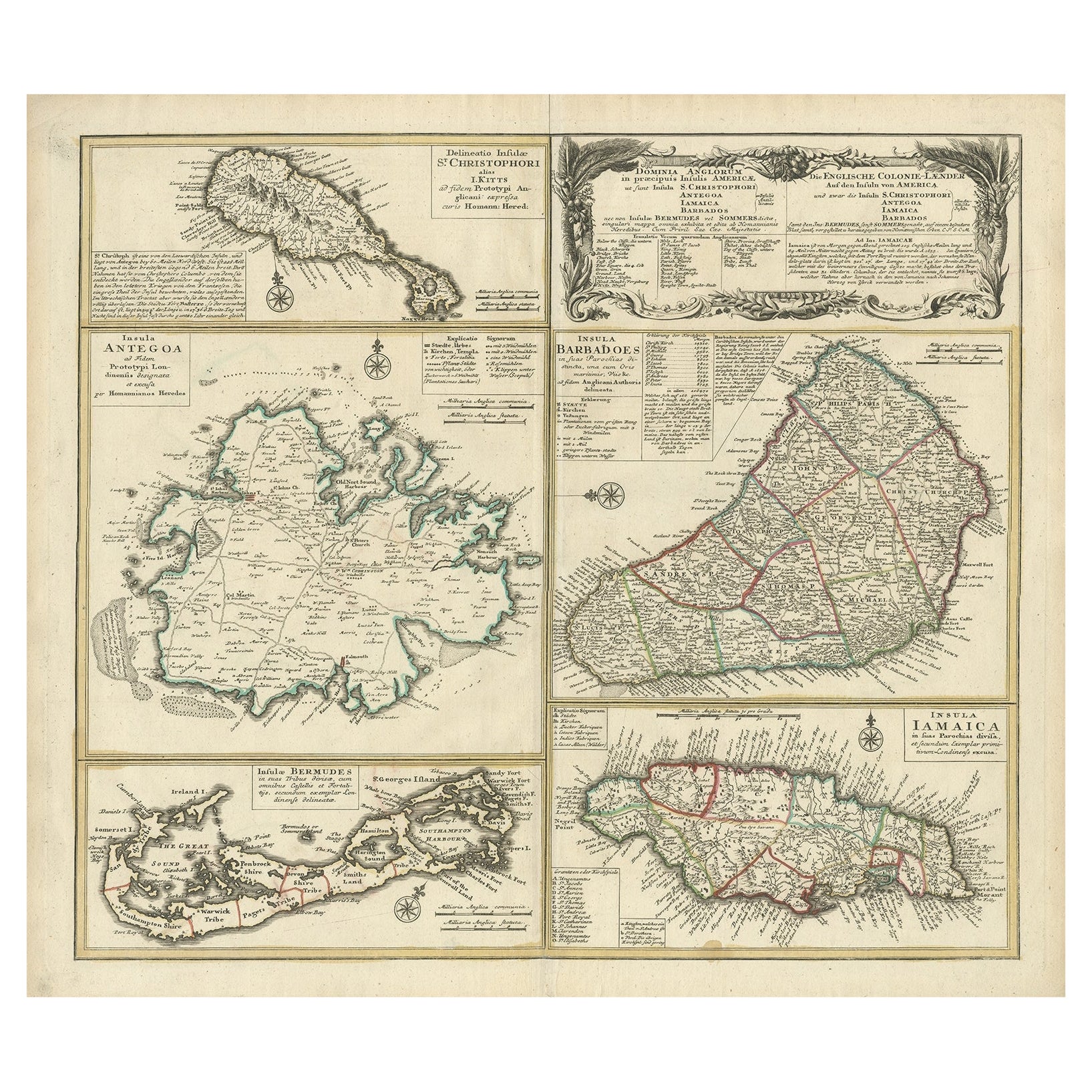
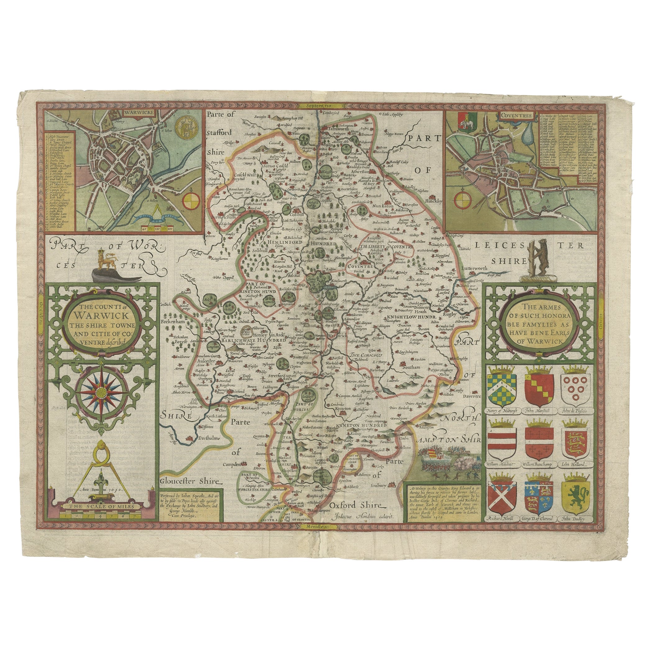
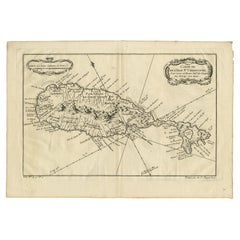
- Original Old Map of St Kitts, Antigua, Bermuda, Barbados, and Jamaica, ca.1745Located in Langweer, NLAntique map titled 'Dominia Anglorum in praecipuis Insulis Americae ut sunt Insula S. Christophori, Antegoa, Iamaica, Barbados nec non Insulae Bermudes vel Sommers dictae. Die Englis...Category
Antique 1740s Maps
MaterialsPaper
 $1,268 Sale Price20% OffFree Shipping
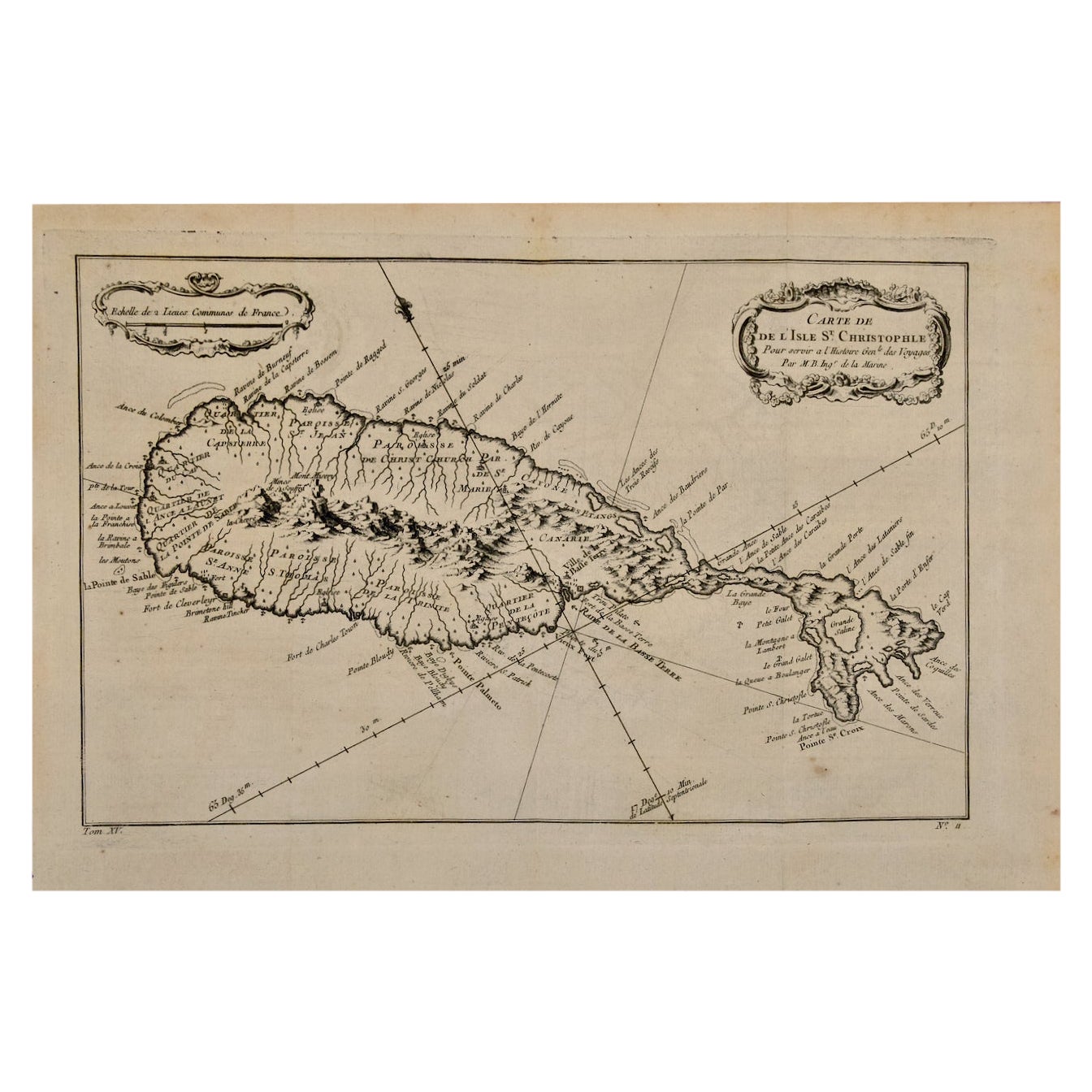
 - Antique Map of the Caribbean Island of St Kitts, ca.1750Located in Langweer, NLDescription: Antique map titled 'Carte de l'Isle St. Christophe pour Servir a l'Histoire Genle. des Voyages.' Detailed map of the Island of St. Kitts, showing the Parishes, towns, ...Category
Antique 1750s Maps
MaterialsPaper
 $630 Sale Price20% Off
 - Detailed Antique Map of the Windward Islands in the CaribbeanBy Covens & MortierLocated in Langweer, NLAntique map titled 'Carte des Antilles Francoises et des Isles Voisines'. Original antique map of the French Antilles, covering an area stretching from Guadeloupe in the north to Gre...Category
Antique Early 18th Century Maps
MaterialsPaper
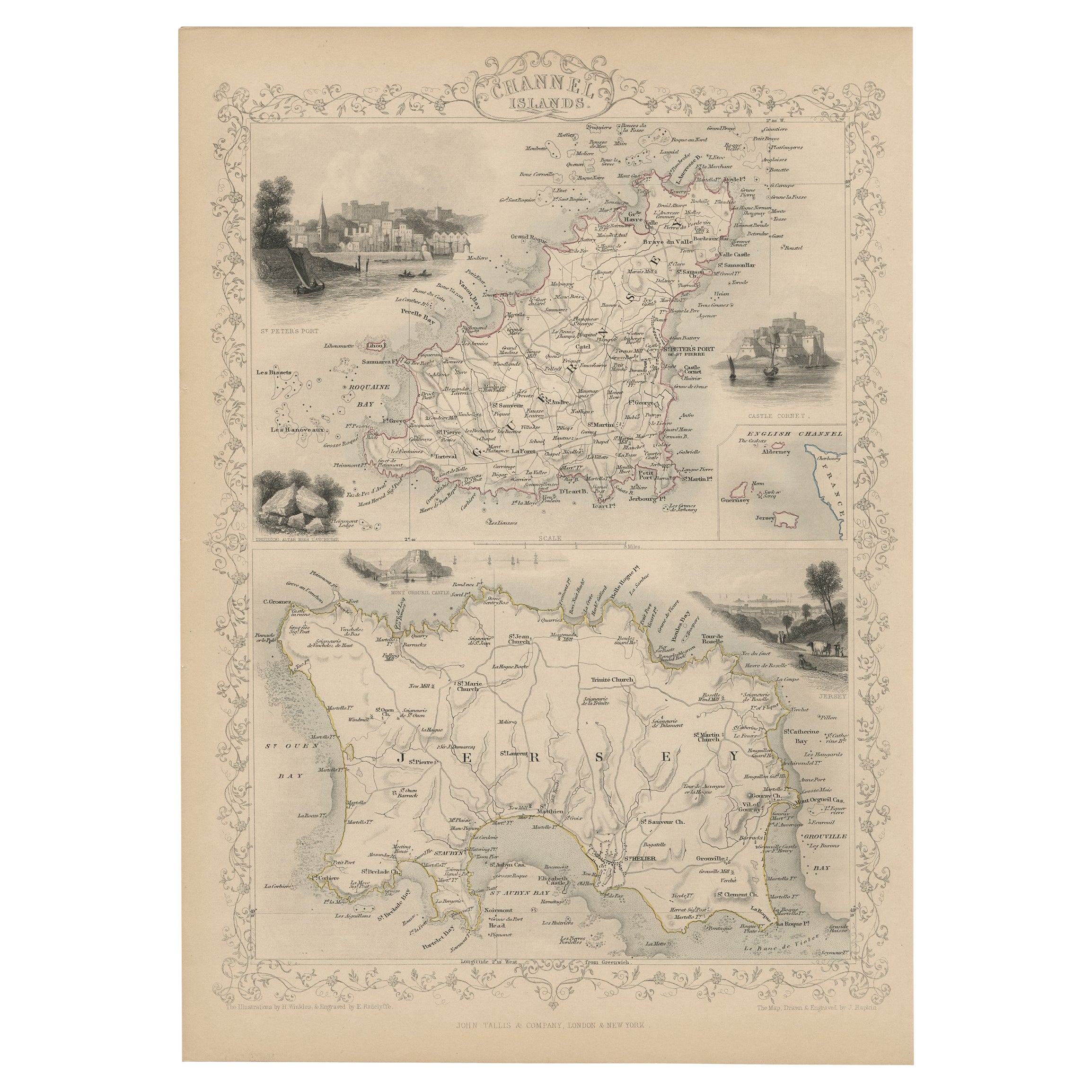
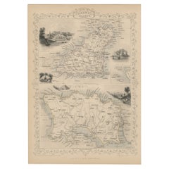
- Original Antique Map of the Channel Islands, Incl. Decorative Vignettes, 1851Located in Langweer, NLAntique map titled ‘Channel Islands’. Includes decorative vignettes titled St. Peters Port, Castle Cornet, Druidical altar near Lancresse, Mont Orgueil Castle and Jersey. Originates from 'The Illustrated Atlas, And Modern History Of The World Geographical, Political, Commercial & Statistical, Edited By R. Montgomery Martin'. Published; John Tallis London, New York, Edinburgh & Dublin. 1851. Drawn and Engraved by J. Rapkin. Artists and engravers: John Tallis (1817-1876) was a British map...Category
Antique 1850s Maps
MaterialsPaper
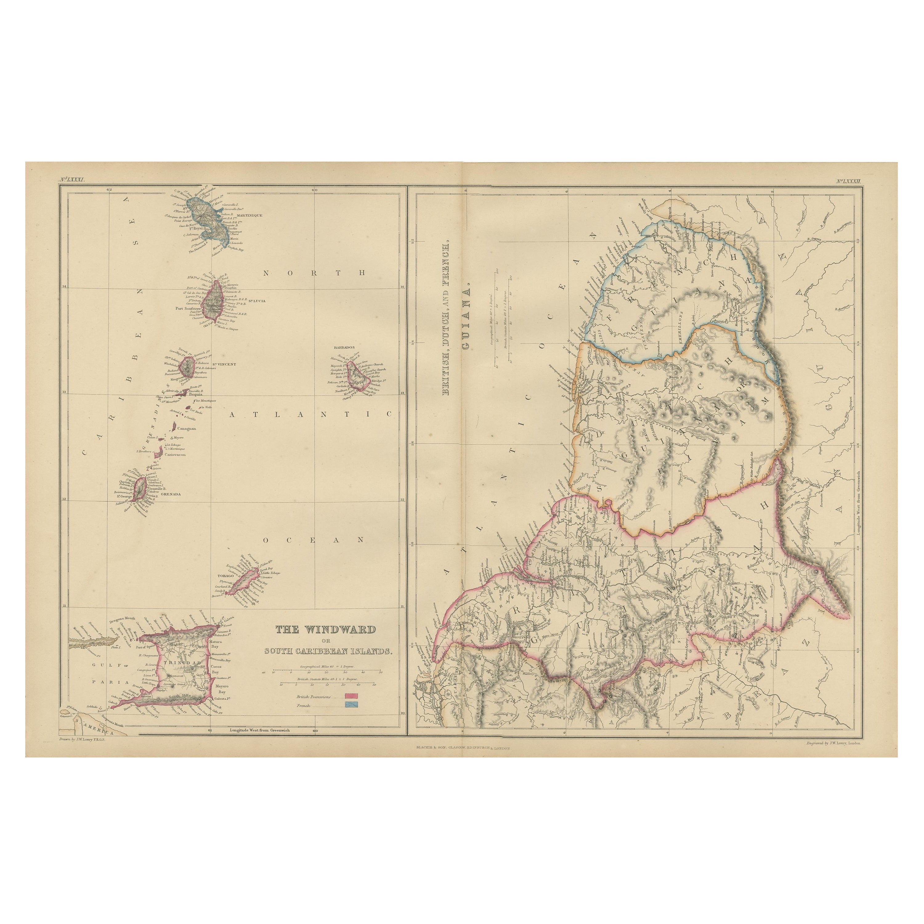
- Antique Map the Windward or South Caribbean Islands and Guiana, 1859Located in Langweer, NLAntique map titled 'The Windward or South Caribbean Islands'. Original antique map of South Caribbean Islands. This map originates from ‘The Imperial Atlas of Modern Geography’. Published by W. G. Blackie, 1859. The Windward Islands, also known as the Islands of Barlovento, are the southern, generally larger islands of the Lesser Antilles. Part of the West Indies, they lie south of the Leeward Islands...Category
Antique Mid-19th Century Maps
MaterialsPaper
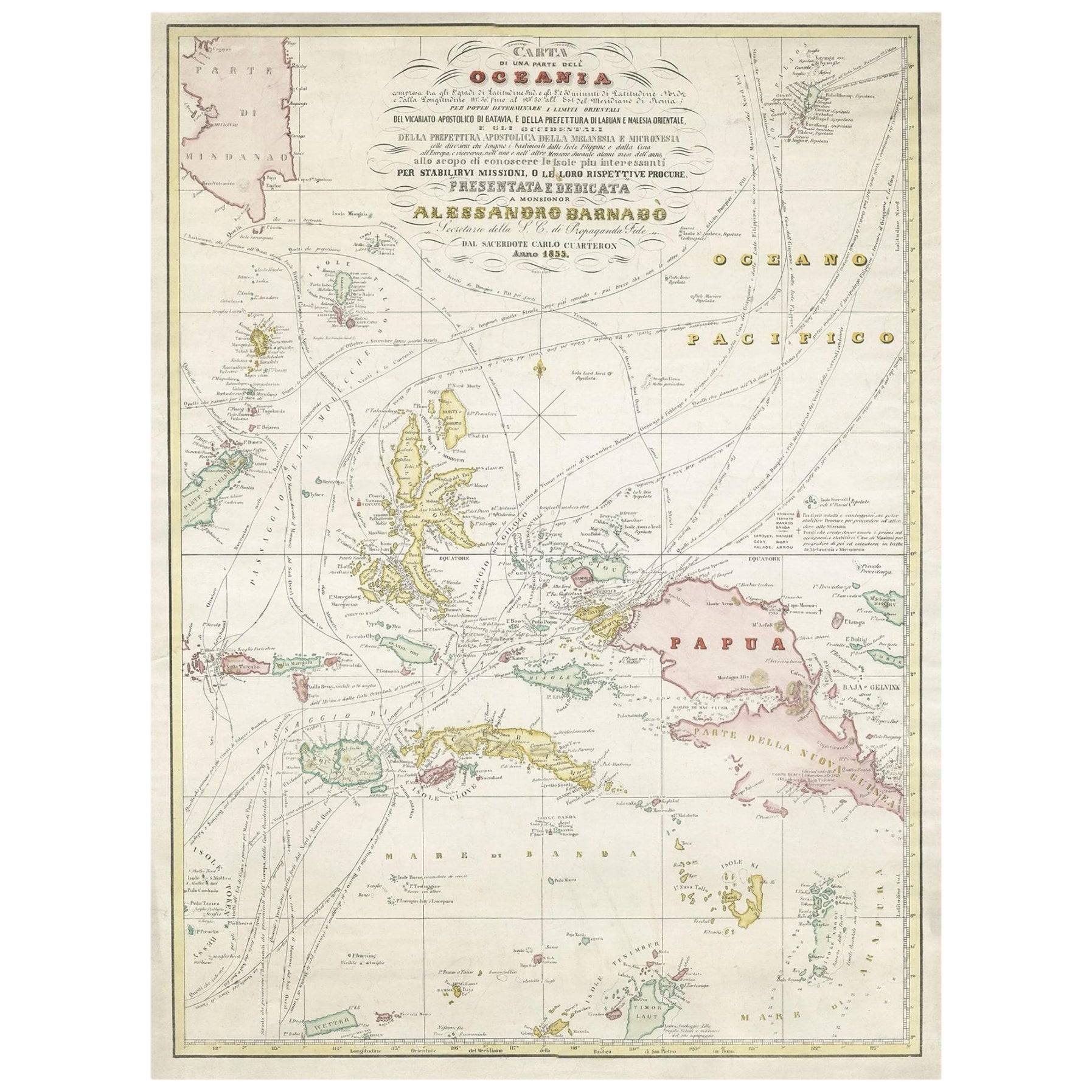
- Large Italian Map of Islands of Oceania, incl Papua, Timor, Banda, Ceram, 1855Located in Langweer, NLDescription: Antique map titled 'Carta di una parte dell'Oceania'. Beautiful large map of the (Spice) islands of Oceania. Depicting Papua, Timor, Ceram, Gilolo and many more. Source ...Category
Antique 1850s Maps
MaterialsPaper
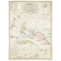 $2,029 Sale Price30% Off

You May Also Like
- St. Christophe 'St. Kitts' Island: An 18th Century Hand-colored Map by BellinBy Jacques-Nicolas BellinLocated in Alamo, CAJacques Bellin's copper-plate map of the Caribbean island of Saint Kitts entitled "Carte De De l'Isle St. Christophe Pour servir á l'Histoire Genle. des V...Category
Antique Mid-18th Century French Maps
MaterialsPaper
- Hand-Colored 18th Century Homann Map of Denmark and Islands in the Baltic SeaBy Johann Baptist HomannLocated in Alamo, CAAn 18th century copper plate hand-colored map entitled "Insulae Danicae in Mari Balthico Sitae utpote Zeelandia, Fionia, Langelandia, Lalandia, Falstria, Fembria Mona" created by Joh...Category
Antique Early 18th Century German Maps
MaterialsPaper
- Map of the Republic of GenoaLocated in New York, NYFramed antique hand-coloured map of the Republic of Genoa including the duchies of Mantua, Modena, and Parma. Europe, late 18th century. Dimension: 25...Category
Antique Late 18th Century European Maps
- Antique Map of Principality of MonacoBy Antonio Vallardi EditoreLocated in Alessandria, PiemonteST/619 - "Old Geographical Atlas of Italy - Topographic map of ex-Principality of Monaco" - ediz Vallardi - Milano - A somewhat special edition ---Category
Antique Late 19th Century Italian Other Prints
MaterialsPaper
 $227 Sale Price74% Off
 - Original Antique Map of Spain and Portugal, circa 1790Located in St Annes, LancashireSuper map of Spain and Portugal Copper plate engraving by A. Bell Published, circa 1790. Unframed.Category
Antique 1790s English Other Maps
MaterialsPaper
- Old Nautical Map of CorsicaLocated in Alessandria, PiemonteST/556/1 - Old map of Corsica isle, surveyed by Captain Hell, of the French Royal Navy in 1824, engraved and published on 1874, with additions and corre...Category
Antique Early 19th Century English Other Prints
MaterialsPaper
 $350 Sale Price20% Off


Recently Viewed
View AllMore Ways To Browse
Compass Antique
Used Furniture Jamaica
Antique Furniture Jamaica
Barbados Furniture
C Moll
Caribbean Antique Furniture
Bermuda Furniture
Caribbean Antiques
Used Furniture Barbados
Antique Island Caribbean
Antique Caribbean Maps
Antique Caribbean Map
Jamaican Antique
Antique Map Caribbean
Antique Maps Caribbean
Caribbean Antique Maps
Caribbean Map Antique
Antique Map Of Caribbean