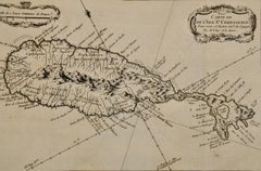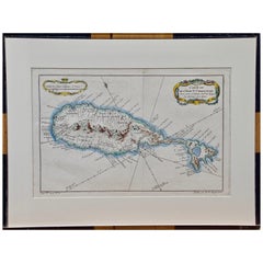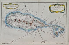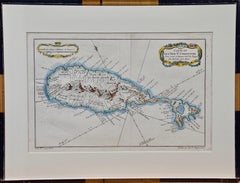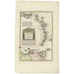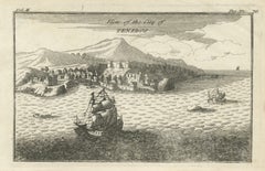

Antique St Eustatius Caribbean View, Ships Harbor, Tournefort 1717
Located in Langweer, NL
Antique St Eustatius Caribbean View, Ships Harbor, Tournefort 1717 A highly evocative early 18th-century engraved view of the Caribbean island of St.
Category
Antique Early 18th Century British Maps
Materials
Paper