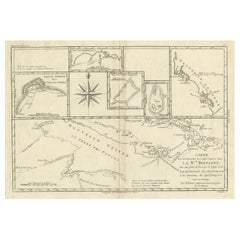
Items Similar to Detailed Antique Map of Santa Domingo, Puerto Rico, Eastern Bahamas, ca. 1780
Want more images or videos?
Request additional images or videos from the seller
1 of 5
Detailed Antique Map of Santa Domingo, Puerto Rico, Eastern Bahamas, ca. 1780
About the Item
Description: Antique map titled 'L'Isle De St. Domingue, et celle De Porto-Rico.'
Detailed map of Santa Domingo, Puerto Rico, etc. Includes substantial topographical detail. Includes Eastern Bahamas. This map originates from 'Atlas de Toutes les Parties Connues du Globe Terrestre'.
Artists and Engravers: Rigobert Bonne (1727-1795 ) was one of the most important cartographers of the late 18th century. In 1773 he succeeded Jacques Bellin as Royal Cartographer to France in the office of the Hydrographer at the Depôt de la Marine. Working in his official capacity Bonne compiled some of the most detailed and accurate maps of the period. Bonne's work represents an important step in the evolution of the cartographic ideology away from the decorative work of the 17th and early 18th century towards a more detail oriented and practical aesthetic. With regard to the rendering of terrain Bonne maps bear many stylistic similarities to those of his predecessor, Bellin. However, Bonne maps generally abandon such common 18th century decorative features such as hand coloring, elaborate decorative cartouches, and compass roses. While mostly focusing on coastal regions, the work of Bonne is highly regarded for its detail, historical importance, and overall aesthetic appeal.
Condition: Good, given age. Slight discolouration near middle fold. Small crease top right margin. Some miniscule unobtrusive wormholes in the lower margin, and two tiny pinholes beside the middle fold in the center of the sheet. Original middle fold as issued. A crease in the lower left margin corner. General age-related toning and/or occasional minor defects from handling. Please study image carefully.
- Dimensions:Height: 11.42 in (29 cm)Width: 15.12 in (38.4 cm)Depth: 0 in (0.02 mm)
- Materials and Techniques:
- Period:1780-1789
- Date of Manufacture:circa 1780
- Condition:
- Seller Location:Langweer, NL
- Reference Number:
About the Seller
5.0
Platinum Seller
These expertly vetted sellers are 1stDibs' most experienced sellers and are rated highest by our customers.
Established in 2009
1stDibs seller since 2017
1,916 sales on 1stDibs
Typical response time: <1 hour
- ShippingRetrieving quote...Ships From: Langweer, Netherlands
- Return PolicyA return for this item may be initiated within 14 days of delivery.
More From This SellerView All
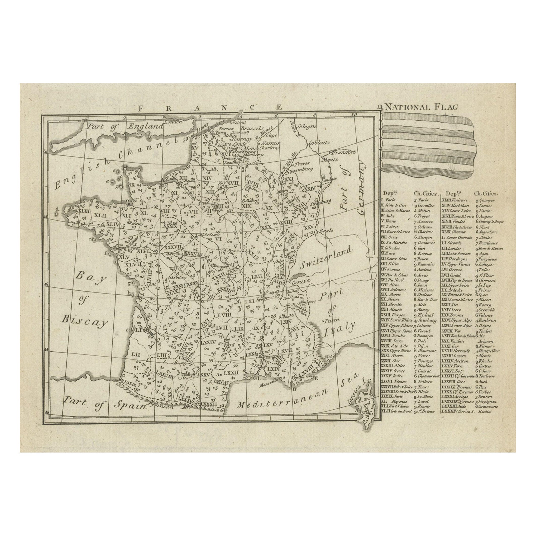
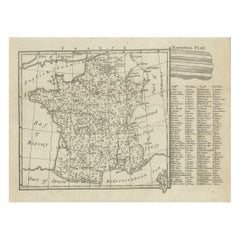
- Small Detailed Antique Map of France, c.1780Located in Langweer, NLAntique map titled 'France'. Small, detailed map of France with legend. Also depicting the English Channel, Bay of Biscay, Part of Spain, the Mediterranean Sea, Part of Italy, Switze...Category
Antique 18th Century Maps
MaterialsPaper
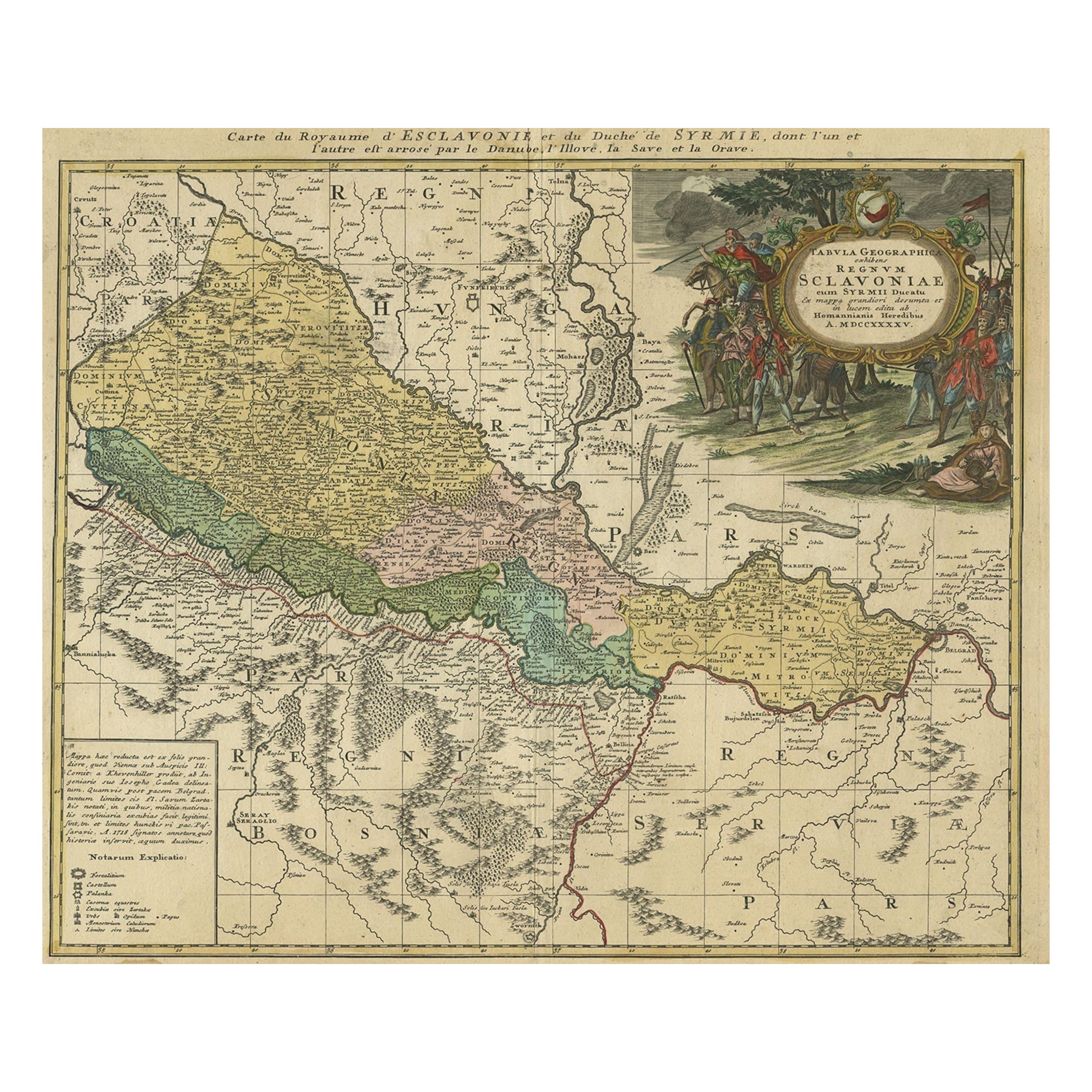
- Detailed Antique Map of Slavonia, the Region in Eastern Croatia, ca.1745Located in Langweer, NLAntique map titled 'Tabula Geographica exhibens Regnum Sclavoniae.' Detailed map of Slavonia, the region in eastern Croatia. Map is dated shortly after the Peace of Belgrade sign...Category
Antique 1740s Maps
MaterialsPaper
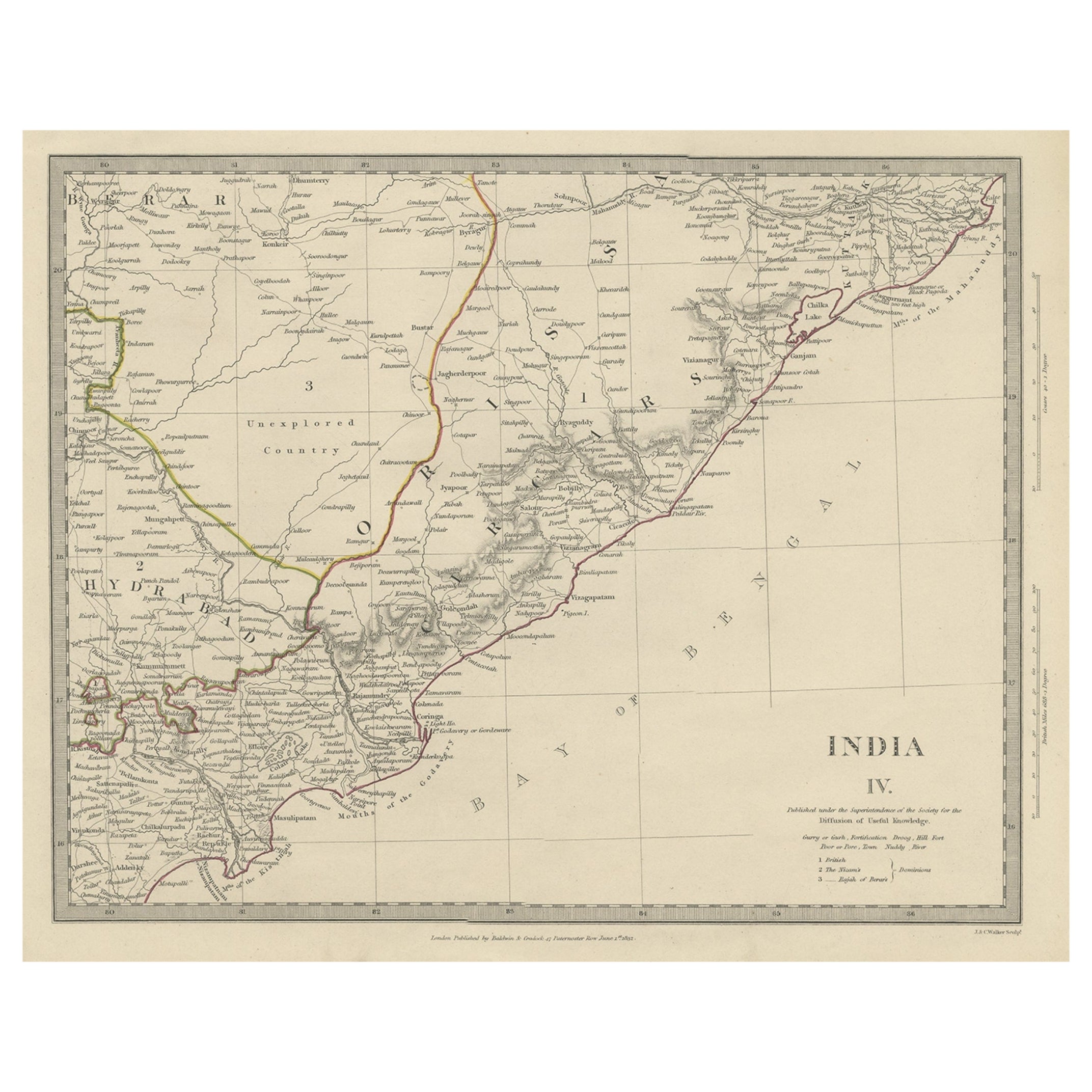
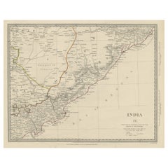
- Interesting Detailed Antique Map of Eastern India, 1832Located in Langweer, NLAntique map titled 'India IV'. Old steel engraved map of the eastern part of India, including the Bay of Bengal, Hydrabad and Masulipatam. Artists and...Category
Antique 19th Century Maps
MaterialsPaper
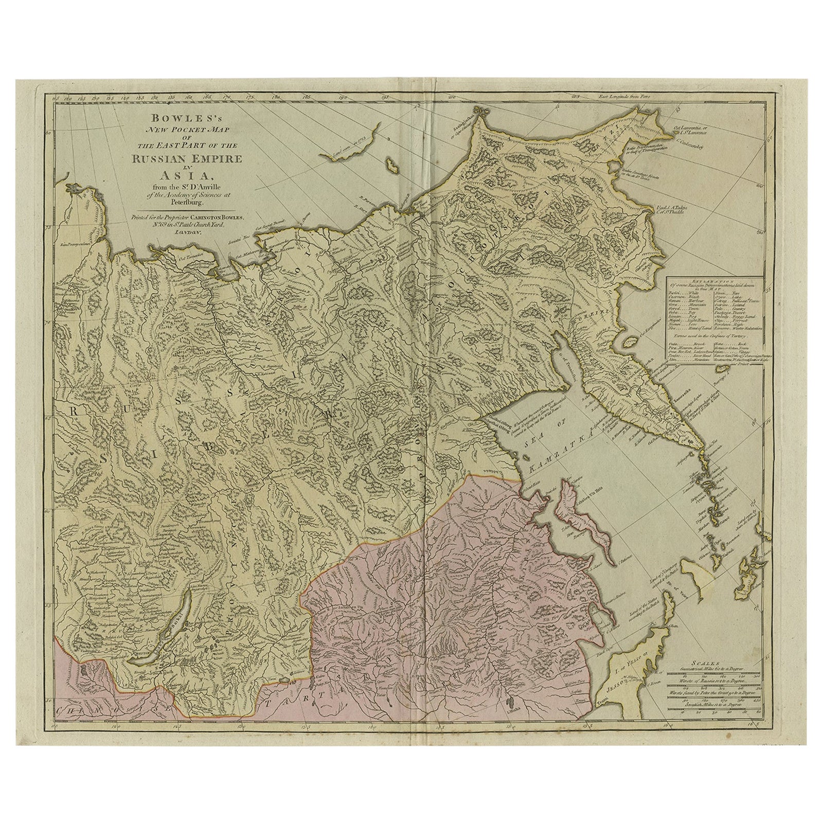
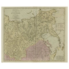
- Large and Detailed Map of the Russian Empire in Asia, ca.1780Located in Langweer, NLDescription: Antique map titled 'Bowles's New Pocket Map of the East Part of the Russian Empire in Asia'. Large and detailed map of the Russian Empire in Asia. Source unknown, to be determined. Artists and Engravers: Made by 'Thomas & Carington Bowles' after 'D'Anville'. Thomas Bowles, born around 1712, was map publisher and seller in London...Category
Antique 1780s Maps
MaterialsPaper
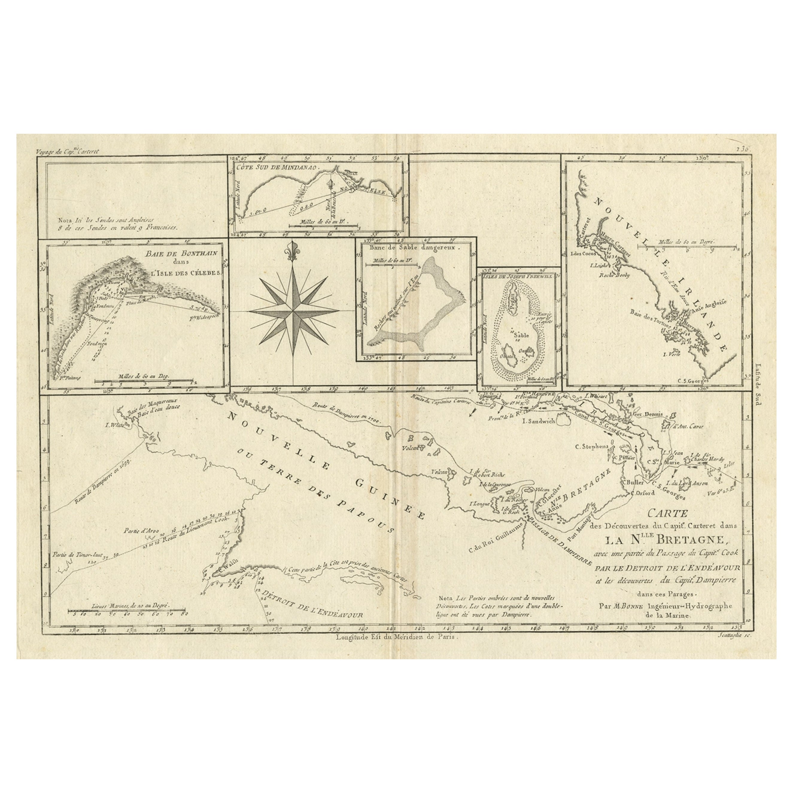
- Antique Detailed Map of Papua New Guinea and the Regions to the West, ca.1780Located in Langweer, NLAntique map titled 'Carte des Decouvertes du Capite. Carteret dans La Nlle. Bretagne avec une parte du passage du Capite. Cook Par Le Detroit De L'Endeavor ...Category
Antique 1780s Maps
MaterialsPaper
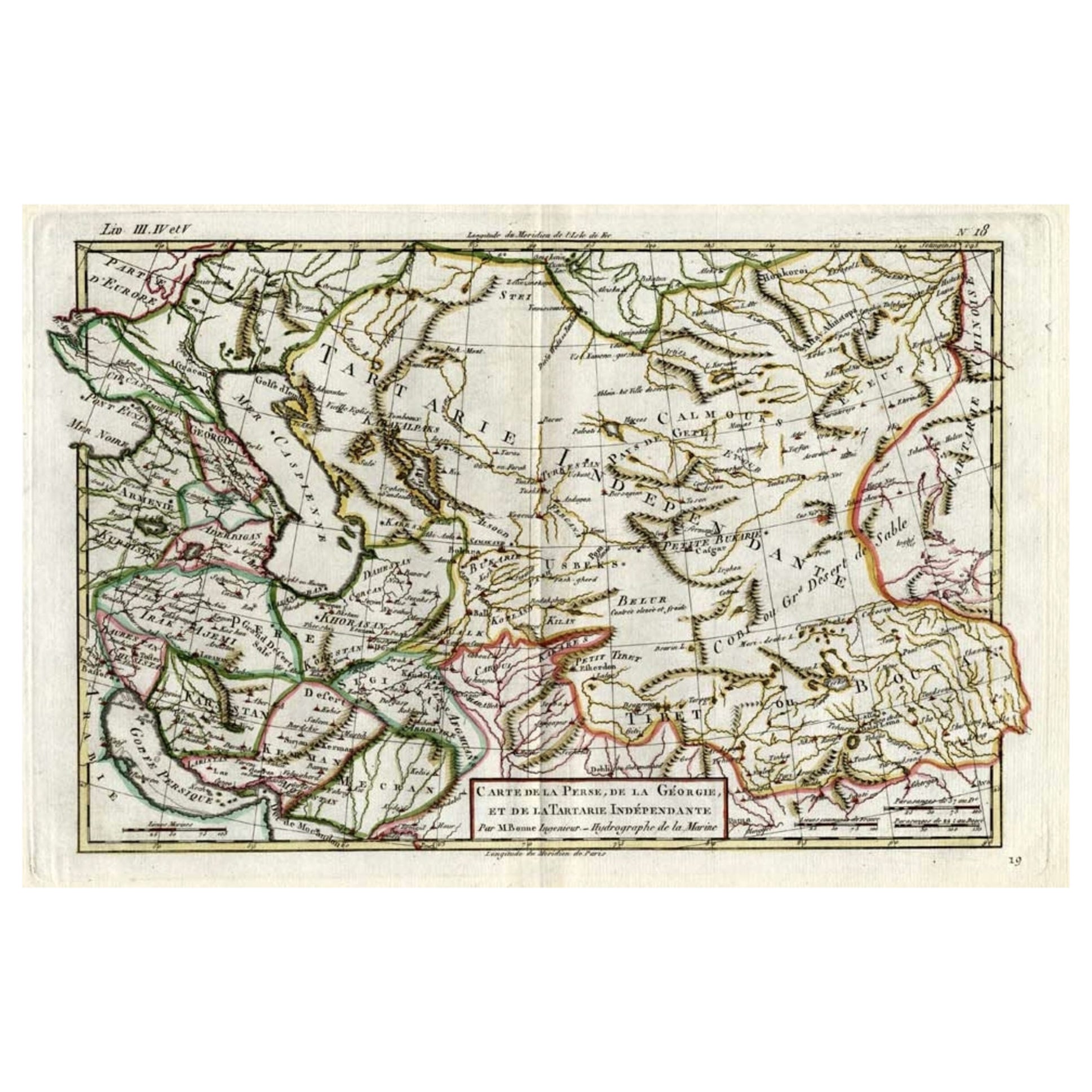
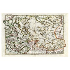
- Antique Map of Persia, Georgia and Kazakhstan, ca.1780Located in Langweer, NLAntique map titled 'Carte de la Perse, de la Georgie, et de la Tartarie Independante'. Map of Persia, Georgia and Kazakhstan. This map shows current days Georgia, Iran, Irak, Kaz...Category
Antique 1780s Maps
MaterialsPaper
You May Also Like
- Original Antique Map of Italy. C.1780Located in St Annes, LancashireGreat map of Italy Copper-plate engraving Published C.1780 Unframed.Category
Antique Early 1800s English Georgian Maps
MaterialsPaper

- Original Antique Map of Asia. C.1780Located in St Annes, LancashireGreat map of Asia Copper-plate engraving Published C.1780 Two small worm holes to right side of map Unframed.Category
Antique Early 1800s English Georgian Maps
MaterialsPaper

- Original Antique Map of India. C.1780Located in St Annes, LancashireGreat map of India Copper-plate engraving Published C.1780 Three small worm holes to right side of map and one bottom left corner Unframed.Category
Antique Early 1800s English Georgian Maps
MaterialsPaper

- Original Antique Map of South America. C.1780Located in St Annes, LancashireGreat map of South America Copper-plate engraving Published C.1780 Two small worm holes to left side of map Unframed.Category
Antique Early 1800s English Georgian Maps
MaterialsPaper
- Super Rare Antique French Map of Chine and the Chinese Empire, 1780Located in Amsterdam, Noord HollandSuper Rare Antique French Map of Chine and the Chinese Empire, 1780 Very nice map of Asia. 1780 Made by Bonne. Additional information: Type: Map ...Category
Antique 18th Century European Maps
MaterialsPaper
- Antique Map of Principality of MonacoBy Antonio Vallardi EditoreLocated in Alessandria, PiemonteST/619 - "Old Geographical Atlas of Italy - Topographic map of ex-Principality of Monaco" - ediz Vallardi - Milano - A somewhat special edition ---Category
Antique Late 19th Century Italian Other Prints
MaterialsPaper


Recently Viewed
View AllMore Ways To Browse
Middle Eastern Antiques
Topographical Map
Compass Map
Small Antique Globes
La Marine Antique
Compass Rose Antique
Antique Compass Rose
Folding Step
Orient Map
Map Of Orient
Used Furniture Depot
Antique Topographic Maps
Antique Map Compass
Compass Antique Map
Antique Compass Map
Antique Map Globe
Globe Compass
Antique Depot