Items Similar to Interesting Detailed Antique Map of Eastern India, 1832
Want more images or videos?
Request additional images or videos from the seller
1 of 6
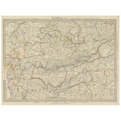
Interesting Detailed Antique Map of Eastern India, 1832
About the Item
Antique map titled 'India IV'. Old steel engraved map of the eastern part of India, including the Bay of Bengal, Hydrabad and Masulipatam.
Artists and Engravers: Engraved by J. & C. Walker. Published under the superintendence of the Society for the Diffusion of Useful Knowledge. Published by Baldwin & Cradock.
Condition: Very good, general age-related toning. Please study image carefully.
Date: 1832
Overall size: 41 x 34.5 cm.
Image size: 34.5 x 27 cm.
We sell original antique maps to collectors, historians, educators and interior decorators all over the world. Our collection includes a wide range of authentic antique maps from the 16th to the 20th centuries. Buying and collecting antique maps is a tradition that goes back hundreds of years. Antique maps have proved a richly rewarding investment over the past decade, thanks to a growing appreciation of their unique historical appeal. Today the decorative qualities of antique maps are widely recognized by interior designers who appreciate their beauty and design flexibility. Depending on the individual map, presentation, and context, a rare or antique map can be modern, traditional, abstract, figurative, serious or whimsical.
- Dimensions:Height: 13.59 in (34.5 cm)Width: 16.15 in (41 cm)Depth: 0 in (0.01 mm)
- Materials and Techniques:
- Period:
- Date of Manufacture:1832
- Condition:Condition: Very good, general age-related toning. Please study image carefully.
- Seller Location:Langweer, NL
- Reference Number:
About the Seller
5.0
Platinum Seller
These expertly vetted sellers are 1stDibs' most experienced sellers and are rated highest by our customers.
Established in 2009
1stDibs seller since 2017
1,933 sales on 1stDibs
Typical response time: <1 hour
- ShippingRetrieving quote...Ships From: Langweer, Netherlands
- Return PolicyA return for this item may be initiated within 14 days of delivery.
More From This SellerView All
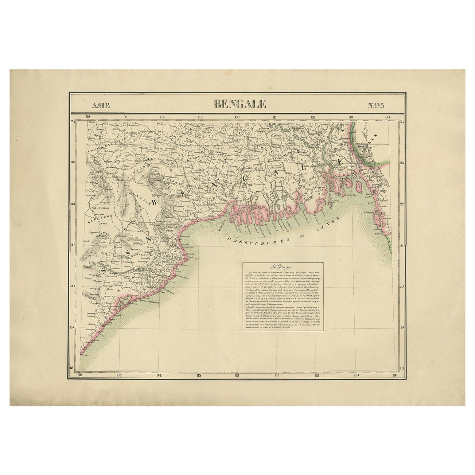
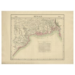
- Detailed Orginal Antique Map of Bengal, India, c.1825Located in Langweer, NLAntique map titled 'No. 95 Bengale'. Detailed map of Bengal, Bangladesh. With text about the Ganges river. Originates from 'Atlas Universel' by P.M. Vand...Category
Antique 19th Century Maps
MaterialsPaper
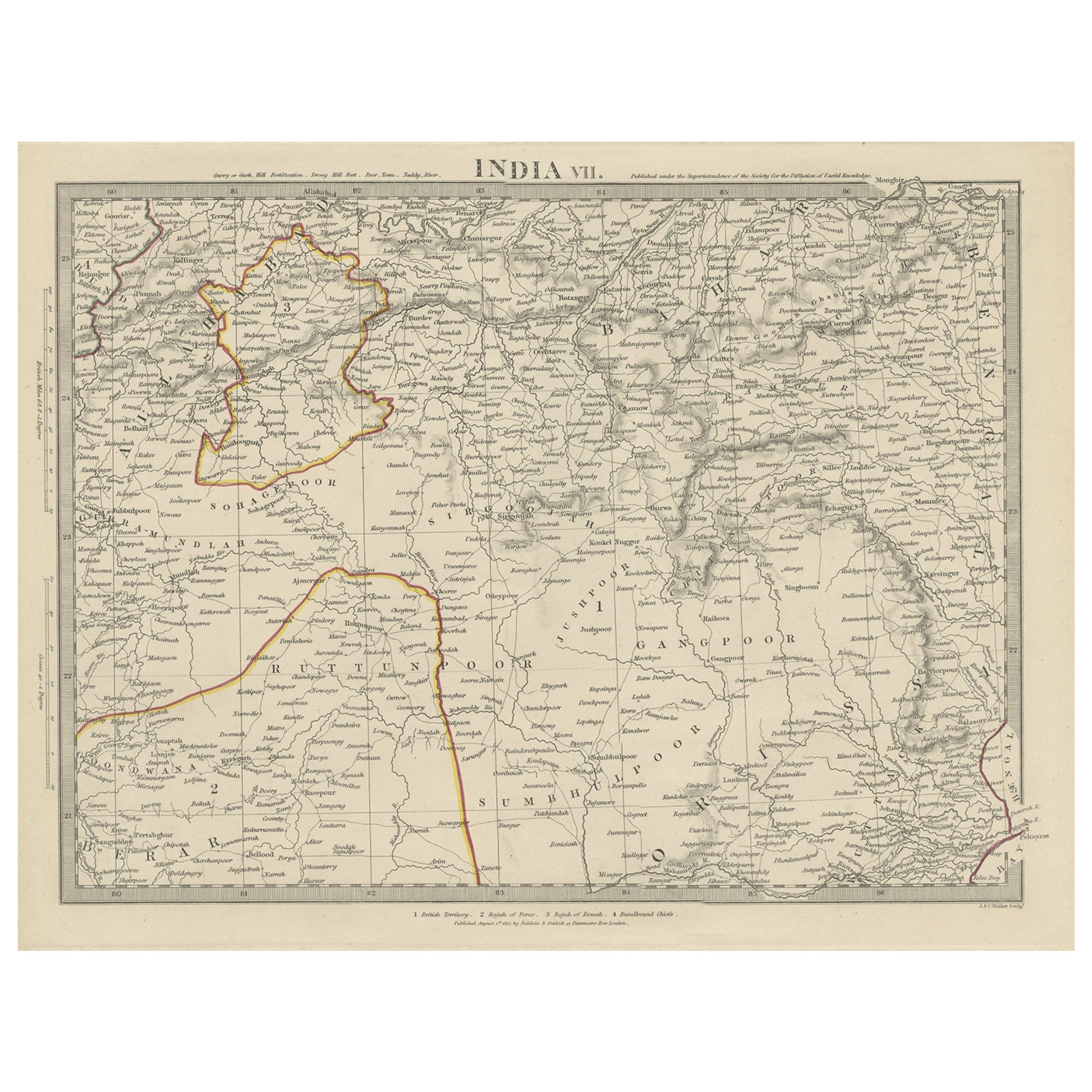
- Antique Map of the Region of Berar and Rewah in India, 1832Located in Langweer, NLAntique map titled 'India VII'. Old steel engraved map of part of India including the Rajah of Berar, the Rajah of Rewah and British Territory. Artists and Engravers: Engraved by...Category
Antique 19th Century Maps
MaterialsPaper
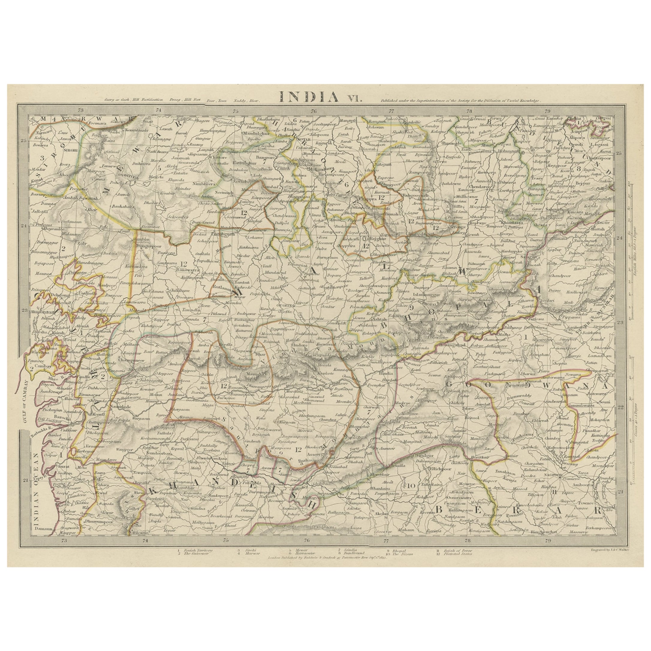
- Detailed Antique Map of the Region of Malwa in India, 1833Located in Langweer, NLAntique map titled 'India VI'. Old steel engraved map of the region of Malwa showing great detail. Artists and Engravers: Engraved by J. & C. Walker. Published under the superint...Category
Antique 19th Century Maps
MaterialsPaper
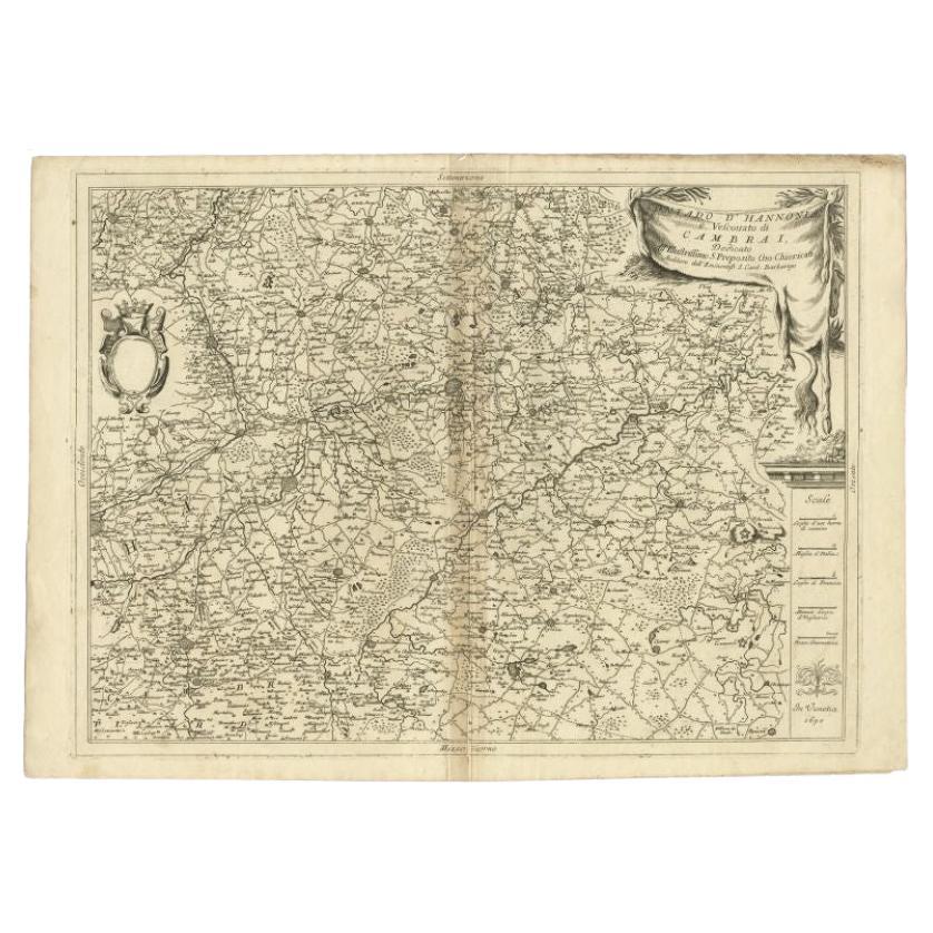
- Detailed Antique Map of Western Belgium and Eastern France by Coronelli, 1690By Vincenzo CoronelliLocated in Langweer, NLAntique map titled 'Contado d'Hannonia (..)'. Map of western Belgium and eastern France, from south of Brussels (not shown) to Cambrai, France, generally centered around the towns of...Category
Antique 17th Century Maps
MaterialsPaper
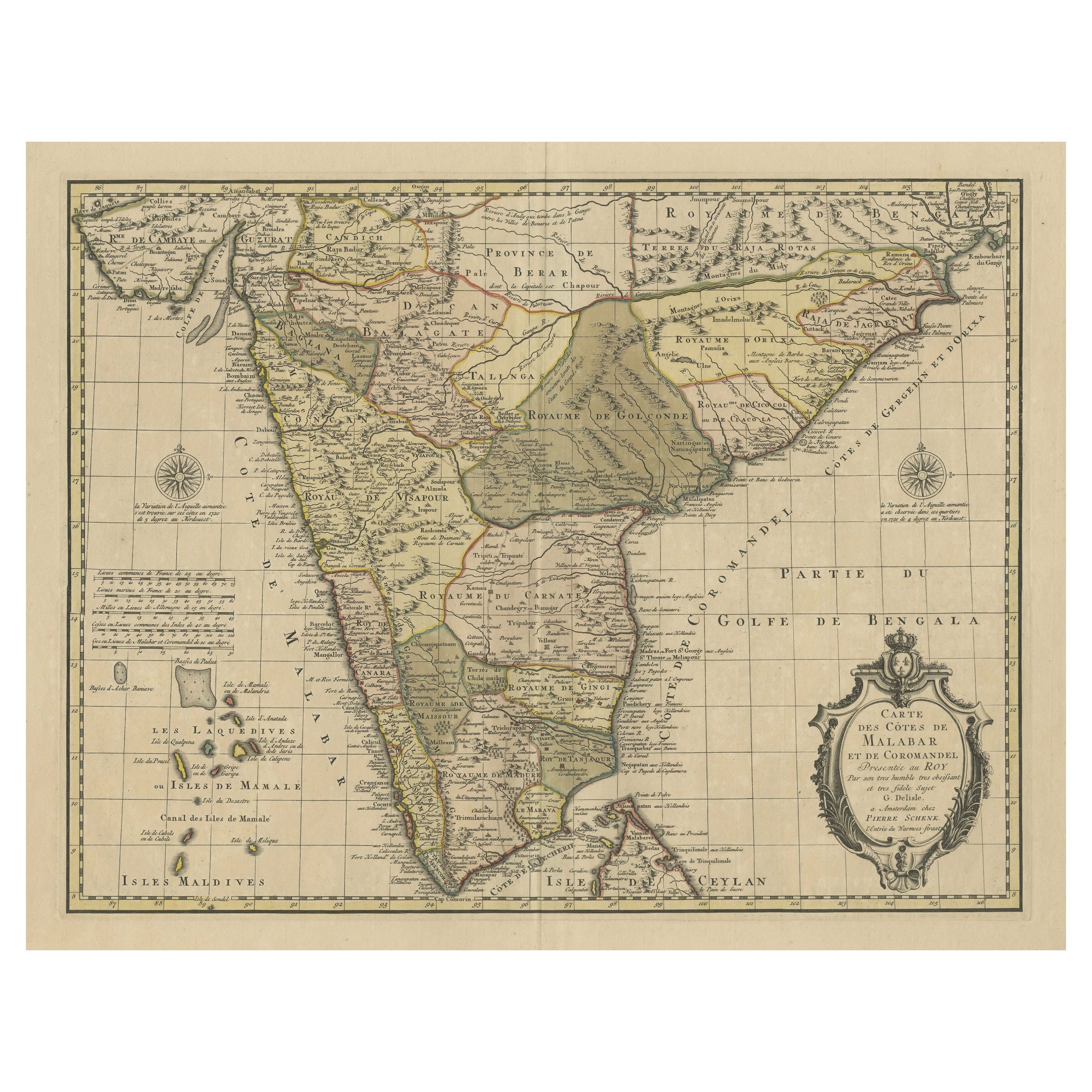
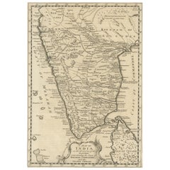
- Detailed Decorative Antique Map of the Coast of Malabar and Coromandel, IndiaLocated in Langweer, NLAntique map titled 'Carte des Côtes de Malabar et de Coromandel'. Finely engraved map of the southern part of India, first issued in 1723 by acclaimed French mapmaker Guillaume De L’...Category
Antique Mid-18th Century Maps
MaterialsPaper
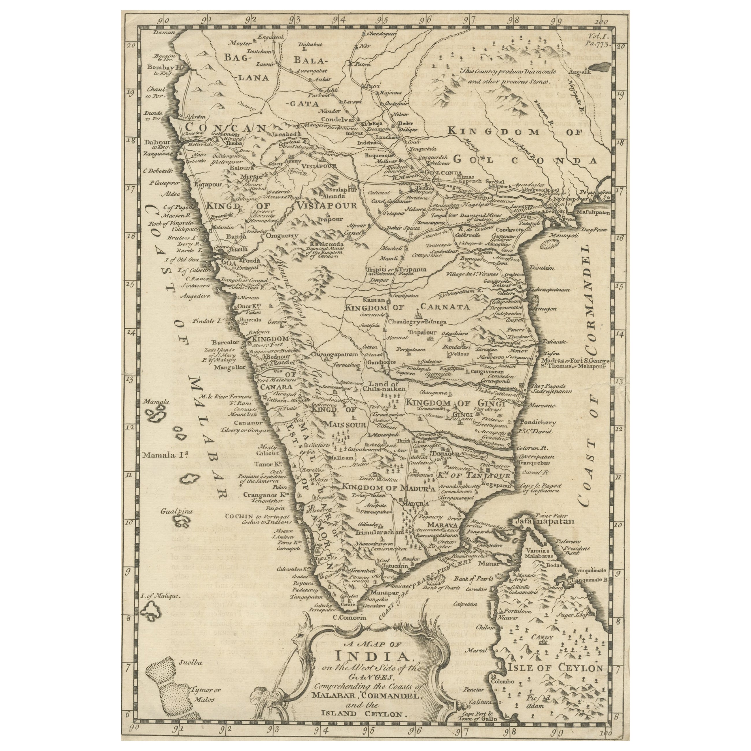
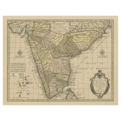
- Original Detailed Antique Map of Southern India and Most of Ceylon, 1744Located in Langweer, NLAntique map titled 'A Map of India on the west Side of the Ganges, comprehending the coasts of Malabar, Coromandel and the Island Ceylon'. Map of Southern India and most of Ceylo...Category
Antique 1740s Maps
MaterialsPaper

You May Also Like
- Original Antique Map of India. C.1780Located in St Annes, LancashireGreat map of India Copper-plate engraving Published C.1780 Three small worm holes to right side of map and one bottom left corner Unframed.Category
Antique Early 1800s English Georgian Maps
MaterialsPaper

- Scandinavia & Portions of Eastern Europe: 18th Century Hand-Colored Homann MapBy Johann Baptist HomannLocated in Alamo, CAAn early 18th century hand-colored copper-plate map entitled "Regni Sueciae in omnes suas Subjacentes Provincias accurate divisi Tabula Generalis" by Johann Baptist Homann (1663-1724...Category
Antique Early 18th Century German Maps
MaterialsPaper
- Antique Map of Principality of MonacoBy Antonio Vallardi EditoreLocated in Alessandria, PiemonteST/619 - "Old Geographical Atlas of Italy - Topographic map of ex-Principality of Monaco" - ediz Vallardi - Milano - A somewhat special edition ---Category
Antique Late 19th Century Italian Other Prints
MaterialsPaper
- Original Antique Map of Italy. C.1780Located in St Annes, LancashireGreat map of Italy Copper-plate engraving Published C.1780 Unframed.Category
Antique Early 1800s English Georgian Maps
MaterialsPaper

- Original Antique Map of Asia. C.1780Located in St Annes, LancashireGreat map of Asia Copper-plate engraving Published C.1780 Two small worm holes to right side of map Unframed.Category
Antique Early 1800s English Georgian Maps
MaterialsPaper

- Large Antique 1859 Map of North AmericaLocated in Sag Harbor, NYThis Map was made by Augustus Mitchell in 1859 It is in amazing condition for being 163 years old. This price is for the rolled up easy to ship version of this piece. I will be Frami...Category
Antique Mid-19th Century American Maps
MaterialsCanvas, Paper


Recently Viewed
View AllMore Ways To Browse
Interesting Antique
Antique Collection India
C Baldwin
J C Walker Map
Bay Of Bengal
Bay Bengal
Map Of Bengal
Bengal Map
Used Nautical Charts
Antique World Chart
Map Of Great Britain
Antique Char
Hand Painted Antique Map
Antique Furniture Depot
Hemisphere Antiques
Antique Map Mexico
Antique Mexico Map
17th Century Scottish