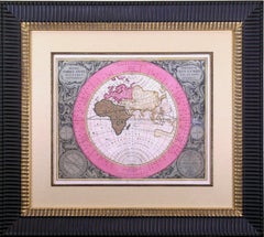
Antique World Chart
7
to
22
159
62
147
100
58
44
31
16
16
16
13
12
11
11
7
6
6
6
6
6
4
4
3
3
3
3
3
2
2
1
1
1
1
1
1
1
1
1
1
18
5
3
3
2
Sort By
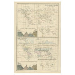
Antique Zoological Chart of the World, 1854
Located in Langweer, NL
Antique map titled 'Zoological Chart of the World'. Total of six maps and insets. Insets of the
Category
19th Century Antique World Chart
Materials
Paper
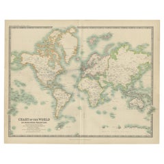
Antique Chart of the World by Johnston '1909'
Located in Langweer, NL
Antique map titled 'Chart of the World on Mercator's Projection Showing the directions of the
Category
Early 20th Century Antique World Chart
Materials
Paper
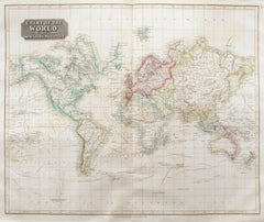
John Thomson (1777-1840) - 1830 Map Engraving, Chart of the World
By John Thomson
Located in Corsham, GB
A fine engraved map of the world on Mercator's projection, from the second edition of John
Category
Early 19th Century Antique World Chart
Materials
Engraving
H 20.48 in W 24.41 in
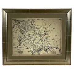
Copy of 1901 Chart of Boston Harbor
Located in Norwell, MA
Later copy after an original Boston Harbor chart by George Eldridge of Vineyard Haven and Boston
Category
1910s North American Antique World Chart
Materials
Paper
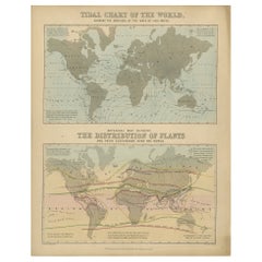
Antique Tidal Chart and Botanical Map, 1843
Located in Langweer, NL
Two antique world maps on one sheet. The upper map is a tidal chart of the world and shows the
Category
19th Century Antique World Chart
Materials
Paper
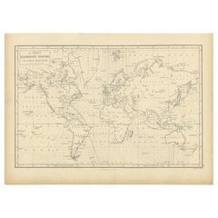
Antique Chart with Isomagnetic Lines by Black, 1854
Located in Langweer, NL
Antique map titled 'A Chart of Magnetic Curves of Equal Variation'. Chart with isomagnetic lines on
Category
19th Century Antique World Chart
Materials
Paper
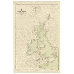
Large Sea Chart of the British Islands, 1918
Located in Langweer, NL
Antique map titled 'The British Islands'.
Large sea chart of the British Islands. It shows
Category
1910s Antique World Chart
Materials
Paper
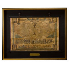
1847 “World at One View” Antique Hand-Colored Wall Map of the World
Located in Colorado Springs, CO
views, female costumes of the world, and statistical charts of river lengths.
The map presents a subtle
Category
19th Century American Antique World Chart
Materials
Paper
Hemispharium Orbis Antiquri. (Ancient World)
By Andreas Cellarius
Located in Florham Park, NJ
century work on the Heavens, Harmonia Macrocosmica. These exquisite maps chart the scientific advances in
Category
18th Century and Earlier Academic Antique World Chart
Materials
Laid Paper
Antique Physical Chart of the Indian Ocean by Johnston, 1850
Located in Langweer, NL
Antique map titled 'Physical Chart of the Indian Ocean'. This map shows the temperature of the
Category
19th Century Antique World Chart
Materials
Paper
Antique Print with Charts of Hemispheres by Scherer, c.1703
Located in Langweer, NL
Various antique charts of hemispheres illustrating the positioning of the earth. Printed for
Category
18th Century Antique World Chart
Materials
Paper
Four 18th Century Celestial Charts Engravings in Brass Frames by Doppelmayr
By Johann Gabriel Doppelmayr 1
Located in London, GB
celestial charts from 1704 onward, in his determination to explain the Copernican-Huygens world system
Category
18th Century German Antique World Chart
Materials
Brass
H 29.14 in W 31.5 in D 1.11 in
Flanders, Holland & Norfolk: Hand-Colored 17th Century Sea Chart by Collins
By Captain Greenvile Collins
Located in Alamo, CA
This hand-colored chart of the seas about Flanders, Holland, Frisia, and Norfolk is from "Great
Category
Late 17th Century English Antique World Chart
Materials
Paper
H 23 in W 27.75 in D 0.5 in
Edinburgh, Scotland: An Original 17th C. Hand-Colored Engraved Sea Chart
By Captain Greenvile Collins
Located in Alamo, CA
This hand-colored sea chart is entitled "Edinburgh Firth" from "Great Britain's Coasting Pilot
Category
Late 17th Century Antique World Chart
Materials
Engraving
H 23 in W 27.75 in D 0.5 in
Antique Chart of the Voyage of Captain Cook by Benard, 1780
Located in Langweer, NL
Resolution, Commandé par le Capitaine Cook en 1774'. Chart detailing the 1774 voyage of Captain Cook in the
Category
18th Century Antique World Chart
Materials
Paper
Antique Sea Chart of the Coast of Sumatra, Indonesia, circa 1775
Located in Langweer, NL
Antique map titled 'Carte de la Côte Occidentale de l'Isle Sumatra'. Sea chart of the part of the
Category
18th Century Antique World Chart
Materials
Paper
Charting Eastern Tartary: An 18th-Century Jesuit and English Collaboration, 1757
Located in Langweer, NL
charts of practically everywhere in the world. A true child of the Enlightenment Era, Bellin's work
Category
Mid-18th Century Antique World Chart
Materials
Paper
Free Shipping
H 9.34 in W 13.12 in D 0.02 in
Navigational Chart of Mexico's Coast, with Acapulco and Port Marquis, 1748
Located in Langweer, NL
Prize.' -
A navigational chart of the coast of Mexico, with the harbours Acapulco and Port Marquis
Category
1740s Antique World Chart
Materials
Paper
H 9.81 in W 17.52 in D 0.01 in
Dartmouth, England: A Hand-Colored 17th Century Sea Chart by Captain Collins
By Captain Greenvile Collins
Located in Alamo, CA
This hand-colored sea chart of the area around Dartmouth, England is from "Great Britain's Coasting
Category
Late 17th Century English Antique World Chart
Materials
Paper
H 23 in W 27.75 in D 0.5 in
Plymouth, England: A Hand-Colored 17th Century Sea Chart by Captain Collins
By Captain Greenvile Collins
Located in Alamo, CA
This hand-colored sea chart of the area around Plymouth, England from "Great Britain's Coasting
Category
Late 17th Century English Antique World Chart
Materials
Paper
H 23 in W 27.75 in D 0.5 in
Edinburgh, Scotland Coast: A 17th Century Hand-Colored Sea Chart by Collins
By Captain Greenvile Collins
Located in Alamo, CA
This hand-colored sea chart is entitled "Edinburgh Firth" from "Great Britain's Coasting Pilot
Category
Late 17th Century English Antique World Chart
Materials
Paper
H 23 in W 27.75 in D 0.5 in
Antique Genealogy Chart of the Duchy of Brunswick-Luneburg, Germany, 1732
Located in Langweer, NL
end of World War I, its territory incorporated into the Weimar Republic as the Free State of Brunswick
Category
18th Century Antique World Chart
Materials
Paper
H 17.01 in W 20.52 in D 0 in
Antique Genealogy Chart of the House of Wurttemberg in Germany, 1732
Located in Langweer, NL
dynastic reason for Francis, Duke of Teck. At the end of World War I during the German Revolution all the
Category
18th Century Antique World Chart
Materials
Paper
Original Antique Sea Chart of the Northern Part of Hispaniola, Western Cuba
Located in Langweer, NL
Antique map titled 'Pas kaart van de Noord Kust van Espaniola (..)'. Beautiful sea chart of the
Category
Late 17th Century Antique World Chart
Materials
Paper
H 21.26 in W 24.02 in D 0.02 in
Large German Chart of the Islands of the Philippines with Hand-Colored Borders
Located in Langweer, NL
detailed chart of the islands of the Philippines. One of the most detailed charts of the Philippines of the
Category
Mid-18th Century Antique World Chart
Materials
Paper
H 21.07 in W 16.74 in D 0.02 in
Charting the Course of Empire: Bonne's 1770 Masterpiece Maps of the Indian Ocean
Located in Langweer, NL
era's indomitable spirit of exploration and commerce that shaped our modern world.
This collection is
Category
1770s Antique World Chart
Materials
Paper
Free Shipping
H 14.18 in W 20.28 in D 0 in
Original Antique Engraving of a Sea Chart of the Western Mediterranean, ca.1650
Located in Langweer, NL
Antique map titled 'Pascaerte van 't westlyckste deel vande Middelandsche-Zee (..)'.
Sea chart of
Category
1650s Antique World Chart
Materials
Paper
No Reserve
H 18.71 in W 22.64 in D 0 in
Vintage School Chart of Coal Mining Operation Plus Cross Section on Verso, 1931
Located in Langweer, NL
largest two-shafts mine in the world. It was the largest coal mine in the Netherlands. When in the
Category
Early 20th Century European Antique World Chart
Materials
Other
H 26.38 in W 34.26 in D 0.16 in
Two Charts of The English Channel, Each Adorned with Nice Compass Roses, ca.1700
Located in Langweer, NL
with with two charts of the English Channel, each adorned with beautiful compass roses. The lower chart
Category
Early 1700s Antique World Chart
Materials
Paper
H 10.63 in W 8.08 in D 0 in
Old Map of Cook's Discovery and Charting of the East Coast of Australia, 1803
Located in Langweer, NL
James Cook's discovery and charting of the east coast of Australia on the first of his three voyages
Category
Early 1800s Antique World Chart
Materials
Paper
H 15.36 in W 31.3 in D 0 in
Large Sea Chart of the Zuyder Zee & The Northsea with the Wadden Islands, 1773
By H. van Loon
Located in Langweer, NL
-century mapmaking.
In summary, this piece provides insight into the competitive and complex world of
Category
Late 18th Century Antique World Chart
Materials
Paper
H 25.2 in W 36.62 in D 0.02 in
John Thomson (1777-1840) - 1830 Map Engraving, The Rivers of the World
By John Thomson
Located in Corsham, GB
A fine engraved chart table showing the lengths of the principal rivers across the world, from the
Category
Early 19th Century Antique World Chart
Materials
Engraving
Antique Map Showing the Religions Around the World by Johnston '1854'
Located in Langweer, NL
Antique map titled 'Moral & Statistical Chart showing the Geographical Distribution of Man
Category
Mid-19th Century Antique World Chart
Materials
Paper
No Reserve
H 21.66 in W 26.38 in D 0.02 in
Winston CHURCHILL. The World Crisis - 6 vols. - ALL FIRST EDITIONS 1923-1931
Located in Hillsborough, NJ
AUTHOR: CHURCHILL, Winston.
TITLE: The World Crisis. 1911-1918 / The Aftermath / The Eastern
Category
1920s British Antique World Chart
Materials
Leather
H 9.13 in W 6.25 in D 2.5 in
Very Attractive Antique Map of the World as Planisphere, Shows Cook's Voyages
Located in Langweer, NL
Antique map titled 'Chart of the World, according to Mercators Projection'. This world map shows
Category
Late 18th Century Antique World Chart
Materials
Paper
No Reserve
H 16.15 in W 20.08 in D 0.02 in
Antique Map of the World in two Hemispheres by Keizer & de Lat, 1788
Located in Langweer, NL
Antique map titled 'Kaart van de Twee platte Warelds Bollen (..)'. Interesting world map in two
Category
Late 18th Century Antique World Chart
Materials
Paper
Original Old Composite of Several Maps of the Ancient World on One Sheet, 1880
Located in Langweer, NL
Theodorus Menke. The map is a detailed depiction of the ancient world. The atlas it comes from is known for
Category
1880s Antique World Chart
Materials
Paper
Free Shipping
H 15.56 in W 18.51 in D 0 in
Map of the World: An Original 18th Century Hand-colored Map by E. Bowen
Located in Alamo, CA
Palace fire in London, where they were housed.
"A New & Correct Chart of All The Known World Laid down
Category
Mid-18th Century Old Masters Antique World Chart
Materials
Engraving
Antique French Commode or Buffet with Pull-Out Desk Drawers Beautiful Rosewood
Located in Chicago, IL
referred to as, Madagascar Rosewood. Not only is this one of the world’s most beautiful species of woods
Category
1890s French Louis Philippe Antique World Chart
Materials
Wood, Rosewood, Leather
H 40.25 in W 49.25 in D 21 in
Jacques Nicolas Bellin, St Lucia, West Indies, Hand Colored Map
By Jacques-Nicolas Bellin
Located in Norwich, GB
format sea-chart of France, the Neptune Francois. He also produced a number of sea-atlases of the world
Category
1770s Dutch Georgian Antique World Chart
Materials
Paper
Map of Vusihyen, Hu Chew Fu and Hou-Tcheou-Fou, Historical Chinese Cities, 1754
Located in Langweer, NL
forefront of maritime charting and exploration. The detail and accuracy of Bellin's maps reflected not only
Category
1750s Antique World Chart
Materials
Paper
H 9.97 in W 7.05 in D 0 in
Early 19th Century Portrait of Naval Captain William Compton Bolton
Located in Nantucket, MA
navigational chart, leaning against the taffrail on the quarterdeck of his ship; there are other ships seen on
Category
1830s American Federal Antique World Chart
Materials
Canvas
Original Antique Map of the Maluku Islands or Moluccas, Indonesia
Located in Langweer, NL
des cartes et plans de la Marine resulted in hundreds of high quality nautical charts of practically
Category
Mid-18th Century Antique World Chart
Materials
Paper
Antique Map of the Maluku Islands or Moluccas, Indonesia
Located in Langweer, NL
des cartes et plans de la Marine resulted in hundreds of high quality nautical charts of practically
Category
Mid-18th Century Antique World Chart
Materials
Paper
Engraving of a Nautical Battle of Dutch in the Seychelles with Giant Crabs, 1601
Located in Langweer, NL
fascination with which Europeans regarded the natural world they encountered. It hails from the second edition
Category
Early 17th Century Antique World Chart
Materials
Paper
H 11.82 in W 7.68 in D 0 in
Antique Map of the Santa Cruz Islands by Hawkesworth, 1774
Located in Langweer, NL
Antique print titled 'Isles de la Reine Charlotte (..)'. A detailed chart of the Santa Cruz islands
Category
18th Century Antique World Chart
Materials
Paper
Island of Giants: The de Bry Engraving of Mauritius' Wonders, 1601
Located in Langweer, NL
descriptive latin text below the image.
Step back into the world of 1601 with this remarkable antique
Category
Early 17th Century Antique World Chart
Materials
Paper
Antique Print of Celestial Hemispheres, 1854
Located in Langweer, NL
with two charts of the celestial hemispheres. This map orginates from 'General Atlas Of The World
Category
19th Century Antique World Chart
Materials
Paper
Mughal Ivory Inlaid Wood Cabinet, 17th Century
Located in Bruxelles, BE
and Ebba Koch, King of the World. The Padshahnama, exhibition catalogue, London, 1997, no.5, pp.28-29
Category
17th Century Indian Anglo-Indian Antique World Chart
Materials
Ivory, Wood
Portrait Gentleman Black Coat Orange Sash, Dutch Old Master, Oil on Panel c.1650
By Bartholomeus van der Helst
Located in London, GB
, was a period when Dutch trade, science, military, and art were among the most acclaimed in the world
Category
17th Century Old Masters Antique World Chart
Materials
Oil, Wood Panel
H 38.59 in W 31.89 in D 2.76 in
Detailed Regional Map of the Gulf of Bengal and the Lower Ganges River, ca.1750
Located in Langweer, NL
Hydrographer, the Dépôt was the one of the most active centers for the production of sea charts and maps in
Category
1750s Antique World Chart
Materials
Paper
H 11 in W 13.5 in D 0.02 in
Detailed Antique Map of Northern Sumatra, Indonesia, circa 1825
Located in Langweer, NL
Antique map titled 'Partie de l'Ile de Sumatra'. Chart showing the northern part of Sumatra
Category
19th Century Antique World Chart
Materials
Paper
Detailed Antique Map of the Western Sumatra, Indonesia, circa 1825
Located in Langweer, NL
Antique map titled 'Partie de l'Ile de Sumatra'. Chart showing the western part of Sumatra
Category
19th Century Antique World Chart
Materials
Paper
Antique Map of the Pacific Ocean by Anson, 1765
Located in Langweer, NL
oceaan (..)'. Nautical chart of the Pacific Ocean depicting the trade routes used by Spanish Galleons
Category
18th Century Antique World Chart
Materials
Paper
Portrait of a Lady in an Elaborate Ruff & Lace Coif c.1610-20, Dutch Old Master
Located in London, GB
art were among the most acclaimed in the world. Dutch explorers charted new territory and settled
Category
17th Century Old Masters Antique World Chart
Materials
Oil, Wood Panel
H 44.89 in W 35.83 in D 2.37 in
Fort Hollandois De Paliacate Nommé Le Fort De Gueldre, Bellin, 1751
Located in Langweer, NL
quality nautical charts of practically everywhere in the world. A true child of the Enlightenment Era
Category
18th Century Antique World Chart
Materials
Paper
Antique Map of Sumatra by Bellin, 1764
Located in Langweer, NL
high quality nautical charts of practically everywhere in the world. A true child of the Enlightenment
Category
18th Century Antique World Chart
Materials
Paper
Antique Map of the Bukhari and Surroundings by Bellin, 1749
Located in Langweer, NL
quality nautical charts of practically everywhere in the world. A true child of the Enlightenment Era
Category
18th Century Antique World Chart
Materials
Paper
Old Engraving of the Track of the Resolution Captain Cook in the Pacific, 1780
Located in Langweer, NL
Resolution, Commandé par le Capitaine Cook en 1774'. Chart detailing the 1774 voyage of Captain Cook in the
Category
18th Century Antique World Chart
Materials
Paper
H 11.82 in W 15.36 in D 0 in
Old Original Engraving of Prussia on the Southeast Coast of the Baltic Sea, 1632
Located in Langweer, NL
cartographer from the County of Flanders. He is most renowned for creating the 1569 world map based on a new
Category
1630s Antique World Chart
Materials
Paper
H 8.47 in W 11.03 in D 0 in
- 1
Get Updated with New Arrivals
Save "Antique World Chart", and we’ll notify you when there are new listings in this category.
Antique World Chart For Sale on 1stDibs
Choose from an assortment of styles, material and more in our collection of antique world chart on 1stDibs. Was constructed with extraordinary care, often using paper, wood and metal. Your living room may not be complete without a piece of antique world chart — find older editions for sale from the 18th Century and newer versions made as recently as the 20th Century. When you’re browsing for the right item from our selection of antique world chart, those designed in Georgian and Regency styles are of considerable interest. Many designers have produced at least one well-made choice in our collection of antique world chart over the years, but those crafted by Jacques-Nicolas Bellin, Captain Greenvile Collins and Frederick de Wit are often thought to be among the most beautiful.
How Much is a Antique World Chart?
A piece of antique world chart can differ in price owing to various characteristics — the average selling price 1stDibs is $602, while the lowest priced sells for $106 and the highest can go for as much as $90,997.
