Items Similar to Antique Zoological Chart of the World, 1854


Want more images or videos?
Request additional images or videos from the seller
1 of 6
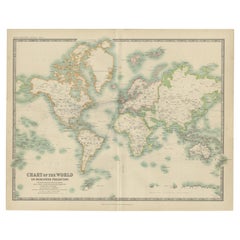
Antique Zoological Chart of the World, 1854
About the Item
Antique map titled 'Zoological Chart of the World'. Total of six maps and insets. Insets of the distribution of Animals in a vertical direction, Chart of the Distribution of the Principal Birds, Distribution of Plants in a Vertical Direction, and Chart of the Region of Cultivation of the Tea, Sugar, Coffee, and Cotton Plants. This map orginates from 'General Atlas Of The World: Containing Upwards Of Seventy Maps (..)' by Adam & Charles Black.
Artists and Engravers: Engraved by J. Bartholomew.
Condition: Good, general age-related toning. Please study image carefully.
Date: 1854
Overall size: 30.1 x 44.3 cm.
Image size: 24.8 x 39.3 cm.
We sell original antique maps to collectors, historians, educators and interior decorators all over the world. Our collection includes a wide range of authentic antique maps from the 16th to the 20th centuries. Buying and collecting antique maps is a tradition that goes back hundreds of years. Antique maps have proved a richly rewarding investment over the past decade, thanks to a growing appreciation of their unique historical appeal. Today the decorative qualities of antique maps are widely recognized by interior designers who appreciate their beauty and design flexibility. Depending on the individual map, presentation, and context, a rare or antique map can be modern, traditional, abstract, figurative, serious or whimsical. We offer a wide range of authentic antique maps for any budget.
- Dimensions:Height: 17.45 in (44.3 cm)Width: 11.86 in (30.1 cm)Depth: 0 in (0.01 mm)
- Materials and Techniques:
- Period:
- Date of Manufacture:1854
- Condition:Condition: Good, general age-related toning. Please study image carefully.
- Seller Location:Langweer, NL
- Reference Number:
About the Seller
5.0
Platinum Seller
These expertly vetted sellers are 1stDibs' most experienced sellers and are rated highest by our customers.
Established in 2009
1stDibs seller since 2017
1,922 sales on 1stDibs
Typical response time: <1 hour
- ShippingRetrieving quote...Ships From: Langweer, Netherlands
- Return PolicyA return for this item may be initiated within 14 days of delivery.
More From This SellerView All
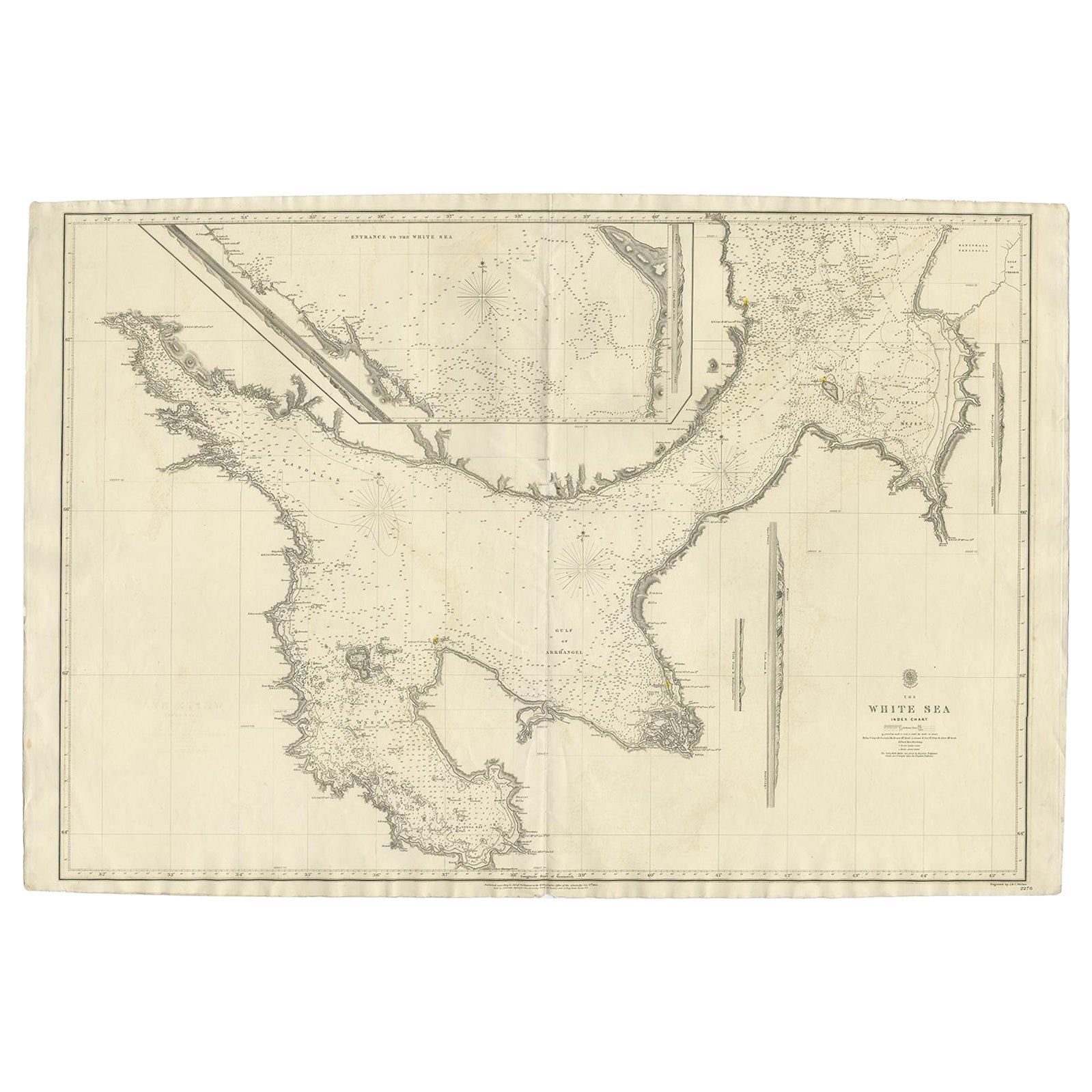
- Large Antique Chart of The White Sea, Russa 1854Located in Langweer, NLAntique map titled 'The White Sea Index Chart'. Large uncommon map of the White Sea with a smaller inset map of the entrance to the White Sea. The white sea is a southern inlet of th...Category
Antique 19th Century Maps
MaterialsPaper
- Antique Map of the World by A. Vuillemin, 1854By Victor LevasseurLocated in Langweer, NLThis map originates from ‘Atlas National de la France Illustré’. Published by A. Combette, Paris, 1854.Category
Antique Mid-19th Century Maps
MaterialsPaper
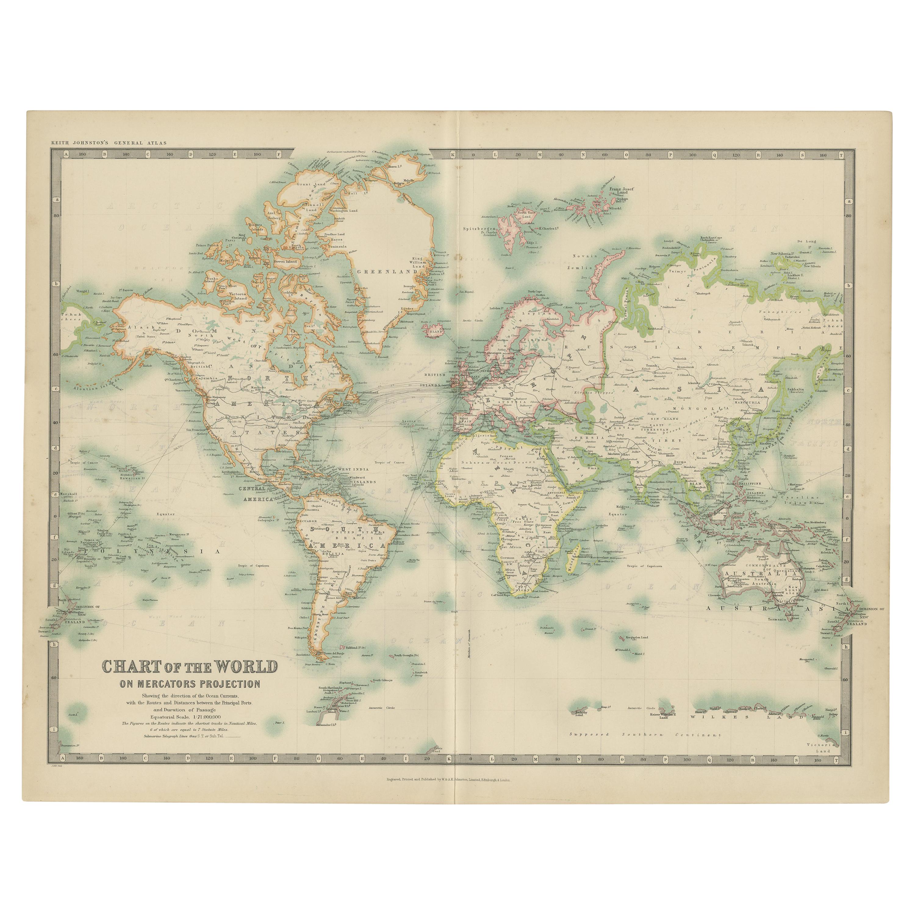
- Antique Chart of the World by Johnston '1909'Located in Langweer, NLAntique map titled 'Chart of the World on Mercator's Projection Showing the directions of the Oceans Currents with the Routes and Distances Between Principal Ports'. Detailed map of ...Category
Early 20th Century Maps
MaterialsPaper
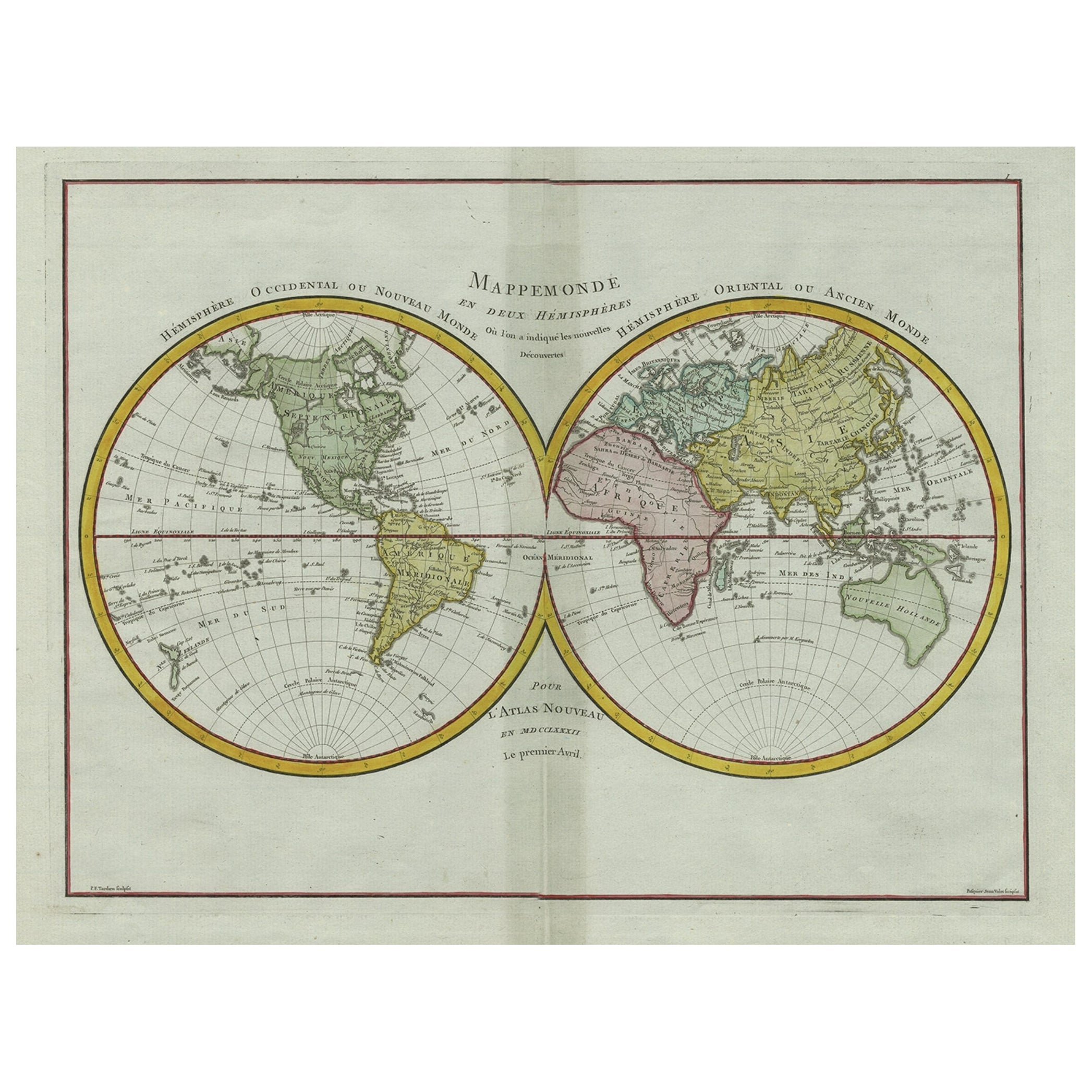
- Original Engraved Antique Map of the World, Colorful and Decorative, C.1780By Pierre François TardieuLocated in Langweer, NLAntique map titled 'Mappemonde en Deux Hemispheres ou l'on a Indique les Nouvelles Decouvertes' - This handsome double hemisphere map presents a ...Category
Antique 18th Century Maps
MaterialsPaper
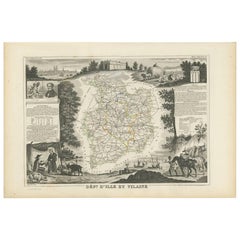
- Antique Map of Ille et Vilaine ‘France’ by V. Levasseur, 1854Located in Langweer, NLAntique map titled 'Dépt. d'Ille et Vilaine'. Map of the French department of Ille et Vilaine. France. Its coastal area is famous for its seafood, and especially its oysters. The reg...Category
Antique Mid-19th Century Maps
MaterialsPaper
- Very Decorative Original Antique Map of the World, Published in France in c.1780By Rigobert BonneLocated in Langweer, NLAntique map titled 'L'Ancien Monde Et Le Nouveau en Deux Hemispheres' - Double hemisphere map of the World, showing the contemporary geographical...Category
Antique 18th Century Maps
MaterialsPaper


You May Also Like
- Large Original Antique Map of The World, Fullarton, C.1870Located in St Annes, LancashireGreat map of the World. Showing both hemispheres From the celebrated Royal Illustrated Atlas Lithograph. Original color. Published by Fullarton, Edinburgh, C.1870 Unframed. Rep...Category
Antique 1870s Scottish Maps
MaterialsPaper
- 50 of the World's Best Apartments Coffee Table BookLocated in North Hollywood, CAIs apartment living the way of the future? According to some, it's the only way to live. For most apartment-dwellers, beautiful views, functional floor plans, low maintenance and convenient, inner-city locations far outweigh the attributes of the traditional quarter-acre suburban block. This book presents, through text, superb floor photographs and floor plans, 50 of the best apartments from around the world. Focusing on fabulous interiors, this book is a digest of the myriad ways to fit out spaces that often begin as concrete shells, but are transformed, through the talents of the best interior architects and designers, into luxurious penthouses, funky lofts, hip apartments, sleek bachelor pads and sumptuous family homes. An inspiring sourcebook for all lovers of beautiful interiors. Title Fifty of the World's Best Apartments Editor Robyn Beaver...Category
21st Century and Contemporary American Modern Books
MaterialsPaper
- Large Original Vintage Map of The World, circa 1920Located in St Annes, LancashireGreat map of The World Original color. Good condition / minor foxing Published by Alexander Gross Unframed.Category
Vintage 1920s English Maps
MaterialsPaper
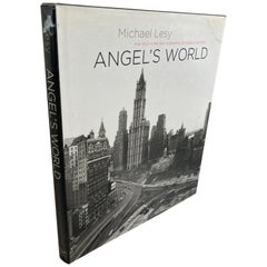
- Angel's World the New York Photographs of Angelo Rizzoto. Lesy, Hardcover BookLocated in North Hollywood, CAAngel's World: The New York Photographs of Angelo Rizzoto. Lesy, Michael First edition of this collection of photographs. Quarto, original black cloth, illustrated. Inscribed by Mi...Category
Early 2000s American Modern Books
MaterialsPaper
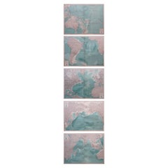
- Set of 5 Large Original Vintage Sea Charts, circa 1920Located in St Annes, Lancashire5 great maps or charts of the oceans I particularly like the color of these maps Unframed Original color By John Bartholomew and Co. Edinburgh Geographical Institute Published, ...Category
Vintage 1920s British Maps
MaterialsPaper
- Pair of Antique Friezes in the Shape of a FlowerLocated in Alessandria, PiemontePair of antique friezes in wood in the shape of a flower. They bear traces of lacquering, now erased by time. I just had the centrale part redone, to gi...Category
Antique Late 17th Century Italian Baroque Models and Miniatures
MaterialsFruitwood


Recently Viewed
View AllMore Ways To Browse
Used Charts
Toner Chart
Antique Chart
Antique Charts
Antique Coffee Collectibles
Chart Antique
Animal World Map
Antique World Chart
Zoology Charts
Bird Chart
Used Nautical Charts
Antique World Chart
Antique Char
Map Of Great Britain
Antique Furniture Depot
Hand Painted Antique Map
Antique Map Mexico
Hemisphere Antiques