Items Similar to Two Charts of The English Channel, Each Adorned with Nice Compass Roses, ca.1700

Want more images or videos?
Request additional images or videos from the seller
1 of 5
Two Charts of The English Channel, Each Adorned with Nice Compass Roses, ca.1700
About the Item
Antique map titled 'Hydrographia Canalis Marini Inter Angliam et Galiiam de Fluentis.'
Sheet with with two charts of the English Channel, each adorned with beautiful compass roses. The lower chart is inset with a tiny map of the region between Angers and Paris.
Source unknown, to be determined.
Artists and engravers: Made by 'Heinrich Scherer' after an anonymous artist. Heinrich Scherer (1628-1704) was a Professor of Hebrew, Mathematics and Ethics at the University of Dillingen until about 1680. Thereafter he obtained important positions as Official Tutor to the Royal Princes of Mantua and Bavaria. It was during his time in Munich as Tutor to the Princely house of Bavaria that his lifetime’s work as a cartographer received acclaim and recognition. Scherer’s world atlas, the Atlas Novus, first published in Munich between 1702 and 1710 and reissued in a second edition between 1730 and 1737, forms a singularly unusual, almost revolutionary work in terms of the development of European mapmaking at the beginning of the 18th century.
- Dimensions:Height: 10.63 in (27 cm)Width: 8.08 in (20.5 cm)Depth: 0 in (0.02 mm)
- Materials and Techniques:
- Period:1700-1709
- Date of Manufacture:circa 1700
- Condition:Condition: Good, given age. Irregular left edge from binding. General age-related toning and/or occasional minor defects from handling. Please study image carefully.
- Seller Location:Langweer, NL
- Reference Number:
About the Seller
5.0
Platinum Seller
These expertly vetted sellers are 1stDibs' most experienced sellers and are rated highest by our customers.
Established in 2009
1stDibs seller since 2017
1,929 sales on 1stDibs
Typical response time: <1 hour
- ShippingRetrieving quote...Ships From: Langweer, Netherlands
- Return PolicyA return for this item may be initiated within 14 days of delivery.
More From This SellerView All
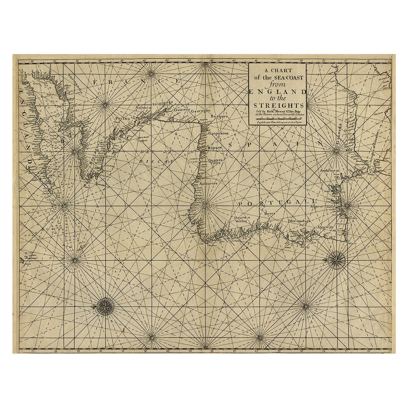
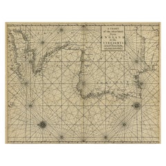
- Original Antique Sea Chart of the Coastline from England to Gibraltar, ca.1700Located in Langweer, NLAntique map titled 'A Chart of the Sea-Coast from England to the Streights.' Original antique map showing the European coastline from the South of England (and North of France) to ...Category
Antique Early 1700s Maps
MaterialsPaper
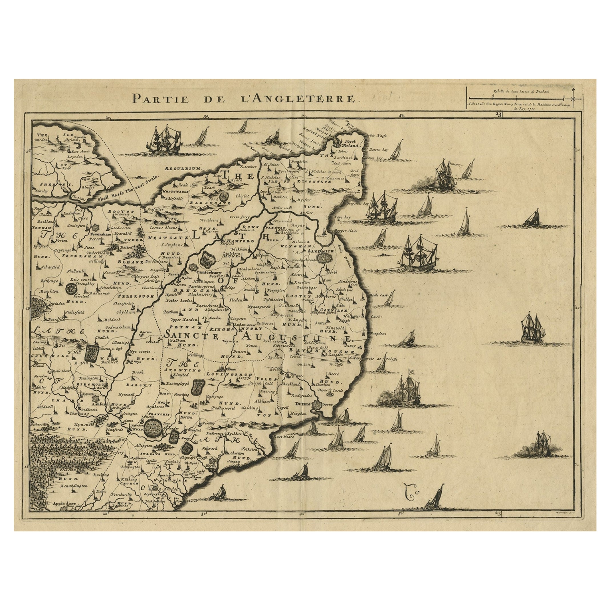
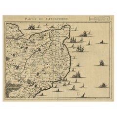
- Uncommon Antique Map of the English Channel Coastline, ca.1709Located in Langweer, NLAntique map titled 'Partie de L'Angleterre' Uncommon map of the English Channel coastline with many boats on the sea. Source unknown, to be determined. Artists and Engravers: Made...Category
Antique Early 1700s Maps
MaterialsPaper
- Antique Map of France with the English Channels, 1754Located in Langweer, NLAntique map France titled 'An Accurate Map of France drawn from the best authorities'. Small, detailed map of France. With decorative title cartouche. Ar...Category
Antique 18th Century Maps
MaterialsPaper
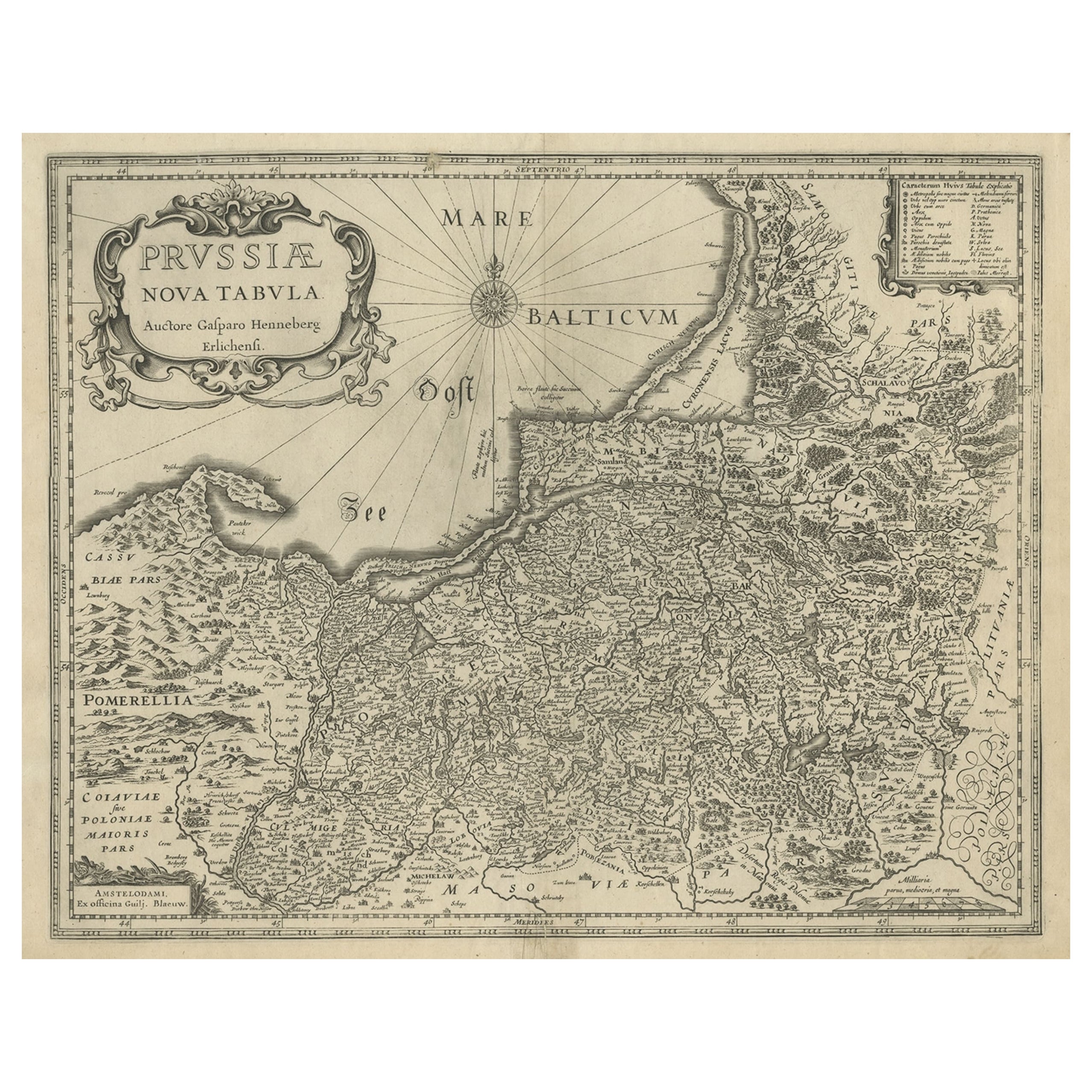
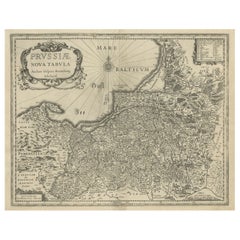
- Old Map of Prussia, Embellished with a Large Cartouche and Compass Rose, ca.1680Located in Langweer, NLAntique map titled 'Prussiae nova Tabula'. Later edition of Blaeu's map of Prussia, embellished with a large cartouche and compass rose. Prussia was a historically prominent Germ...Category
Antique 1680s Maps
MaterialsPaper
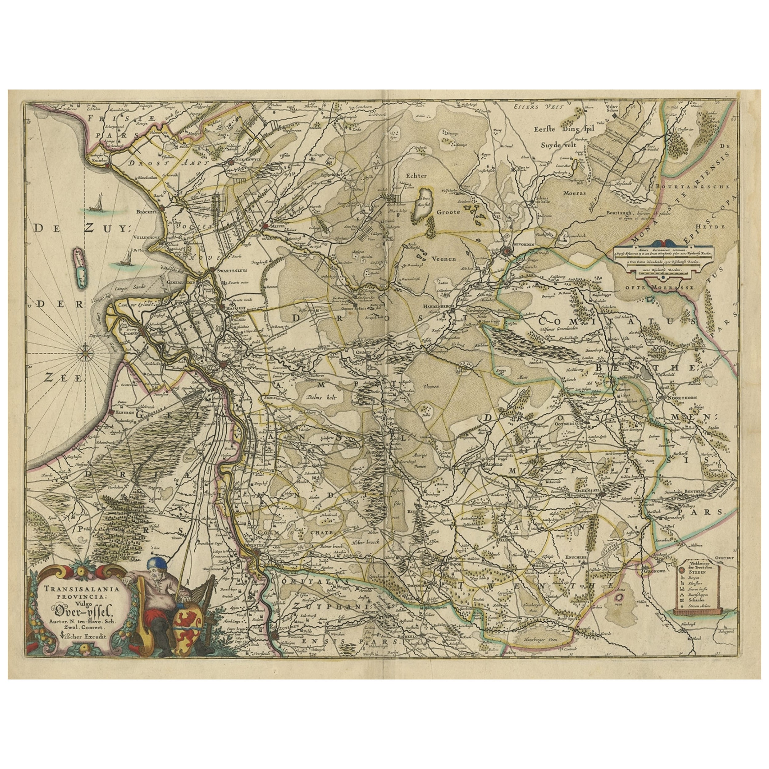
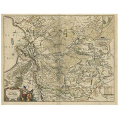
- Attractive Original Map of the Province of Overijssel, the Netherlands, Ca.1700Located in Langweer, NLAntique print, titled: 'Transisalania Provincia vulgo Over-yssel.' Attractive original handcoloured map of the province of Overijssel, The Netherlands. With beautiful title carto...Category
Antique Early 1700s Maps
MaterialsPaper
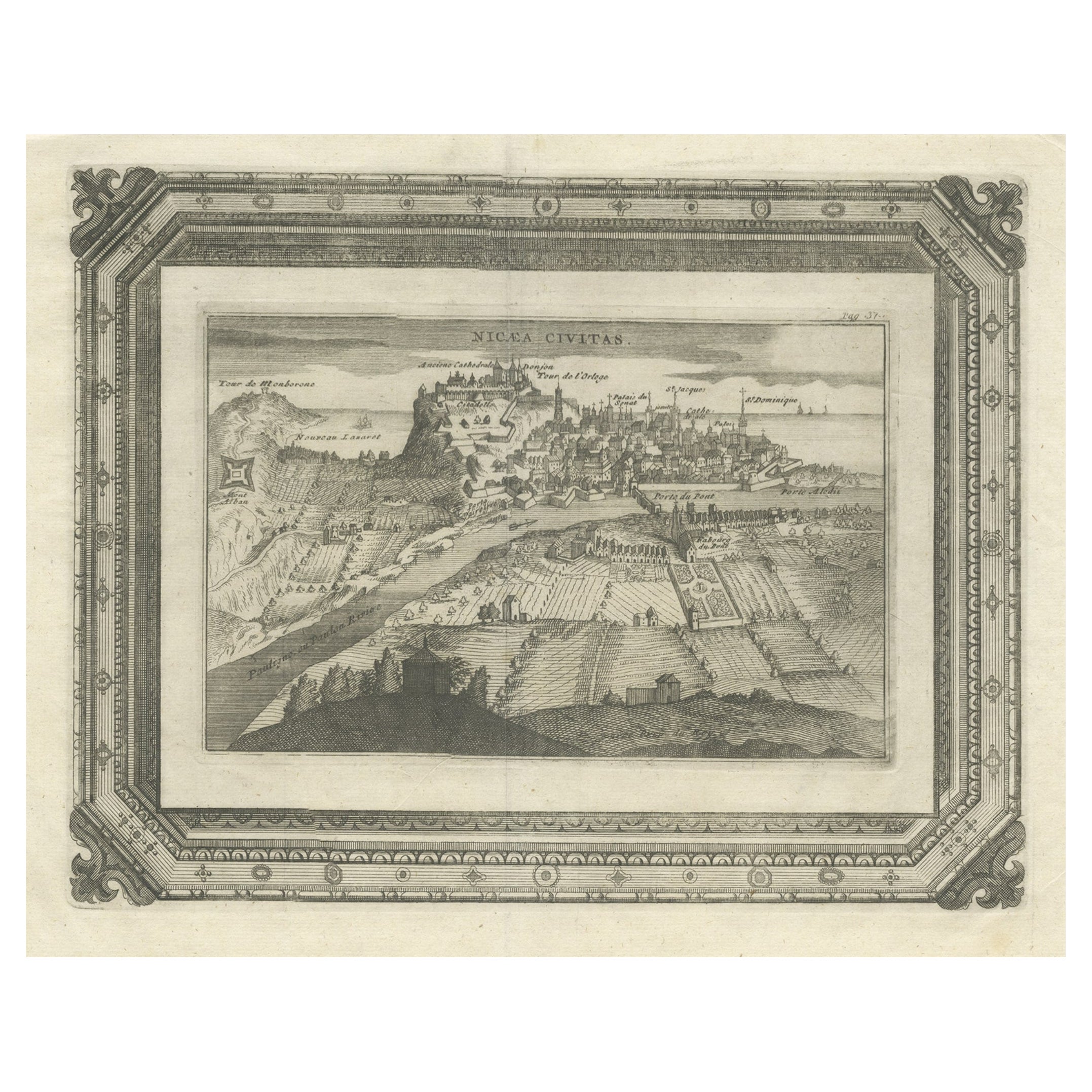
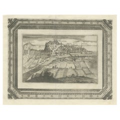
- Very Rare Antique Print of the City of Nice in France, c.1700Located in Langweer, NLAntique print titled 'Nicaea Civitas'. Original antique print with a view of the city of Nice, France. Rare in this edition. Source unknown, to be determined. Artists and Engraver...Category
Antique 17th Century Prints
MaterialsPaper

You May Also Like
- Antique Anatomical Wall Chart Depicting the Human SkeletonLocated in Berghuelen, DEA rare 19th century anatomical wall chart depicting the human skeleton. On the sides On the sides are detailed description in German language. The wall...Category
Early 20th Century German Victorian Prints
MaterialsPaper
- Anatomical Wall Chart Depicting the Human Lymphatic and Blood VesselsLocated in Berghuelen, DEA rare 19-carat anatomical wall chart depicting the human lymphatic and blood vessels. On the sides with detailed description in German language. Print...Category
Early 20th Century German Victorian Prints
MaterialsPaper
- Lithographic print on paper, depicting the atlas of the hand, France 1850 ca.Located in Milan, ITAn anatomical lithographic print on paper, depicting the anatomical atlas of the hand. Black lacquered fir wood frame with golden ramin wood batting. N. H. Ja...Category
Antique Mid-19th Century French Prints
MaterialsGlass, Wood, Paper
- Genito-Urinary Anatomical Chart Fritz FrohseBy Nystrom / Frohse Art, Fritz FrohseLocated in Philadelphia, PAGenito-Urinary Anatomical Chart by Fritz Frohse. Dated 1922. Paper mounted on canvas. Shows wear but still presents very well!Category
Vintage 1920s German American Classical Prints
MaterialsCanvas, Paper
- Foldable Anatomical Wall Chart Depicting Human MusculatureLocated in Berghuelen, DEA rare 19th century anatomical wall chart depicting human musculature and internal organs. With removable multicolored human organs like lung, heart, l...Category
Early 20th Century German Victorian Prints
MaterialsPaper
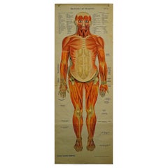
- Antique Foldable Anatomical Wall Chart Depicting Human MusculatureLocated in Berghuelen, DEAntique Foldable Anatomical Wall Chart Depicting Human Musculature The rare 19th century anatomical wall chart depicts the human musculature and inter...Category
Early 20th Century German Victorian Prints
MaterialsWood, Paper