Items Similar to Uncommon Antique Map of the English Channel Coastline, ca.1709

Want more images or videos?
Request additional images or videos from the seller
1 of 5
Uncommon Antique Map of the English Channel Coastline, ca.1709
About the Item
Antique map titled 'Partie de L'Angleterre' Uncommon map of the English Channel coastline with many boats on the sea. Source unknown, to be determined.
Artists and Engravers: Made by 'Jacobus Harrewijn' after 'Henry Fricx'. Jacobus Harrewijn (1660-1727): Dutch engraver and etcher of topographical and decorative prints. Born in Amsterdam, died in Brussels. He was a scholar of the famous Romeyn de Hooghe. Married in Amsterdam in 1683. He became a master in the guild in Brussels in 1695 and he is known to have worked in The Hague in 1727.
- Dimensions:Height: 18.9 in (48 cm)Width: 24.18 in (61.4 cm)Depth: 0 in (0.02 mm)
- Materials and Techniques:
- Period:1700-1709
- Date of Manufacture:circa 1709
- Condition:Condition: Good. Some crinkles and soft creases. Small hole bottom margin. A few small spots. Original middle fold as issued. General age-related toning and/or occasional minor defects from handling. Blank verso. Please study image carefully.
- Seller Location:Langweer, NL
- Reference Number:
About the Seller
5.0
Platinum Seller
These expertly vetted sellers are 1stDibs' most experienced sellers and are rated highest by our customers.
Established in 2009
1stDibs seller since 2017
1,922 sales on 1stDibs
Typical response time: <1 hour
- ShippingRetrieving quote...Ships From: Langweer, Netherlands
- Return PolicyA return for this item may be initiated within 14 days of delivery.
More From This SellerView All
- Antique Map of France with the English Channels, 1754Located in Langweer, NLAntique map France titled 'An Accurate Map of France drawn from the best authorities'. Small, detailed map of France. With decorative title cartouche. Ar...Category
Antique 18th Century Maps
MaterialsPaper
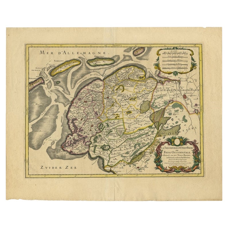
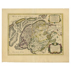
- French Edition of an Antique Map of Friesland in the Netherlands, 1709Located in Langweer, NLAntique map titled 'La Seigneurie d'Ouest-Frise ou Frise Occidentale (..)'. Original antique map of Friesland, published 1709. Artists and Engravers: Alexis-Hubert Jaillot (1632 ? 2 ...Category
Antique 18th Century Maps
MaterialsPaper
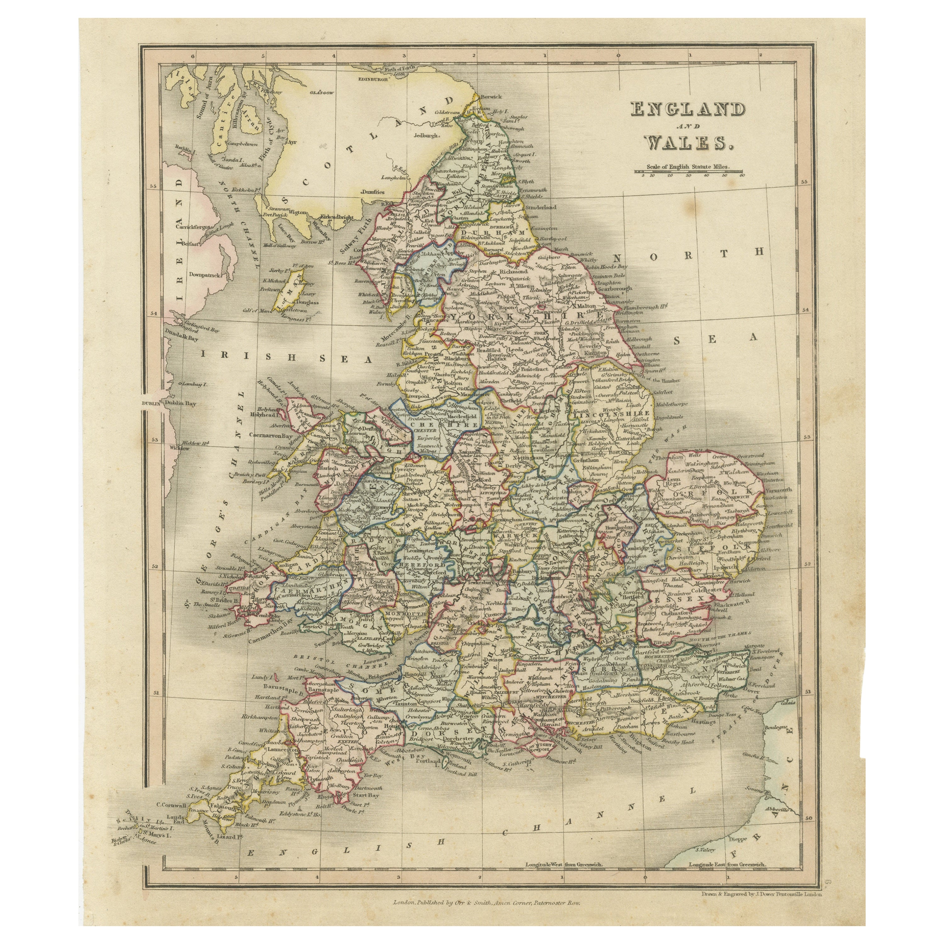
- Antique Map of England and Wales, Also Showing the English ChannelLocated in Langweer, NLAntique map titled 'England and Wales'. Original antique map of England and Wales. Drawn and engraved by J. Dower. Originates from 'A General Descriptive Atlas Of The Earth, Containi...Category
Antique Mid-19th Century Maps
MaterialsPaper
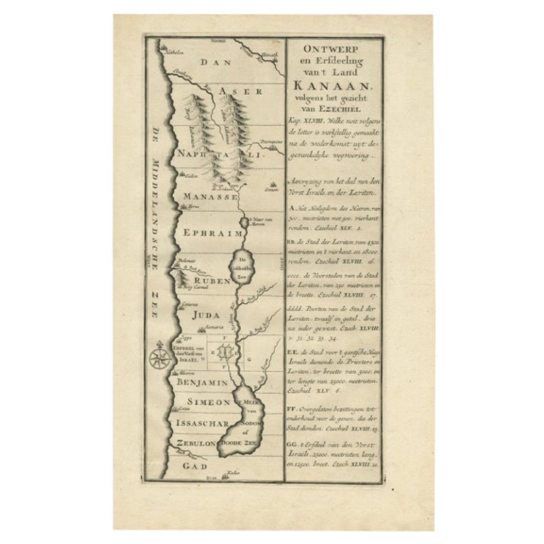
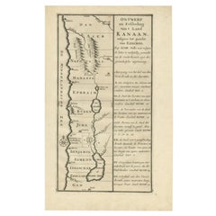
- Antique Uncommon Dutch Map of Ancient Israel, c.1730Located in Langweer, NLAntique map titled 'Ontwerp en Erfdeeling van't Land Kanaan, volgens het gezicht van Ezechiel.' Uncommon map of ancient Israel. This map shows Israel fr...Category
Antique 18th Century Maps
MaterialsPaper
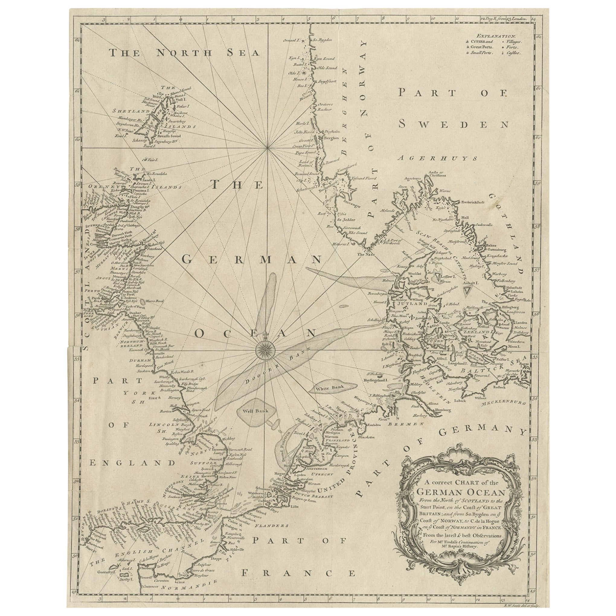
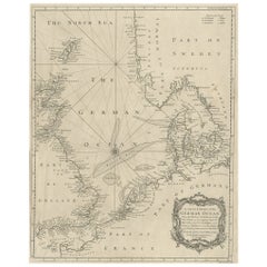
- Antique Map of the North Sea From the English Channel to Norway & Sweden, 1746Located in Langweer, NLAntique map titled 'A correct Chart of the German Ocean from the North of Scotland to the Start Point, on the Coast of Great Britain; and from So. Bygden on ye coast of Norway, to C....Category
Antique 1740s Maps
MaterialsPaper
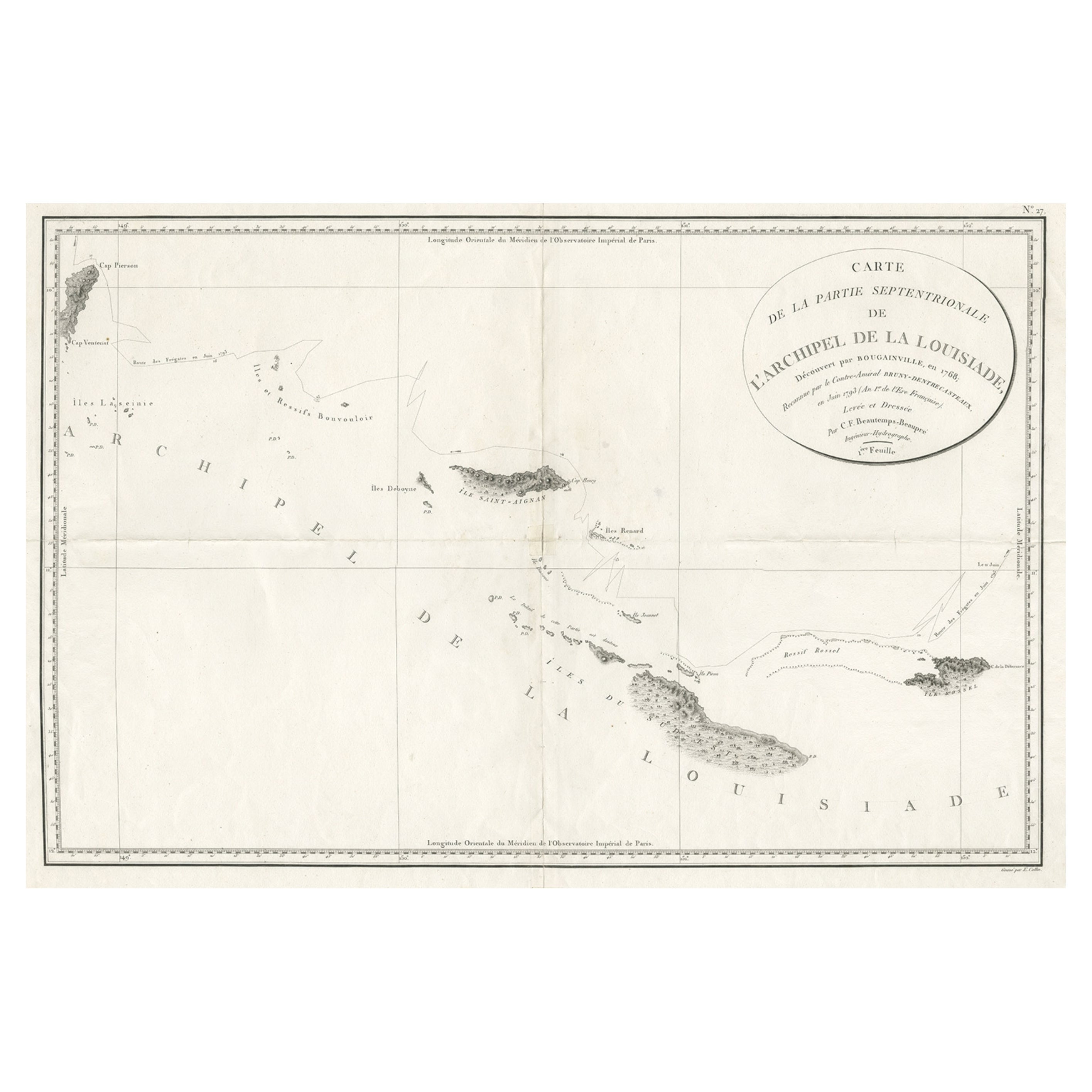
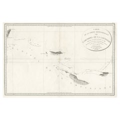
- Uncommon Rare Map Showing The Louisiade Archipelago, Papua New Guinea, ca.1798Located in Langweer, NLAntique map titled 'Carte de la Partie Septentrionale de l'Archipel de la Louisiade'. Uncommon map showing the area around the Louisiade Archipelago, named for Louis XV by Louis ...Category
Antique 1790s Maps
MaterialsPaper


You May Also Like
- Map of the Republic of GenoaLocated in New York, NYFramed antique hand-coloured map of the Republic of Genoa including the duchies of Mantua, Modena, and Parma. Europe, late 18th century. Dimension: 25...Category
Antique Late 18th Century European Maps
- Antique Map of Principality of MonacoBy Antonio Vallardi EditoreLocated in Alessandria, PiemonteST/619 - "Old Geographical Atlas of Italy - Topographic map of ex-Principality of Monaco" - ediz Vallardi - Milano - A somewhat special edition ---Category
Antique Late 19th Century Italian Other Prints
MaterialsPaper
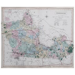
- Original Antique English County Map, Hampshire, J & C Walker, 1851Located in St Annes, LancashireGreat map of Hampshire Original colour By J & C Walker Published by Longman, Rees, Orme, Brown & Co. 1851 Unframed.Category
Antique 1850s English Other Maps
MaterialsPaper
- Original Antique English County Map, Berkshire. J & C Walker, 1851Located in St Annes, LancashireGreat map of Berkshire Original colour By J & C Walker Published by Longman, Rees, Orme, Brown & Co. 1851 Unframed.Category
Antique 1850s English Other Maps
MaterialsPaper
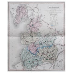
- Original Antique English County Map, Lancashire, J & C Walker, 1851Located in St Annes, LancashireGreat map of Lancashire Original colour By J & C Walker Published by Longman, Rees, Orme, Brown & Co. 1851 Unframed.Category
Antique 1850s English Other Maps
MaterialsPaper
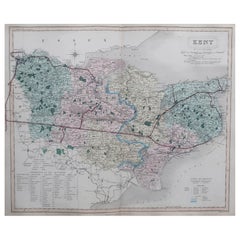
- Original Antique English County Map, Kent. J & C Walker, 1851Located in St Annes, LancashireGreat map of Kent Original colour By J & C Walker Published by Longman, Rees, Orme, Brown & Co. 1851 Unframed.Category
Antique 1850s English Other Maps
MaterialsPaper


Recently Viewed
View AllMore Ways To Browse
Antique English Collectibles
Antique Channel
Boat Collectables
Topographical Map
Antique Topographic Maps
Maps Brussels
General Empire
Wood And Sons Plate
Antique Caribbean
Holland Utrecht
Large World Map
Antique Paper Globe
World Map Globe
Small Antique Globes
India Antique Map
Antique Maps India
Antique Map India
Antique India Map