Antique Map India

18
to
85
436
37
329
176
137
125
66
52
45
39
31
24
22
21
21
19
14
14
12
11
10
9
8
7
7
6
6
6
6
6
6
4
4
4
4
4
4
3
3
2
2
2
2
2
2
1
1
1
1
23
9
5
4
3
Sort By
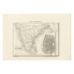
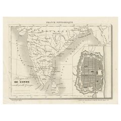
French Antique Map of India with an Inset of Pondicherry, 1835
Located in Langweer, NL
Antique map India titled 'Presqu'ile de l'Inde en de ca du Gange'. Miniature map depicting India
Category

19th Century Antique Map India

Materials

Paper

Antique Map of India with Inset of Puducherry by Monin, 1835
Located in Langweer, NL
Antique map India titled 'Presqu'ile de l'Inde en de ca du Gange'. Miniature map depicting India
Category

19th Century Antique Map India

Materials

Paper

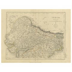
Original Antique Map of Northern India
Located in Langweer, NL
Antique map titled 'India. Northern Part'. Original antique map of Northern India. Drawn and
Category

Mid-19th Century Antique Map India

Materials

Paper

Original Antique Map of Northern India
H 10.63 in W 14.85 in D 0.02 in
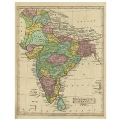
Antique Map of Hindustan, or India
Located in Langweer, NL
Antique map titled 'Hindoostan, or India'. Original antique map of India (Hindustan) and Sri Lanka
Category

Early 19th Century Antique Map India

Materials

Paper

Antique Map of Hindustan, or India
H 10.52 in W 8.19 in D 0.02 in
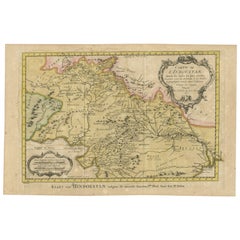
Original Antique Map of Northern India
By Jakob van der Schley
Located in Langweer, NL
northern India. This map originates from 'Historische beschryving der reizen, of Nieuwe en volkoome
Category

Mid-18th Century Antique Map India

Materials

Paper

Original Antique Map of Northern India
H 9.85 in W 13 in D 0.02 in
Original Antique Map of India. C.1780
Located in St Annes, Lancashire
Great map of India Copper-plate engraving Published C.1780 Three small worm holes to right
Category

Early 1800s English Georgian Antique Map India

Materials

Paper

Original Antique Map of India. C.1780
No Reserve
H 8.75 in W 12.5 in D 0.07 in
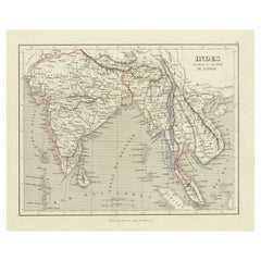
Antique Map of India to Southeast Asia
Located in Langweer, NL
Antique map titled 'Indes en-decà et au-delà du Gange'. Original old map of India to Southeast Asia
Category

Mid-19th Century Antique Map India

Materials

Paper

Antique Map of India to Southeast Asia
H 10.01 in W 12.05 in D 0.02 in
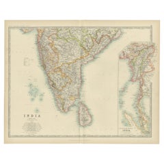
Antique Map of India ( Southern ) by Johnston (1909)
Located in Langweer, NL
Antique map titled 'India'. Original antique map of India Southern sheet. With inset maps of south
Category

Early 20th Century Antique Map India

Materials

Paper

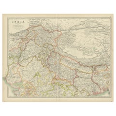
Antique Map of India 'Northern' by Johnston '1909'
Located in Langweer, NL
Antique map titled 'India'. Original antique map of India, Northern sheet. This map originates from
Category

Early 20th Century Antique Map India

Materials

Paper

Authentic Antique Map of India and Ceylon, '1875'
Located in Langweer, NL
Antique map titled 'Carte générale des Indes'. Large map of India and Ceylon. This map originates
Category

Late 19th Century Antique Map India

Materials

Paper

Interesting Detailed Antique Map of Eastern India, 1832
Located in Langweer, NL
Antique map titled 'India IV'. Old steel engraved map of the eastern part of India, including the
Category

19th Century Antique Map India

Materials

Paper

Large Original Vintage Map of India, circa 1920
Located in St Annes, Lancashire
Great map of India Original color. Good condition / repair to some minor damage just above Sri
Category

1920s English Antique Map India

Materials

Paper

Large Original Vintage Map of India, circa 1920
No Reserve
H 19.5 in W 25 in D 0.07 in
Antique Map of Northwestern India by Weller, 1857
Located in Langweer, NL
Antique map titled 'India, The North West Provinces and Oude'.Detailed map of the northwestern part
Category

19th Century Antique Map India

Materials

Paper

Antique Map of Northern India by Johnston, 1882
Located in Langweer, NL
Antique map titled 'India (Northern Sheet)'. Old map of Northern India. This map originates from
Category

19th Century Antique Map India

Materials

Paper

Antique Map of Northern India by Bonne, 1780
Located in Langweer, NL
and Guilleme Raynal?s 1780 map of northern India. Covers the northern part of India from Kandahar
Category

18th Century Antique Map India

Materials

Paper

Antique Map of Northern India by Johnston, 1867
Located in Langweer, NL
Antique map titled 'India (Northern Sheet)'. Depicting Rajputana, Bombay, Nepal and more
Category

19th Century Antique Map India

Materials

Paper

Antique Map of Southeast Asia, China, Philippines and India
Located in Langweer, NL
Antique map titled 'Indiae Orientalis et Insularum Adiacentium'. Decorative map of Southeast Asia
Category

Early 18th Century Antique Map India

Materials

Paper

Rare Antique Map of Calcutta 'Kolkata' in India, 1893
Located in Langweer, NL
Antique map titled 'Calcutta (India)'. Old map of Calcutta/Kolkata, India. On verso, a map of Egypt
Category

19th Century Antique Map India

Materials

Paper

Antique Map of Northern India by Blackie & Son, 1860
Located in Langweer, NL
Antique map titled 'India'. Old map depicting northern India. This map originates from 'The
Category

19th Century Antique Map India

Materials

Paper

Antique Map of India and Ceylon by Lapie, 1842
Located in Langweer, NL
Antique map titled 'Carte de l'Inde en deca et au dela du Gange'. Map of India and Ceylon (Sri
Category

Mid-19th Century Antique Map India

Materials

Paper

Antique Map of India and Ceylon by Lapie, 1842
H 19.89 in W 26.78 in D 0.02 in
Original Antique Map of Malabar, Coromandel 'India' and Ceylon
Located in Langweer, NL
Antique map titled 'Peninsula Indiae citra Gangem, hoc est Orae celeberrimae Malabar & Coromandel
Category

Mid-18th Century Antique Map India

Materials

Paper

Detailed Orginal Antique Map of Bengal, India, c.1825
Located in Langweer, NL
Antique map titled 'No. 95 Bengale'. Detailed map of Bengal, Bangladesh. With text about the Ganges
Category

19th Century Antique Map India

Materials

Paper

Antique Map of Southern India by Chatelain, c.1720
Located in Langweer, NL
Coromandel'. Map of the southern portion of India, originating from Chatelain's 'Atlas Historique'. The map
Category

18th Century Antique Map India

Materials

Paper

Antique Map of Eastern India by Kuyper, C.1880
Located in Langweer, NL
Plate 55 : 'Britsch-Indie, Oost.' (British Indies, East). This lithographed map originates from
Category

19th Century Antique Map India

Materials

Paper

Antique Map of Northern India 'British Indies', C.1880
Located in Langweer, NL
Plate 56 : 'Britsch-Indie, Noord.' (British Indies, North). This lithographed map originates from
Category

19th Century Antique Map India

Materials

Paper

Antique 1803 Italian Map of Asia Including China Indoneseia India
Located in Amsterdam, Noord Holland
Antique 1803 Italian Map of Asia Including China Indoneseia India Very nice map of Asia. 1803
Category

19th Century European Antique Map India

Materials

Paper

Antique Map of part of India, the Ganges and Hindustan
Located in Langweer, NL
Antique map titled 'Carte de l'Indoustan'. Original antique map of part of India, the Ganges and
Category

Mid-18th Century Antique Map India

Materials

Paper

Antique Map of India and Southeast Asia by Balbi '1847'
Located in Langweer, NL
Antique map titled 'India en deçà et au delà du Gange'. Original antique map of India and Souteast
Category

Mid-19th Century Antique Map India

Materials

Paper

Antique Map of India, the East Indies and the Philippines
Located in Langweer, NL
Antique map titled 'Les Indes Orientales et leur Archipel'. Original antique map of India, the East
Category

Mid-18th Century Antique Map India

Materials

Paper

Old Map of Southern India and Ceylon 'Sri Lanka', 1882
Located in Langweer, NL
Antique map titled 'India (Southern Sheet)'. Old map of Southern India and Ceylon (Sri Lanka
Category

1880s Antique Map India

Materials

Paper

Antique Map of the Region of Delhi in India, 1833
Located in Langweer, NL
Antique map titled 'India IX'. Old steel engraved map of the region of Delhi, with great detail
Category

19th Century Antique Map India

Materials

Paper

Antique Map of India and Southeast Asia by Sanson '1654'
Located in Langweer, NL
Antique map titled 'Partie Meridionale de l'Inde'. Early map of India and Southeast Asia. The map
Category

Mid-17th Century Antique Map India

Materials

Paper

Antique Map of Northeastern India, Nepal, Bhutan, Assam and Bangladesh
Located in Langweer, NL
'. Interesting map showing the region of northeastern India, Nepal, Bhutan, Assam and Bangladesh. At center is
Category

Early 18th Century Antique Map India

Materials

Paper

Antique Map of India and Ceylon, along with the Maldives
Located in Langweer, NL
Antique map titled 'Stato del Mogol con l'Isole di Ceilan e Maldive'. Beautiful map of India and
Category

Late 18th Century Antique Map India

Materials

Paper

Antique Map of the Gulf of Cambay, Gujarat, India, 1725
By Pieter Van Der Aa
Located in Langweer, NL
Antique map titled 'Le Golfe de Cambaye at la Rade de Suratt.' (The gulf of Cambay and the coast of
Category

18th Century Antique Map India

Materials

Paper

Antique Map of Choromandel, Golconda and Orixa, Malabar, India, 1744
By Philip Baldaeus
Located in Langweer, NL
Antique map titled 'Regionum Choromandel, Golconda (..).' Handsome map of Choromandel, Golconda and
Category

18th Century Antique Map India

Materials

Paper

Antique French Map of Asia Including China Indoneseia India, 1783
Located in Amsterdam, Noord Holland
Very nice map of Asia. 1783 Dedie au Roy. Additional information: Country of Manufacturing: Europe
Category

18th Century European Antique Map India

Materials

Paper

Antique Map of Southern India and Ceylon by Thomson, 1816
Located in Langweer, NL
"Antique map titled 'Southern Hindostan'. A map of Southern India and the North of Ceylon. From
Category

19th Century Antique Map India

Materials

Paper

Original Hand-colored Antique Map of the Southern Part of India
Located in Langweer, NL
Malabar et de Coromandel'. Beautiful map of the southern part of India. It focuses on trade routes within
Category

Early 18th Century Antique Map India

Materials

Paper

Antique Map of India, Afghanistan, Balochistan and surroundings by Lowry, '1852'
Located in Langweer, NL
Antique map titled 'India, Afghanistan, Beloochistan, Birmah & C'. Four individual sheets of India
Category

Mid-19th Century Antique Map India

Materials

Paper

Antique Map of Part of the Bombay Presidency in India, 1831
Located in Langweer, NL
Antique map titled 'India III Bombay Presidency'. Old steel engraved map of part of the Bombay
Category

19th Century Antique Map India

Materials

Paper

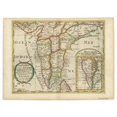
Original Antique Map showing Southern India, Northern Sri Lanka & Malabar, 1652
Located in Langweer, NL
part of India, including the northern part of Sri Lanka. With inset map of Southern India (Malabar
Category

1650s Antique Map India

Materials

Paper

Antique Map of British India with Insets of Kabul and Nepal
Located in Langweer, NL
Antique map titled 'British India, northern part'. Large format map of the northern area of the
Category

Early 19th Century Antique Map India

Materials

Paper

Original and Colourful Map of Northern India with Surrounding Regions, 1783
Located in Langweer, NL
Antique map titled 'Indes'. A map of Northern India with surrounding regions. From Lattre's 'Atlas
Category

1780s Antique Map India

Materials

Paper

Original Antique Map of the East India Islands 'Indonesia', ca.1820
Located in Langweer, NL
Antique map titled 'A Chart of the East India Islands'. Old map of the East Indies. This map
Category

1820s Antique Map India

Materials

Paper

Detailed Antique Map of the Region of Malwa in India, 1833
Located in Langweer, NL
Antique map titled 'India VI'. Old steel engraved map of the region of Malwa showing great detail
Category

19th Century Antique Map India

Materials

Paper

Original Antique Map of Part of the Bahar Region (India), 1834
Located in Langweer, NL
Antique map titled 'India X'. Old steel engraved map of part of the Bahar region, it also shows
Category

19th Century Antique Map India

Materials

Paper

Map of Northern India & Surrounding Regions, incl Kabul, Candahar & Bhutan, 1710
Located in Langweer, NL
.' Map of Northern India and surrounding regions. This includes Kabul and Candahar in the top left corner
Category

1710s Antique Map India

Materials

Paper

Superb, Large Map of British India, Chinese Empire, Indochina, Malaysia, 1860
Located in Langweer, NL
. A superb, large-scale map of British India, the Chinese Empire, Indochina, the Malay Peninsula, and
Category

1860s Antique Map India

Materials

Paper

Antique Hand-Coloured Map of India, Sri Lanka, Maldives, ca.1599
Located in Langweer, NL
Title: Tabula Asiae XI - 1599 Very old and decorative map of India, Sri Lanka and the Maledives
Category

16th Century Antique Map India

Materials

Paper

Rare Attractive Antique Map of Asia, India, Sri Lanka, Maldives, 1599
Located in Langweer, NL
Original Antique map of Asia, India, Ceylon (Sri Lanka), Maldives by Rosaccio / Ruscelli in
Category

16th Century European Antique Map India

Materials

Paper

Colorful and Decorative Miniature Map of India, Ceylon by Bertius 1616
Located in Langweer, NL
Old 17th century miniature antique map of India - Ceylon from the 1616 edition of Jadocus Hondius
Category

17th Century Antique Map India

Materials

Paper

Mid-19th Century Decorative Map of India with Cultural and Natural Vignettes
Located in Langweer, NL
The Tallis maps, including the one of India, are known for their detailed and ornamental style
Category

1850s Antique Map India

Materials

Paper

Rare Antique Miniature Map of Pakistan, India and Cambaia, ca.1616
Located in Langweer, NL
Old 17th century miniature antique map of 'Cambaia' , from the 1616 edition of Jadocus Hondius
Category

17th Century Antique Map India

Materials

Paper

Rare Antique Miniature Map of Pakistan, India and Cambaia, ca.1618
Located in Langweer, NL
Old 17th century miniature antique map of 'Cambaia' , from the 1616 edition of Jadocus Hondius
Category

17th Century Antique Map India

Materials

Paper

Original Old Map Northeast India, incl Part of Himalayas and China, 1853
Located in Langweer, NL
Antique map titled 'India X'. Old map of the the northeast region of India, including part of
Category

1850s Antique Map India

Materials

Paper

Antique Map of the Region of Berar and Rewah in India, 1832
Located in Langweer, NL
Antique map titled 'India VII'. Old steel engraved map of part of India including the Rajah of
Category

19th Century Antique Map India

Materials

Paper

Original Antique Map of Southern India and Ceylon 'Present-Day Sri Lanka'
By Jakob van der Schley
Located in Langweer, NL
(..)'. Original antique map of Southern India and Ceylon (present-day Sri Lanka). This map originates from
Category

Mid-18th Century Antique Map India

Materials

Paper

Original Detailed Antique Map of Southern India and Most of Ceylon, 1744
Located in Langweer, NL
Antique map titled 'A Map of India on the west Side of the Ganges, comprehending the coasts of
Category

1740s Antique Map India

Materials

Paper

Antique Map of the Region of Gujarat and Cutch in India, 1833
Located in Langweer, NL
Antique map titled 'India V'. Old steel engraved map of the region of Gujarat and Cutch showing
Category

19th Century Antique Map India

Materials

Paper

  • 1
Get Updated with New Arrivals
Save "Antique Map India", and we’ll notify you when there are new listings in this category.

Antique Map India For Sale on 1stDibs

At 1stDibs, there are many versions of the ideal antique map India for your home. Frequently made of paper, wood and brass, every antique map India was constructed with great care. Whether you’re looking for an older or newer antique map India, there are earlier versions available from the 18th Century and newer variations made as recently as the 20th Century. When you’re browsing for the right antique map India, those designed in Victorian and Georgian styles are of considerable interest. You’ll likely find more than one antique map India that is appealing in its simplicity, but Philip Baldaeus and Henri-Abraham Chatelain produced versions that are worth a look.

How Much is a Antique Map India?

An antique map India can differ in price owing to various characteristics — the average selling price 1stDibs is $418, while the lowest priced sells for $25 and the highest can go for as much as $3,950.

Read More

Pamela Shamshiri Shares the Secrets behind Her First-Ever Book and Its Effortlessly Cool Interiors

The sought-after designer worked with the team at Hoffman Creative to produce a monograph that beautifully showcases some of Studio Shamshiri's most inspiring projects.

Moroccan Artworks and Objects Take Center Stage in an Extraordinary Villa in Tangier

Italian writer and collector Umberto Pasti opens the doors to his remarkable cave of wonders in North Africa.

Montecito Has Drawn Royalty and Celebrities, and These Homes Are Proof of Its Allure

Hollywood A-listers, ex-pat aristocrats and art collectors and style setters of all stripes appreciate the allure of the coastal California hamlet — much on our minds after recent winter floods.

Whaam! Blam! Pow! — a New Book on Pop Art Packs a Punch

Publishing house Assouline and writer Julie Belcove have teamed up to trace the history of the genre, from Roy Lichtenstein, Andy Warhol and Yayoi Kusama to Mickalene Thomas and Jeff Koons.

The Sparkling Legacy of Tiffany & Co. Explained, One Jewel at a Time

A gorgeous new book celebrates — and memorializes — the iconic jeweler’s rich heritage.
What Makes a Gem-Encrusted Chess Set Worth $4 Million?

The world’s most opulent chess set, weighing in at 513 carats, is literally fit for a king and queen.

Tauba Auerbach’s Geometric Pop-Up Book Is Mighty Rare, Thanks to a Hurricane

This sculptural art book has an epic backstory of its own.

Step inside the Storied Mansions of Palm Beach’s Most Effervescent Architect

From Spanish-style courtyards to fanciful fountains, these acclaimed structures abound in surprising and elegant details.