Items Similar to Antique Map of India and Ceylon, along with the Maldives


Want more images or videos?
Request additional images or videos from the seller
1 of 6
Antique Map of India and Ceylon, along with the Maldives
About the Item
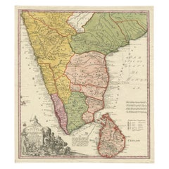
Antique map titled 'Stato del Mogol con l'Isole di Ceilan e Maldive'. Beautiful map of India and Ceylon, along with the Maldives. Includes a large decorative title cartouche. The map was issued in Zatta's Atlante Novissimo a monumental 4 volume work and is one of the last great decorative atlases.
Antonio Zatta (fl. 1757-1797) was a prominent Italian editor, cartographer, and publisher. Little is known about his life beyond his many surviving published works. It is possible that he was born as early as 1722 and lived as late as 1804. He lived in Venice and his work flourished between 1757 and 1797. He is best known for his atlas, Atlante Novissimo (1779-1785), and for his prolific output of prints and books that were both precisely made and aesthetically pleasing. Zatta clearly had a large network from which to draw information; this is how he was able to publish the first glimpse of the islands visited by Captain Cook in the Atlante Novissimo. Zatta also published books of plays and architecture.
- Dimensions:Height: 19.41 in (49.3 cm)Width: 15.04 in (38.2 cm)Depth: 0.02 in (0.5 mm)
- Materials and Techniques:
- Period:
- Date of Manufacture:1785
- Condition:General age-related toning. Original folding line with split in right margin and a very small split affecting image. Minor wear and soiling, blank verso. Please study image carefully.
- Seller Location:Langweer, NL
- Reference Number:
About the Seller
5.0
Platinum Seller
These expertly vetted sellers are 1stDibs' most experienced sellers and are rated highest by our customers.
Established in 2009
1stDibs seller since 2017
1,928 sales on 1stDibs
Typical response time: <1 hour
- ShippingRetrieving quote...Ships From: Langweer, Netherlands
- Return PolicyA return for this item may be initiated within 14 days of delivery.
More From This SellerView All
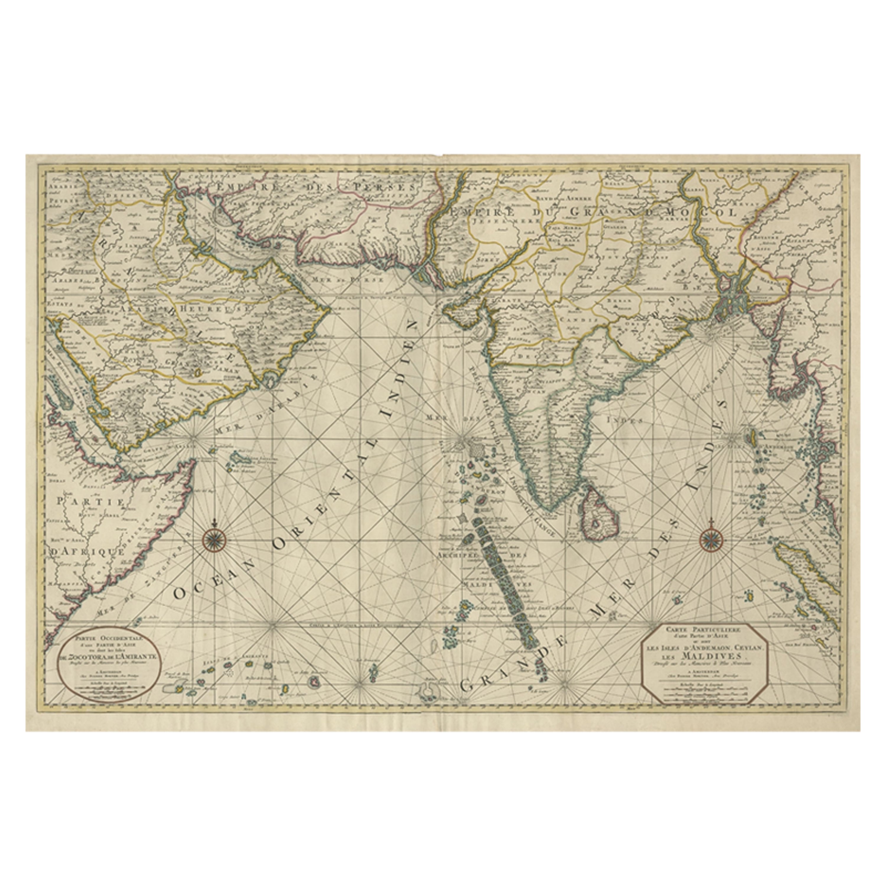
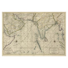
- Antique Map of Southern Asia with India, the Maldives, Ceylon and Arabia, c.1700Located in Langweer, NLStunning Old Map of Asia. Description: Two-sheet map of Asia, joined. The left part of this antique map is titled 'Partie occidentale d'une partie d'Asie ou sont les Isles de Zoco...Category
Antique Early 18th Century Maps
MaterialsPaper
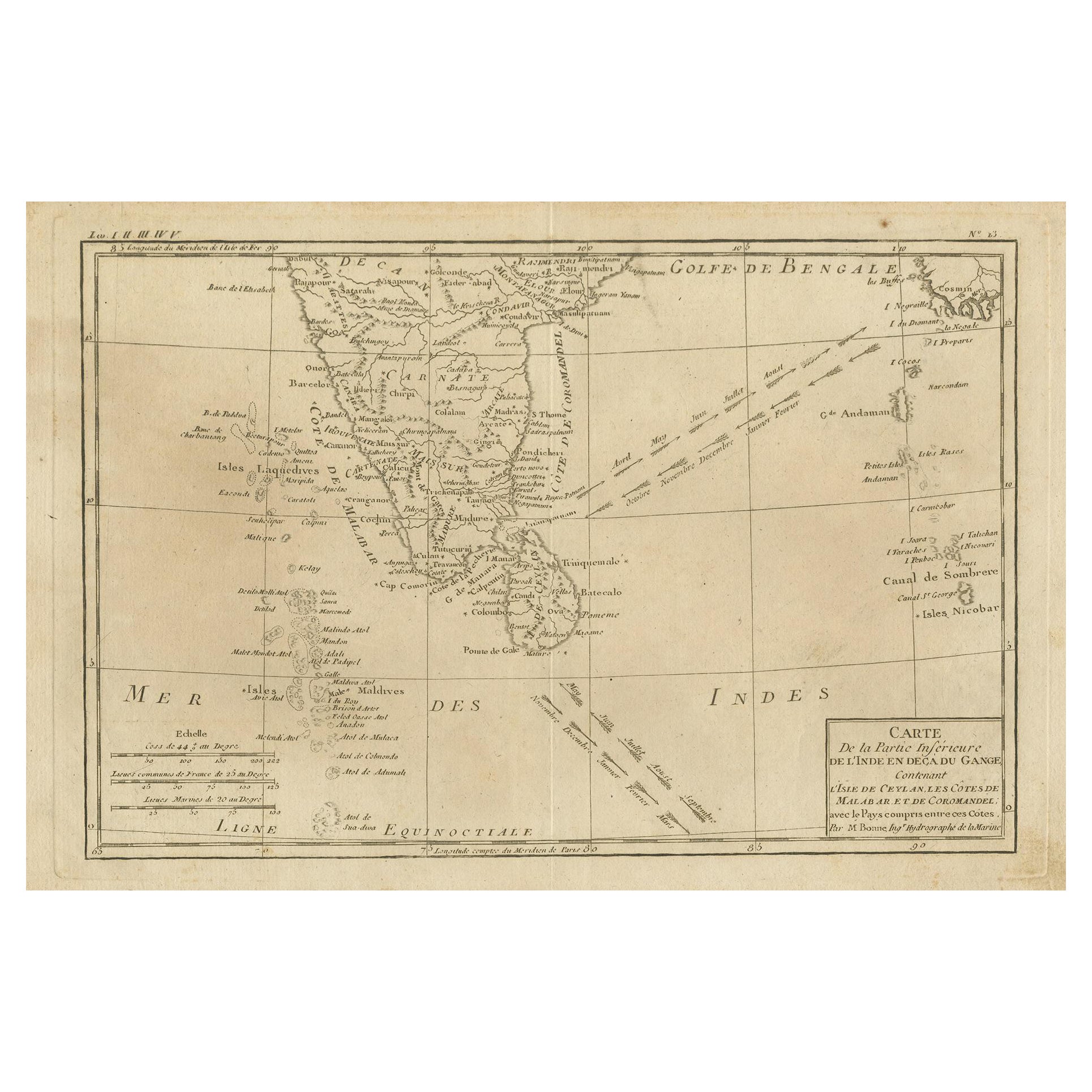
- Antique Map of Southern India, the Maldives and Sri Lanka with CurrentsLocated in Langweer, NLAntique map titled 'Carte de la Partie Inferieure De L'Inde En Deca Du Gange (..)'. Interesting map of Southern India, the Maldives and Sri Lanka. Includes a month by month charting ...Category
Antique Late 18th Century Maps
MaterialsPaper
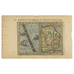
- Antique Miniature Map of Ceylon 'Sri Lanka' and the Maldives by Bertius, 1618Located in Langweer, NLAntique map titled 'Descriptio Zeilan, et Maldivarum Inss'. Rare, original antique miniature map of Ceylon/Sri Lanka and the Maldives. This map originate...Category
Antique Early 17th Century Maps
MaterialsPaper
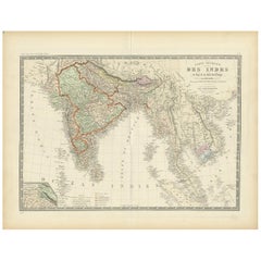
- Authentic Antique Map of India and Ceylon, '1875'Located in Langweer, NLAntique map titled 'Carte générale des Indes'. Large map of India and Ceylon. This map originates from 'Atlas de Géographie Moderne Physique et Politique' by A. Levasseur. Published ...Category
Antique Late 19th Century Maps
MaterialsPaper
- Antique Map of India and Ceylon by Lapie, 1842Located in Langweer, NLAntique map titled 'Carte de l'Inde en deca et au dela du Gange'. Map of India and Ceylon (Sri Lanka). This map originates from 'Atlas universel de géographie ancienne et moderne (.....Category
Antique Mid-19th Century Maps
MaterialsPaper
- Original Antique Map of Malabar, Coromandel 'India' and CeylonLocated in Langweer, NLAntique map titled 'Peninsula Indiae citra Gangem, hoc est Orae celeberrimae Malabar & Coromandel (..)'. Large and attractive original hand colored map of Sri Lanka and the Southern ...Category
Antique Mid-18th Century Maps
MaterialsPaper


You May Also Like
- Original Antique Map of India. C.1780Located in St Annes, LancashireGreat map of India Copper-plate engraving Published C.1780 Three small worm holes to right side of map and one bottom left corner Unframed.Category
Antique Early 1800s English Georgian Maps
MaterialsPaper

- Antique 1803 Italian Map of Asia Including China Indoneseia IndiaLocated in Amsterdam, Noord HollandAntique 1803 Italian Map of Asia Including China Indoneseia India Very nice map of Asia. 1803. Additional information: Type: Map Country of Manufacturing: Europe Period: 19th centu...Category
Antique 19th Century European Maps
MaterialsPaper
- Antique French Map of Asia Including China Indoneseia India, 1783Located in Amsterdam, Noord HollandVery nice map of Asia. 1783 Dedie au Roy. Additional information: Country of Manufacturing: Europe Period: 18th century Qing (1661 - 1912) Condition: Overall Condition B (Good Used)...Category
Antique 18th Century European Maps
MaterialsPaper
- 1861 Topographical Map of the District of Columbia, by Boschke, Antique MapLocated in Colorado Springs, COPresented is an original map of Albert Boschke's extremely sought-after "Topographical Map of the District of Columbia Surveyed in the Years 1856 ...Category
Antique 1860s American Historical Memorabilia
MaterialsPaper
- Large Original Vintage Map of India, circa 1920Located in St Annes, LancashireGreat map of India Original color. Good condition / repair to some minor damage just above Sri Lanka. Shown in the last image. Published by Alexander Gross Unframed.Category
Vintage 1920s English Maps
MaterialsPaper
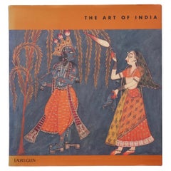
- The Art of IndiaLocated in Bradenton, FLThe Art of India. Hardcover book with dustjacket. First edition, published in 1997 by Laurel Glen Publishing. Illustrated, 97 pages.Category
Late 20th Century Books
MaterialsPaper


Recently Viewed
View AllMore Ways To Browse
Atlas 42
Large Old Map
Map Collection
Antique Kiel Furniture
Collectible Barbies
Jackson Hole Map
Miles Johnston
Native American Mountie
Toledo Scale Company Antique
Vintage Marthas Vineyard Map
Charente Map
F Colton
Ian Maguire
Ithaca Antique Map
Rand McNally & Co. On Sale
Vintage Butcher Shop Posters
Antique Ornamental Map
Asian Centric World Map