Items Similar to Antique Map of Northwestern India by Weller, 1857
Want more images or videos?
Request additional images or videos from the seller
1 of 5
Antique Map of Northwestern India by Weller, 1857
About the Item
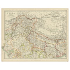
Antique map titled 'India, The North West Provinces and Oude'.Detailed map of the northwestern part of India, extending to the Himalaya Mountains. Shows part of Nepal including Dharmsala. Originates from the 'Weekly Dispatch Atlas'. Artists and Engravers: 'The Weekly Dispatch' newspaper between the years 1856 and 1862 included in each edition a map of a part of the world. During this period a total of 118 maps were issued. The maps bear the distinctive sign of a half globe with the figure of Mercury above. The engravers varied but included John Dower and Edward Weller.
Artist: 'The Weekly Dispatch' newspaper between the years 1856 and 1862 included in each edition a map of a part of the world. During this period a total of 118 maps were issued. The maps bear the distinctive sign of a half globe with the figure of Mercury above. The engravers varied but included John Dower and Edward Weller.
Antique prints have long been appreciated for both their aesthetic and investment value. They were the product of engraved, etched or lithographed plates. These plates were handmade out of wood or metal, which required an incredible level of skill, patience and craftsmanship. Whether you have a house with Victorian furniture or more contemporary decor an old engraving can enhance your living space.
- Dimensions:Height: 13.39 in (34 cm)Width: 19.49 in (49.5 cm)Depth: 0 in (0.01 mm)
- Materials and Techniques:
- Period:
- Date of Manufacture:1857
- Condition:Condition: Good, general age-related toning. Stamp in upper left corner stating the Weekly Dispatch edition. Few small tears, please study image carefully.
- Seller Location:Langweer, NL
- Reference Number:
About the Seller
5.0
Platinum Seller
These expertly vetted sellers are 1stDibs' most experienced sellers and are rated highest by our customers.
Established in 2009
1stDibs seller since 2017
1,929 sales on 1stDibs
Typical response time: <1 hour
- ShippingRetrieving quote...Ships From: Langweer, Netherlands
- Return PolicyA return for this item may be initiated within 14 days of delivery.
More From This SellerView All
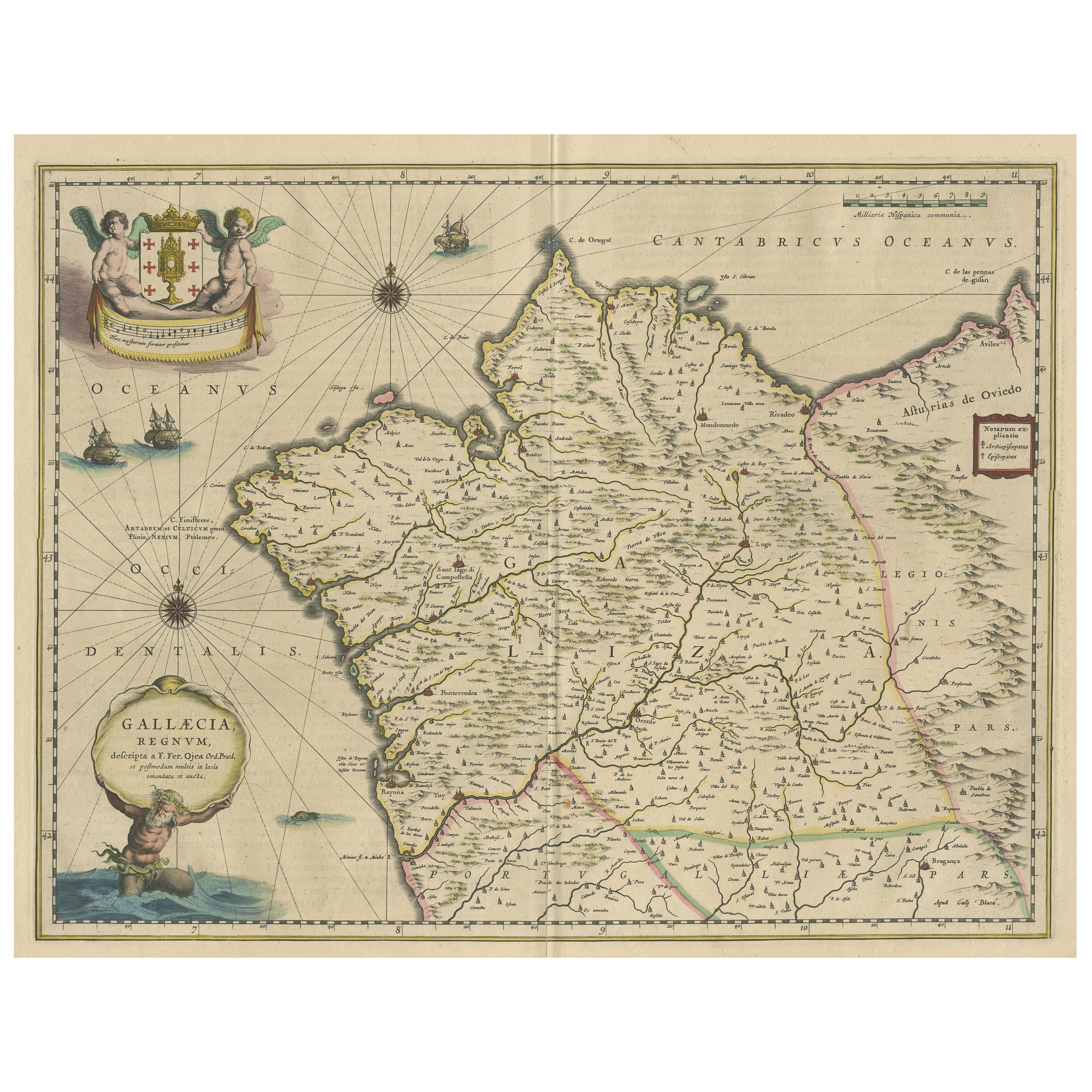
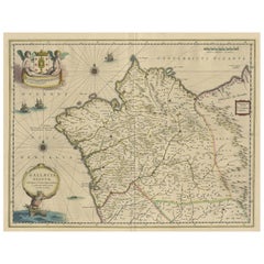
- Antique Map of the Northwestern Coast of SpainLocated in Langweer, NLAntique map titled 'Gallaecia Regnum'. Original old map of the northwestern coast of Spain, extending from the Asturias de Oviedo region and Aviles in the Northeast to Bayona and the...Category
Antique Mid-17th Century Maps
MaterialsPaper
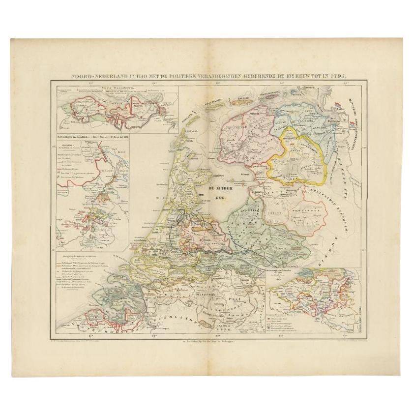
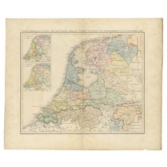
- Antique Map of the Netherlands in 1740 by Mees, 1857Located in Langweer, NLAntique map titled 'Noord-Nederland in 1740 met de Politieke veranderingen gedurende de 18e eeuw tot in 1795'. Map of the Netherlands in 1740. This map originates from 'Historische A...Category
Antique 19th Century Maps
MaterialsPaper
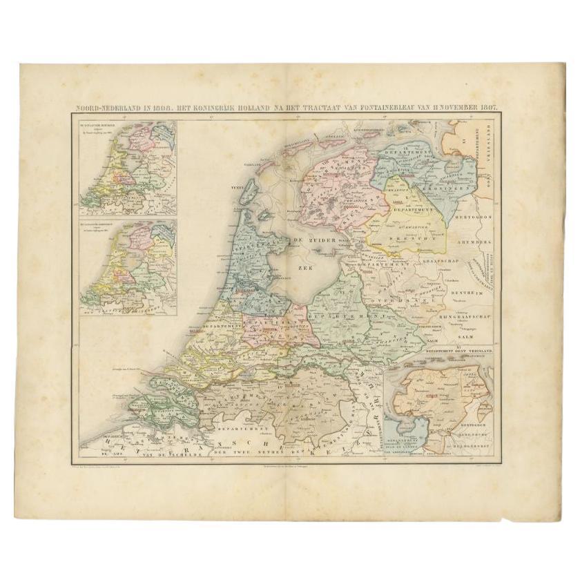
- Antique Map of the Netherlands in 1808 by Mees, 1857Located in Langweer, NLAntique map titled 'Noord-Nederland in 1808. Het Koningrijk Holland na het tractaat van Fontainebleau van 11 november 1807'. Map of the Netherlands in 1808. This map originates from ...Category
Antique 19th Century Maps
MaterialsPaper
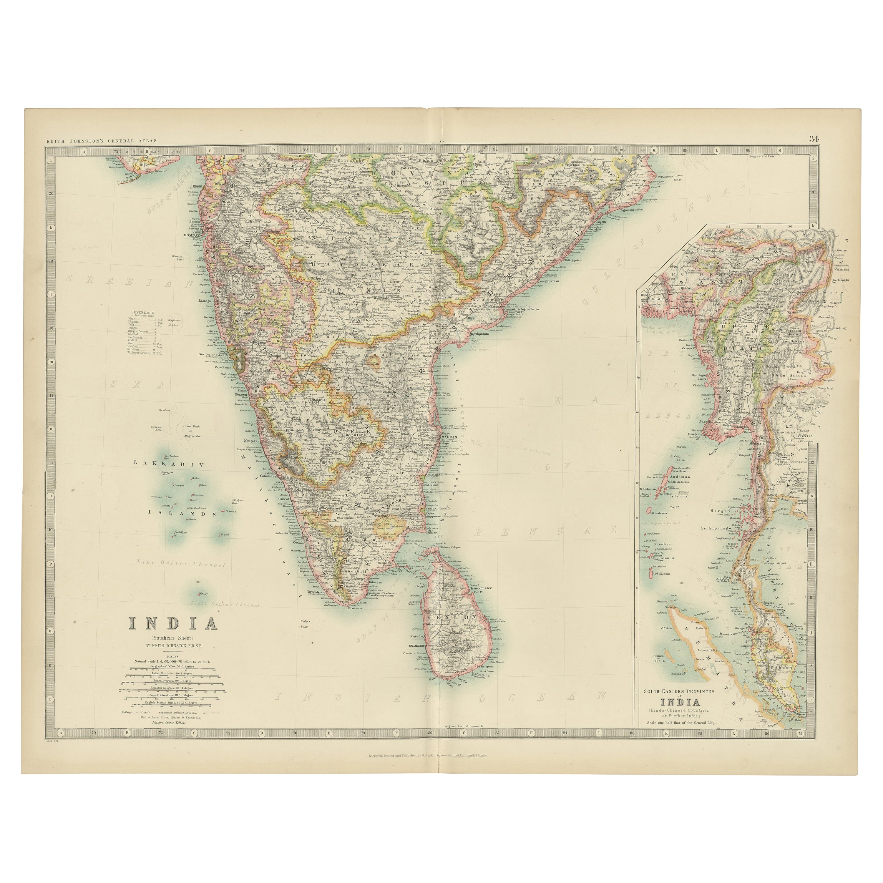
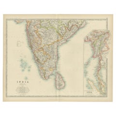
- Antique Map of India ( Southern ) by Johnston (1909)Located in Langweer, NLAntique map titled 'India'. Original antique map of India Southern sheet. With inset maps of south eastern provinces of India. This map originates from the ‘Royal Atlas of Modern Geo...Category
Early 20th Century Maps
MaterialsPaper
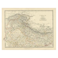
- Antique Map of India 'Northern' by Johnston '1909'Located in Langweer, NLAntique map titled 'India'. Original antique map of India, Northern sheet. This map originates from the ‘Royal Atlas of Modern Geography’. Published by W. & A.K. Johnston, 1909.Category
Early 20th Century Maps
MaterialsPaper
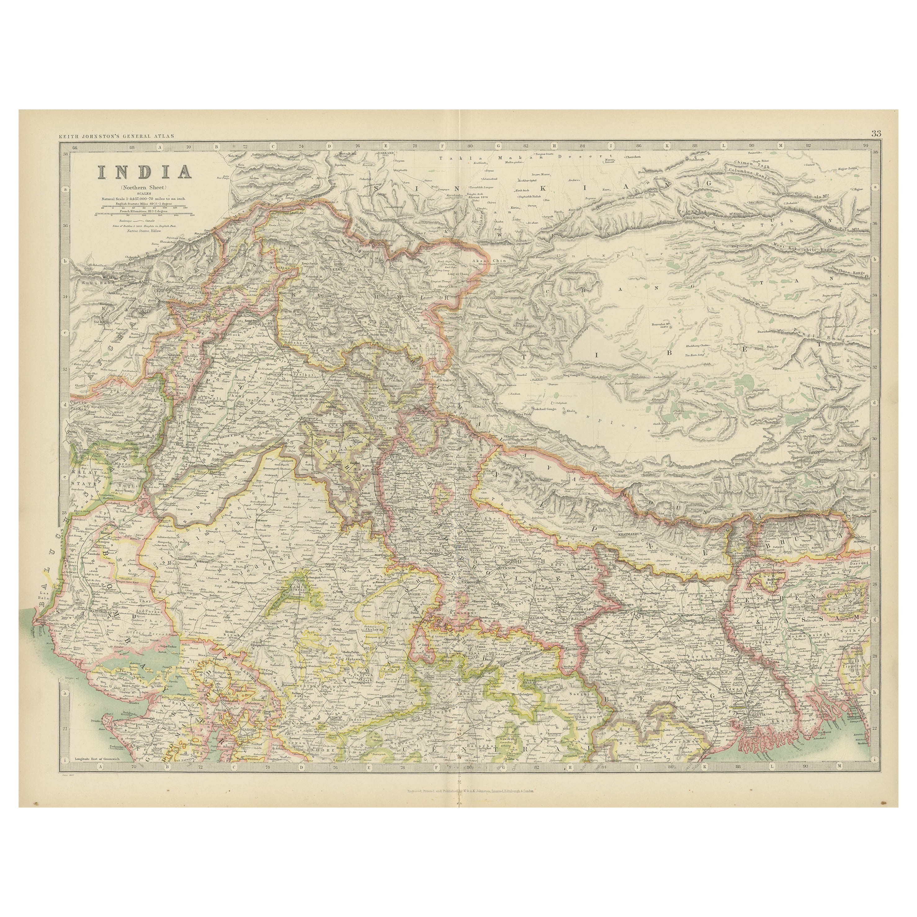
- Antique Map of Northern India by Johnston, 1867Located in Langweer, NLAntique map titled 'India (Northern Sheet)'. Depicting Rajputana, Bombay, Nepal and more. Originates from the 'Handy Royal Atlas of Modern Geography' by Alex Keith Johnston. Artists ...Category
Antique 19th Century Maps
MaterialsPaper
You May Also Like
- Antique French Map of Asia Including China Indoneseia India, 1783Located in Amsterdam, Noord HollandVery nice map of Asia. 1783 Dedie au Roy. Additional information: Country of Manufacturing: Europe Period: 18th century Qing (1661 - 1912) Condition: Overall Condition B (Good Used)...Category
Antique 18th Century European Maps
MaterialsPaper
- Antique 1803 Italian Map of Asia Including China Indoneseia IndiaLocated in Amsterdam, Noord HollandAntique 1803 Italian Map of Asia Including China Indoneseia India Very nice map of Asia. 1803. Additional information: Type: Map Country of Manufacturing: Europe Period: 19th centu...Category
Antique 19th Century European Maps
MaterialsPaper
- Large Original Vintage Map of India, circa 1920Located in St Annes, LancashireGreat map of India Original color. Good condition / repair to some minor damage just above Sri Lanka. Shown in the last image. Published by Alexander Gross Unframed.Category
Vintage 1920s English Maps
MaterialsPaper
- 1861 Topographical Map of the District of Columbia, by Boschke, Antique MapLocated in Colorado Springs, COPresented is an original map of Albert Boschke's extremely sought-after "Topographical Map of the District of Columbia Surveyed in the Years 1856 ...Category
Antique 1860s American Historical Memorabilia
MaterialsPaper
- 1907 Map of Colorado, Antique Topographical Map, by Louis NellLocated in Colorado Springs, COThis highly detailed pocket map is a topographical map of the state of Colorado by Louis Nell from 1907. The map "has been complied from all availabl...Category
Antique Early 1900s American Maps
MaterialsPaper
- Antique Map of Italy by Andriveau-Goujon, 1843By Andriveau-GoujonLocated in New York, NYAntique Map of Italy by Andriveau-Goujon, 1843. Map of Italy in two parts by Andriveau-Goujon for the Library of Prince Carini at Palazzo Carini i...Category
Antique 1840s French Maps
MaterialsLinen, Paper


Recently Viewed
View AllMore Ways To Browse
Old Well
Antiques Of India
India Plates
Antique Globes Of The World
Northwestern Furniture
Victorian India
Antique World Map Print
India Decor
India Engraving
Half Globes
Antique Metal Globes
Old Antique Globes
Antique Decor India
Antique Furniture Nepal
Antique Prints Mountains
Antique Map Globe
Antiques Nepal
Atlas Globe