Items Similar to Original Hand-colored Antique Map of the Southern Part of India

Want more images or videos?
Request additional images or videos from the seller
1 of 6
Original Hand-colored Antique Map of the Southern Part of India
About the Item
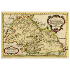
Antique map titled 'Orarum Malabariae, Coromandelae &c Tabula Accuratissima - Carte des Cotes de Malabar et de Coromandel'. Beautiful map of the southern part of India. It focuses on trade routes within India, as well as the Coromandel and Malabar Coasts. The map shows the Indian subcontinent, from Gujarat and Bengal south. The northern tip of Ceylon, or Sri Lanka, peeks out of the southern border. To the west, the Maldives dot the waters off the Malabar coast.
Rivers, including the mighty Ganges, are indicated, as our mountain ranges. Political boundaries are outlined, with settlements marked by circles or small buildings. Trade routes snake across the terrain, indicated by double dashed lines. They radiate from areas rich in resources, such as the diamond mine of Raolconda [part of the Golconda diamond mines], or from cities at the crossroads of commerce, such as Amandabat [Ahmedabad].
Published by Covens & Mortier, circa 1725.
- Dimensions:Height: 22.05 in (56 cm)Width: 26.3 in (66.8 cm)Depth: 0.02 in (0.5 mm)
- Materials and Techniques:
- Period:
- Date of Manufacture:c.1725
- Condition:Repaired: repair on split. General age-related toning. Original folding line, with repair on split. Minor wear and soiling. Blank verso. Please study image carefully.
- Seller Location:Langweer, NL
- Reference Number:
About the Seller
5.0
Platinum Seller
These expertly vetted sellers are 1stDibs' most experienced sellers and are rated highest by our customers.
Established in 2009
1stDibs seller since 2017
1,922 sales on 1stDibs
Typical response time: <1 hour
- ShippingRetrieving quote...Ships From: Langweer, Netherlands
- Return PolicyA return for this item may be initiated within 14 days of delivery.
More From This SellerView All
- Nicely Hand-Colored Antique Map of Part of India, the Ganges & Hindustan, 1755Located in Langweer, NLAntique map titled 'Carte de l'Inde en deca du Gange comprenant l' Indoustan (..)' A map of part of India, the Ganges and Hindustan. From: Antoine Francois Prevost d'Exiles' (or ...Category
Antique 1750s Maps
MaterialsPaper
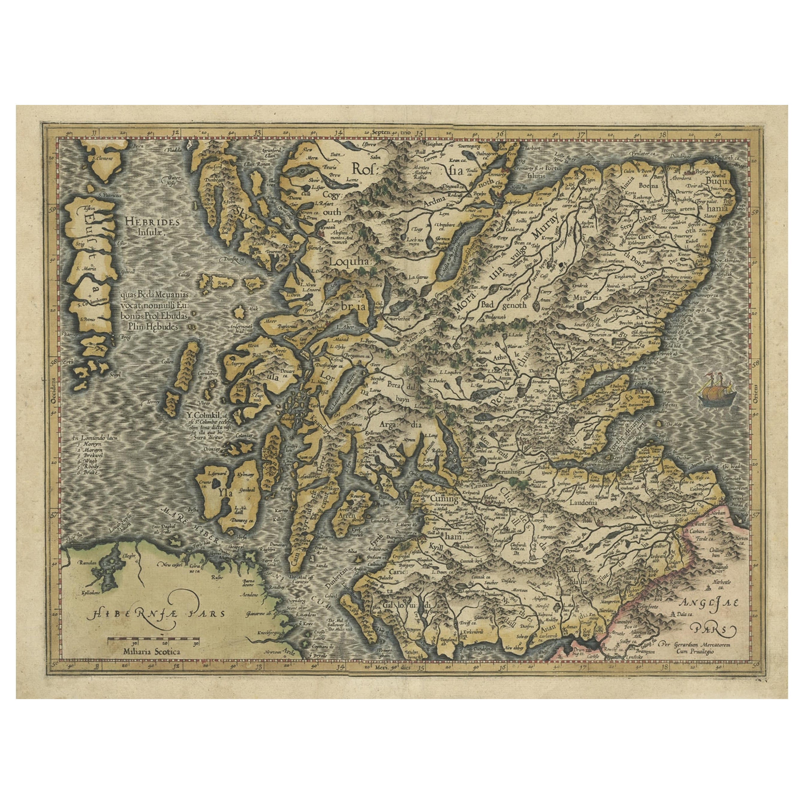
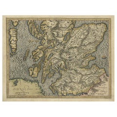
- Original Antique Hand-Colored Map of Southern Scotland, ca.1600Located in Langweer, NLAntique map of Southern Scotland. This map was published by G. Mercator, he also published a map of Northern Scotland titled 'Scotiae Regnum'. Both maps were published on individual sheets. Artists and Engravers: Gerard Mercator (1512 - 1594) originally a student of philosophy was one of the most renowned cosmographers and geographers of the 16th century, as well as an accomplished scientific instrument maker. He is most famous for introducing Mercators Projection, a system which allowed navigators to plot the same constant compass bearing on a flat map...Category
Antique Early 1600s Maps
MaterialsPaper
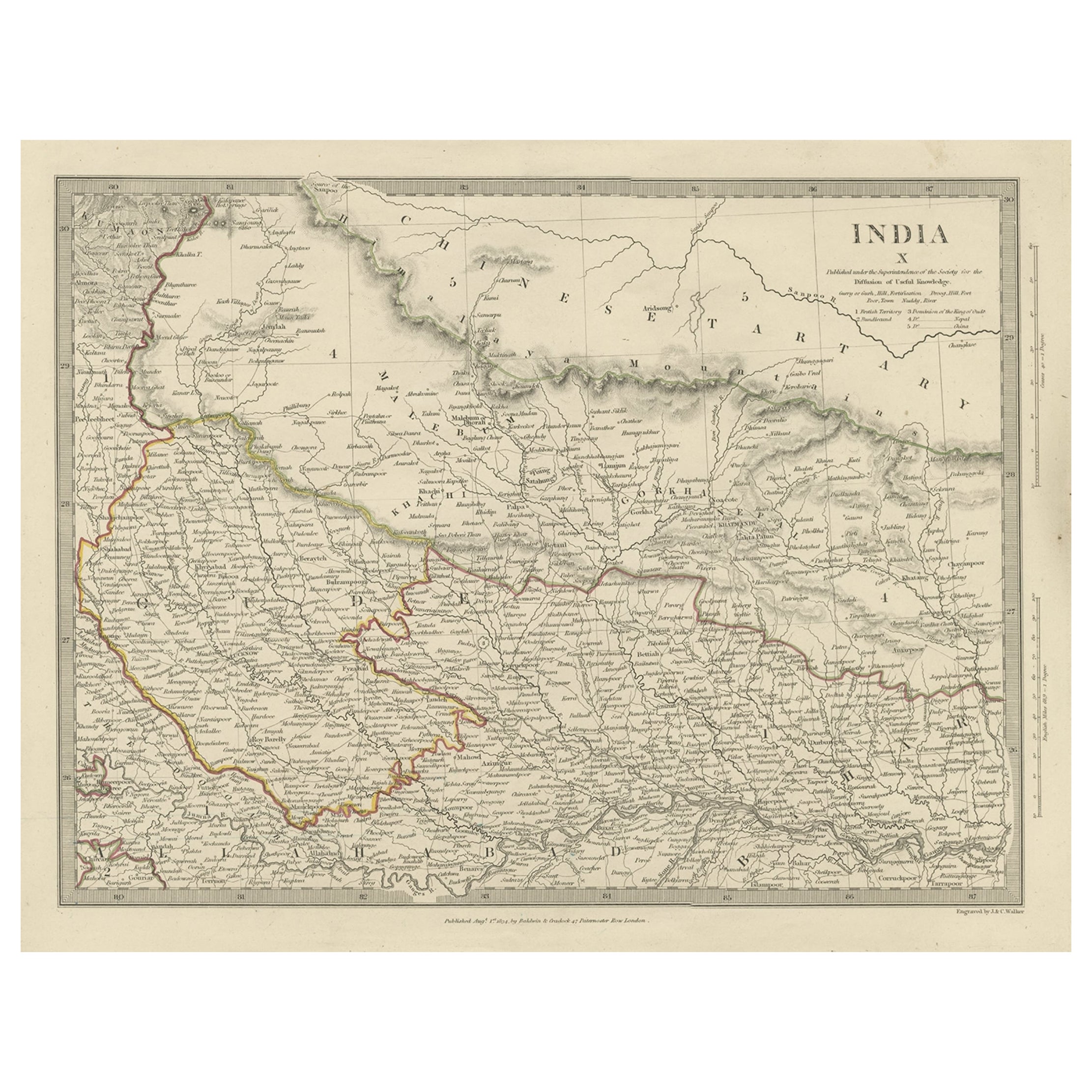
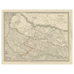
- Original Antique Map of Part of the Bahar Region (India), 1834Located in Langweer, NLAntique map titled 'India X'. Old steel engraved map of part of the Bahar region, it also shows part of Nepal. Artists and Engravers: Engraved by J. & C. Walker. Published under th...Category
Antique 19th Century Maps
MaterialsPaper
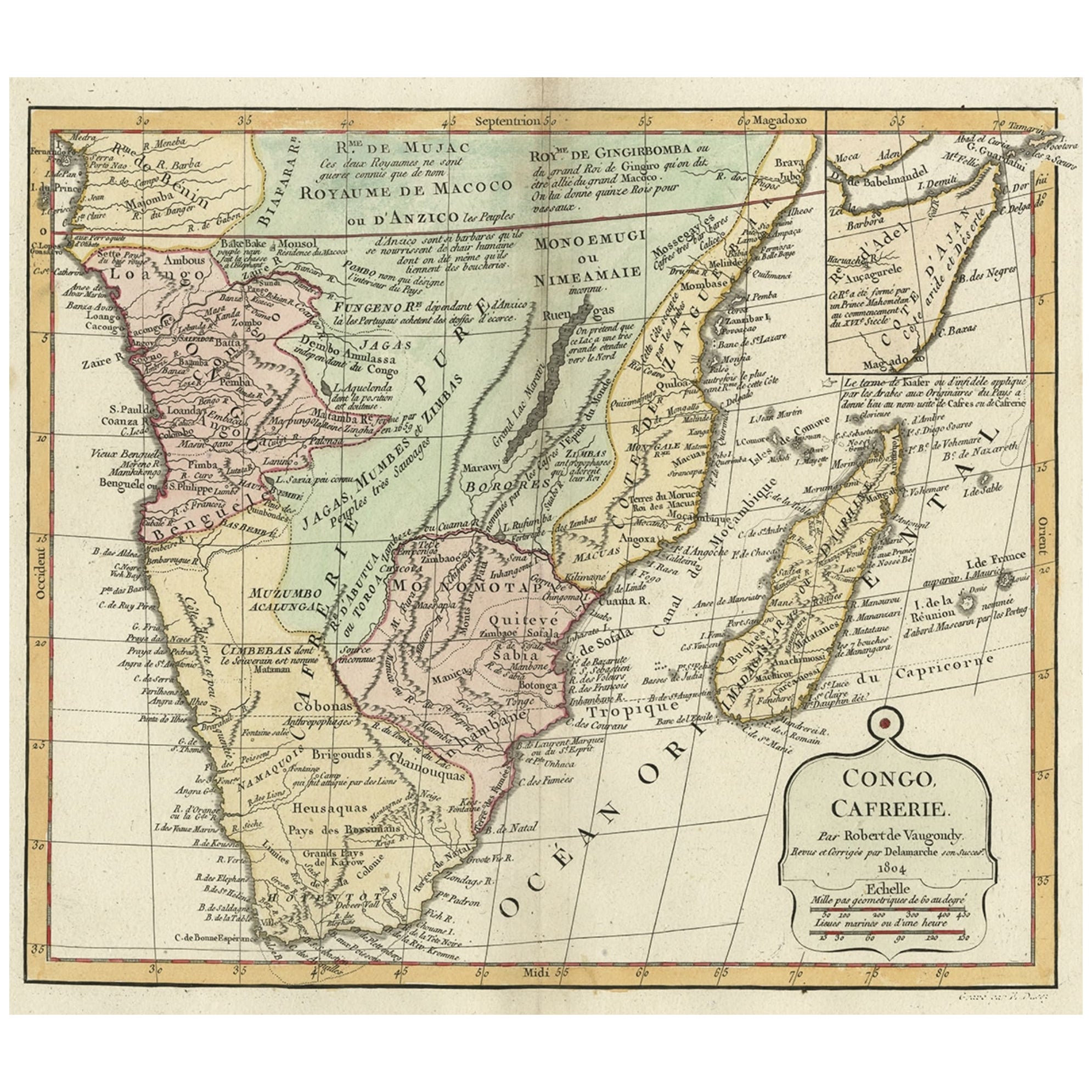
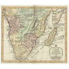
- Decorative Antique Map of the Southern Part of Africa, 1806Located in Langweer, NLAntique map titled 'Congo, Cafrerie.' Decorative map of the southern part of Africa by Robert de Vaugondy, revised and published by Delamarche. Source unknown, to be determined. Artists and Engravers: Charles Francois Delamarche (1740-1817) founded the important and prolific Paris based Maison Delamarche map publishing firm in the late 18th century. A lawyer by trade Delamarche entered the map business with the acquisition from Jean-Baptiste Fortin of Robert de Vaugondy's map plates...Category
Antique Early 1800s Maps
MaterialsPaper
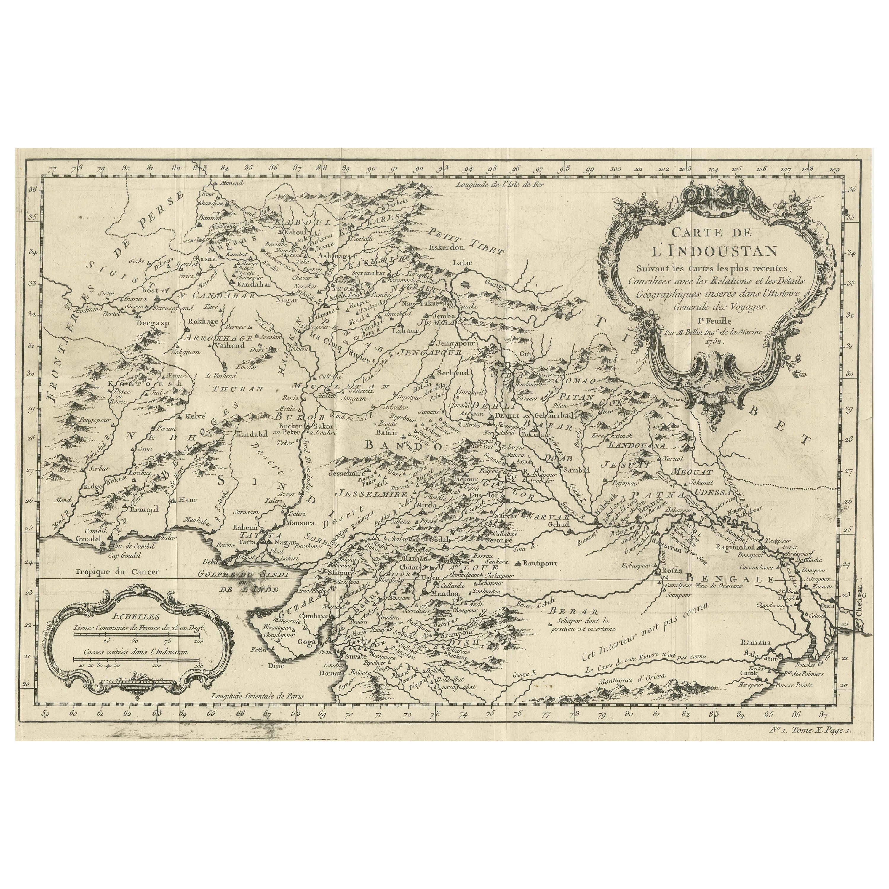
- Antique Map of part of India, the Ganges and HindustanLocated in Langweer, NLAntique map titled 'Carte de l'Indoustan'. Original antique map of part of India, the Ganges and Hindustan. This map originates from 'Histoire Generale Des Voyages' by Antoine Franco...Category
Antique Mid-18th Century Maps
MaterialsPaper
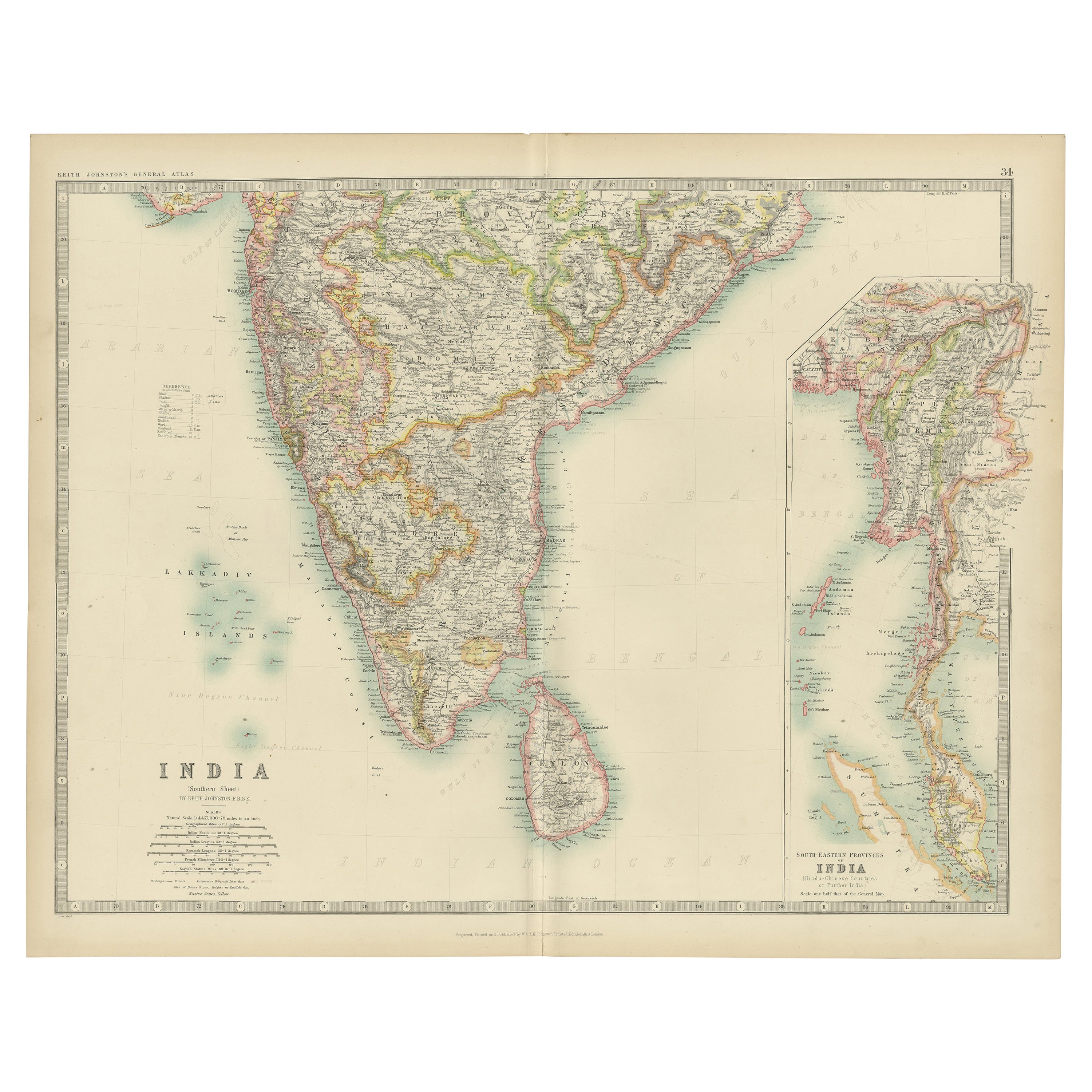
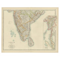
- Antique Map of India ( Southern ) by Johnston (1909)Located in Langweer, NLAntique map titled 'India'. Original antique map of India Southern sheet. With inset maps of south eastern provinces of India. This map originates from the ‘Royal Atlas of Modern Geo...Category
Early 20th Century Maps
MaterialsPaper
You May Also Like
- Original Antique Map of India. C.1780Located in St Annes, LancashireGreat map of India Copper-plate engraving Published C.1780 Three small worm holes to right side of map and one bottom left corner Unframed.Category
Antique Early 1800s English Georgian Maps
MaterialsPaper

- The Kingdom of Naples and Southern Italy: A Hand-Colored 18th Century Homann MapBy Johann Baptist HomannLocated in Alamo, CA"Novissima & exactissimus Totius Regni Neapolis Tabula Presentis Belli Satui Accommo Data" is a hand colored map of southern Italy and the ancient Kingdom of Naples created by Johann...Category
Antique Early 18th Century German Maps
MaterialsPaper
- Antique Hand Colored Framed Map of EuropeLocated in West Palm Beach, FLAntique reproduction copied from an edition dated 1595 by Ortelius.Category
Antique Late 19th Century Maps
- Hand Colored 17th Century Visscher Map "Hollandiae" Southern HollandBy Nicolaes Visscher IILocated in Alamo, CAA hand colored 17th century map of the southern portions of Holland by Nicolaus (Nicolas) Visscher II entitled "Hollandiae pars Meridionalis, vulgo Zuyd-Holland", published in Amsterdam in 1678. The map shows the region between Breda, Heusden, Gornichem, Gouda, Dordrecht, and Willemstad. It includes a decorative cartouche in the lower left corner. The map is presented in an attractive maple colored wood frame with gold trim and a fabric mat. The Visscher family were one of the great cartographic families of the 17th century. Begun by Claes Jansz Visscher...Category
Antique Early 18th Century Dutch Maps
MaterialsPaper
- Framed 1820s Hand Colored Map of the United StatesLocated in Stamford, CTFramed 1820s hand colored map photos of North America and South America. As found framed in giltwood frame.Category
Antique 1820s American Spanish Colonial Maps
MaterialsGiltwood, Paper, Glass
- Framed 1839 Hand Colored Map of the United StatesLocated in Stamford, CTFramed hand colored map of the United States of America from 1839. Newly framed in a giltwood frame.Category
Antique 1830s American American Classical Maps
MaterialsGiltwood, Paper, Glass


Recently Viewed
View AllMore Ways To Browse
Yugoslavia Map
Rand Mcnally Map Of Colorado
Ottoman Empire Map
Serbia Antique Map
Antique Curiosities North Carolina
Antique Maps Of Ukraine
Ukraine Antique Map
Map Alps
Map Of Alps
Map Oxford England
Antique Maps Of Lithuania
Babylon Map
Montenegro Antique Map
Antique Maps Kansas City
Cornwall Map
Jordan Antique Map
Vintage Maps Of Hawaii
Wyoming Map