Wyoming Map

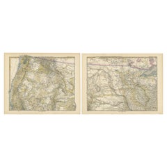
Set of two Antique Maps of the region of Oregon, Idaho, Wyoming, Nebraska & Iowa
Located in Langweer, NL
Set of two individual antique maps of part of the United States. It shows the region and
Category

Antique Late 19th Century Maps

Materials

Paper

Antique Map Colton's United States of America
Located in Langweer, NL
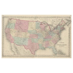
Antique map titled 'Colton's United States of America'. Show railroads, canals, state capitals
Category

Antique Mid-19th Century Maps

Materials

Paper

Antique Map Colton's United States of America
H 17.45 in W 27.45 in D 0.02 in
1889 "The Pacific States and Territories"
Located in Colorado Springs, CO
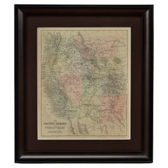
Presented is an uncommon 1889 map of the western United States, titled “The Pacific States and
Category

Antique 1880s American Maps

Materials

Paper

1889 "The Pacific States and Territories"
H 16.25 in W 14.25 in D 1 in
1879 "United States of America, Western Part" by O. J. Stuart
Located in Colorado Springs, CO
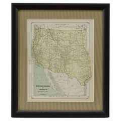
This colorful original map, titled “United States of America, Western Part,” was issued in Volume
Category

Antique 1870s American Maps

Materials

Paper

People Also Browsed

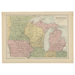
Antique Map of Western States, Michigan, Wisconsin, Iowa by A & C. Black, 1870
Located in Langweer, NL
Antique map titled 'Western States, Michigan, Wisconsin, Minnesota, Iowa with portions of Illinois & Indiana'. Original antique map of Western States, Michigan, Wisconsin, Minnesota,...
Category

Antique Late 19th Century Maps

Materials

Paper

American Victorian Oak and Pink and Green Patterned Fabric Upholstered Circular
Located in New York, NY
American Victorian circular borne / conversation seat with an oak frame, upholstered in a pink and green bow patterned damask fabric with a channeled center post and pleated seat ski...
Category

Antique 19th Century Victorian Ottomans and Poufs

Materials

Oak

Original Antique Hand-colored Map of the United States, circa 1845
Located in Langweer, NL
Antique map titled 'United States'. Old map of the United States, includes the last part of the North West Territory (present day Wisconsin and part of Minnesota). It also marks Ft. ...
Category

Antique Mid-19th Century Maps

Materials

Paper

Large Original Antique Map of Arizona, Usa, C.1900
Located in St Annes, Lancashire
Fabulous map of Arizona Original color. Engraved and printed by the George F. Cram Company, Indianapolis. Published, C.1900. Unframed. Free shipping.
Category

Antique 1890s American Maps

Materials

Paper

Large Original Antique Map of Arizona, Usa, C.1900
No Reserve
H 22 in W 15 in D 0.07 in
Large Original Antique Map of New Mexico, Usa, C.1900
Located in St Annes, Lancashire
Fabulous map of New Mexico. Original color. Engraved and printed by the George F. Cram Company, Indianapolis. Published, C.1900. Unframed. Free shipping.
Category

Antique 1890s American Maps

Materials

Paper

Antique Decorative Coloured Map of North America, 1882
Located in Langweer, NL
This original antique map of North America is from the Blackie & Son Atlas published in 1882. Here are several points of interest about this map: 1. **Political Borders**: The map l...
Category

Antique 1880s Maps

Materials

Paper

Antique Decorative Coloured Map of North America, 1882
No Reserve
H 14.97 in W 22.45 in D 0 in
Large Antique Map of the State of Texas, 1861
Located in Langweer, NL
Antique map titled 'Johnson's New Map of the State of Texas' Large map of Texas, shows railroads, wagon roads, the U.S. Mail Route, rivers, ports, large towns, and villages of the mi...
Category

Antique Mid-19th Century Maps

Materials

Paper

Large Antique Map of the State of Texas, 1861
Free Shipping
H 18.04 in W 26.58 in D 0.02 in
Large Original Antique Map of Ohio, Usa, C.1900
Located in St Annes, Lancashire
Fabulous map of Ohio Original color. Engraved and printed by the George F. Cram Company, Indianapolis. Published, C.1900. Unframed. Free shipping.
Category

Antique 1890s American Maps

Materials

Paper

Large Original Antique Map of Ohio, Usa, C.1900
No Reserve
H 22 in W 15 in D 0.07 in
Large Original Antique Map of Wisconsin, USA, circa 1900
Located in St Annes, Lancashire
Fabulous map of Wisconsin Original color Engraved and printed by the George F. Cram Company, Indianapolis. Published, circa 1900 Unframed  
Category

Antique 1890s American Maps

Materials

Paper

Reply of the Zaporozhian Cossacks to Sultan Mehmed IV Painting after Ilya Repin
By Ilya Repin
Located in New York, NY
Reply of the Zaporozhian Cossacks to Sultan Mehmed IV of the Ottoman Empire, also known as Cossacks of Saporog Are Drafting a Manifesto. Late 19th Century. Monumental oil on ca...
Category

Antique Late 19th Century Russian Paintings

Materials

Canvas

Vintage Map of Nantucket Town by Ruth Haviland Sutton, 1946
Located in Nantucket, MA
Vintage Map of Nantucket Town by Ruth Haviland Sutton, 1946, a classic vintage tourist map of Nantucket Island showing historic landmarks and geographic details along with decorative...
Category

Vintage 1940s American Other Maps

Materials

Paper

Antique Map of The Kingdom of Alexander the Great, Published in 1880
Located in Langweer, NL
The map is titled "ALEXANDRI MAGNI REGNUM," which translates to "The Kingdom of Alexander the Great." It depicts the vast territories conquered by Alexander the Great during his reig...
Category

Antique 1880s Maps

Materials

Paper

1859 "Map of the United States of America..." by J. H. Colton
By J.H. Colton
Located in Colorado Springs, CO
Presented is an 1859 “Map of the United States of America, the British Provinces, Mexico, the West Indies and Central America with Part of New Granada and Venezuela” by John Hutchins...
Category

Antique 1850s American Maps

Materials

Paper

Adolf Constantin Baumgartner Stoiloff Oil on Board, Warriors
By Adolf Constantin Baumgartner-Stoiloff
Located in Los Angeles, CA
Adolf Constantin Baumgartner Stoiloff (Austrian/Russian, 1850-1924) a fine oil on board "Charging Warriors on Horseback" within an ornate giltwood frame, circa 1890 Born in 1850 i...
Category

Antique Late 19th Century Russian Baroque Paintings

Materials

Gesso, Canvas, Giltwood, Paint

Antique Map of The United States of North America, Pacific States, 1882
Located in Langweer, NL
The map is from the same 1882 Blackie Atlas and focuses on the Pacific States of the United States of America during that period. Here are some details and historical context about t...
Category

Antique 1880s Maps

Materials

Paper

19th Century Embroidered Silk Panel Map Of The World
Located in Forney, TX
A rare and visually striking framed antique European embroidered silk panel. Exquisitely hand-crafted in Continental Europe in the 19th century, depicting map of the world, double ...
Category

Antique 19th Century European Victorian Decorative Art

Materials

Silk, Thread

Recent Sales

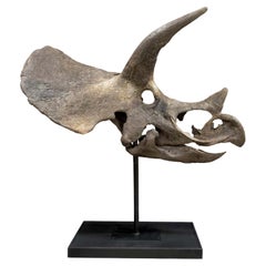
Large Bisected Fossilised Skull of a Triceratops Dinosaur with Bespoke Mount
Located in Cambridge, GB
' Late Cretaceous (68-66 million years ago) 224 x 213 x 84 cm From the Hell Creek Formation, Wyoming, US
Category

Antique 15th Century and Earlier American Natural Specimens

Materials

Bone

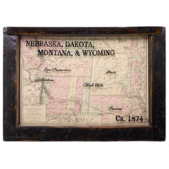
1874 Antique Map of Nebraska, Dakota, Montana, and Wyoming
Located in Colorado Springs, CO
Presented is an original map of Nebraska, Dakota, Montana, and Wyoming from 1874. This authentic
Category

Antique 1870s American Maps

Materials

Paper

Map of Montana, Idaho & Wyoming, from Colton's Atlas, Antique Hand-Colored, 1876
By G.W. & C.B. Colton
Located in Colorado Springs, CO
This is a remarkable large format map of the Territories of Montana, Wyoming, and Idaho, from a
Category

Antique 1870s American Maps

Materials

Paper

1848 "Pictorial Map of the United States" by Ensign & Thayer
Located in Colorado Springs, CO
full territorial claims of Texas, extending as far north as the border of present day Wyoming. This map
Category

Antique 1840s Maps

Materials

Paper

1847 "Pictorial Map of the United States" by Ensign and Thayer
Located in Colorado Springs, CO
territorial claims of Texas, extending as far north as the border of present day Wyoming. This map exhibits
Category

Antique 1840s American Maps

Materials

Paper

1854 "New Map of That Portion of North America" Published by Jacob Monk
Located in Colorado Springs, CO
“New Map of that Portion of North America, exhibiting the United States and Territories, The
Category

Antique 1850s American Maps

Materials

Paper

Our National Parks by John Muir, First Edition, 1901
Located in Colorado Springs, CO
illustrations and map diagrams throughout. The ten essays included had previously appeared as separately issued
Category

Antique Early 1900s American Books

Large Original Antique Map of Wyoming, USA, 1894
By Rand McNally & Co.
Located in St Annes, Lancashire
Fabulous map of Wyoming. Original color. By Rand, McNally & Co. Published, 1894
Category

Antique 1890s American Maps

Materials

Paper

Large Original Antique Map of Wyoming, USA, 1894
No Reserve
H 13.5 in W 20.5 in D 0.07 in
Original Antique Map of Idaho & Wyoming, circa 1890
Located in St Annes, Lancashire
Great map of Idaho & Wyoming Original Color. Published circa 1890 Slight paper loss (see
Category

Antique 1890s English Other Maps

Materials

Paper

Original Antique Map of Idaho & Wyoming, circa 1890
Free Shipping
H 15.5 in W 11.25 in D 0.07 in
Large Original Antique Map of Wyoming, Usa, C.1900
Located in St Annes, Lancashire
Fabulous map of Wyoming. Original color. Engraved and printed by the George F. Cram Company
Category

Antique 1890s American Maps

Materials

Paper

Large Original Antique Map of Wyoming, Usa, C.1900
No Reserve
H 15 in W 22 in D 0.07 in
Original Antique Map of The States of Wyoming, Idaho, Montana & Dakota
Located in St Annes, Lancashire
Great map of Wyoming, Idaho, Montana and Dakota Drawn and Engraved by W. & A.K. Johnston
Category

Antique 1880s Scottish Victorian Maps

Materials

Paper

"Jackson Hole Country, Wyoming" Vintage Pictorial Map by Harold Hopkinson, 1956
Located in Colorado Springs, CO
This is an attractive and rare 1956 pictorial view map of Jackson Hole, Wyoming, drawn by Harold
Category

Vintage 1950s American Maps

Materials

Paper

Antique Map of Nebraska, Dakota, Idaho, Montana and Wyoming by Johnson '1872'
Located in Langweer, NL
Wyoming. This map originates from 'Johnson's New Illustrated Family Atlas of the World' by A.J. Johnson
Category

Antique Late 19th Century Maps

Materials

Paper

Antique Map of Texas, California and the Southwest by Tallis, c.1850
Located in Langweer, NL
Antique map titled 'Mexico, California and Texas'. Decorative regional map of the Texas, California
Category

Antique Mid-19th Century Maps

Materials

Paper

Eduardo Chavez Vintage 1977 Bronze Sculpture "Ouray"
Located in Denver, CO
map for the Glenwood Springs post office. In the late 1930s, under one of the Federal art programs
Category

Vintage 1970s American Mid-Century Modern Abstract Sculptures

Materials

Bronze

Monumental Pair of Cary's Library Globes
Located in New York, NY
, ending in spade feet on brass casters. The terrestrial globe is mapped with detailed
Category

Antique 19th Century English Globes

Materials

Mahogany

Get Updated with New Arrivals
Save "Wyoming Map", and we’ll notify you when there are new listings in this category.

Read More

Pamela Shamshiri Shares the Secrets behind Her First-Ever Book and Its Effortlessly Cool Interiors

The sought-after designer worked with the team at Hoffman Creative to produce a monograph that beautifully showcases some of Studio Shamshiri's most inspiring projects.

Moroccan Artworks and Objects Take Center Stage in an Extraordinary Villa in Tangier

Italian writer and collector Umberto Pasti opens the doors to his remarkable cave of wonders in North Africa.

Montecito Has Drawn Royalty and Celebrities, and These Homes Are Proof of Its Allure

Hollywood A-listers, ex-pat aristocrats and art collectors and style setters of all stripes appreciate the allure of the coastal California hamlet — much on our minds after recent winter floods.

Whaam! Blam! Pow! — a New Book on Pop Art Packs a Punch

Publishing house Assouline and writer Julie Belcove have teamed up to trace the history of the genre, from Roy Lichtenstein, Andy Warhol and Yayoi Kusama to Mickalene Thomas and Jeff Koons.

The Sparkling Legacy of Tiffany & Co. Explained, One Jewel at a Time

A gorgeous new book celebrates — and memorializes — the iconic jeweler’s rich heritage.

What Makes a Gem-Encrusted Chess Set Worth $4 Million?

The world’s most opulent chess set, weighing in at 513 carats, is literally fit for a king and queen.

Tauba Auerbach’s Geometric Pop-Up Book Is Mighty Rare, Thanks to a Hurricane

This sculptural art book has an epic backstory of its own.

Step inside the Storied Mansions of Palm Beach’s Most Effervescent Architect

From Spanish-style courtyards to fanciful fountains, these acclaimed structures abound in surprising and elegant details.