Antique Florida Map

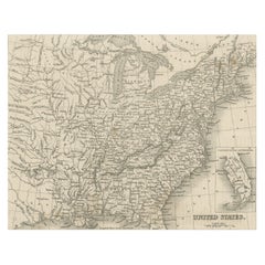
Steel Engraved Map of the United States with Inset Map of Florida
Located in Langweer, NL
Antique map titled 'United States'. Steel engraved map of the United States. With small inset map
Category

Mid-19th Century Antique Florida Map

Materials

Paper

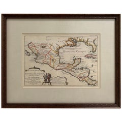
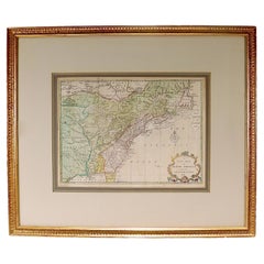
1705 Golfe de Mexico and Florida Framed Map
Located in Stamford, CT
Framed map of Mexico & Florida circa 1705, Paris. Small map with Mexico and the Gulf Coast. Inset
Category

Early 1700s French Spanish Colonial Antique Florida Map

Materials

Glass, Wood, Paper

Original Antique Map of Central America / Florida, Arrowsmith, 1820
Located in St Annes, Lancashire
Great map of Central America. Drawn under the direction of Arrowsmith. Copper-plate engraving
Category

1820s English Antique Florida Map

Materials

Paper

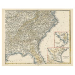
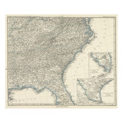
Antique Map of the Region of Georgia with Inset Maps of Florida and Texas
Located in Langweer, NL
, Tennessee, Kentucky, Virginia and part of Florida. With inset maps of the southern part of Florida and the
Category

Late 19th Century Antique Florida Map

Materials

Paper

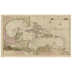
Engraving of a Map of Florida, the Gulf Coast, Caribbean & Central America, 1728
Located in Langweer, NL
early 18th-century mapmaking. The map showcases a meticulous and comprehensive depiction of Florida
Category

Mid-18th Century European Antique Florida Map

Materials

Paper

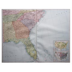
Large Original Vintage Map of the South Eastern States Inc. Florida, circa 1920
Located in St Annes, Lancashire
Great map of The South Eastern States Original color. Good condition Published by Alexander
Category

1920s English Antique Florida Map

Materials

Paper

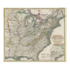
Antique Map of the Eastern United States with Only the Northern Part of Florida
Located in Langweer, NL
Antique map titled 'Verein-Staaten von Nord-America mit Ausnahme Florida's und der Westlichen
Category

Mid-19th Century Antique Florida Map

Materials

Paper

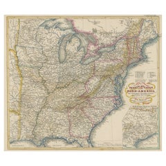
Antique Map of the Eastern United States with Inset Map of Texas
Located in Langweer, NL
Antique map titled 'Verein-Staaten von Nord-America mit Ausnahme Florida's und der Westlichen
Category

Mid-19th Century Antique Florida Map

Materials

Paper

Antique Map of Tennessee, Kentucky, Virginia, Alabama, Georgia and Surroundings
Located in Langweer, NL
, Tennessee, Kentucky, Virginia and part of Florida. With inset maps of the southern part of Florida and the
Category

Mid-19th Century Antique Florida Map

Materials

Paper

New Map of North America from the Latest Discoveries, 1763
Located in Philadelphia, PA
A fine antique 18th century map of the North American seaboard. Entitled "A New Map of North
Category

Mid-18th Century English Georgian Antique Florida Map

Materials

Paper

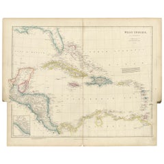
Original Antique Map of the West Indies by J. Arrowsmith, 1842
Located in Langweer, NL
landmasses, including Florida, the Gulf of Mexico, and the northern coastline of South America. The map
Category

Early 19th Century Antique Florida Map

Materials

Paper

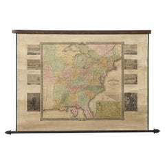
"The United States from the Latest Authorities" Antique Wall Map, 1835
Located in Colorado Springs, CO
a separate map of Oregon Territory in any publication. A smaller inset shows South Florida. A table
Category

1830s American Antique Florida Map

Materials

Paper

1863 "Lloyd's New Map of the United States, the Canadas, and New Brunswick"
Located in Colorado Springs, CO
, "Indian Territory," and Texas. The southern continuation of Florida is shown in an inset map along the
Category

1860s American Antique Florida Map

Materials

Linen, Wood, Paper

Set of 2 Antique Maps of the United States by W. G. Blackie, 1859
Located in Langweer, NL
Mississippi. With inset map of Florida. This map originates from ‘The Imperial Atlas of Modern Geography
Category

Mid-19th Century Antique Florida Map

Materials

Paper

Engraving by Tallis and Rapkin of Map of the West Indies in The Caribbean, 1851
Located in Langweer, NL
John Tallis' 1851 map of the West Indies stands as a striking example of his renowned cartographic
Category

Mid-19th Century Antique Florida Map

Materials

Paper

1842 Wall Map of the United States by J. H. Young, Published by S. A. Mitchell
Located in Colorado Springs, CO
Presented is an 1842 hanging “Map of the United States,” engraved by J. H. Young and published by
Category

1840s American Antique Florida Map

Materials

Paper

Ornate Cartography of Colonial Grandeur: The West India Islands around 1851
Located in Langweer, NL
This map is a part of John Tallis's series of maps, known for their detailed and ornamental style
Category

1850s Antique Florida Map

Materials

Paper

Original Engraving of the West Indies, Gulf of Mexico, Antilles, Caribbean, 1780
Located in Langweer, NL
Rigobert Bonne and G. Raynal's 1780 map of the West Indies, Gulf of Mexico, Antilles, and the
Category

Late 18th Century Antique Florida Map

Materials

Paper

Florida. USA Century Atlas state antique vintage map
Located in Melbourne, Victoria
'The Century Atlas. Florida' Original antique map, 1903. Central fold as issued. Map name and
Category

Early 20th Century Victorian Antique Florida Map

Materials

Lithograph

Map Tabula Asiae IX Pakistan Afghanistan Iran Indian Ocean
Located in Florham Park, NJ
edition. The work was illustrated with 64 double page engraved maps. Twenty-seven were Ptolemaic and
Category

16th Century Realist Antique Florida Map

Materials

Copper

“Haughton in the County of Nottingham” (Near Newark Upon Trent)
By Johannes Kip
Located in Southampton, NY
cross between a landscape view and a map. Exquisite matting and framing. Overall framed measurements are
Category

Early 1700s Academic Antique Florida Map

Materials

Engraving

A huge pair of 21 inches Cruchley Library Globes
By G.F. Cruchley
Located in ZWIJNDRECHT, NL
, published by G.F. Cruchley, map-seller & globe maker, 81 Fleet street. Signed: CRUCHLEY in London England
Category

1850s British Victorian Antique Florida Map

Materials

Other

Memoirs of General William T. Sherman, First Edition, Two-Volume Set, 1875
Located in Colorado Springs, CO
Florida, California, New York, Kansas, and Louisiana. Yet the bulk of the writing is focused on the Civil
Category

1870s American Antique Florida Map

Materials

Leather, Paper

Wonderful and extremely rare Dutch pocketglobe
By Dementz Family DEUR Art Company
Located in ZWIJNDRECHT, NL
still appears misshapen; North America comprises only regions named ‘Florida’, ‘Nova Francia’, and ‘New
Category

Early 18th Century Dutch Dutch Colonial Antique Florida Map

Materials

Hardwood, Paper

Wonderful and extremely rare Dutch pocketglobe
Free Shipping
H 2.5 in Dm 2.5 in
Indiarum Occidentalium Tractus Littorales cum Insulis Caribicis / Pascaert van W
By Louis Renard
Located in New York, NY
This early 18th-century engraved map was published by Louis Renard in Amsterdam. The image size is
Category

18th Century Other Art Style Antique Florida Map

Materials

Engraving

English Pocket Globe, London, Circa 1775-1798
By Herman Moll
Located in Milano, IT
region in his 1727 map. (Encyclopaedia Britannica, ed. 1902, under "States of Central Africa"); Tartary
Category

Late 18th Century English George III Antique Florida Map

Materials

Shagreen, Paper

Habits et Maisons des Floridiens - Original Etching by J.-N. Bellin - 1747
By Jacques-Nicolas Bellin
Located in Roma, IT
Florida settlement surrounded by palm trees with early settlers in the foreground and near stilts or
Category

1740s Old Masters Antique Florida Map

Materials

Etching

A truly delightful miniature terrestrial pocket globe
By Nathaniel Mills
Located in ZWIJNDRECHT, NL
turning overhead. In line with its counterpart, the terrestrial globe, celestial globes are mapped by a
Category

Mid-18th Century British Dutch Colonial Antique Florida Map

Materials

Other

Primary Triangulation Between the Hudson and St. Croix Rivers
Located in Florham Park, NJ
Survey commissioned famed naturalist Louis Agassiz to conduct the first scientific study of the Florida
Category

Late 19th Century Academic Antique Florida Map

Materials

Watercolor, Lithograph

People Also Browsed

19th Century English Victorian Campaign Style Travel Desk Writing Box
Located in Forney, TX
A antique Victorian era English campaign style brass bound mahogany portable lap desk / writing slope with nicely aged patina. circa 1850 Commonly used by military officers in the f...
Category

Mid-19th Century English Campaign Antique Florida Map

Materials

Brass

The Picnic
Located in San Francisco, CA
This artwork titled "The Picnic" c.1990, is an oil painting on canvas board by Irish artist Val McGann, 1928-2016. It is signed at the lower left corner by the artist. The artwork (...
Category

Late 20th Century Realist Antique Florida Map

Materials

Oil

Antique The Picnic
The Picnic
H 16.75 in W 19.35 in D 1.5 in
Worn-In Distressed Antique Persian Karaja Heriz Rug with Rustic Style
Located in Dallas, TX
72988 Worn-In Distressed Antique Persian Karaja Heriz Rug with Rustic Style. This hand-knotted wool distressed antique Persian Karaja Heriz rug with Mid-Century Modern style features...
Category

Early 20th Century Persian Rustic Antique Florida Map

Materials

Wool

Robert Merill & Sons Ship's Compass
Located in Norwell, MA
Mid-19th century ship's compass with dry card from Robert Merrrill and Sons, New York. Fitted to a timber box with sliding lid. Ornate axis. Dimensions: 10" L x 10" W x 6.5...
Category

Mid-19th Century Antique Florida Map

Robert Merill & Sons Ship's Compass
H 6.5 in W 10 in D 10 in
Rotherhithe's Maritime Past: Sailing Ships and St. Mary's Church Spire, 1835
Located in Langweer, NL
The engraving depicts a vivid scene from the banks of the River Thames, offering a glimpse into the bustling maritime life of Rotherhithe in the early 19th century. In the foregrou...
Category

1830s Antique Florida Map

Materials

Paper

Spanish Colonial Antique Santo Figure
Located in Atlanta, GA
A stunning antique parcel-giltwood statue of St. John, 19th century, possibly earlier, from Mexico, Spanish Colonial with polychrome paint decoration. St John was depicted as a regal...
Category

19th Century Mexican Spanish Colonial Antique Florida Map

Materials

Gold Leaf

Spanish Colonial Antique Santo Figure
H 24.75 in W 11.5 in D 9 in
Spanish Colonial Screen
Located in Mexico, DF
Fantastic Spanish Colonial school screen. Probably from Peru. This screen, with a kind of European landscape, give us an idea of the influence of Europe, especially Spain, in the Col...
Category

18th Century Peruvian Spanish Colonial Antique Florida Map

Spanish Colonial Screen
H 198.43 in W 81.89 in D 1.97 in
Antique Print with Two Portraits and a View of the General Post-Office 'Sydney'
Located in Langweer, NL
Antique print with a portrait of the late Baron de Beaulieu (Belgian ambassador), a portrait of field marshal Sir. W. Gomm and a view of the general post-office (Sydney, New South Wa...
Category

Late 19th Century Antique Florida Map

Materials

Paper

19th Century Bronze Coin with Silver Bezel Earrings by Jewels
Located in Point Richmond, CA
19th Century Bronze Coin with Silver Bezel Earrings by Jewels of Santa Fe/Marrakesh A pair of earrings made by Jewels with bronze coins from Morocco and Egypt set in silver bezels a...
Category

19th Century Moroccan Tribal Antique Florida Map

Materials

Silver, Bronze

"Saint Ferrer", Oil on Tin
Located in Mexico, DF
A 19th century oil on tin folk retablo San Vicente Ferrer, a Dominican Friar who traveled 21 straight years spreading his faith as a missionary. Saint Vincent is the patron saint of ...
Category

Early 19th Century North American Spanish Colonial Antique Florida Map

"Saint Ferrer", Oil on Tin
H 14 in W 10 in D 0.5 in
Santa Rita Retablo
Located in Santa Monica, CA
This late 19th century Mexican Folk Art devotional painting depicts St. Rita of Casia, the patron saint of lost and improbable causes. Wishing to join an Augustinian convent ...
Category

19th Century Mexican Spanish Colonial Antique Florida Map

Materials

Tin

Santa Rita Retablo
Santa Rita Retablo
H 14 in W 10 in D 0.07 in
2 Antique Nautical Marine Brass Gimbal Swivel Hurricane Candle Holder Sconces
Located in Dayton, OH
Pair of 19th century brass nautical / maritime / marine / railway / sailing ship's swiveling / gimbal wall sconce pair. Simple column design with pointed / weighted bases that can be...
Category

19th Century Victorian Antique Florida Map

Materials

Brass

Alphonse Mucha Sarah Bernhardt Lefèvre-Utile 1903
By Alphonse Mucha
Located in Dallas, TX
Mucha, Alfons Maria 1860 - 1939 Lefevre-Utile - Sarah Bernhardt Lithograph 1903 Dimensions: 27.5 x 20 in. (70 x 51 cm) Framed: 28 x 35.5 Inches Printer: F. Champenois, Paris Conditi...
Category

Early 1900s French Art Nouveau Antique Florida Map

Materials

Paper

The Brigantine E. MILLER
By Elisha Taylor Baker
Located in Costa Mesa, CA
This luminous work depicts the American merchant brigantine E. MILLER. The sun sits low behind the ship, illuminating the sky with colors of yellow and deep rose tones. The sun has j...
Category

1860s Antique Florida Map

Materials

Canvas, Oil

‘The Ark & the Dove off the Scillies with Lord Baltimore aboard’ Montague Dawson
By Montague Dawson
Located in Lymington, Hampshire
‘The Ark and the Dove off the Scillies with Lord Baltimore aboard’ by Montague Dawson, reputedly a commission for the White House, oil on board, showing the two ships of Cecilius Ca...
Category

1960s English Antique Florida Map

Materials

Paint

Antique Farm Print of Mustering Cattle in Australia, 1871
Located in Langweer, NL
Antique print of mustering cattle in Australia. This print originates from the graphic, an illustrated weekly newspaper. The graphic is known for its coverage of the following subjec...
Category

Late 19th Century Antique Florida Map

Materials

Paper

Recent Sales

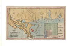
1772 Map of Part of "West Florida"
Located in New York, NY
Original 1772 hand-colored copper plate engraving full title "A Map of Part of West Florida, from
Category

1770s Realist Antique Florida Map

Materials

Engraving

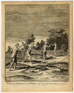
Witwen aus Florida, die Ihre Haare auf das Grab Ihrer Manner strenen.
By Jacques-Nicolas Bellin
Located in Zeeland, Noord-Brabant
Etching / engraving on hand laid paper. Watermark: Text. Native American widows from Florida who
Category

1750s Antique Florida Map

Materials

Engraving, Etching

1719 Chatelain Map of Mexico, Southeast North America and the Caribbean
By Henri-Abraham Chatelain
Located in New York, NY
Original first edition 1719 engraved map, full title in French "Carte contenant royaume mexique et
Category

1710s Realist Antique Florida Map

Materials

Engraving

Kleidung and Haeuser der Floridaner.
By Jacques-Nicolas Bellin
Located in Zeeland, Noord-Brabant
Etching / engraving on hand laid paper. Watermark: Grapes Clothes and houses of Florida natives
Category

1750s Antique Florida Map

Materials

Engraving, Etching

Offer, welches die Floridaner der Sonne mit einem Hirsche bringen.
By Jacques-Nicolas Bellin
Located in Zeeland, Noord-Brabant
Etching / engraving on hand laid paper. Print of the manner in which Native Americans of Florida
Category

1750s Antique Florida Map

Materials

Etching

Floridanerinnen, die Ihre Manner im Kriege verloren haben [...].
By Jacques-Nicolas Bellin
Located in Zeeland, Noord-Brabant
Etching / engraving on hand laid paper. Watermark: Text. Grieving Florida natives who have lost
Category

1750s Antique Florida Map

Materials

Engraving, Etching

Cochin Rex elephante vextus [...].
By Jan Huygen van Linschoten
Located in Zeeland, Noord-Brabant
the New World, and island to island in the East Indies. The third book covers Florida, the Caribbean
Category

1630s Antique Florida Map

Materials

Engraving

Virginis Lusitane in India […].
By Jan Huygen van Linschoten
Located in Zeeland, Noord-Brabant
island to island in the East Indies. The third book covers Florida, the Caribbean, and Brazil
Category

1630s Antique Florida Map

Materials

Engraving

Indorum casae, villae, et vici circa Goam [...].
By Jan Huygen van Linschoten
Located in Zeeland, Noord-Brabant
Florida, the Caribbean, and Brazil (Description de l'Amerique ...). The work was first published in Dutch
Category

1630s Antique Florida Map

Materials

Engraving

Naves celoces seu biremes […].
By Jan Huygen van Linschoten
Located in Zeeland, Noord-Brabant
book covers Florida, the Caribbean, and Brazil (Description de l'Amerique ...). The work was first
Category

1630s Antique Florida Map

Materials

Engraving

Left: Naute Arabes [...] - Arabischer scheepluyden [...].
By Jan Huygen van Linschoten
Located in Zeeland, Noord-Brabant
island to island in the East Indies. The third book covers Florida, the Caribbean, and Brazil
Category

1630s Antique Florida Map

Materials

Engraving

Horrendae Idolorum effigies [...].
By Jan Huygen van Linschoten
Located in Zeeland, Noord-Brabant
the New World, and island to island in the East Indies. The third book covers Florida, the Caribbean
Category

1630s Antique Florida Map

Materials

Engraving

Scaphe piscatorie Goensium et Cochinensium [...].
By Jan Huygen van Linschoten
Located in Zeeland, Noord-Brabant
the New World, and island to island in the East Indies. The third book covers Florida, the Caribbean
Category

1630s Antique Florida Map

Materials

Engraving

Sunset with Figure Walking into Village with Stream in the foreground
By In the style of George Inness
Located in Graton, CA
a map engraver. Impatient with supervision, he started to paint alone and exhibited with the
Category

Late 19th Century Tonalist Antique Florida Map

Materials

Oil

Painting of a Cotton Picker by William Aiken Walker
By William Aiken Walker
Located in Alexandria, VA
the Blue Ridge Mountains of North Carolina, to Florida, to New Orleans, and wherever he traveled, he
Category

1870s American Antique Florida Map

Materials

Composition

Rare 17th Century American Map of Virginia and Florida by Jan Janssonius
By Jan Johansson
Located in Wiscasset, ME
dedicated to Italy. 1646 a fourth volume came out with "English County Maps", a year after a similar issue
Category

18th Century and Earlier Dutch Rococo Antique Florida Map

Florida and Virginia: A 17th Century Hand-colored Map by Hondius after Mercator
By Gerard Mercator
Located in Alamo, CA
This hand-colored early 17th century copper-plate map entitled "Virginia et Florida" was originally
Category

Early 17th Century Dutch Antique Florida Map

Materials

Paper

Moll's Famous "Beaver Map"
Located in San Francisco, CA
Harbour of Charles-Town", and a map of Louisiana and East Florida. Moll's famous "Beaver Map
Category

18th Century and Earlier English Antique Florida Map

1847 Guide Map of the U.S., from Phelps's Travellers Guide, Antique Map
Located in Colorado Springs, CO
New York and vicinity, as well as a nice inset of southern part of Florida. Other larger inset maps of
Category

1840s American Antique Florida Map

Materials

Paper

1828 "Map of the United States" by T. Ensign
Located in Colorado Springs, CO
Presented is Timothy Ensign’s “Map of the United States,” published in 1828. The map is one of the
Category

1820s American Antique Florida Map

Materials

Paper

1839 Antique Ornamental Map of the United States, by William Chapin
Located in Colorado Springs, CO
This is a wonderfully "ornamental" hand-colored wall map of the United States from 1839, the first
Category

19th Century American Antique Florida Map

Materials

Paper

1856 Hanging "Map of the United States from the Latest Authorities"
Located in Colorado Springs, CO
“Map of the Western Portion of the United States” and the “Southern part of Florida.” This is a
Category

1850s American Antique Florida Map

Materials

Linen, Wood, Paper

An Early Map of Florida and the Carolinas by Seligmann
Located in Downingtown, PA
including Florida and The Carolina's, Nuremberg: Seligmann, 1755. Copper-engraved map, with
Category

18th Century and Earlier German Antique Florida Map

Gulf of Mexico, Florida, C. America, Cuba: 18th C. Hand-colored Map by Bellin
By Jacques-Nicolas Bellin
Located in Alamo, CA
This beautiful 18th century hand-colored map entitled "Carte du Golphe du Mexique et des Isles de
Category

1750s Antique Florida Map

Materials

Engraving

Crayon or Pastel on Muslin Naive Map of America
Located in York County, PA
NAÏVE MAP OF AMERICA, CRAYON OR PASTEL ON MUSLIN, CA 1920-30, WITH A MYRIAD OF INTERESTING
Category

Early 20th Century Antique Florida Map

Materials

Cotton

Americae Pars Magis Cognita.
By Johann Theodor De Bry
Located in New York, NY
Johann van Stadden and Jean de Lery. Cartographically, it is drawn from de Bry's own map of Florida and
Category

16th Century Other Art Style Antique Florida Map

Materials

Engraving

"Twilight In Venice"
By George Inness
Located in Lambertville, NJ
worked for a map engraver. Impatient with supervision, he started to paint alone and exhibited with the
Category

19th Century Impressionist Antique Florida Map

Materials

Canvas, Oil

"Southern Gentleman" Unusal White Subject. Known for his African American
By William Aiken Walker
Located in San Antonio, TX
, which included Florida, Galveston, Texas, and the Carolinas. It is thought that he was somewhat inspired
Category

1870s Realist Antique Florida Map

Materials

Oil

Oil Painting Portrait of Lord Edward Grenfell, 1st Baron St Just (1870-1941)
By Oswald Birley
Located in London, GB
Battle of the Somme). Birley focussed on making maps and models of positions to be assaulted by First
Category

Early 20th Century Victorian Antique Florida Map

Materials

Oil

Antique Map of Florida by Johnson, 1872
Located in Langweer, NL
Antique map titled 'Johnson's Florida'. Original map of Florida with an inset map of the Florida
Category

Late 19th Century Antique Florida Map

Materials

Paper

Antique Map of Florida by Johnson, 1872
H 14.18 in W 17.92 in D 0.02 in
Large Original Antique Map of Florida, USA, 1894
By Rand McNally & Co.
Located in St Annes, Lancashire
Fabulous map of Forida Original color By Rand, McNally & Co. Published, 1894 Unframed
Category

1890s American Antique Florida Map

Materials

Paper

Large Original Antique Map of Florida, USA, 1894
1 bid
No Reserve
H 20.5 in W 27 in D 0.07 in
Drew's New Map of the State of Florida, 1870
Located in West Palm Beach, FL
Drew's new map of the state of Florida showing the Progress of the U.S. Surveys, the completed and
Category

Mid-19th Century North American Victorian Antique Florida Map

Materials

Paper

Drew's New Map of the State of Florida, 1870
H 25.75 in W 25.75 in D 0.5 in
Original Antique Map of Florida & The Caribbean, circa 1800
Located in St Annes, Lancashire
Great map of The Caribbean showing Florida, Bahamas etc. Copper plate engraving Published in
Category

Early 1800s English Other Antique Florida Map

Materials

Paper

Large Original Antique Map of Florida, USA, C.1900
Located in St Annes, Lancashire
Fabulous map of Florida Original color Engraved and printed by the George F. Cram Company
Category

1890s American Antique Florida Map

Materials

Paper

Large Original Antique Map of Florida, USA, C.1900
1 bid
No Reserve
H 22 in W 15 in D 0.07 in
Original Antique Map of The American State of Florida, 1889
Located in St Annes, Lancashire
Great map of Florida Drawn and Engraved by W. & A.K. Johnston Published By A & C Black
Category

1880s Scottish Victorian Antique Florida Map

Materials

Paper

Antique Map of Florida, the Gulf Coast and Caribbean, 1771
Located in Langweer, NL
antique map of Florida, the Gulf Coast & Caribbean, showing Barroto's influence. Southern Florida is an
Category

18th Century Antique Florida Map

Materials

Paper

Original Antique Map of Florida And The Caribbean, Engraved By Barlow, 1806
Located in St Annes, Lancashire
Great map of Florida And The Caribbean Copper-plate engraving by Barlow Published by Brightly
Category

Early 1800s English Antique Florida Map

Materials

Paper

Original Antique Map of Central America And Florida By Thomas Clerk, 1817
Located in St Annes, Lancashire
Great map of Central America Copper-plate engraving Drawn and engraved by Thomas Clerk
Category

1810s English Antique Florida Map

Materials

Paper

Large Original Vintage Map of the South Eastern States Inc. Florida, circa 1920
Located in St Annes, Lancashire
Great map of The South Eastern States Original color. Good condition Published by Alexander
Category

1920s English Victorian Antique Florida Map

Materials

Paper

Large Original Vintage Map of the South Eastern States Inc. Florida, circa 1920
Located in St Annes, Lancashire
Great map of The South Eastern States Original color. Good condition/repair to a minor tear
Category

1920s English Victorian Antique Florida Map

Materials

Paper

Gulf of Mexico, Florida, C. America, Cuba, etc.: 18th C. Hand-colored Bellin Map
By Jacques-Nicolas Bellin
Located in Alamo, CA
This beautiful 18th century hand-colored map entitled "Carte du Golphe du Mexique et des Isles de
Category

Mid-18th Century French Antique Florida Map

Materials

Paper

Antique Map of the West Indies, with Frame Style Border
Located in Langweer, NL
Antique map titled 'Antilles ou Indes Occidentales'. Attractive map of the West Indies. Covers from
Category

Mid-19th Century Antique Florida Map

Materials

Paper

Framed 19th Century Colton Map of Mexico, Texas, California and US Territories
By J.H. Colton
Located in Alamo, CA
This framed 19th century map of the southern portions of North America by J. H. Colton, published
Category

Mid-19th Century American Other Antique Florida Map

Materials

Paper

Antique Map of the United States of North America ‘East’ by A.K. Johnston, 1865
Located in Langweer, NL
, Alabama, Florida, Virginia, North Carolina, South Carolina, Tennessee, Kentucky, Ohio and more. This map
Category

Mid-19th Century Antique Florida Map

Materials

Paper

1650 "Virginiae Partis Australis et Floridae Partis Orientalis..., " Jan Jansson
Located in Colorado Springs, CO
handsome map of the southeast colonies, extending from the southern part of Virginia to northern Florida
Category

1650s Antique Florida Map

Materials

Paper

West-Indies Herman Moll William Paterson Spanish Trade Routes Gold
By Herman Moll
Located in BUNGAY, SUFFOLK
A rare map of the West-Indies or the islands of America in the North Sea with ye adjacent countries
Category

18th Century Central American Baroque Antique Florida Map

Materials

Paper

Very Rare Marine Map of Florida, France, 1864
Located in Kensington, MD
Rare marine map engraving of Florida and the Gulf of Mexico dated 1864. The inscription reads
Category

1860s French Beaux Arts Antique Florida Map

Materials

Giltwood, Paper

Florida and Virginia: A 17th Century Hand-colored Map by Hondius after Mercator
By Gerard Mercator
Located in Alamo, CA
This hand-colored early 17th century copper-plate map entitled "Virginia et Florida" was originally
Category

Early 17th Century Antique Florida Map

Materials

Engraving

SOUTHERN US, FLORIDA, MEXICO & CARRIBIAN etc. - Mappa INDIAE OCCIDENTILIS..
By Homann Heirs
Located in Santa Monica, CA
map of the United Stated Gulf Coast, Florida, the Caribbean, Mexico., Panama and Central America
Category

1740s Old Masters Antique Florida Map

Materials

Engraving

Map of the West Indies
By Thomas Conder
Located in Saint Augustine, FL
. c. 1768 - 1825), titled "An Accurate Map of the West Indies" published June 2nd, 1794. Engraved by
Category

18th Century and Earlier Other Art Style Antique Florida Map

Materials

Copper

1805 Map of the United States
Located in Missouri, MO
. This is a finely detailed and engraved map credited in the inscription to Aaron Arrowsmith and printed
Category

Early 1800s Antique Florida Map

Materials

Etching

The Atlantic Ocean, Americas, Africa and Europe: Hand-colored 18th C. Bowen Map
Located in Alamo, CA
This is an original 18th century hand-colored map entitled "A New & Accurate Chart of the The
Category

Mid-18th Century Old Masters Antique Florida Map

Materials

Engraving

Bermuda
By Willem Blaeu
Located in London, GB
-coloured double-page engraved map, centre fold as issued, cartouches for the title and scale, Latin text on
Category

17th Century Antique Florida Map

Materials

Watercolor, Engraving

Bermuda
Bermuda
H 19.3 in W 22.45 in
A Cotton Picker - Realist Figurative Oil Painting by William Aiken Walker
By William Aiken Walker
Located in Marlow, Buckinghamshire
painting. For the next two years his service to the Confederacy consisted mainly of drawing maps and
Category

Early 20th Century American Realist Antique Florida Map

Materials

Board, Oil

A Cotton Picker - Realist Figurative Oil Painting by William Aiken Walker
By William Aiken Walker
Located in Marlow, Buckinghamshire
Confederacy consisted mainly of drawing maps and sketches of Charleston's defences until he was mustered out
Category

Early 20th Century American Realist Antique Florida Map

Materials

Board, Oil

Pensacola - Original Etching 1769
By Dominic Serres
Located in Roma, IT
”. Our engraving shows us the restored Spanish settlement. Pensacola is a city in northwestern Florida
Category

1790s Old Masters Antique Florida Map

Materials

Etching

Early View of HAVANA HARBOR, Cuba
By Elias Durnford
Located in Santa Monica, CA
Library "Elias Durnford, an engineer, was appointed surveyor-general of British West Florida in 1764. The
Category

1760s Old Masters Antique Florida Map

Materials

Engraving

Memoirs of General William T. Sherman, First Edition, Two-Volume Set, 1875
Located in Colorado Springs, CO
Florida, California, New York, Kansas, and Louisiana. Yet the bulk of the writing is focused on the Civil
Category

1870s American Antique Florida Map

Materials

Leather, Paper

Nantucket: Davis' Shoal
By Lieutenant Charles Davis
Located in Florham Park, NJ
Survey commissioned famed naturalist Louis Agassiz to conduct the first scientific study of the Florida
Category

Mid-19th Century Academic Antique Florida Map

Materials

Lithograph

Antique Map of the Southern United States with Inset Map of New Orleans
Located in Langweer, NL
Antique map titled 'Die Staaten von Arkansas Mississippi, Louisiana & Alabama'. Detailed map of the
Category

Mid-19th Century Antique Florida Map

Materials

Paper

Get Updated with New Arrivals
Save "Antique Florida Map", and we’ll notify you when there are new listings in this category.

Antique Florida Map For Sale on 1stDibs

At 1stDibs, there are many versions of the ideal antique florida map for your home. Each antique florida map for sale was constructed with extraordinary care, often using paper, wood and giltwood. You’ve searched high and low for the perfect antique florida map — we have versions that date back to the 18th Century alongside those produced as recently as the 19th Century are available. When you’re browsing for the right antique florida map, those designed in Victorian and Rococo styles are of considerable interest. Many designers have produced at least one well-made antique florida map over the years, but those crafted by Jacques-Nicolas Bellin, Gerard Mercator and Jan Johansson are often thought to be among the most beautiful.

How Much is a Antique Florida Map?

Prices for an antique florida map can differ depending upon size, time period and other attributes — at 1stDibs, they begin at $55 and can go as high as $12,528, while the average can fetch as much as $1,075.