Items Similar to Large Original Antique Map of Arizona, Usa, C.1900
Want more images or videos?
Request additional images or videos from the seller
1 of 5
Large Original Antique Map of Arizona, Usa, C.1900
About the Item
Fabulous map of Arizona
Original color.
Engraved and printed by the George F. Cram Company, Indianapolis.
Published, C.1900.
Unframed.
Free shipping.
- Dimensions:Height: 22 in (55.88 cm)Width: 15 in (38.1 cm)Depth: 0.07 in (1.78 mm)
- Materials and Techniques:Paper,Other
- Place of Origin:
- Period:
- Date of Manufacture:1900
- Condition:Wear consistent with age and use. ¹.
- Seller Location:St Annes, GB
- Reference Number:1stDibs: LU1836338032302
About the Seller
4.9
Platinum Seller
These expertly vetted sellers are 1stDibs' most experienced sellers and are rated highest by our customers.
1stDibs seller since 2016
2,546 sales on 1stDibs
Typical response time: <1 hour
Associations
International Confederation of Art and Antique Dealers' Associations
- ShippingRetrieving quote...Ships From: St Annes, United Kingdom
- Return PolicyA return for this item may be initiated within 3 days of delivery.
Auctions on 1stDibs
Our timed auctions are an opportunity to bid on extraordinary design. We do not charge a Buyer's Premium and shipping is facilitated by 1stDibs and/or the seller. Plus, all auction purchases are covered by our comprehensive Buyer Protection. Learn More
More From This SellerView All
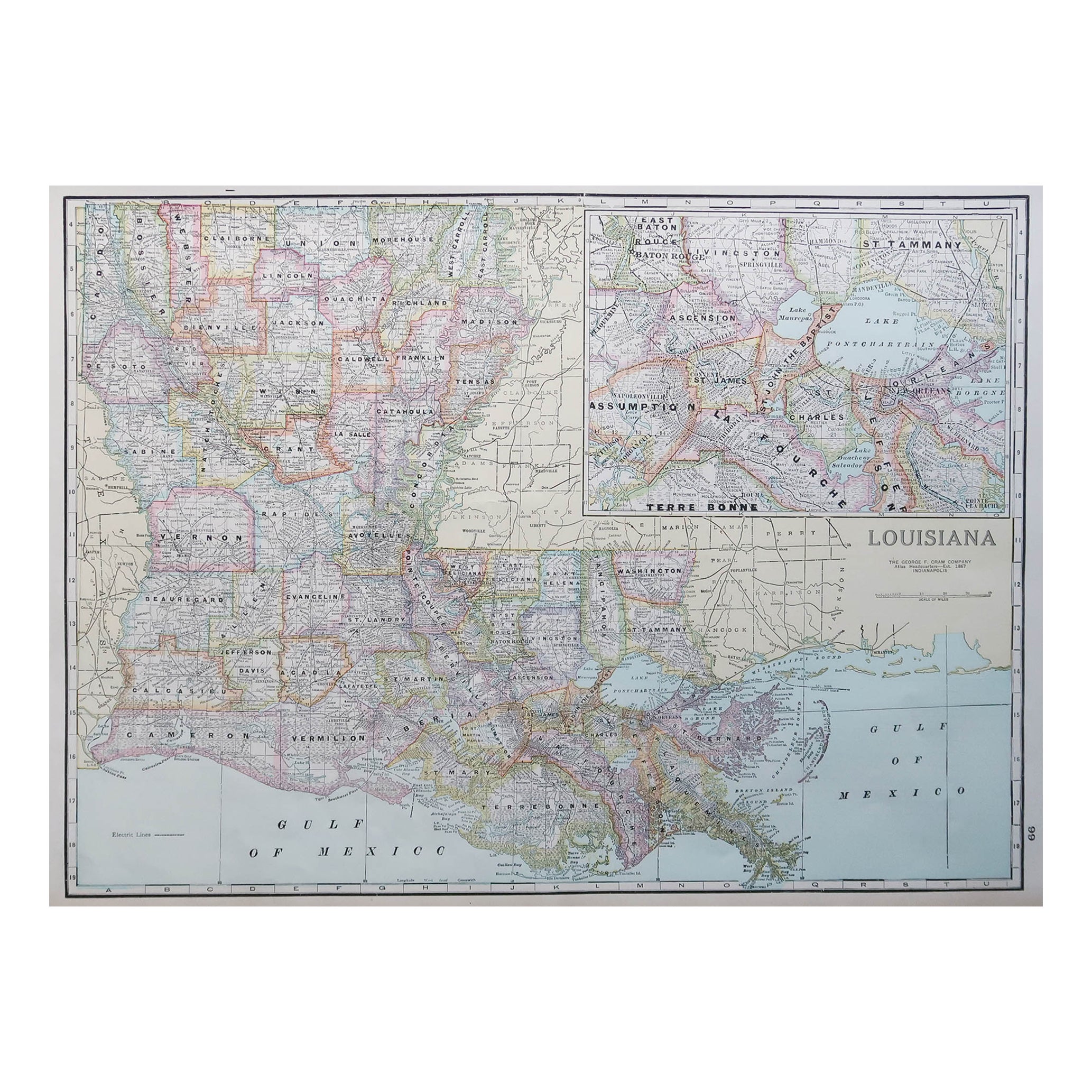
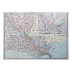
- Large Original Antique Map of Louisiana, USA, C.1900Located in St Annes, LancashireFabulous map of Louisiana. Original color. Engraved and printed by the George F. Cram Company, Indianapolis. Published, c.1900. Unframed. Repair ...Category
Antique 1890s American Maps
MaterialsPaper
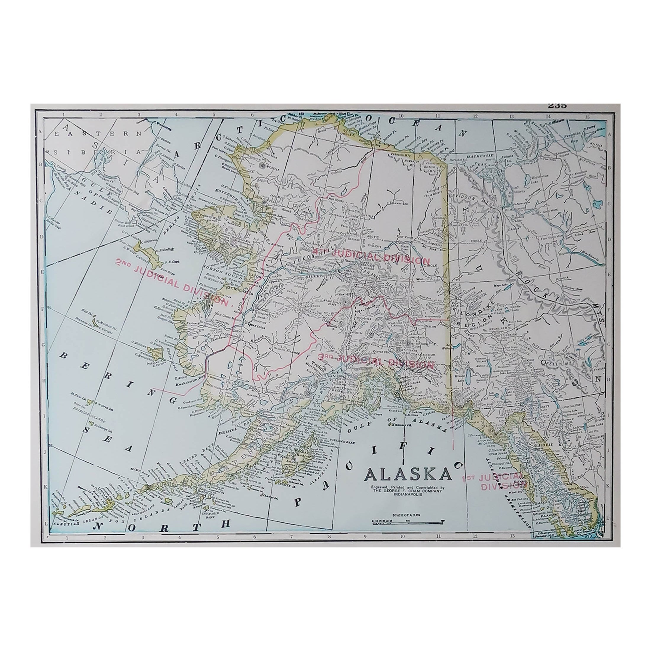
- Large Original Antique Map of Alaska, USA, C.1900Located in St Annes, LancashireFabulous map of Alaska Original color Engraved and printed by the George F. Cram Company, Indianapolis. Published, C.1900 Unframed Free shipping.Category
Antique 1890s American Maps
MaterialsPaper
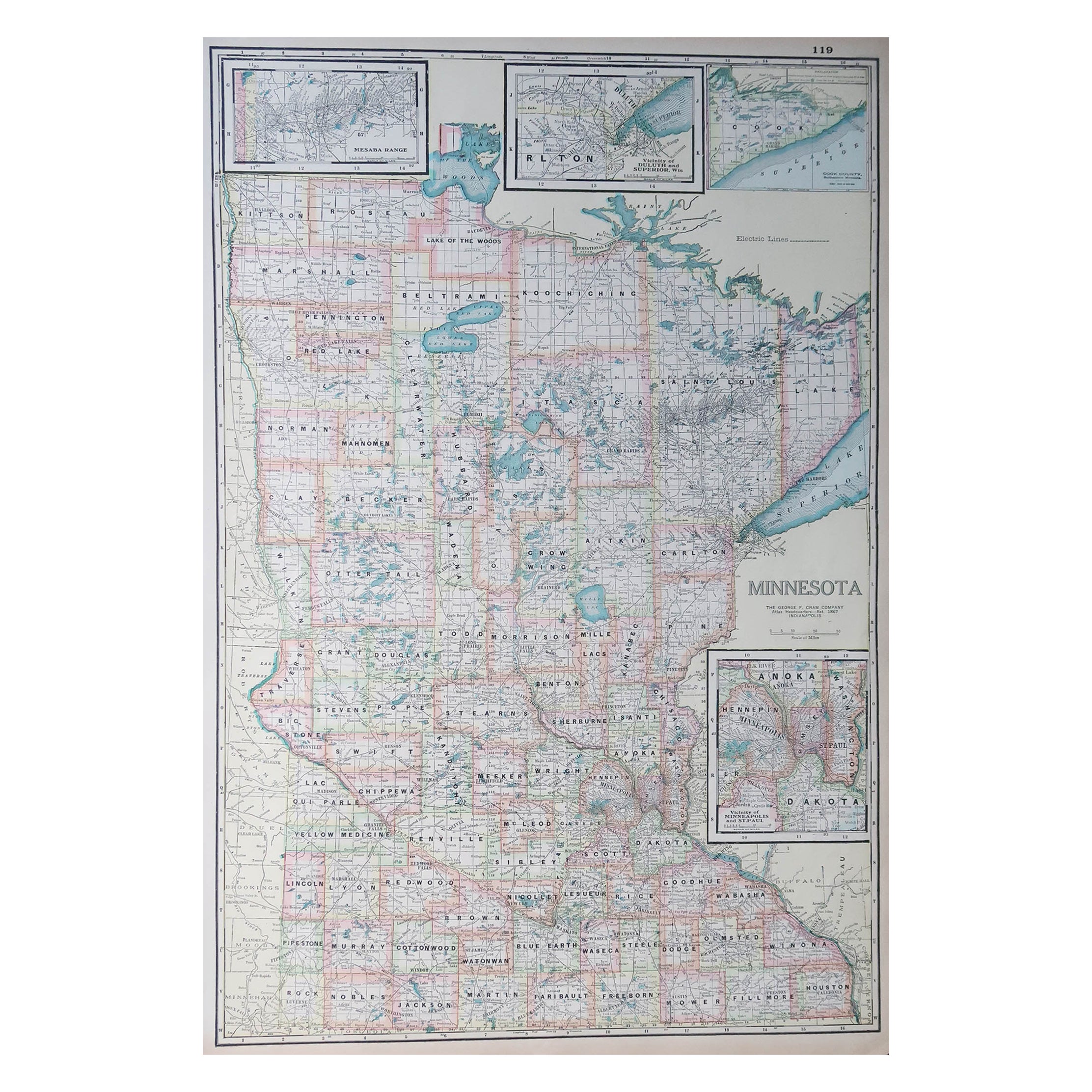
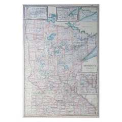
- Large Original Antique Map of Minnesota, USA, C.1900Located in St Annes, LancashireFabulous map of Minnesota Original color Engraved and printed by the George F. Cram Company, Indianapolis. Published, C.1900 Unframed Repair to a small tear bottom left corner ...Category
Antique 1890s American Maps
MaterialsPaper
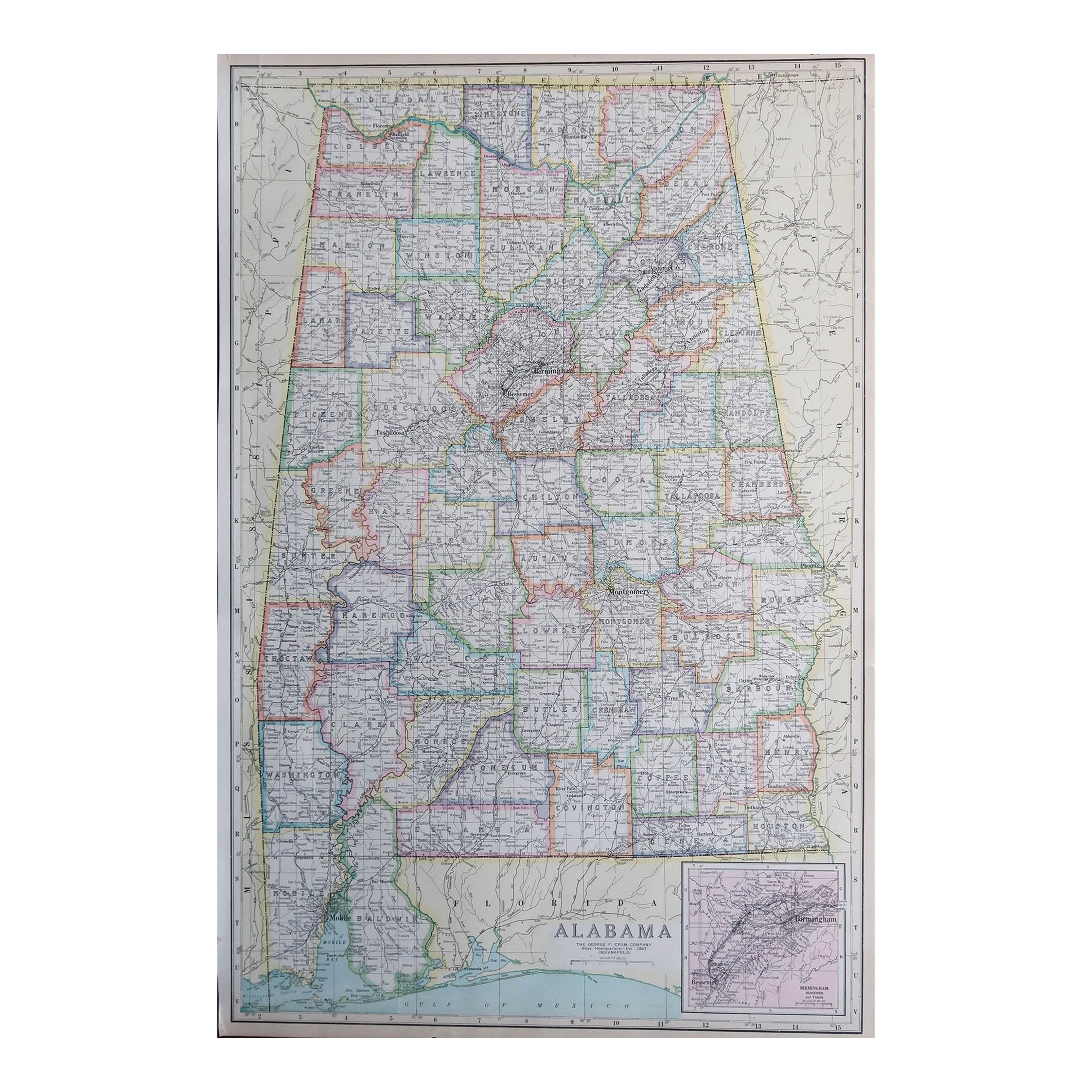
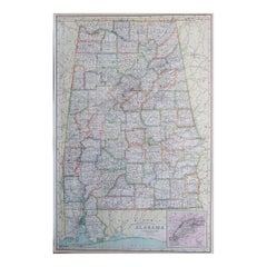
- Large Original Antique Map of Alabama, USA, C.1900Located in St Annes, LancashireFabulous map of Alabama Original color Engraved and printed by the George F. Cram Company, Indianapolis. Published, C.1900 Unframed Repair to a minor edge tear top left corner ...Category
Antique 1890s American Maps
MaterialsPaper
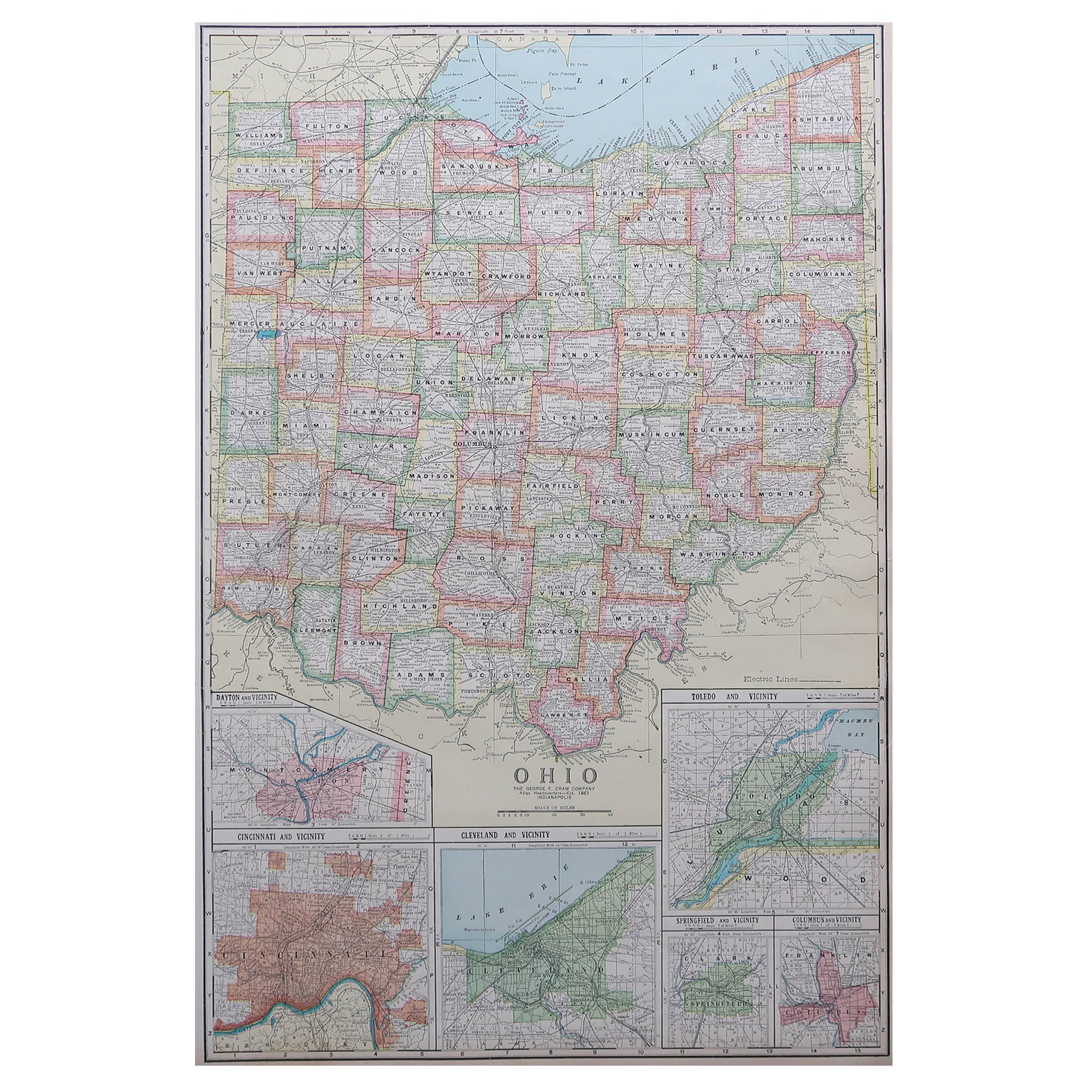
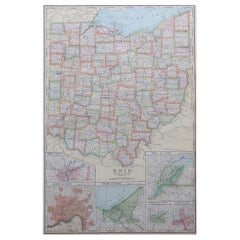
- Large Original Antique Map of Ohio, Usa, C.1900Located in St Annes, LancashireFabulous map of Ohio Original color. Engraved and printed by the George F. Cram Company, Indianapolis. Published, C.1900. Unframed. Free shipping.Category
Antique 1890s American Maps
MaterialsPaper
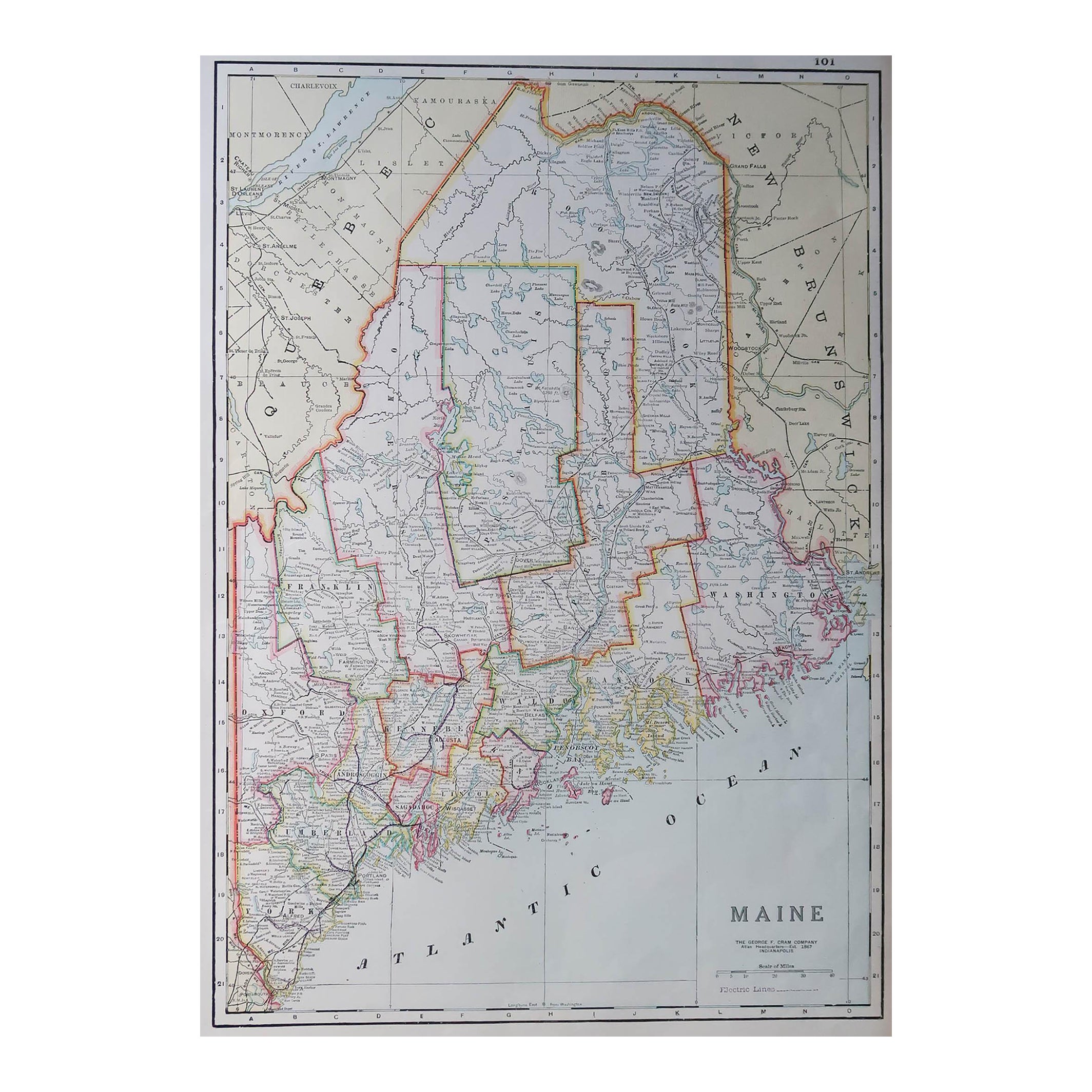
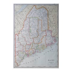
- Large Original Antique Map of Maine, USA, C.1900Located in St Annes, LancashireFabulous map of Maine Original color Engraved and printed by the George F. Cram Company, Indianapolis. Published, C.1900 Unframed Free shipping.Category
Antique 1890s American Maps
MaterialsPaper

You May Also Like
- Antique Map of the Mentawai Islands, Sumatra, 1900Located in Langweer, NLAntique map of the Mentawai Islands, Sumatra. Also depicting the region of Padang. This map originates from 'Atlas van Nederlandsch Oost- en West-Indië' by I. Dornseiffen. Artists ...Category
20th Century Maps
MaterialsPaper
- Original Engraved Antique Map of the World, Colorful and Decorative, C.1780By Pierre François TardieuLocated in Langweer, NLAntique map titled 'Mappemonde en Deux Hemispheres ou l'on a Indique les Nouvelles Decouvertes' - This handsome double hemisphere map presents a ...Category
Antique 18th Century Maps
MaterialsPaper
- Large Antique Wall Map of Friesland by Vegelin van Claerbergen, 1739Located in Langweer, NLAntique map titled 'Nieuwe Caert van Frieslant, Vermeerdert en verbetert op order der Ed. Mo. Heeren Gedeputeerde Staeten'. Rare and large attractive wall map of Friesland, the so-called 'Vegelin-map'. It shows the region of Oostergo, Westergo and Zevenwolden in Friesland, the Netherlands. Decorated with coats of arms of Friesland, Oostergo, Zevenwolden and other regions and cities/villages of Friesland. Artists and Engravers: For this particular map, Bernhardus Schotanus à Sterringa prepared the plates. However, these plates were never published in his 'Schotanus Atlas'. He wanted the plates to be published as a large wall map...Category
Antique 18th Century Maps
MaterialsPaper
- Very Decorative Original Antique Map of the World, Published in France in c.1780By Rigobert BonneLocated in Langweer, NLAntique map titled 'L'Ancien Monde Et Le Nouveau en Deux Hemispheres' - Double hemisphere map of the World, showing the contemporary geographical...Category
Antique 18th Century Maps
MaterialsPaper
- Antique Map of Venezuela by Montanus, 1671By Arnoldus MontanusLocated in Langweer, NLAntique map titled 'Venezuela cum parte Australi Novae Andalusiae'. The map extends from Coquibocoa to the Orinoque River, centered on Bariquicemento and Cape de Curiacao. Large cart...Category
Antique Mid-17th Century English Maps
MaterialsPaper
- Antique Map of Korea by Kozaki, 1903Located in Langweer, NLOld map of Korea by S. Kozaki. Restored and mounted.Category
20th Century Maps
MaterialsPaper


Recently Viewed
View AllMore Ways To Browse
Map Of Maine Et Loire
Mapp Plate
Marthas Vineyard Map
Nantucket Chart
Native American Mountie
Nicolaes Visscher II On Sale
Vintage Marthas Vineyard Map
W. & A.K. Johnston On Sale
Yemen 1789
Yugoslavia Map
Rand Mcnally Map Of California
Antique Map Copenhagen
Antique Map Of Finland
Map Prussia Germany
Antique Map Of Colombia
Antique Map Of South Korea
Antique Map Vietnam
Colombia Map Antique