Items Similar to Antique Map of The Kingdom of Alexander the Great, Published in 1880

Want more images or videos?
Request additional images or videos from the seller
1 of 7
Antique Map of The Kingdom of Alexander the Great, Published in 1880
About the Item
The map is titled "ALEXANDRI MAGNI REGNUM," which translates to "The Kingdom of Alexander the Great." It depicts the vast territories conquered by Alexander the Great during his reign, stretching from Greece across the Near East to parts of India.
This map is particularly interesting for its depiction of:
1. **Vast Empire**: It covers the extensive reach of Alexander's empire, highlighting the diverse regions he conquered, from Macedonia and Greece to Egypt, Persia, and beyond.
2. **Historical Context**: The map represents the Hellenistic world post-Alexander’s conquests, which led to the spread of Greek culture across the known world in a period known as the Hellenistic Age.
3. **Inset Maps**: There are inset maps of significant battle sites and cities, like Halicarnassus and Tyre, reflecting key moments in Alexander's military campaigns.
4. **Geographical Features**: The map shows important geographical landmarks, such as the Nile River, the Tigris and Euphrates rivers, and the mountain ranges that Alexander's army would have traversed.
5. **Latin Nomenclature**: The use of Latin titles and labels for places and geographic features reflects the academic traditions of the time when the map was created.
6. **Cultural Blending**: The map may illustrate the beginnings of the fusion between Greek and Eastern cultures that Alexander's conquests initiated.
7. **Strategic Routes**: It might depict strategic routes used in Alexander’s military campaigns, including the path to the Indus Valley.
This map is from the "Spruner-Menke Atlas Antiquus," crafted by Karl Spruner von Merz and edited by Theodorus Menke. The atlas was a notable 19th-century publication used for educational purposes, offering detailed maps of ancient civilizations with a focus on historical accuracy.
The period the map covers corresponds to Alexander's campaigns, which lasted from 336 to 323 BC, a time when he created one of the largest empires in ancient history and greatly influenced the subsequent cultural and political landscape of these regions.
- Dimensions:Height: 15.56 in (39.5 cm)Width: 18.51 in (47 cm)Depth: 0 in (0.02 mm)
- Materials and Techniques:
- Period:
- Date of Manufacture:1880
- Condition:Good, given age. General age-related toning, especially around the edges. vertical folding line as issued. Please study scan carefully.
- Seller Location:Langweer, NL
- Reference Number:
About the Seller
5.0
Platinum Seller
These expertly vetted sellers are 1stDibs' most experienced sellers and are rated highest by our customers.
Established in 2009
1stDibs seller since 2017
1,916 sales on 1stDibs
Typical response time: <1 hour
- ShippingRetrieving quote...Ships From: Langweer, Netherlands
- Return PolicyA return for this item may be initiated within 14 days of delivery.
More From This SellerView All
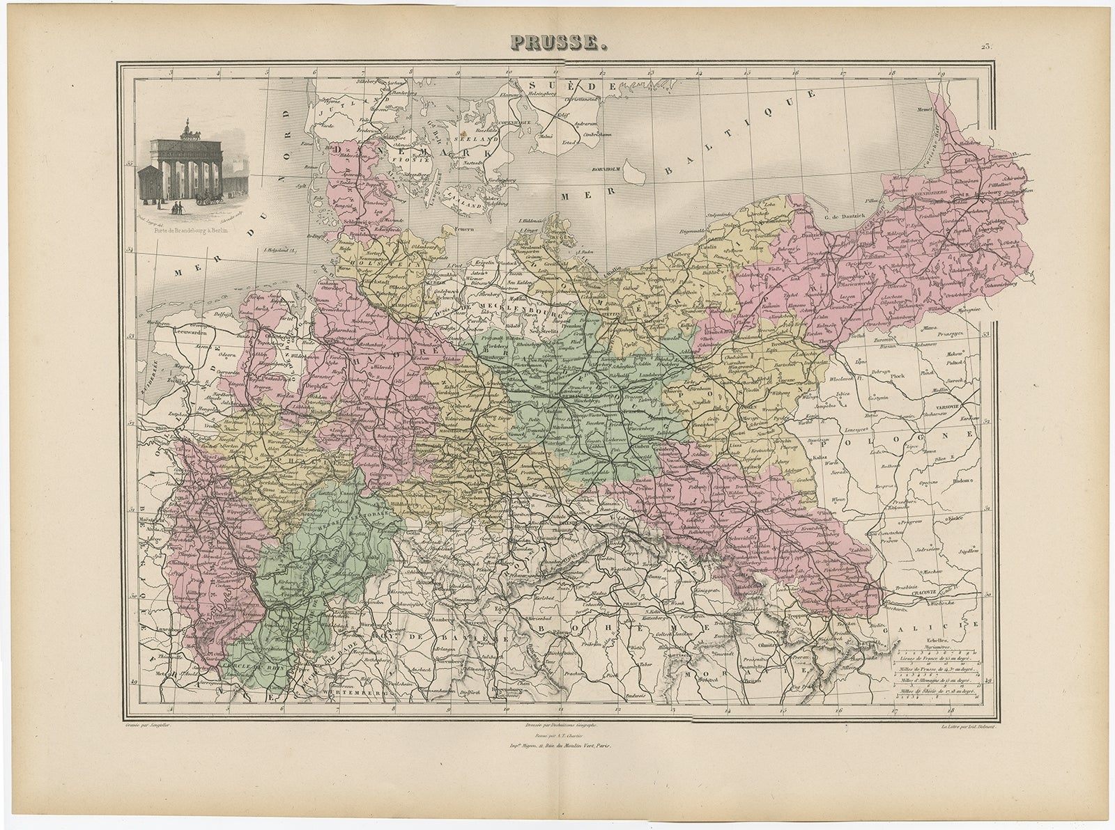
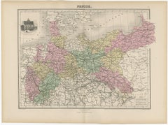
- Antique Map of the Kingdom of Prussia, 1880Located in Langweer, NLAntique map titled 'Prusse'. Old map of the Kingdom of Prussia, with a decorative vignette of the gate of Brandenburg, Berlin. This map originates from 'Géographie Universelle Atlas-...Category
Antique 19th Century Maps
MaterialsPaper
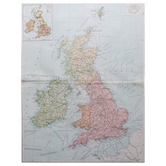
- Original Antique Map of the United Kingdom and Ireland, Published in 1875Located in Langweer, NLAntique map titled 'Iles Britanniques ou Royaume-Uni de la Grande Bretagne (..)'. Large map of the United Kingdom and Ireland. This map originates from...Category
Antique Late 19th Century Maps
MaterialsPaper
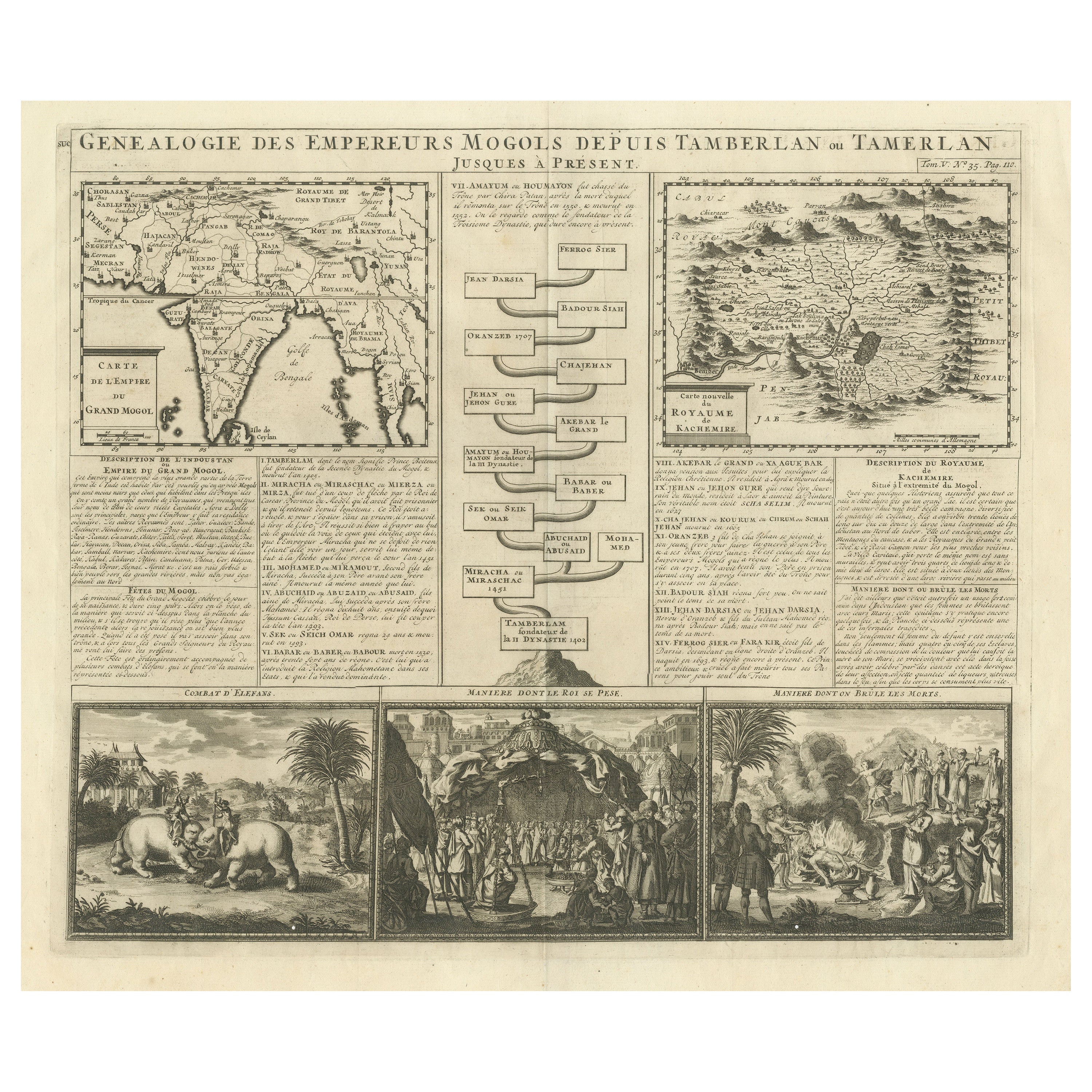
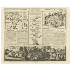
- Antique Map of the Empire of the Great Mogol and the Kingdom of KachimereLocated in Langweer, NLAntique map titled 'Genealogie des Empereurs Mogols depuis Tamberlan ou Tamerlan'. Two maps, a genealogical tree and three indigenous views of the Mogol Empire on one sheet with desc...Category
Antique Early 18th Century Maps
MaterialsPaper
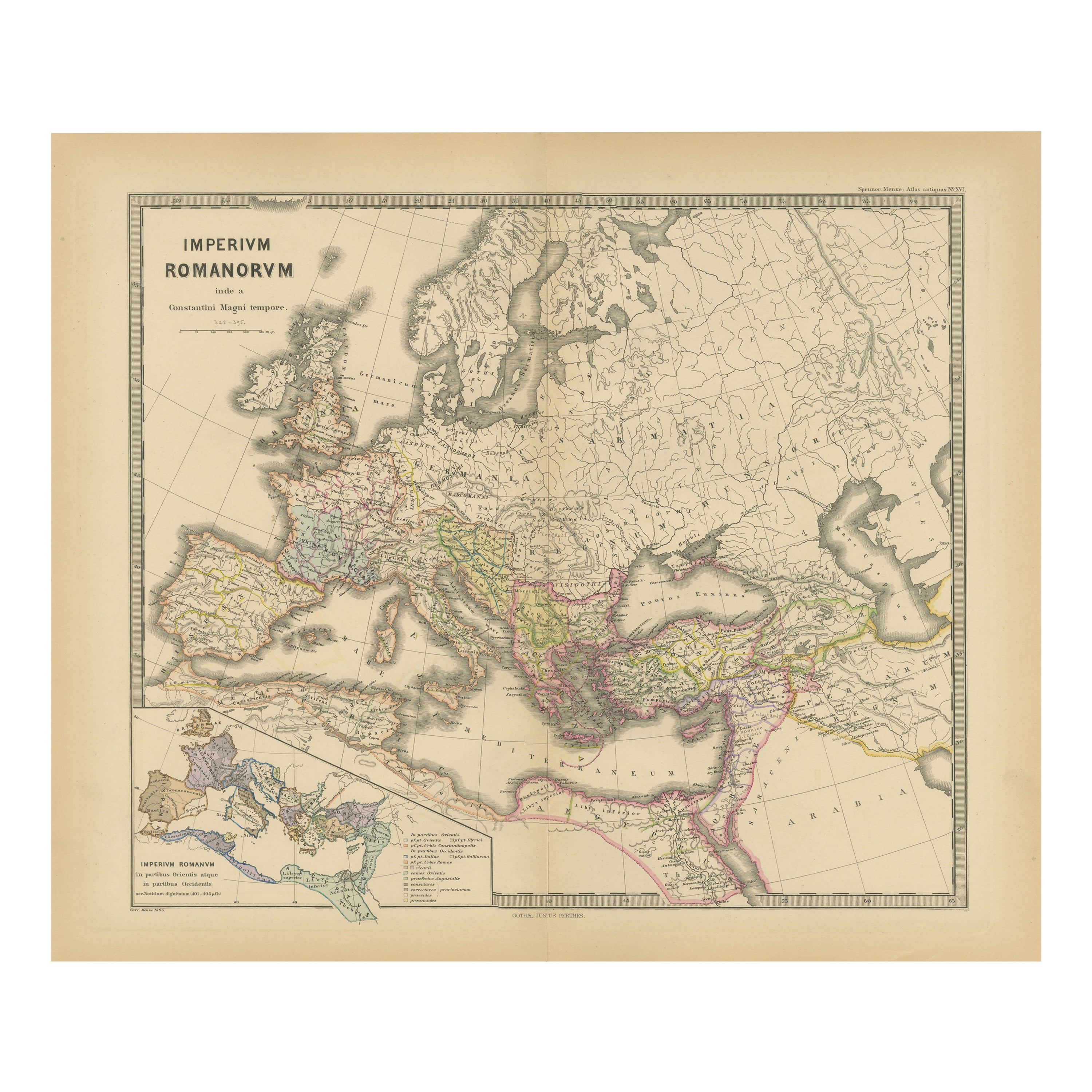
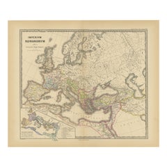
- The Roman Empire from the Time of Constantine the Great, Published in 1880Located in Langweer, NLAntique map titled: "IMPERIUM ROMANORUM inde a Constantini Magni tempore," which translates to "The Roman Empire from the time of Constantine the Great." This map is designed to re...Category
Antique 1880s Maps
MaterialsPaper
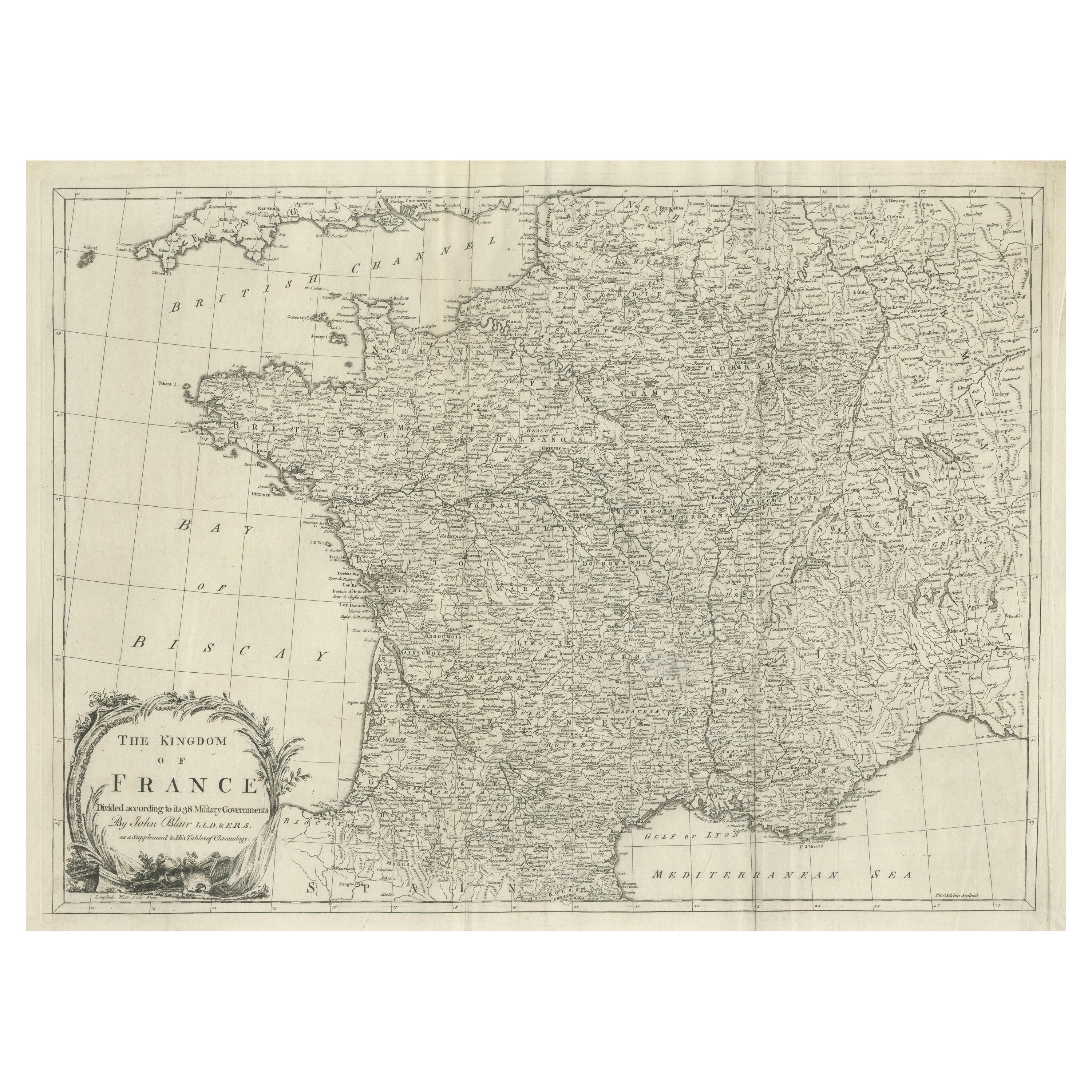
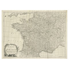
- Large Antique Map of the Kingdom of FranceLocated in Langweer, NLAntique map titled 'The Kingdom of France (..)'. Large antique map of the Kingdom of France. Engraved by T. Kitchin. Published J. Blair, circa 1779.Category
Antique Late 18th Century Maps
MaterialsPaper
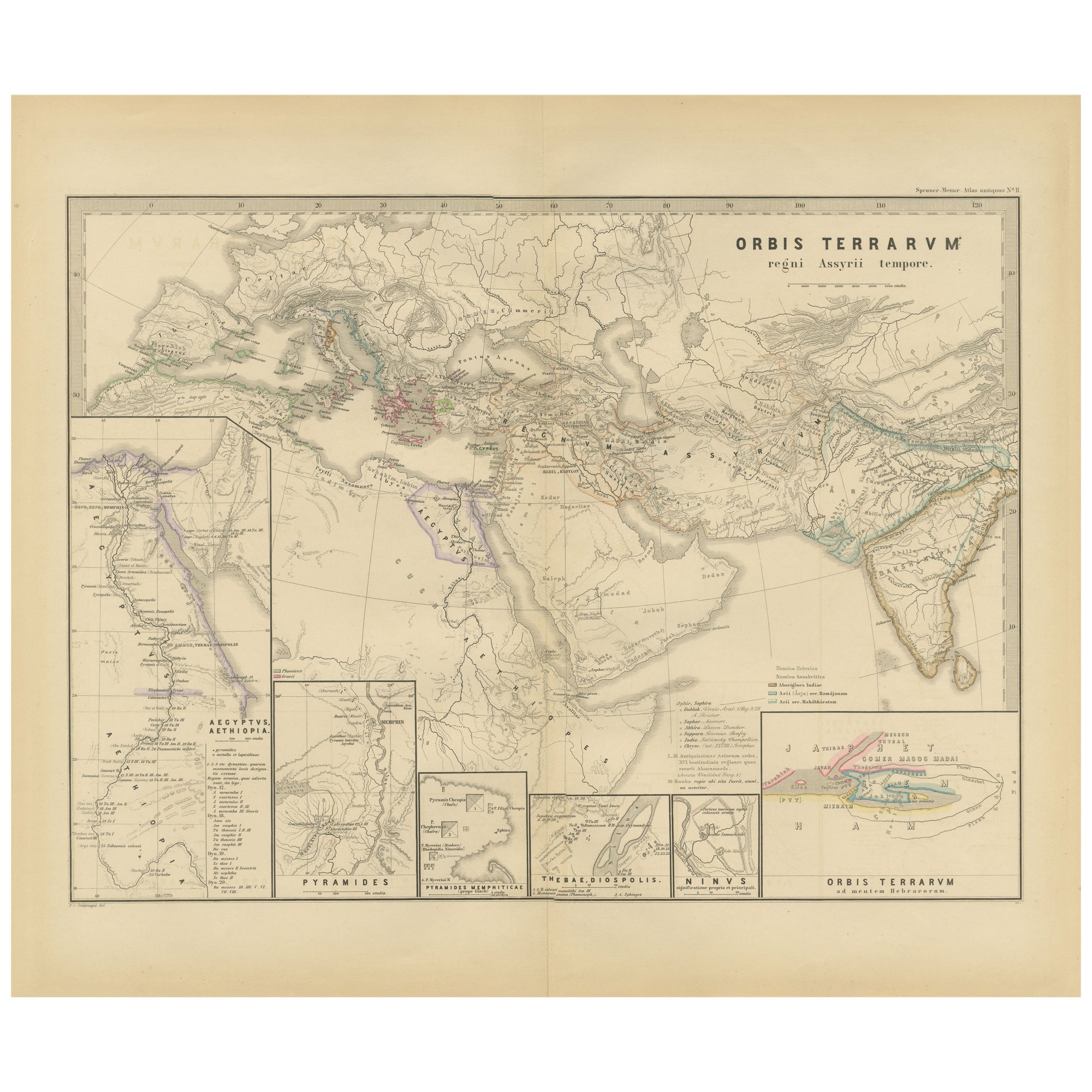
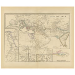
- The World in the Assyrian Empire's Era: A Historical Map, Published in 1880Located in Langweer, NLThis map from the "Spruner-Menke Atlas Antiquus" is titled "ORBIS TERRARVM regni Assyrii tempore," which translates to "The World at the Time of the Assyrian Kingdom." It depicts the...Category
Antique 1880s Maps
MaterialsPaper

You May Also Like
- Map of the Kingdom of Sardinia and Part of the Kingdom of Genoa, RomeBy Giovanni Maria CassiniLocated in Hamilton, Ontario18th century map by Italian engraver Giovanni Maria Cassini (Italy 1745-1824). Map of Part of the Kingdom of Sardinia and Part of the Kingdom of Genoa: Rome. This is a hand colored a...Category
Antique 18th Century Italian Maps
MaterialsPaper
- Antique Oarsman's Map of the River Thames, English, Cartography, Published 1912Located in Hele, Devon, GBThis is an antique copy of The Oarsman's and Angler's Map of the River Thames - New Edition. An English, bound map book, published in English by Edward Stanford, London, this new edi...Category
Early 20th Century British Other Books
MaterialsPaper
- Original Antique Map of Cyprus. Circa 1880Located in St Annes, LancashireGreat map of Cyprus Drawn and Engraved by R.Walker Published W.Mackenzie, London Original colour Unframed.Category
Antique 1880s English Maps
MaterialsPaper
- Large Original Vintage Map of the United Kingdom, circa 1920Located in St Annes, LancashireGreat map of The United Kingdom Unframed Original color By John Bartholomew and Co. Edinburgh Geographical Institute Published, circa 1920 Free shipping.Category
Vintage 1920s British Maps
MaterialsPaper
- Large Original Vintage Map of The United Kingdom, circa 1920Located in St Annes, LancashireGreat map of The United Kingdom Original color. Published by Alexander Gross Unframed.Category
Vintage 1920s English Maps
MaterialsPaper
- Large Original Antique Map of The Environs of Dublin, Ireland, circa 1880Located in St Annes, LancashireGreat map of The Environs of Dublin Published circa 1880 Unframed Free shipping.Category
Antique 1880s Scottish Maps
MaterialsPaper