Items Similar to Antique Map of the Empire of the Great Mogol and the Kingdom of Kachimere

Want more images or videos?
Request additional images or videos from the seller
1 of 6
Antique Map of the Empire of the Great Mogol and the Kingdom of Kachimere
About the Item
Antique map titled 'Genealogie des Empereurs Mogols depuis Tamberlan ou Tamerlan'. Two maps, a genealogical tree and three indigenous views of the Mogol Empire on one sheet with descriptive text. The upper maps show the Empire of the Great Mogol and the Kingdom of Kachimere. The center includes a tree showing the Mogol Dynasty, beginning with Tamberlan in 1402 and ending with Ferrog Sier. At the bottom, three engraved views show indigenous scenes of the Mogol Empire, including 2 combatants on Elephants, a scene in the Royal Court, and the custom of Burning the Dead. Originates from Chatelain's 'Atlas Historique'. Published circa 1712.
Henri Abraham Chatelain (1684-1743), his father Zacharie Chatelain (d.1723) and Zacharie Junior (1690-1754), worked as a partnership publishing the Atlas Historique, Ou Nouvelle Introduction A L'Histoire under several different Chatelain imprints, depending on the Chatelain family partnerships at the time of publication.
- Dimensions:Height: 18.31 in (46.5 cm)Width: 20.99 in (53.3 cm)Depth: 0.02 in (0.5 mm)
- Materials and Techniques:
- Period:
- Date of Manufacture:c.1712
- Condition:General age-related toning. Original folding line with small splits. Shows some wear and soiling. Few small tears in margins. Blank verso. Please study image carefully.
- Seller Location:Langweer, NL
- Reference Number:
About the Seller
5.0
Platinum Seller
These expertly vetted sellers are 1stDibs' most experienced sellers and are rated highest by our customers.
Established in 2009
1stDibs seller since 2017
1,933 sales on 1stDibs
Typical response time: <1 hour
- ShippingRetrieving quote...Ships From: Langweer, Netherlands
- Return PolicyA return for this item may be initiated within 14 days of delivery.
More From This SellerView All
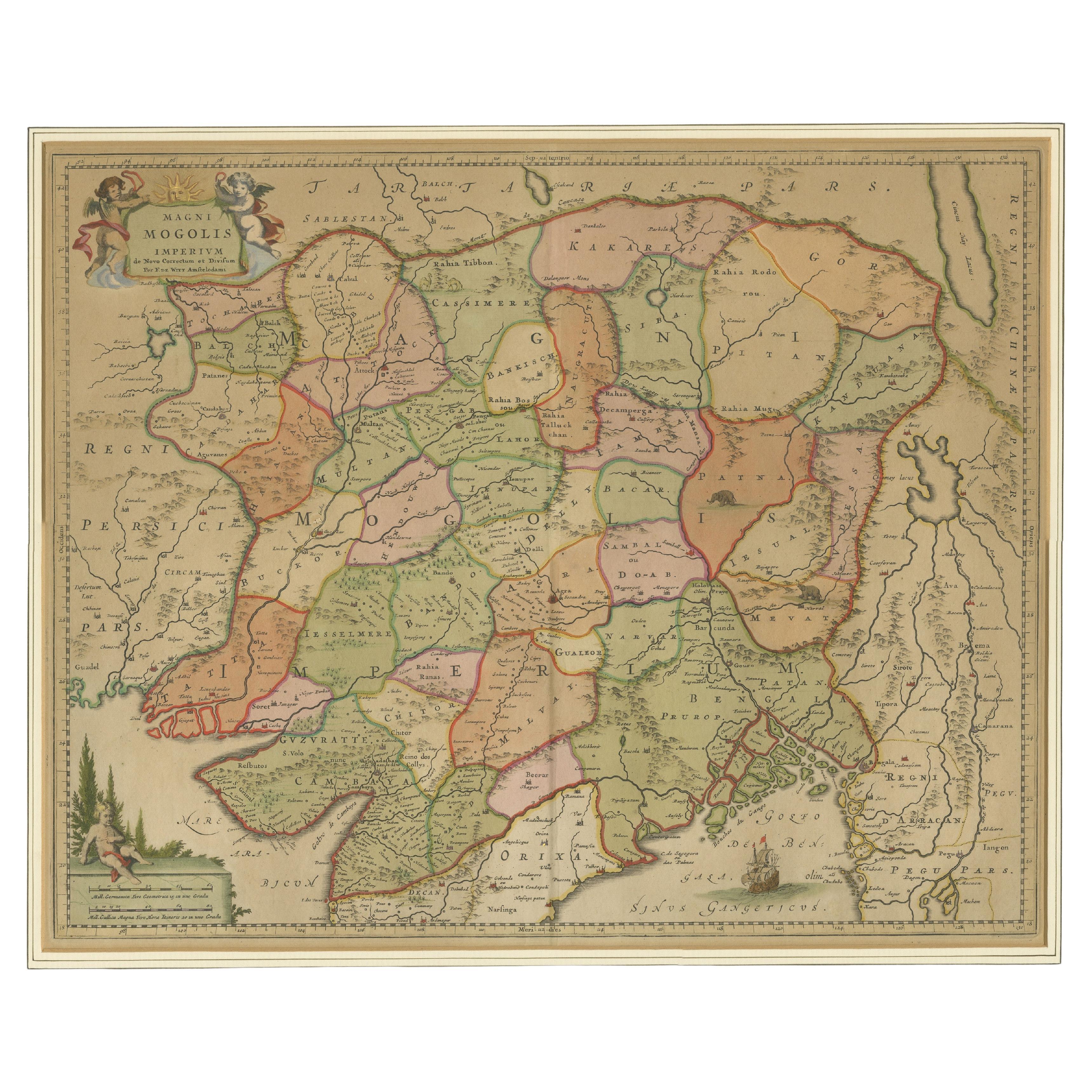
- Antique Map of the Empire of the Great MogulLocated in Langweer, NLAntique map titled 'Magni Mogolis Imperium'. This map depicts the Empire of the Great Mogul in northern India including the region from Iran to Burma. The Indus and Ganges Rivers are...Category
Antique Late 17th Century Maps
MaterialsPaper
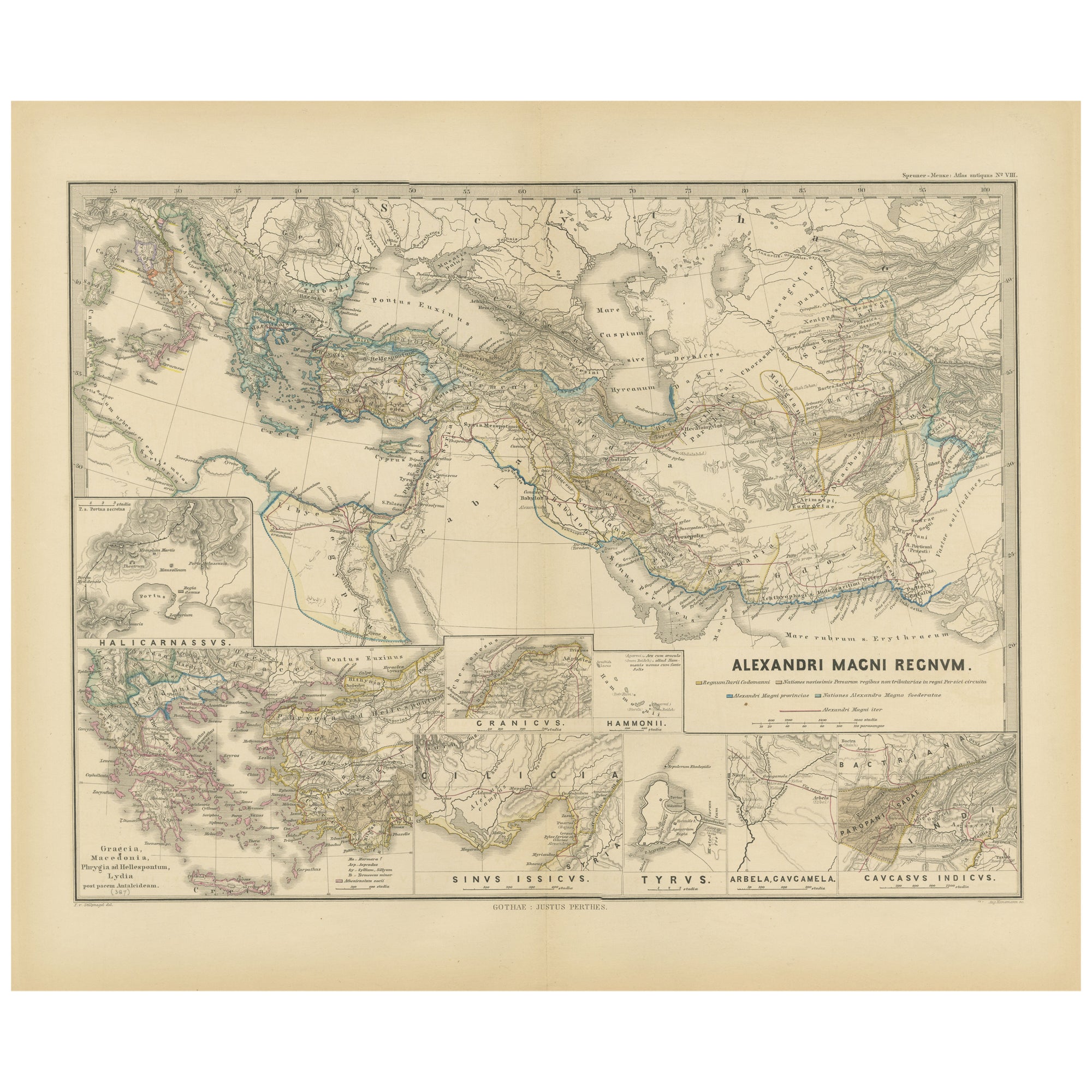
- Antique Map of The Kingdom of Alexander the Great, Published in 1880Located in Langweer, NLThe map is titled "ALEXANDRI MAGNI REGNUM," which translates to "The Kingdom of Alexander the Great." It depicts the vast territories conquered by Alexander the Great during his reig...Category
Antique 1880s Maps
MaterialsPaper
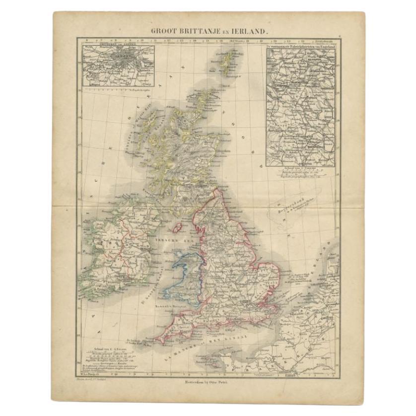
- Antique Map of the United Kingdom and Ireland, 1852Located in Langweer, NLAntique map titled 'Groot-Brittanje en Ierland'. Map of the United Kingdom and Ireland. This map originates from 'School-Atlas van alle deelen der Aarde' by Otto Petri. Artists a...Category
Antique 19th Century Maps
MaterialsPaper
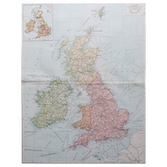
- Antique Map of the United Kingdom and Ireland, c.1873Located in Langweer, NLAntique map titled 'Groot Brittanje en Ierland'. Old map depicting the United Kingdom and Ireland, with inset maps of London and factory districts of the UK. This map originates from...Category
Antique 19th Century Maps
MaterialsPaper
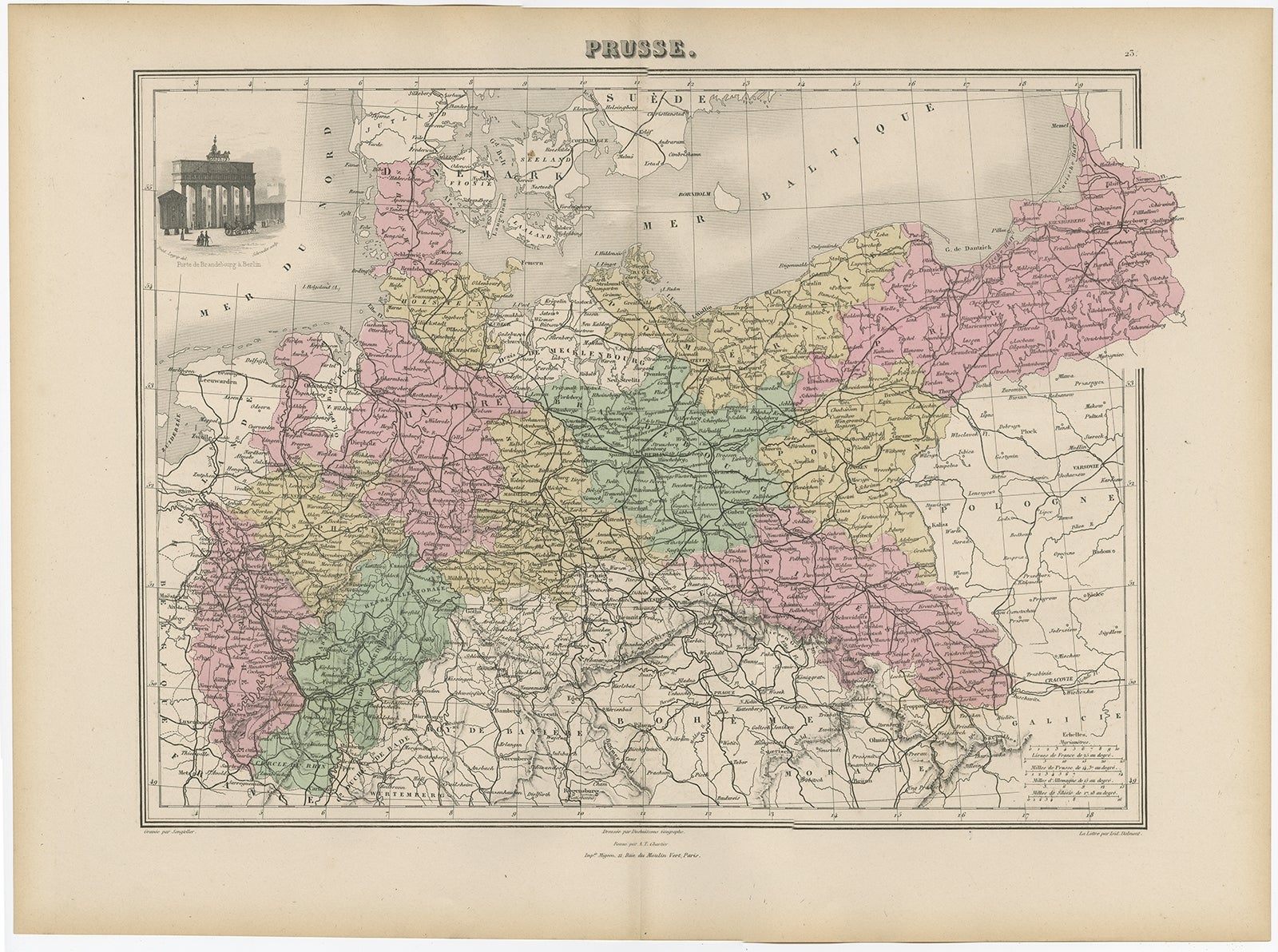
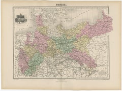
- Antique Map of the Kingdom of Prussia, 1880Located in Langweer, NLAntique map titled 'Prusse'. Old map of the Kingdom of Prussia, with a decorative vignette of the gate of Brandenburg, Berlin. This map originates from 'Géographie Universelle Atlas-...Category
Antique 19th Century Maps
MaterialsPaper
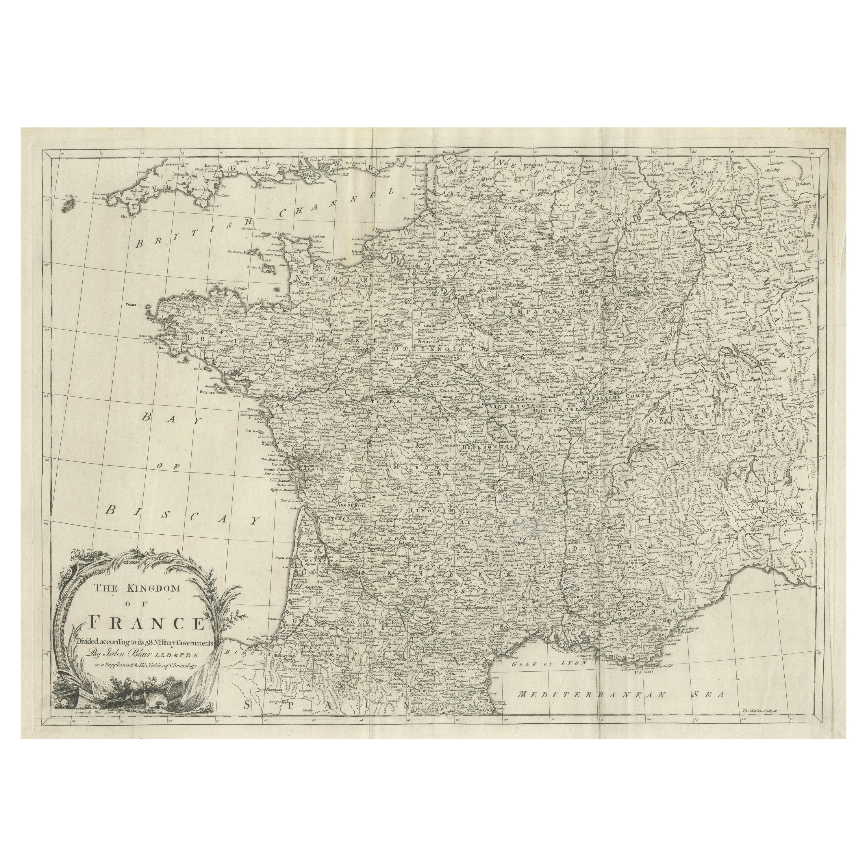
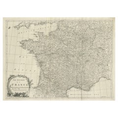
- Large Antique Map of the Kingdom of FranceLocated in Langweer, NLAntique map titled 'The Kingdom of France (..)'. Large antique map of the Kingdom of France. Engraved by T. Kitchin. Published J. Blair, circa 1779.Category
Antique Late 18th Century Maps
MaterialsPaper


You May Also Like
- Map of the Kingdom of Sardinia and Part of the Kingdom of Genoa, RomeBy Giovanni Maria CassiniLocated in Hamilton, Ontario18th century map by Italian engraver Giovanni Maria Cassini (Italy 1745-1824). Map of Part of the Kingdom of Sardinia and Part of the Kingdom of Genoa: Rome. This is a hand colored a...Category
Antique 18th Century Italian Maps
MaterialsPaper
- Super Rare Antique French Map of Chine and the Chinese Empire, 1780Located in Amsterdam, Noord HollandSuper Rare Antique French Map of Chine and the Chinese Empire, 1780 Very nice map of Asia. 1780 Made by Bonne. Additional information: Type: Map ...Category
Antique 18th Century European Maps
MaterialsPaper
- Large Original Vintage Map of the United Kingdom, circa 1920Located in St Annes, LancashireGreat map of The United Kingdom Unframed Original color By John Bartholomew and Co. Edinburgh Geographical Institute Published, circa 1920 Free shipping.Category
Vintage 1920s British Maps
MaterialsPaper
- Large Original Vintage Map of The United Kingdom, circa 1920Located in St Annes, LancashireGreat map of The United Kingdom Original color. Published by Alexander Gross Unframed.Category
Vintage 1920s English Maps
MaterialsPaper
- The Kingdom of Naples and Southern Italy: A Hand-Colored 18th Century Homann MapBy Johann Baptist HomannLocated in Alamo, CA"Novissima & exactissimus Totius Regni Neapolis Tabula Presentis Belli Satui Accommo Data" is a hand colored map of southern Italy and the ancient Kingdom of Naples created by Johann...Category
Antique Early 18th Century German Maps
MaterialsPaper
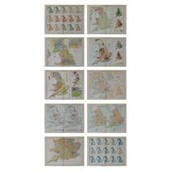
- Set of 10 Large Scale Vintage Maps of The United Kingdom, circa 1900Located in St Annes, LancashireGreat set of maps of the UK Lithographs. By John Bartholomew & Co. Published by The Edinburgh Geographical Institute Unframed. The measurement ...Category
Antique Early 1900s English Maps
MaterialsPaper


Recently Viewed
View AllMore Ways To Browse
Map Of Bali
Palliser Furniture
Oman Map
Antique Furniture Manitoba
Antique Map Of Republic Of Texas
E H Fletcher
Giovanni Maria Cassini On Sale
H Chatelain 1719
Kiribati Islands Map
Map Of Kiribati Islands
Nova Hollandia
William Wyld
Barbados Map
Bubble Glass Book Ends
Covens & Mortier On Sale
Cyclades Map
Formosa Vintage Map
Map Cleveland