Items Similar to Antique Map of the Kingdom of Prussia, 1880
Want more images or videos?
Request additional images or videos from the seller
1 of 7
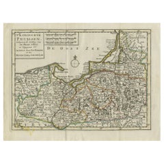
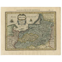
Antique Map of the Kingdom of Prussia, 1880
About the Item
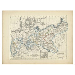
Antique map titled 'Prusse'. Old map of the Kingdom of Prussia, with a decorative vignette of the gate of Brandenburg, Berlin. This map originates from 'Géographie Universelle Atlas-Migeon' by J. Migeon.
Artists and Engravers: Published by J. Migeon. Reviewed by A. Vuillemin. Alexandre Vuillemin (1812-1880) was a cartographer and an book editor based in Paris, France.
Condition: Good, age-related toning. Please study image carefully.
Date: 1880
Overall size: 47.5 x 34.5 cm.
Image size: 37.5 x 28 cm.
We sell original antique maps to collectors, historians, educators and interior decorators all over the world. Our collection includes a wide range of authentic antique maps from the 16th to the 20th centuries. Buying and collecting antique maps is a tradition that goes back hundreds of years. Antique maps have proved a richly rewarding investment over the past decade, thanks to a growing appreciation of their unique historical appeal. Today the decorative qualities of antique maps are widely recognized by interior designers who appreciate their beauty and design flexibility. Depending on the individual map, presentation, and context, a rare or antique map can be modern, traditional, abstract, figurative, serious or whimsical. We offer a wide range of authentic antique maps for any budget.
- Dimensions:Height: 13.59 in (34.5 cm)Width: 18.71 in (47.5 cm)Depth: 0 in (0.01 mm)
- Materials and Techniques:
- Period:
- Date of Manufacture:1880
- Condition:
- Seller Location:Langweer, NL
- Reference Number:
About the Seller
5.0
Platinum Seller
These expertly vetted sellers are 1stDibs' most experienced sellers and are rated highest by our customers.
Established in 2009
1stDibs seller since 2017
1,928 sales on 1stDibs
Typical response time: <1 hour
- ShippingRetrieving quote...Ships From: Langweer, Netherlands
- Return PolicyA return for this item may be initiated within 14 days of delivery.
More From This SellerView All
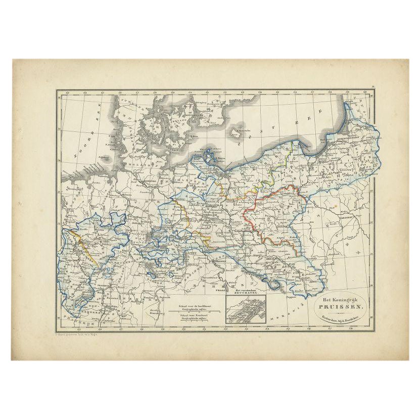
- Antique Map of the Kingdom of Prussia by Petri, 1852Located in Langweer, NLAntique map titled 'Het Koningrijk Pruissen'. Map of the Kingdom of Prussia. This map originates from 'School-Atlas van alle deelen der Aarde' by Otto Petri. Artists and Engraver...Category
Antique 19th Century Maps
MaterialsPaper
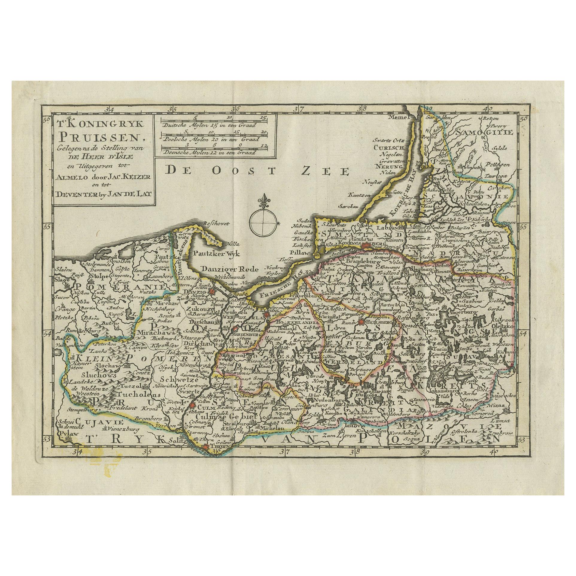
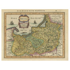
- Antique Map of the Kingdom of Prussia by Keizer & de Lat, 1788Located in Langweer, NLAntique map titled 't Koninkryk Pruissen (..)'. Uncommon original antique map of the Kingdom of Prussia. This map originates from 'Nieuwe Natuur- Geschied- en Handelkundige Zak- en R...Category
Antique Late 18th Century Maps
MaterialsPaper
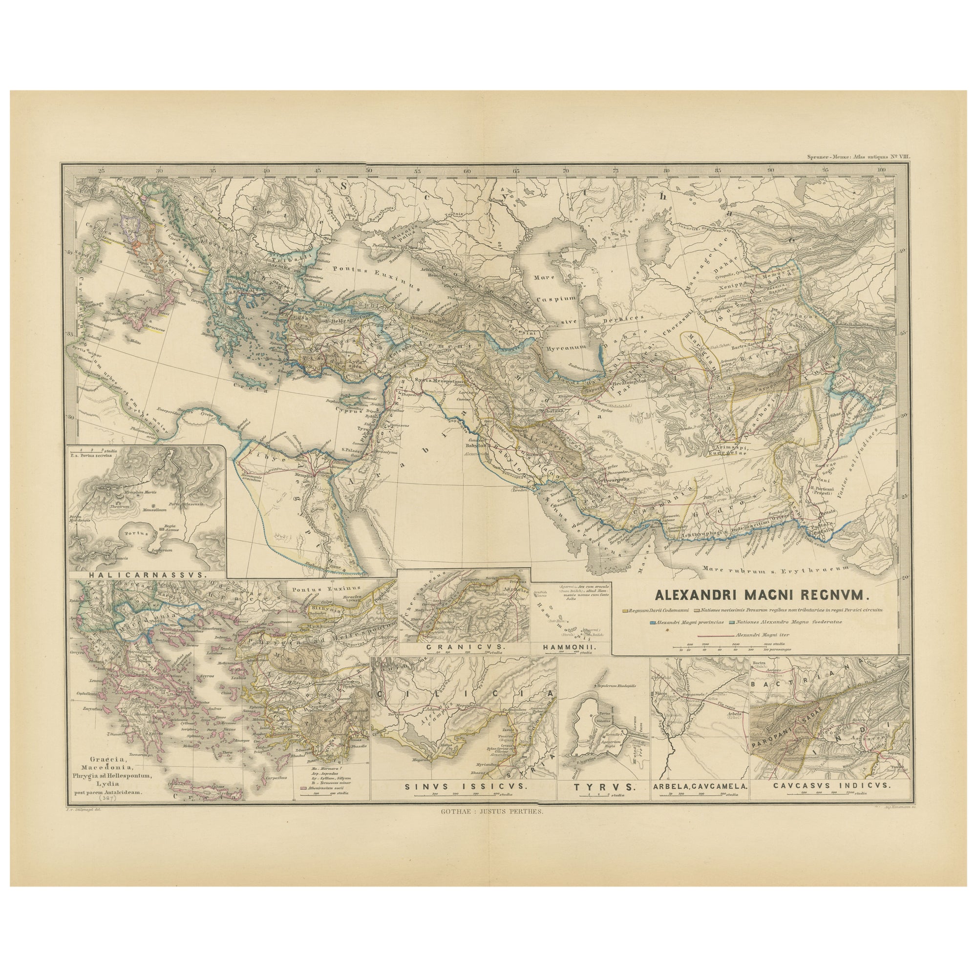
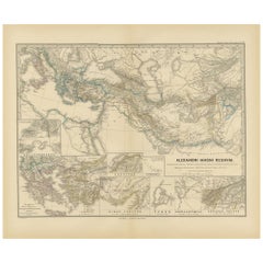
- Antique Map of The Kingdom of Alexander the Great, Published in 1880Located in Langweer, NLThe map is titled "ALEXANDRI MAGNI REGNUM," which translates to "The Kingdom of Alexander the Great." It depicts the vast territories conquered by Alexander the Great during his reig...Category
Antique 1880s Maps
MaterialsPaper
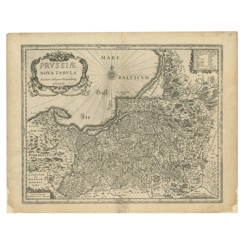
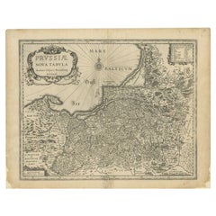
- Antique Map of Prussia by Blaeu, c.1680Located in Langweer, NLAntique map titled 'Prussiae nova Tabula'. Later edition of Blaeu's map of Prussia, embellished with a large cartouche and compass rose. Prussia was a h...Category
Antique 17th Century Maps
MaterialsPaper
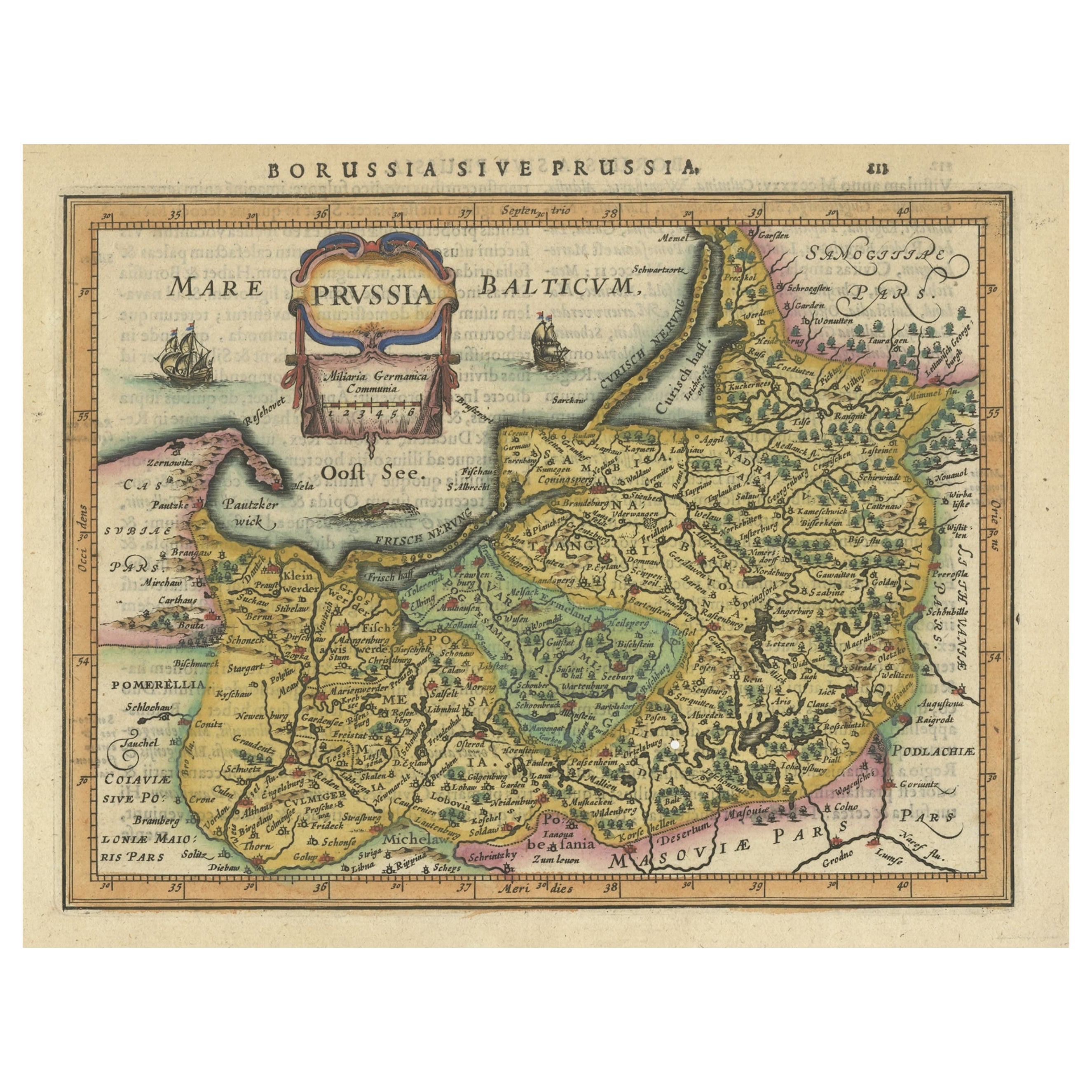
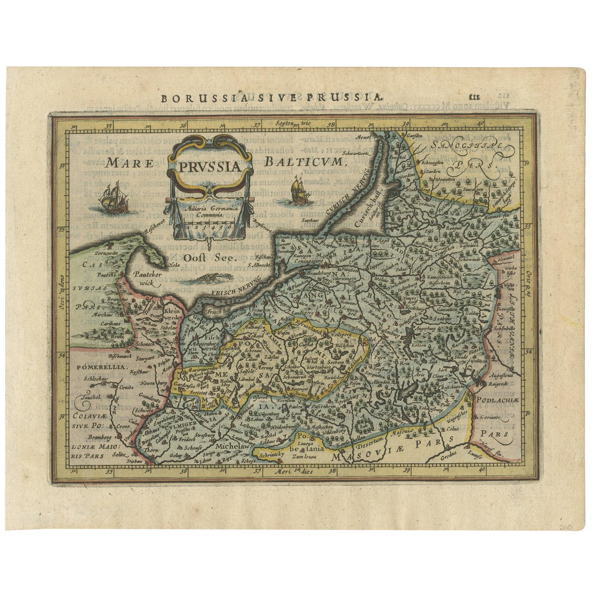
- Original Decorative Antique Map of Prussia, 1628Located in Langweer, NLAntique map titled 'Prussia'. Original antique map of Prussia, a historically prominent German state that originated in 1525 with a duchy centered on th...Category
Antique 1620s Maps
MaterialsPaper
- Antique Map of Prussia by Janssonius, 1628Located in Langweer, NLAntique map titled 'Prussia'. Original antique map of Prussia, a historically prominent German state that originated in 1525 with a duchy centered on th...Category
Antique Mid-17th Century Maps
MaterialsPaper
You May Also Like
- Map of the Kingdom of Sardinia and Part of the Kingdom of Genoa, RomeBy Giovanni Maria CassiniLocated in Hamilton, Ontario18th century map by Italian engraver Giovanni Maria Cassini (Italy 1745-1824). Map of Part of the Kingdom of Sardinia and Part of the Kingdom of Genoa: Rome. This is a hand colored a...Category
Antique 18th Century Italian Maps
MaterialsPaper
- Original Antique Map of Cyprus. Circa 1880Located in St Annes, LancashireGreat map of Cyprus Drawn and Engraved by R.Walker Published W.Mackenzie, London Original colour Unframed.Category
Antique 1880s English Maps
MaterialsPaper
- Large Original Vintage Map of the United Kingdom, circa 1920Located in St Annes, LancashireGreat map of The United Kingdom Unframed Original color By John Bartholomew and Co. Edinburgh Geographical Institute Published, circa 1920 Free shipping.Category
Vintage 1920s British Maps
MaterialsPaper
- Large Original Antique Map of The Environs of Dublin, Ireland, circa 1880Located in St Annes, LancashireGreat map of The Environs of Dublin Published circa 1880 Unframed Free shipping.Category
Antique 1880s Scottish Maps
MaterialsPaper
- Large Original Antique Map of the Environs of Cork, Ireland, circa 1880Located in St Annes, LancashireGreat map of The Environs of Cork Published circa 1880 Unframed Free shipping.Category
Antique 1880s Scottish Maps
MaterialsPaper
- Set of 10 Large Scale Vintage Maps of The United Kingdom, circa 1900Located in St Annes, LancashireGreat set of maps of the UK Lithographs. By John Bartholomew & Co. Published by The Edinburgh Geographical Institute Unframed. The measurement ...Category
Antique Early 1900s English Maps
MaterialsPaper