Antique Street Maps
5
to
22
189
126
171
103
63
54
48
48
32
25
23
20
18
17
16
15
14
13
12
11
9
8
7
6
6
6
5
5
4
4
3
3
3
2
2
2
2
1
1
1
16
10
4
3
3
Sort By
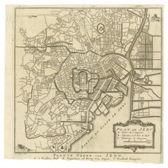
Antique Street Map of the City of Edo 'Modern Tokyo' in Japan
Located in Langweer, NL
Antique map titled 'Plan de Jedo - Platte Grond van Jedo'. A detailed street map of the city of Edo
Category
Mid-18th Century Antique Street Maps
Materials
Paper
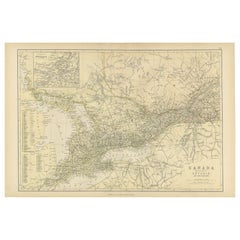
Antique Map of Canada, The Province of Ontario and Part of Quebec, 1882
Located in Langweer, NL
and the Atlantic Ocean.
An inset in the top left corner provides a more detailed street map of the
Category
1880s Antique Street Maps
Materials
Paper
Free Shipping
H 14.97 in W 22.45 in D 0 in
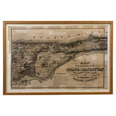
1868 Map of the Upper Part of the Island of Manhattan Above 86th Street
By Wm. Rogers Mfg. Co.
Located in San Francisco, CA
This wonderful piece of New York City history is over 150 years old. It depicts 86th street and
Category
1860s American American Colonial Antique Street Maps
Materials
Paper
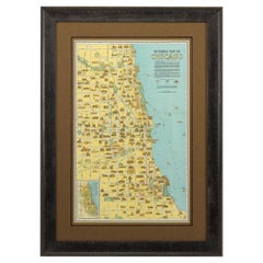
Pictorial Map of Chicago, circa 1926
Located in Colorado Springs, CO
This is a colorful folding pocket map of the city of Chicago, published by The Clason Map Co
Category
1920s American Antique Street Maps
Materials
Paper
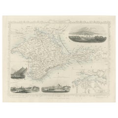
A Decorative Detailed Map of the Crimea, with an Inset Map of Sebastopol, c 1851
Located in Langweer, NL
, detailed and historically interesting mid 19th century map of the Crimea -- with an inset plan of
Category
1850s Antique Street Maps
Materials
Paper
H 10.83 in W 14.18 in D 0 in
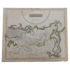
1814 Map of "Russian Empire" Ric.r032
Located in Norton, MA
1814 Map of
"Russian Empire"
Ric.r032
Russian Empire. Description: This is an 1814 John
Category
19th Century Unknown Antique Street Maps
Materials
Paper
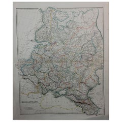
1832 Large Map "Russian & Poland" Ric. R0012
Located in Norton, MA
Large map 1832
"Russian & Poland"
Ric.r0012
Russia & Poland, by J. Arrowsmith. London, pubd
Category
19th Century Unknown Antique Street Maps
Materials
Paper
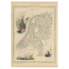
Antique Map of Holland with Colorful Vignettes, 1851
Located in Langweer, NL
Antique map titled 'Holland'.
Decorative map of Holland. Includes vignettes of Rotterdam, Dutch
Category
19th Century Antique Street Maps
Materials
Paper
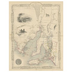
Antique Map of South Australia by Tallis, 1851
By Thomas Kitchin
Located in Langweer, NL
Antique map Australia titled 'Part of South Australia'. Decorative map of part of South Australia
Category
19th Century Antique Street Maps
Materials
Paper
Large Antique Map of England Hand Colored by Counties
Located in Langweer, NL
Antique map titled 'A New Map of England from the latest Authorities'. Large map of England, hand
Category
Early 19th Century Antique Street Maps
Materials
Paper
Rare Antique Map of Calcutta 'Kolkata' in India, 1893
Located in Langweer, NL
Antique map titled 'Calcutta (India)'. Old map of Calcutta/Kolkata, India. On verso, a map of Egypt
Category
19th Century Antique Street Maps
Materials
Paper
Antique Map of the Pacific Ocean by Anson, 1765
Located in Langweer, NL
capture of the Nostra the treasures were paraded through the streets of London. The map shows the pacific
Category
18th Century Antique Street Maps
Materials
Paper
Old Engraved Map of Hungary with Decorative Vignettes, 1851
Located in Langweer, NL
Antique map titled Hungary. Includes decorative vignettes titled Hungarian Peasants, Pesth and the
Category
19th Century Antique Street Maps
Materials
Paper
1855 "New-York City & County Map" by Charles Magnus
By Charles Magnus
Located in Colorado Springs, CO
This is a beautiful hand-colored map titled “New York City & County Map with Vicinity entire
Category
1850s American Antique Street Maps
Materials
Paper
Map Shropshire Joseph Ellis Robert Sayer Carington Bowles Framed
Located in BUNGAY, SUFFOLK
A modern map of Shropshire Drawn from the latest surveys corrected and improved by the best
Category
18th Century English Georgian Antique Street Maps
Materials
Paper
Antique Map of Russia and Surroundings by Stieler, 1874
Located in Langweer, NL
Bering Street and Japan in the right edge of the map.Sheet 59 from 'Stieler's Hand-Atlas' published in
Category
19th Century Antique Street Maps
Materials
Paper
Road Map, John Ogilby, No 54, London, Yarmouth, Britannia
By John Ogilby
Located in BUNGAY, SUFFOLK
-sixth year, as a publisher of maps and geographical accounts.
Ogilby was born outside Dundee, in
Category
1670s English Baroque Antique Street Maps
Materials
Paper
Map Berkshire C&J Greenwood Windsor Castle JDower Polling Hundreds
Located in BUNGAY, SUFFOLK
Map of the County of Berkshire from an Actual Survey made in the Years 1822 & 1823 by C&J Greenwood
Category
19th Century English Georgian Antique Street Maps
Materials
Paper
Italian Parchment Map of the City of Lucca Dated 1640
By Matthäus Merian the Elder
Located in Roma, IT
An antique map of the Tuscan city of Lucca engraved for The 'Itinerarium Italiæ Nov-antiquæ' by
Category
1640s Italian Antique Street Maps
Materials
Parchment Paper, Paper
Antique Folding London Map, English, Cartography, Historic, Georgian, Dated 1783
Located in Hele, Devon, GB
This is an antique folding London map. An English, paper on linen cartographical study of the
Category
Late 18th Century British Georgian Antique Street Maps
Materials
Linen, Paper
H 6.3 in W 6.11 in D 0.6 in
Antique Map of Russia in Asia by Tallis, c.1851
Located in Langweer, NL
Antique map titled 'Russia in Asia'. Map of Russia in Asia. Showing vignettes of a polar hunting
Category
19th Century Antique Street Maps
Materials
Paper
Antique Map of England and Wales with Decorative Vignettes, 1851
Located in Langweer, NL
Antique map titled ‘England and Wales’. Includes decorative vignettes titled The grand stand on the
Category
19th Century Antique Street Maps
Materials
Paper
Beautiful Decorative Hand-Colored Antique Map of West Canada, 1851
Located in Langweer, NL
Description: Antique map of Canada titled 'West Canada'.
With decorative vignettes titled
Category
1850s Antique Street Maps
Materials
Paper
No Reserve
H 10.63 in W 14.38 in D 0 in
Plan of Paris, France, by A. Vuillemin, Antique Map, 1845
Located in Colorado Springs, CO
This large and detailed plan of Paris was published by Alexandre Vuillemin in 1845. The map conveys
Category
1840s American Antique Street Maps
Materials
Paper
Large Map of Castile's Southern Realms - Granada, Andalusia, and Murcia, 1652
Located in Langweer, NL
This antique map, titled 'Les Etats de la Couronne de Castille', represents the southern regions of
Category
Mid-17th Century Antique Street Maps
Materials
Paper
H 17.64 in W 23.75 in D 0.02 in
Original Antique Map of the Channel Islands, Incl. Decorative Vignettes, 1851
Located in Langweer, NL
Antique map titled ‘Channel Islands’.
Includes decorative vignettes titled St. Peters Port
Category
1850s Antique Street Maps
Materials
Paper
H 14.57 in W 10.24 in D 0 in
1915 "San Francisco City and County" Hanging Map by W. Bashford Smith
Located in Colorado Springs, CO
1915, this map indicates streets and city districts, and, most notably, shows the site of the Panama
Category
1910s American Art Deco Antique Street Maps
Materials
Wood, Paper
Antique Map of the City of Leuven, Belgium, with Original Coloring, 1609
Located in Langweer, NL
An original antique map titled "Lovanium Brabantiarum," which depicts the city of Leuven in Belgium
Category
Early 17th Century Antique Street Maps
Materials
Paper
H 11.74 in W 13.94 in D 0.02 in
1847 Ornamental Map of the United States & Mexico by H. Phelps
Located in Colorado Springs, CO
States & Mexico" by Humphrey Phelps. The map was issued as an act of Congress by Phelps on Fulton Street
Category
1840s American Antique Street Maps
Materials
Paper
Road Map, John Ogilby, London, Barwick, York, Chester, Darlington, Durham Framed
By John Ogilby
Located in BUNGAY, SUFFOLK
ye Street. Plate ye 4th continuing 76 ½ miles. No 8.
York to Burrowbridge, to Topcliff, to
Category
1670s English Baroque Antique Street Maps
Materials
Paper
H 18.12 in W 23.04 in D 0.6 in
Map of Western Australia & Swan River, insets of Perth, Aboriginals, Sheep, 1851
Located in Langweer, NL
Antique map titled 'Western Australia, Swan River'. Map of Western Australia and Swan River
Category
1850s Antique Street Maps
Materials
Paper
H 14.57 in W 10.63 in D 0 in
Decorative Map of part of South Australia with Illustrations of Adelaide, 1851
Located in Langweer, NL
Antique map Australia titled 'Part of South Australia'.
Decorative map of part of South
Category
1850s Antique Street Maps
Materials
Paper
H 13.71 in W 10.83 in D 0 in
Decorative Antique Map of the Malay Archipelago or East Indies Island, 1851
Located in Langweer, NL
Antique map Indonesia titled 'Malay Archipelago, or East India Islands'. With vignettes of Victoria
Category
1850s Antique Street Maps
Materials
Paper
No Reserve
H 10.44 in W 14.18 in D 0 in
The Illustrated Map of the Var Department from the Atlas National Illustré, 1856
Located in Langweer, NL
This original hand-colored map is from the "Atlas National Illustré," a work by Victor Levasseur, a
Category
1850s Antique Street Maps
Materials
Paper
H 14.18 in W 20.87 in D 0 in
Map Road Strip Britannia Sheet 2 John Ogilby London Aberistwith Islip Bramyard
By John Ogilby
Located in BUNGAY, SUFFOLK
of England and Wales.
Strip map Islip to Bramyard, on a scale of approximately one inch to the mile
Category
17th Century English Baroque Antique Street Maps
Materials
Paper
H 14.38 in W 19.3 in D 0.79 in
Road Map John Ogilby No 75 Kings Lyn Harwich, Britannia Framed Wallhanging
By John Ogilby
Located in BUNGAY, SUFFOLK
, as a publisher of maps and geographical accounts.
Ogilby was born outside Dundee, in 1600, the
Category
1670s European Baroque Antique Street Maps
Materials
Paper
H 15.75 in W 19.69 in D 0.6 in
Map Road John Ogilby Britannia No 74 Ipswich to Norwich Cromer Framed
By John Ogilby
Located in BUNGAY, SUFFOLK
his sixty-sixth year, as a publisher of maps and geographical accounts.
Ogilby was born outside
Category
1670s English Baroque Antique Street Maps
Materials
Paper
Beautiful Original Antique Map of Antwerp, Belgium by Mapmaker Blaeu, ca.1652
Located in Langweer, NL
Description: Antique map titled 'Antverpia; Gallis Anvers. Vernacule Antwerpen.'
A very nicely
Category
1650s Antique Street Maps
Materials
Paper
H 19.1 in W 24.53 in D 0 in
Map of Russia with Vignettes of the Neoskoi Prospect, St. Petersburg, ca.1851
Located in Langweer, NL
Antique map titled 'Russia in Europe'.
Map of European Russia. Showing vignettes of the Neoskoi
Category
1850s Antique Street Maps
Materials
Paper
H 14.38 in W 10.63 in D 0 in
Antique Map of British Guayana with Insets of Georgetown, Devil's Rock Etc, 1851
Located in Langweer, NL
Antique map titled ‘British Guayana’. Includes decorative vignettes titled Georgetown, Christmas
Category
19th Century Antique Street Maps
Materials
Paper
Free Shipping
H 14.18 in W 10.83 in D 0 in
1840 "New Map of the City of New York With Part of Brooklyn & Williamsburg"
Located in Colorado Springs, CO
Presented is a hand-colored, engraved folding map titled "New Map of the City of New York With Part
Category
1840s American Antique Street Maps
Materials
Paper
H 30 in W 27.5 in D 3 in
Road Map No43 London to Kings Lynn, Royston to Downham, John Ogilby, Britannia
By John Ogilby
Located in BUNGAY, SUFFOLK
John Ogilby (British 1600-1676) Cosmographer and Geographick Printer to Charles II.
A road map
Category
Late 17th Century British Charles II Antique Street Maps
Materials
Paper
H 20.48 in W 24.41 in D 0.4 in
Road Map John Ogilby London St David's Britannia No 15 Abingdon Monmouth Framed
By John Ogilby
Located in BUNGAY, SUFFOLK
John Ogilby (British 1600-1676) Cosmographer and Geographick Printer to Charles II. A road map from
Category
1670s English Baroque Antique Street Maps
Materials
Paper
H 20.48 in W 24.41 in D 0.6 in
Antique Map of Western Africa with Vignettes of Cape Coast Castle etc, ca.1851
Located in Langweer, NL
Antique map titled ‘Western Africa’. Includes decorative vignettes titled Christiansborg, Cape
Category
1850s Antique Street Maps
Materials
Paper
H 10.44 in W 13.98 in D 0 in
Road Map Britannia No 32 the Road from London to Barnstable John Ogilby Framed
By John Ogilby
Located in BUNGAY, SUFFOLK
A road map from Britannia, by John Ogilby Esq., Cosmographer and Geographick Printer to Charles II
Category
Late 17th Century English Charles II Antique Street Maps
Materials
Paper
H 20.48 in W 24.41 in D 0.6 in
Road Map Britannia No 15 London to St Davids John Ogilby Brown Gilt Frame
By John Ogilby
Located in BUNGAY, SUFFOLK
Lechlade, to Fairford, to Barnsley to Gloucester showing Monmouth as the destination. A road map from
Category
Late 17th Century British Charles II Antique Street Maps
Materials
Paper
H 22.05 in W 26.19 in D 0.6 in
City View of Nuremberg, Germany: An 18th Century Hand-Colored Map by M. Seutter
By Matthew Seutter
Located in Alamo, CA
streets in great detail. Buildings, including churches, administration buildings and Nuremburg Castle are
Category
Mid-18th Century German Antique Street Maps
Materials
Paper
H 22 in W 24.25 in D 0.13 in
Road Map Britannia No 25 London to the Lands End, John Ogilby Brown Gilded Frame
By John Ogilby
Located in BUNGAY, SUFFOLK
Senan in Cornwall. By John Ogilby His Majesties Cosmographer. A road map from Britannia, 1675/6. No 25
Category
Late 17th Century British Charles II Antique Street Maps
Materials
Paper
H 22.05 in W 26.19 in D 0.6 in
Road Map Britannia 1675/6 No 5 Road London to Barwick, London Stilton Grey Frame
By John Ogilby
Located in BUNGAY, SUFFOLK
John Ogilby (British 1600-1676) cosmographer and geographick printer to Charles II.
A road map from
Category
Late 17th Century British Charles II Antique Street Maps
Materials
Paper
H 22.84 in W 25.99 in D 0.4 in
London (England)
Located in Florham Park, NJ
Highly detailed street map of late 19th Century London. Each street is named as are gardens, parks
Category
19th Century Academic Antique Street Maps
Materials
Lithograph
London (England)
Located in Florham Park, NJ
Late 19th Century map of London highlighting the city's marvels. Serving also as a mundane street
Category
Late 19th Century Academic Antique Street Maps
Materials
Lithograph
Utrecht city plan
Located in UTRECHT, UT
three years. It is the first map of Utrecht that includes street names.
Category
1770s Dutch Other Antique Street Maps
Materials
Paper
Essex John Cary 1787 Cary's New & Correct English Atlas 40cm 16" long gilt frame
By John Cary
Located in BUNGAY, SUFFOLK
Engraver Map & Printseller no 188 the corner of Arundel Street Strand
Antique engraved copperplate map with
Category
18th Century English Georgian Antique Street Maps
Materials
Paper
H 13.78 in W 15.75 in D 0.79 in
Plan for the City of Washington by Andrew Ellicott, Antique Print, 19th Century
Located in Colorado Springs, CO
wove paper. The map has one faintly discolored area to the left of the “Breadth of Streets” description
Category
Late 19th Century American Antique Street Maps
Materials
Paper
H 36 in W 43.75 in D 3 in
Rare Large Etching of a Market of War Horses, Ca.1720
Located in Langweer, NL
city. A woman trades in food on the street. The masts of ships are visible on the right. In the
Category
1720s Antique Street Maps
Pair of Fine Desk Globes by J. Cary, 1816 and 1824
Located in Amsterdam, NL
to the present time. Made and sold by G & J Cary, 86 St James Street, Mar. 1 1824
“Cary’s New
Category
Early 19th Century Antique Street Maps
Materials
Other
Rare Engraving of Dutch and Danish Forts on the West African Gold Coast, 1744
Located in Langweer, NL
house in St John’s Street in Westminster. Awnsham Churchill (d. 1728), bookseller, was connected with
Category
1740s Antique Street Maps
Materials
Paper
H 15.36 in W 13.67 in D 0 in
18th Century Map Engraving - Mechlin, or Malines
Located in Corsham, GB
A map of Mechelen, known as Malines in French and Mechlin in English, a city and municipality in
Category
18th Century Antique Street Maps
Materials
Engraving
1861 Original vintage map of Paris - Historical cartography
Located in PARIS, FR
. Using detailed drawing techniques and meticulous depictions of streets, monuments and fortified
Category
1860s Antique Street Maps
Materials
Paper, Lithograph
H 33.86 in W 42.92 in
Prague, Czechoslovakia. Antique Map City Plan Chromolithograph, circa 1895
Located in Melbourne, Victoria
plan of Prague, Czechoslovakia.
Central vertical fold. Printed street index on the reverse of the map.
Category
Late 19th Century Victorian Antique Street Maps
Materials
Lithograph
H 9.85 in W 12.01 in
- 1
Get Updated with New Arrivals
Save "Antique Street Maps", and we’ll notify you when there are new listings in this category.
Antique Street Maps For Sale on 1stDibs
There is a range of antique street maps for sale on 1stDibs. Each of these unique antique street maps was constructed with extraordinary care, often using paper, metal and brass. Antique street maps have been made for many years, and versions that date back to the 18th Century alongside those produced as recently as the 20th Century. There are many kinds of antique street maps to choose from, but at 1stDibs, Baroque, Victorian and Art Deco antique street maps are of considerable interest. Cary’s, Charles J. Kleingrothe and Charles Magnus each produced beautiful antique street maps that are worth considering.
How Much are Antique Street Maps?
Prices for antique street maps start at $76 and top out at $238,935 with the average selling for $813.
