Items Similar to Pictorial Map of Chicago, circa 1926

Want more images or videos?
Request additional images or videos from the seller
1 of 5
Pictorial Map of Chicago, circa 1926
About the Item
This is a colorful folding pocket map of the city of Chicago, published by The Clason Map Co., circa 1926.
This highly decorative, double sided map features "Pictorial Map of Chicago" with a "Pictorial Map of Downtown Chicago" on the verso. The maps is a fascinating documentation of Chicago architecture in the 1920s.
On the "Pictorial Map of Chicago" side, a declaration is printed from the publisher: "This pictorial map, the first of its kind to be made of any American city, gives a comprehensive picture of Chicago. Buildings of many kinds are illustrated... The view of each building is from the direction best illustrating architectural lines." The area covered is from Central Avenue to the Lake and from Howard Street in the north to 87th Avenue in the south, with pictographs of major buildings. There is a small inset Outline Map of Chicago, with the North, West and South Side motor coach routes marked. The verso features a "Pictorial Map of Downtown Chicago" with many more prominent buildings illustrated in all their architectural glory.
Condition:
Original double sided color lithograph. Map is in very good condition. Paper is healthy, with original fold lines present.
Framed with "Pictorial Map of Chicago" side visible. Map is framed to the highest archival standards, with acid-free top mats, UV Conservation Clear glass, and a custom-built wooden frame.
- Dimensions:Height: 45 in (114.3 cm)Width: 33 in (83.82 cm)Depth: 1.5 in (3.81 cm)
- Materials and Techniques:
- Place of Origin:
- Period:
- Date of Manufacture:1926
- Condition:Wear consistent with age and use.
- Seller Location:Colorado Springs, CO
- Reference Number:
About the Seller
4.9
Platinum Seller
These expertly vetted sellers are 1stDibs' most experienced sellers and are rated highest by our customers.
Established in 2010
1stDibs seller since 2011
400 sales on 1stDibs
Typical response time: <1 hour
- ShippingRetrieving quote...Ships From: Colorado Springs, CO
- Return PolicyA return for this item may be initiated within 10 days of delivery.
More From This SellerView All
- "Clason's Guide Map of Montana" by The Clason Map Company, Circa 1920sLocated in Colorado Springs, COPresented is “Clason's Guide Map of Montana,” published in the early 1920s by the Clason Map Company. Issued as a folding map, this map identifies county boundaries, county seats, Na...Category
Vintage 1920s American Art Deco Maps
MaterialsPaper
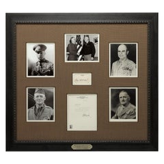
- Fathers of the Air Service Authentic Signature Collage, circa 1926-1993Located in Colorado Springs, COPresented is a collage celebrating the men who made an early impact on the formation of America’s Air Service. Complete with signatures by Jimmy Doolittle, Tooey Spaatz, Hap Arnold, ...Category
Late 20th Century American Historical Memorabilia
MaterialsPaper
- 1907 Map of Colorado, Antique Topographical Map, by Louis NellLocated in Colorado Springs, COThis highly detailed pocket map is a topographical map of the state of Colorado by Louis Nell from 1907. The map "has been complied from all availabl...Category
Antique Early 1900s American Maps
MaterialsPaper
- 1861 Topographical Map of the District of Columbia, by Boschke, Antique MapLocated in Colorado Springs, COPresented is an original map of Albert Boschke's extremely sought-after "Topographical Map of the District of Columbia Surveyed in the Years 1856 ...Category
Antique 1860s American Historical Memorabilia
MaterialsPaper
- 1854 Map of Massachusetts, Connecticut and Rhode Island, Antique Wall MapLocated in Colorado Springs, COThis striking wall map was published in 1854 by Ensign, Bridgman & Fanning and has both full original hand-coloring and original hardware. This impression is both informative and highly decorative. The states are divided into counties, outlined in red, green, and black, and subdivided into towns. Roads, canals, and railroad lines are prominently depicted, although they are not all labeled. The mapmakers also marked lighthouses, banks, churches, and prominent buildings, with a key at right. The map is an informative and comprehensive overview of the infrastructural development of New England prior to the Civil War. Physical geographies depicted include elevation, conveyed with hachure marks, rivers and lakes. The impression features an inset map of Boston...Category
Antique 19th Century American Maps
MaterialsPaper
- 1864 Map of North America, Antique Hand-Colored Map, by Adolphe Hippolyte DufourLocated in Colorado Springs, COOffered is a map of North America entitled Amerique du Nord from 1864. This rare, separately published wall map was produced by Adolphe Hippolyte Dufour. This map includes vibrant an...Category
Antique 1860s French Maps
MaterialsPaper


You May Also Like
- Old Decorative Pictorial Map of the United States, circa 1953Located in Langweer, NLAntique map titled 'A Pictorial Map of the United States of America Showing Principal Regional Resources, Products, and Natural Features'. This information-packed map was create by the General Drafting Company for the New Jersey Bell Telephone Company. The main map features over 700 drawings in full color including points of interest, natural resources, and agricultural products. At bottom are inset maps showing railroad lines, air routes, telephone lines, as well as a pictorial map of New Jersey...Category
20th Century Maps
MaterialsPaper
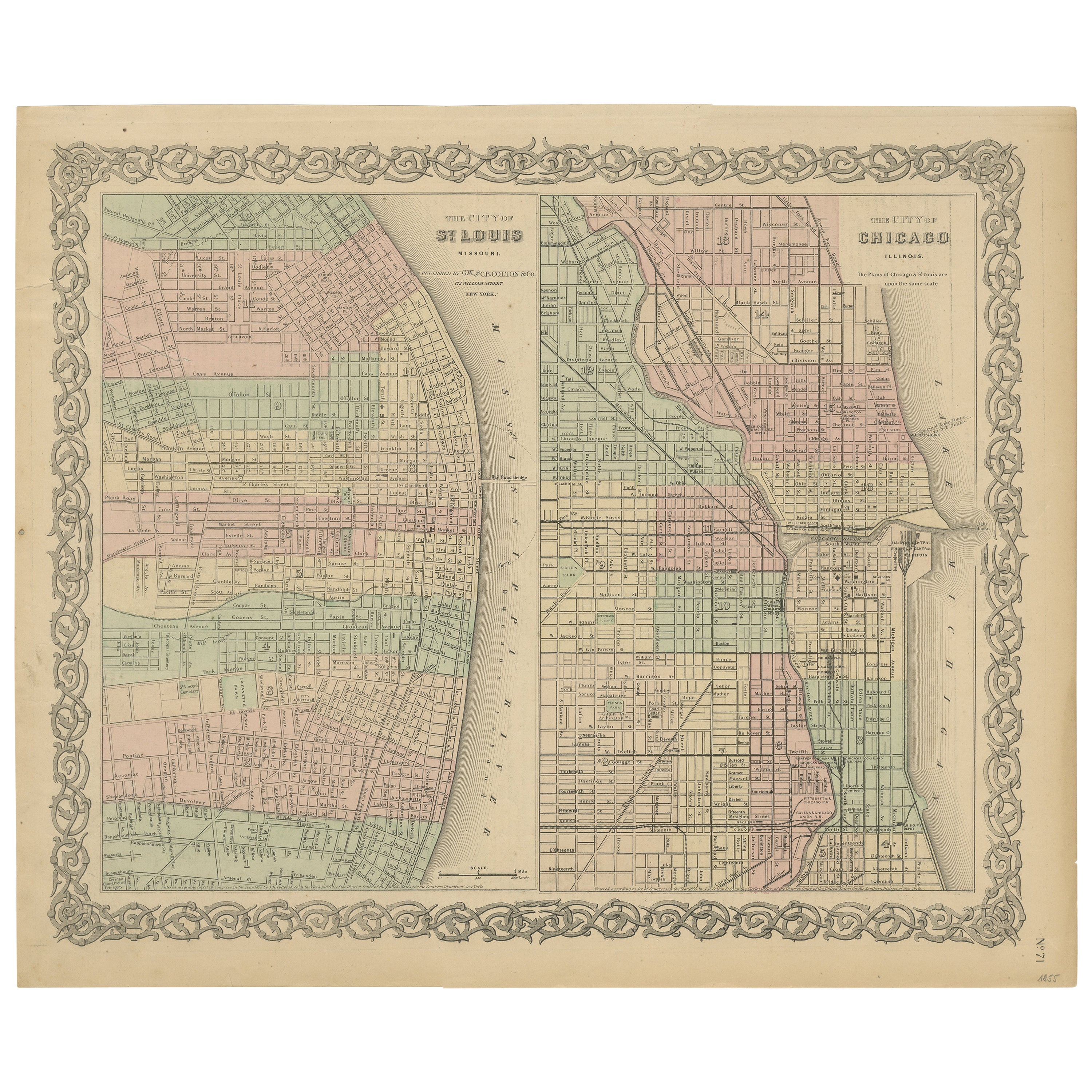
- Antique Map of St. Louis and ChicagoLocated in Langweer, NLAntique map titled 'The City of St. Louis Missouri - The City of Chicago Illinois'. Dual map on single page showing St. Louis and Chicago. Finely produ...Category
Antique Mid-19th Century Maps
MaterialsPaper
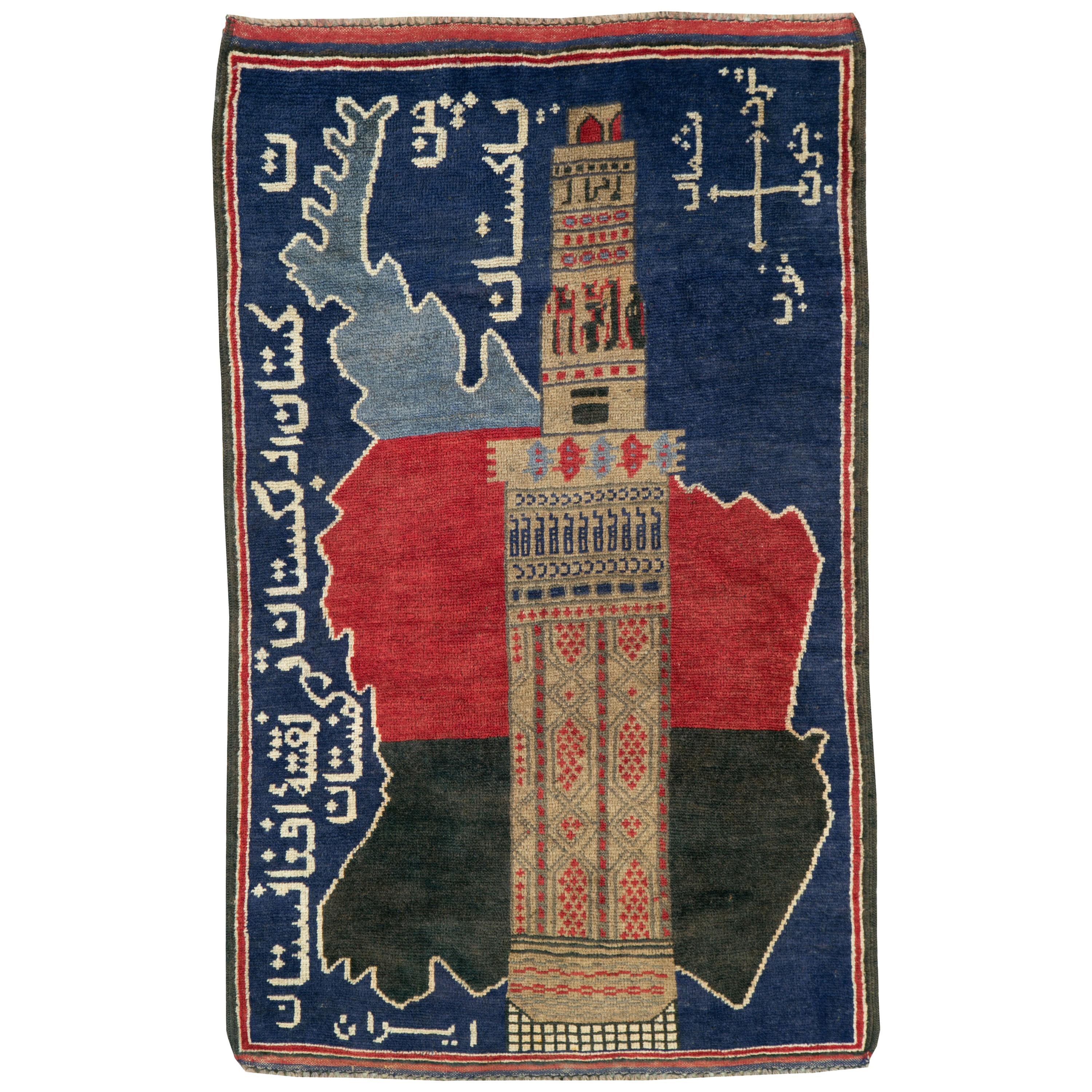
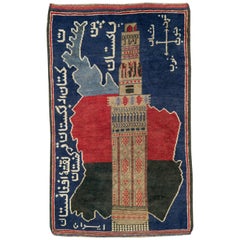
- Vintage Afghan Pictorial Map RugLocated in New York, NYA vintage Afghan Pictorial map rug from the mid-20th century. Measures: 3' 0" x 4' 10"Category
Mid-20th Century Afghan Folk Art Central Asian Rugs
MaterialsWool
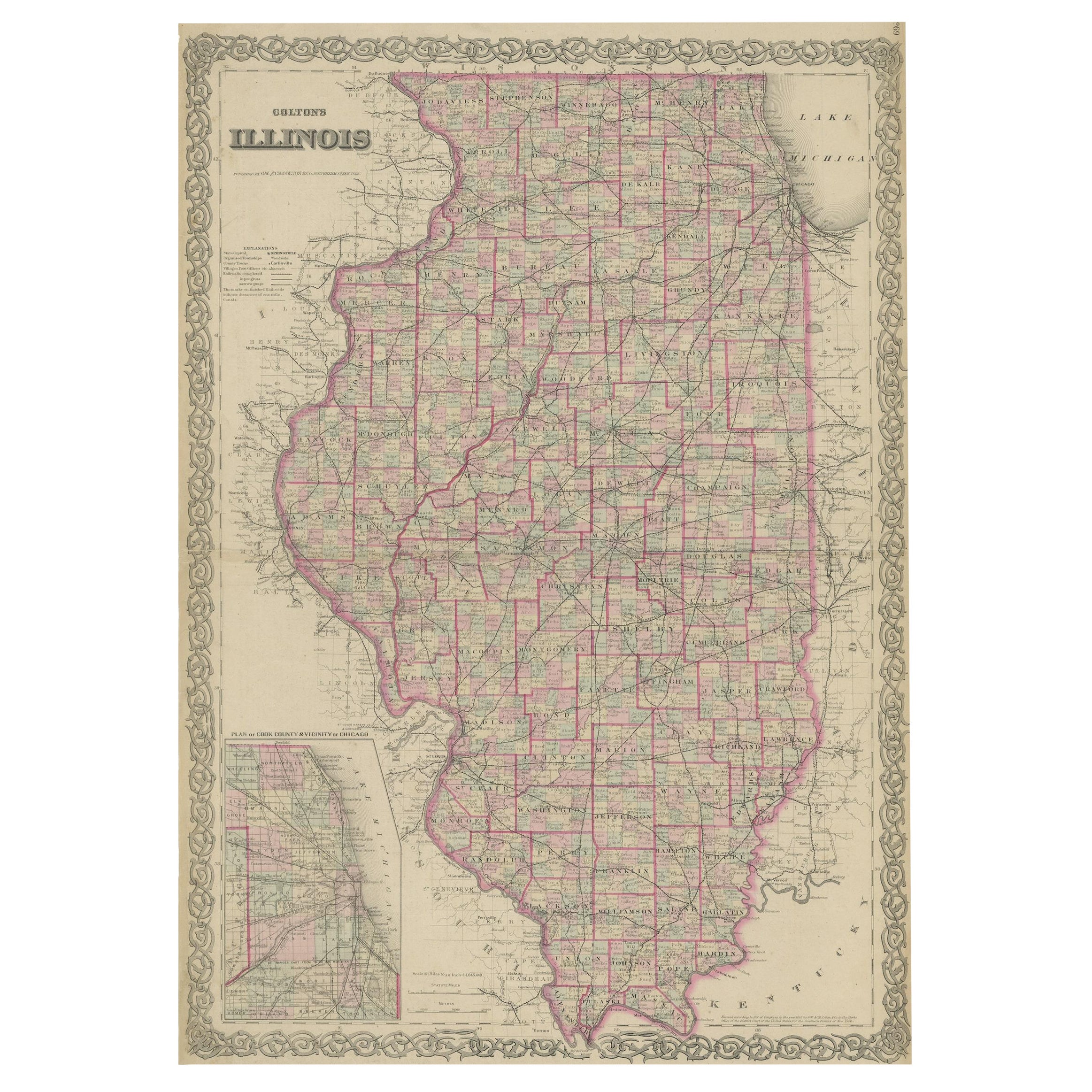
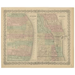
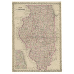
- Colton's Map of Illinois, with an Inset of ChicagoLocated in Langweer, NLAntique map titled 'Colton's Illinois'. Antique map of Illinois, a state in the Midwestern United States. With an inset map of of Cook County &...Category
Antique Mid-19th Century Maps
MaterialsPaper
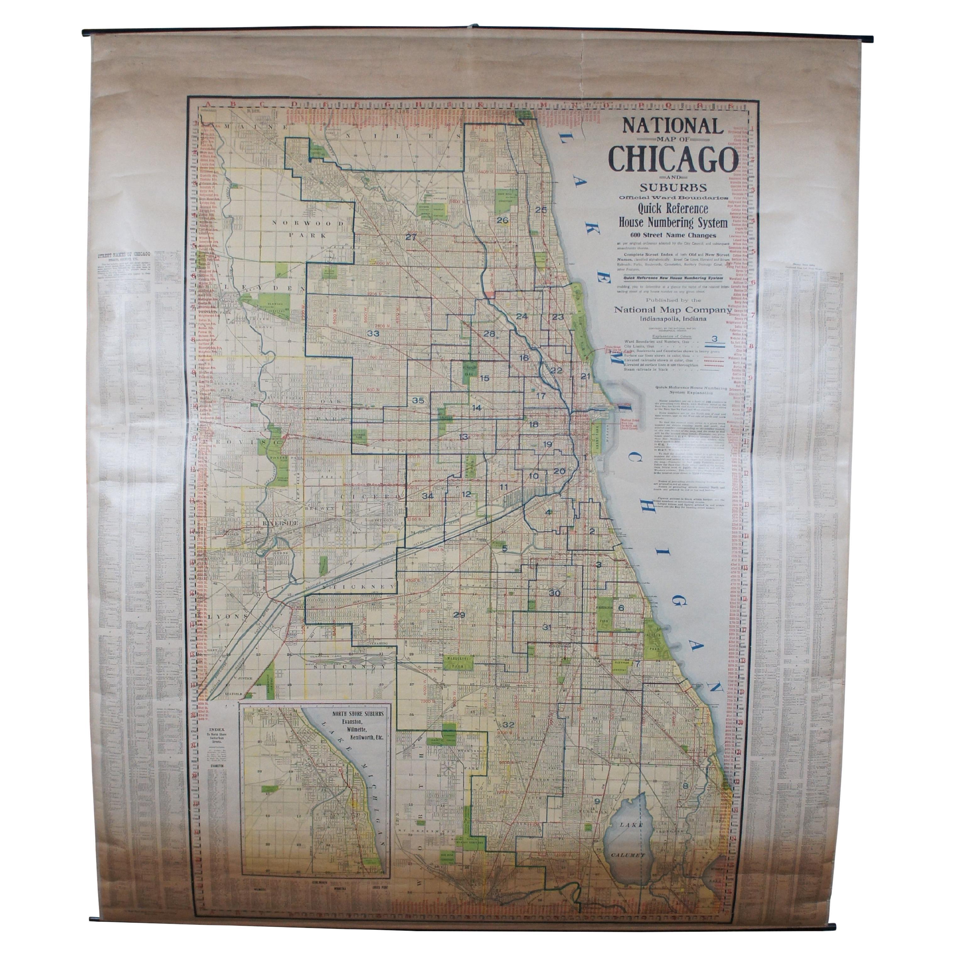
- Antique Chicago Illinois National Map Commercial Rollup Classroom Census Map 47"Located in Dayton, OHAntique early to mid 20th century double sided hanging map titled the New Commercial and Census Map of Illinois, Edition 1073. Verso shows the National Map of Chicago and Suburbs - O...Category
Early 20th Century North American Maps
MaterialsPaper
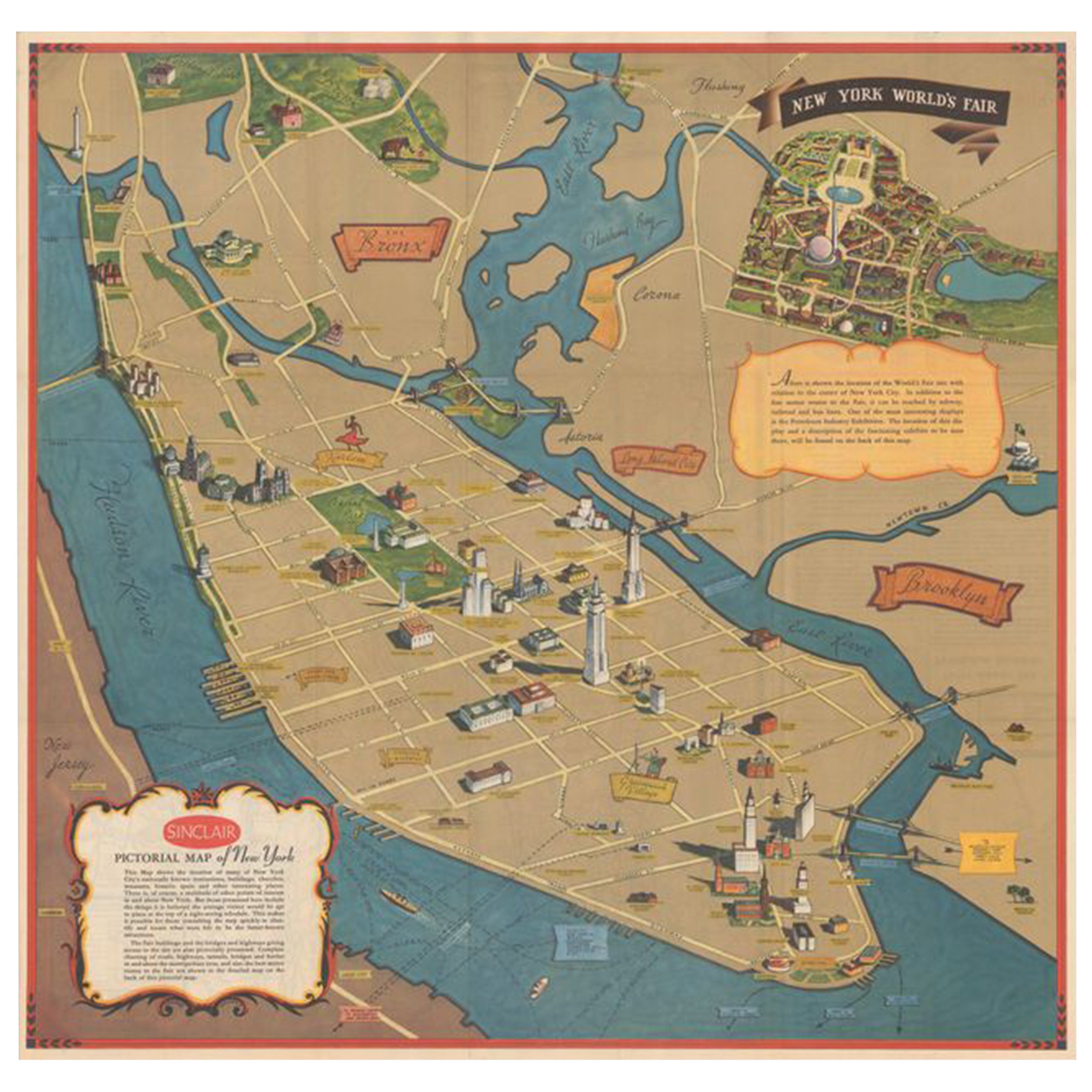
- Pictorial Vintage Map of New York City Showing Numerous Landmarks, 1939Located in Langweer, NLThis pictorial souvenir map focuses on New York City and the site of the 1939 World's Fair. It was drawn by graphic artist George Annand and published by Sinclair Oil...Category
Vintage 1930s Maps
MaterialsPaper


Recently Viewed
View AllMore Ways To Browse
Used Furniture In Chicago
American Of Chicago Furniture
Map Of Itsly
United States Map
Map Of United States
The United States Map
Map Of The United States
Folding Maps
Map Lithograph
Illustrated Map
Framed Maps
Framed Map
Wooden Map
Map North America
Map Of North America
Chicago Custom Furniture
Framed Map United States
Map South America