Map Lithograph
36
to
100
947
411
550
527
333
276
240
163
117
91
82
81
77
66
50
46
41
40
32
31
29
29
22
20
19
17
15
11
10
8
8
7
5
5
4
2
1
1
1
1
1
1
1
1
42
42
36
14
13
Sort By
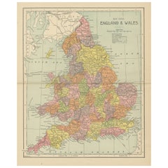
Lithographed Antique Map of England and Wales
Located in Langweer, NL
Original antique map titled 'Map XXIII England & Wales'. Lithographed map of England and Wales
Category
Antique Late 19th Century Maps
Materials
Paper
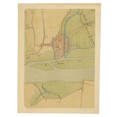
Antique Map of The Dutch City of Gorinchem by Smulders, Lithograph, 1916
Located in Langweer, NL
Antique map Gorinchem titled 'Gorkum'. Antique map depicting the city of Gorinchem, The Netherlands
Category
20th Century Maps
Materials
Paper
H 18.51 in W 13.78 in D 0 in
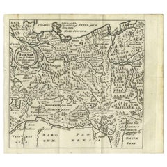
Antique Map of Swabia, 1685
Located in Langweer, NL
Antique map titled 'Sueviae quae cis Codanum fuit finum Antiqua defcriptio.' Miniature map of
Category
Antique 17th Century Maps
Materials
Paper
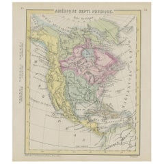
Small Map of the United States
Located in Langweer, NL
Antique map titled 'Amérique septe. Physique'. Small map of the United States. lithographed by C
Category
Antique Mid-19th Century Maps
Materials
Paper
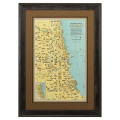
Pictorial Map of Chicago, circa 1926
Located in Colorado Springs, CO
illustrated in all their architectural glory.
Condition:
Original double sided color lithograph. Map is in
Category
Vintage 1920s American Maps
Materials
Paper
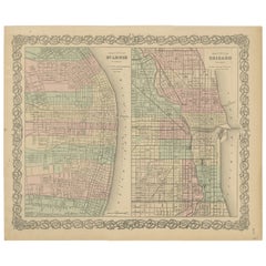
Antique Map of St. Louis and Chicago
Located in Langweer, NL
Antique map titled 'The City of St. Louis Missouri - The City of Chicago Illinois'. Dual map on
Category
Antique Mid-19th Century Maps
Materials
Paper
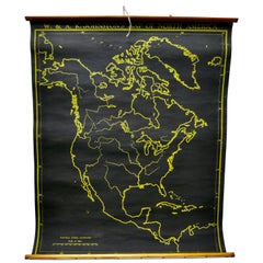
University Chart “Black Map of North America
Located in Chillerton, Isle of Wight
Bacon,
This is a Black Physical map of North America, it is large lithograph set on Linen mounted on
Category
Early 20th Century Industrial Maps
Materials
Linen
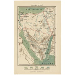
Antique Map of the Sinai Peninsula, '1895'
Located in Langweer, NL
Antique map titled 'Peninsula of Sinaï'. Lithographed map of the Sinai Peninsula, a peninsula in
Category
Antique Late 19th Century Maps
Materials
Paper
German Antique Map of Australia, Meyers, 1885
Located in Langweer, NL
Australien.' (Map of Australia. With inset maps of the large cities and Tasmania.) This attractive
Category
Antique 19th Century Maps
Materials
Paper
Antique Map of Sloten by Kuyper, 1868
Located in Langweer, NL
Antique map titled 'Provincie Friesland - Gemeente Sloten'. Map of the township of Sloten
Category
Antique 19th Century Maps
Materials
Paper
Antique Map of Sneek by Kuyper, 1868
Located in Langweer, NL
Antique map titled 'Provincie Friesland - Gemeente Sneek'. Map of the township of Sneek, Friesland
Category
Antique 19th Century Maps
Materials
Paper
Antique Map of Sneek by Kuyper, 1868
Located in Langweer, NL
Antique map titled 'Provincie Friesland - Gemeente Sneek'. Map of the township of Sneek, Friesland
Category
Antique 19th Century Maps
Materials
Paper
Antique Map of Rauwerderhem by Kuyper, 1868
Located in Langweer, NL
Antique map titled 'Provincie Friesland - Gemeente Rauwerderhem'. Map of the township of
Category
Antique 19th Century Maps
Materials
Paper
Antique Map of Stavoren by Kuyper, 1868
Located in Langweer, NL
Antique map titled 'Provincie Friesland - Gemeente Stavoren'. Map of the township of Stavoren
Category
Antique 19th Century Maps
Materials
Paper
Antique Map of Russia by Tyrer, 1821
Located in Langweer, NL
Antique map titled 'Russia'. Beautiful antique map of Russia engraved by Tyrer. Artists and
Category
Antique 19th Century Maps
Materials
Paper
Antique Map of Ooststellingwerf by Kuyper, 1868
Located in Langweer, NL
Antique map titled 'Provincie Friesland - Gemeente Oost-Stellingwerf'. Map of the township of
Category
Antique 19th Century Maps
Materials
Paper
Antique Map of Schoterland by Kuyper, 1868
Located in Langweer, NL
Antique map titled 'Provincie Friesland - Gemeente Schoterland'. Map of the township of Schoterland
Category
Antique 19th Century Maps
Materials
Paper
Antique Map of Oostdongeradeel by Kuyper, 1868
Located in Langweer, NL
Antique map titled 'Provincie Friesland - Gemeente Oost Dongeradeel'. Map of the township of
Category
Antique 19th Century Maps
Materials
Paper
Antique Map of Padang, Sumatra, Indonesia, 1900
Located in Langweer, NL
Antique map titled 'De Padangsche Beneden-en Bovenlanden van de Koninginnedbaai tot Fort de Kock
Category
20th Century Maps
Materials
Paper
Antique Map of Overijssel by Brugsma, 1864
Located in Langweer, NL
Antique map titled 'De Provincie Overijssel'. Map of the province of Overijssel, the Netherlands
Category
Antique 19th Century Maps
Materials
Paper
Antique Map of Overijssel by Kuyper, 1883
Located in Langweer, NL
Antique map titled 'De Provincie Overijssel'. Map of the province of Overijssel, the Netherlands
Category
Antique 19th Century Maps
Materials
Paper
Antique Map of Smallingerland by Kuyper, 1868
Located in Langweer, NL
Antique map titled 'Provincie Friesland - Gemeente Smallingerland'. Map of the township of
Category
Antique 19th Century Maps
Materials
Paper
Antique Map of Ooststellingwerf by Kuyper, 1868
Located in Langweer, NL
Antique map titled 'Provincie Friesland - Gemeente Oost-Stellingwerf'. Map of the township of
Category
Antique 19th Century Maps
Materials
Paper
Antique Map of Oostdongeradeel by Kuyper, 1868
Located in Langweer, NL
Antique map titled 'Provincie Friesland - Gemeente Oost Dongeradeel'. Map of the township of
Category
Antique 19th Century Maps
Materials
Paper
Antique Map of Peru by Carey, 1822
Located in Langweer, NL
Antique map titled 'Peru'. Geographical, historical, and statistical map of Peru, surrounded by
Category
Antique 19th Century Maps
Materials
Paper
Antique Map of South America, c.1840
Located in Langweer, NL
Antique map titled 'South America'. Original, antique map depicting South America. With outline
Category
Antique 19th Century Maps
Materials
Paper
Antique Map of Spain by Perthes, 1848
Located in Langweer, NL
Antique map titled 'Hispania'. Old map of Spain originating from 'Orbis Terrarum Antiquus in usum
Category
Antique 19th Century Maps
Materials
Paper
Antique Map of Spain by Funke, 1825
Located in Langweer, NL
Antique map titled 'Hispania'. Old map of Spain originating from 'Atlas der Oude Wereld'. Artists
Category
Antique 19th Century Maps
Materials
Paper
Antique Map of Overijssel by Bachiene, 1758
Located in Langweer, NL
Antique map titled 'Over-Yssel'. Map of the Overijssel, the Netherlands. This map originates from
Category
Antique 18th Century Maps
Materials
Paper
Antique Map of Sweden by Delamarche, 1806
Located in Langweer, NL
Antique map titled 'La Suede.' Decorative map of Sweden and part of Finland by Robert de Vaugondy
Category
Antique 19th Century Maps
Materials
Paper
Antique Map of Russia in Europe, 1842
Located in Langweer, NL
Antique map titled 'Carte de la Russie d'Europe'. Map of Russia in Europe. This map originates from
Category
Antique 19th Century Maps
Materials
Paper
Antique Map of Oceania by Delamarche, 1836
Located in Langweer, NL
Antique map titled 'Carte de l'Oceanie contenant l'Australie la Poynesie et les iles Asiatiques
Category
Antique 19th Century Maps
Materials
Paper
Antique Map of Siberia by Lapie, 1842
Located in Langweer, NL
Antique map titled 'Carte de la Sibérie ou Russie d'Asie'. Map of Siberia. This map originates from
Category
Antique 19th Century Maps
Materials
Paper
Antique Map of Sweden by Bowen, 1747
Located in Langweer, NL
Antique map titled 'A New & Accurate Map of Sweden'. This map covers Sweden and Finland (shown as
Category
Antique 18th Century Maps
Materials
Paper
Antique Map of Oceania by Lapie, 1842
Located in Langweer, NL
Antique map titled 'Carte de l'Océanie contenant l'Australie, la Polynesie et les Iles Asiatiques
Category
Antique 19th Century Maps
Materials
Paper
Antique Map of Overijssel by Colom, 1635
Located in Langweer, NL
Antique map titled 'Ditio Trans-Isulana'. Original antique map of the province of Overijssel, the
Category
Antique 17th Century Maps
Materials
Paper
Antique Map of the Baarderadeel Township, 1718
Located in Langweer, NL
Antique map Friesland titled 'Baardera Deel de Vierde Grietenije van Wester Goo (..)'. Old map of
Category
Antique 18th Century Maps
Materials
Paper
Antique Map of the Barradeel Township, 1718
Located in Langweer, NL
Antique map Friesland titled 'De Grietenije van Barra Deel (..)'. Old map of Friesland, the
Category
Antique 18th Century Maps
Materials
Paper
Antique Map of the Baarderadeel Township, 1718
Located in Langweer, NL
Antique map Friesland titled 'Baardera Deel de Vierde Grietenije van Wester Goo (..)'. Old map of
Category
Antique 18th Century Maps
Materials
Paper
Antique Map of Switzerland by Janssonius, 1657
Located in Langweer, NL
Antique map of Switzerland titled 'Helvetiae Rhetiae & Valesiae'. Decorative and detailed map of
Category
Antique 17th Century Maps
Materials
Paper
Antique Map of Oceania by Johnston, 1882
Located in Langweer, NL
Antique map titled 'Oceania'. Old map of Oceania with inset maps of Western Australia, Tasmania and
Category
Antique 19th Century Maps
Materials
Paper
Antique Map of Nottinghamshire by Speed, 1676
Located in Langweer, NL
Antique map titled 'The Countie of Nottingham (..)'. Map of Nottinghamshire, England. Includes an
Category
Antique 17th Century Maps
Materials
Paper
Antique Map of Surrey by Speed, 1676
Located in Langweer, NL
Antique map titled 'Surrey described and divided into hundreds'. Map of Surrey, England. Includes
Category
Antique 17th Century Maps
Materials
Paper
Antique Map of Oostergo by Tirion, 1744
Located in Langweer, NL
Antique map titled 'Oostergo'. Original antique map of Oostergo, part of the province of Friesland
Category
Antique 18th Century Maps
Materials
Paper
Antique Map of Portugal by Moll, 1727
Located in Langweer, NL
Antique map Portugal titled 'Portugal Agreeable to Modern History'. Detailed map of Portugal
Category
Antique 18th Century Maps
Materials
Paper
Antique Map of Oostergo by Tirion, 1744
Located in Langweer, NL
Antique map titled 'Oostergo'. Original antique map of Oostergo, part of the province of Friesland
Category
Antique 18th Century Maps
Materials
Paper
Antique Map of Oceania by Didot, 1836
Located in Langweer, NL
Antique map titled 'Oceanie par G.L.Dy. De Rienzi'. Map of the Oceania region, around Australia
Category
Antique 19th Century Maps
Materials
Paper
Antique Map of Switzerland by Barlow, 1807
Located in Langweer, NL
Antique map titled 'Switzerland with its subjects & allies from the best authorities'. Small map of
Category
Antique 19th Century Maps
Materials
Paper
Antique Map of Spain and Portugal, 1882
Located in Langweer, NL
"Antique map titled 'Spain & Portugal'.
Old map of Spain and Portugal. This map originates from
Category
Antique 19th Century Maps
Materials
Paper
Antique Map of Switzerland by Homann, 1753
Located in Langweer, NL
Antique map Switzerland titled 'Territorium Reipublicae liberae Helveticae Scaphusiensis
Category
Antique 18th Century Maps
Materials
Paper
Antique Map of Stavoren by Coronelli, 1706
Located in Langweer, NL
Antique map titled 'Staveren'. Rare antique map of the city of Stavoren, Friesland, the Netherlands
Category
Antique 18th Century Maps
Materials
Paper
Antique Map of Polynesia by Walker, 1840
Located in Langweer, NL
Antique map titled 'Polynesia or Islands in the Pacific Ocean'. This map depicts various islands
Category
Antique 19th Century Maps
Materials
Paper
German Antique Map of Southeastern Australia, 1904
Located in Langweer, NL
This large antique map is taken from; 'Andrees Allgemeiner Handatlas in 126 Haupt-Und 139
Category
20th Century Maps
Materials
Paper
Antique Map of Switzerland by Johnston, 1882
Located in Langweer, NL
Antique map titled 'Switzerland and the Alps of Savoy and Piedmont'. Old map of Switzerland and the
Category
Antique 19th Century Maps
Materials
Paper
Antique Map of Switzerland by Cluver, 1685
Located in Langweer, NL
Antique map titled 'Helvetiae Conterminarumque Terrarii, antiqua descriptio.' Miniature map of
Category
Antique 17th Century Maps
Materials
Paper
Antique Map of Overijssel by Visscher, 1632
Located in Langweer, NL
Antique map titled 'De Heerlyckheyt van Over-IJssel'. Old map of the province of Overijssel, the
Category
Antique 17th Century Maps
Materials
Paper
Antique Map of Sumatra by Bellin, 1764
Located in Langweer, NL
Antique map Sumatra titled 'Carte de l'Isle de Sumatra'. Old map of Sumatra, Malaysia and the
Category
Antique 18th Century Maps
Materials
Paper
Antique Map of Stavoren by Blaeu, 1649
Located in Langweer, NL
Antique map titled 'Staveren'. Original antique map of the city of Stavoren, Friesland, The
Category
Antique 17th Century Maps
Materials
Paper
Antique Map of Stavoren by Priorato, 1673
Located in Langweer, NL
Antique map titled 'Staveren'. Original antique map of the city of Stavoren, Friesland, the
Category
Antique 17th Century Maps
Materials
Paper
Antique Map of Stavoren by Priorato, 1673
Located in Langweer, NL
Antique map titled 'Staveren'. Original antique map of the city of Stavoren, Friesland, the
Category
Antique 17th Century Maps
Materials
Paper
- 1
- ...
Get Updated with New Arrivals
Save "Map Lithograph", and we’ll notify you when there are new listings in this category.
Map Lithograph For Sale on 1stDibs
Surely you’ll find the exact map lithograph you’re seeking on 1stDibs — we’ve got a vast assortment for sale. Find street art versions now, or shop for street art creations for a more modern example of these cherished works. Making the right choice when shopping for a map lithograph may mean carefully reviewing examples of this item dating from different eras — you can find an early iteration of this piece from the 18th Century and a newer version made as recently as the 21st Century. On 1stDibs, the right map lithograph is waiting for you and the choices span a range of colors that includes beige, gray, brown and white. Finding an appealing map lithograph — no matter the origin — is easy, but Invader, Jasper Johns, Jacques Liozu, Leslie MacDonald Gill and Julius Bien each produced popular versions that are worth a look. These artworks were handmade with extraordinary care, with artists most often working in lithograph, paper and fabric.
How Much is a Map Lithograph?
A map lithograph can differ in price owing to various characteristics — the average selling price for items in our inventory is $85, while the lowest priced sells for $49 and the highest can go for as much as $13,468.
More Ways To Browse
Antique Map Of Argentina
Antique Map Argentina
Bolivia Antique Map
Vintage Geological Maps
Ecuador Antique Map
Patagonia Map
Antique Furniture Queensland
Antique Maps Surrey
Queensland Maps
J Beringer
Map Of Ural
Babylon Map
Nottinghamshire Antique Map
Sumatra Pendant
Antique Map Vietnam
Antique Barbie Furniture
Antique Puerto Rico Map
Antique Minnesota Map
