Items Similar to Antique Map of the Barradeel Township, 1718

Want more images or videos?
Request additional images or videos from the seller
1 of 5
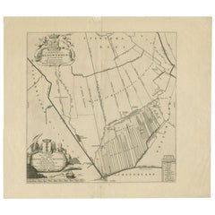
Antique Map of the Barradeel Township, 1718
About the Item
Antique map Friesland titled 'De Grietenije van Barra Deel (..)'. Old map of Friesland, the Netherlands. This map depicts the region of Barradeel and includes cities and villages like Sexbierum, Harlingen, Minnertsga and more. With coat of arms of the Van Holdinga family. Originates from 'Uitbeelding van de Heerlijkheid van Friesland' by Bernardus Schotanus à Sterringa. This atlas is considered the best atlas of Friesland, the Netherlands. Artists and Engravers: Published by F. Halma, Leeuwarden.
Artist: Published by F. Halma, Leeuwarden.
Condition: Good, general age-related toning. Minor defects and repair on folding line, please study image carefully.
Date: 1718
Overall size: 66.5 x 55.5 cm.
Image size: 0.001 x 51 x 43 cm.
Antique prints have long been appreciated for both their aesthetic and investment value. They were the product of engraved, etched or lithographed plates. These plates were handmade out of wood or metal, which required an incredible level of skill, patience and craftsmanship. Whether you have a house with Victorian furniture or more contemporary decor an old engraving can enhance your living space. We offer a wide range of authentic antique prints for any budget.
- Dimensions:Height: 21.86 in (55.5 cm)Width: 26.19 in (66.5 cm)Depth: 0 in (0.01 mm)
- Materials and Techniques:
- Period:
- Date of Manufacture:1718
- Condition:
- Seller Location:Langweer, NL
- Reference Number:
About the Seller
5.0
Platinum Seller
These expertly vetted sellers are 1stDibs' most experienced sellers and are rated highest by our customers.
Established in 2009
1stDibs seller since 2017
1,929 sales on 1stDibs
Typical response time: <1 hour
- ShippingRetrieving quote...Ships From: Langweer, Netherlands
- Return PolicyA return for this item may be initiated within 14 days of delivery.
More From This SellerView All
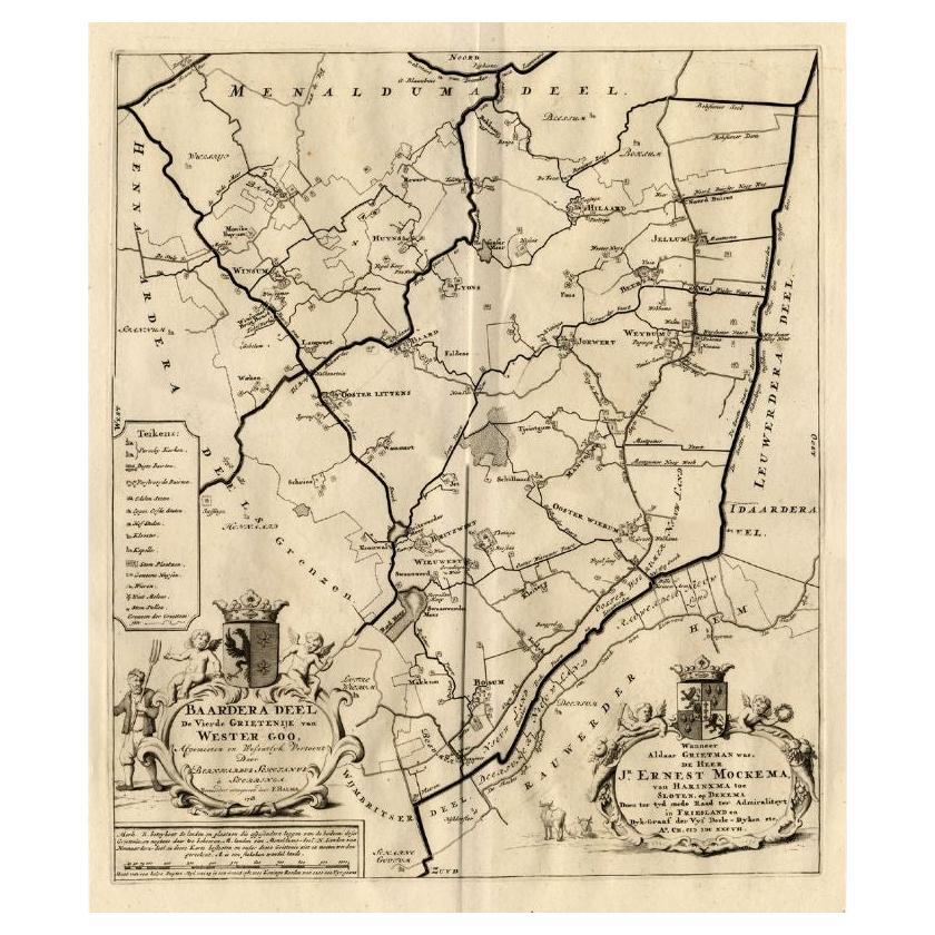
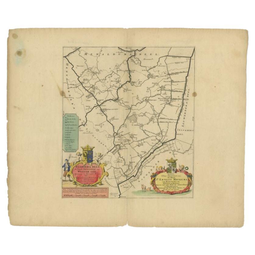
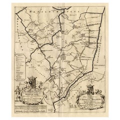
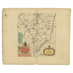
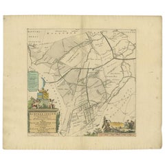
- Antique Map of the Baarderadeel Township, 1718Located in Langweer, NLAntique map Friesland titled 'Baardera Deel de Vierde Grietenije van Wester Goo (..)'. Old map of Friesland, the Netherlands. This map depicts the region of B...Category
Antique 18th Century Maps
MaterialsPaper
- Antique Map of the Baarderadeel Township, 1718Located in Langweer, NLAntique map Friesland titled 'Baardera Deel de Vierde Grietenije van Wester Goo (..)'. Old map of Friesland, the Netherlands. This map depicts the region of B...Category
Antique 18th Century Maps
MaterialsPaper
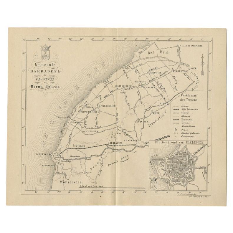
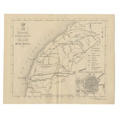
- Antique Dutch Map of The Barradeel Township by Behrns, 1861Located in Langweer, NLAntique map titled 'Gemeente Barradeel'. Old map depicting the Barradeel township including cities and villages like Midlum, Franeker, Dongjum, Minnertsga, Sexbierum and Harlingen. T...Category
Antique 19th Century Maps
MaterialsPaper
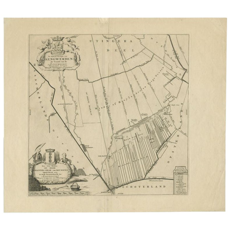
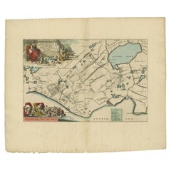
- Antique Map of the Aengwirden Township, Friesland, the Netherlands, 1718Located in Langweer, NLAntique map titled 'De Grietenije van Aengwerden, de Tweede van de Zevenwolden (..)'. Old map of Friesland, the Netherlands. This map depicts the region of Aengwirden and includes ci...Category
Antique 18th Century Maps
MaterialsPaper
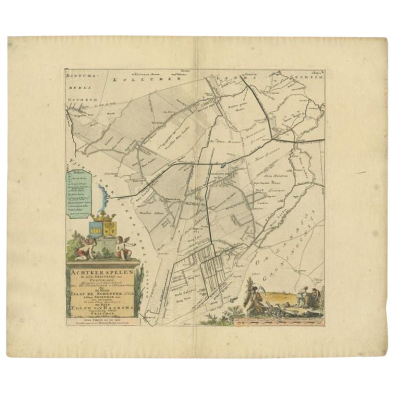
- Antique Map of the Achtkarspelen township, Friesland, The Netherlands, 1718Located in Langweer, NLAntique map Friesland titled 'Achtkarspelen, de sesde Grietenije van Ooster-Goo (..)'. Old map of Friesland, the Netherlands. This map depicts the region of Achtkarspelen and include...Category
Antique 18th Century Maps
MaterialsPaper
- Antique Map of the Gaasterland Township 'Friesland' by Halma, 1718Located in Langweer, NLAntique map Friesland titled 'Gaasterland de Zevende Grietenije van de Zevenwolden (..)'. Old map of Friesland, the Netherlands. This map depicts the region of Gaasterland and includ...Category
Antique 18th Century Maps
MaterialsPaper
You May Also Like
- 1861 Topographical Map of the District of Columbia, by Boschke, Antique MapLocated in Colorado Springs, COPresented is an original map of Albert Boschke's extremely sought-after "Topographical Map of the District of Columbia Surveyed in the Years 1856 ...Category
Antique 1860s American Historical Memorabilia
MaterialsPaper
- Original Antique Map of the American State of Pennsylvania, 1889Located in St Annes, LancashireGreat map of Pennsylvania Drawn and Engraved by W. & A.K. Johnston Published By A & C Black, Edinburgh. Original colour Unframed. Repair to a minor tear on bottom edge.Category
Antique 1880s Scottish Victorian Maps
MaterialsPaper
- Original Antique Map of the American State of Washington, 1889Located in St Annes, LancashireGreat map of Washington Drawn and Engraved by W. & A.K. Johnston Published By A & C Black, Edinburgh. Original colour Unframed.Category
Antique 1880s Scottish Victorian Maps
MaterialsPaper
- Original Antique Map of the American State of Nevada, 1889Located in St Annes, LancashireGreat map of Nevada Drawn and Engraved by W. & A.K. Johnston Published By A & C Black, Edinburgh. Original colour Unframed.Category
Antique 1880s Scottish Victorian Maps
MaterialsPaper
- Map of the Republic of GenoaLocated in New York, NYFramed antique hand-coloured map of the Republic of Genoa including the duchies of Mantua, Modena, and Parma. Europe, late 18th century. Dimension: 25...Category
Antique Late 18th Century European Maps
- Large Original Antique Map of The World, Fullarton, C.1870Located in St Annes, LancashireGreat map of the World. Showing both hemispheres From the celebrated Royal Illustrated Atlas Lithograph. Original color. Published by Fullarton, Edinburgh, C.1870 Unframed. Rep...Category
Antique 1870s Scottish Maps
MaterialsPaper


Recently Viewed
View AllMore Ways To Browse
Metal Coat Of Arms
Coat Of Arms Engraving
Lithograph City Maps
City Map Lithograph
Antique Wood Coat Of Arms
Vans Coat Of Arms
Used Furniture Harlingen
Antique Map Paint
Israeli Antique
Tree Bag
Ohio Antique
16th Century Scotland
New England Maps
New England Map
Great Britain Maps
Used Furniture Depot
World Map British
Antique Topographic Maps