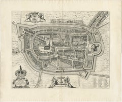
City Map Lithograph
4
to
18
195
140
149
90
85
81
53
44
39
34
30
27
21
19
16
14
13
11
10
10
9
9
7
6
6
5
5
4
3
3
3
2
1
1
1
1
35
13
13
9
5
Sort By
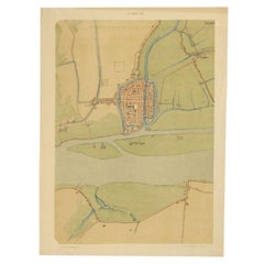
Antique Map of The Dutch City of Gorinchem by Smulders, Lithograph, 1916
Located in Langweer, NL
Antique map Gorinchem titled 'Gorkum'. Antique map depicting the city of Gorinchem, The Netherlands
Category
20th Century Maps
Materials
Paper
H 18.51 in W 13.78 in D 0 in
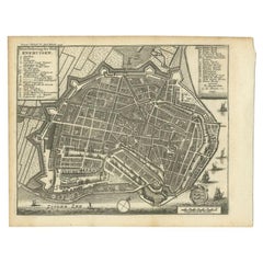
Antique Map of the City of Enkhuizen by Tirion, 1743
Located in Langweer, NL
Antique map titled ?Grondtekening der Stad Enkhuisen?. Beautiful map of the City of Enkhuizen. With
Category
Antique 18th Century Maps
Materials
Paper
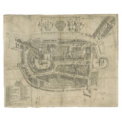
Antique Map of the City of Franeker by Bast, 1598
Located in Langweer, NL
Antique map titled 'Franeker'. Very rare and early map of the city of Franeker, Friesland. With
Category
Antique 16th Century Maps
Materials
Paper
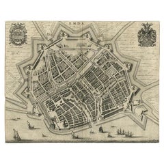
Antique Map of the City of Emden by Blaeu, 1649
Located in Langweer, NL
Antique map titled 'Emda'. Old map of the city of Emden, Germany. This map originates from 'Novum
Category
Antique 17th Century Maps
Materials
Paper
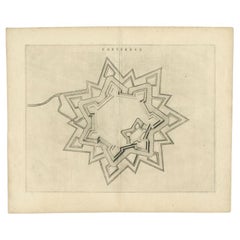
Antique Map of the City of Coevorden by Blaeu, 1649
Located in Langweer, NL
Antique map titled 'Coeverden'. Original map of the city of Coevorden, the Netherlands. This map
Category
Antique 17th Century Maps
Materials
Paper
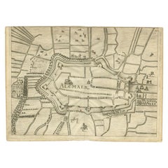
Antique Map of the City of Alkmaar by Priorato, 1673
Located in Langweer, NL
Antique map titled 'Alcmaer'. Original map of the city of Alkmaar, the Netherlands. This map
Category
Antique 17th Century Maps
Materials
Paper
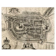
Antique Map of the City of Franeker by Blaeu, 1649
Located in Langweer, NL
Antique map titled 'Franekera'. Old map of the city of Franeker, Friesland. Also shows two
Category
Antique 17th Century Maps
Materials
Paper
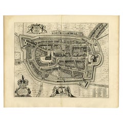
Antique Map of the City of Franeker by Blaeu, 1652
Located in Langweer, NL
Antique map titled 'Franekera'. Old map of the city of Franeker, Friesland. Also shows two
Category
Antique 17th Century Maps
Materials
Paper
Antique Map of the City of Franeker by Blaeu, 1652
Located in Langweer, NL
Antique map titled 'Franekera'. Old map of the city of Franeker, Friesland. Also shows two
Category
Antique 17th Century Maps
Materials
Paper
Antique Map of the City of Arnhem by Guicciardini, 1613
Located in Langweer, NL
Antique map titled ?Arnhemium Gelriae in Ripa Rheni Opp?. Plan of Arnhem in the province of
Category
Antique 17th Century Maps
Materials
Paper
Antique Map of the City of Alkmaar by Merian, 1659
Located in Langweer, NL
Antique map titled 'Alckmaer'. This print depicts the city of Alkmaar (The Netherlands). This print
Category
Antique 17th Century Maps
Materials
Paper
Antique Map of the City of Enkhuizen by Merian, 1659
Located in Langweer, NL
Antique map titled 'Enckhuysen'. This print depicts the city of Enkhuizen, the Netherlands. This
Category
Antique 17th Century Maps
Materials
Paper
Antique Map of the City of Enkhuizen by Guicciardini, 1625
Located in Langweer, NL
Antique map titled 'Die Stadt Enchuijsen, La ville denchuijsen'. Map of Enkhuizen, Noord-Holland
Category
Antique 17th Century Maps
Materials
Paper
Old Map of The Frisian City of Workum in Holland, 1916
Located in Langweer, NL
Antique map Workum titled 'Workum'. Antique map depicting the Frisian city of Workum, the
Category
20th Century Maps
Materials
Paper
Old Map of the Dutch City of Megen in Holland, 1916
Located in Langweer, NL
Antique map Megen titled 'Megen'. Antique map depicting the city of Megen, Noord-Brabant, The
Category
20th Century Maps
Materials
Paper
Antique Map of the City of Bolsward by Merian, c.1650
Located in Langweer, NL
Antique map titled 'Bolzvardia'. Old map of the city of Bolsward, Friesland. This map was published
Category
Antique 17th Century Maps
Materials
Paper
Antique Map of the City of Copenhagen in Denmark c.1720
Located in Langweer, NL
Antique map titled 'Copenhagen'. Original antique map of the city of Copenhagen, Denmark. This map
Category
Antique 18th Century Maps
Materials
Paper
Antique Map of the City of Alkmaar by Merian, c.1659
Located in Langweer, NL
Antique map titled 'Alckmaer'. Old map of the city of Alkmaar, the Netherlands. This print
Category
Antique 17th Century Maps
Materials
Paper
Antique Map of the City of Dokkum by Blaeu, c.1650
Located in Langweer, NL
Antique map titled 'Dockum'. Large map of the city of Dokkum, Friesland, The Netherlands
Category
Antique 17th Century Maps
Materials
Paper
Antique Original Map of the City of Deventer, the Netherlands, 1588
Located in Langweer, NL
plan of the Dutch hanseatic city Deventer, on the situated IJssel river. This map originates from Braun
Category
Antique 16th Century Maps
Materials
Paper
Antique Map of the City of Dokkum, Friesland by Blaeu, c.1650
Located in Langweer, NL
. Around 1649 Joan Blaeu published a collection of Dutch city maps named Tooneel der Steeden (Views of
Category
Antique 17th Century Maps
Materials
Paper
Antique Map of the City of Dordrecht by Braun & Hogenberg, c.1581
Located in Langweer, NL
Antique map titled 'Dordrecht'. Map of the city of Dordrecht, the Netherlands. Bird's-eye plan view
Category
Antique 16th Century Maps
Materials
Paper
Antique Map of the Cities of the Qing Dynasty Provinces in China, 1738
Located in Langweer, NL
Antique print titled 'Cities of the Province of Kyang-si, Fo-kyen, Shan-Si & Yun-nan'. Old map
Category
Antique 18th Century Maps
Materials
Paper
Antique Map of the Cities of the Province of Quey-Chew by Basire, 1738
Located in Langweer, NL
Antique print titled 'Cities of the Province of Quey-Chew'. Old map depicting four walled cities of
Category
Antique 18th Century Maps
Materials
Paper
Antique Map of the Cities of the Province of Shen-Si by Basire, 1738
Located in Langweer, NL
Antique print titled 'Cities of the Province of Shen-Si'. Old map depicting four walled cities of
Category
Antique 18th Century Maps
Materials
Paper
Antique Map of the Cities of the Province of Hu-Quang by Basire, 1738
Located in Langweer, NL
Antique print titled 'Cities of the Province of Hu-Quang'. Old map depicting four walled cities of
Category
Antique 18th Century Maps
Materials
Paper
Pictorial Map of Chicago, circa 1926
Located in Colorado Springs, CO
This is a colorful folding pocket map of the city of Chicago, published by The Clason Map Co
Category
Vintage 1920s American Maps
Materials
Paper
Antique Map of St. Louis and Chicago
Located in Langweer, NL
Antique map titled 'The City of St. Louis Missouri - The City of Chicago Illinois'. Dual map on
Category
Antique Mid-19th Century Maps
Materials
Paper
German Antique Map of Australia, Meyers, 1885
Located in Langweer, NL
Australien.' (Map of Australia. With inset maps of the large cities and Tasmania.) This attractive
Category
Antique 19th Century Maps
Materials
Paper
Antique Map of Sweden by Bowen, 1747
Located in Langweer, NL
Antique map titled 'A New & Accurate Map of Sweden'. This map covers Sweden and Finland (shown as
Category
Antique 18th Century Maps
Materials
Paper
Antique Map of the Baarderadeel Township, 1718
Located in Langweer, NL
Friesland, the Netherlands. This map depicts the region of Baarderadeel and includes cities and villages
Category
Antique 18th Century Maps
Materials
Paper
Antique Map of the Barradeel Township, 1718
Located in Langweer, NL
Netherlands. This map depicts the region of Barradeel and includes cities and villages like Sexbierum
Category
Antique 18th Century Maps
Materials
Paper
Antique Map of the Baarderadeel Township, 1718
Located in Langweer, NL
Friesland, the Netherlands. This map depicts the region of Baarderadeel and includes cities and villages
Category
Antique 18th Century Maps
Materials
Paper
Antique Map of Stavoren by Priorato, 1673
Located in Langweer, NL
Antique map titled 'Staveren'. Original antique map of the city of Stavoren, Friesland, the
Category
Antique 17th Century Maps
Materials
Paper
Antique Map of Stavoren by Priorato, 1673
Located in Langweer, NL
Antique map titled 'Staveren'. Original antique map of the city of Stavoren, Friesland, the
Category
Antique 17th Century Maps
Materials
Paper
Antique Map of Stavoren by Coronelli, 1706
Located in Langweer, NL
Antique map titled 'Staveren'. Rare antique map of the city of Stavoren, Friesland, the Netherlands
Category
Antique 18th Century Maps
Materials
Paper
Antique Map of Stavoren by Blaeu, 1649
Located in Langweer, NL
Antique map titled 'Staveren'. Original antique map of the city of Stavoren, Friesland, The
Category
Antique 17th Century Maps
Materials
Paper
Antique Map of Stavoren by Blaeu, 1649
Located in Langweer, NL
Antique map titled 'Staveren'. Original antique map of the city of Stavoren, Friesland, The
Category
Antique 17th Century Maps
Materials
Paper
Antique Map of Stavoren by Blaeu, 1649
Located in Langweer, NL
Antique map titled 'Staveren'. Original antique map of the city of Stavoren, Friesland, The
Category
Antique 17th Century Maps
Materials
Paper
Antique Map of Stavoren by Blaeu, 1649
Located in Langweer, NL
Antique map titled 'Staveren'. Original antique map of the city of Stavoren, Friesland, The
Category
Antique 17th Century Maps
Materials
Paper
Antique Map of Stavoren by Merian, c.1650
Located in Langweer, NL
Antique map titled 'Stavera'. Map of the city of Stavoren, Friesland. With German legend. Trimmed
Category
Antique 17th Century Maps
Materials
Paper
Antique Map of Stavoren by Merian, c.1650
Located in Langweer, NL
Antique map titled 'Stavera'. Map of the city of Stavoren, Friesland. With German legend. Trimmed
Category
Antique 17th Century Maps
Materials
Paper
Antique Map of Part of Russia, c.1740
Located in Langweer, NL
Antique map titled 'Ienisensis Provinicia cum adjacentibus Toboliensis & Irkutensis'. Old map of
Category
Antique 18th Century Maps
Materials
Paper
Antique Map of Southern Palestine by Bachiene, 1763
Located in Langweer, NL
"Antique map of the south part of Palestine. This simplified map shows the most important cities of
Category
Antique 18th Century Maps
Materials
Paper
Antique Map of Prussia by Blaeu, c.1680
Located in Langweer, NL
Blaeu published a collection of Dutch city maps named Tooneel der Steeden (Views of Cities). In 1651 he
Category
Antique 17th Century Maps
Materials
Paper
Antique Map of Northern India by Bonne, 1780
Located in Langweer, NL
Antique map titled 'Carte de la partie Supérieure de l'Inde (..)'. A fine example of Rigobert Bonne
Category
Antique 18th Century Maps
Materials
Paper
Antique Map of Switzerland by Homann Heirs, c.1732
Located in Langweer, NL
Antique map titled 'Potentissimae Helvetiorum Reipublicae (..)'. Beautiful detailed map of
Category
Antique 18th Century Maps
Materials
Paper
Antique Map of South America by Scherer, c.1700
By Thomas Kitchin
Located in Langweer, NL
Antique map of part of South America. Two maps on a single sheet, each depicting nearly the same
Category
Antique 18th Century Maps
Materials
Paper
Antique Map of Walcheren in Zeeland, the Netherlands, c.1910
Located in Langweer, NL
Antique map of Walcheren, part of the province of Zeeland, the Netherlands. Shows the cities of
Category
20th Century Maps
Materials
Paper
Antique Map of the Achtkarspelen township, Friesland, The Netherlands, 1718
Located in Langweer, NL
Friesland, the Netherlands. This map depicts the region of Achtkarspelen and includes cities and villages
Category
Antique 18th Century Maps
Materials
Paper
H 21.66 in W 25.79 in D 0 in
Antique Map of the Beaujolais Region by Homann Heirs, 1762
Located in Langweer, NL
(..)'. Detailed regional map of the Beaujolais region including the cities of Lyon, Clermont Ferrand, Roanne
Category
Antique 18th Century Maps
Materials
Paper
Antique Map of the Aengwirden Township, Friesland, the Netherlands, 1718
Located in Langweer, NL
Friesland, the Netherlands. This map depicts the region of Aengwirden and includes cities and villages like
Category
Antique 18th Century Maps
Materials
Paper
H 18.12 in W 20.48 in D 0 in
Antique Map of the Aengwirden Township 'Friesland' by Halma, 1718
Located in Langweer, NL
Friesland, the Netherlands. This map depicts the region of Aengwirden and includes cities and villages like
Category
Antique 18th Century Maps
Materials
Paper
Antique Map of the Bildt Township 'Friesland' by Halma, 1718
Located in Langweer, NL
map of Friesland, the Netherlands. This map depicts the region of 't Bildt and includes cities and
Category
Antique 18th Century Maps
Materials
Paper
Antique Map of Part of Russia by Spyk, c.1740
Located in Langweer, NL
Antique map titled 'Mappa Geogr: Continens partem Russici Imperii (..)'. Old map of part of Russia
Category
Antique 18th Century Maps
Materials
Paper
Antique Map of Northern Italy by Homann Heirs, c.1730
Located in Langweer, NL
Antique map titled 'Domini Veneti cum vicinis Parmae Mutinae, Matuae et Mirandol (..).' Detailed
Category
Antique 18th Century Maps
Materials
Paper
Antique Map of Batavia 'Jakarta', Indonesia by Montanus, circa 1669
Located in Langweer, NL
Antique map Batavia titled 'Ware Affbeeldinge wegens het Casteel ende Stadt Batavia'. Antique print
Category
Antique 17th Century Maps
Materials
Paper
Antique Map of Sloten, IJlst, Workum & Hindeloopen by Blaeu, 1652
Located in Langweer, NL
. Around 1649 Joan Blaeu published a collection of Dutch city maps named Tooneel der Steeden (Views of
Category
Antique 17th Century Maps
Materials
Paper
Antique Map of part of Europe by Scherer, c.1703
Located in Langweer, NL
Untitled map of Europe depicting Calais, Münster, Paris, Lion, Prag, Wien, Berlin, Clermont and
Category
Antique 18th Century Maps
Materials
Paper
Antique Map of the Baltic Region by Homann Heirs, c.1730
Located in Langweer, NL
Antique map titled 'Regnum Borussiae gloriosis auspicijs Seerenissimi et Potentissimi Princip
Category
Antique 18th Century Maps
Materials
Paper
- 1
Get Updated with New Arrivals
Save "City Map Lithograph", and we’ll notify you when there are new listings in this category.
More Ways To Browse
Antique Dispensary
Geological Survey New Jersey
Colonial Mfg Co
General Sherman Army Prints
Chloe 1996
Lake District Vintage Posters
Carrera U Carrera
Lake District Vintage Poster
Bien Map
Chloe B Art
Antique Maps Kansas City
Aldo Luongo Lithograph
Canadian Railway Map
Chassidic Dancers
Blondel La Rougery
Map Nsw
C B Egg Cup
Georgetown Map
