Items Similar to Antique Map of the City of Coevorden by Blaeu, 1649
Want more images or videos?
Request additional images or videos from the seller
1 of 5
Antique Map of the City of Coevorden by Blaeu, 1649
About the Item
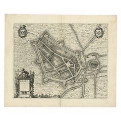
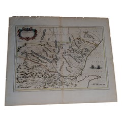
Antique map titled 'Coeverden'. Original map of the city of Coevorden, the Netherlands. This map originates from 'Novum Ac Magnum Theatrum Urbium Belgicae Liberae Ac Foederatae' published by J. Blaeu. Artists and Engravers: Joan Blaeu (23 September 1596 - 28 May 1673) was a Dutch cartographer. He was born in Alkmaar, the son of cartographer Willem Blaeu. In 1620 he became a doctor of law but he joined the work of his father. In 1635 they published the Atlas Novus (full title: Theatrum orbis terrarum, sive, Atlas novus) in two volumes. Joan and his brother Cornelius took over the studio after their father died in 1638. Joan became the official cartographer of the Dutch East India Company. Around 1649 Joan Blaeu published a collection of Dutch city maps named Tooneel der Steeden (Views of Cities). In 1651 he was voted into the Amsterdam council. In 1654 Joan published the first atlas of Scotland, devised by Timothy Pont. In 1662 he reissued the atlas with 11 volumes, and one for oceans. It was also known as Atlas Maior. A cosmology was planned as their next project, but a fire destroyed the studio completely in 1672. Joan Blaeu died in Amsterdam the following year.
Artist: Joan Blaeu (23 September 1596 - 28 May 1673) was a Dutch cartographer. He was born in Alkmaar, the son of cartographer Willem Blaeu. In 1620 he became a doctor of law but he joined the work of his father. In 1635 they published the Atlas Novus (full title: Theatrum orbis terrarum, sive, Atlas novus) in two volumes. Joan and his brother Cornelius took over the studio after their father died in 1638. Joan became the official cartographer of the Dutch East India Company. Around 1649 Joan Blaeu published a collection of Dutch city maps named Tooneel der Steeden (Views of Cities). In 1651 he was voted into the Amsterdam council. In 1654 Joan published the first atlas of Scotland, devised by Timothy Pont. In 1662 he reissued the atlas with 11 volumes, and one for oceans. It was also known as Atlas Maior. A cosmology was planned as their next project, but a fire destroyed the studio completely in 1672. Joan Blaeu died in Amsterdam the following year.
Condition: Good, general age-related toning. Latin text on verso, few creases and small splits. Please study image carefully.
Date: 1649
Overall size: 61 x 52 cm.
Image size: 0.001 x 52.5 x 41 cm.
Antique prints have long been appreciated for both their aesthetic and investment value. They were the product of engraved, etched or lithographed plates. These plates were handmade out of wood or metal, which required an incredible level of skill, patience and craftsmanship. Whether you have a house with Victorian furniture or more contemporary decor an old engraving can enhance your living space. We offer a wide range of authentic antique prints for any budget.
- Dimensions:Height: 20.48 in (52 cm)Width: 24.02 in (61 cm)Depth: 0 in (0.01 mm)
- Materials and Techniques:
- Period:
- Date of Manufacture:1649
- Condition:
- Seller Location:Langweer, NL
- Reference Number:
About the Seller
5.0
Platinum Seller
These expertly vetted sellers are 1stDibs' most experienced sellers and are rated highest by our customers.
Established in 2009
1stDibs seller since 2017
1,933 sales on 1stDibs
Typical response time: <1 hour
- ShippingRetrieving quote...Ships From: Langweer, Netherlands
- Return PolicyA return for this item may be initiated within 14 days of delivery.
More From This SellerView All
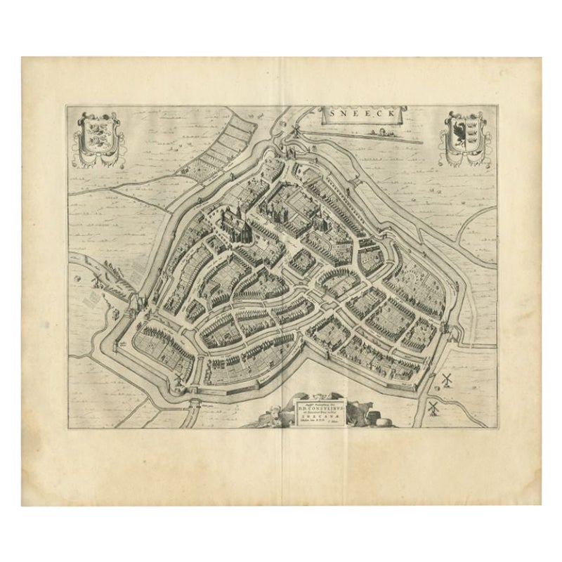
- Antique Map of the City of Sneek by Blaeu, 1649Located in Langweer, NLAntique map Friesland titled 'Sneeck'. Bird's-eye view plan of Sneek, the Netherlands. This map originates from 'Toneel der Steeden' published by Joan Blaeu, 1649. Artists and Eng...Category
Antique 17th Century Maps
MaterialsPaper
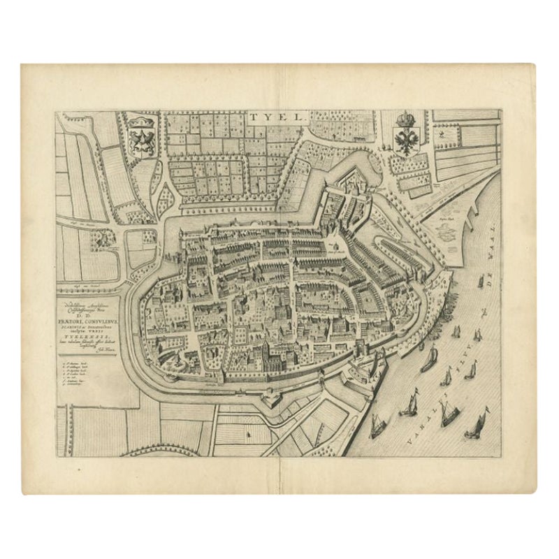
- Antique Map of the City of Tiel by Blaeu, 1649Located in Langweer, NLAntique map titled 'Tyel'. Beautiful map of the city of Tiel, The Netherlands. With a coat of arms and key of various locations. Originates from 'Toneel der Steeden' published by Joa...Category
Antique 17th Century Maps
MaterialsPaper
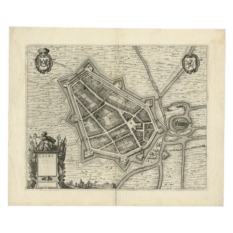
- Antique Map of the City of Geldern by Blaeu, 1649Located in Langweer, NLAntique map titled 'Gelre'. Old map of the city of Geldern, Germany. This map originates from 'Toonneel der Steden van de Vereenighde Nederlanden' by J. Blaeu. Artists and Engrav...Category
Antique 17th Century Maps
MaterialsPaper
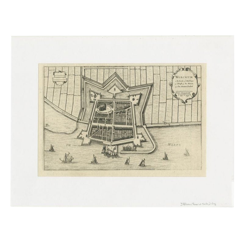
- Antique Map of the City of Workum by Blaeu, 1649Located in Langweer, NLAntique map titled 'Worckum'. Old map of the city of Workum, Friesland. Originates from J. Blaeu's 'Town Book'. Artists and Engravers: Joan Blaeu (23 September 1596 - 28 May 1673...Category
Antique 17th Century Maps
MaterialsPaper
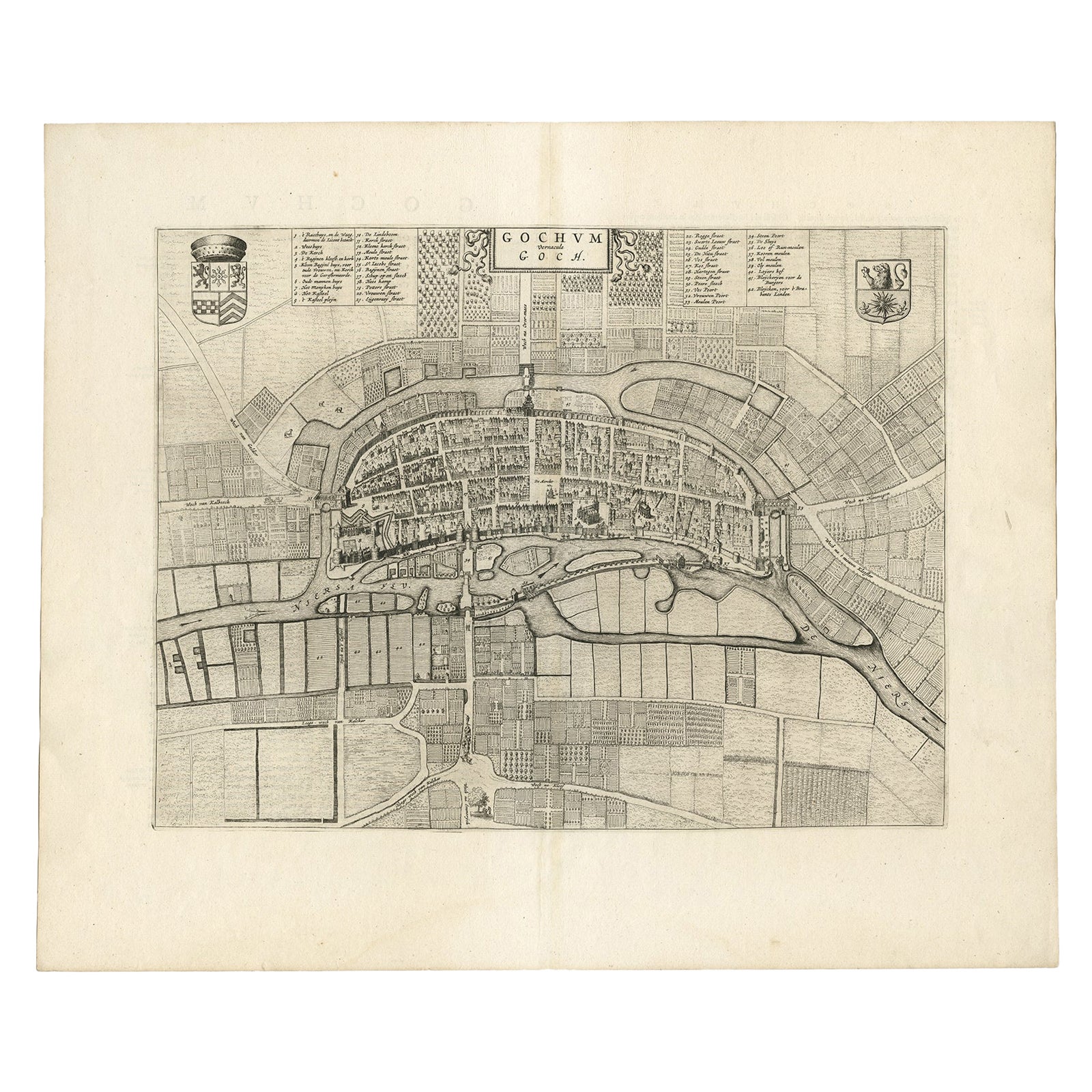
- Antique Map of the City of Goch by Blaeu, 1649Located in Langweer, NLAntique map titled 'Gochum vernacule Goch'. Old map of the city of Goch, Germany. This map originates from 'Novum Ac Magnum Theatrum Urbium Belgicæ Liberæ ac Foederatæ' by J. Blaeu. ...Category
Antique 17th Century Maps
MaterialsPaper
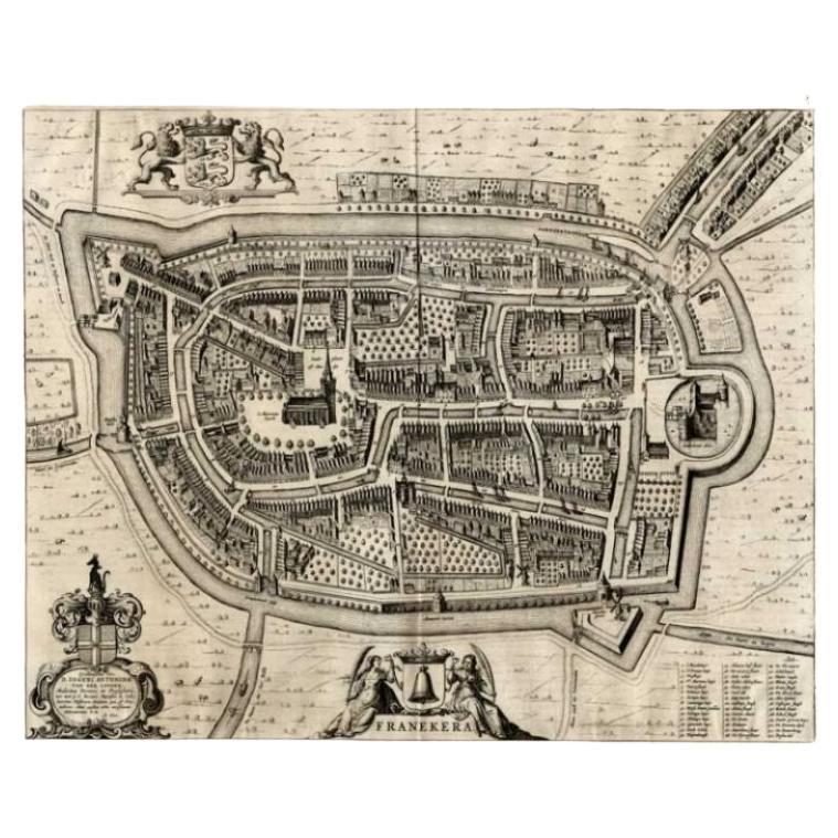
- Antique Map of the City of Franeker by Blaeu, 1649Located in Langweer, NLAntique map titled 'Franekera'. Old map of the city of Franeker, Friesland. Also shows two cartouches, coats of arms and legend. This plan originates from the famous city Atlas: 'Ton...Category
Antique 17th Century Maps
MaterialsPaper
You May Also Like
- 1840 Map of the City of Washington Published by William M. MorrisonLocated in Colorado Springs, COThis map, printed in 1840, is a detailed representation of Washington, D.C. in the mid-19th century. The map shows block numbers, wards, and government buildings as well as details o...Category
Antique 1840s American Federal Maps
MaterialsPaper
- 1654 Joan Blaeu Map the Sutherland, Scotland, Entitled "Southerlandia, "Ric0007Located in Norton, MA1654 Joan Blaeu map of the Sutherland, Scotland, entitled "Southerlandia," Hand Colored Ric0007 Description: Lovely map centered on Sedan and D...Category
Antique 17th Century Dutch Maps
MaterialsPaper
- 1861 Topographical Map of the District of Columbia, by Boschke, Antique MapLocated in Colorado Springs, COPresented is an original map of Albert Boschke's extremely sought-after "Topographical Map of the District of Columbia Surveyed in the Years 1856 ...Category
Antique 1860s American Historical Memorabilia
MaterialsPaper
- Antique Map of American Cities, Vignette of New York City, circa 1920Located in St Annes, LancashireGreat maps of American Cities Unframed Original color By John Bartholomew and Co. Edinburgh Geographical Institute Published, circa 1920Category
Vintage 1920s British Maps
MaterialsPaper
- Italian Parchment Map of the City of Pisa Dated, 1640By Matthäus Merian the ElderLocated in Roma, ITAn antique map of the Tuscan city of Pisa engraved for The 'Itinerarium Italiæ Nov-antiquæ' by Matthäus Merian the Elder and printed in 1640....Category
Antique 1640s Italian Maps
MaterialsPaper
- Italian Parchment Map of the City of Lucca Dated 1640By Matthäus Merian the ElderLocated in Roma, ITAn antique map of the Tuscan city of Lucca engraved for The 'Itinerarium Italiæ Nov-antiquæ' by Matthäus Merian the Elder and printed in 1640...Category
Antique 1640s Italian Maps
MaterialsParchment Paper, Paper


Recently Viewed
View AllMore Ways To Browse
City Used Office Furniture
Antique City Furniture
Antique City Views
Antique Fire Collectibles
Dutch East India Company
Dutch East India
17th Century Scotland
Lithograph City Maps
City Map Lithograph
Antique Ocean Map
Map Blaeu
Blaeu Maps
Antique Doctors Office Furniture
Atlas Furniture Company
Cornelius Hollander
Antique Ac
Antique Map Blaeu
East India Map