Items Similar to 1654 Joan Blaeu Map the Sutherland, Scotland, Entitled "Southerlandia, "Ric0007


Want more images or videos?
Request additional images or videos from the seller
1 of 12
1654 Joan Blaeu Map the Sutherland, Scotland, Entitled "Southerlandia, "Ric0007
About the Item
1654 Joan Blaeu map of the
Sutherland, Scotland, entitled
"Southerlandia,"
Hand Colored
Ric0007
Description:
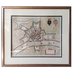
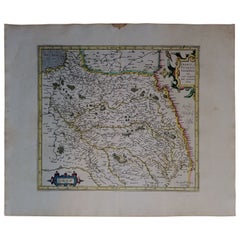
Lovely map centered on Sedan and Doncheri and the Meuze River from Charleville and Mezieres to Mosuon and Yvoy. The fortified cities are well depicted. Richly embellished with a large title cartouche with the royal arms, a scale cartouche and coat of arms. Latin text on verso.
Artists and Engravers: Joan (Johannes) Blaeu (1596-1673) was a Dutch cartographer active in the 17th Century. Joan was the son of Willem Janszoon Blaeu, founder of the Blaeu firm. Like his farther Willem, Johannes was born in Aklmaar, North Holland, He studied law, attaining a doctorate, before moving to Amsterdam to join the family mapmaking business. In 1633, Willem arranged for Johannes to take over Hessel Gerritsz's position as the official chartmaker of the Dutch East India Company, although little is known of his work for that organisation, which was by contract and oath secretive. Where other cartographers often fell into financial ruin, the Blaeu form thrived. It was most likely those profits that allowed the firm to publish the 'Theatrum Orbis Terrarum, Altlas Novus', their most significant and best known publication. When Willem Blaeu died in 1638, Johannes, along with this Borther Cornelius (1616-1648) took over the management of the Blaeu firm. In 1662, Joan and Cornelius produced a vastly expanded and updated work, the 'Atlas Novus', whose handful of editions ranged from 9 to 12 volumes. In 1672 the Great Amsterdam Fire destroyed their offices and most of their printing plates. Johannes Blaeu died the following year. Johannes Blaeu was survived by his son, also Johannes but commonly called Joan II, who inherited the family's VOC contract, for whom he compiled maps until 1712.
Dimension: Paper: 23.3" W x 20.3" H (59 cm W x 51.7 cm H) ; Sight: 19.7" x 15.7" H (50 cm W x 39.8 cm H)
Condition: Good condition with aged toning, please see photos.
- Dimensions:Height: 20.36 in (51.7 cm)Width: 23.23 in (59 cm)Depth: 0.4 in (1 cm)
- Materials and Techniques:
- Place of Origin:
- Period:
- Date of Manufacture:1654
- Condition:
- Seller Location:Norton, MA
- Reference Number:1stDibs: LU5848230191482
About the Seller
5.0
Platinum Seller
These expertly vetted sellers are 1stDibs' most experienced sellers and are rated highest by our customers.
Established in 2000
1stDibs seller since 2021
85 sales on 1stDibs
Typical response time: <1 hour
- ShippingRetrieving quote...Ships From: Norton, MA
- Return PolicyA return for this item may be initiated within 3 days of delivery.
More From This SellerView All
- 1571-1638 Willem Blaeu map entitled, "Ilcadorino, " Hand Colored Ric0009Located in Norton, MAWillem Blaeu map entitled, "Ilcadorino,". Hand colored. Description: large, unusual, and nice antique copper engraved map of Ilcadorino, by Willem BL...Category
Antique 16th Century Dutch Maps
MaterialsPaper
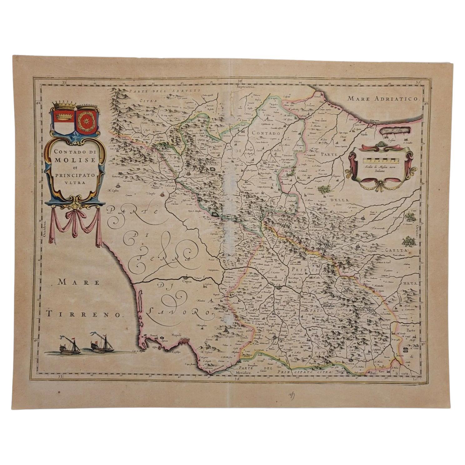
- 1640 Willem Blaeu Map Entitled "Contado di molise et principato vltra, " Ric.a003By Willem BlaeuLocated in Norton, MA1640 Willem Blaeu map entitled "Contado di molise et principato vltra," Colored Ric. a003 Measures: 38 x 49.6 cm and wide margins DBLAEU. Cou...Category
Antique 17th Century Dutch Maps
MaterialsPaper
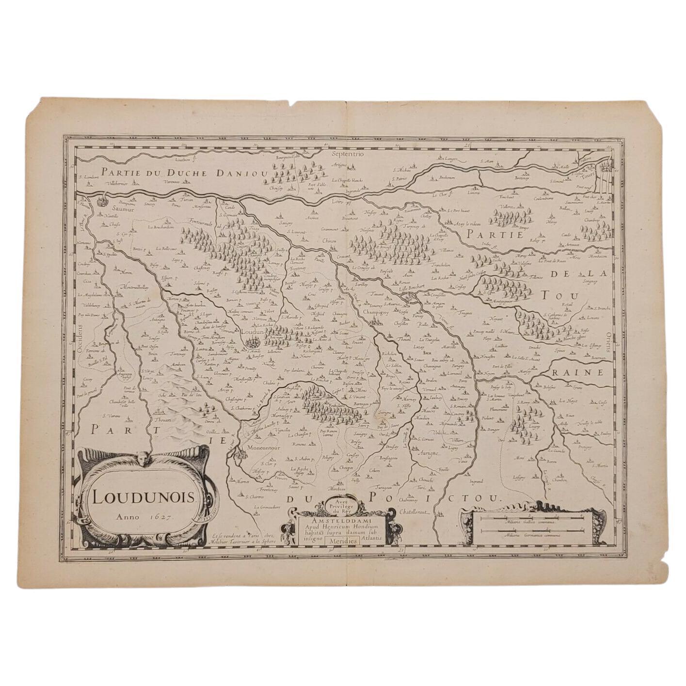
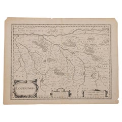
- 1627 Map Entitled "Loudunois, " Signed on the Back, Ric.a013Located in Norton, MA1627 map entitled "Loudunois," Signed on the Back Ric.a013 cartography close up double-page hand-colored elevated view no person print hand-tinted hilly close-up early 17th-...Category
Antique 17th Century Dutch Maps
MaterialsPaper
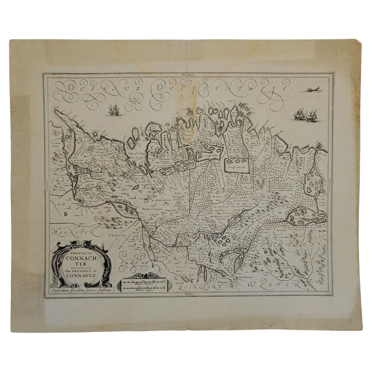
- 1646 Jansson Map Entitled "Procinvia Connactiae, " Ric.a006Located in Norton, MA1646 Jansson map entitled "Procinvia connactiae," Ric.a006 Description: The PROVINCE of CONNAVGT 490 x 380From vol 4 of Jansson's Atlas Novus 1646, published in Amsterdam with...Category
Antique 17th Century Unknown Maps
MaterialsPaper
- 1633 Map Entitled "Beauvaisis Comitatus Belova Cium, Ric.0002Located in Norton, MA1633 map entitled "Beauvaisis Comitatus Belova Cium," Hand Colored Ric.0002 Description: Cartographer : - Hondius, Henricus 1587-1638 Artists and Engravers:Jodocus Hondius, one of the most notable engravers of his time. He is known for his work in association with many of the cartographers and publishers prominent at the end of the sixteenth and the beginning of the seventeenth century. A native of Flanders, he grew up in Ghent, apprenticed as an instrument and globe maker and map engraver. In 1584, to escape the religious troubles sweeping the Low Countries at that time, he fled to London where he spent some years before finally settling in Amsterdam about 1593. In the London period he came into contact with the leading scientists and geographers of the day and engraved maps in The Mariner\\\\\\\\\\\\\\\'s Mirrour, the English edition of Waghenaer\\\\\\\\\\\\\\\'s Sea Atlas, as well as others with Pieter van den Keere, his brother-in-law. No doubt his temporary exile in London stood him in good stead, earning him an international reputation, for it could have been no accident that Speed chose Hondius to engrave the plates for the maps in The Theatre of the Empire of Great Britaine in the years between 1605 and 1610. In 1604 Hondius bought the plates of Mercator\\\\\\\\\\\\\\\'s Atlas which, in spite of its excellence, had not competed successfully with the continuing demand for the Ortelius Theatrum Orbis Terrarum. To meet this competition Hondius added about 40 maps to Mercator\\\\\\\\\\\\\\\'s original number and from 1606 published enlarged editions in many languages, still under Mercator\\\\\\\\\\\\\\\'s name but with his own name as publisher. These atlases have become known as the Mercator/Hondius series. The following year the maps were reengraved in miniature form and issued as a pocket Atlas Minor. After the death of Jodocus Hondius the Elder in 1612, work on the two atlases, folio and miniature, was carried on by his widow and sons, Jodocus II and Henricus, and eventually in conjunction with Jan Jansson in Amsterdam. In all, from 1606 onwards, nearly 50 editions with increasing numbers of maps with texts in the main European languages were printed. Summaries of these issues are given under the entry for Gerard Mercator. Jodocus Hondius the Elder * 1588 Maps in The Mariner\\\\\\\\\\\\\\\'s Mirrour (Waghenaer/Ashley) * 1590 World Map...Category
Antique 17th Century Dutch Maps
MaterialsPaper
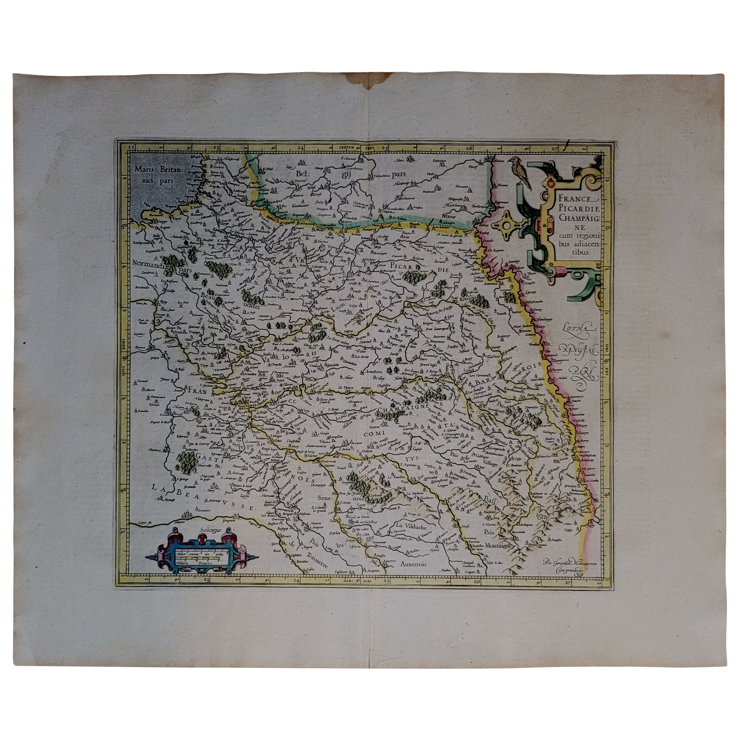
- 1590 Mercator Map Entitled "France Picardie Champaigne, Ric.0001Located in Norton, MADescription: Published in Amsterdam by Mercator/Hondius ca. 1590. Ric.0001 Artists and Engravers: Map : 'France Picardie Champaigne cum regionibus adiacentibus'. (Map of the french provinces of Picardie and Champagne.) Copper engraved map of the french provinces of Picardie and Champagne, showing the cities of Caen, Paris, Melun, Auxerre, Verdun, etc. Copperplate engraving on verge type hand laid paper with watermark. Description: Published in Amsterdam by Mercator/Hondius ca. 1600.Artists and Engravers: Mercator was born in Rupelmonde in Flanders and studied in Louvain under Gemma Frisius, Dutch writer, astronomer and mathematician. The excellence of his work brought him the patronage of Charles V, but in spite of his favor with the Emperor he was caught up in the persecution of Lutheran protestants and charged with heresy, fortunately without serious consequences. No doubt the fear of further persecution influenced his move in 1552 to Duisburg, where he continued the production of maps, globes and instruments. Mercator's sons and grandsons, were all cartographers and made their contributions in various ways to his atlas. Rumold, in particular, was responsible for the complete edition in 1595. The map plates...Category
Antique 16th Century Dutch Maps
MaterialsPaper


You May Also Like
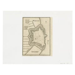
- Antique Map of the City of Workum by Merian, 1654Located in Langweer, NLAntique map titled 'Worcum'. Old map of the city of Workum, Friesland. Originates from 'Topographia Germaniæ Inferioris' by C. Merian. Artists and Engravers: Caspar Merian (1627-1...Category
Antique 17th Century Maps
MaterialsPaper
- Antique Map of the Maluku Islands by Blaeu, c.1640Located in Langweer, NLAntique map titled 'Moluccae Insulae Celeberrimae'. Decorative map of the Maluku Islands, also known as the Moluccas or the Spice Islands. Inset of the island of Bachian (Batjan) in ...Category
Antique 17th Century Maps
MaterialsPaper
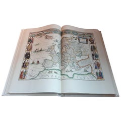
- Facsimile Joan Blaeu's Atlas Major '12 Volumes'Located in Langweer, NLFacsimile of the original French edition of Joan Blaeu's Atlas Major, 1663. Printed in Amsterdam, by N.V. Theatrum Orbis Terrarum, 1967-68. 12 volumes with ...Category
Late 20th Century Books
MaterialsPaper
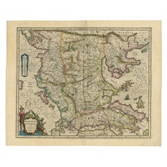
- Antique Map of Macedonia by the Famous Mapmaker Blaeu, c.1650Located in Langweer, NLAntique map titled 'Macedonia, Epirus et Achaia'. Ornated with a nice allegoric cartouche, one ship and a milage scale. Macedonia is shown in the centre of the map. With many detai...Category
Antique 17th Century Maps
MaterialsPaper
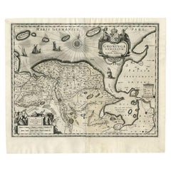
- Antique Map of the Province of Groningen by Blaeu, 1635Located in Langweer, NLAntique map titled 'Groninga Dominium.' A map of the Dutch province Groningen. This includes the Wadden islands Schiermonnikoog, Rottumeroog (Rottumerplaat) and Borkum. With compass ...Category
Antique 17th Century Maps
MaterialsPaper
- Antique Map of the City of Grave by Blaeu, 1649Located in Langweer, NLAntique map titled 'Grave'. Original antique map of the city of Grave, the Netherlands. Published by J. Blaeu, 1649. Artists and Engravers: Joan Blaeu (23 September 1596 - 28 May...Category
Antique 17th Century Maps
MaterialsPaper