Items Similar to 1627 Map Entitled "Loudunois, " Signed on the Back, Ric.a013


Want more images or videos?
Request additional images or videos from the seller
1 of 10
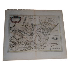
1627 Map Entitled "Loudunois, " Signed on the Back, Ric.a013
About the Item
1627 map entitled
"Loudunois,"
Signed on the Back
Ric.a013
cartography close up double-page hand-colored elevated view no person print hand-tinted hilly close-up early 17th-century natural space hand paint french text navigation equipment the 1630s 1620s lettering close-up color hand-colored European artist nobody word hand-colored text sheet prints hand-colored german art artist german leaves geographical 17th century increased artist European map · 17th-century · geography · double-page · artist-german · page · nobody · printed · beginning of the 17th Century · hand · color no people · writer · · hand color · hill · print · print · großbuchstabe · color · Europe german artist language Gerard Mercator slope hand coloring Theatrum universal gallian loudunois Gerard France Mercator
Dimension: Paper Size: 22 1/2" W x 17" H (57 cm W x 43.2 cm H)
Date: 17th century
Condition: Good Condition with age, please see photos.
; Image Size: 19 5/8" W x 14 3/4" H (50 cm W x 37.5 cm H).
- Dimensions:Height: 14.77 in (37.5 cm)Width: 19.69 in (50 cm)Depth: 0.4 in (1 cm)
- Materials and Techniques:
- Place of Origin:
- Period:
- Date of Manufacture:1633
- Condition:
- Seller Location:Norton, MA
- Reference Number:1stDibs: LU5848230190992
About the Seller
5.0
Platinum Seller
These expertly vetted sellers are 1stDibs' most experienced sellers and are rated highest by our customers.
Established in 2000
1stDibs seller since 2021
83 sales on 1stDibs
Typical response time: <1 hour
- ShippingRetrieving quote...Ships From: Norton, MA
- Return PolicyA return for this item may be initiated within 3 days of delivery.
More From This SellerView All
- 1627 Hendrik Hondius Map Entitled "Vltoniae Orientalis Pars, " Ric.a009Located in Norton, MA1627 Hendrik Hondius map entitled "Vltoniae orientalis pars," Ric.a009 Title: Vltoniae orientalis : pars Title (alt.) : Ultoniae orientalis pars Creator: Mercator, Gerh...Category
Antique 17th Century Dutch Maps
MaterialsPaper
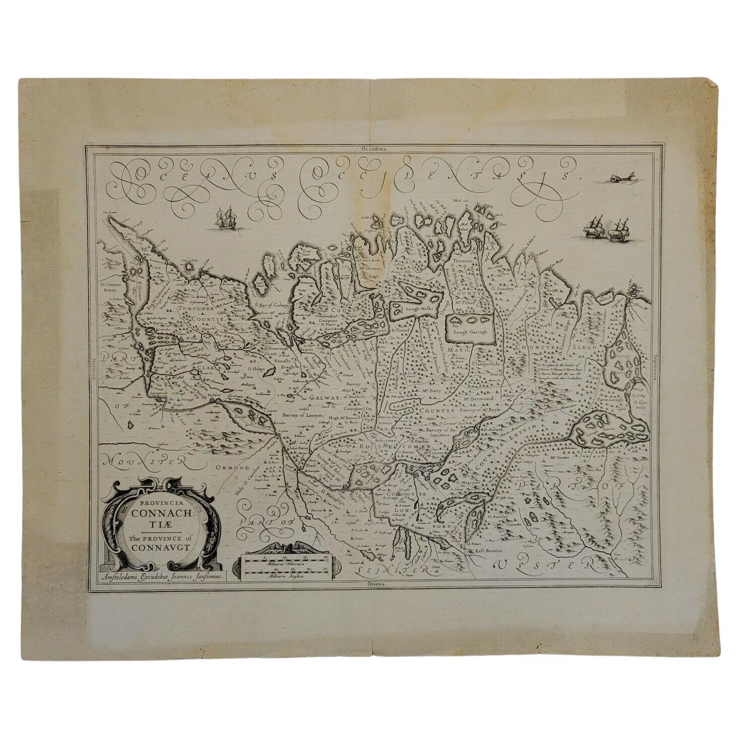
- 1646 Jansson Map Entitled "Procinvia Connactiae, " Ric.a006Located in Norton, MA1646 Jansson map entitled "Procinvia connactiae," Ric.a006 Description: The PROVINCE of CONNAVGT 490 x 380From vol 4 of Jansson's Atlas Novus 1646, published in Amsterdam with...Category
Antique 17th Century Unknown Maps
MaterialsPaper
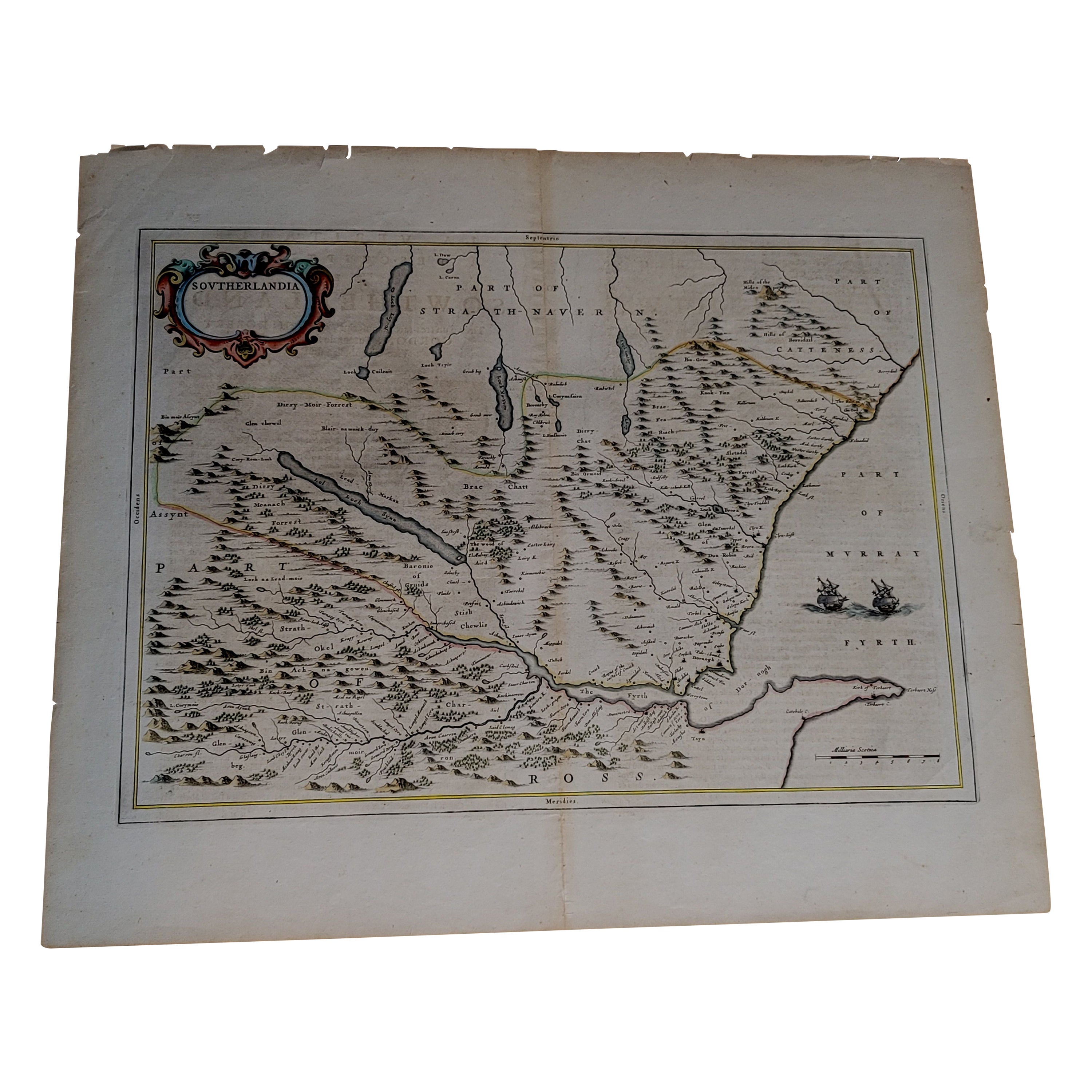
- 1654 Joan Blaeu Map the Sutherland, Scotland, Entitled "Southerlandia, "Ric0007Located in Norton, MA1654 Joan Blaeu map of the Sutherland, Scotland, entitled "Southerlandia," Hand Colored Ric0007 Description: Lovely map centered on Sedan and D...Category
Antique 17th Century Dutch Maps
MaterialsPaper
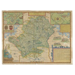
- 1633 Map Entitled "Beauvaisis Comitatus Belova Cium, Ric.0002Located in Norton, MA1633 map entitled "Beauvaisis Comitatus Belova Cium," Hand Colored Ric.0002 Description: Cartographer : - Hondius, Henricus 1587-1638 Artists and Engravers:Jodocus Hondius, one of the most notable engravers of his time. He is known for his work in association with many of the cartographers and publishers prominent at the end of the sixteenth and the beginning of the seventeenth century. A native of Flanders, he grew up in Ghent, apprenticed as an instrument and globe maker and map engraver. In 1584, to escape the religious troubles sweeping the Low Countries at that time, he fled to London where he spent some years before finally settling in Amsterdam about 1593. In the London period he came into contact with the leading scientists and geographers of the day and engraved maps in The Mariner\\\\\\\\\\\\\\\'s Mirrour, the English edition of Waghenaer\\\\\\\\\\\\\\\'s Sea Atlas, as well as others with Pieter van den Keere, his brother-in-law. No doubt his temporary exile in London stood him in good stead, earning him an international reputation, for it could have been no accident that Speed chose Hondius to engrave the plates for the maps in The Theatre of the Empire of Great Britaine in the years between 1605 and 1610. In 1604 Hondius bought the plates of Mercator\\\\\\\\\\\\\\\'s Atlas which, in spite of its excellence, had not competed successfully with the continuing demand for the Ortelius Theatrum Orbis Terrarum. To meet this competition Hondius added about 40 maps to Mercator\\\\\\\\\\\\\\\'s original number and from 1606 published enlarged editions in many languages, still under Mercator\\\\\\\\\\\\\\\'s name but with his own name as publisher. These atlases have become known as the Mercator/Hondius series. The following year the maps were reengraved in miniature form and issued as a pocket Atlas Minor. After the death of Jodocus Hondius the Elder in 1612, work on the two atlases, folio and miniature, was carried on by his widow and sons, Jodocus II and Henricus, and eventually in conjunction with Jan Jansson in Amsterdam. In all, from 1606 onwards, nearly 50 editions with increasing numbers of maps with texts in the main European languages were printed. Summaries of these issues are given under the entry for Gerard Mercator. Jodocus Hondius the Elder * 1588 Maps in The Mariner\\\\\\\\\\\\\\\'s Mirrour (Waghenaer/Ashley) * 1590 World Map...Category
Antique 17th Century Dutch Maps
MaterialsPaper
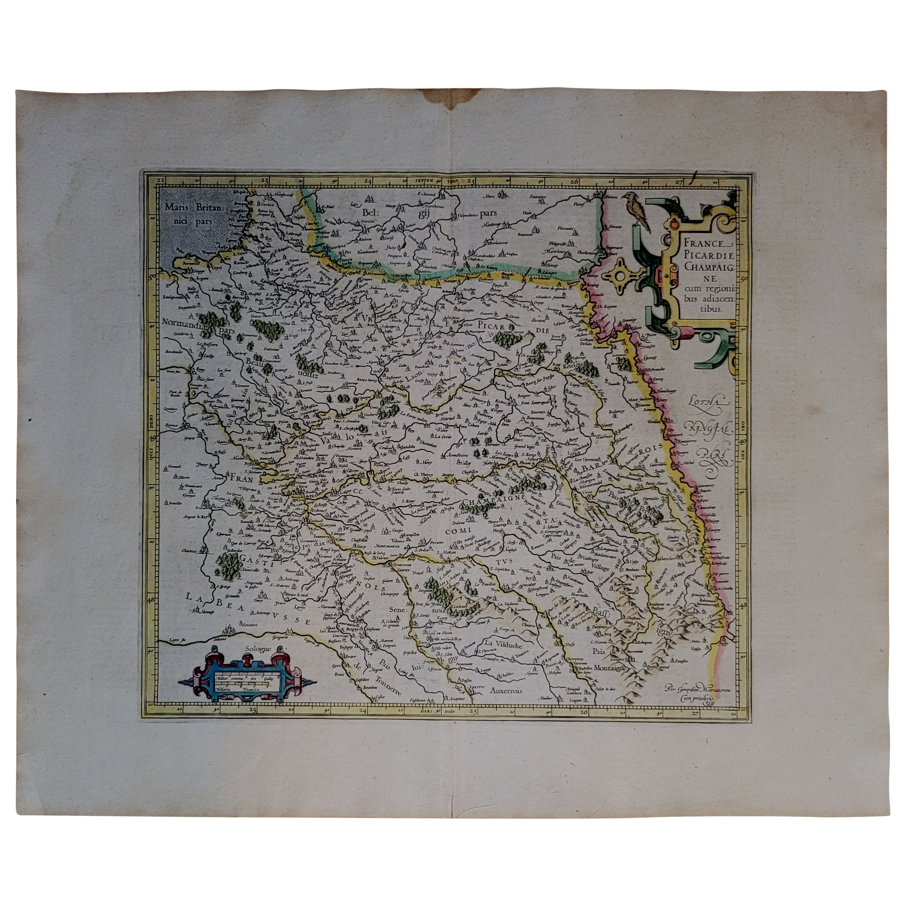
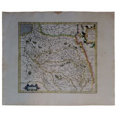
- 1590 Mercator Map Entitled "France Picardie Champaigne, Ric.0001Located in Norton, MADescription: Published in Amsterdam by Mercator/Hondius ca. 1590. Ric.0001 Artists and Engravers: Map : 'France Picardie Champaigne cum regionibus adiacentibus'. (Map of the french provinces of Picardie and Champagne.) Copper engraved map of the french provinces of Picardie and Champagne, showing the cities of Caen, Paris, Melun, Auxerre, Verdun, etc. Copperplate engraving on verge type hand laid paper with watermark. Description: Published in Amsterdam by Mercator/Hondius ca. 1600.Artists and Engravers: Mercator was born in Rupelmonde in Flanders and studied in Louvain under Gemma Frisius, Dutch writer, astronomer and mathematician. The excellence of his work brought him the patronage of Charles V, but in spite of his favor with the Emperor he was caught up in the persecution of Lutheran protestants and charged with heresy, fortunately without serious consequences. No doubt the fear of further persecution influenced his move in 1552 to Duisburg, where he continued the production of maps, globes and instruments. Mercator's sons and grandsons, were all cartographers and made their contributions in various ways to his atlas. Rumold, in particular, was responsible for the complete edition in 1595. The map plates...Category
Antique 16th Century Dutch Maps
MaterialsPaper
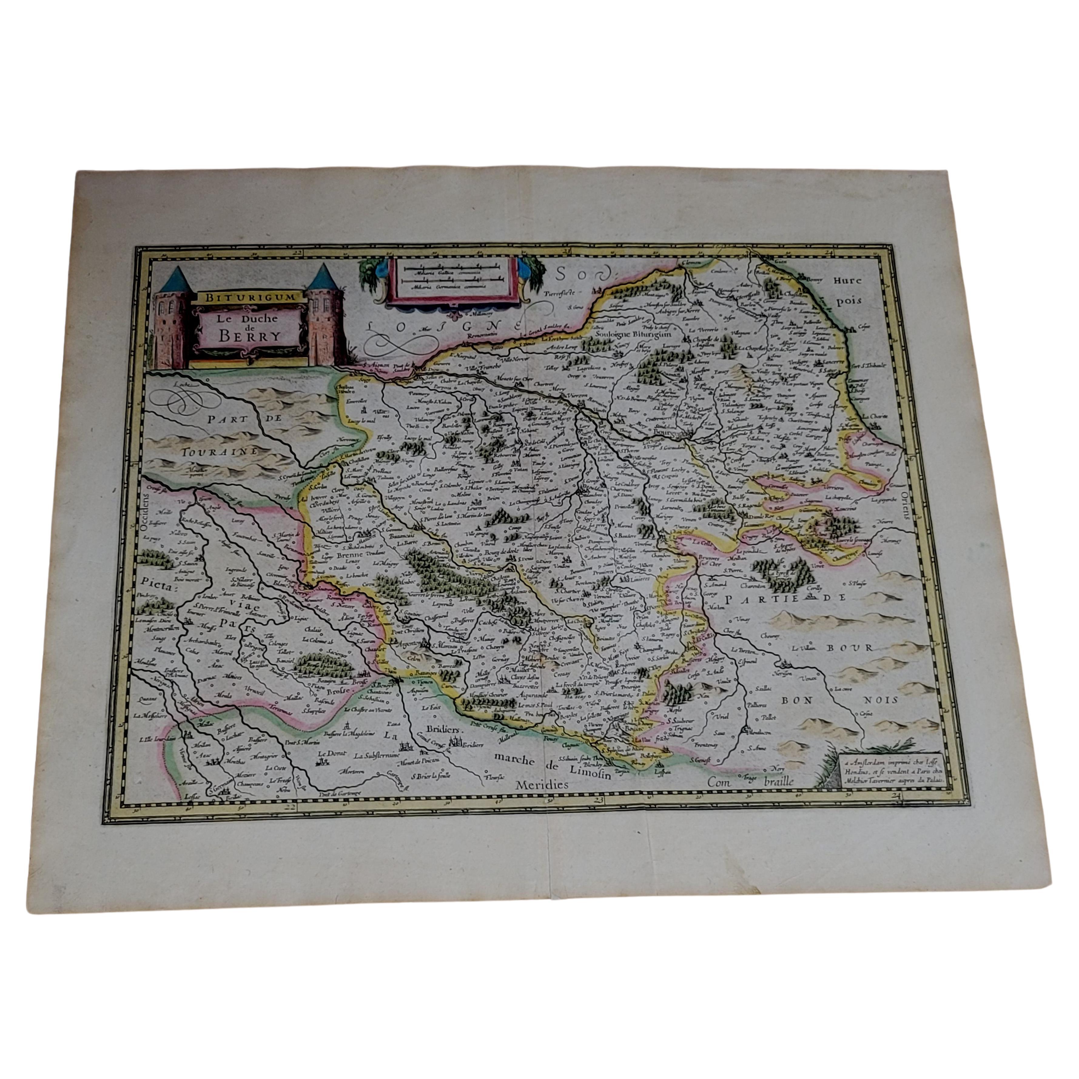
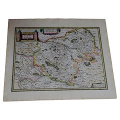
- 1633 Map, Entitled "La Douche De Berry, " Ric.0005Located in Norton, MA1633 map, entitled "La douche de Berry," Hand Colored Ric.0005 Description: 1633 map, entitled "La douche de Berry," Dimension: Paper: 23.3" W x 20.3" H (59 cm W x 51.7 c...Category
Antique 17th Century Unknown Maps
MaterialsPaper


You May Also Like
- Antique Map of Hertfordshire in England by Speed, 1627Located in Langweer, NLAntique map titled 'Hartfordshire described the sittuations of Hartford (..)'. Map of Hertfordshire, England. Includes inset maps of Hertford and the Roman settlement of Verolani...Category
Antique 17th Century Maps
MaterialsPaper
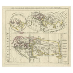
- Antique Map of the Old World Projection, Entitled Orbis Terrarum Ad Mentem, 1825Located in Langweer, NLAntique map titled 'Orbis Terrarum ad Mentem (..)'. Old map of the world originating from 'Atlas der Oude Wereld'. Artists and Engravers: Published by C. Ph. Funke and W. van Boe...Category
Antique 19th Century Maps
MaterialsPaper
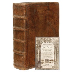
- HEYLYN. Mikrokosmos A Little Description of the Great World. THIRD EDITION 1627Located in Hillsborough, NJAUTHOR: HEYLYN, Peter. TITLE: Mikrokosmos. A Little Description of the Great World. PUBLISHER: Oxford: by I. L. & W. T. for William Turner & Thomas Huggins, 1627. DESCRIPTION: TH...Category
Antique 1620s British Books
MaterialsLeather
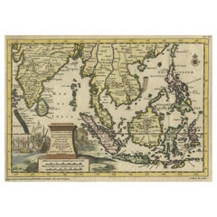
- Striking Antique Map Centered on the Malay PeninsulaBy Pieter Van Der AaLocated in Langweer, NLAntique map titled 'D'Indiaanze Landschappen Zeen en Eylanden, van Couchin af tot in de Moluccos (...)'. Striking map of the region from the Philippines and Formosa to India and the ...Category
Antique Early 18th Century Maps
MaterialsPaper
- Antique Map of the World on Mercator's Projection, 1788Located in Langweer, NLAntique map titled 'Kaart van de Geheele Wereld (..)'. Uncommon small world map on Mercator's projection. Nice detail of the islands throughout the wor...Category
Antique Late 18th Century Maps
MaterialsPaper
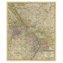
- Antique Map of the Area centered on the Rhine River, GermanyLocated in Langweer, NLAntique map titled 'Uterque Rheni Circulus Superior (..)'. Fine old color map of the area centered on the Rhine River, from Strassbourg to Wesel and Duisburg, Germany. With cities hi...Category
Antique Early 18th Century Maps
MaterialsPaper

Recently Viewed
View AllMore Ways To Browse
Antique Paper Paint Color
Photo Equipment
17th Century Hand Paint Print
Antique Map Art Collectibles
Antique Maps Art Collectibles
Antique Navigation Map
Antique Style Atlas
Nautical Map
Nautical Maps
Pacific Map
Antique Ship Decor
Coastal Maps
Antique Maps Mexico
Antique Sea Charts
Antique Sea Chart
Mexico Antique Map
Antique Roman Map
Amsterdam Coat Of Arms