Antique Maps Art Collectibles

7
to
26
148
62
105
74
62
39
37
37
34
28
20
18
14
13
10
10
9
8
8
7
6
6
5
3
3
3
2
2
2
2
2
2
1
1
1
1
1
1
1
1
1
1
1
1
5
4
3
2
2
Sort By
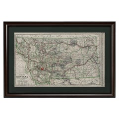
"Clason's Guide Map of Montana" by The Clason Map Company, Circa 1920s
Located in Colorado Springs, CO
Presented is “Clason's Guide Map of Montana,” published in the early 1920s by the Clason Map
Category

1920s American Art Deco Antique Maps Art Collectibles

Materials

Paper

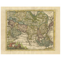
Cartographic Elegance: The Art and Science of 17th-Century Asian Maps, ca.1681
Located in Langweer, NL
geographical knowledge of its time but also the intertwining of art and science in map-making. The
Category

1680s Antique Maps Art Collectibles

Materials

Paper

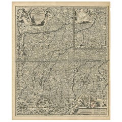
Antique Map of Upper Bavaria, Germany
Located in Langweer, NL
Nicolaus Visscher (1649-1702). The Visscher family were art and map dealers in Amsterdam during the 17th
Category

Late 17th Century Antique Maps Art Collectibles

Materials

Paper

Antique Map of Upper Bavaria, Germany
H 25.2 in W 20.79 in D 0.02 in
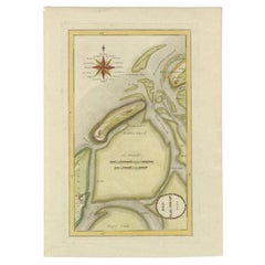
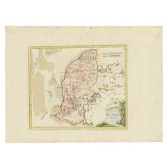
Antique Map of the Wadden Islands, 1792
Located in Langweer, NL
authentic antique maps from the 16th to the 20th centuries. Buying and collecting antique maps is a
Category

18th Century Antique Maps Art Collectibles

Materials

Paper

Antique Map of the Wadden Islands, 1792
H 16.15 in W 11.42 in D 0 in
Antique Map of Westergo in Friesland, 1791
Located in Langweer, NL
Reilly (1766-1820) was a Vienna based art dealer. He is also known as the author of two atlases. The maps
Category

18th Century Antique Maps Art Collectibles

Materials

Paper

Antique Map of Westergo in Friesland, 1791
H 11.42 in W 15.36 in D 0 in
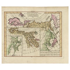
Map of North and East coast of Asia with Japan & inset maps of Kamchatka, c1750
Located in Langweer, NL
Antique map titled 'Nouvelle representation des Cotes Nord et Est de L'Asie.' Map the north and
Category

1750s Antique Maps Art Collectibles

Materials

Paper

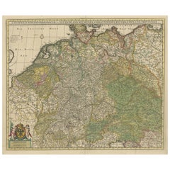
Antique Map of Germany and Central Europe
Located in Langweer, NL
. Published by N. Visscher, circa 1690. The Visscher family were art and map dealers in Amsterdam during the
Category

Late 17th Century Antique Maps Art Collectibles

Materials

Paper

Antique Map of Germany and Central Europe
H 20.67 in W 24.22 in D 0.02 in
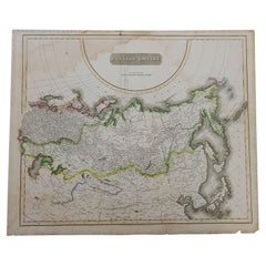
1814 Map of "Russian Empire" Ric.r032
Located in Norton, MA
detail. Thomson's work, including this map, represents some of the finest cartographic art of the 19th
Category

19th Century Unknown Antique Maps Art Collectibles

Materials

Paper

Antique 1814 Map of "Russian Empire" Ric.r032
1814 Map of "Russian Empire" Ric.r032
H 20.87 in W 24.81 in D 0.4 in
Antique Map of Friesland by Von Reilly, 1791
Located in Langweer, NL
(1766-1820) was a Vienna based art dealer. He is also known as the author of two atlases. The maps were
Category

18th Century Antique Maps Art Collectibles

Materials

Paper

Large Antique County Map of Leicestershire, England, 1805
Located in Langweer, NL
Explore Leicestershire's Past: Antique Map by John Cary Step into the history of Leicestershire
Category

Early 19th Century Antique Maps Art Collectibles

Materials

Paper

Historical Map Depicting the Continent of Asia, 1882
Located in Langweer, NL
This 1882 map presents a meticulously detailed representation of the continent of Asia, a testament
Category

1880s Antique Maps Art Collectibles

Materials

Paper

Antique Map of Oostergo by Von Reilly, 1791
Located in Langweer, NL
(1766-1820) was a Vienna based art dealer. He is also known as the author of two atlases. The maps were
Category

18th Century Antique Maps Art Collectibles

Materials

Paper

Antique Map of Oostergo by Von Reilly, 1791
Located in Langweer, NL
-1820) was a Vienna based art dealer. He is also known as the author of two atlases. The maps were
Category

18th Century Antique Maps Art Collectibles

Materials

Paper

Antique Map of Overijssel by Visscher, c.1652
Located in Langweer, NL
Engravers: The Visscher family were art and map dealers in Amsterdam during the 17th century. Founded by C
Category

17th Century Antique Maps Art Collectibles

Materials

Paper

Antique Map of Overijssel by Visscher, c.1660
Located in Langweer, NL
Engravers: The Visscher family were art and map dealers in Amsterdam during the 17th century. Founded by C
Category

17th Century Antique Maps Art Collectibles

Materials

Paper

Antique Map of Pomerania by Schenk, circa 1750
Located in Langweer, NL
The "Ducatus Pomeraniae" is a historical map depicting the Duchy of Pomerania, a region that
Category

Mid-18th Century Antique Maps Art Collectibles

Materials

Paper

Antique Map of Pomerania by Schenk, circa 1750
H 20.67 in W 24.02 in D 0.02 in
Map Turkey in Europe & Hungary Thomas Kitchin, 1783
Located in BUNGAY, SUFFOLK
Thomas Kitchen (1718 - 1784) : Map of Turkey in Europe & Hungary 1783 Visible sheet within the
Category

18th Century English Georgian Antique Maps Art Collectibles

Materials

Paper

Antique Map of Bavaria with many details, Germany
Located in Langweer, NL
. Visscher. The Visscher family were art and map dealers in Amsterdam during the 17th century. Funded by C
Category

Late 17th Century Antique Maps Art Collectibles

Materials

Paper

Antique Map of Northern Asia by Mallet, 1719
Located in Langweer, NL
Antique map titled 'Das Mitternächtige Theil des Alten Asien'. This sheet of five miniature maps
Category

18th Century Antique Maps Art Collectibles

Materials

Paper

1915 "San Francisco City and County" Hanging Map by W. Bashford Smith
Located in Colorado Springs, CO
Presented is a rare wall map of San Francisco by W. Bashford Smith. Published in San Francisco in
Category

1910s American Art Deco Antique Maps Art Collectibles

Materials

Wood, Paper

Antique Map of North and East Asia, 1751
Located in Langweer, NL
Map 2: 'Carte des parties nord et est de L'Asie'. (Map of the Northern parts and East Asia.) Five
Category

18th Century Antique Maps Art Collectibles

Materials

Paper

Antique Map of North and East Asia, 1751
H 18.35 in W 14.97 in D 0 in
Antique Map of the Holy Land by Schut, 1710
Located in Langweer, NL
collecting antique maps is a tradition that goes back hundreds of years. Antique maps have proved a richly
Category

18th Century Antique Maps Art Collectibles

Materials

Paper

Antique Map of Bavaria, Bayern, with original Hand Coloring
Located in Langweer, NL
shown. Published by N. Visscher, circa 1695. The Visscher family were art and map dealers in Amsterdam
Category

Late 17th Century Antique Maps Art Collectibles

Materials

Paper

Madrid 1901: A Historical Map of Spain's Capital Province
Located in Langweer, NL
The map is of the province of Madrid, the capital region of Spain, as it appeared in 1901. Here are
Category

Early 1900s Antique Maps Art Collectibles

Materials

Paper

Madrid 1901: A Historical Map of Spain's Capital Province
Free Shipping
H 20.08 in W 14.77 in D 0 in
Antique Map of Southern Zeeland by Von Reilly, 1790
Located in Langweer, NL
"Antique map titled 'Seelands südlicher Theil oder die Inseln Süd Beverland, Tholen, Wolfersdyk und
Category

18th Century Antique Maps Art Collectibles

Materials

Paper

Antique Map of Southern Europe by F. Delamarche, 1837
Located in Langweer, NL
historical art. The map is detailed, highlighting various regions, territories, and significant landmarks
Category

Mid-19th Century Antique Maps Art Collectibles

Materials

Paper

Antique Map of Portugal by P. Schenk, circa 1700
Located in Langweer, NL
Antique map titled 'Portugalliae et Algarbia'. Striking example of Schenk's rare map of Portugal
Category

Early 18th Century Antique Maps Art Collectibles

Materials

Paper

Antique Map of Friesland by Bussemacher in Frame, c.1592
Located in Langweer, NL
authentic antique maps from the 16th to the 20th centuries. Buying and collecting antique maps is a
Category

18th Century Antique Maps Art Collectibles

Materials

Paper

Historical Map of the Black Sea and Surrounding Regions, 1705
Located in Langweer, NL
-Beschryving," this map is not only a geographic document but also a piece of art, which would have been prized
Category

Early 1700s Antique Maps Art Collectibles

Materials

Paper

Antique Map of Greece from Ortelius's Theatrum Orbis Terrarum, 1595
Located in Langweer, NL
Original antique map titled "Graecia Sophiani." This is a very detailed and decorative engraved map
Category

16th Century Antique Maps Art Collectibles

Materials

Paper

Antique Map of the Middle East by Von Sandrart, 1708
Located in Langweer, NL
range of authentic antique maps from the 16th to the 20th centuries. Buying and collecting antique maps
Category

18th Century Antique Maps Art Collectibles

Materials

Paper

Antique Map of the region of Bremen and Verden, Germany
Located in Langweer, NL
and Verden, Germany. Published by N. Visscher, circa 1690. The Visscher family were art and map
Category

Late 17th Century Antique Maps Art Collectibles

Materials

Paper

Antique Map of the Iberian Peninsula with two decorative Cartouches
Located in Langweer, NL
arms. Published by N. Visscher, circa 1680. The Visscher family were art and map dealers in Amsterdam
Category

Late 17th Century Antique Maps Art Collectibles

Materials

Paper

1797 Tardieu Map of Southeast Asia: The Malay Archipelago and Beyond
Located in Langweer, NL
- Collectible map - Decorative map - Educational piece - Geographic art - Borneo and Philippines - Exploration
Category

1790s Antique Maps Art Collectibles

Materials

Paper

Antique Map of the Netherlands and Belgium by Hérisson, 1829
Located in Langweer, NL
art but also a reliable historical document. This map is a valuable historical artifact, offering
Category

Mid-19th Century Antique Maps Art Collectibles

Materials

Paper

Antique Map of the Westerkwartier Region, a Region in Groningen, 1791
Located in Langweer, NL
antique maps from the 16th to the 20th centuries. Buying and collecting antique maps is a tradition that
Category

18th Century Antique Maps Art Collectibles

Materials

Paper

Antique Map of Part of Groningen by Von Reilly, 1792
Located in Langweer, NL
Antique map titled 'Oldambt oder die Alten Aemter'. This map depicts part of the Dutch province
Category

18th Century Antique Maps Art Collectibles

Materials

Paper

Antique Map of Part of Overijssel by Von Reilly, 1792
Located in Langweer, NL
Antique map titled 'Das Drostamt Twenthe und Haarbergen'. This map depicts part of The Netherlands
Category

18th Century Antique Maps Art Collectibles

Materials

Paper

Antique Map of the Spice Islands by Van Linschoten, 1598
Located in Langweer, NL
Antique map titled 'INSVLAE MOLVCCAE celeberrimae/funt ob Maximan aromatum copiam quam totum terr
Category

16th Century Antique Maps Art Collectibles

Materials

Paper

1627 Map Entitled "Loudunois, " Signed on the Back, Ric.a013
Located in Norton, MA
1627 map entitled "Loudunois," Signed on the Back Ric.a013 cartography close up double
Category

17th Century Dutch Antique Maps Art Collectibles

Materials

Paper

Original Antique Map of the West Indies by J. Arrowsmith, 1842
Located in Langweer, NL
Title: "J. Arrowsmith's 19th Century Map of the West Indies" This original antique map, crafted by
Category

Early 19th Century Antique Maps Art Collectibles

Materials

Paper

Antique Map of the Region of Gaasterland, Friesland, The Netherlands, 1791
Located in Langweer, NL
centuries. Buying and collecting antique maps is a tradition that goes back hundreds of years. Antique maps
Category

18th Century Antique Maps Art Collectibles

Materials

Paper

Map of Independent Tartary with Vignettes of the Region's Culture, 1851
Located in Langweer, NL
& Company:** Known for the high level of detail and ornate borders, Tallis maps are works of art in the
Category

1850s Antique Maps Art Collectibles

Materials

Paper

19th Century Illustrated Map of Ceylon (Sri Lanka) with Notable Landmarks
Located in Langweer, NL
John Tallis & Company is known for producing maps and atlases that were highly regarded for their
Category

1850s Antique Maps Art Collectibles

Materials

Paper

Antique Map of the Province Groningen in The Netherlands, c.1680
Located in Langweer, NL
(..)'. Artists and Engravers: The Visscher family were art and map dealers in Amsterdam during the 17th century
Category

17th Century Antique Maps Art Collectibles

Materials

Paper

1644 Janssonius Original Wine Regions Map: The Ducal and Comital Burgundy
Located in Langweer, NL
This authentic handcolored map is a detailed 17th-century depiction of the Burgundy region
Category

1640s Antique Maps Art Collectibles

Materials

Paper

Cartographic Elegance of Touraine: A 17th-Century Map Showing French Heritage
Located in Langweer, NL
"Ducatus Turonensis - Touraine," is a original antique historical map of the Touraine region, which
Category

1630s Antique Maps Art Collectibles

Materials

Paper

Antique Map of the Empire of the Assyriens by Mallet, 1683
By Alain Manesson Mallet
Located in Langweer, NL
to the 20th centuries. Buying and collecting antique maps is a tradition that goes back hundreds of
Category

17th Century Antique Maps Art Collectibles

Materials

Paper

Colorful Detailed Antique Map of The World on Mercators Projection, 1882
Located in Langweer, NL
The 'World of Mercator's Projection' is a map with a stunning portrayal of global geography and
Category

1880s Antique Maps Art Collectibles

Materials

Paper

Antique Engraved Map with Original Hand Colour of French Guiana, 1876
Located in Langweer, NL
The 1876 map of French Guiana from the "Grand Atlas Départemental de la France de L'Algérie et des
Category

Late 19th Century Antique Maps Art Collectibles

Materials

Paper

Original Antique Hand-Colored Map of Friesland by C. Merian, 1659
Located in Langweer, NL
craftsmanship in the engraving, coupled with the hand coloring, would make it a collectible item for map
Category

Mid-17th Century Antique Maps Art Collectibles

Materials

Paper

Antique Map of the Northern Part of Scotland by Black '1854'
Located in Langweer, NL
Maps. Engraved On Steel, In The First Style Of Art, By Sidney Hall, William Hughes, F.R.G.S., &c. New
Category

Mid-19th Century Antique Maps Art Collectibles

Materials

Paper

1864 Johnson's Map of the World on Mercator's Projection, Ric.B009
Located in Norton, MA
attention to detail and the fine steel engraving make them works of art. Johnson maps are characterized by
Category

19th Century Dutch Antique Maps Art Collectibles

Materials

Paper

Original Antique Map of the Western Part of NEW MEXICO & CALIFORNIA
Located in Langweer, NL
Title: "Map of the Western Part of NEW MEXICO and CALIFORNIA According to the Latest Discoveries by
Category

1760s Antique Maps Art Collectibles

Materials

Paper

Antique Map of Overijssel and Drenthe by Von Reilly, c.1795
Located in Langweer, NL
Reilly (1766-1820) was a Vienna based art dealer. He is also known as the author of two atlases. The maps
Category

18th Century Antique Maps Art Collectibles

Materials

Paper

Antique Map of Overijssel and Drenthe by Von Reilly, c.1795
Located in Langweer, NL
) was a Vienna based art dealer. He is also known as the author of two atlases. The maps were engraved
Category

18th Century Antique Maps Art Collectibles

Materials

Paper

Mid-19th Century Decorative Map of Asia with Cultural and Natural Vignettes
Located in Langweer, NL
John Tallis & Company, known for their decorative mid-19th-century maps, created this map of Asia
Category

1850s Antique Maps Art Collectibles

Materials

Paper

Mid-19th Century Decorative Map of India with Cultural and Natural Vignettes
Located in Langweer, NL
The Tallis maps, including the one of India, are known for their detailed and ornamental style
Category

1850s Antique Maps Art Collectibles

Materials

Paper

Striking Antique Map of Luxembourg and Northern France 'Lotharingen', c.1680
Located in Langweer, NL
Description: Antique map titled 'Exactissima Lotharingia tam Regis Gallorum quam Ducis
Category

1680s Antique Maps Art Collectibles

Materials

Paper

Antique Map of the Sunda Islands Including Sumatra, Java, and Borneo, 1705
Located in Langweer, NL
Title: “Antique Map of the Sunda Islands Including Sumatra, Java, and Borneo” This print is a
Category

Early 1700s Antique Maps Art Collectibles

Materials

Paper

  • 1
Get Updated with New Arrivals
Save "Antique Maps Art Collectibles", and we’ll notify you when there are new listings in this category.

Antique Maps Art Collectibles For Sale on 1stDibs

There is a range of antique maps art collectibles for sale on 1stDibs. Frequently made of paper, metal and animal skin, all antique maps art collectibles available were constructed with great care. Antique maps art collectibles have been made for many years, and versions that date back to the 18th Century alongside those produced as recently as the 20th Century. Antique maps art collectibles made by Art Deco designers — as well as those associated with folk art — are very popular at 1stDibs. There have been many well-made antique maps art collectibles over the years, but those made by Antonio Vallardi Editore, Denis Diderot and Alain Manesson Mallet are often thought to be among the most beautiful.

How Much are Antique Maps Art Collectibles?

The average selling price for at 1stDibs is $595, while they’re typically $105 on the low end and $45,446 highest priced.

Read More

Pamela Shamshiri Shares the Secrets behind Her First-Ever Book and Its Effortlessly Cool Interiors

The sought-after designer worked with the team at Hoffman Creative to produce a monograph that beautifully showcases some of Studio Shamshiri's most inspiring projects.

Moroccan Artworks and Objects Take Center Stage in an Extraordinary Villa in Tangier

Italian writer and collector Umberto Pasti opens the doors to his remarkable cave of wonders in North Africa.

Montecito Has Drawn Royalty and Celebrities, and These Homes Are Proof of Its Allure

Hollywood A-listers, ex-pat aristocrats and art collectors and style setters of all stripes appreciate the allure of the coastal California hamlet — much on our minds after recent winter floods.

Whaam! Blam! Pow! — a New Book on Pop Art Packs a Punch

Publishing house Assouline and writer Julie Belcove have teamed up to trace the history of the genre, from Roy Lichtenstein, Andy Warhol and Yayoi Kusama to Mickalene Thomas and Jeff Koons.

The Sparkling Legacy of Tiffany & Co. Explained, One Jewel at a Time

A gorgeous new book celebrates — and memorializes — the iconic jeweler’s rich heritage.

What Makes a Gem-Encrusted Chess Set Worth $4 Million?

The world’s most opulent chess set, weighing in at 513 carats, is literally fit for a king and queen.

Tauba Auerbach’s Geometric Pop-Up Book Is Mighty Rare, Thanks to a Hurricane

This sculptural art book has an epic backstory of its own.

Step inside the Storied Mansions of Palm Beach’s Most Effervescent Architect

From Spanish-style courtyards to fanciful fountains, these acclaimed structures abound in surprising and elegant details.