Items Similar to Antique Map of the Sunda Islands Including Sumatra, Java, and Borneo, 1705


Want more images or videos?
Request additional images or videos from the seller
1 of 7
Antique Map of the Sunda Islands Including Sumatra, Java, and Borneo, 1705
About the Item
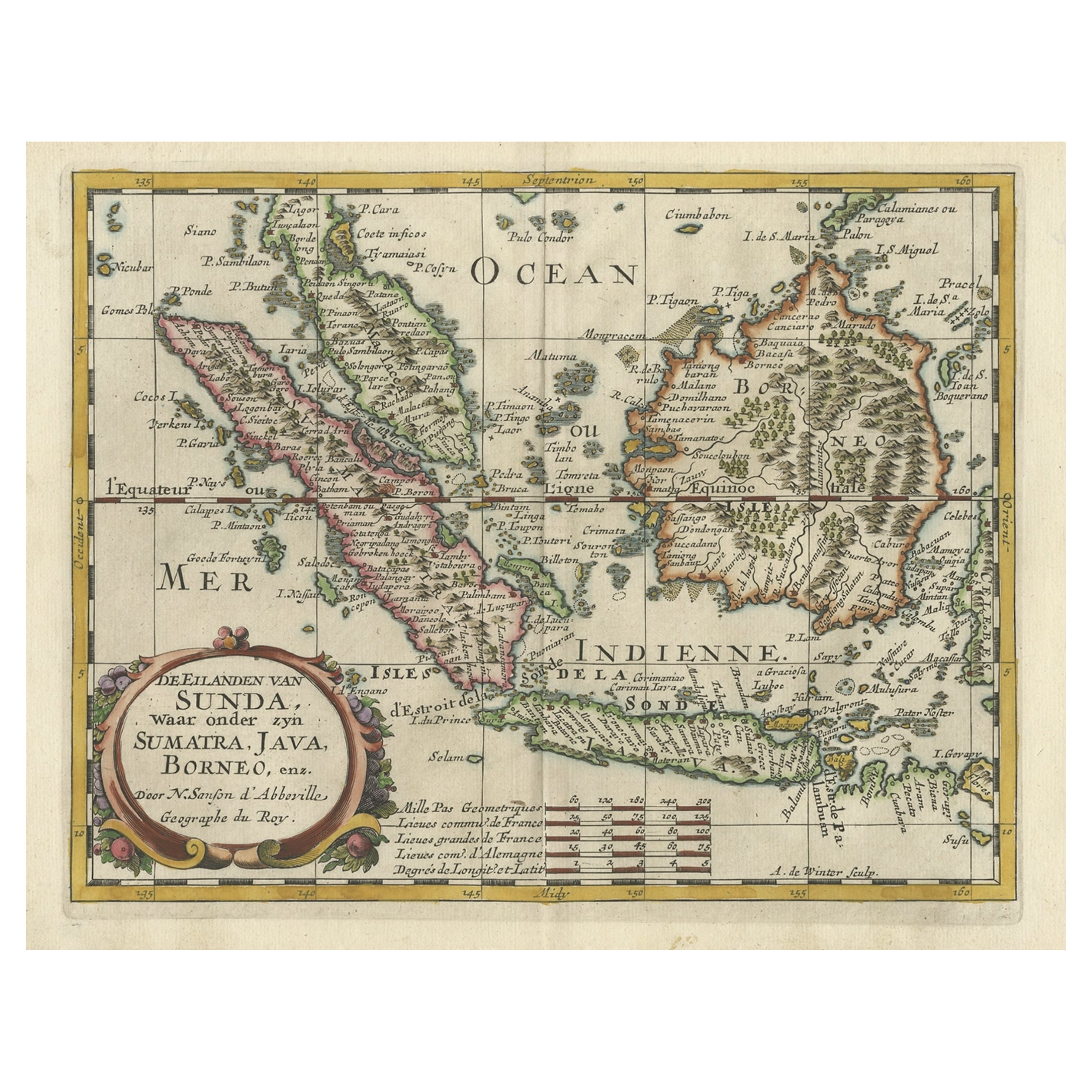
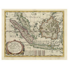
Title: “Antique Map of the Sunda Islands Including Sumatra, Java, and Borneo”
This print is a beautifully detailed and relatively rare map of Western Indonesia, encompassing the region historically known as the Sunda Islands. Created by the cartographer Nicolas Sanson and published in 1705, it measures approximately 9.8 x 7.6 inches (24.9 x 19.3 cm). The map features hand-applied coloring, enhancing its visual appeal and highlighting the distinctive geographical features of the Malay Peninsula, Sumatra, Java, and Borneo, among others.
The map is noteworthy for its precision and the abundance of place names, such as Sincapura (Singapore), Bali, Flores, and others, which are meticulously noted. A striking feature of this map is its ornate title cartouche, adorned with a garland of fruit, which adds an artistic element to the scientific endeavor of cartography.
Nicolas Sanson's small maps, originally from his work "L'Asie en Plusieurs Cartes..." first published in 1652 and engraved by A. Peyrounin, were popular and influential enough to be replicated by various publishers. Johann David Zunners included copies of Sanson's maps in his German translation of "Die Gantze Erd-Kugel" in 1679. Johannes Ribbius and Simon de Vries also published copies in 1682 and 1683, introducing new maps engraved by Antoine d'Winter.
The engraving plates changed hands over time, eventually being acquired by Francois Halma, who utilized them in 1699 and later in 1705, with the titles being re-engraved in Dutch. These same plates saw further use, with titles re-engraved back into French for use by Nicholas Chemereau in 1715 and Henri du Sauzet in 1738.
This map, originating from "Algemeene Weereld-Beschryving," represents a significant period in cartographic history, illustrating the era's geographical knowledge and artistic flair. The intricate detailing and the charming coloration of the map make it not only an important historical document but also a piece of art.
- Dimensions:Height: 8.67 in (22 cm)Width: 11.89 in (30.2 cm)Depth: 0 in (0.02 mm)
- Materials and Techniques:Paper,Engraved
- Period:1700-1709
- Date of Manufacture:1705
- Condition:Very good. A dark and attractive impression on a bright sheet with a bit of offsetting and a narrow top margin. Study the scans carefully.`.
- Seller Location:Langweer, NL
- Reference Number:
About the Seller
5.0
Platinum Seller
These expertly vetted sellers are 1stDibs' most experienced sellers and are rated highest by our customers.
Established in 2009
1stDibs seller since 2017
1,916 sales on 1stDibs
Typical response time: <1 hour
- ShippingRetrieving quote...Ships From: Langweer, Netherlands
- Return PolicyA return for this item may be initiated within 14 days of delivery.
More From This SellerView All
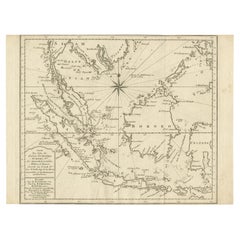
- Antique Map of the Sunda Islands Sumatra, Java, Malay Peninsula & Borneo (1739)By Isaak TirionLocated in Langweer, NLAntique map titled 'Nieuwe kaart van de Sundasche Eilanden als Borneo, Sumatra en Groot Iava & c'. Detailed map of the Sunda Islands, Southeast Asia, extending from the tip of Cambod...Category
Antique Mid-18th Century Maps
MaterialsPaper
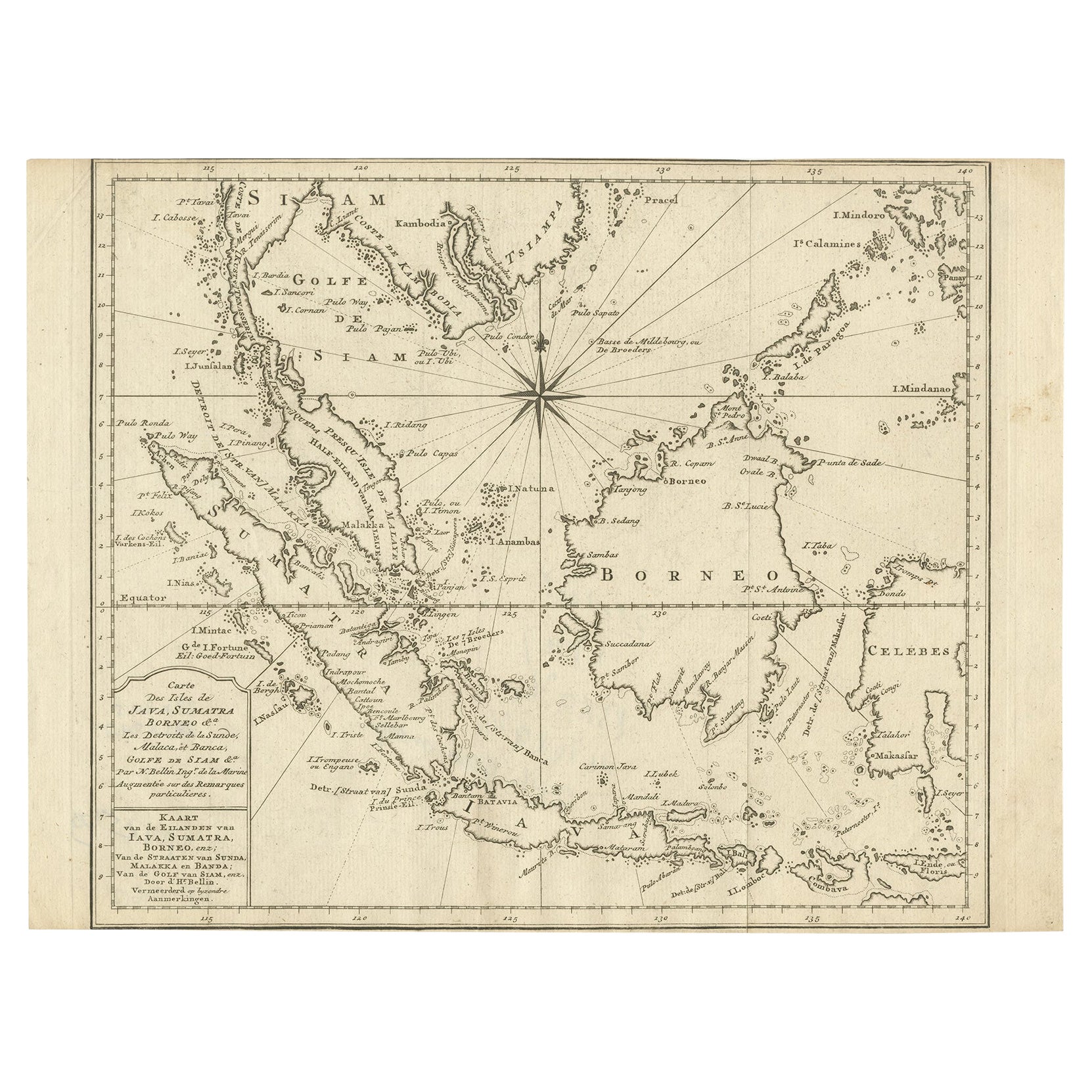
- Original Map of the East Indies Including Sumatra, Java, Borneo & Malaysia, 1747Located in Langweer, NLAntique map titled 'Carte des Isles Java, Sumatra, Borneo (..) - Kaart van de Eilanden van Iava, Sumatra, Borneo (..)'. Map of the East Indies including Sumatra, Java, Borneo and...Category
Antique 1740s Maps
MaterialsPaper
- Old Map of the Bangka Belitun Islands, Greater Sunda Islands, Indonesia, 1705Located in Langweer, NLAntique map Sunda Islands titled 'De Eilanden van Sunda, waar onder zyn Sumatra, Java, Borneo enz'. Old map of the Bangka Belitun Islands, part of the Greater Sunda Islands, incl...Category
Antique Early 1700s Maps
MaterialsPaper
- Antique Map of Singapore, Malaysia, Borneo, Sumatra and Java (Indonesia), 1739Located in Langweer, NL"Antique map titled 'Nieuwe kaart van de Sundasche Eilanden als Borneo, Sumatra en Groot Iava & c'. Detailed map of Southeast Asia, extending from the tip of Cambodia to Java. This m...Category
Antique 18th Century Maps
MaterialsPaper
- Antique Map of the Sunda Islands by Tirion 'c.1760'Located in Langweer, NLAntique map titled 'Nuova Carta delle Isole di Sunda come Borneo, Sumatra e Iava Grande'. Detailed map of the Sunda Islands, Southeast Asia, extending from the tip of Cambodia to Jav...Category
Antique Mid-18th Century Maps
MaterialsPaper
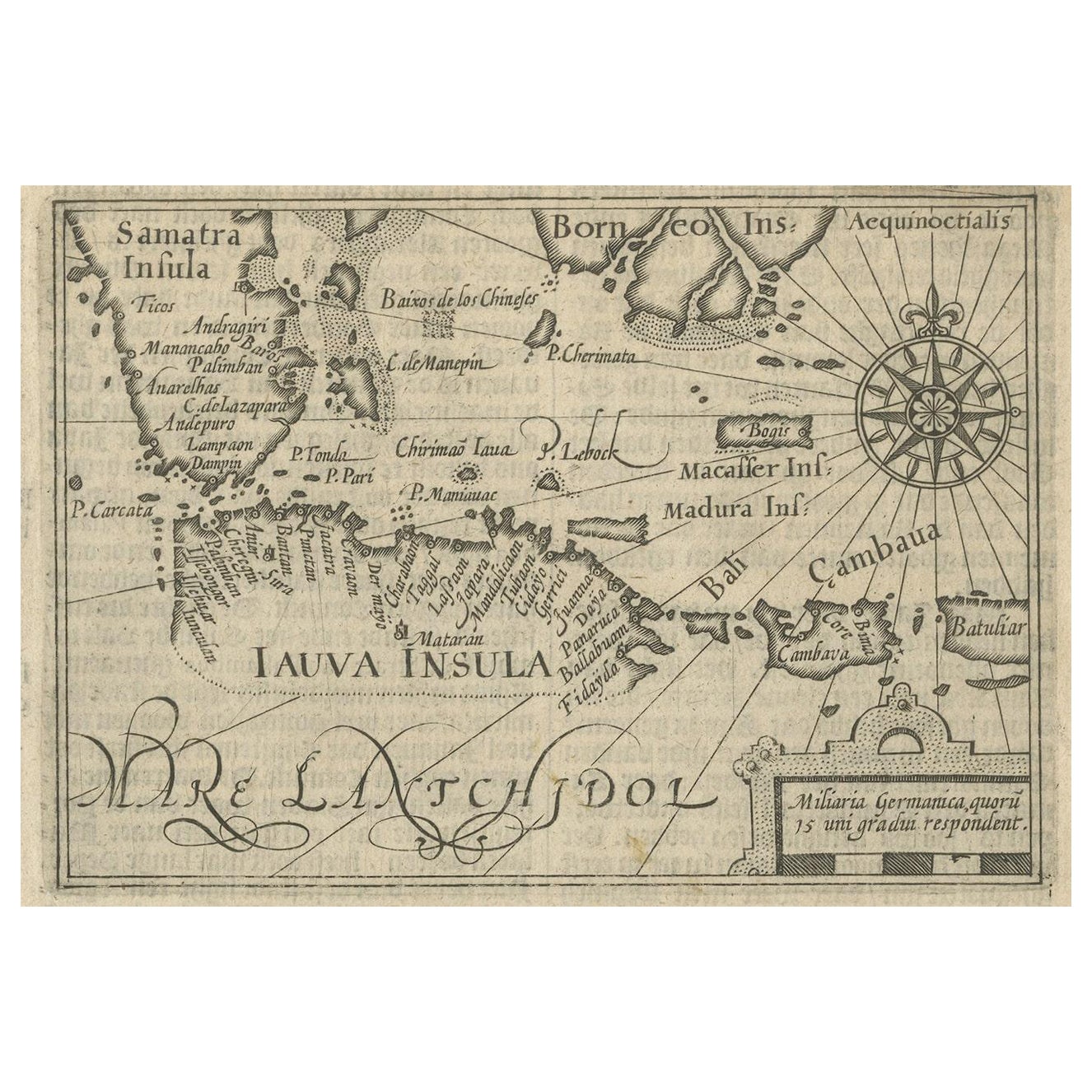
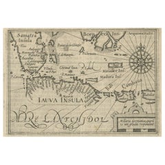
- Rare Small Map of Sumatra, Java, Borneo, Macassar, Madura, Bali, 1614Located in Langweer, NLOne of the first maps of the Indonesia islands of Java, Bali, Sumbawa etc. in early days of the Dutch Indies. Also showing Banten, Jakarta (Jacatra), Indr...Category
Antique Early 17th Century Maps
MaterialsPaper


You May Also Like
- Large Original Antique Map of Java and Borneo, Fullarton, C.1870Located in St Annes, LancashireGreat map of Java and Borneo Wonderful figurative borders From the celebrated Royal Illustrated Atlas Lithograph. Original color. Published by Fullarton, Edinburgh. C.1870 Unfr...Category
Antique 1870s Scottish Maps
MaterialsPaper
- Large Original Vintage Map of The Pacific Islands Including HawaiiLocated in St Annes, LancashireGreat map of The Pacific Islands Unframed Original color By John Bartholomew and Co. Edinburgh Geographical Institute Published, circa 1...Category
Vintage 1920s British Maps
MaterialsPaper
- 1854 Map of Massachusetts, Connecticut and Rhode Island, Antique Wall MapLocated in Colorado Springs, COThis striking wall map was published in 1854 by Ensign, Bridgman & Fanning and has both full original hand-coloring and original hardware. This impression is both informative and highly decorative. The states are divided into counties, outlined in red, green, and black, and subdivided into towns. Roads, canals, and railroad lines are prominently depicted, although they are not all labeled. The mapmakers also marked lighthouses, banks, churches, and prominent buildings, with a key at right. The map is an informative and comprehensive overview of the infrastructural development of New England prior to the Civil War. Physical geographies depicted include elevation, conveyed with hachure marks, rivers and lakes. The impression features an inset map of Boston...Category
Antique 19th Century American Maps
MaterialsPaper
- 1705 Golfe de Mexico and Florida Framed MapLocated in Stamford, CTFramed map of Mexico & Florida circa 1705, Paris. Small map with Mexico and the Gulf Coast. Inset text indicating Panama, Acapulco, Mexico City and the Mississippi. Extends North to ...Category
Antique Early 1700s French Spanish Colonial Maps
MaterialsGlass, Wood, Paper
- Antique French Map of Asia Including China Indoneseia India, 1783Located in Amsterdam, Noord HollandVery nice map of Asia. 1783 Dedie au Roy. Additional information: Country of Manufacturing: Europe Period: 18th century Qing (1661 - 1912) Condition: Overall Condition B (Good Used)...Category
Antique 18th Century European Maps
MaterialsPaper
- Antique 1803 Italian Map of Asia Including China Indoneseia IndiaLocated in Amsterdam, Noord HollandAntique 1803 Italian Map of Asia Including China Indoneseia India Very nice map of Asia. 1803. Additional information: Type: Map Country of Manufacturing: Europe Period: 19th centu...Category
Antique 19th Century European Maps
MaterialsPaper


