Items Similar to 19th Century Illustrated Map of Ceylon (Sri Lanka) with Notable Landmarks

Want more images or videos?
Request additional images or videos from the seller
1 of 6
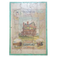
19th Century Illustrated Map of Ceylon (Sri Lanka) with Notable Landmarks
About the Item
John Tallis & Company is known for producing maps and atlases that were highly regarded for their accurate cartographic detail and their distinctive style. They often included ornate borders and decorative vignettes depicting culturally and historically relevant scenes of the areas they represent. These vignettes served as illustrations of local scenes, people, and historical events, providing a visual context for the places on the map.
The map of Ceylon, now known as Sri Lanka, from Tallis's series would be a fine example of their work. Ceylon was an important British colony at the time, and maps like these would have been used both for administrative purposes and for educating the British public about their empire.
Robert Montgomery Martin, often credited with the text accompanying these maps, was a civil servant, a colonial administrator, and an author with a deep interest in the British Empire and its colonies. He was involved in various aspects of colonial administration and trade, and his works reflected his interests in economics, history, and geography.
Tallis maps are appreciated not just as navigational tools but also as works of art and historical documents. They represent a time when the British Empire was at its height, and they reflect the Victorian interest in exploration, commerce, and the wider world. Collectors and historians value them for their beauty and the insight they provide into 19th-century colonial attitudes and knowledge.
Regarding the countries depicted, many of the regions shown in the Tallis series have undergone significant changes since the time of publication. Borders have shifted, countries have gained independence, and names have changed. The maps offer a snapshot of the world as it was understood in the Victorian era.
The Tallis series itself was among the last decorative map series produced as the industrial age was turning toward more utilitarian and less artistic representations. As such, they represent the end of an era in map-making.
More details of the map and its insets:
The insets on the map of Ceylon (Sri Lanka) are small, detailed illustrations that embellish the cartographic information with cultural, historical, and geographical context. They are typical of the style of Tallis maps, which combined practical cartography with decorative artistry.
1. **Temple of Buddha, KALANY**: This inset appears to depict a grand Buddhist temple, indicative of the country's deep-rooted Buddhist traditions. The presence of a stupa-like structure suggests the temple is significant for Buddhist worship and may be a site of pilgrimage. The lush vegetation and architectural style reflect the tropical climate and cultural heritage of the region.
2. **COLOMBO**: The port city of Colombo is shown from a coastal perspective, highlighting its importance as a maritime hub. The image shows several ships in the harbor, pointing to the active trade and colonial influence of the time. Notably, the colonial architecture, such as the clock tower, reveals the European impact on the city's development.
3. **LAKE OF KANDY**: This illustration presents a serene view of the Lake of Kandy, surrounded by the hill country. Kandy was the last capital of the ancient kings' era of Sri Lanka and is known for its scenic beauty and historical significance. The calm water, the gentle hills in the background, and the classical pavilion style buildings suggest a place of both beauty and cultural importance.
4. **RUINS OF A DAGORA, TOOFARAMAYA**: This vignette captures the ruins of a dagoba (stupa), which is a typical structure in Buddhist temple complexes. The depiction of ruins indicates the long history of the island and the presence of ancient civilizations. The tropical flora indicates the natural environment in which these historical sites are found.
These vignettes serve not only as decorations but also as a window into the life, history, and environment of Ceylon during the time of the British colonial period. They provide a visual narrative that complements the map's geographical information, offering a snapshot of the land, its monuments, and its colonial urban centers.
- Dimensions:Height: 14.26 in (36.2 cm)Width: 10.71 in (27.2 cm)Depth: 0 in (0.02 mm)
- Materials and Techniques:
- Period:
- Date of Manufacture:1851
- Condition:Good given age. Original fold in middle as published. General age-related toning, please study scan carefully.
- Seller Location:Langweer, NL
- Reference Number:
About the Seller
5.0
Platinum Seller
These expertly vetted sellers are 1stDibs' most experienced sellers and are rated highest by our customers.
Established in 2009
1stDibs seller since 2017
1,928 sales on 1stDibs
Typical response time: <1 hour
- ShippingRetrieving quote...Ships From: Langweer, Netherlands
- Return PolicyA return for this item may be initiated within 14 days of delivery.
More From This SellerView All
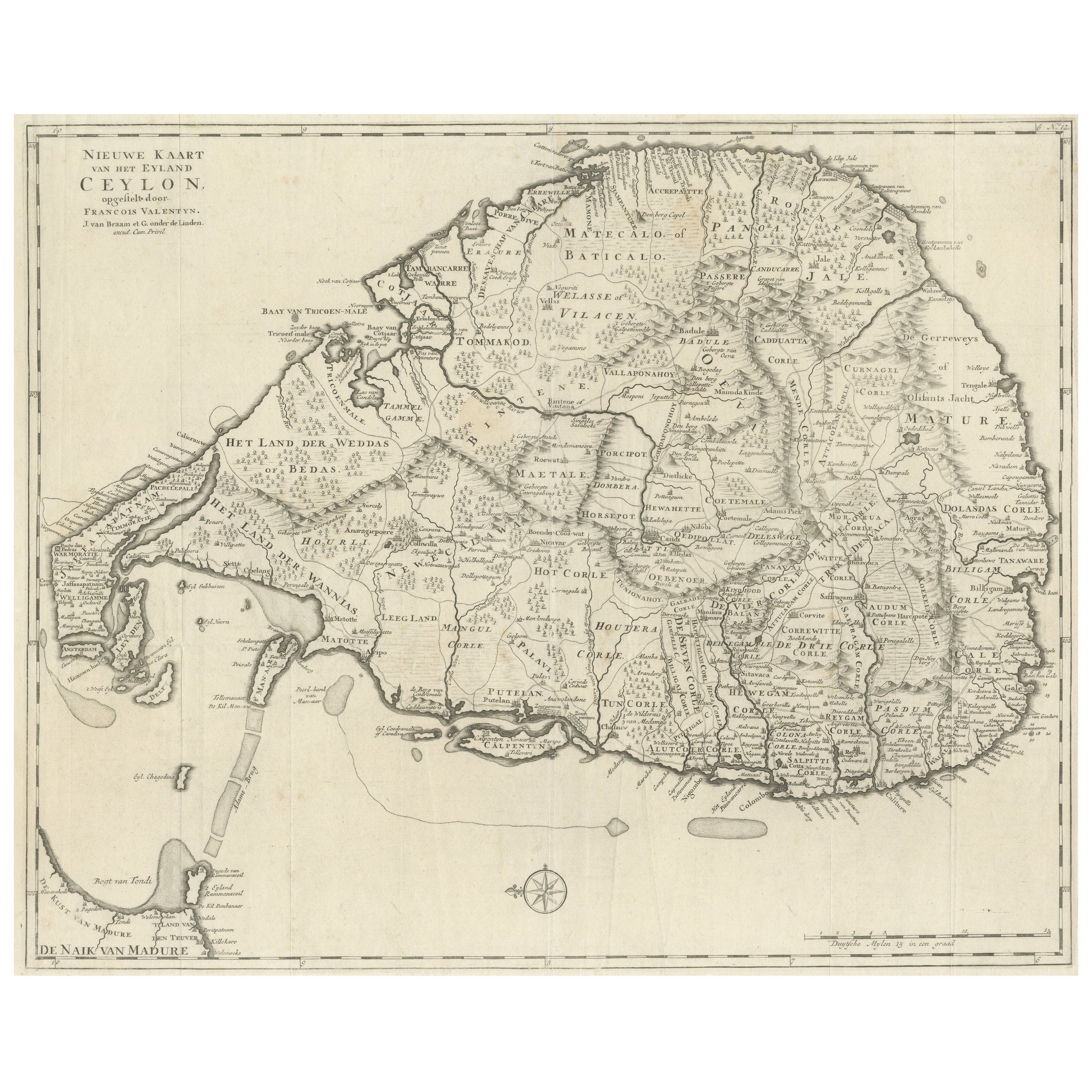
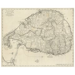
- Large Antique Map of Ceylon, Sri LankaLocated in Langweer, NLAntique map titled 'Nieuwe Kaart van het Eyland Ceylon opgestelt door Francois Valentyn'. Beautiful map of Sri Lanka. Originates from 'Oud en Nieuw Oost Indien (..)' by F. Valentijn,...Category
Antique Mid-18th Century Maps
MaterialsPaper
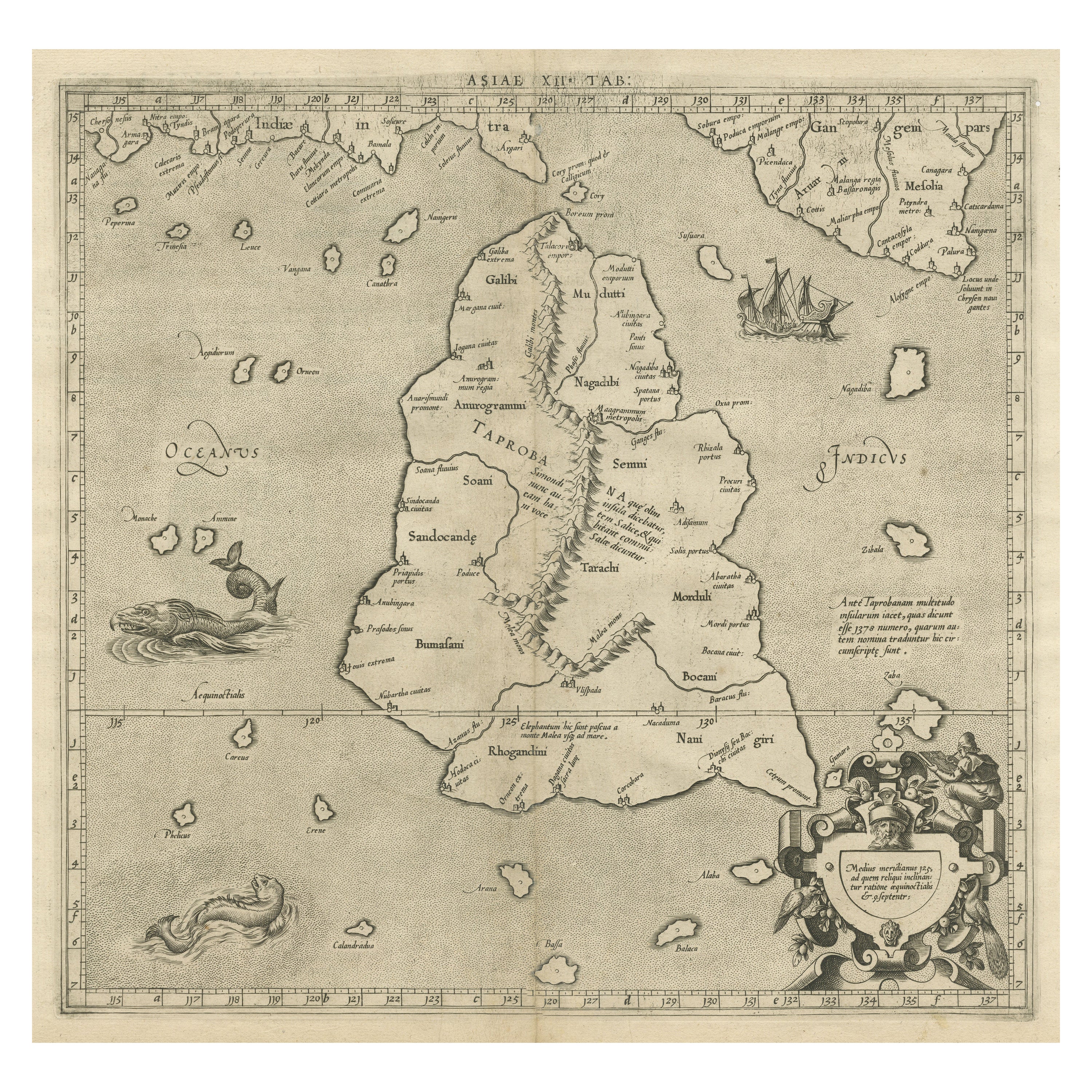
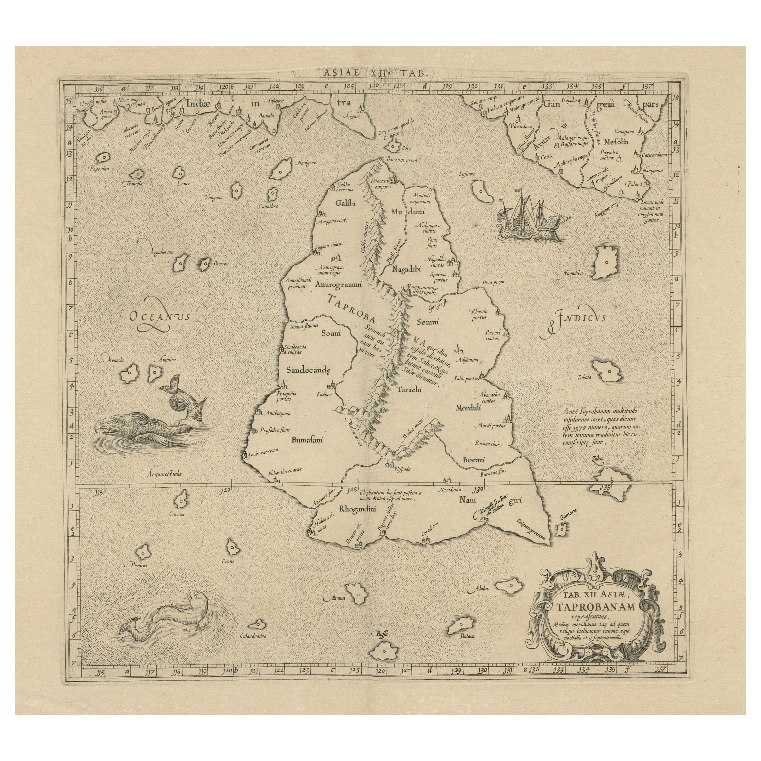
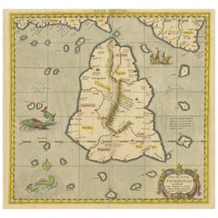
- Mercator's Ptolemaic map of Taprobana, (Ceylon) Sri LankaLocated in Langweer, NLAntique map titled 'Asiae XII Tab'. Mercator's Ptolemaic map of Taprobana. The map shows Ptolemy's erroneous location of the island of Sri Lanka near the equator, with a bit of India...Category
Antique 16th Century Maps
MaterialsPaper
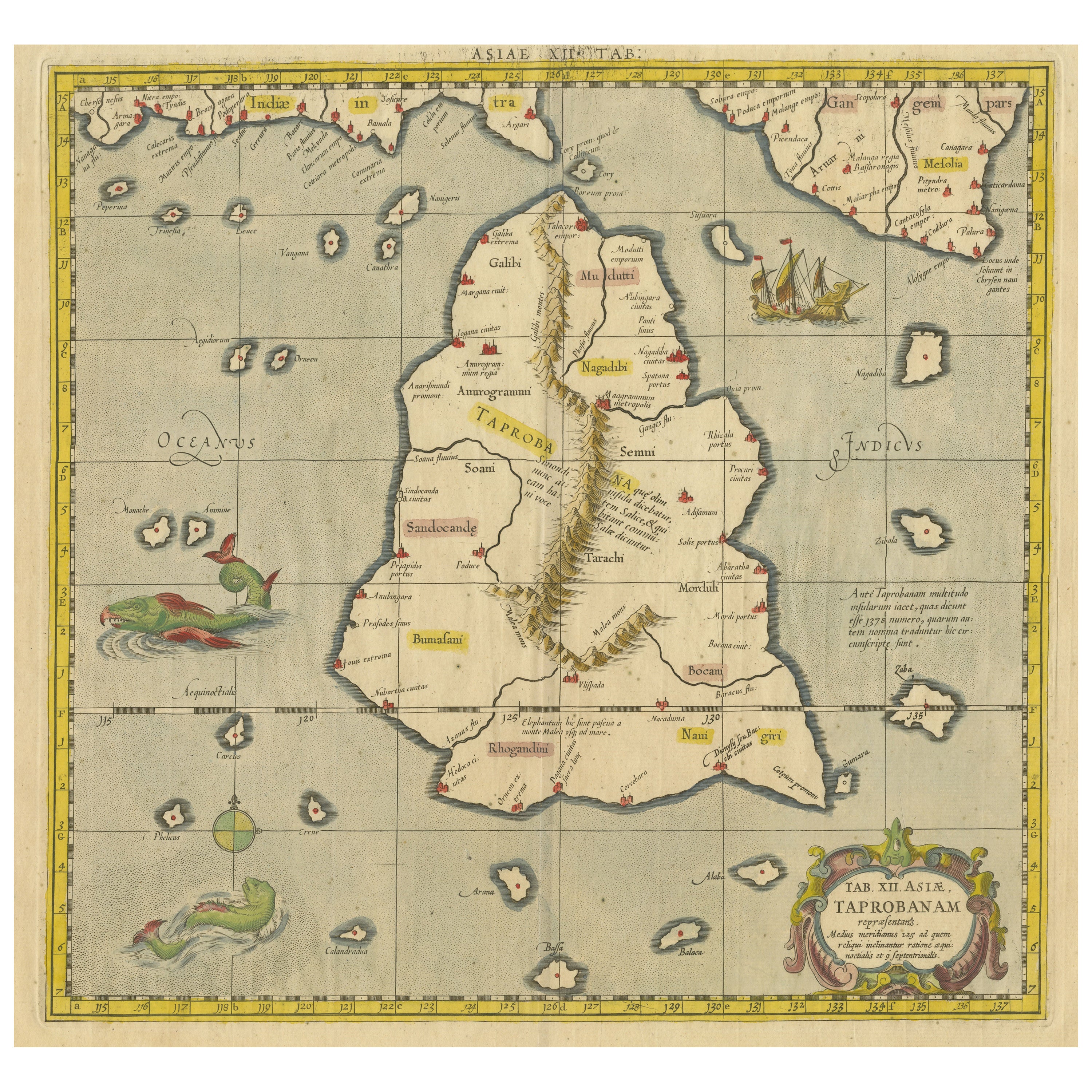
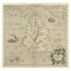
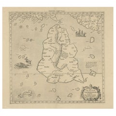
- Antique Ptolemaic Map of Ceylon or nowadays Sri LankaLocated in Langweer, NLAntique map titled 'Tab XII. Asiae Taprobanam'. Ptolemaic map of Sri Lanka. Ptolemy drew on the accounts of travelers and sailors and though the information was secondhand and often ...Category
Antique Mid-18th Century Maps
MaterialsPaper
- Old Map of Southern India and Ceylon 'Sri Lanka', 1882Located in Langweer, NLAntique map titled 'India (Southern Sheet)'. Old map of Southern India and Ceylon (Sri Lanka). With an inset map of the South-Eastern Provinces of India. This map originates from...Category
Antique 1880s Maps
MaterialsPaper
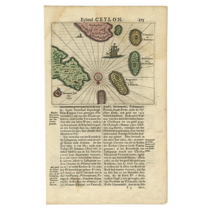
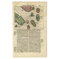
- Antique 17th Century Map of the Islands Near Ceylon or Sri Lanka, 1672Located in Langweer, NLAntique map titled 'Eyland Ceylon.' Map of the islands near Ceylon or Sri Lanka. Dutch text on verso. Source unknown, to be determined. Artists and Engravers: Philip Baldaeus (1632-...Category
Antique 17th Century Maps
MaterialsPaper
- Rare Original Antique Ptolemy Map of Ceylon, Present Day Sri LankaLocated in Langweer, NLOriginal antique map titled 'Tab XII Asiae Taprobanam (..)'. For this map of Toprobana (Sri Lanka), Ptolemy drew on the accounts of travelers and sailors and though the information was secondhand and often inaccurate, it represented the most advanced account of the world's geography at that time. This map depicts the island with the typical misconceptions of the period with the enlarged island straddling the Equator and nearly divided by a ridge of mountains. A small part of India is incorrectly shown in the northeast corner of the map and a spurious coastline labeled Gangem fills the upper right corner. The stipple engraved sea contains an oriental ship...Category
Antique Late 17th Century Maps
MaterialsPaper

You May Also Like
- Illustrated Map of London from ExhibtionLocated in Alton, GBDetailed illustrated map of London from the great exhibition of industry of all nations 1851.Category
Antique 19th Century Maps
MaterialsPaper
- Louisiana: A Framed 19th Century Map by O. W. GrayBy Gray and CoLocated in Alamo, CAThis framed 19th century map of the Louisiana territory was published in "Gray's Atlas of the United States with General Maps of the World, accompanied by Descriptions Geographical, Historical, Scientific and Statistica" published in 1873 in Philadelphia by O.W. Gray and Son and Stedman, Brown and Lyon. It is a highly detailed map of Louisiana...Category
Antique Mid-19th Century American Other Maps
MaterialsPaper
- Framed Mid-19th Century Wall Map of Long Island, the HamptonsLocated in Sag Harbor, NYA Framed museum quality find. This large wall map dates to the mid-1800s. Detailed inset maps of, Sag Harbor, East Hampton, Amagansett, Shelter Island and most villages in Long Islan...Category
Antique Mid-19th Century American Maps
MaterialsLinen, Paper
- America "Amérique Septentrionale": A 19th Century French Map by DelamarcheBy Maison Delamarche 1Located in Alamo, CAThis framed mid 19th century map of North America entitled "Amérique Septentrionale" by Felix Delamarche was published in Paris in 1854 by Quay de l'Horloge du Palais, avec les Carte...Category
Antique Mid-19th Century American Other Maps
MaterialsPaper
- Advertising Puzzle USA Map Sherwin Williams Paint, 19th CenturyLocated in Fulton, CAA cardboard advertising puzzle for Sherwin Williams Paint, circa 1883. All original pieces intact. Reverse of puzzle has map of United States. Feature...Category
Antique Late 19th Century American Late Victorian Historical Memorabilia
MaterialsComposition
- 19th Century John Cary Map of North Part of West Riding of Yorkshire, C.1805By John CaryLocated in Royal Tunbridge Wells, KentAntique 19th century British original John Cary sr (1755-1835) map of North part of the West Riding of Yorkshire, From the beft Authorities. Engraved J Car...Category
Antique 19th Century British Maps
MaterialsPaper