Items Similar to Mercator's Ptolemaic map of Taprobana, (Ceylon) Sri Lanka


Want more images or videos?
Request additional images or videos from the seller
1 of 6
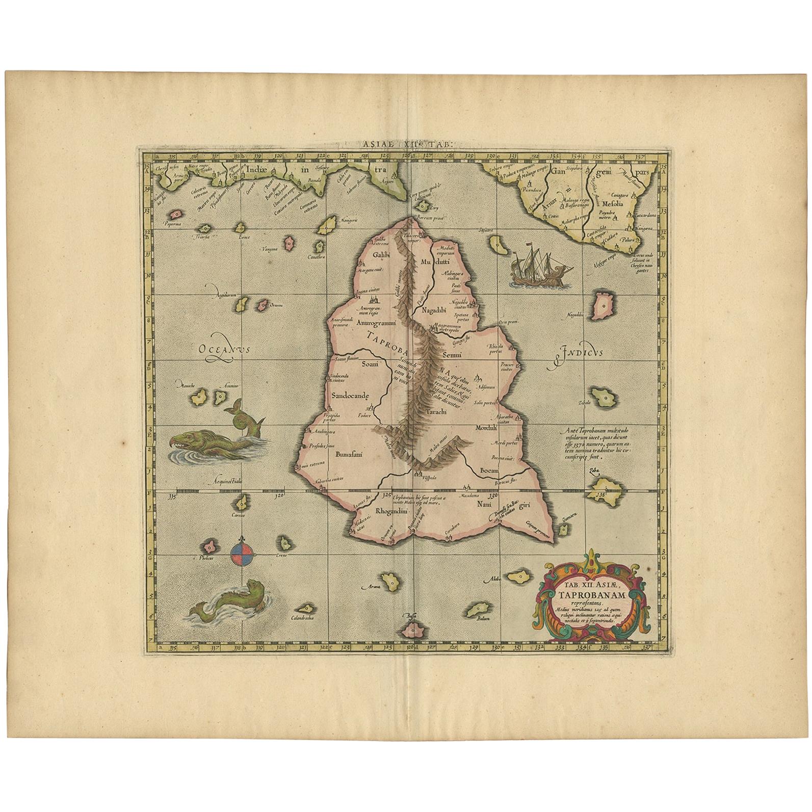
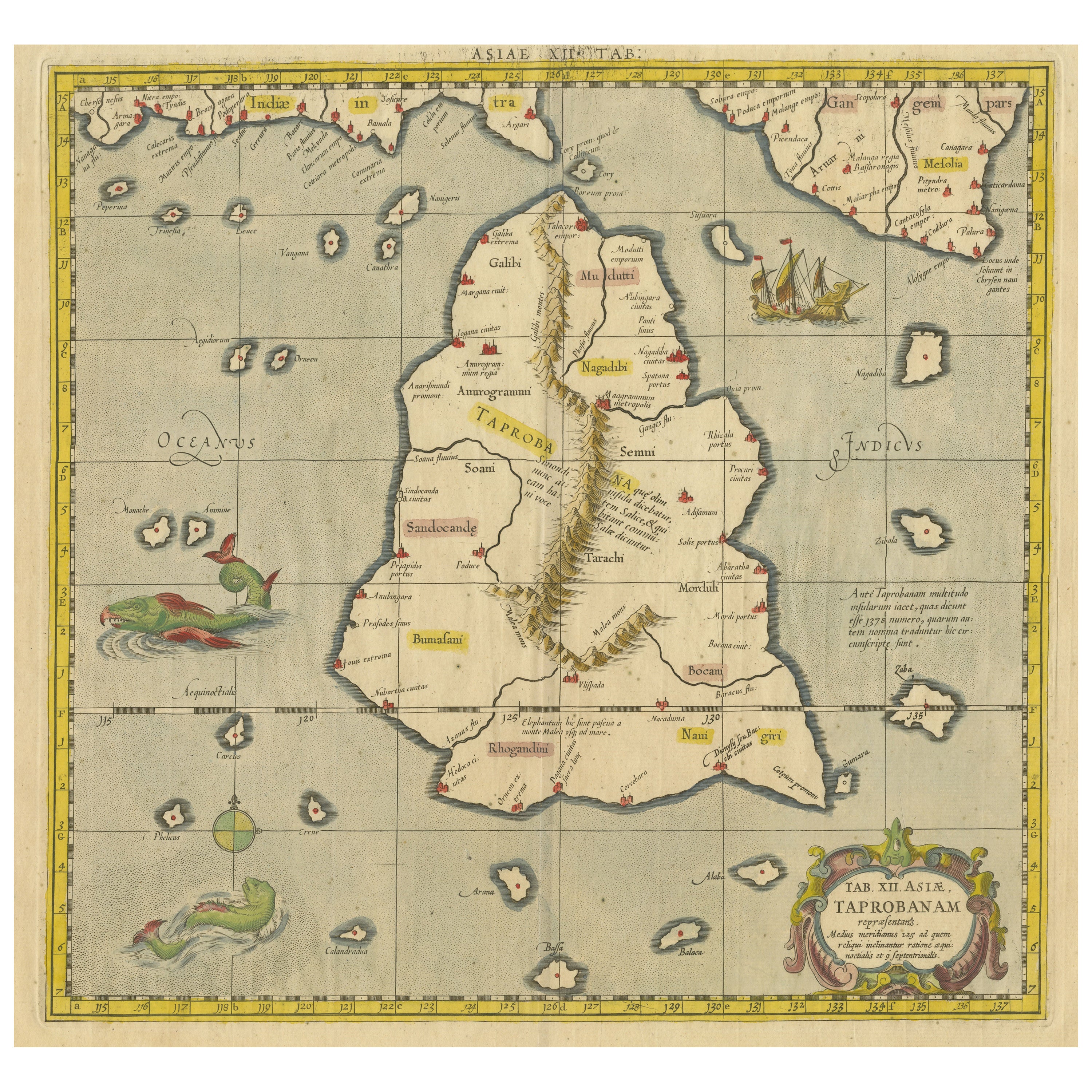
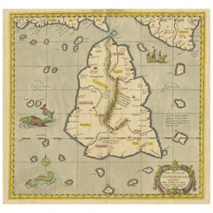
Mercator's Ptolemaic map of Taprobana, (Ceylon) Sri Lanka
About the Item
Antique map titled 'Asiae XII Tab'. Mercator's Ptolemaic map of Taprobana. The map shows Ptolemy's erroneous location of the island of Sri Lanka near the equator, with a bit of India shown to the northeast. Includes a pair of sea monsters and a sailing ship. Published circa 1580.
Gerard Mercator (1512 - 1594) originally a student of philosophy was one of the most renowned cosmographers and geographers of the 16th century, as well as an accomplished scientific instrument maker. He is most famous for introducing Mercators Projection, a system which allowed navigators to plot the same constant compass bearing on a flat map.
- Dimensions:Height: 15.95 in (40.5 cm)Width: 20.01 in (50.8 cm)Depth: 0.02 in (0.5 mm)
- Materials and Techniques:
- Period:
- Date of Manufacture:c.1580
- Condition:General age-related toning. Original folding line, with split. Shows some creasing and staining. Few tiny holes. Latin text on verso. Please study image carefully.
- Seller Location:Langweer, NL
- Reference Number:
About the Seller
5.0
Platinum Seller
These expertly vetted sellers are 1stDibs' most experienced sellers and are rated highest by our customers.
Established in 2009
1stDibs seller since 2017
1,929 sales on 1stDibs
Typical response time: <1 hour
- ShippingRetrieving quote...Ships From: Langweer, Netherlands
- Return PolicyA return for this item may be initiated within 14 days of delivery.
More From This SellerView All
- Antique Ptolemaic Map of Ceylon or nowadays Sri LankaLocated in Langweer, NLAntique map titled 'Tab XII. Asiae Taprobanam'. Ptolemaic map of Sri Lanka. Ptolemy drew on the accounts of travelers and sailors and though the information was secondhand and often ...Category
Antique Mid-18th Century Maps
MaterialsPaper
- Antique Map of Ceylon or Sri Lanka by Ptolemy/Mercator, circa 1695Located in Langweer, NLAntique map titled 'Tab XII Asiae Taprobanam'. Ptolemaic map of Taprobana (Sri Lanka). Ptolemy drew on the accounts of travelers and sailors and though the information was secondhand and often inaccurate it represented the most advanced account of the world's geography at that time. This map depicts the island with the typical misconceptions of Ptolemy with the island straddling the Equator and nearly divided by a ridge of mountains. A small part of India is incorrectly shown in the northeast corner of the map. The stipple engraved sea is filled with an oriental ship...Category
Antique Late 17th Century Maps
MaterialsPaper
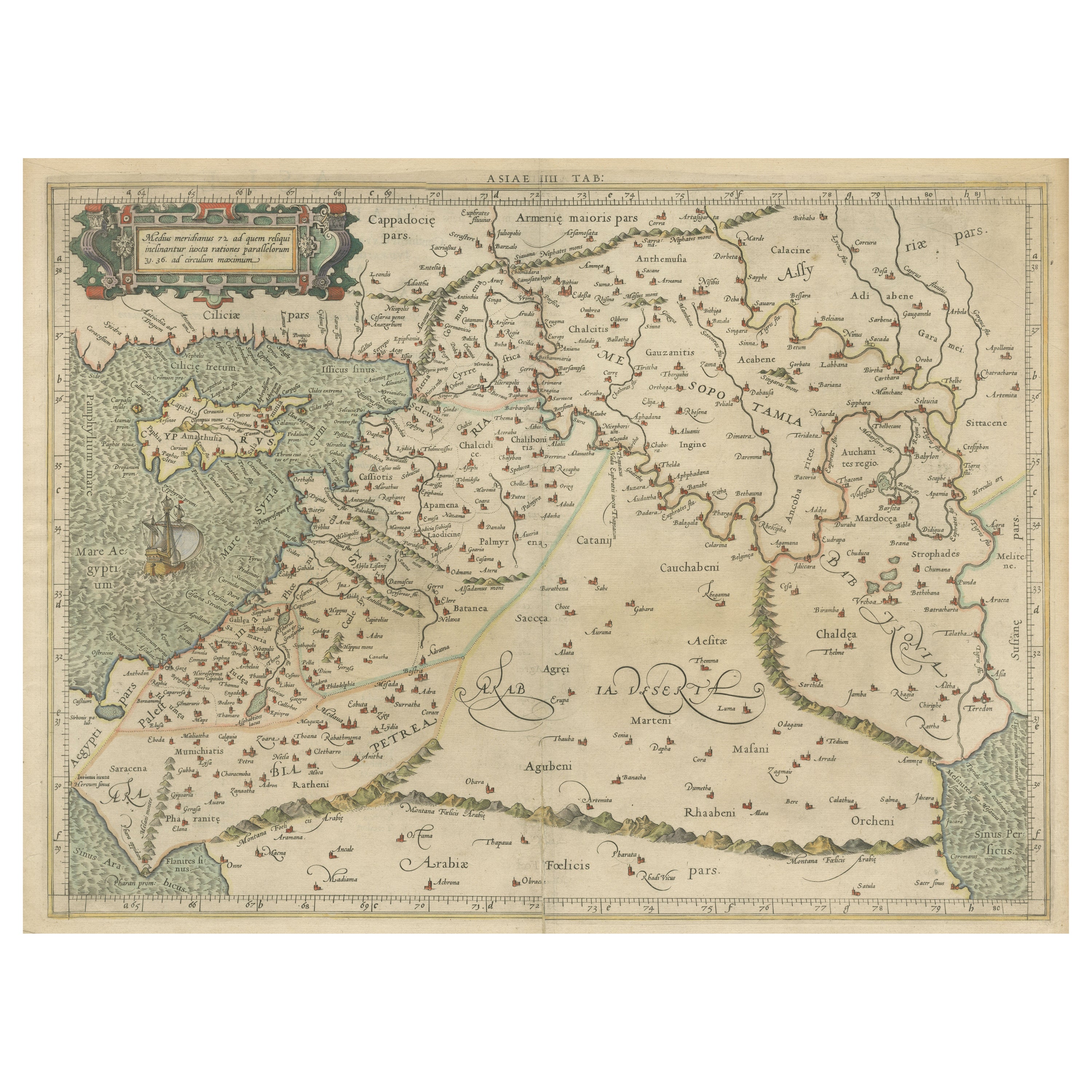
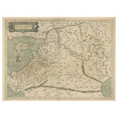
- Mercator's Ptolemaic Map of the Holy Land, Cyprus and Syria, circa 1580Located in Langweer, NLAntique map titled 'Asiae IIII Tab'. Beautiful map of Mercator's Ptolemaic map of the Holy Land, Cyprus, Syria, etc. Originates from Mercator's 'Geographia'. Gerard Mercator (1512 ...Category
Antique 16th Century Maps
MaterialsPaper
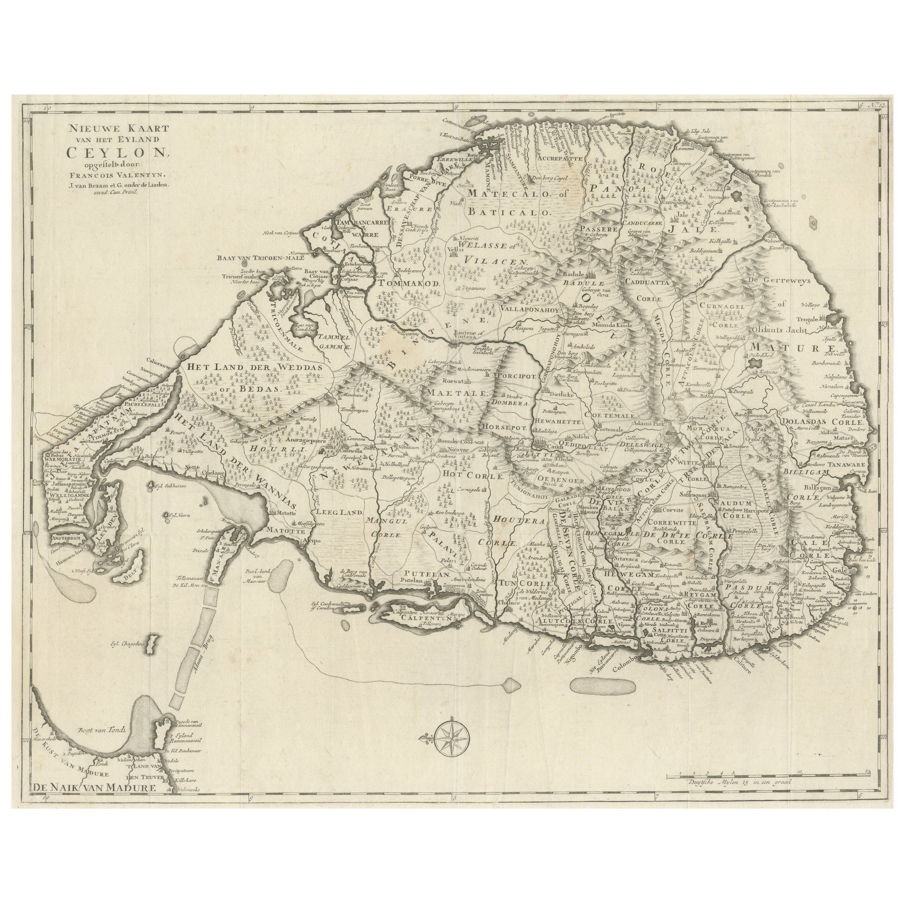
- Large Antique Map of Ceylon, Sri LankaLocated in Langweer, NLAntique map titled 'Nieuwe Kaart van het Eyland Ceylon opgestelt door Francois Valentyn'. Beautiful map of Sri Lanka. Originates from 'Oud en Nieuw Oost Indien (..)' by F. Valentijn,...Category
Antique Mid-18th Century Maps
MaterialsPaper
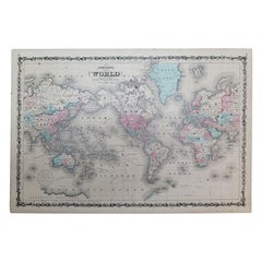
- Antique Map of the World on Mercator's Projection, 1788Located in Langweer, NLAntique map titled 'Kaart van de Geheele Wereld (..)'. Uncommon small world map on Mercator's projection. Nice detail of the islands throughout the wor...Category
Antique Late 18th Century Maps
MaterialsPaper
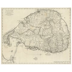
- Old Map of Southern India and Ceylon 'Sri Lanka', 1882Located in Langweer, NLAntique map titled 'India (Southern Sheet)'. Old map of Southern India and Ceylon (Sri Lanka). With an inset map of the South-Eastern Provinces of India. This map originates from...Category
Antique 1880s Maps
MaterialsPaper


You May Also Like
- 1864 Johnson's Map of the World on Mercator's Projection, Ric.B009Located in Norton, MAAn 1864 Johnson's map of the World on Mercator's Projection Ric.b009 About this Item "This antique map came from Johnson's New Illustrated (Steel Plate) Family Atlas, publ...Category
Antique 19th Century Dutch Maps
MaterialsPaper
- Framed Mercator Hondius Hispania Nova Atlas Minor MapLocated in Stamford, CTFramed colored example of this decorative and important minature map. Newly framed in brown wood frame with gold trim. Mercator Hondius “Atlas Minor” pu...Category
Antique 17th Century Dutch Spanish Colonial Maps
MaterialsGlass, Wood, Paper
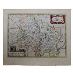
- 1625 Mercator Map of the Provenience of Quercy, "Quercy Cadvrcivm Ric.0013Located in Norton, MA1625 Mercator map of the provenience of Quercy, entitled "Quercy Cadvrcivm," Ric.0013 " Authentic" - Map of the provenience of Quercy Cadvrcivm D...Category
Antique 17th Century French Maps
MaterialsPaper
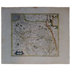
- 1590 Mercator Map Entitled "France Picardie Champaigne, Ric.0001Located in Norton, MADescription: Published in Amsterdam by Mercator/Hondius ca. 1590. Ric.0001 Artists and Engravers: Map : 'France Picardie Champaigne cum regionibus adiacentibus'. (Map of the french provinces of Picardie and Champagne.) Copper engraved map of the french provinces of Picardie and Champagne, showing the cities of Caen, Paris, Melun, Auxerre, Verdun, etc. Copperplate engraving on verge type hand laid paper with watermark. Description: Published in Amsterdam by Mercator/Hondius ca. 1600.Artists and Engravers: Mercator was born in Rupelmonde in Flanders and studied in Louvain under Gemma Frisius, Dutch writer, astronomer and mathematician. The excellence of his work brought him the patronage of Charles V, but in spite of his favor with the Emperor he was caught up in the persecution of Lutheran protestants and charged with heresy, fortunately without serious consequences. No doubt the fear of further persecution influenced his move in 1552 to Duisburg, where he continued the production of maps, globes and instruments. Mercator's sons and grandsons, were all cartographers and made their contributions in various ways to his atlas. Rumold, in particular, was responsible for the complete edition in 1595. The map plates...Category
Antique 16th Century Dutch Maps
MaterialsPaper
- 17th Century Hand-Colored Map of West Africa by Mercator/HondiusLocated in Alamo, CAA 17th century hand-colored map entitled "Guineae Nova Descriptio" by Gerard Mercator and Jodocus Hondius, published in their 'Atlas Minor' in Amsterdam in 1635. It is focused on the...Category
Antique Mid-17th Century Dutch Maps
MaterialsPaper
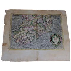
- 1585 Mercator Map of Ireland, Entitled "Irlandiae Regnvm, " Hand Colored Ric0006Located in Norton, MA1585 Mercator map of Ireland, entitled "Irlandiae Regnvm." Hand Colored Description: Published in Amsterdam by Mercator/Hondius ca. 1585. Artists and Engravers: 1585 Mercator map of Ireland, entitled "Irlandiae Regnvm." Copperplate engraving on verge type hand laid paper with watermark. Description: Published in Amsterdam by Mercator/Hondius ca. 1585.Artists and Engravers: Mercator was born in Rupelmonde in Flanders and studied in Louvain under Gemma Frisius, Dutch writer, astronomer and mathematician. The excellence of his work brought him the patronage of Charles V, but in spite of his favor with the Emperor he was caught up in the persecution of Lutheran protestants and charged with heresy, fortunately without serious consequences. No doubt the fear of further persecution influenced his move in 1552 to Duisburg, where he continued the production of maps, globes and instruments. Mercator's sons and grandsons, were all cartographers and made their contributions in various ways to his atlas. Rumold, in particular, was responsible for the complete edition in 1595. The map plates...Category
Antique 16th Century Dutch Maps
MaterialsPaper


Recently Viewed
View AllMore Ways To Browse
Bolivian Antique
St Thomas Cross
Map Of Liverpool
Georgetown Antique
Map Of Gulf Of Mexico
Authentic Pirate
Historic Map Virginia
Map Of Indonesia
United States Antique Map
Antique Map Coats Of Arms
Antique Book Map France
Old Maps England
Map Sumatra
Scotland Coat Of Arms
Malaysia Antique
Map Of Siam
Antique Map Of Sri Lanka
Globes Antique Terrestre