Map Of Indonesia

8
to
91
362
7
250
204
74
53
53
46
44
20
19
18
13
12
8
7
7
6
6
5
4
4
4
4
4
3
3
3
3
3
3
3
3
2
2
2
2
2
2
1
1
1
1
1
1
1
1
1
1
1
1
15
7
7
7
4
Sort By
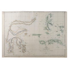
Original Antique Map of Indonesia, 1861
Located in St Annes, Lancashire
Great map of Indonesia Drawn and engraved by Edward Weller Original color Published in
Category

Antique 1860s English Victorian Maps

Materials

Paper

Original Antique Map of Indonesia, 1861
No Reserve
H 13 in W 19 in D 0.07 in
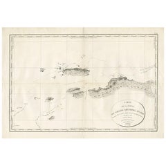
Antique Map of Indonesia by C.F. Beautemps-Beaupre, circa 1807
Located in Langweer, NL
Antique map titled 'Carte de la partie du grand archipel d'Asie'. Map of Indonesia showing tracks
Category

Antique Early 19th Century Maps

Materials

Paper

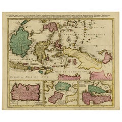
Old Map of Indonesian Islands Borneo, Celebes, New Guinea & New Britain, 1792
Located in Langweer, NL
Borneo, Iava, Celebes, Mindanao (..)'. Detailed map of the Indonesian islands Borneo, Celebes, New
Category

Antique 1790s Maps

Materials

Paper

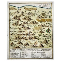
Map of Indonesia, Semarang, Kartasoera, Soerabaya by Schley
By Jakob van der Schley
Located in Norwich, GB
' Map of the Road between Semarang and Kartasura by Van Schley. Published 1763. Semarang is the
Category

Antique 1760s Indonesian Georgian Prints

Materials

Paper

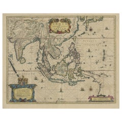
Original Antique Hand-Colored Map of The East Indies and Southeast Asia, c.1644
Located in Langweer, NL
decorative maps of Indonesia or South East Asia in general. This map is dedicated to D. Christophorus Thisius
Category

Antique 1640s Maps

Materials

Paper

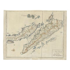
Antique Map of Sumatra, Indonesia 'c.1780'
Located in Langweer, NL
Antique map titled 'Neue Karte von der Insel Sumatra'. Extremely rare map of Sumatra, Indonesia
Category

Antique Late 18th Century Maps

Materials

Paper

Antique Map of Sumatra, Indonesia 'c.1780'
H 19.49 in W 24.81 in D 0.02 in
Antique Map of Java, Indonesia, circa 1770
By Jakob van der Schley
Located in Langweer, NL
Antique map Indonesia titled 'Nouvelle Carte de l'Isle de Java - Nieuwe kaart, van het Eiland Java
Category

Antique Mid-18th Century Maps

Materials

Paper

Antique Map of Java, Indonesia, circa 1770
H 10.44 in W 18.51 in D 0.02 in
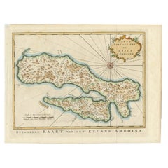
Antique Map of Ambon Island, Indonesia, 1756
Located in Langweer, NL
’. Antique map of the island of Ambon, Indonesia. This map originates from 'Historische beschryving der
Category

Antique 18th Century Maps

Materials

Paper

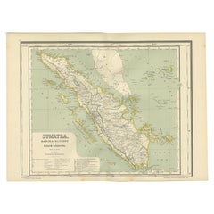
Antique Map of West Sumatra, Indonesia, 1900
Located in Langweer, NL
Antique map titled 'Sumatra, Bangka, Blitoeng en de Riouw-Archipel'. Old map of West Sumatra
Category

20th Century Maps

Materials

Paper

Antique Map of Bangka Island, Indonesia, 1885
Located in Langweer, NL
Antique map titled 'Kaart van het Eiland Banka. Old map of Bangka Island, or Banka. This map
Category

Antique 19th Century Maps

Materials

Paper

Antique Map of Part of Java, Indonesia, 1900
Located in Langweer, NL
Antique map of West Java. This map originates from 'Atlas van Nederlandsch Oost- en West-Indië' by
Category

20th Century Maps

Materials

Paper

Antique Map of Padang, Sumatra, Indonesia, 1900
Located in Langweer, NL
Antique map titled 'De Padangsche Beneden-en Bovenlanden van de Koninginnedbaai tot Fort de Kock
Category

20th Century Maps

Materials

Paper

Antique Map of the Island of Java, Indonesia
Located in Langweer, NL
Antique map titled 'Nouvelle Carte de l'Isle de Java (..) - Nieuwe Kaart van het Eiland Java
Category

Antique Late 18th Century Maps

Materials

Paper

Antique Map of the Island of Java, Indonesia
H 10.24 in W 18.71 in D 0.02 in
Scarce Antique Map of the Island of Java, Indonesia
Located in Langweer, NL
Title: "Kaart van 't Eyland Groot Java: Antique Map of Java, Indonesia" Description: This antique
Category

Antique Late 18th Century Maps

Materials

Paper

Old Map of Java, Indonesia by Stemler, 1875
By Stemler
Located in Langweer, NL
Geographical Service in the Dutch-Indies on Java and Madoera.) This scarce map shows the Indonesian island of
Category

Antique 19th Century Maps

Materials

Paper

Antique Map of Buru Island, Indonesia, c.1725
Located in Langweer, NL
Antique map titled 'Boero'. Original antique map of Buru island. With an inset of the lake on top
Category

Antique 18th Century Maps

Materials

Paper

Antique Map of West Kalimantan, Borneo, Indonesia, 1900
Located in Langweer, NL
Antique map titled 'Borneo en Belitoeng'. Old map of West Kalimantan, Borneo. This map originates
Category

20th Century Maps

Materials

Paper

Antique Map of the Region of Banjarmasin, Indonesia 1900
Located in Langweer, NL
Antique Map of the Region of Banyuasin, Sumatra. Also depicting Bangka/Banka island. This map
Category

20th Century Maps

Materials

Paper

Antique Map of Aceh in Sumatra, Indonesia, 1900
Located in Langweer, NL
Antique map titled 'Groot-Atjeh en aangrenzende Kuststaten'. Old map of Aceh, with surrounding
Category

20th Century Maps

Materials

Paper

Antique Decorative French Map of Java, Indonesia, 1718
Located in Langweer, NL
Antique map of Java titled 'Carte de l'Ile de Java: Partie Occidentale, Partie Orientale, Dressee
Category

Antique 18th Century Maps

Materials

Paper

Antique Map of Java 'Indonesia' by Chatelain, 1719
Located in Langweer, NL
Antique map titled 'Carte de l'Ile de Java: Partie Occidentale, Partie Orientale, Dressee tout
Category

Antique Early 18th Century Maps

Materials

Paper

Antique Map of Bali 'Indonesia' by Bellin, 'c.1750'
Located in Langweer, NL
Antique map titled 'Ile de Baly ou petite Java'. Map of Bali, Indonesia. The map depicts the island
Category

Antique Mid-18th Century Maps

Materials

Paper

Antique Map of Java 'Indonesia' by Arkstee & Markus (1763)
Located in Langweer, NL
the island of Java, Indonesia. With cartouche, scale and compass rose. This map originates from
Category

Antique Mid-18th Century Maps

Materials

Paper

Antique Map of Boero in Indonesia by Valentijn, 1726
By F. Valentijn
Located in Langweer, NL
Antique map titled 'Boero-Amblauw'. Detailed map of the Island Ambelau and Buru, Maluku Islands
Category

Antique Early 18th Century Dutch Maps

Materials

Paper

Antique Map of the Maluku Islands or Moluccas, Indonesia
Located in Langweer, NL
East Indies. Today the Moluccas are part of Indonesia. This map originates from Prevost’s ‘Histoire
Category

Antique Mid-18th Century Maps

Materials

Paper

Antique French Map of Java, Indonesia by Chatelain, '1719'
Located in Langweer, NL
Nouvellement Sur Les Memoires Les Plus Exacts (..)'. This beautiful map of Java (Indonesia) exists of two
Category

Antique Early 18th Century Maps

Materials

Paper

Antique Map of Celebes 'Sulawesi', Island in Indonesia, 1754
By Jacques-Nicolas Bellin
Located in Langweer, NL
Antique map titled 'Carte De L'Isle Celebes ou Macassar'. Detailed copper engraved map of Celebes
Category

Antique 18th Century Maps

Materials

Paper

Antique Map of the Malay Archipelago with Images of Indigenous People, 1851
Located in Langweer, NL
illustrated geographical publications in the mid-19th century. Tallis maps, such as the one of Indonesia, are
Category

Antique 1850s Maps

Materials

Paper

Antique Map of the Region of Lampung, Sumatra, Indonesia, 1900
Located in Langweer, NL
Antique map of the region of Lampung, Sumatra. Also depicting part of Palembang and Java. This map
Category

20th Century Maps

Materials

Paper

Antique Map of the East Coast of Sumatra , Indonesia, 1900
Located in Langweer, NL
Antique map of the East Coast of Sumatra. Also depicting the Strait of Malacca. This map originates
Category

20th Century Maps

Materials

Paper

Antique Map of the Region of Bengkulu in Indonesia, 1900
Located in Langweer, NL
Antique map of the region of Benkulu, Sumatra. Also depicting Enggano Island. This map originates
Category

20th Century Maps

Materials

Paper

Detailed Antique Map of Northern Sumatra, Indonesia, circa 1825
Located in Langweer, NL
Antique map titled 'Partie de l'Ile de Sumatra'. Chart showing the northern part of Sumatra
Category

Antique 19th Century Maps

Materials

Paper

Antique Map of a Bay of Borneo, Indonesia, c.1760
Located in Langweer, NL
Antique map titled 'La Baye de l'isle et Ville de Borneo'. Small map depicting a Bay of Borneo
Category

Antique 18th Century Maps

Materials

Paper

Antique Map of the Region of Pasuruan, Java, Indonesia, 1726
Located in Langweer, NL
"Map of the region around Pasuruan. It shows the location of rice fields, the village Bangil, as
Category

Antique 18th Century Maps

Materials

Paper

Antique Map of Java and Batavia of nowadays Indonesia, '1818'
Located in Langweer, NL
Antique map titled 'Kaart van het Eiland Java'. A rare and attractive early 19th century Dutch map
Category

Antique Early 19th Century Maps

Materials

Paper

Antique Map of Banten Bay, Java, Indonesia, c.1725
Located in Langweer, NL
A small early 18th century map of Banten Bay showing the islands of Pulo Dua and Pulo Batto
Category

Antique 18th Century Maps

Materials

Paper

Antique Map of the Island Java, Indonesia, c.1650
Located in Langweer, NL
Antique map titled 'Insulae Iavae cum parte insularum Boreno Sumatrae (..)'. Beautiful map of the
Category

Antique 17th Century Maps

Materials

Paper

Antique Map of Batavia 'Jakarta, Indonesia' by Montanus, 1679
Located in Langweer, NL
Fine early plan of Batavia (Jakarta), published by Arnoldus Montanus. This map has a vignette at
Category

Antique Late 17th Century Unknown Maps

Materials

Paper

Old Original Antique Map of the Sunda Islands of Indonesia, 1756
Located in Langweer, NL
Joor. Bali and Lombok are also on it. This map of West Indonesia is from a period when it was colonised
Category

Antique 1750s Maps

Materials

Paper

Antique Map of the Island of Java in Indonesia, circa 1760
By Jacques-Nicolas Bellin
Located in Langweer, NL
Antique map Indonesia titled 'Nouvelle Carte de l'Isle de Java'. Chart of the island of Java
Category

Antique Mid-18th Century Maps

Materials

Paper

Antique Map of Batavia, Nowadays Jakarta, the Capital of Indonesia, 1782
Located in Langweer, NL
Antique map Batavia titled 'Batavia zo als het was in den Jaare 1731'. Old map of the city of
Category

Antique 18th Century Maps

Materials

Paper

Antique Map of Celebes 'Sulawesi, Indonesia' by Bellin, ciarca 1755
By Jacques-Nicolas Bellin
Located in Langweer, NL
Antique map titled 'Carte de l'Isle Celebes ou Macassar'. Map of Celebes (Sulawesi, Indonesia
Category

Antique Mid-18th Century European Maps

Materials

Paper

Large Antique Map of the west coast of Celebes, Sulawesi, Indonesia
Located in Langweer, NL
map shows the west coast of Celebes, Sulawesi, Indonesia. It covers the region of Makassar to Cikoang
Category

Antique Mid-19th Century Maps

Materials

Paper

Rare Antique Map of the Dutch East Indies 'Indonesia', 1774
Located in Langweer, NL
Rare decorative engraved map of the Dutch East Indies, or nowadays Indonesia. Title (in old
Category

Antique 1770s Maps

Materials

Paper

Antique Map of the Island of Borneo in Asia (Indonesia), 1726
Located in Langweer, NL
Antique map titled 'Kaart van het Eyland Borneo'. Early map of the island of Borneo. This map
Category

Antique 18th Century Maps

Materials

Paper

Original Antique Map of the Maluku Islands or Moluccas, Indonesia
Located in Langweer, NL
East Indies. Today the Moluccas are part of Indonesia. This map originates from Prevost’s ‘Histoire
Category

Antique Mid-18th Century Maps

Materials

Paper

Antique Map of Celebes 'Sulawesi', Island in Indonesia, c.1750
By Jacques-Nicolas Bellin
Located in Langweer, NL
Antique map titled 'Carte De L'Isle Celebes ou Macassar'. Detailed copper engraved map of Celebes
Category

Antique 18th Century Maps

Materials

Paper

Antique Map of Manipa and Other Maluku Islands, Indonesia, 1726
Located in Langweer, NL
Maluku Province of Indonesia, in the Pacific Ocean. This map originates from 'Oud en Nieuw Oost-Indiën
Category

Antique 18th Century Maps

Materials

Paper

Antique Miniature Map of Borneo, incl Kalimantan, Indonesia, c.1610
Located in Langweer, NL
Antique map titled 'Descriptio Borneo Insulae'. Old miniature map of the Indonesian island of
Category

Antique 17th Century Maps

Materials

Paper

Antique Map of Java and Part of Borneo, Indonesia, c.1657
Located in Langweer, NL
Antique map titled 'Insulae Iavae cum parte insularum Boreno Sumatrae (..)'. Beautiful map of the
Category

Antique 17th Century Maps

Materials

Paper

Antique Map of West Kalimantan (Schwaner Mountains), Borneo, Indonesia, 1900
Located in Langweer, NL
Antique map of West Kalimantan, Borneo. It shows the region of the Schwaner Mountains. This map
Category

20th Century Maps

Materials

Paper

Detailed Antique Map of the Western Sumatra, Indonesia, circa 1825
Located in Langweer, NL
Antique map titled 'Partie de l'Ile de Sumatra'. Chart showing the western part of Sumatra
Category

Antique 19th Century Maps

Materials

Paper

Antique Map of the Moluques Islands, Part of Indonesia, circa 1750
Located in Langweer, NL
Map of the Moluques (also known as the Moluccas, Moluccan Islands or simply Maluku). Depicts the
Category

Antique Mid-18th Century Maps

Materials

Paper

Old Original Antique Map of the Islands of East Indonesia, 1756
Located in Langweer, NL
Title: Isles Moluques. Old and rare, this decorative map of the Maluku Islands in the period it
Category

Antique 1750s Maps

Materials

Paper

Antique Map of Java and Madura Island, Indonesia, c.1760
Located in Langweer, NL
Antique map titled 'Idee de l'Isle de Java.' Well engraved and attractive chart of the island
Category

Antique 18th Century Maps

Materials

Paper

Old Antique Map of Borneo 'Kalimantan Indonesia, Sabah Malaysia & Brunei'
Located in Langweer, NL
Antique map titled 'Kaart van het Eyland Borneo'. Original antique map of the island of Borneo
Category

Antique Early 18th Century Maps

Materials

Paper

Large Antique Map of Java ‘Indonesia’ by F. Valentijn, 1728
Located in Langweer, NL
Antique map titled 'Nieuwe en zeer naaukeurige Kaart van t Eyland Java Major of Groot Java'. This
Category

Antique Early 18th Century Maps

Materials

Paper

Antique Map of Batavia 'Jakarta', Indonesia by Montanus, circa 1669
Located in Langweer, NL
Antique map Batavia titled 'Ware Affbeeldinge wegens het Casteel ende Stadt Batavia'. Antique print
Category

Antique 17th Century Maps

Materials

Paper

Antique Map of Southern Mindanao, Sulawesi and Gilolo 'Halmahera', Indonesia
Located in Langweer, NL
Antique lithograph, with a text vignette on Borneo. This important map for the Philippines shows
Category

Antique Early 19th Century Maps

Materials

Paper

Old Map of the Philippines and Part of Indonesia 'Spice Islands', 1744
Located in Langweer, NL
mede Celebes etc'. Old map of the Philippines and part of Indonesia. Originates from 'Nieuwe Hand
Category

Antique 1740s Maps

Materials

Paper

  • 1
Get Updated with New Arrivals
Save "Map Of Indonesia", and we’ll notify you when there are new listings in this category.

Map Of Indonesia For Sale on 1stDibs

Find many varieties of an authentic map of Indonesia available at 1stDibs. Frequently made of paper, animal skin and canvas, every map of Indonesia was constructed with great care. You’ve searched high and low for the perfect map of Indonesia — we have versions that date back to the 18th Century alongside those produced as recently as the 20th Century are available. A map of Indonesia is a generally popular piece of furniture, but those created in Georgian and Victorian styles are sought with frequency. You’ll likely find more than one map of Indonesia that is appealing in its simplicity, but F. Valentijn, Jacques-Nicolas Bellin and Pieter Van Der Aa produced versions that are worth a look.

How Much is a Map Of Indonesia?

Prices for a map of Indonesia can differ depending upon size, time period and other attributes — at 1stDibs, they begin at $40 and can go as high as $18,726, while the average can fetch as much as $487.
Questions About Map Of Indonesia
  • 1stDibs ExpertApril 5, 2022
    In Bali, Indonesia, Jackfruit is considered the best wood when it comes to carving. Jackfruit is a medium hardwood, resistant to termite attacks and is easy to polish. You’ll find a variety of Indonesian carvings from some of the world’s top sellers on 1stDibs.

Read More

Pamela Shamshiri Shares the Secrets behind Her First-Ever Book and Its Effortlessly Cool Interiors

The sought-after designer worked with the team at Hoffman Creative to produce a monograph that beautifully showcases some of Studio Shamshiri's most inspiring projects.

Moroccan Artworks and Objects Take Center Stage in an Extraordinary Villa in Tangier

Italian writer and collector Umberto Pasti opens the doors to his remarkable cave of wonders in North Africa.

Montecito Has Drawn Royalty and Celebrities, and These Homes Are Proof of Its Allure

Hollywood A-listers, ex-pat aristocrats and art collectors and style setters of all stripes appreciate the allure of the coastal California hamlet — much on our minds after recent winter floods.

Whaam! Blam! Pow! — a New Book on Pop Art Packs a Punch

Publishing house Assouline and writer Julie Belcove have teamed up to trace the history of the genre, from Roy Lichtenstein, Andy Warhol and Yayoi Kusama to Mickalene Thomas and Jeff Koons.

The Sparkling Legacy of Tiffany & Co. Explained, One Jewel at a Time

A gorgeous new book celebrates — and memorializes — the iconic jeweler’s rich heritage.

What Makes a Gem-Encrusted Chess Set Worth $4 Million?

The world’s most opulent chess set, weighing in at 513 carats, is literally fit for a king and queen.

Tauba Auerbach’s Geometric Pop-Up Book Is Mighty Rare, Thanks to a Hurricane

This sculptural art book has an epic backstory of its own.

Step inside the Storied Mansions of Palm Beach’s Most Effervescent Architect

From Spanish-style courtyards to fanciful fountains, these acclaimed structures abound in surprising and elegant details.